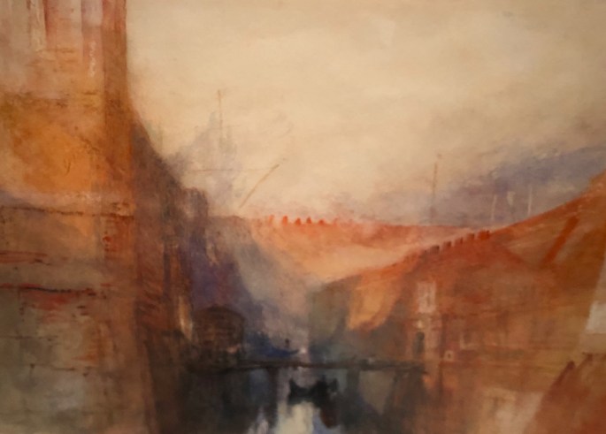
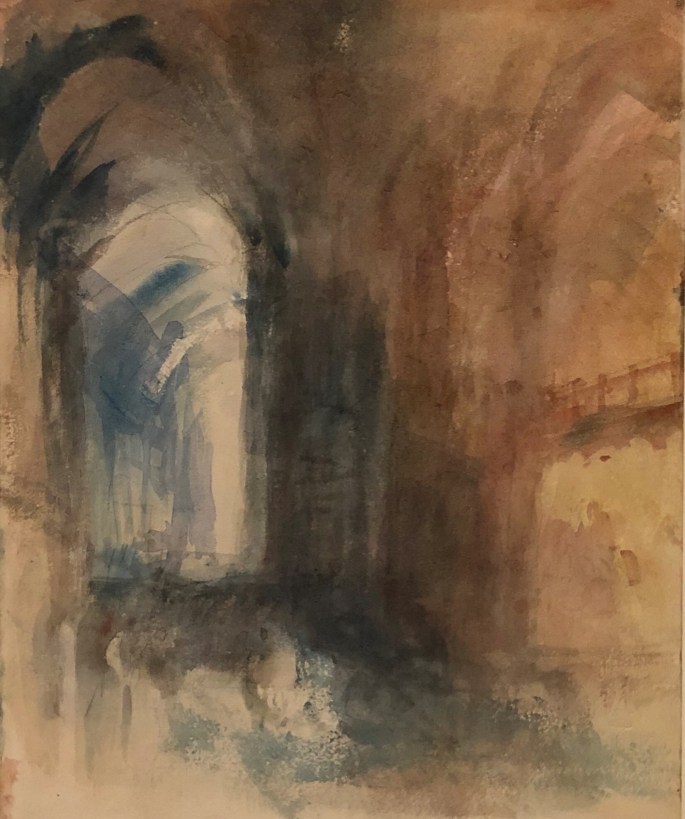
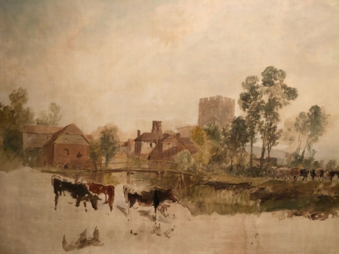
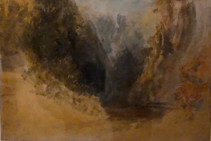
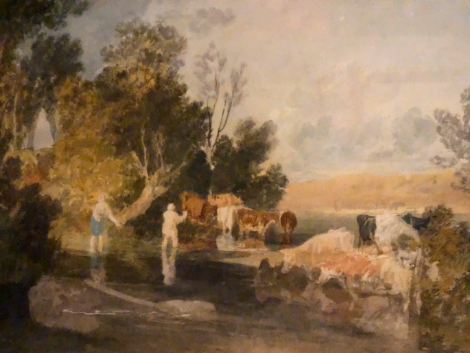
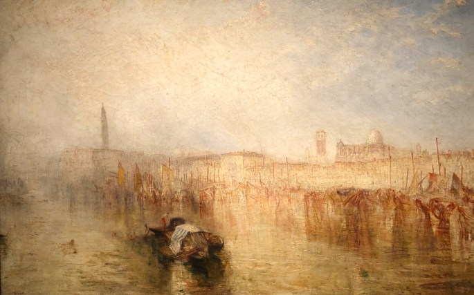
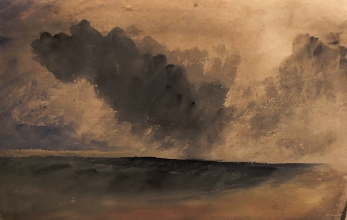
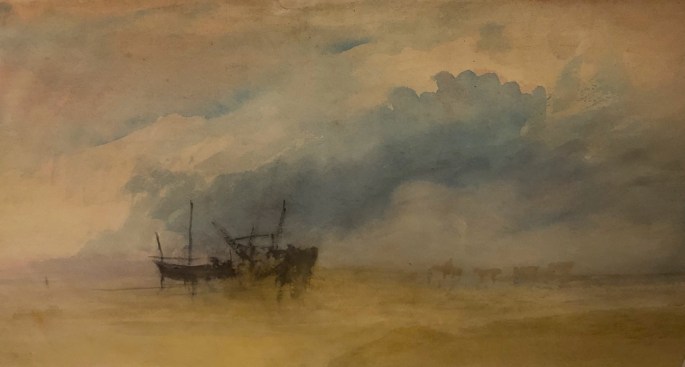
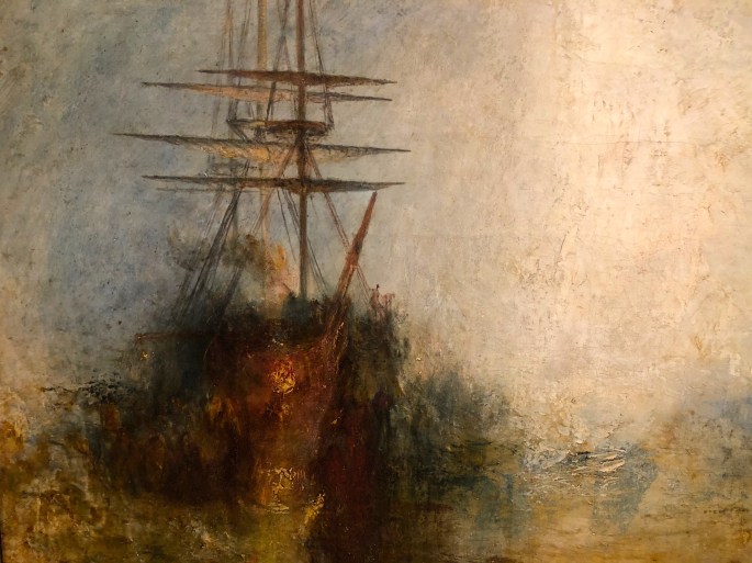
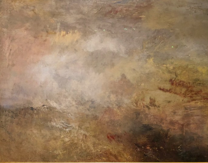
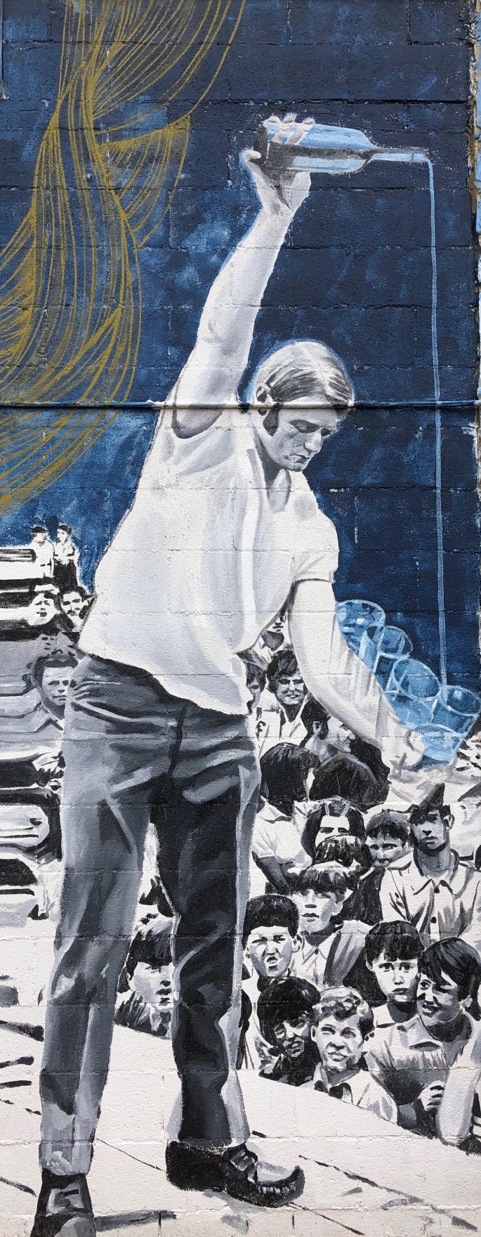
We are glad to be back in Connecticut for the next several months but our desire to explore remains undiminshed so we are planning a series of day trips in Connecticut. Our first venture since returning took us to the Mystic Seaport Museum to view the J.M.W. Turner exhibition. The exhibit features 97 works by Turner (1775-1851) on loan from Tate London. This exhibit will not appear anywhere else in the United States and will be at Mystic until 23 February. All of the works are watercolors with the exception of two oil paintings. The exhibit is organized chronologically and includes early paintings from England, Wales and later works from his travels to Switzerland, France and Italy. The watercolors are almost exclusively done on paper. We have included photographs of 13 of the paintings below to provide a sense of his artistry.
We think the Turner exhibit alone is worth the trip but since the entrance fee is a general admission to the entire seaport we would also recommend the Voyaging in the Wake of theWhalers exhibit which chronicles the whaling industry through artifacts and interactive displays.
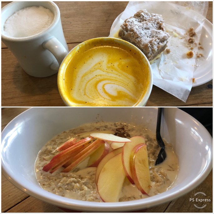
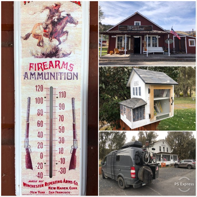
Post exhibit lunch brought delight with our discovery of Grass & Bone. G&B describes themselves as butcher shop to table. We split a delicious roastisserie chicken and of course purchased some house smoked bacon and house made sausage. https://grassandbonect.com/
Be seeing you!
P.S. There is an excellent biographical movie released in 2014 which portrays the last 25 years of Turner’s life entitled Mr. Turner.
After departing Yosemite we traveled through northern Nevada to return to Oregon and spend the last week of OTR 3.0 in the high desert of eastern Oregon. We had originally planned to spend time here after leaving Boise but the temperatures in the Alvord Desert persuaded us to defer visiting until later in the trip.
The area around the Steens is known as the Oregon “Outback” with good reason. Steens sits within Harney Countywhich is the ninth largest county in the United States, spanning more than 10,000 square miles. The population is a mere 7600 people of which4400 live in two adjacent towns. Because the population is so sparse Harney County operates a public boarding high school in Crane, Oregon. It is one of a handful of public boarding high schools remaining in the United States.
Economically this area is predominately supported by cattle ranching and farming. There are 14 head of cattle for every person living in the county. The cattle and farming economy has been in conflict with the federal government on a number of occasions. Federal agencies (BLM, USFWS, USDA) manage about 75% of the land in the county. Some of the ranchers believe that they should have access to the public land without having to pay for grazing rights.
The conflict came to a head in 2016 the Malheur Wildlife Refuge headquarters was occupied by Amon Bundy and a group of armed anti-government activists. The occupation lasted for 40 days and culminated with the death of one protestor and the arrest of many of the activists.
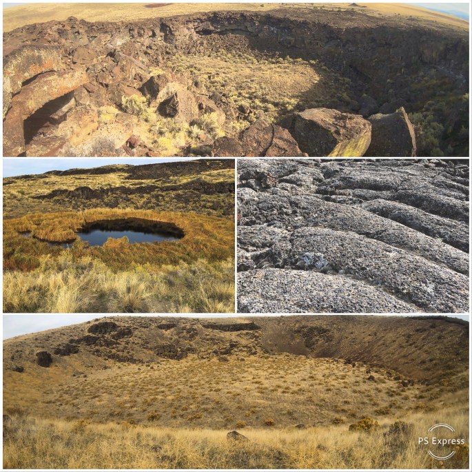
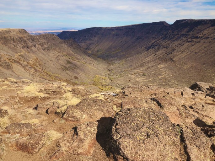
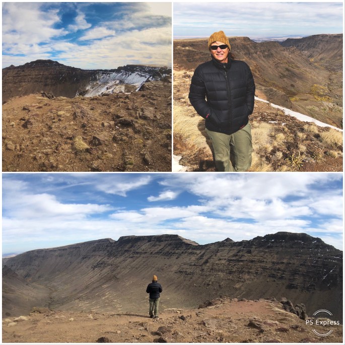
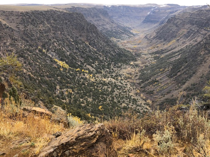
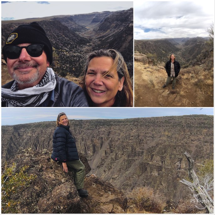
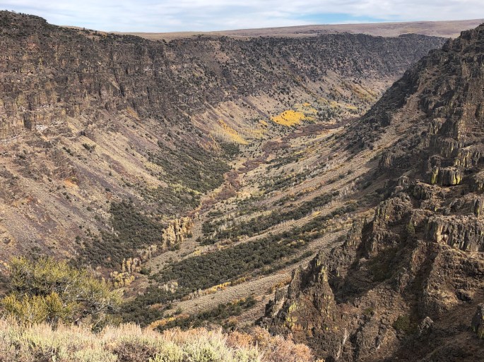
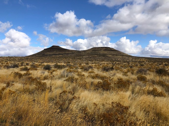
Geologically the Steens formed as a result of glacial and volcanicactivity which has created a fascinating landscape of impressive glacial gorges and volcanic cones and craters. The BLM has created a number of auto tour routes through the craters and up onto Steens Mountain. The road to the summit is the highest road in Oregon at just over 9700 feet. We drove both the Diamond Craters and Steens Mountain loops.
There are also numerous hikes throughout the area which provide views of the gorges from the rims and access into the gorges.
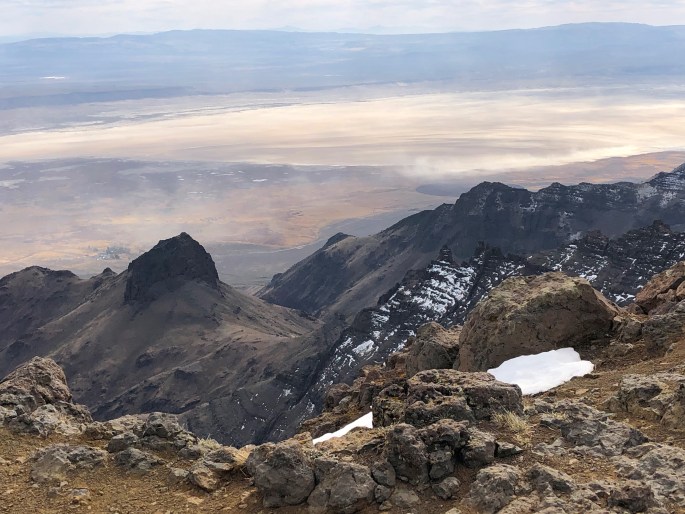
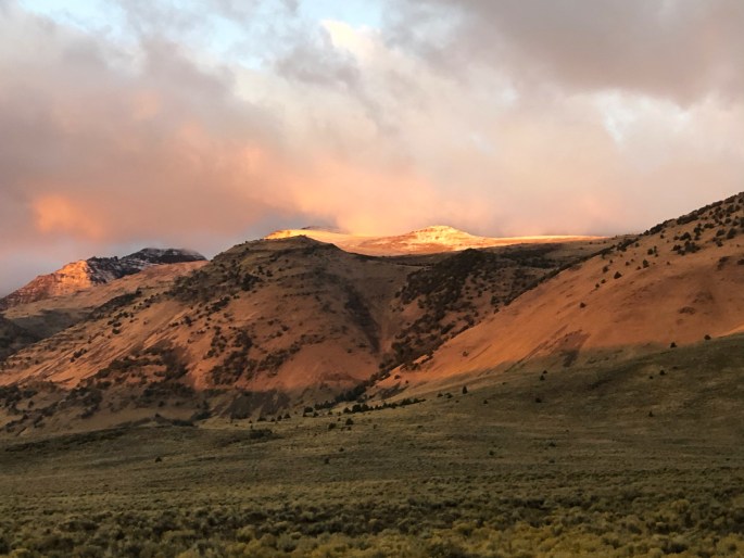
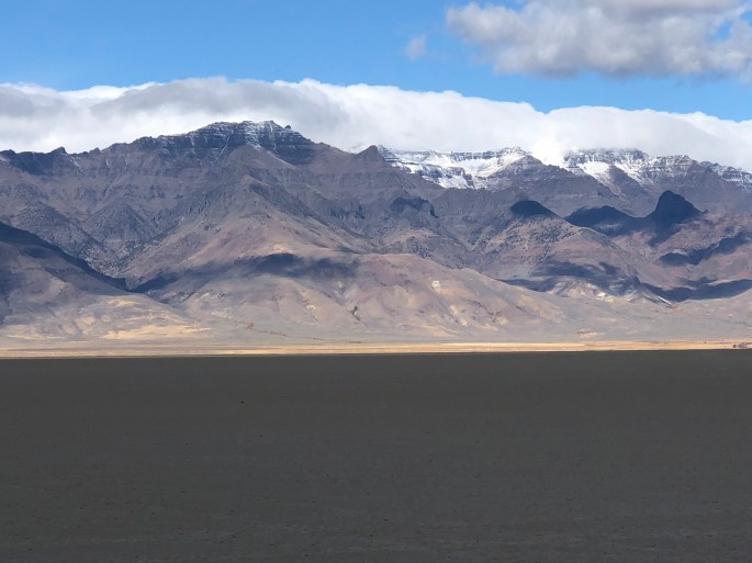
From the Steens we drove north and then circled back south to spend time on the eastern slope of the Steens and the Alvord Desert. The Alvord is a small (84 sq. miles) desert that is suitable for driving during the dry season. It is not uncommon to see small planes land on the playa. The area shows up as Princeton, Oregon on a map but there is no town or station – just cattle ranches and BLM administered land including the desert playa. Opportunities for solitude abound. An evening by the campfire brings a miraculous night sky and the howls and yips of coyotes in the distance.
During the day the view of the already snow covered Steens rising from the desert floor from the eastern side was quite impressive. There are several excellent hikes from the desert side up through creeks into the Steens.The Alvord Desert sits in a rain shadow created by the north-south running Steens Mountain. We watched rain and snow fall on the mountain and dissipate before reaching the playa.
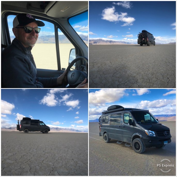
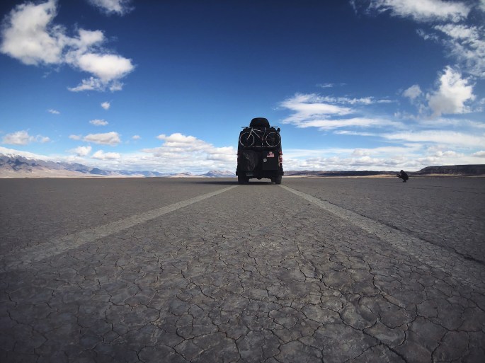
We definitely recommend driving out on to the playa. You can access the playa at Alvord Hot Springs for a five dollar fee or if you have a high clearance vehicle for free about two miles south of the hot springs. Driving on the playa is exhilarating – you can drive as fast as you like or as fast as your vehicle will go or as fast as you are comfortable going – your call – there are no rules!!! By the way, the hot springs are terrific! Sort of a ramshackle affair but the 130 degree water is very enjoyable and therapeutic. Nude bathing is allowed if you are so inclined – thankfully we did not encounter any nudists during our soak!
It takes some time to get to the Orgeon Outback of Harney County but we found the experience more than worth the effort it takes to get there. One thing to keep in mind is that many of the roads are not paved in this area – the roads are very rutted and rough on the Steen and Diamond Craters Loops – and you and your vehicle will be absolutely covered withdust!
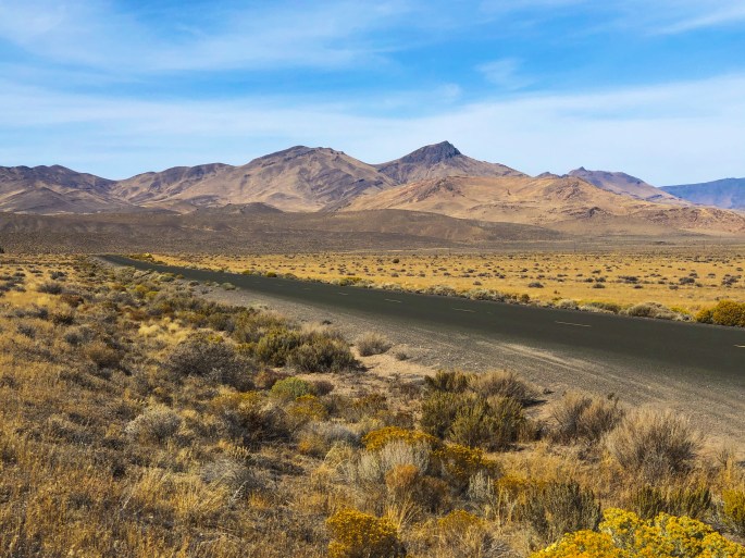
Heading across northern Nevada to Salt Lake City and our flight home.
Be seeing you!
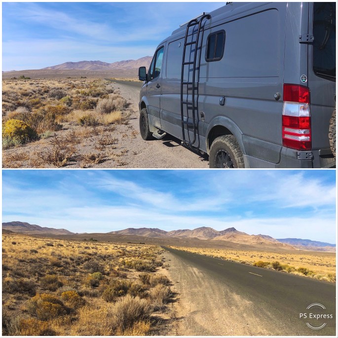
Winnemucca Mountain, Winnemucca, Nevada
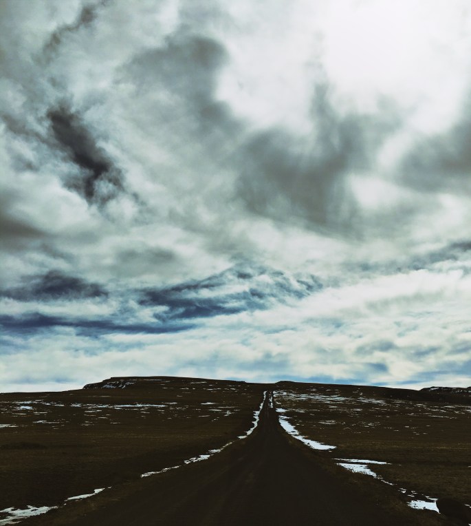
Water Canyon Road, Winnemucca, Nevada
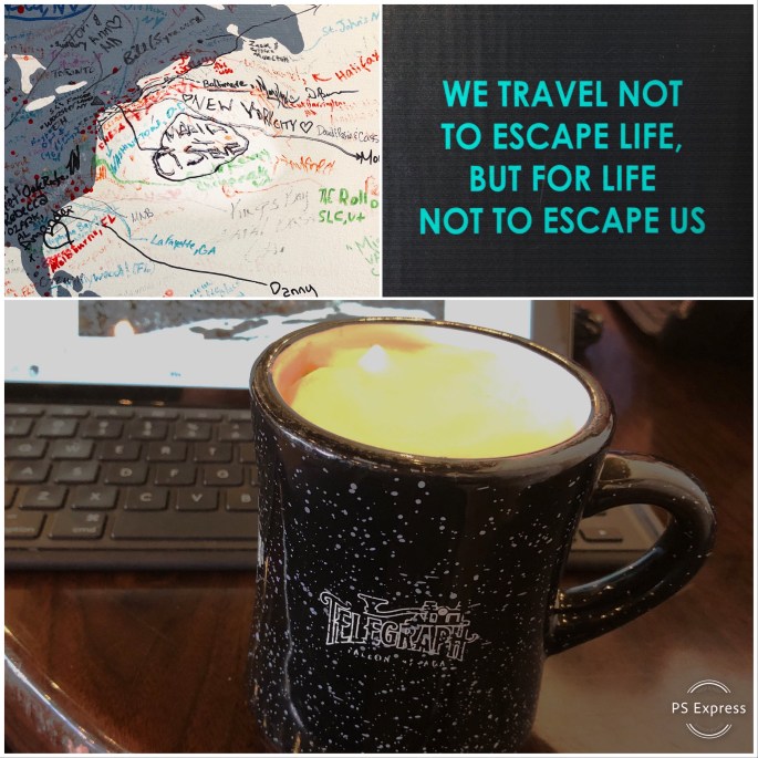
On The Road – Powered by Caffeine – Global Espresso and Telegraph Cofffee
Oregon 205, Fields, Oregon
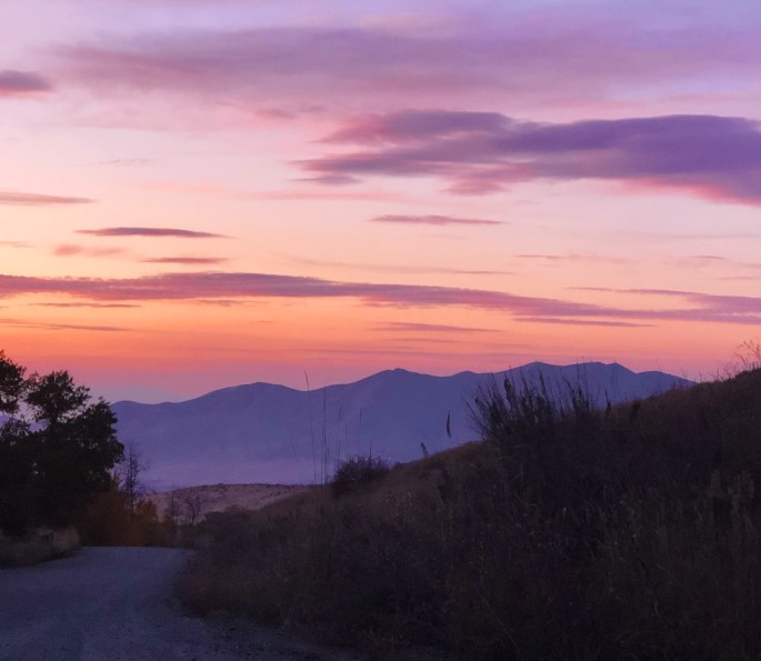
Pueblo Mountains
Fields Station, Fields, Oregon (population 9) Established 1881
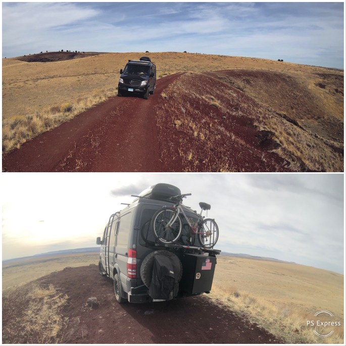
Driving the Rim of Red Bomb Crater, Diamond Craters ONA
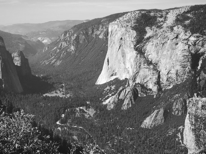
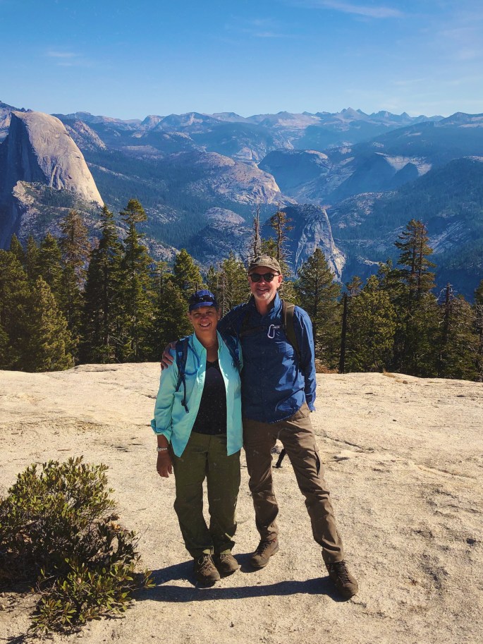
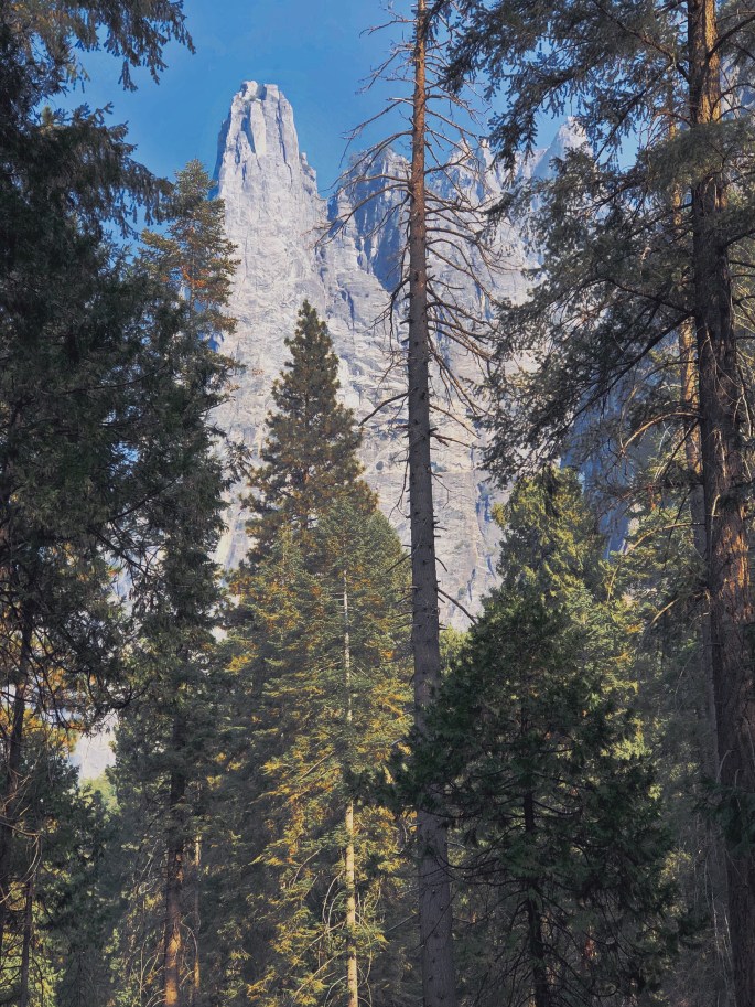
With repairs to the Beast completed we set out to Yosemite National Park for our first ever visit. We had perfect weather during our three day visit to the park. We did have to contend with smoke from the Briceburg Fire settling in the Yosemite Valley on our first day.
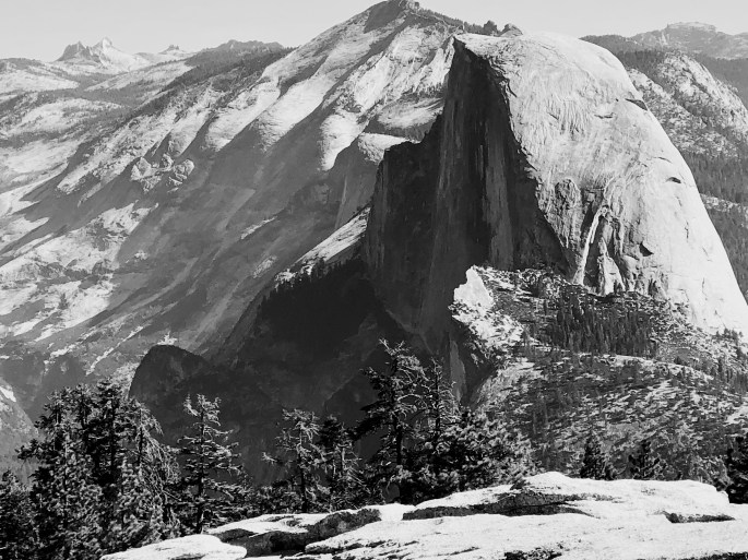
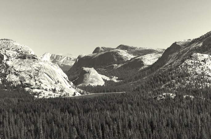
Yosemite is located in the Western Sierra Nevada and features a number of dramatic, well known granite formations. Many of these formations are in Yosemite Valley and should be seen or experienced in some fashion – hiking, climbing or driving. We particularly enjoyed the hikes accessed from Glacier Point Road which provide many spectacular views.
We also recommend visiting other areas of the park outside of the valley. The park is almost 1200 squaremiles in size – there are many opportunites to see and experience the park outside of Yosemite Valley, without the traffic and crowds.
Yosemite NP is a must see if you are a national park fan. We camped outside the park in the Stanislaus NF. If you want to to stay in one of the park campgrounds or lodges you will need to reserve many months in advance. Regardless of where you stay, driving will be required to access the various areas of the park. Also, go early as trailhead parking is very limited.
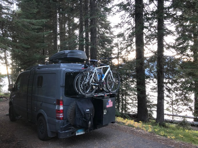
Working our way through northern Nevada to get to the Alvord Desert and Steens Mountain Wilderness in Oregon.
Be seeing you!
Half Dome
El Capitan, Yosemite Valley
Three Brothers
Merced River, Yosemite Valley from Roosevelt Point
Smoke from Briceburg Fire Drifting Through the Valley
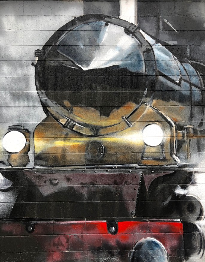
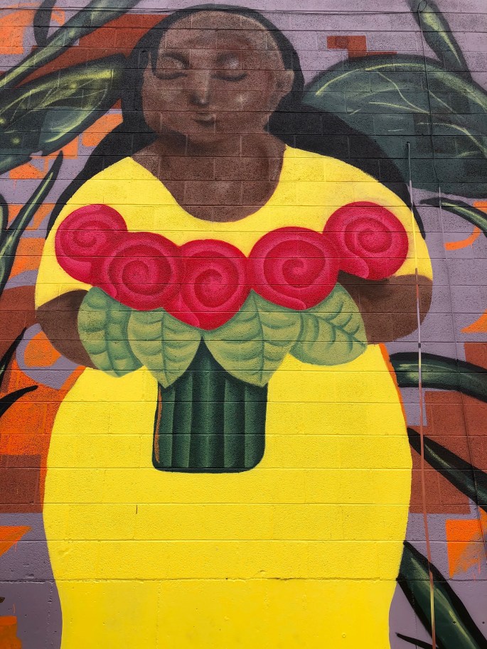
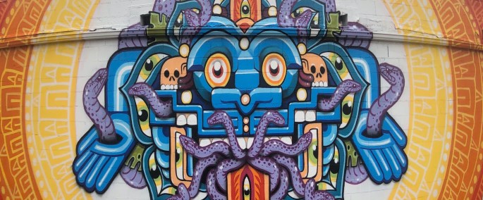
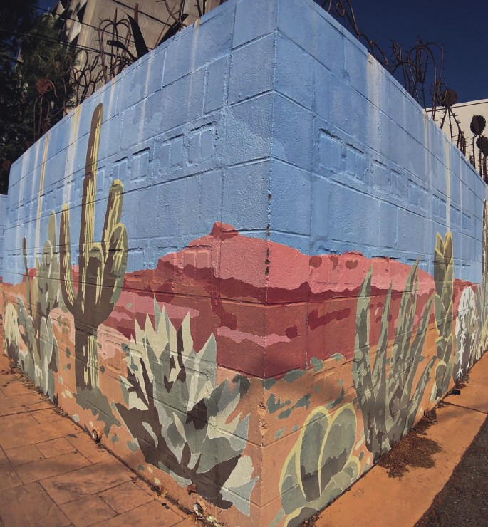
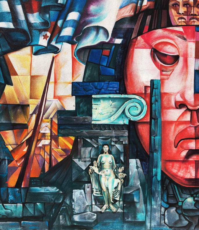
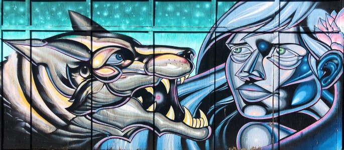
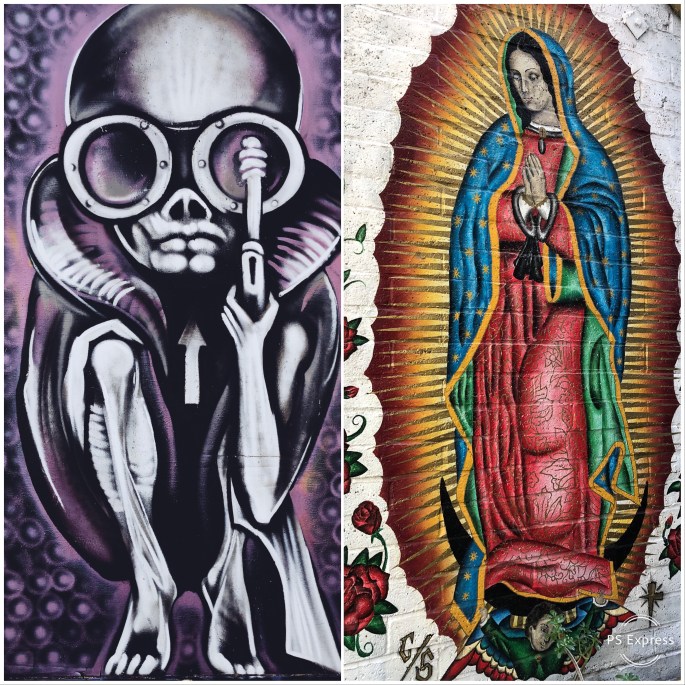
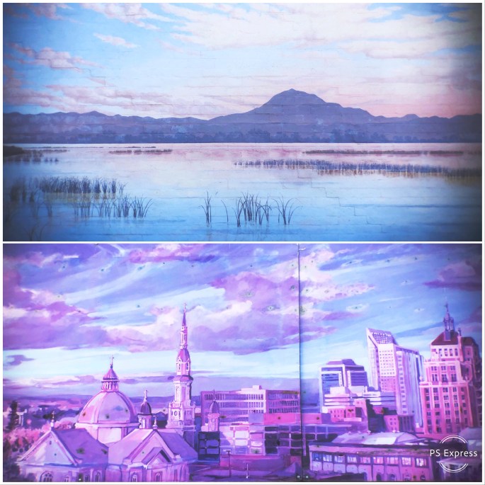
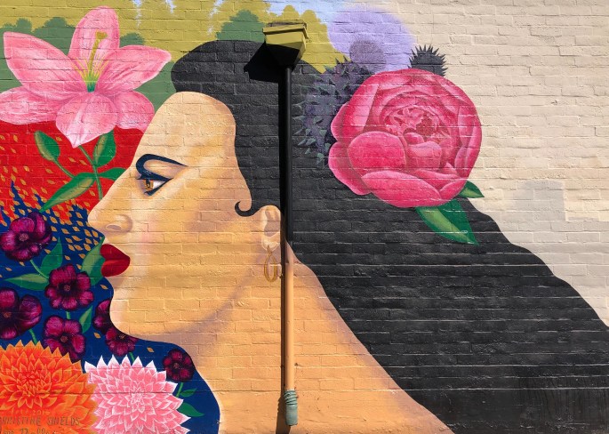
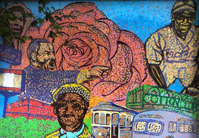
Greetings from Sacramento, CA! We spent a couple of days here to check out the street and mural art scene and sample some java and tea in the bargain. Sacramento has a vibrant street art scene that is fully supported by local government and businesses. Sac sponsors a mural festival annually. Additionally, the Wide Open Walls organization promotes diversity through art – which is very evident from the art itself.
With just a short stop in Sac we knew we would only be able to scratch the surface in regard to viewing the murals. We chose to focus on the mid town area where there is a concentration of art in the alleys which run between the back of buildings on many blocks. The mid town area is a mix of residential and commercial properties with many well preserved Victorian style houses.
We have included photos of a few of the murals below to provide a sense of some of the work. If you are interested in seeing the street art in Sac when you visit there are a number of good on-line resources.
Of course, any visit to a city would be unfulfilling without the opportunity to visit several of the finer purveyors of coffee and tea. Based on our research and the recommendations of the baristas we met on the coast we selected Temple Coffee and Old Soul Coffee. You can read more about both firms by visiting our friends @fikawithfiona.
We are heading south on the 99 to Fresno for repairs to the Beast.
Be seeing you!
Temple Coffee – K Street + Old Soul Coffee – Broadway, Sacramento
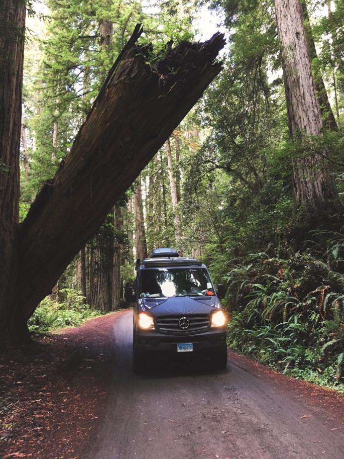
We continued down the coast to the town of Arcata after leaving the Redwoods National and State Parks. Arcata is home to Humbolt State University and very much has the look and feel of a small college town, albeit sitting on the Pacific coast. The weather favored us with a couple more delightful beach days of which we took full advantage.
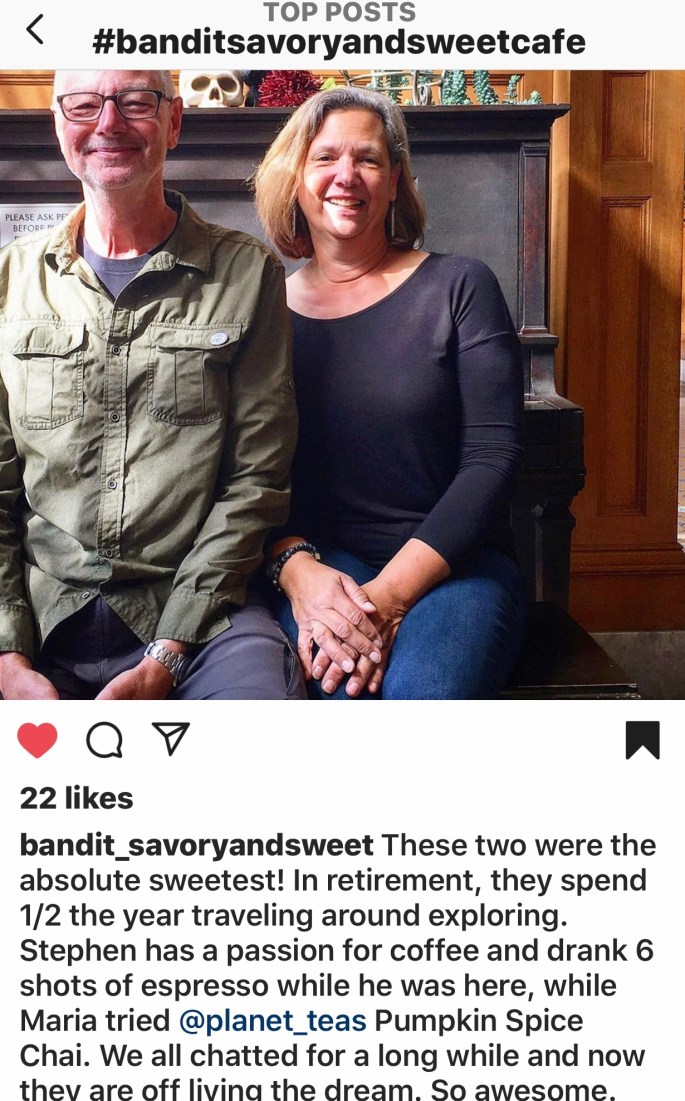
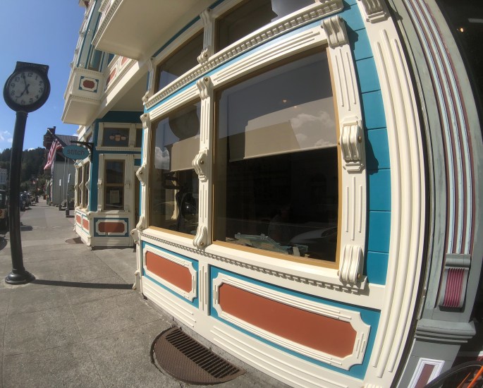
From Arcata we stopped in Eureka to visit Bandit Savory and Sweet for coffee and tea before setting out for the town of Ferndale. Ferndale is a picturesque town with a quaint main street and beautiful Victorian homes. The town has been used in many television shows and movies. Lots of boutique stores for those so inclined.
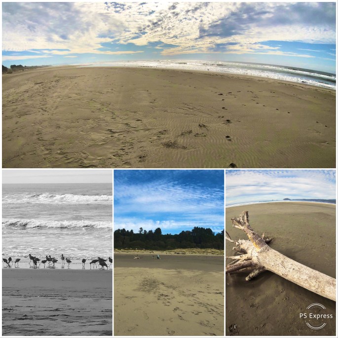
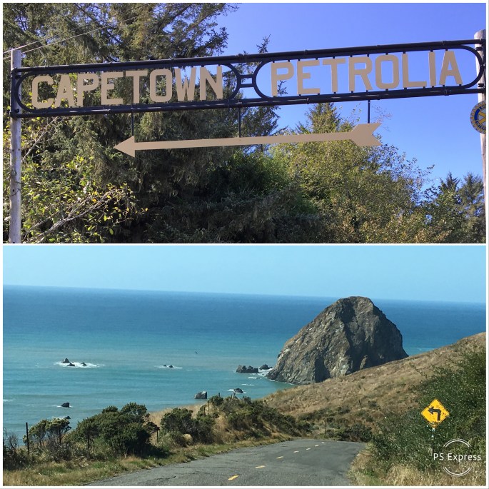
After a walk through town we decided to tackle the “Wildcat”. The “Wildcat” is a narrow, twisty, sometimes paved road that starts in Ferndale and winds up and over the northern King Mountain Range and then drops down to the ocean at Cape Mendocino. This area is the only coastal wilderness in all of California. There are no major roads and literally no development. Many automobile commercials are filmed on this road in order to take advantage of the spectacular scenery.
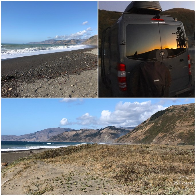
We followed the road to Mattole Beach where we were able to camp on the beach. It is incredibly beautiful but completely primitive – no facilities. The combination of the sound of the surf and the night sky is mesmerizing!
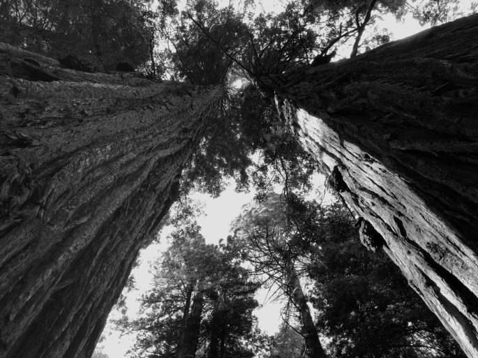
From the beach we followed Mattole Road to Humbolt Redwoods State Park. We were awed by our experience at Redwoods National and State Park. The Redwood Sequoias at Humbolt are even more impressive than what we had seen previously. The trees in Humbolt are protected from the wind by the King Mountain Range and receive far more sun than the coastal redwoods further north. As a result they are even taller than the coastal trees. If you only have time to visit one park we recommend Humbolt.
This area is all part of Humbolt County. While the area is wild and scenic it is economically depressed. We observed many “travelers” in the small towns. There is an edginess with so many travelers about in such small towns (many are transient pickers).
Humbolt County has been home to a significant number of small marijuana farmers since the 1970s. As this industry was vital to the local economy the police in the county did not generally enforce laws regarding the growing and selling of marijuana.
The legalization of marijuana has changed all of that dramatically. Officials are now obligated to regulate the industry. The long time illegal growers that operated on a completely cash basis must now get licensed, follow environmental regulations, pay taxes and put their transient pickers on the payroll.
While a number of farmers have quit the business we still saw many marijuana operations as we drove through the remote Lost Coast area.
We highly recommend touring the Lost Coast. It is some of the most beautiful and undeveloped coastline that remains anywhere in the states.
Off to Sacramento……be seeing you!
North Town Coffee, Bandit Savory & Sweet, Black Oak Coffee Roasters
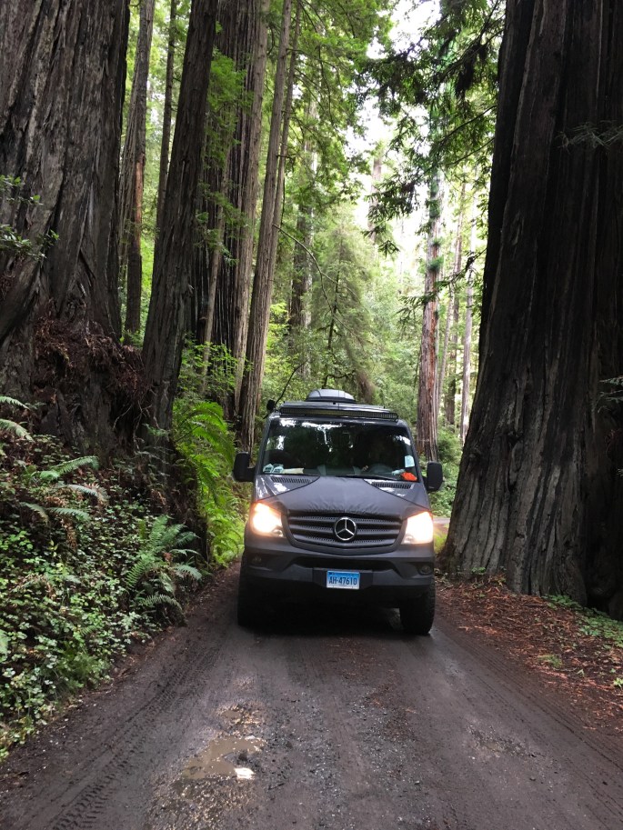
‘Good night, good night! Parting is such sweet sorrow’ …or we departed Ashland, home of the Oregon Shakespeare Festival, for the Northern California coast and the majesty of the Redwood forests in Redwood National and State Parks.
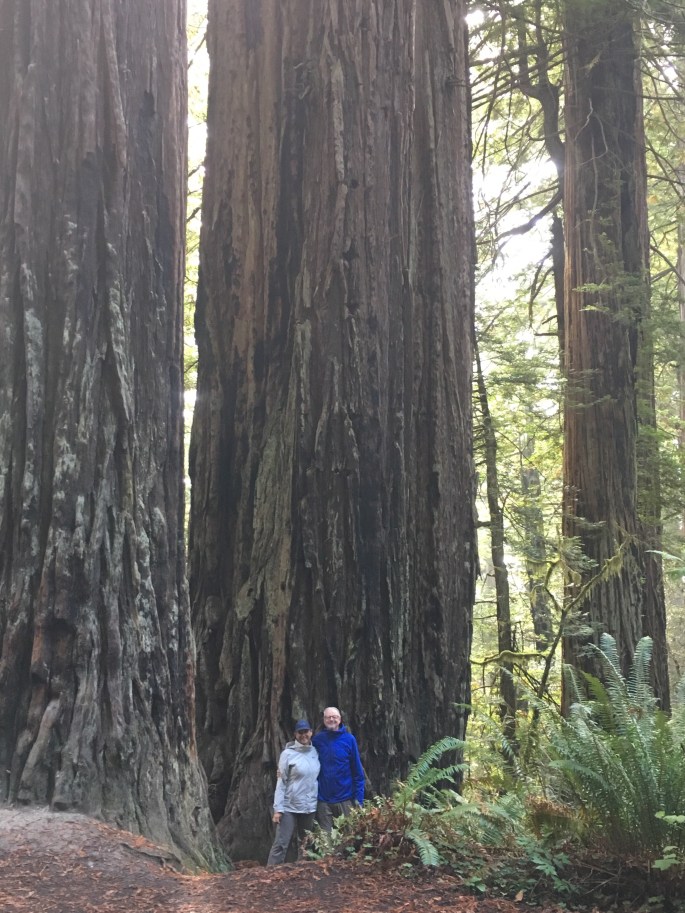
The Southern Oregon and Northern California coast is home to the vast majority of coastal Redwood trees in existence today. These trees are as tall as 360 feet, with a trunk diameter of 30 feet and may live up to 2000 years.
Just a fraction of the old growth Redwoods remain standing today as logging of these magnificent trees continued as late as the 1960s. Today the majority of Coastal Redwoods reside within state and federal lands and are protected by law. Additionally, state and federal agencies are working to ensure the survival of new growth Redwoods through careful management of the environment surrounding the current generation of trees.
Hiking and camping within a Redwood forest was an experience that reminded us of how small we are as human beings and how temporary our stay here is in regard to the natural order of all things. These silent giants dwarf everything around them and demand reverence and silence as you walk among them – we cannot articulate why – they just do.
There are many camping opportunities within the forest and along the coast from which to visit and enjoy the Redwoods, so come and enjoy the beauty.
We will spend a few more days on the coast before moving inland to go to Fresno for repairs to the Beast. After that, weather permitting we will visit Yosemite National Park.
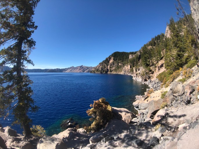
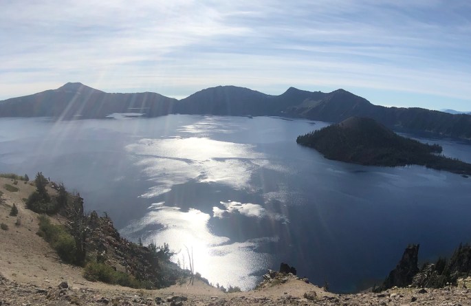
After leaving the Oregon coast we followed the Umpqua River east to visit Crater Lake National Park. Crater Lake is fascinating geologically and quite the natural phenomenon to behold. The crater was formed about 7700 years ago when Mt. Mazama erupted. Years of rain and snowfall into the crater, which has no outlet, gave birth to the lake. It is believed to contain the cleanest water in the world and the average water depth of 6500 feet makes it the deepest lake in the U.S.
Having said that, we would not recommend more than a day or two if you plan on visiting the park. The rim drive allows you to stop at a significant number of lookouts and view the lake from various vantage points but the entire drive is only 31 miles and at most consumes half a day.
There are a number of hikes in the park but only a handful provide views of the lake and only one goes down to the lake. If you visit CLNP, most definitely have a drink (or two) on the porch of the lodge in Rim Village in the late afternoon. And yes, the water is really that blue!
Heading back to the coast and Redwood National Forest after a quick stop in Ashland, Oregon to visit Noble Coffee Roasting (Good Foods Award winning roaster of Ethiopa Buku beans).
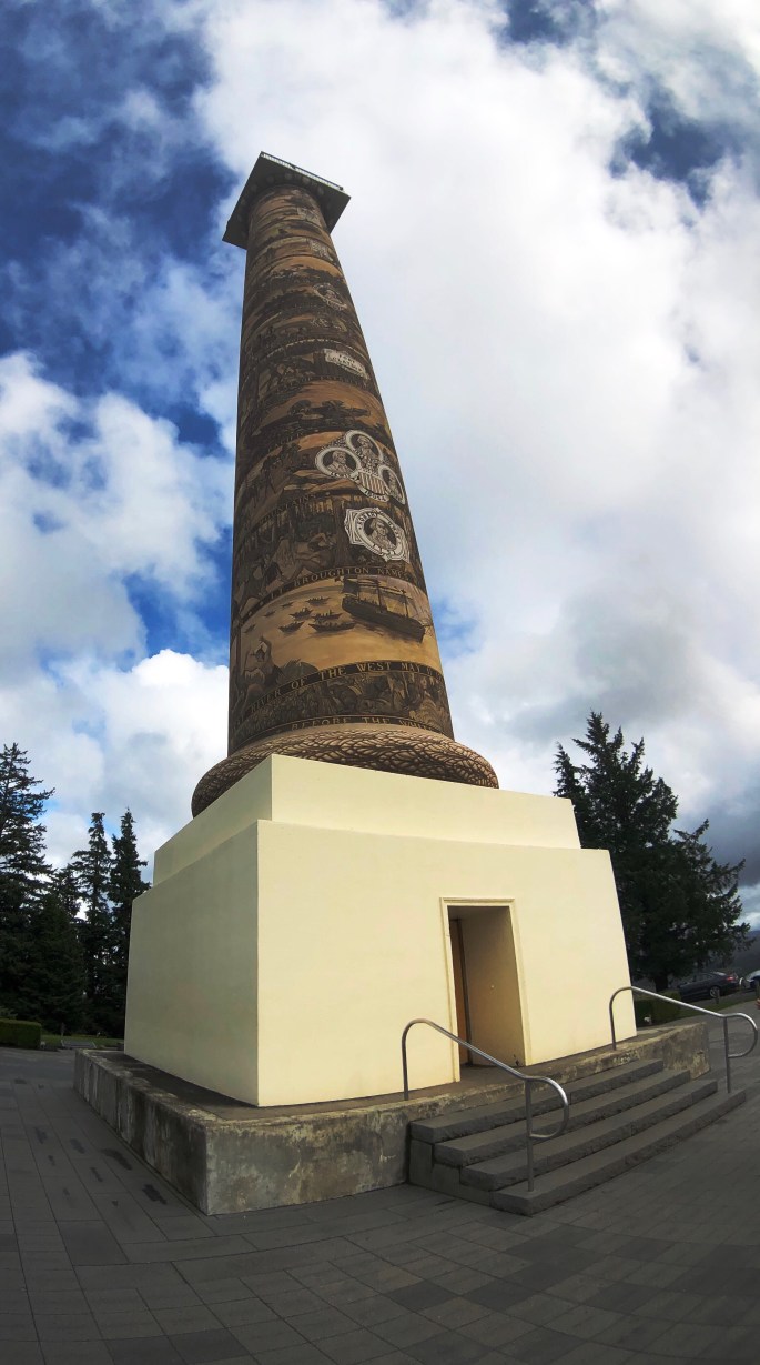
After our stay in Portland we traveled west along the banks of the Columbia River to Astoria where we would begin our journey south along the Oregon coast. Astoria sits at the confluence of the Columbia and the Pacific Ocean. Due to the massive flow from the Columbia into the Pacific entering and departing the river is often extremely hazardous due to the ever shifting “bar”. The Columbia River Maritime Museum in Astoria is an excellent museum which provides a much deeper understanding of the maritime history of the river. The museum sits right on the bank of the river and has a retired light ship which can be toured as well.
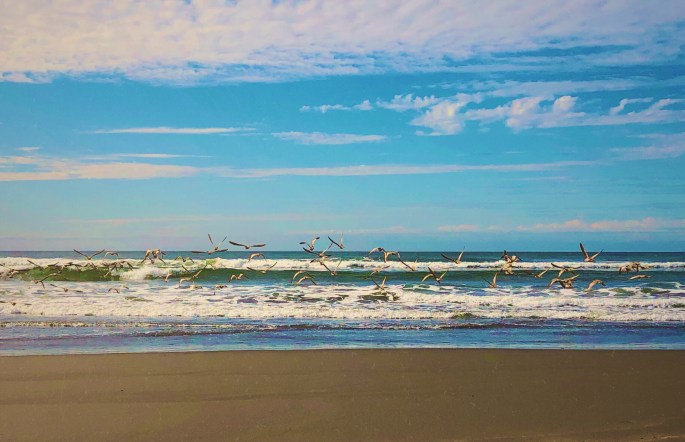
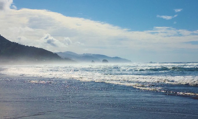
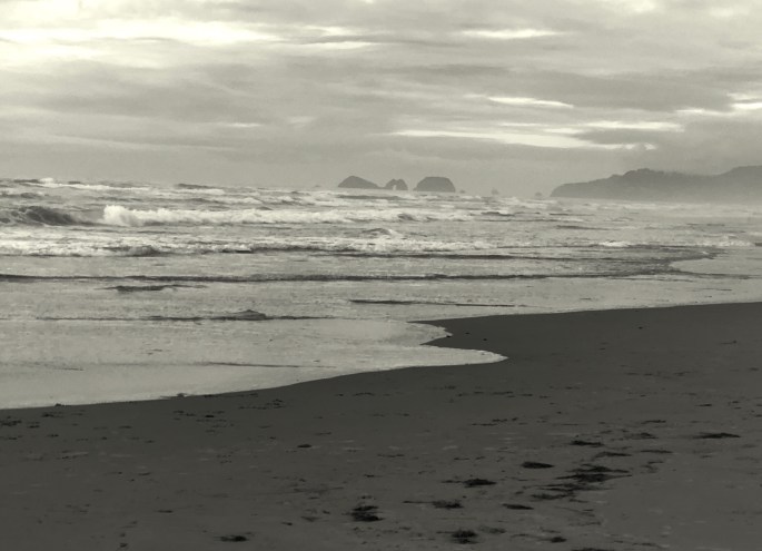
From Astoria we followed the Pacific Coast Highway south as far as Reedsport before turning inland to visit Crater Lake NP. The Oregon coast is breathtakingly beautiful and pristine. The state of Oregon purchased the land along the coastline back in the 1930s. As a result there is no commercial development on the beaches and the entire coastline is dotted with state parks and recreation areas where you can camp with a view of the ocean and walk five minutes through the dunes to the beach. Most of the beaches range from three to seven miles in length with broad flat expanses of firm sand making for great walks along the shore. Temperatures this time of the year average around 65F as the high.
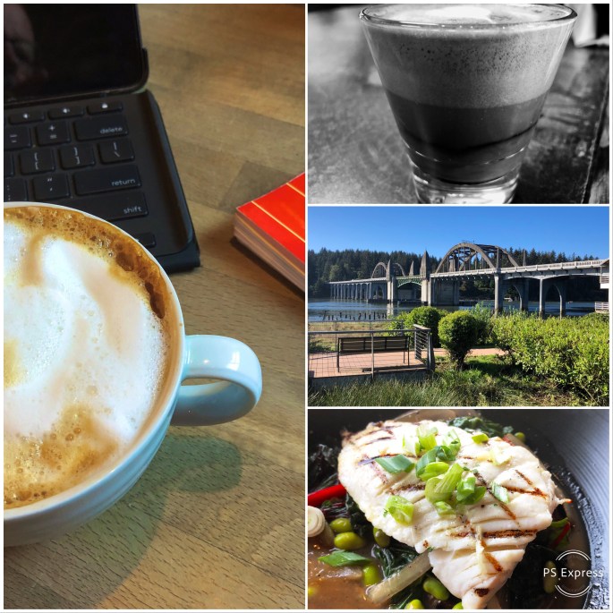
There are also a number of small beach towns lining the coast which offered us the opportunity to dine on fresh seafood and enjoy good coffee and tea during our leisurely tour.
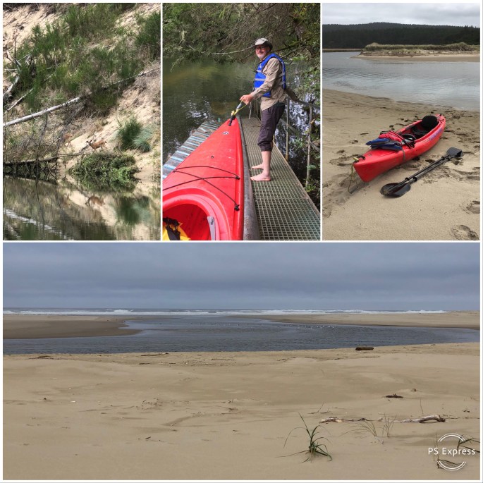
The Oregon coast also has numerous smaller rivers emptying into the Pacific. We capitalized on this by kayaking on the Nehalem and Siltcoos Rivers. We particularly enjoyed the Siltcoos as we were able to kayak all the way to the Pacific.
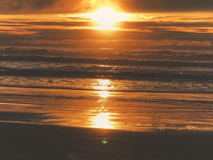
We had never been to the Oregon coast before this trip but came away as big fans. We cannot speak to the summer season (crowds) but September is glorious. And, by the way, the sunsets viewed from the beaches here are magnificent!
Be seeing you!
Columbia River, Fort Stevens
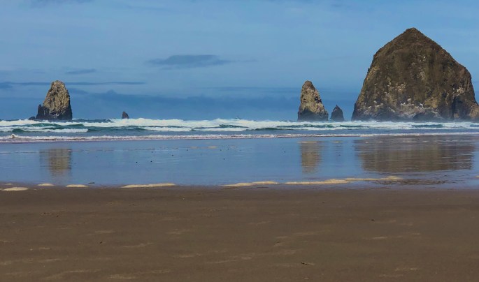
Haystack Rock, Cannon Beach, Oregon
Kayaking, Nehalem River, Wheeler, Oregon
Three Arch Rocks National Wildlife Refuge
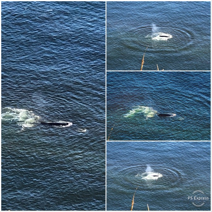
Migrating Grey Whales, Cape Lookout
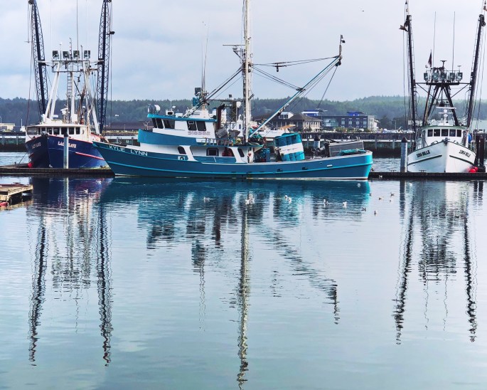
Fishing Fleet, Newport, Oregon
Beachside SRA, Waldport, Oregon
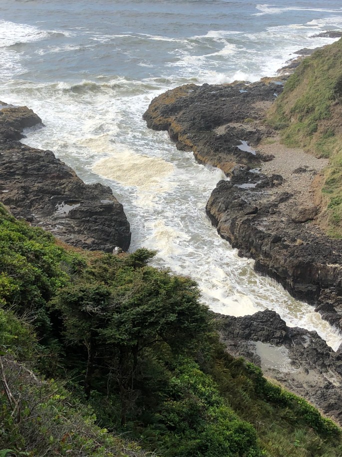
Devils Churn, Cape Perpetua
Cape Perpetua Light, Siuslaw NF
Oregon Dunes NRA
Siltcoos River
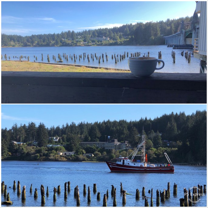
Coffee with a View, Siuslaw River, Florence, Oregon
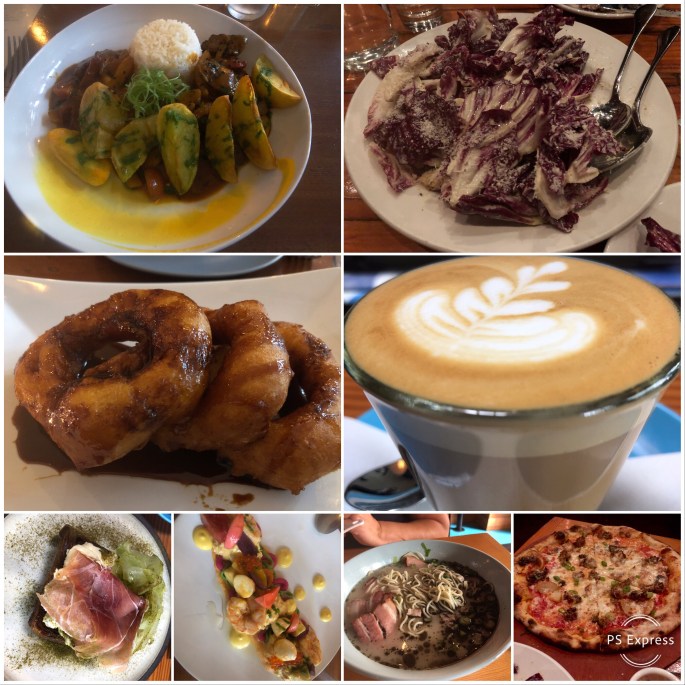
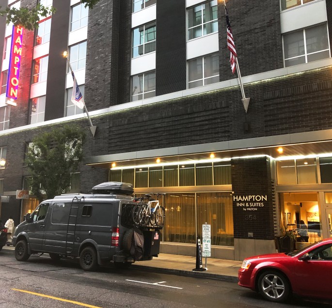
After leaving the spectacular scenery of Mt. Hood NF we rolled into Portland for a four day stay. We set up base camp at the Hampton – Pearl District which allowed us to explore a number of the interesting and eclectic neighborhoods on foot. We followed our general city visit modus operandii for a city visit – lots of coffee and tea, museums, live music, books and local restaurants.
We had not been in Portland for many years, and yet we were still surprised at the amount of growth that has taken place. PDX is incredibly vibrant! There is something here for every interest, taste and lifestyle.
The coffee scene is outstanding and our baristas generously supplied us with additional recommendations for shops and restaurants that were not on our radar. Our dining highlight was Casa Zoraya – a recently opened restaurant serving Peruvian cuisine. We have no previous experience with Peruvian food so all we can say is – it was delicious!
The Portland Art Museum (PAM) is a medium sized art museum located in the Pearl District. PAM has a small collection of Impressionist works and a good sized collection of Northwest Native American artifacts. PAM is definitely worth a visit in our opinion.
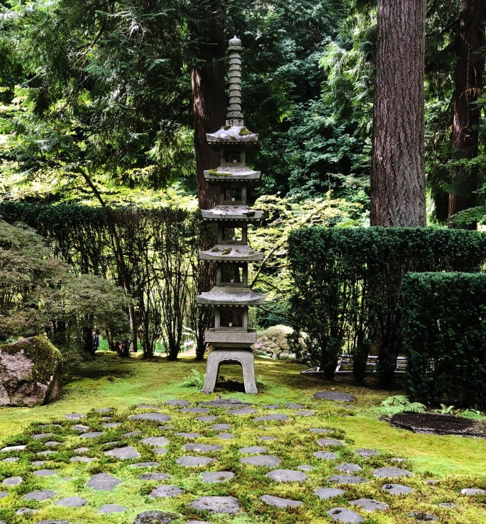
Regardless of the weather get out to the Portland Japanese Garden at Washington Park. This garden is reputed to be the finest example of a Japanese Garden outside of Japan – it is a place of beauty and harmony – you will feel better after visiting.
We always enjoy visiting independent book stores and in Portland Powell’s City of Books is not to be missed! It is the largest bookstore in the world and they stock books on every coinceivable topic one can imagine.
Lots to see and do in PDX and the surrounding area. Also, remember only tourists use umbrellas!
Off to Astoria and the Oregon coast. Be seeing you!