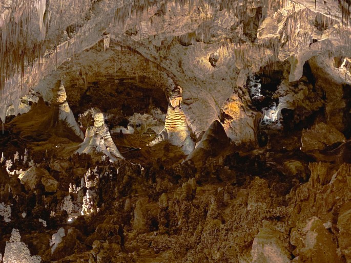
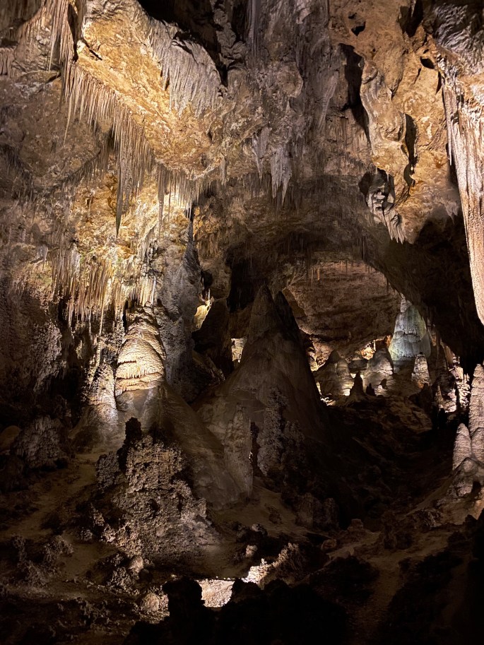
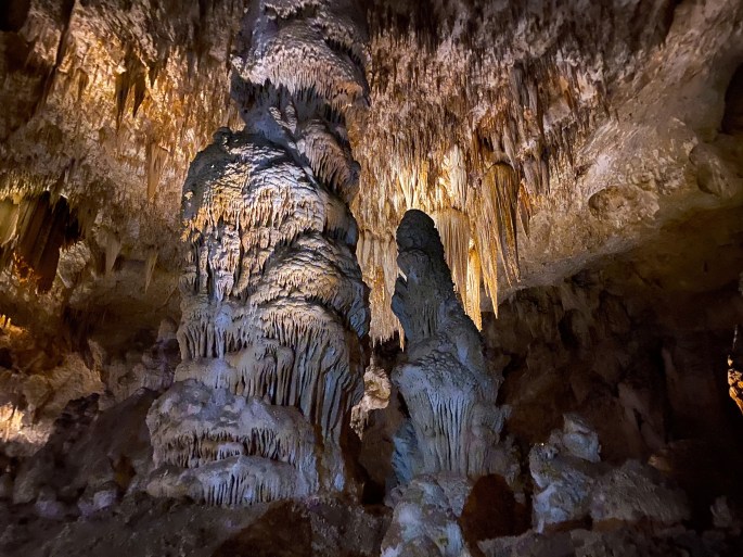
We spent a day at CCNP exploring the Big Room which is one of the 119 caverns that have been discovered so far. The Big Room is the 5th largest limestone cavern in North America. It is 4000 feet long, 255 feet high and over 600 feet wide! The Big Room presents a fantastical display of columns, stalactites, stalagmites, draperies, soda straws and popcorn. You can actually see the formations happening as water draining downward leaves deposits of calcium carbonate – quite fascinating to see this happening real time.
You can reach the Big Room by elevator or hike in via the natural entrance to the cavern. We hiked down the series of switchbacks which eventually take you down 800 feet to the cavern floor. We thought the most breathtaking views we experienced were on the hike down – so we were glad we hiked down. We did however opt to take the elevator back up to the surface.
While this national park is largely about the massive cavern system below the surface there are a number of good hikes in the canyons within the park and a terrific 9.5 mile loop drive (unpaved) through Walnut Canyon.
We recommend a visit to this park in conjunction with other attractions in the area but not as a single destination. Carlsbad is adjacent to Guadalupe Mountains National Park and can easily be combined into a single destination trip.
One thing to remember is there is no lodging or camping within CCNP. It really is a day use facility. We camped on public lands in the Chihuahuan Desert about five miles south of the park – primitive camping.
Be seeing you!
P.S. If you travel from the north avoid Texas Route 652 if at all possible. Route 652 begins at the New Mexico – Texas border and connects to Route 285. Route 652 runs right through the heart of the Mid-Continent Oil Field which is in the middle of a major boom. The roads are a mess and the two lane road is congested with heavy trucks driven by crazed people!
Video Clip – Camp Site Chihuahuan Desert, Mile Marker 10
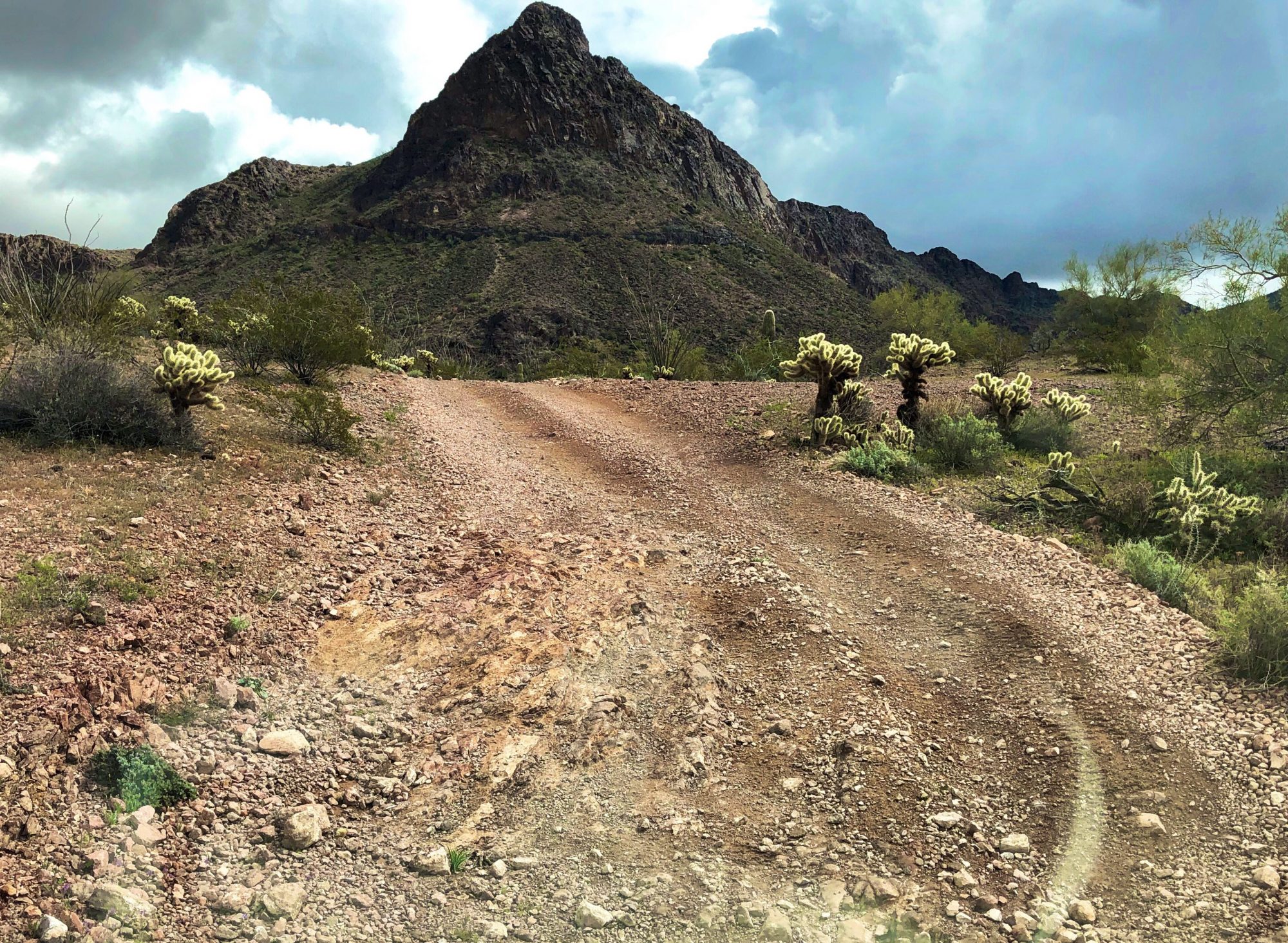
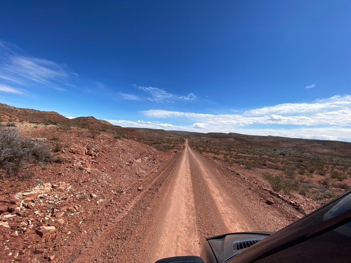
After our stay in ABQ we began our journey to southern New Mexico to visit White Sands National Park and Carlsbad Caverns National Park. We travel the backways as much as we can in order to take in as much natural beauty as possible. Fortunately, New Mexico offers many opportunities to travel overland on dirt roads and trails through public lands managed by the BLM and NFS.
From ABQ we journeyed overland via the Quebradas Backway which took us through rolling hills and canyons. Beautifully striated ridgelines are in view to the west throughout the length of the backway.
After completing the backway we continued further south stopping in Truth or Consequences before camping north of Las Cruces. Truth or Consequences was originally named named Hot Springs for the 40 different hot springs located in the town. The town changed its name to Truth or Consequences in 1950 to in order to have the radio show of the same name aired in town for the shows tenth anniversary. Our only recommendation if you find yourself in T or C is to stop into Ingo’s Art Cafe, have a cup of coffee and meet Ingo.
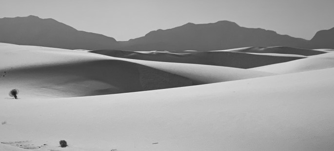
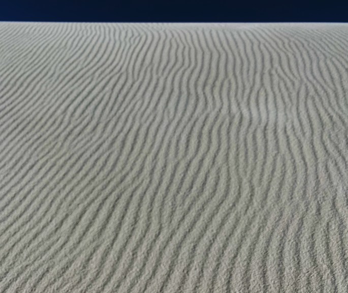
White Sands National Park is the largest gypsum dunefield in the world. It is truely unique with its ever changing landscape of wind sculpted dunes that cover 275 square miles of the Tularosa Basin. The other unique feature is that the national park sits inside the White Sands Missile Range. When missiles are being fired the park closes for obvious safety reasons – check before you go so you are not disappointed.
We think the park can be experienced in one day by driving the loop road and taking a couple of hikes into the dunes. You will also see kids sledding on the dunes.
Video Clip
Video Clip
After leaving White Sands we traveled up into the Sacramento Mountains of the Lincoln National Forest. The Sacramento Mountains rise right up out of the basin floor to an elevation of over 8000 feet above sea level. There are a number of vista points that provide surreal views of the White Sands dunefield below.
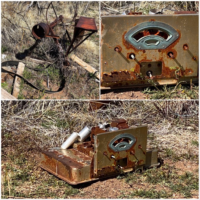
Lincoln NF has hundreds of hiking trails through out the forest. The town of Cloudcroft sits at the top of the range, a cute mountain town that is a good base camp for hiking in the forest and offers several good restaurants and coffee shops. High Altitude outfitters is an excellent shop for anything you need for your outdoor activities and Black Bear Coffee will get you caffeinated. A number of the trails utilize the railbed from the former Almagordo & Sacramento Mountain Railroad which hauled timber down through the Fresnel Canyon. The railroad shutdown in 1947 but a number of the impressive trestles are still standing and can be seen while hiking. We also came upon several abandoned homesteads while hiking in the forest.
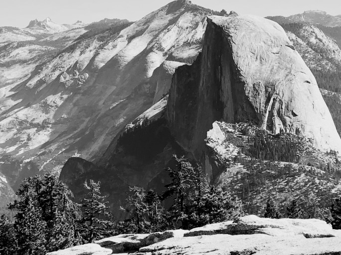
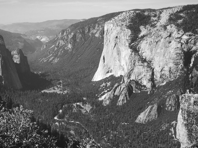
With repairs to the Beast completed we set out to Yosemite National Park for our first ever visit. We had perfect weather during our three day visit to the park. We did have to contend with smoke from the Briceburg Fire settling in the Yosemite Valley on our first day.
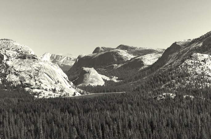
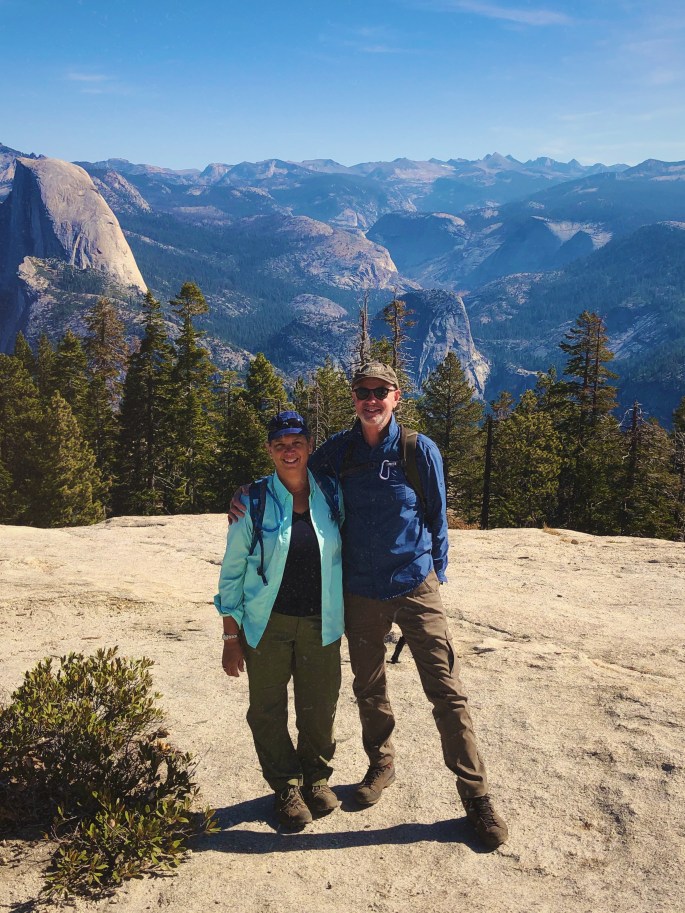
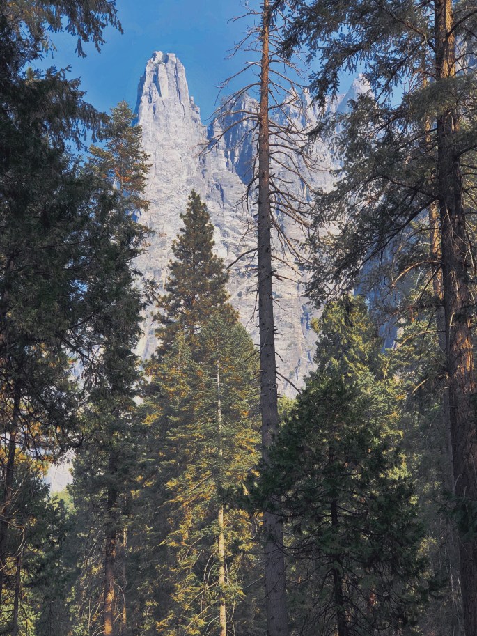
Yosemite is located in the Western Sierra Nevada and features a number of dramatic, well known granite formations. Many of these formations are in Yosemite Valley and should be seen or experienced in some fashion – hiking, climbing or driving. We particularly enjoyed the hikes accessed from Glacier Point Road which provide many spectacular views.
We also recommend visiting other areas of the park outside of the valley. The park is almost 1200 squaremiles in size – there are many opportunites to see and experience the park outside of Yosemite Valley, without the traffic and crowds.
Yosemite NP is a must see if you are a national park fan. We camped outside the park in the Stanislaus NF. If you want to to stay in one of the park campgrounds or lodges you will need to reserve many months in advance. Regardless of where you stay, driving will be required to access the various areas of the park. Also, go early as trailhead parking is very limited.
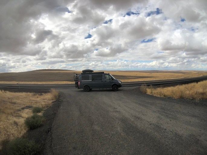
Working our way through northern Nevada to get to the Alvord Desert and Steens Mountain Wilderness in Oregon.
Be seeing you!
Half Dome
El Capitan, Yosemite Valley
Three Brothers
Merced River, Yosemite Valley from Roosevelt Point
Smoke from Briceburg Fire Drifting Through the Valley
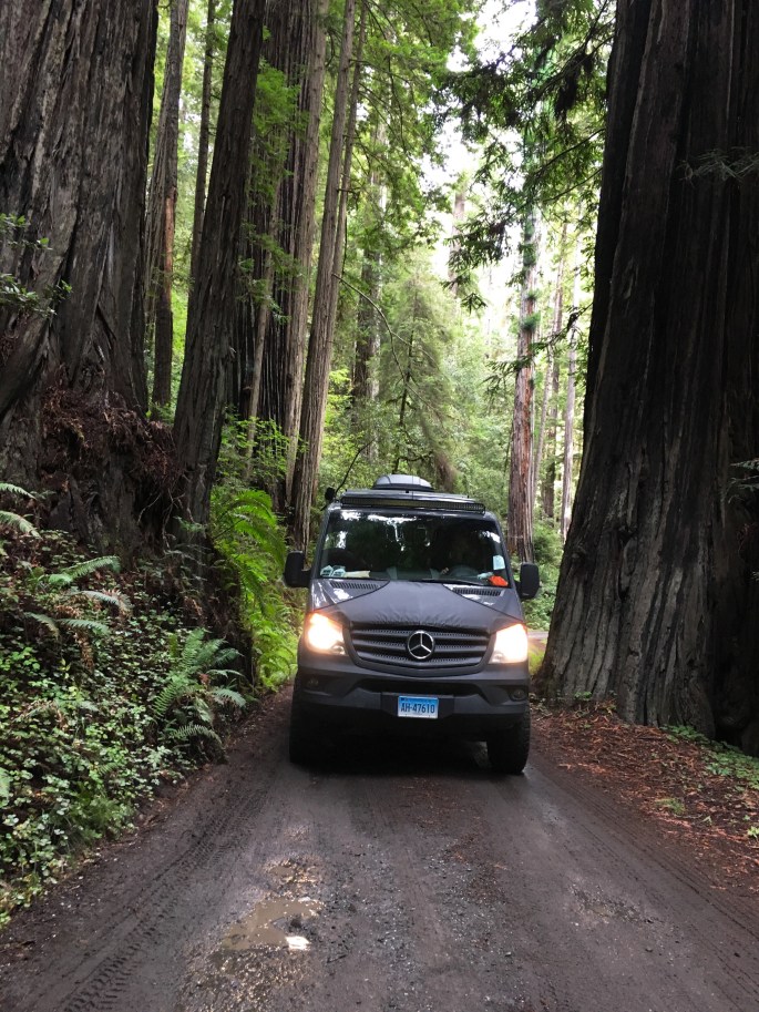
We continued down the coast to the town of Arcata after leaving the Redwoods National and State Parks. Arcata is home to Humbolt State University and very much has the look and feel of a small college town, albeit sitting on the Pacific coast. The weather favored us with a couple more delightful beach days of which we took full advantage.
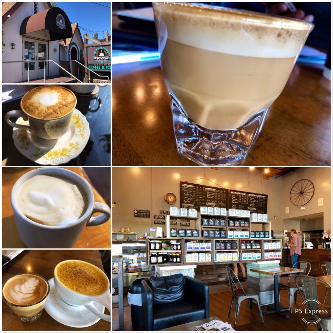
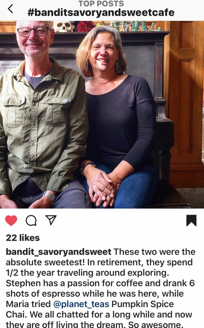
From Arcata we stopped in Eureka to visit Bandit Savory and Sweet for coffee and tea before setting out for the town of Ferndale. Ferndale is a picturesque town with a quaint main street and beautiful Victorian homes. The town has been used in many television shows and movies. Lots of boutique stores for those so inclined.
After a walk through town we decided to tackle the “Wildcat”. The “Wildcat” is a narrow, twisty, sometimes paved road that starts in Ferndale and winds up and over the northern King Mountain Range and then drops down to the ocean at Cape Mendocino. This area is the only coastal wilderness in all of California. There are no major roads and literally no development. Many automobile commercials are filmed on this road in order to take advantage of the spectacular scenery.
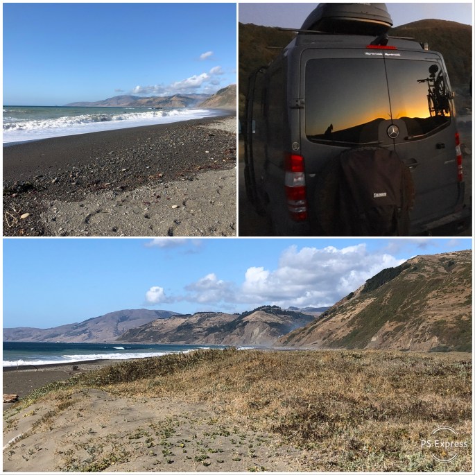
We followed the road to Mattole Beach where we were able to camp on the beach. It is incredibly beautiful but completely primitive – no facilities. The combination of the sound of the surf and the night sky is mesmerizing!
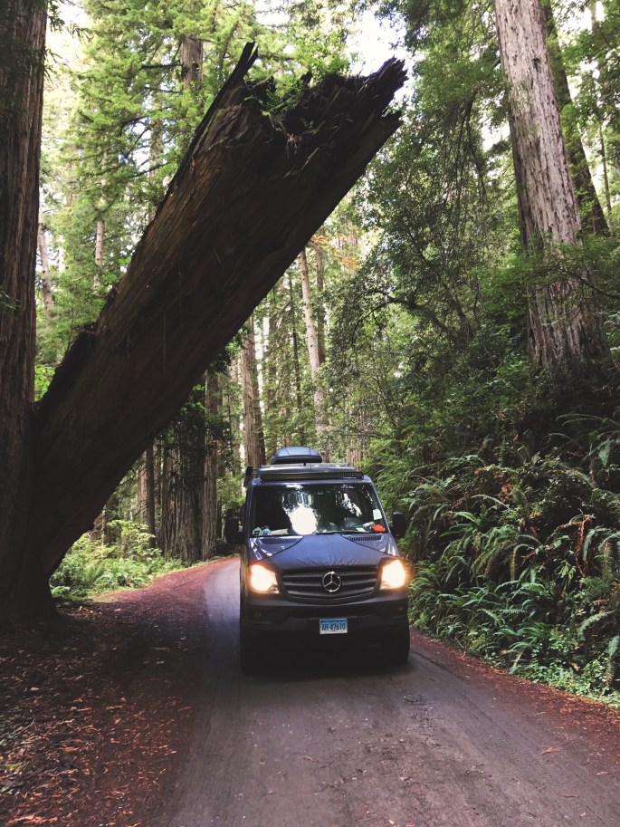
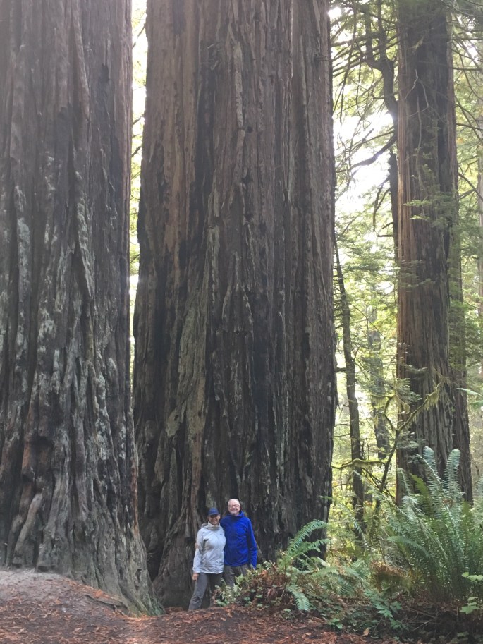
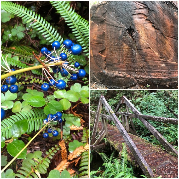
From the beach we followed Mattole Road to Humbolt Redwoods State Park. We were awed by our experience at Redwoods National and State Park. The Redwood Sequoias at Humbolt are even more impressive than what we had seen previously. The trees in Humbolt are protected from the wind by the King Mountain Range and receive far more sun than the coastal redwoods further north. As a result they are even taller than the coastal trees. If you only have time to visit one park we recommend Humbolt.
This area is all part of Humbolt County. While the area is wild and scenic it is economically depressed. We observed many “travelers” in the small towns. There is an edginess with so many travelers about in such small towns (many are transient pickers).
Humbolt County has been home to a significant number of small marijuana farmers since the 1970s. As this industry was vital to the local economy the police in the county did not generally enforce laws regarding the growing and selling of marijuana.
The legalization of marijuana has changed all of that dramatically. Officials are now obligated to regulate the industry. The long time illegal growers that operated on a completely cash basis must now get licensed, follow environmental regulations, pay taxes and put their transient pickers on the payroll.
While a number of farmers have quit the business we still saw many marijuana operations as we drove through the remote Lost Coast area.
We highly recommend touring the Lost Coast. It is some of the most beautiful and undeveloped coastline that remains anywhere in the states.
Off to Sacramento……be seeing you!
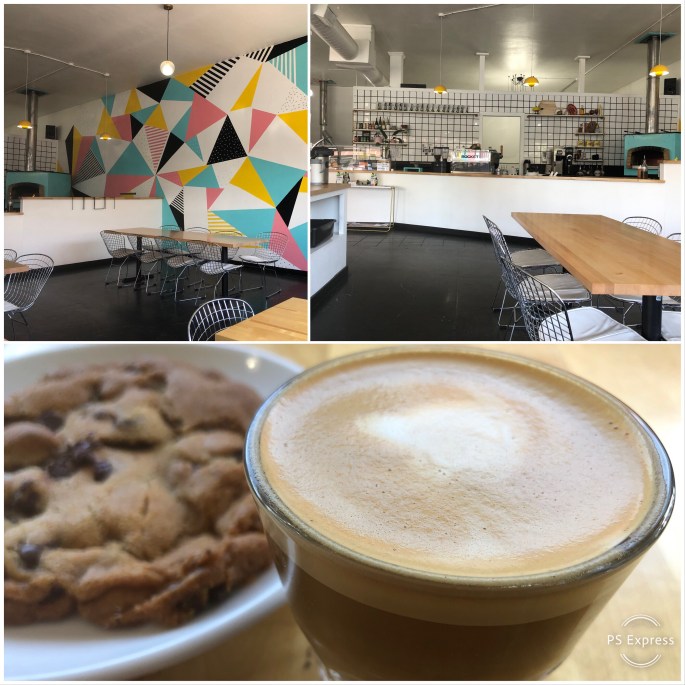
North Town Coffee, Bandit Savory & Sweet, Black Oak Coffee Roasters
‘Good night, good night! Parting is such sweet sorrow’ …or we departed Ashland, home of the Oregon Shakespeare Festival, for the Northern California coast and the majesty of the Redwood forests in Redwood National and State Parks.
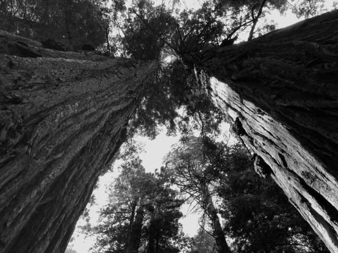
The Southern Oregon and Northern California coast is home to the vast majority of coastal Redwood trees in existence today. These trees are as tall as 360 feet, with a trunk diameter of 30 feet and may live up to 2000 years.
Just a fraction of the old growth Redwoods remain standing today as logging of these magnificent trees continued as late as the 1960s. Today the majority of Coastal Redwoods reside within state and federal lands and are protected by law. Additionally, state and federal agencies are working to ensure the survival of new growth Redwoods through careful management of the environment surrounding the current generation of trees.
Hiking and camping within a Redwood forest was an experience that reminded us of how small we are as human beings and how temporary our stay here is in regard to the natural order of all things. These silent giants dwarf everything around them and demand reverence and silence as you walk among them – we cannot articulate why – they just do.
There are many camping opportunities within the forest and along the coast from which to visit and enjoy the Redwoods, so come and enjoy the beauty.
We will spend a few more days on the coast before moving inland to go to Fresno for repairs to the Beast. After that, weather permitting we will visit Yosemite National Park.
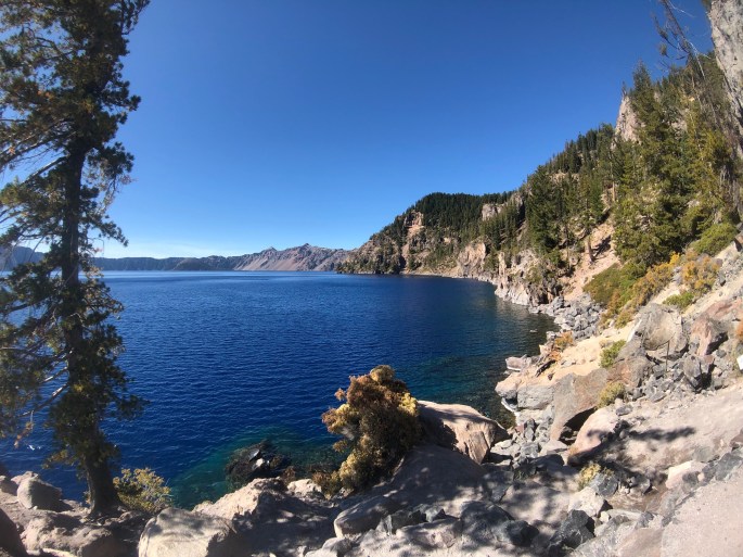
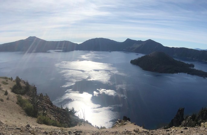
After leaving the Oregon coast we followed the Umpqua River east to visit Crater Lake National Park. Crater Lake is fascinating geologically and quite the natural phenomenon to behold. The crater was formed about 7700 years ago when Mt. Mazama erupted. Years of rain and snowfall into the crater, which has no outlet, gave birth to the lake. It is believed to contain the cleanest water in the world and the average water depth of 6500 feet makes it the deepest lake in the U.S.
Having said that, we would not recommend more than a day or two if you plan on visiting the park. The rim drive allows you to stop at a significant number of lookouts and view the lake from various vantage points but the entire drive is only 31 miles and at most consumes half a day.
There are a number of hikes in the park but only a handful provide views of the lake and only one goes down to the lake. If you visit CLNP, most definitely have a drink (or two) on the porch of the lodge in Rim Village in the late afternoon. And yes, the water is really that blue!
Heading back to the coast and Redwood National Forest after a quick stop in Ashland, Oregon to visit Noble Coffee Roasting (Good Foods Award winning roaster of Ethiopa Buku beans).
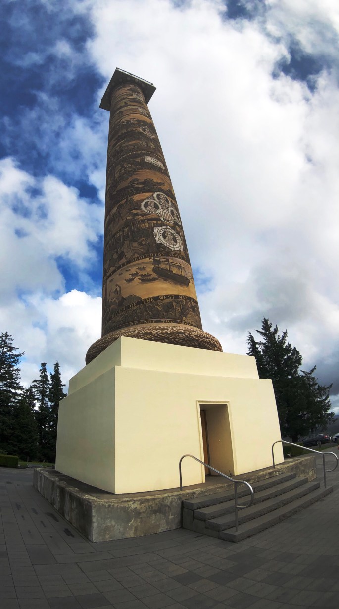
After our stay in Portland we traveled west along the banks of the Columbia River to Astoria where we would begin our journey south along the Oregon coast. Astoria sits at the confluence of the Columbia and the Pacific Ocean. Due to the massive flow from the Columbia into the Pacific entering and departing the river is often extremely hazardous due to the ever shifting “bar”. The Columbia River Maritime Museum in Astoria is an excellent museum which provides a much deeper understanding of the maritime history of the river. The museum sits right on the bank of the river and has a retired light ship which can be toured as well.
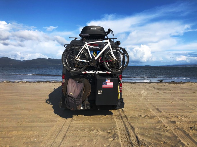
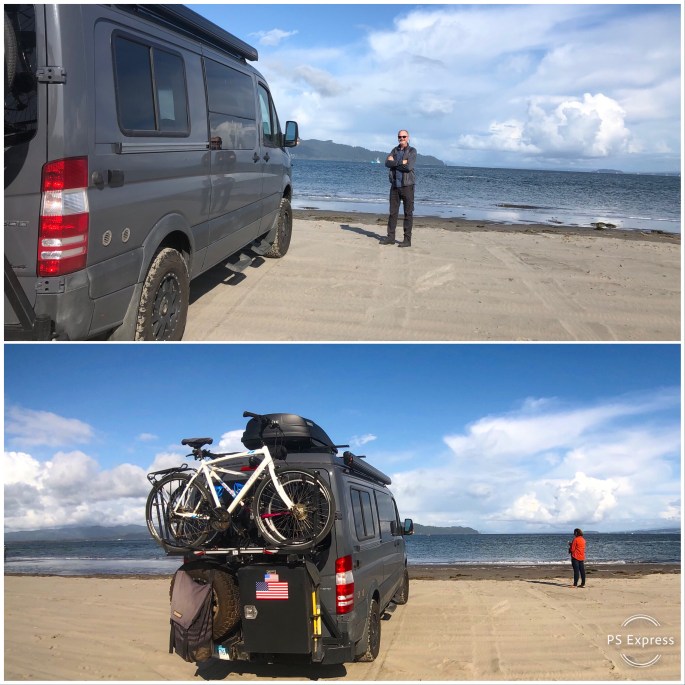
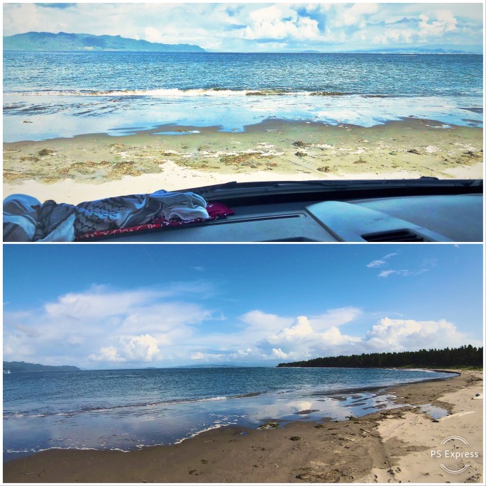
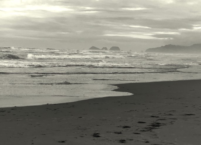
From Astoria we followed the Pacific Coast Highway south as far as Reedsport before turning inland to visit Crater Lake NP. The Oregon coast is breathtakingly beautiful and pristine. The state of Oregon purchased the land along the coastline back in the 1930s. As a result there is no commercial development on the beaches and the entire coastline is dotted with state parks and recreation areas where you can camp with a view of the ocean and walk five minutes through the dunes to the beach. Most of the beaches range from three to seven miles in length with broad flat expanses of firm sand making for great walks along the shore. Temperatures this time of the year average around 65F as the high.
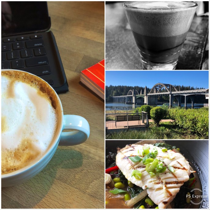
There are also a number of small beach towns lining the coast which offered us the opportunity to dine on fresh seafood and enjoy good coffee and tea during our leisurely tour.
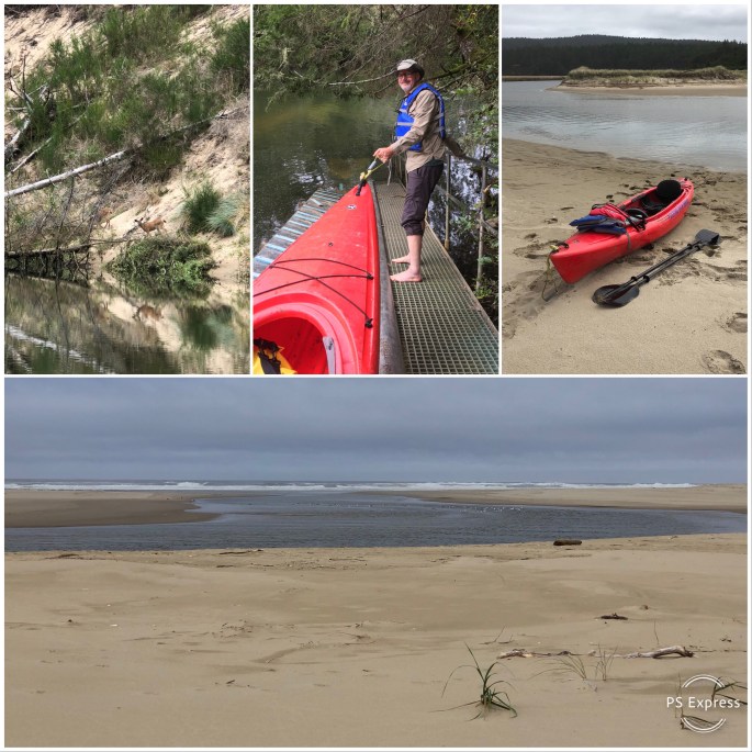
The Oregon coast also has numerous smaller rivers emptying into the Pacific. We capitalized on this by kayaking on the Nehalem and Siltcoos Rivers. We particularly enjoyed the Siltcoos as we were able to kayak all the way to the Pacific.
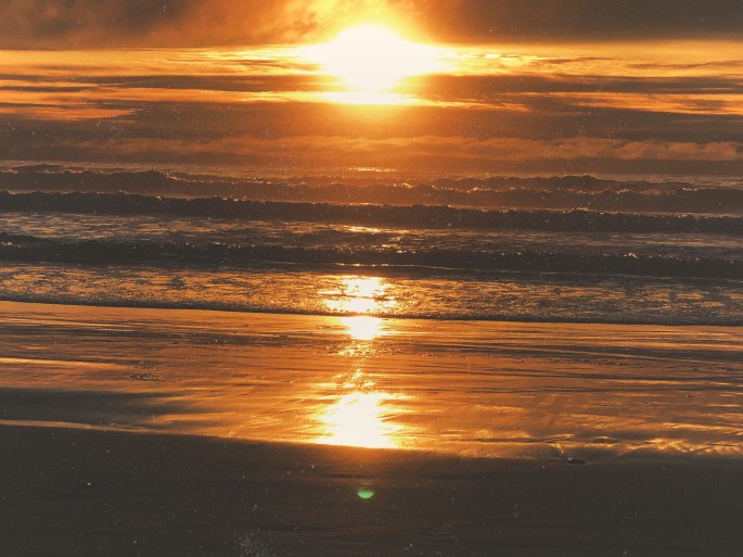
We had never been to the Oregon coast before this trip but came away as big fans. We cannot speak to the summer season (crowds) but September is glorious. And, by the way, the sunsets viewed from the beaches here are magnificent!
Be seeing you!
Columbia River, Fort Stevens
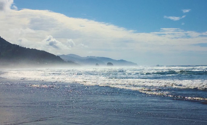
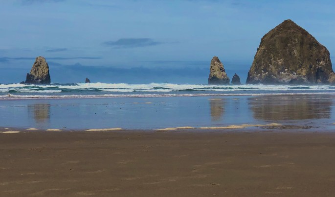
Haystack Rock, Cannon Beach, Oregon
Kayaking, Nehalem River, Wheeler, Oregon
Three Arch Rocks National Wildlife Refuge
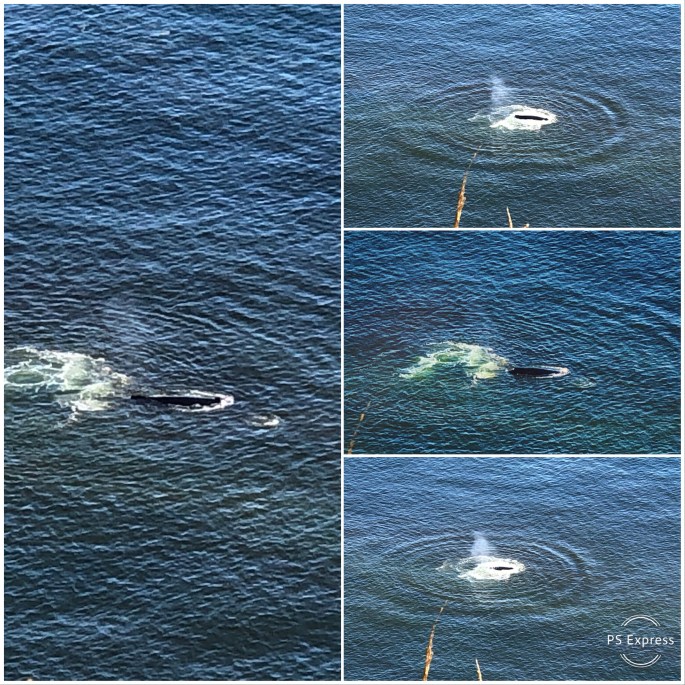
Migrating Grey Whales, Cape Lookout
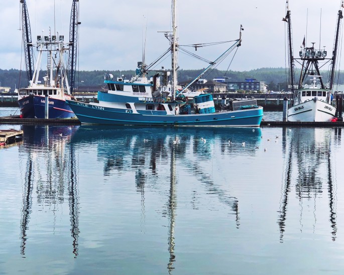
Fishing Fleet, Newport, Oregon
Beachside SRA, Waldport, Oregon
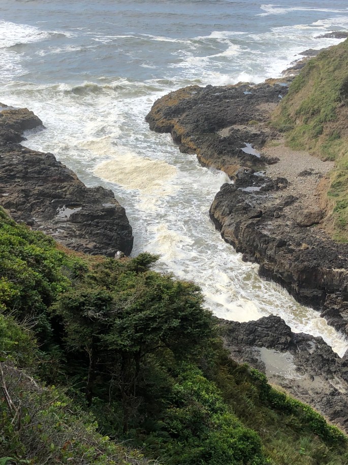
Devils Churn, Cape Perpetua
Cape Perpetua Light, Siuslaw NF
Oregon Dunes NRA
Siltcoos River
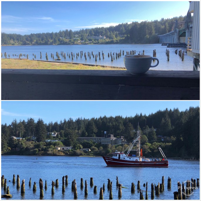
Coffee with a View, Siuslaw River, Florence, Oregon
After a couple of days of vicariously living the cowboy and cowgirl life at the Pendleton Round-Up (“let ‘er buck”) we took off the spurs and began our journey westward towards Portland and ultimately the Oregon coast.
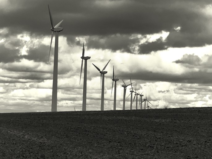
We charted a course to Cottonwood Canyon in order to camp and hike along the John Day River. Our route took us through Gilliam and Morrow Counties which are dominated by large ranches and grain growing operations. What we did not realize prior to this trip was that this vast agricultural landscape has become home to four of the largest wind farms in the United States (some thoughts on this subject in closing).
Cottonwood Canyon SP was created in 2008 when the Western Rivers Conservancy purchased the 8000 acre Murtha cattle ranch and in turn sold the land to the state of Oregon. The Western Rivers Conservancy made this purchase to ensure that the John Day River remains free-flowing from its source in the Strawberry Mountains until it merges into the Columbia River. The John Day river is the third longest free-flowing river in the lower 48 states at 284 miles (Yellowstone River and Salmon River are first and second longest).
We were keen to hike and camp here to experience the spectacularly beautiful and pristine canyons rising along both sides of the river and explore some of the beautiful and rugged side canyons. The scenery did not disappoint. Camping is limited to 21 primitive sights available on a first come first served basis – so keep that point in mind when you set out to this area.
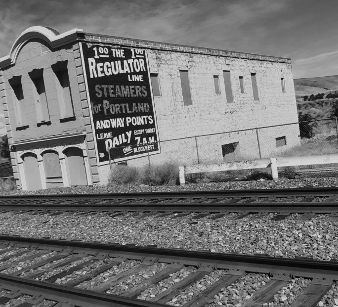
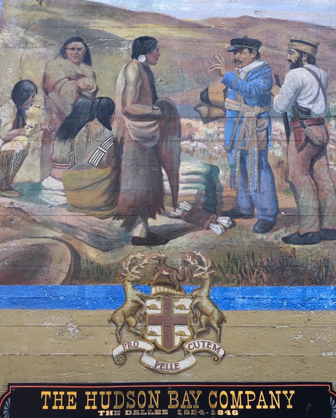
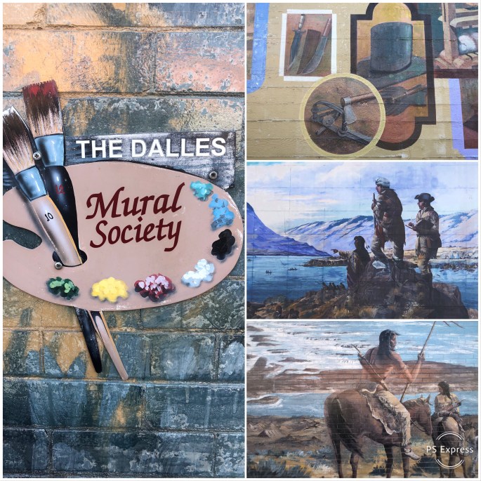
From Cottonwood Canyon we drove north to the Columbia River and traveled west to The Dalles which is a city of apx. 15,000 sitting hard on the river. The Dalles’ history goes back 10,000 years as a major Native American trading post. In the early 1800s Lewis and Clark stopped here and within several years the Hudson Bay and other fur trading companies were actively doing business in The Dalles.
We have included below several photographs of various murals that we saw in The Dalles. The Dalles, like other western towns we have visited, have active mural societies which focus on preserving the history of the town through these works.
Our ultimate stop before Portland was Mt. Hood National Forest. The “centerpiece” here is of course Mt. Hood which dominates the skyline at an elevation above sea level of over 11,000 feet and a prominence of over 7,000 feet. Mt. Hood is certainly spectacular but the Mt. Hood NF would be worth visiting without the draw of the peak.
Mt. Hood NF covers almost 1.8 million acres and has eight distinct wilderness areas. There are over 1000 miles of hiking trails, numerous lakes for boating and unlimited camping opportunities through out the forest. In winter Mt. Hood NF is a “snow zone” affording snowshoeing, nordic skiing, and alpine skiing opportunities at any of the many snow parks accessed from Routes 35 or 26. These two roads which bisect the park are kept open all year. Lastly, if all that does not tire you out you can attempt to climb Mt. Hood!
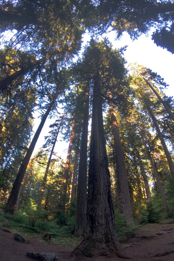
We were able to camp along rivers or creeks every night during our stay and enjoy the rush of the water and the night sky in complete solitude while being comfortably surrounded by towering Douglas-fir trees. It does not get any better for us!
Okay…wind power. As we have traveled across the west during the last 13 months we have seen vast tracts of land lined with massive wind turbines marring the beauty of the landscape. What we have observed is that there is no consideration of the asethetic damage inflicted upon our eyes and souls. Five hundred foot tall turbines lining the ridges of the Sierra Nevada Mountains is an awful sight plain and simple. The fact that the large wind farms in Eastern Oregon are placed in lightly populated agricultural areas does not change the equation in our opinion.
But in our minds the real issue is that this scarring of the landscape – the beauty of our world – can never replace fossil fuels. Wind provides intermittent power and will always need to be supplemented by current power sources. Economically wind power owes its perceived viability to deep tax credits provided at the federal and state level. Not a single turbine would have been erected without these credits. This is nothing short of crony capitalism.
So let’s postulate that we all agree that the world would be better if we did not need to create electricity by burning coal which releases so much CO2. Natural gas is better but emits CO2 at about 50% the rate of coal.
It might surprise you to know that nuclear power is the lowest cost means to generate electricity and produces zero emissions. France committed to nuclear power 40 years ago and generates over 70% of its electricity via nuclear power with just 58 power reactors.
Perhaps it is time to reconsider nuclear power as the viable replacement for fossil fuels as the power source for electricity generation.
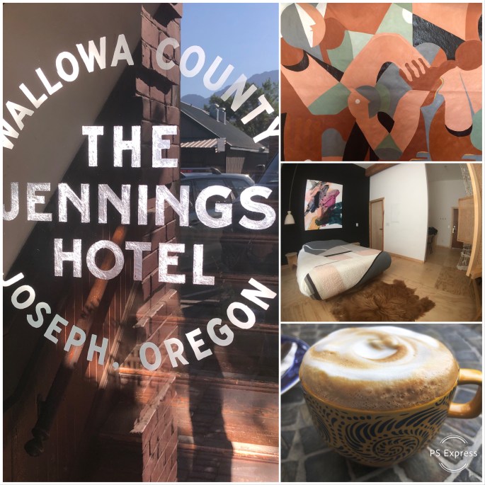
After leaving Hat Point and the breathtaking views of Hells Canyon and the Snake River we followed the Hells Canyon Scenic Byway to Joseph, Oregon. Joseph is a small town (pop. 1081) named after Chief Joseph, the leader of the Nez Pearce. The town was historically highly dependent on agriculture and timber as the major drivers of its economy. Tourism and three local bronze foundaries have replaced agriculture and timber.
Joseph is a gem. Despite its small size it has a number of fine restaurants, coffee shops and interesting retail stores. The town is the classic main street with no traffic lights and diagonal parking (no chain stores here!).
We stayed at a brand new hotel called the Jennings located in a turn of the century brick building that was formerly…you guessed it…the Jennings Hotel. A local artist by the name of Greg Hennes brought the hotel back to life through a Kickstarter funding campaign. Each room is unique – designed by a different artist or designer.
The Jennings also has an artist in-residency program and a cooking and crafts school. A very cool and fun place to stay. The second floor has a covered porch where you can sit and watch everything happening on Main Street or take in the Wallowa Mountains that lie just outside the town.
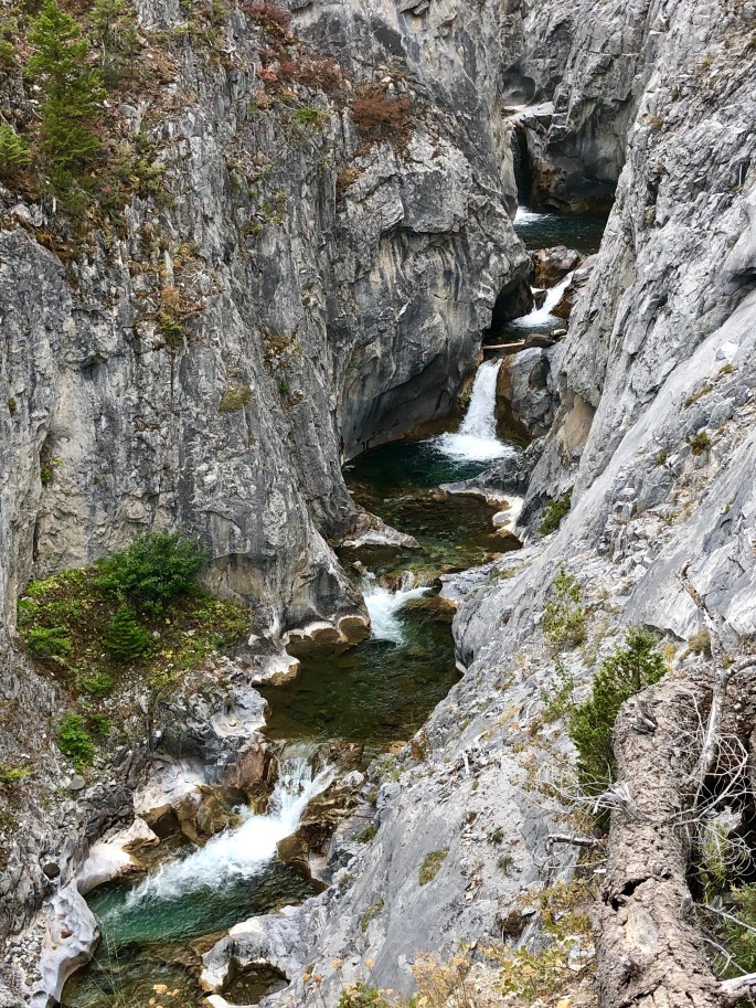
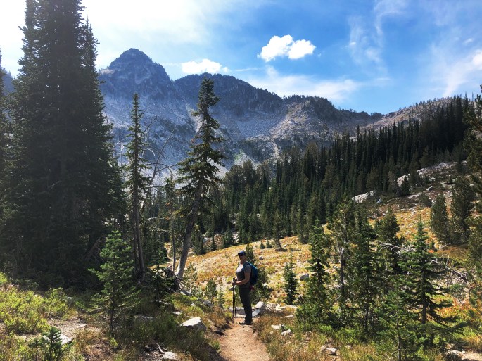
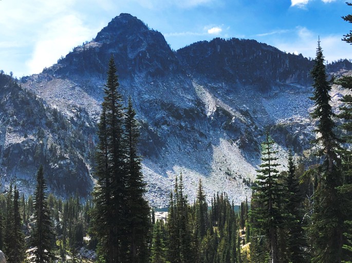
The Wallowa-Whitman NF offers an abundance of hiking, fishing, equestrian and camping opportunities. After leaving the Jennings we ventured into the Wallowa by journeying south some 20 miles into the Lostine Canyon. We camped along the banks of the Wild and Scenic Lostine River from where we could access a number of challenging hikes that provided us with the opportunity to climb high into the Wallowas for views of the Hurrincane Divide and wading in glacially formed lakes surrounded by granite cirques.
We left Lostine Canyon exhausted but happy!
We completed the Hells Canyon Scenic Byway with stops in Enterprise, Wallowa and La Grande before departing further north for the city of Pendleton. Pendleton is the home of Pendleton Woolen Mills and very much the classic cowboy town.
Our visit to Pendleton coincided with the 109th Pendleton Round-Up. The Round-Up takes place over a full week with many activities – parades, rodeo events, pageants, dances and concerts. Rodeo contestants come from all over to participate and the round-up includes a Professional Bull Riders (PBR) competition.
We extended our stay to watch the womens barrel racing event. These riders and their horses have no fear. The speed and power of the horses is amazing – particularly to the unitiated like us.
We are working our way west from Pendleton with the expectation (at least for now) that we make the Oregon coast about a week from now.
Be seeing you!
Hurricane Creek Rapids
Sacajawea Peak, Eagle Cap Wilderness, Wallowa NF
Slippery Rock Creek, Wallowa Mountains
Maxwell Lake, Eagle Cap Wilderness
Hurricane Divide, Wallowa Mountains, Eagle Cap Wilderness
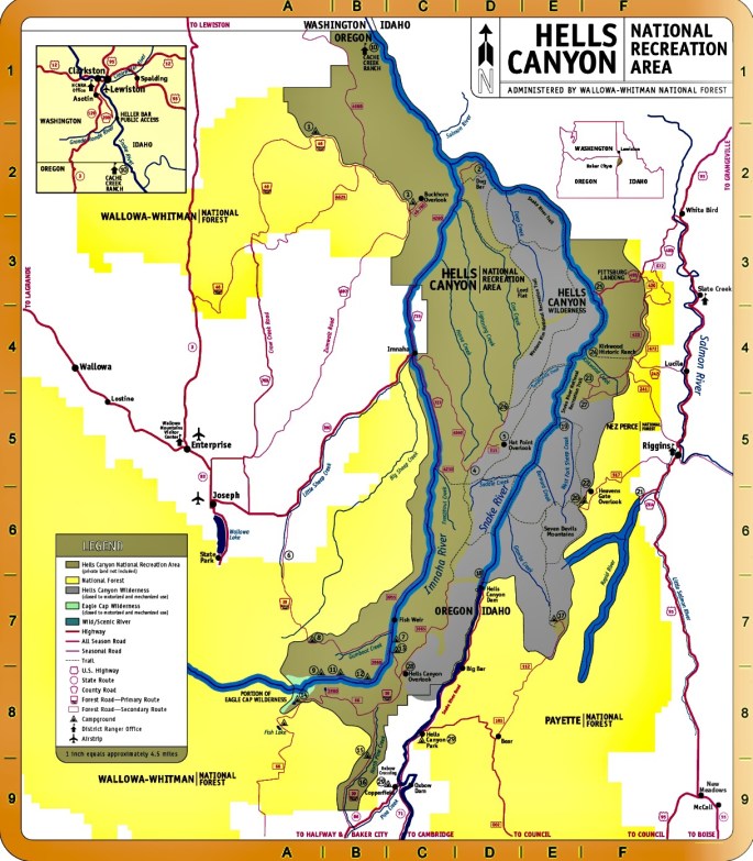
After leaving the McCall area we traveled west to follow the Snake River north to Hells Canyon. The Hells Canyon Wilderness has been on our must see list for quite some time. Three dams were constructed on the river by Idaho Power Company (IPC) in the early 1960s, which generate significant power to Idaho. The dams and power plants are so remote that IPC provides company housing nearby each of the facilities.
The good news is that below the last dam (Hells Canyon Dam) the canyon and river remain a protected wilderness – there is no road – no electricity – no water. In order to access the canyon in the wilderness area you have three options – walk, go down river (raft, kayak or jet boat) – access at HC Dam – or fly in utilizing the grass airstrip on the banks of the river by the former Kirkwood Ranch.
Today, Hells canyon is completely uninhabited. A number of families attempted to make a living ranching and mining within the canyon but only a couple of ranches managed to survive for any length of time. The last ranch was abandoned in the early 1960s. There is ample evidence from pictographs that native americans were in the canyon long ago.
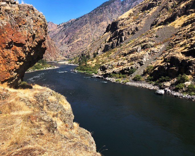
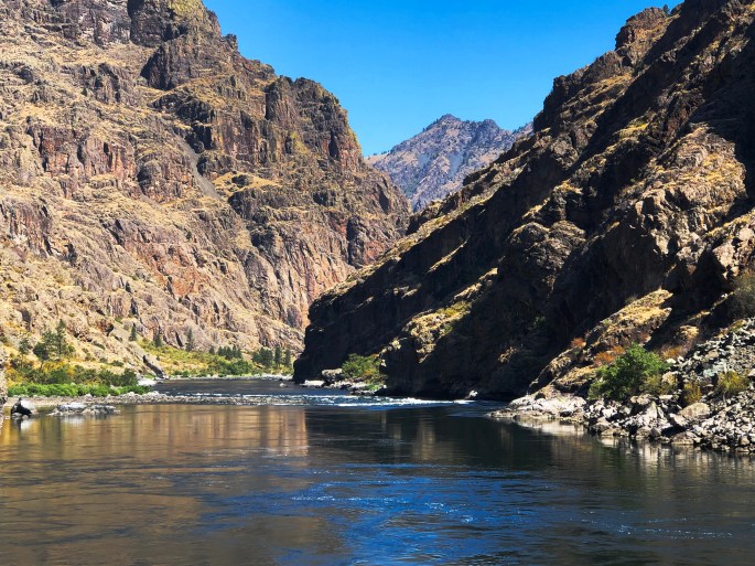
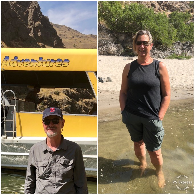
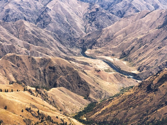
Hells Canyon at is deepest point is the deepest gorge in North America (7900 feet). We wanted to experience the canyon from river level, from above, and go as far downriver as possible. Fortunately, we were able to catch a jetboat tour that took us downriver 27 miles to the site of the former Kirkwood Ranch (sheep) before returning to the dam access point. Our river journey provided us with the ability to see the very remote and pristine canyon – we could not possibly have hiked anywhere near that far downstream. The added benefit was the fun of running the numerous rapids on the river between the dam and our turnaround point. We did hike along the river for several miles which gave us the on the ground vantage point. Finally, we drove the Hat Point Road to gain a spectacular view of the canyon and river from an elevation of 6900 feet above sea level.
The Hells Canyon Wilderness is a beautiful, awe-inspiring area, but come prepared as there is very minimal infrastucture anywhere near the area and almost no connectivity.
P.S. Summer temperatures average daily high 100+F!
Hiking To Stud Creek Trail, Snake River, Hells Canyon
Imnaha, Oregon Pop. 159 – Starting Point for Hat Point Road Drive
Wild and Scenic Snake River Viewed From Hat Point (Elev. 6982)