Grand Teton National Park

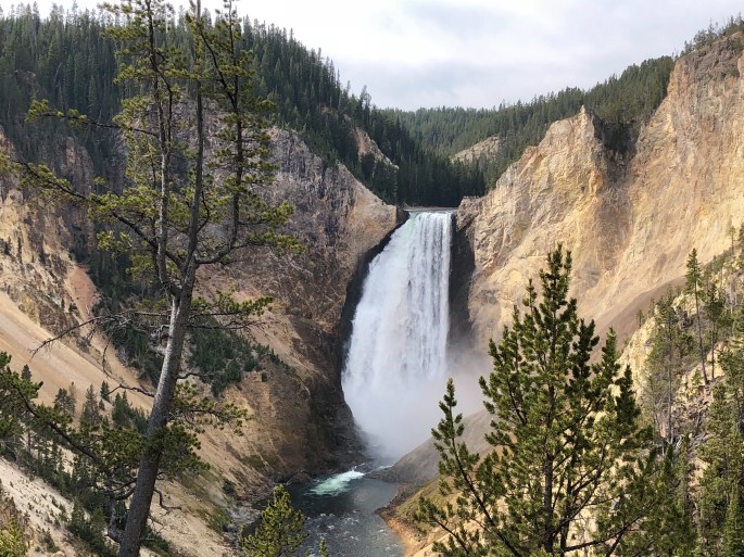
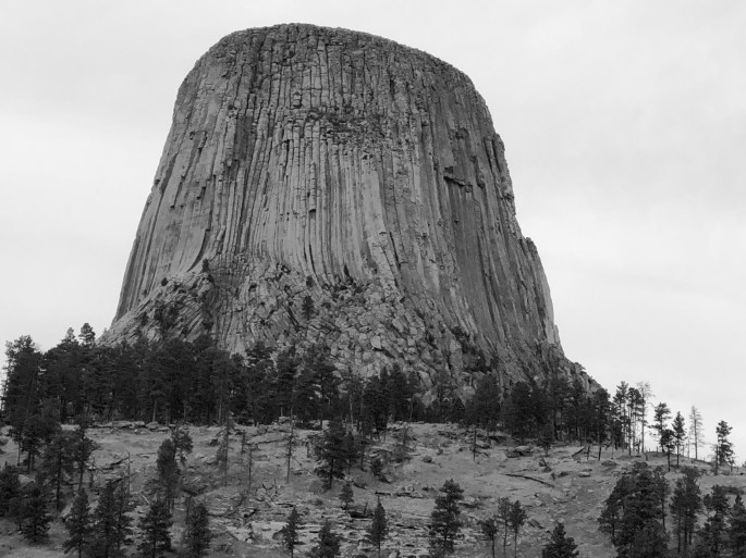
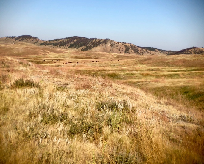
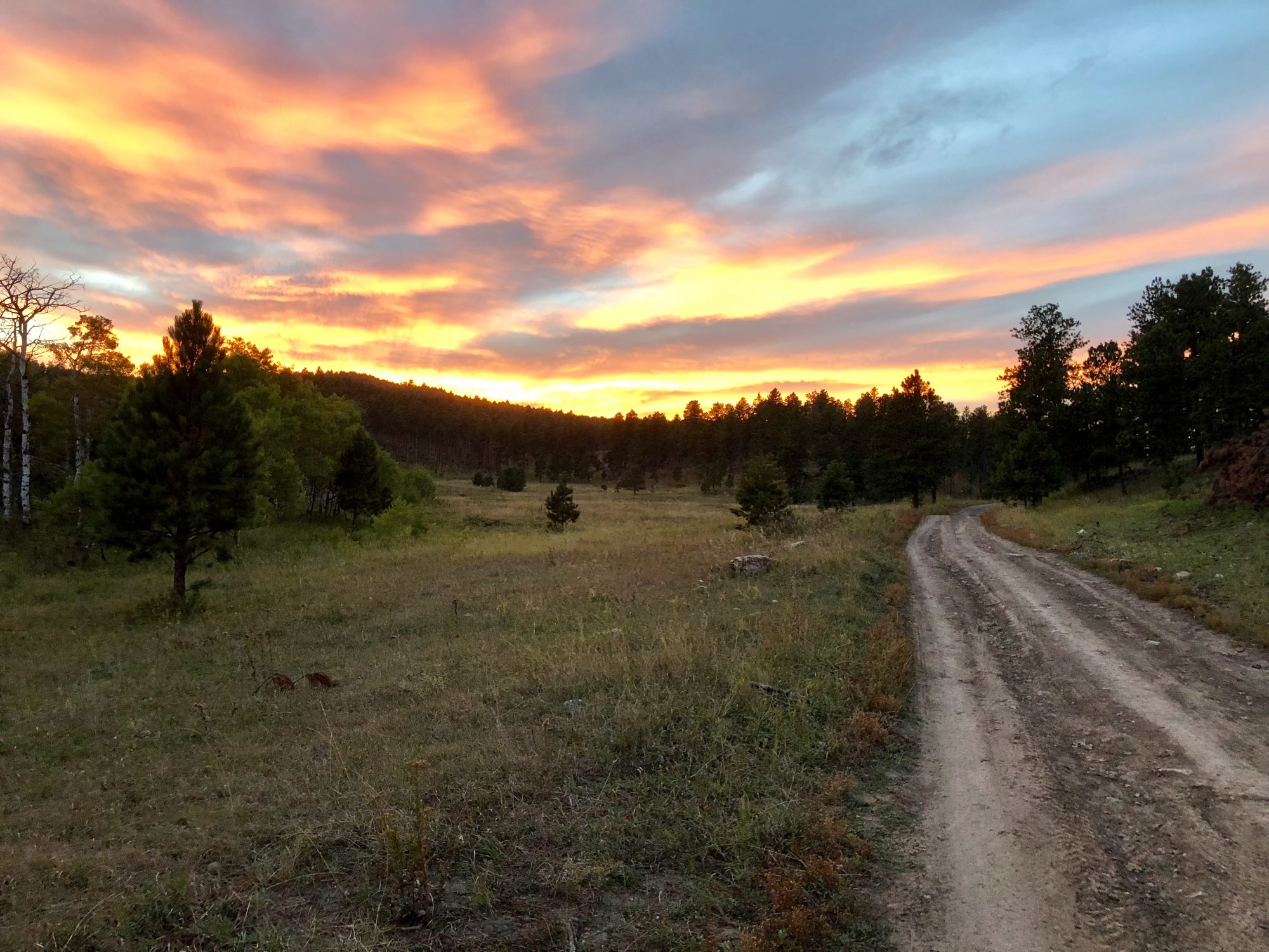
GTNP is a small NP compared to YNP. The dozen or so peaks that exceed 12,000 feet are a spectacular sight rising straight up from the floor of the Jackson Hole with no foothills. The park is abundant with Elk and Moose feeding along the Snake River.

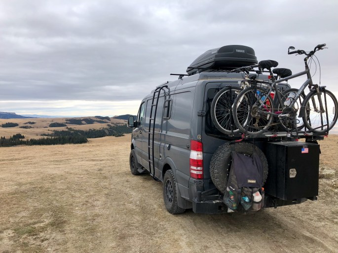
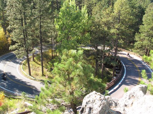
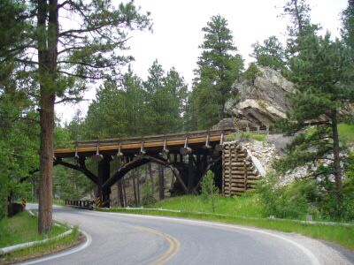
Over the last several years hundreds of miles of mountain bike trails and paved trails have been added all around the Jackson Hole. You can ride your bike from Jackson all the way to and through way the park. This area is really becoming a biking meca. Aditionally, there are a number of excellent hiking trails of which we were able to take advantage of with the mild day time temperatures and dry conditions.

The town of Jackson has become very touristy and pricey. There has been a considerable influx of foreign tourists coming in large bus convoys. The good news is that despite all the crowds you can still find relative solitude on the trails since most of these groups hop on and off the buses to take photos and then move to the next scenic look out. Can’t help but feel sometimes that the more popular parks feel  Disney like in the way they now have to manage transportation and crowds to accommodate up to four million visitors a year. Some of the parks are way to small to handle these numbers and now have waits of hours to get a shuttle into the park.

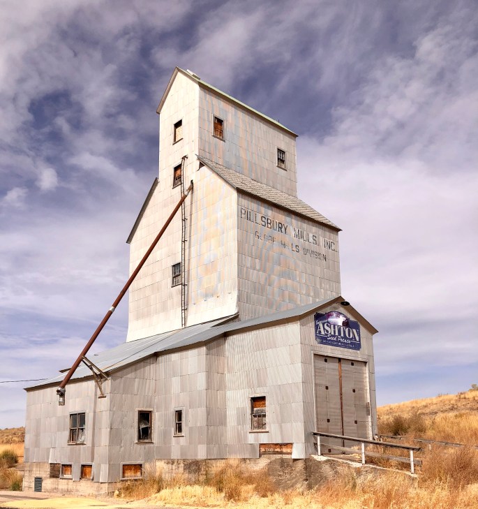
Excited to be heading west into Idaho to spend some time at several unique national monuments that require backcounty travel capability.

678346A2-3289-4571-BA5B-680F91D13932
Taggert Lake
FEDBF5BA-A00E-49B6-8D55-95714D1B1AB4
Bald Eagle Snake River
EDDB4A44-4385-4DBC-B4D4-EE972EE41F65
Bird Watching at Snake River

Big Horn National Forest and Yellowstone National Park

We traveled through Big Horn NF on our way to Yellowstone NP. The weather in Big Horn was cold and windy but we managed to hike out to the Medicine Wheel. The Medicine Wheel is a sacred site for Native Americans, constructed by Plains Indians between 300 and 800 years ago. The various spokes of the circle align to astronomical events.

The weather at Yellowstone NP was cool but mostly dry, so we were able to complete a number of hikes and drive the park loop roads.

We made the obligatory visit to Old Faithful Geyser to see the eruption which we have to say is pretty cool. The thermal activity throughout the park is spectacular, especially in the morning when the air is cool.

Grizzly Bears were out and about while we were in the park. Many folks seem disappointed not to have seen a Grizzly up close however, they clearly do not understand the danger of an encounter with a Grizzly. We did have a terrific view from a safe distance of a female Grizzly by the lake. We also had to wait on one trail while park law enforcement drove off a Grizzly by firing blank shotgun rounds – a little too close for comfort.

The night time temperatures are dipping consistently under freezing so we are heading south towards warmer weather.


3777E09A-C589-4F74-A2E8-9057AA67ABE4
Medicine Mountain 

Medicine Wheel


664432D7-7D4A-4A2B-A0BA-D351072191B6
Yellowstone Canyon
DE3665F6-108C-4BE2-BF07-CEEFFC9C84E8
Lower Falls Yellowstone River


Sheridan, Wyoming


Enjoying great weather as we journey west towards Yellowstone National Park. We spent a couple of days in Sheridan. This is truely cowboy country. Saloons abound along Main Street along with sellers and manufacturers of everything related to horses – saddles, bridles, bits, blankets, etc. This is ranch, horse and rodeo country.

We were fortunate to be able to stay at the Sheridan Inn while in Sheridan. The Inn first opened in 1893 and was home to Buffalo Bill Cody for a number of years. Cody would audition potential new acts for his wild west show on the large expanse of front lawn at the inn.

Western towns typically have alleys and narrow lanes running behind store fronts. We have learned to wander around in these spaces as they often are art spaces and living spaces. Sheridan proved productive in that regard. 0050,0051

980BDF34-C545-4737-812A-224FFB41FCA4
Kings Saddlery
FE392CAD-1DE3-470F-9E58-F563ED118B23
Sheridan Inn

437A4421-E56D-4B67-AB11-601A4699AD60

24B6CEB2-6B6A-416A-8AE9-69CE4DC4966A


Devils Tower National Monument

We camped and hiked at Devils Tower NM near Moorcroft, Wyoming. This is the rock structure that was prominently featured in the Spielberg film Close Encounters of the Third Kind. This formation rises over 1200 feet including the base. It is a sacred site for Native Americans and as you hike around the formation you will see prayer flags hanging from rocks and trees.

The bottom left photo was the view from our campsite. The formation so dominates the landscape that you just find yourself drawn to it and staring at it for several minutes at a time. 

Heading further West and North today and hoping the weather cooperates for a bit longer. The nighttime tempertures are dipping down into the thirties already and snow is falling in the higher elevations. 

92913183-98E3-48B4-85C8-AAE92BBB2668.jpeg
Devils Tower

8590B271-E6A7-4CA0-B1B9-639F2FDF363A.jpeg

D0512587-5253-44F0-A233-FF5E8F6DDE2A
Belle Fourche River

Badlands National Park and Buffalo National Grassland

From Rapid City we looped back east to spend some time in Badlands NP. We had fabulous weather which enhanced the spectacular scenery. We did several short hikes and were fortunate to catch spectacular sunsets. We also took advantage of the Baja Motorized Travel Area within Buffalo Gap to spend some time driving overland and putting the “Beast” to the test on some great terrain.

688A04C5-EFD5-4E18-B61A-5FDC8CC2B990

23F13305-F829-4B62-A695-47350E847A3A
Baja Motorized Travel Area

369CBF50-90F1-4820-9678-E5D81D94182F

0E42B63D-0A1E-42B1-9B13-657934A7E3EA

EBEDC9B4-B6FB-43D6-BD16-AA70DD5A9B0B.jpeg

13DDA9B5-9110-42BA-BE42-117BCEA610DD.jpeg
Gold Mounds

B085D10B-AA2A-4928-9416-8620E4660CC4

8F2A8A5F-9F96-43CC-9B5F-8E46246B1DDD

Wind Cave National Park

We camped one night at Wind Cave National Park just south of Custer Sate Park. We did some hiking, toured part of the cave system and were serenaded by the bugling of the park’s elk herd as we relaxed by our campfire. We were forced to turn back on our first attempt to hike because the bison pictured below would not budge from the trail and we decided ticking off a 2000 pound bison that can sprint at 30 miles an hour is just a bad idea! We were able to instead hike the Wind Canyon trail pictured below.

Wind Cave is the sixth longest cave in the world with 140 miles of cave discovered to date. The cave has three lakes at 600 feet below the surface. We toured with a park ranger and descended to a depth of 212 feet. This cave system is truely a maze with all 140 miles of passage contained within a square mile. The cave is also notable in that 95% of the known boxwork (photo below) in the world is contained within this cave system. 

7F3BEE2E-D8FD-4EFC-974A-C0D4F31AECA1
Calcite Boxwork

Black Hills, South Dakota:

Iron Mountain Road and Mount Rushmore

Route 16A , also known as Iron Mountain Road, is a very exciting drive on a narrow winding road which climbs through and over Iron Mountain. The drive presents distant views of Mt Rushmore as you exit tunnels and from overlooks along the way.

Iron Mountain Road is only 17 miles long but has 314 curves, 14 switchbacks, three pigtails and three tunnels (pigtails pictured below).

Seeing this monument is far more impressive in person than the photos you have seen all your life. The history is just as fascinating as the entire genesis was to boost an ailing economy by creating a tourist attraction. During the 1920s the mining based economy in the area was ailing. Initially this effort was completely a private endeavor until President Coolidge became a supporter and pushed funding through Congress. Today the monument draws three million people annually so I would have to say that it was a heck of an idea. Fourteen years in the making and not a single worker fatality (obviously a former insurance underwriter)! 0040

Custer State Park

CSP is the largest state park in the United States and would stack up well against many national parks in regard to scenic beauty, wildlife and opportunities  for recreation (hiking, biking, horseriding, kayaking, canoeing and ohv). 0038,0039

3C86C967-C9AA-4CC2-AF9E-0BC69108A673542AA633-6DBA-4598-9AFB-20AE8FF0C9F6EE58C4F2-8A81-4BCB-8D67-DFBC8C99402DD4350DB8-9368-46F1-92F8-B36A22FE38E9367FDC30-958A-4ECE-9907-C7BABB04BEDA

Mickelson Trail

This 109 mile trail runs through the heart of the Black Hills NF. The trail is the former Chicago, Burlington and Quincy Railroad which came about as the result of the gold rush which started in the 1870s. This particular line was abandoned in 1983.

We biked several sections of the trail and were treated to many spectacular views and the opportunity to bike through rock tunnels and across numerous trestles. 0037

North Dakota Badlands

We were able to camp on the banks of the Little Missouri River while visiting Theodore Roosevelt NP. We camped and hiked in both the north and south unit. The south unit is in Medora which is about 70 miles due south of the north unit. Both units abound with wildlife. We saw prairie dogs, bison, feral horses, deer, pronghorn antelope and turkey as we hiked.  The south unit is in the heart of the badlands of North Dakota and our hikes presented tremendous panoramic vistas. We also hiked through a petrified forest area in the south unit that has a significant concentration of petrified wood that is estimated to be 225 million years old. The petrified wood now rests on the surface as layers of stone, clay and coal have been washed away over many millions of years.

Good coffee in short supply here (along with connectivity) but nonetheless a worthwhile segment of our first road trip.

Next stop is Custer Gallatin NF before traveling to South Dakota. 0033,0034,0035,0036


Lake Sakakawea and Oil Country

From Bismarck we followed the Missouri River north and west along ND 1804 – which roughly follows the route that the Lewis & Clark Discovery Corps Expedition charted in 1804. As you enter Parshall and continue on to Williston the landscape changes radically as oil rigs and oil wells abound accented by numerous gas flares. This latest boom began in the early 2000s with the discovery of an estimated four million barrels within the Bakken formation. Hydraulic Fracturing spurred production on with almost 500,000 barrels a day coming out of these fields at the peak of the boom.

We camped at Lake Sakakawea (178 mile long man made lake) near Epping. It is a bit surreal to camp along the lake and see the lake encircled by gas flares once the sun sets. Mixed feelings about the trade offs between the signifcant economic benefit that North Dakota has experienced and the blighted landscape created by this massive oil field. 0032


Sheyenne River Valley

Sheyenne River Scenic Backway – typical Lutheran church found in this part of North Dakota. Most of the Lutheran churches in the area were founded by Swedish immigrants during the 1800s. This church conducted services only in Swedish until 1917 when they added a second service in English. 0027,0028

DEAB9837-2006-4392-9CCA-3CF8198F2B06.jpeg

Kathryn, ND Pop. 50

Lunch Box Eatery, Fort Ransom, ND Pop. 130 Breakfast is serious business in ND!

CA17D0BA-B116-4A64-894E-1816866BEFF6.jpeg

Redetzke Ridge Hike – Fort Ransom to Kathryn