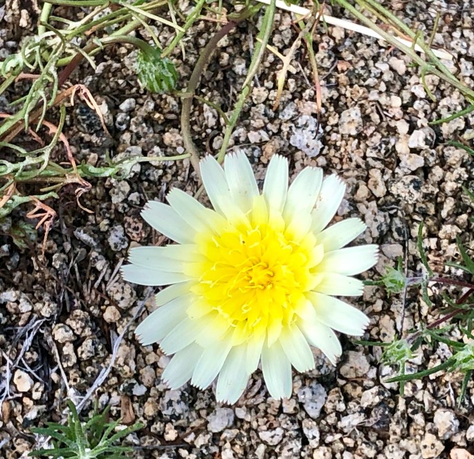
We have been enjoying the “Super Bloom” ( desert wildflowers benefiting from a wet winter) in the Colorado Desert located within the Anza Borrego State Park, California. The weather and scenery here is so idyllic that we keeping extending our stay here – moving every couple of days to a new spot in the desert to camp.
Great hiking and exploring – temperatures averaging 75F during the day and bottoming out at 50F overnight. We have met a number of Connecticut transplants of late – fortunately all Red Sox fans.
Nothing profound from our end at the moment. Extended periods of time without connectivity is good for the soul. We are feeling very content all in all. Over and out!
Boondocking in Arroyo Saleda – Borrego Badlands
Seventeen Palms Oasis – Borrego BadlandsSanta Rosa Mountains
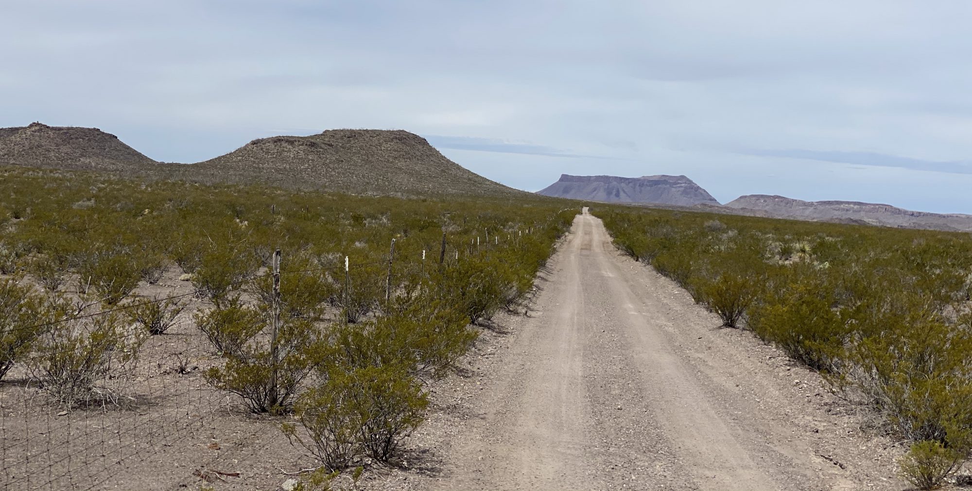
After a two day pit stop in Yuma (warning – no legit coffee!) we drove north for our final Arizona segment. We camped in the Kofa NWR in the shadow of Castle Dome Peak and then journeyed overland via McPherson Pass. As we came across the pass and began our descent into the King Valley we were treated to a panoramic view of the Kofa Mountain Range. The Kofa Mountains are named after the King of Arizona gold mine (K of A) which operated in the King Valley during the very late 1800’s.
A storm moved through during the night bringing cold temperature, high winds and rain. However, we consider that a small price to pay for the solitude and beauty that we experienced while in the refuge, and of course the exhilaration of a 4WD overland adventure.
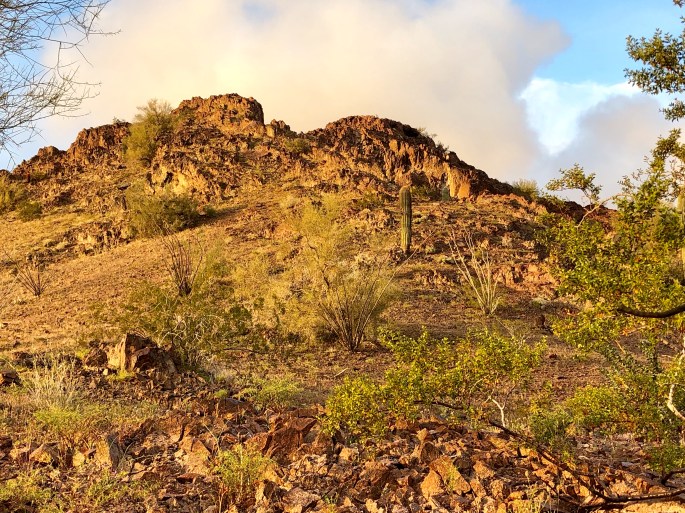
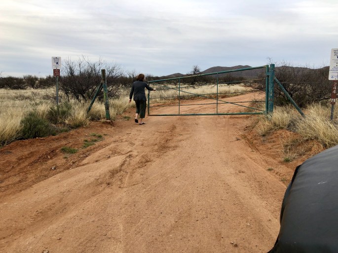
After a taking three days off from the road in Bisbee we have started our journey west to California along the Mexican border. Our first day of travel took as far as the Buenos Aires NWR which lies just west of Arivaca, AZ (pop. 700).
The BANWR was created in 1985 with the purchase of 117,464 acres of land. As with all of the 585 national wildlife refuges in the U.S. the land was purchased under the authority of the Endangered Species Act. In this particular case the endangered specie was the Masked Bobwhite Quail. The U.S. Fish & Wildlife Service which manages this refuge also reintroduced grasses that had vanished from the area and Pronghorn Antelope.
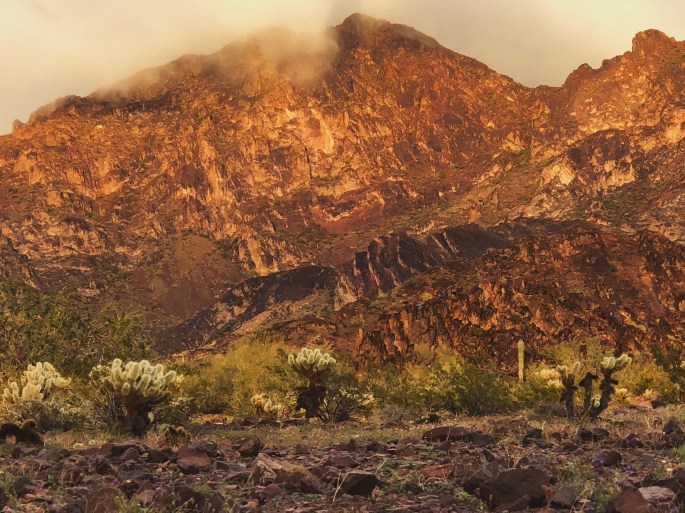
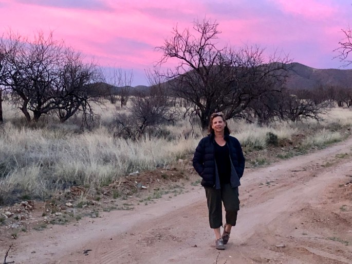
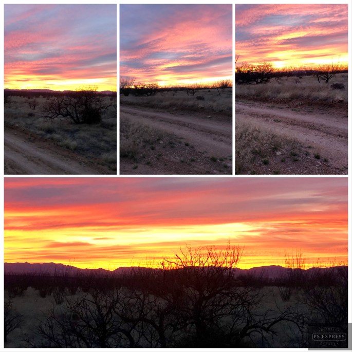
While the BANWR was created to protect an endangered specie this is public land and open for camping, hunting, horesback riding and hiking. We took advantage of the camping opportunity and were treated to a beautiful sunset and dark sky. We saw no other humans during our stay here. From a wildlife perspective we did not see any quail but did see our first javelinas of the trip.
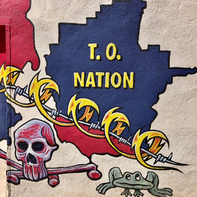
From BANWR we traveled through the Tohono O’odham Nation Reservation. The T.O. Nation is a 2.8 million acre reservation with a current population of apx. 14,000. Tohono O’odham means “desert people”. In this case the desert is the Sonoran desert of southwestern Arizona and Sonora, Mexico.
The T.O. Nation extends into Mexico. The residents of T.O. consider the reservation to be one nation irrespective of the U.S. – Mexico border and believe they should be able to travel freely within the nation. The U.S. Border Patrol disagrees and this has resulted in an ongoing conflict between the two parties. Additionally, the Border Patrol wants unfettered access to the border within the reservation which the T.O. Nation is not willing to provide.
Politics aside, we were fortunate to travel through the reservation at a time when the Sonoran Desert is in full bloom. Purple, yellow and orange flowers lined the highway against a backdrop of cacti and mountains making for breathtaking scenery.
We stopped briefly in Ajo just west of the T.O. Nation before proceeding to Yuma. Ajo was another town which came into existence as a result of a large copper mining operation which is now defunct. The art work pictured below is part of an arts project in Ajo.
Baboquivari Peak – Tohono O’odham NahtionBuenos Aires National Wildlife Refuge
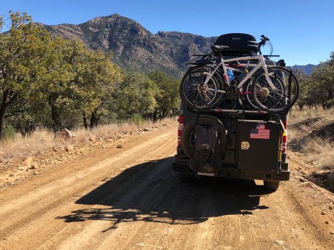
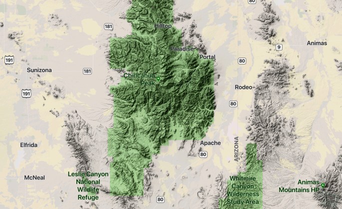
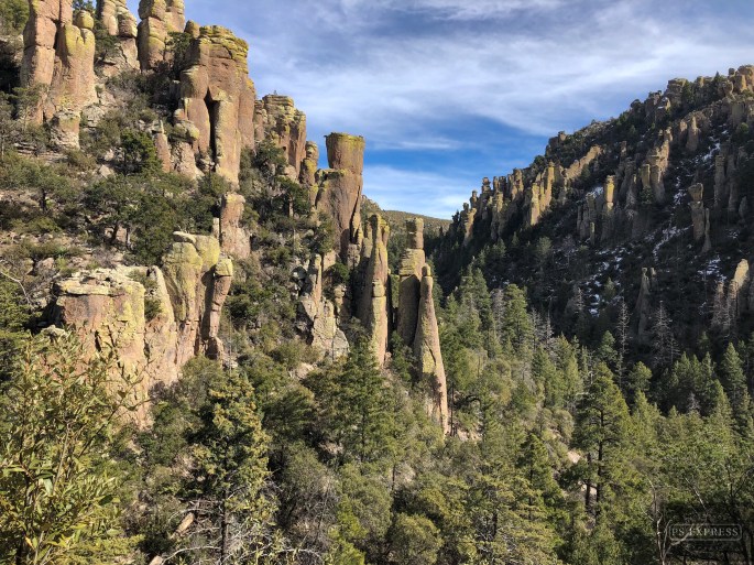
After three days in the Dragoon Mountains we ventured east to hike and camp in the Chirachua Mountains. The Chirachua are about twice the size of the Dragoon Mountains, 35 miles long and 21 miles wide. Chirachua Peak, at 9800 feet, is the tallest peak in the range. The Chirachua Mountain range is an officially designated Sky Island.
Chirachua National Monument, which is managed by the NPS, sits at the northern end of the range. It contains numerous rugged canyons with a spectacular array of pinnacles, hoodoos, capstones and balance rocks. The hiking is strenuous but the payoff of dramatic scenery and vistas is well worth the effort.
The majority of the mountain range lies within the Coronado National Forest giving us access to dispersed camping close to the trails in the national monument.
We left from our campsite via Forest Road 42, traversing through the range exiting in Portal, Arizona. We were treated to stunning vistas as we wound our way up through the range and down the western slope toward New Mexico.
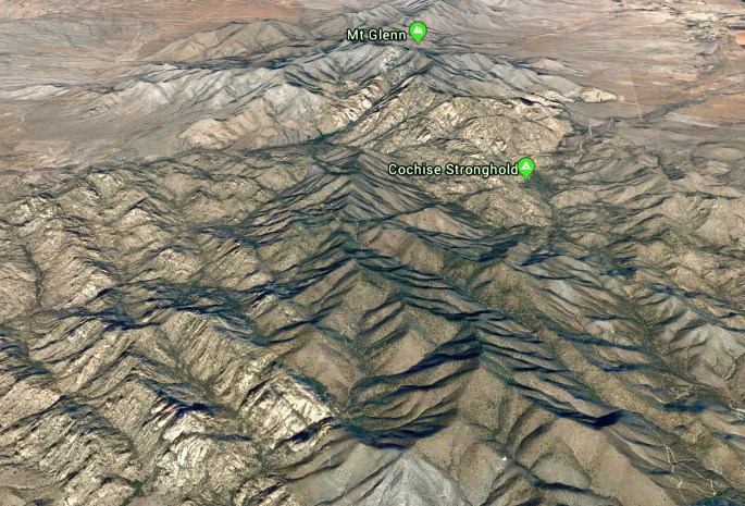
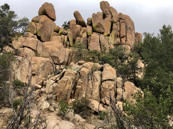
We traveled further east in Southern Arizona to venture into the rugged Dragoon Mountains for three days of hiking and camping. We were fortunate that the Middlemarch Road was in good shape depsite the recent snowstorm, allowing us to traverse the southern portion of the Dragoons through the Middlemarch Pass before proceeding north to an area of the mountains known as Cochise Stronghold.
This mountain range is storied in that while range is only about 15 miles long by eight miles wide it served as the base of operation for Apache Chief Cochise and his band of approximately 1000. Cochise and his band fought a guerilla style war against the both the Confederate Army and the U.S. Cavalry in an ongoing conflict that started in 1861 and ended in 1872 when Cochise agreed to cease fighting. He died shortly afterwards and is buried somewhere within the Dragoons. However, only his blood brother Thomas Jeffords (long since deceased) knew the location which he never divulged.
The hiking in the Cochise Stronghold is excellent. The hikes generally follow the winding canyons, traverse the many streams running through the canyons and gain elevation to provide fantastic views. The solitude factor here is very high as relatively few folks find their way into these mountains to hike or camp.
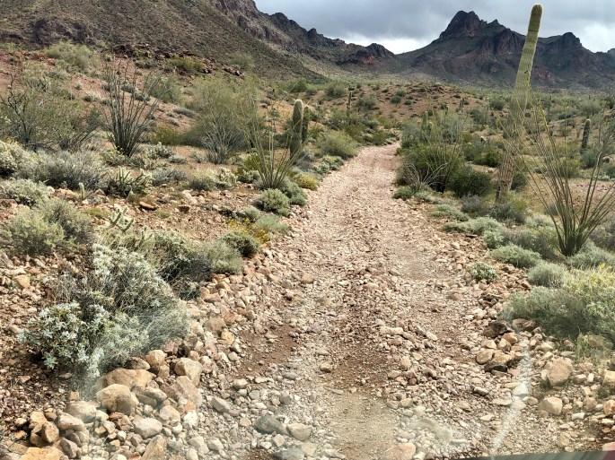
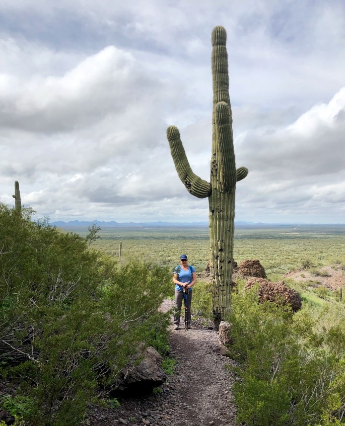
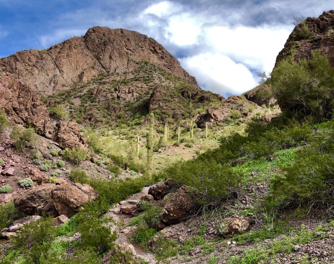
The Southern Arizona landscape is dominated by cacti. However, we never realized until we began exploring in this area that there are more than two dozen species of cactus living here. The most well recognized is the Saguaro. This species can live to be 200 years old, grow to 50 feet in height and weigh six tons. We have identified six species during our hikes: saguaro, barrel, teddy bear, ocotillo, prickly pear and cane cholla.
Saguaro National Park + Tucson Mountains
We hiked Kings Canyon Trail to Wasson Peak loop trail. Wasson Peak is the highest peak in the Tucson Mountains and provided us with tremendous vistas. We were able to clearly see Mt Lemmon, Mt Wrightson, Kitt and Picacho Peaks as well as the city of Tucson. This hike is a bit on the strenous side at eight miles with an elevation gain of over 1600 feet but well worth the effort. In addition to the views the trail was awash with wild flowers.
Catalina Mountains
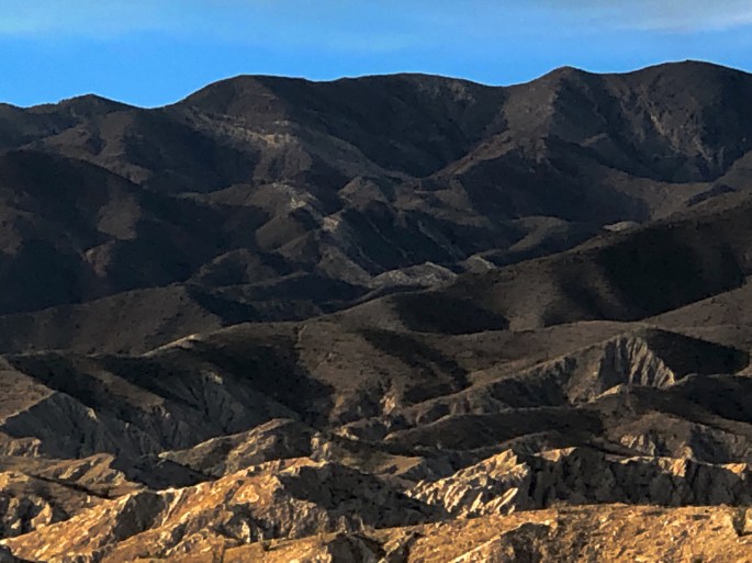
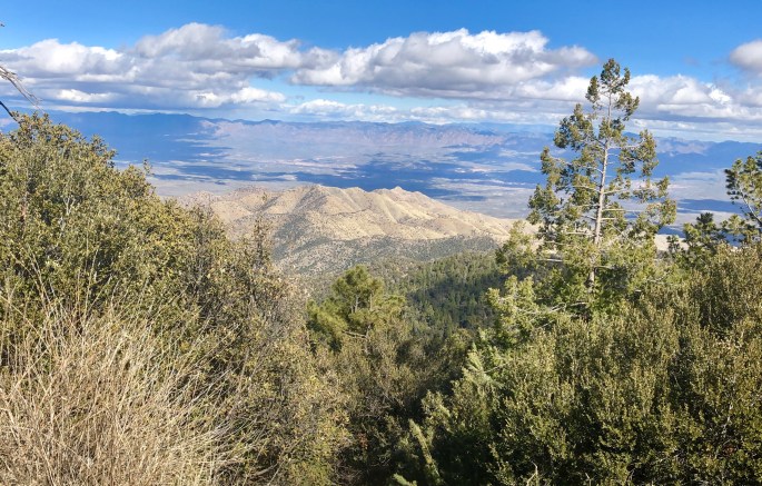
Looking to rest our legs between hikes we spent an afternoon making the drive from Tucson up to Mt Lemmon and the village of Summerhaven via the Sky Island Scenic Byway. The road winds up through the Catalina Mounatains with an elevation gain of more than 6000 feet. As you leave Tucson you are in the desert and by the time you reach Mt Lemmon we found ourselves driving through connifer forests. The temperature drop was more than 30 degrees. Picture below is a view of the San Pedro River Valley from an elevation of apx. 8000 feet above sea level. This byway is a beautifully engineered road with incredible views and scenery. The general store is Summerhaven can provide you with ice cream and fudge as an added incentive to go all the way to the end of the drive.
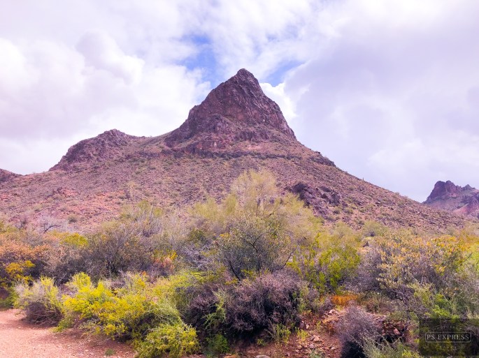
Picacho Peak
Picacho Peak State Park was our base of operation for six nights. This location provided easy access to Tucson proper (coffee and tea!) and plenty of hiking in Saguaro NP and the Coronado NF. The added bonus was that Picacho Peak presented us with several challenging hikes without needing to leave the park. We photos below are from our hike on the Sunset Vista Trail.
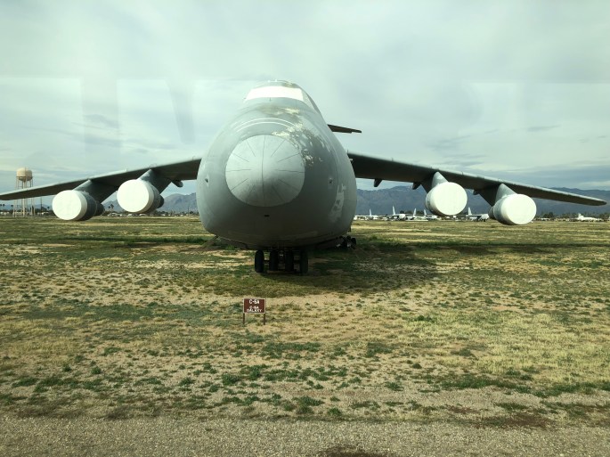
Pima Air + Space
As we are both aviation buffs we kicked off our stay in the Tucson area with a visit to the Pima Air & Space Museum. Pima has a large collection of primarily military aircraft. We were able to see two aircraft (pictured below) that we had never seen in person previously. The Convair B58 Husler (left below) was the first USAF bomber capable of Mach 2 flight and was operational with SAC during the 1960s. On the top right is the Boeing B36 Peacemaker. The B36 was used from 1949 until 1959. It was the largest piston engined plane ever built. It was powered by six pusher props and four jet engines and had a wingspan of 230 feet. It is ugly but could travel 10,000 miles without refueling and carry 87,000 pounds of nuclear bombs. Two rare aircraft that we were pleased to have the opportunity to see in person.
We also took a tour of the “boneyard” located within Davis Monthan Air Force Base. The boneyard is home to more than 3000 military aircraft not currently needed operationally. A portion of the aircraft staged to be ready to operate within 24 hours while others are being cannabilized for parts to keep active models of the same aircraft flying.
C5A Galaxy
Our next stop is Kartchner Caverns State Park located at the base of the Whetstone Mountains, located about 50 miles southeast of Tucson.
Lastly, please continue to follow the coffee and tea adventures of our good friends @fikawithfiona on Instagram.
After driving just four hours south of Salt Lake City we are in a very different environment – sunshine and daytime temperatures in the 60 degree range. We spent one night in Sand Hollow SP in Hurricane, UT and were treated to a hot air balloon festival with balloons launching all around our campsite.
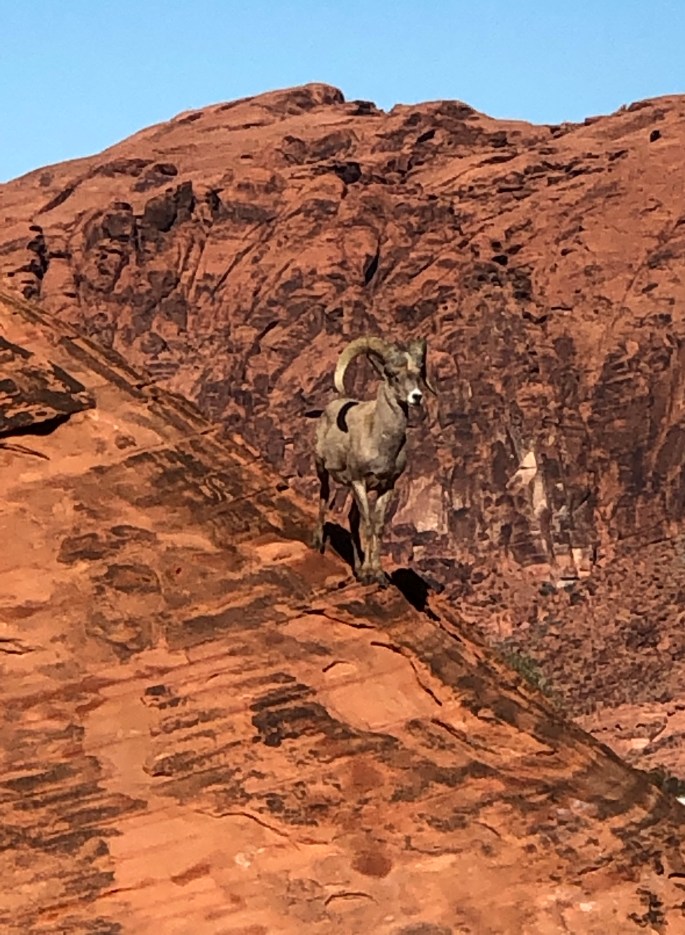
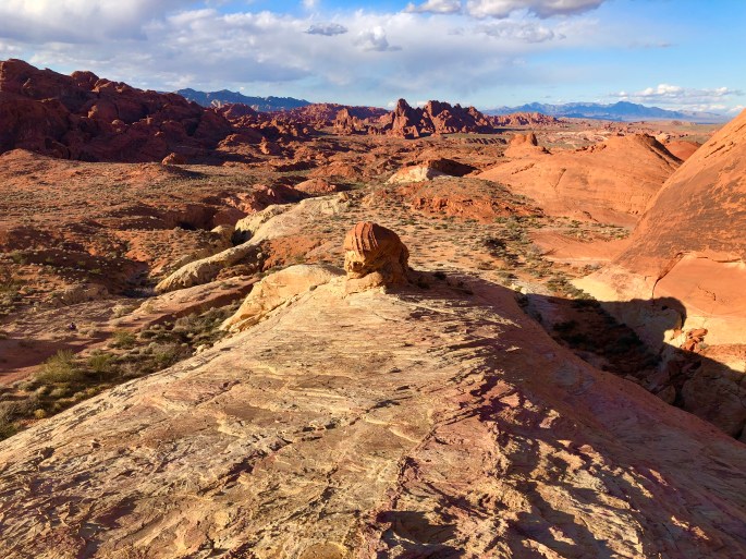
From Hurricane we traveled further south into Nevada where we camped and hiked at Valley of Fire SP. VFSP consists of 40,000 acres of land dominated by Aztec sandstone and limestone which combined creates spectacular scenery across the entire park. There are a number of petroglyphs in the park dating back apx. 2500 years. The state of Nevada has done a terrific job maintaining and conserving this land. The hiking trails are relatively short but offer great payoffs in regard to the views and wildlife viewing. We also found a number of narrow side canyons that provided solitude and great views. (004,005,006)
Fire Canyon
Wave Rock
White Dome, Valley of FireHot Air Balloons, Hurricane, UT
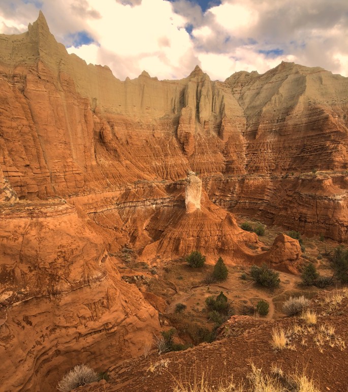
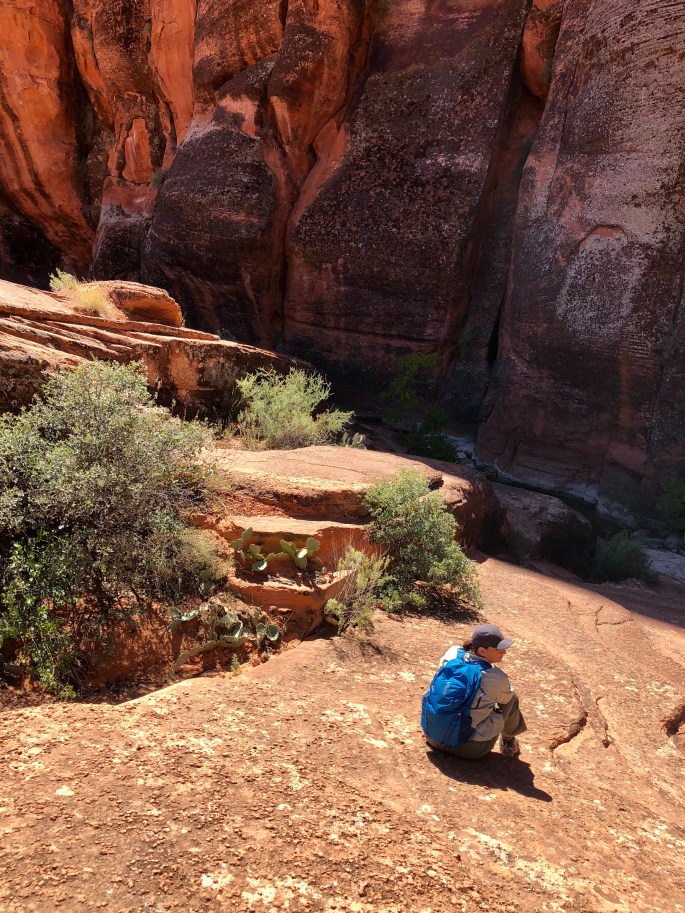
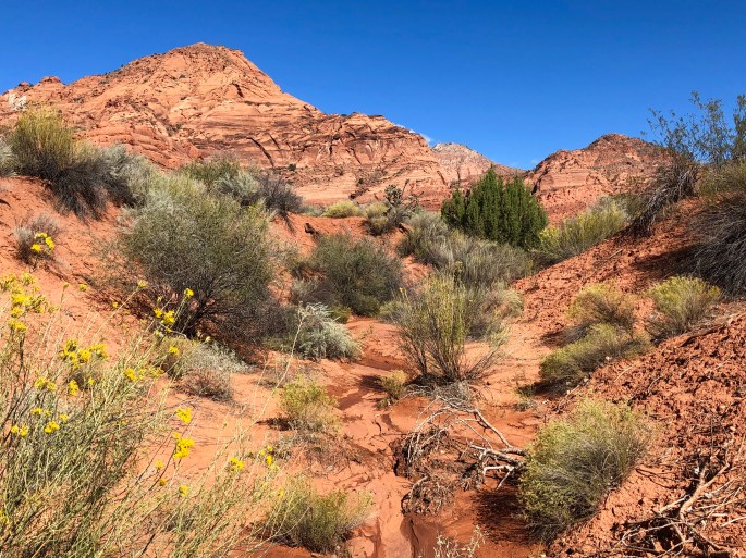
We were hoping to head to Arizona via the Cottonwood Canyon Scenic Backway, unfortunately, heavy rains have made the road impassable. We have extended our stay in Kodachrome Basin for a couple of days. Kodachrome Basin is the first “step” of the Grand Staircase and has a bounty of impressive spires and great hikes. If Cottonwood remains impassable tomorrow we will travel east towards Lake Powell before turning south and working our way to Sedona, Arizona. 0076,0077
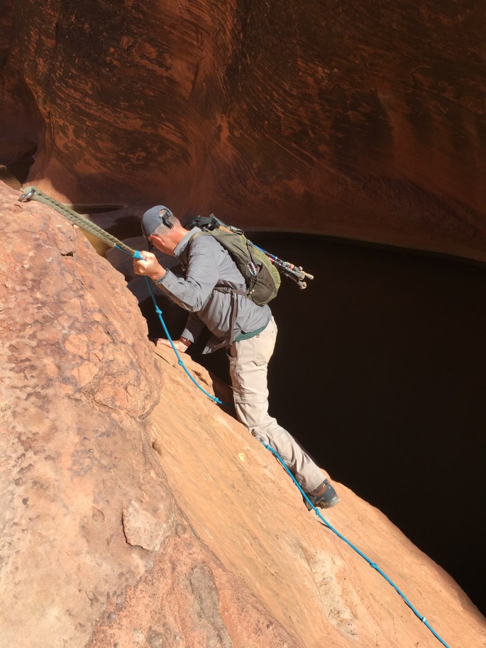
We have journeyed to Southern Utah near the Arizona border and we are enjoying the beautiful weather. Enjoying Fika with our old friends at River Rock Roasting in La Verkin. Camping in the Dixie NF under breathtaking night sky. Phenomenal scenery, hiking and scrambling! Not sure what else to say…..life is good. 0065,0066,0067,0068,0069
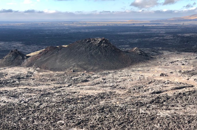
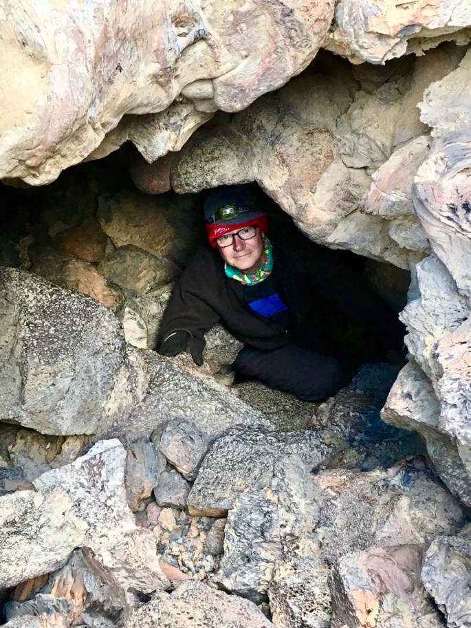
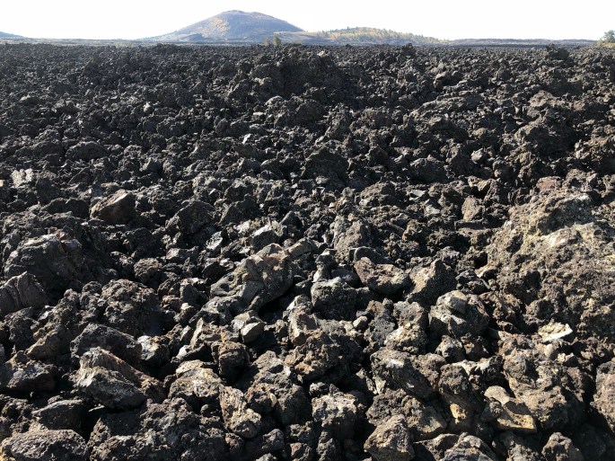
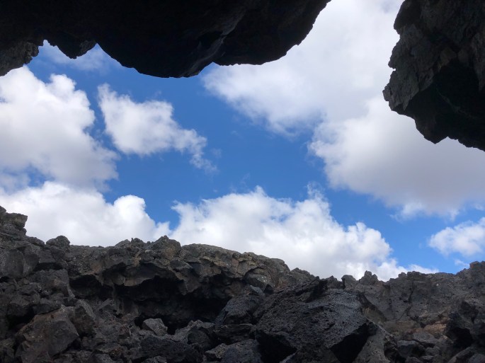
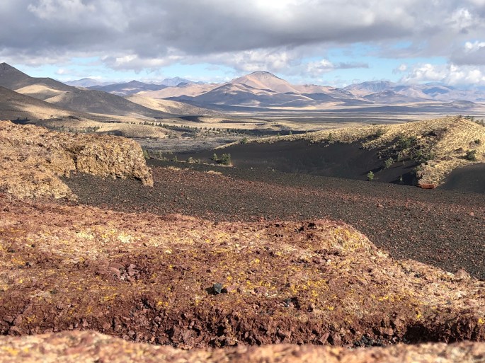
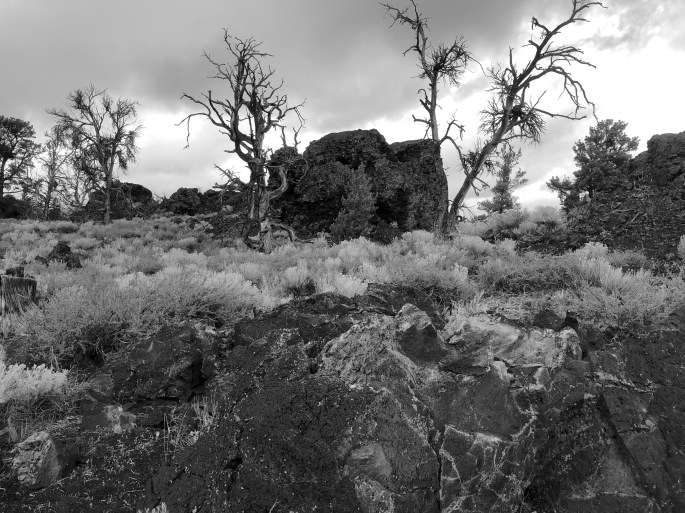
We did an overnight at CMNM which is in Eastern Idaho about 20 miles west of Arco. This is a 752,000 acre monument and wilderness area. This massive tract was once an area of significant volcanic activity and features huge lava fields, spatter cones and the remnants of a number of smaller volcanoes. This monument is so otherworldly that NASA sends astronauts to train here for Moon and Mars walks. We also did some caving in several lava tube caves which were formed by underground molten lava flows. 0058,0059