Tucson Part 1

B500243C-9614-48BA-9AE3-3701F6CCA71E.jpeg

Cacti

The Southern Arizona landscape is dominated by cacti. However, we never realized until we began exploring in this area that there are more than two dozen species of cactus living here. The most well recognized is the Saguaro. This species can live to be 200 years old, grow to 50 feet in height and weigh six tons. We have identified six species during our hikes: saguaro, barrel, teddy bear, ocotillo, prickly pear and cane cholla.

304223C5-329F-4104-B31B-BB951C9B0DE0.jpeg

Saguaro National Park + Tucson Mountains

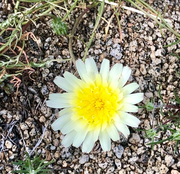
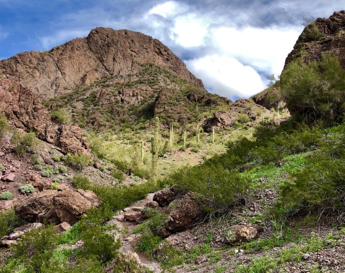
We hiked Kings Canyon Trail to Wasson Peak loop trail. Wasson Peak is the highest peak in the Tucson Mountains and provided us with tremendous vistas. We were able to clearly see Mt Lemmon, Mt Wrightson, Kitt and Picacho Peaks as well as the city of Tucson. This hike is a bit on the strenous side at eight miles with an elevation gain of over 1600 feet but well worth the effort. In addition to the views the trail was awash with wild flowers.

img_6849

1BB3EED8-2DB4-4A2E-8797-8DBFFA18063D

img_6851

Catalina Mountains

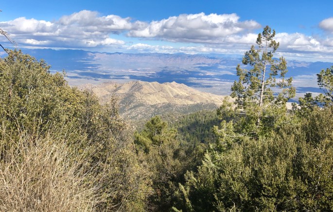
Looking to rest our legs between hikes we spent an afternoon making the drive from Tucson up to Mt Lemmon and the village of Summerhaven via the Sky Island Scenic Byway. The road winds up through the Catalina Mounatains with an elevation gain of more than 6000 feet. As you leave Tucson you are in the desert and by the time you reach Mt Lemmon we found ourselves driving through connifer forests. The temperature drop was more than 30 degrees. Picture below is a view of the San Pedro River Valley from an elevation of apx. 8000 feet above sea level. This byway is a beautifully engineered road with incredible views and scenery. The general store is Summerhaven can provide you with ice cream and fudge as an added incentive to go all the way to the end of the drive.
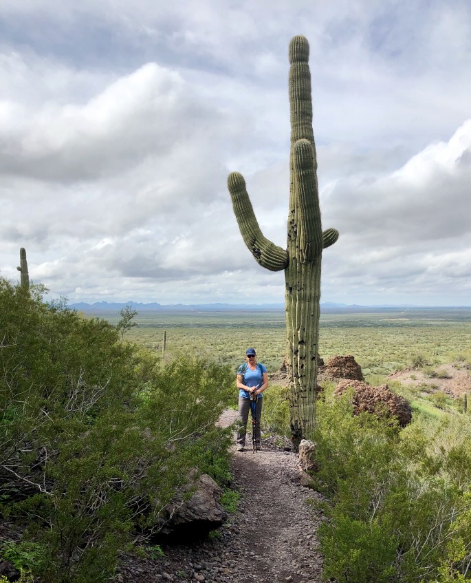
img_6745

Picacho Peak

Picacho Peak State Park was our base of operation for six nights. This location provided easy access to Tucson proper (coffee and tea!) and plenty of hiking in Saguaro NP and the Coronado NF. The added bonus was that Picacho Peak presented us with several challenging hikes without needing to leave the park. We photos below are from our hike on the Sunset Vista Trail.

img_6576

img_6643

Pima Air + Space

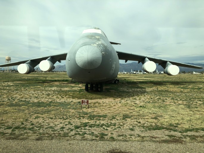
As we are both aviation buffs we kicked off our stay in the Tucson area with a visit to the Pima Air & Space Museum. Pima has a large collection of primarily military aircraft. We were able to see two aircraft (pictured below) that we had never seen in person previously. The Convair B58 Husler (left below) was the first USAF bomber capable of Mach 2 flight and was operational with SAC during the 1960s. On the top right is the Boeing B36 Peacemaker. The B36 was used from 1949 until 1959. It was the largest piston engined plane ever built. It was powered by six pusher props and four jet engines and had a wingspan of 230 feet. It is ugly but could travel 10,000 miles without refueling and carry 87,000 pounds of nuclear bombs. Two rare aircraft that we were pleased to have the opportunity to see in person.

We also took a tour of the “boneyard” located within Davis Monthan Air Force Base. The boneyard is home to more than 3000 military aircraft not currently needed operationally. A portion of the aircraft staged to be ready to operate within 24 hours while others are being cannabilized for parts to keep active models of the same aircraft flying.

433A8AA9-612F-4E96-A9A6-D553B0A86FCD
C5A Galaxy

Our next stop is Kartchner Caverns State Park located at the base of the Whetstone Mountains, located about 50 miles southeast of Tucson.

Lastly, please continue to follow the coffee and tea adventures of our good friends @fikawithfiona on Instagram.

Sand Hollow to Valley of Fire

After driving just four hours south of Salt Lake City we are in a very different environment – sunshine and daytime temperatures in the 60 degree range. We spent one night in Sand Hollow SP in Hurricane, UT and were treated to a hot air balloon festival with balloons launching all around our campsite.

From Hurricane we traveled further south into Nevada where we camped and hiked at Valley of Fire SP. VFSP consists of 40,000 acres of land dominated by Aztec sandstone and limestone which combined creates spectacular scenery across the entire park. There are a number of petroglyphs in the park dating back apx. 2500 years. The state of Nevada has done a terrific job maintaining and conserving this land. The hiking trails are relatively short but offer great payoffs in regard to the views and wildlife viewing. We also found a number of narrow side canyons that provided solitude and great views. (004,005,006)

img_0717

img_6483
Wave Rock

img_6331

img_6277

58FF43A2-524A-4F6A-B429-E284874E908B
White Dome, Valley of Fire
16D42CA8-B384-46A5-BD67-F090D5F2DB7E
Hot Air Balloons, Hurricane, UT


Salt Lake City + Snow = Fika

We spent several days in Salt Lake City waiting out a snowstorm that made travel south impossible. Maria and I made the best of it by visiting some old coffee friends and trying out several recommended coffee shops for the first time. Traveling to Hurricane, Ut and then on to Valley of Fire in Nevada. (001,002,003)

What is Art?

Pictured below in our final post is a sample of various forms of art we experienced during our first adventure. Thanks for following along on our maiden voyage in the Beast.  We spent time in thirteen states and logged almost 8,400 miles over 90 days. To say the least, we had a blast, saw many beautful places and met a lot of really nice and very interesting people along the way.

We welcome any feedback, thoughts or suggestions you may have in regard to the blog.

Fika, Fika, Fika…..

Coffee is always a good idea

Coffee, because it is too early for wine

I judge a restaurant by the bread and by the coffee – Burt Lancaster

Coffee: the favorite drink of the civilized world – Thomas Jefferson

I never laugh until I’ve had my coffee – Clark Gable


San Rafael Swell

After departing Moab we ventured into the northern portion of the San Rafael Swell. The Swell is a rugged and undeveloped wilderness managed by the BLM. As is the case with most BLM public lands, there is unrestricted access for camping, hiking, driving and other activities. We followed the Buckhorn Draw Road which is unpaved but was dry and in good condition during our trip. The Swell is canyon country with many of the canyon walls reaching up to 500 feet. A number of the canyon walls also have pictographs and petroglyphs which were created about 2000 years ago by Barrier Canyon Indians.

The Swell was at one time a source of uranium but those mines are largely played out. The only other use of the land in the Swell is for grazing cattle. There are also a fair number of wild horses and burros roaming through the Swell.

The Swell is a starkly beautiful, undeveloped area and we hope that the BLM continues to keep it that way.

A5E531B7-9219-48C7-AECA-F61D28EDB89E

A6C0D93C-7F97-4FE9-B9C4-37EA5CE3BD5E

58B63690-5031-4D19-9809-E42E3E1B67A4

42D893E0-870D-4765-B295-F341FA07CD60

1DCC96A6-81B7-4D7B-9859-13F55F7224E4

BB9A7D5F-DB6B-4D97-AF19-F5E3F198EC48

Moab, Utah

Traveled from Blanding to Moab as we make our way back to Salt Lake City. While in Moab we hiked the Hidden Valley Trail out to Hidden Pass on a perfect fall day. Stopping over in Moab also provided the opportunity to spend time at long time favorite Moab Coffee Roasters.

Moab was a down and out former mining town (uranium) of about 1500 people. More recently, like Sedona, it has experienced significant growth as a tourist destination for both American and international tourists. The growing popularity of mountain biking and off roading combined with two national parks has dramatically revitalized Moab’s economy and brought new people into the area.

5FA34BFC-9172-4E2B-835E-546EB9282AFF

2BCBBC3C-21EA-4D3C-A62C-BE276F281688
La Sal Mountains 
CCF35862-1FFB-4000-AA23-BF45EEE352DC
Hidden Pass

Valley of the Gods

On our way north from Arizona to Utah we ventured into the Valley of the Gods. This valley was part of the Bears Ears NM until President Trump reduced the size of the NM. Fortunately, the valley is still protected for environmental concerns and remains under the management of the BLM.

While the valley is off the beaten path we found the trip to be more than worthwhile as the valley has a significant number of striking buttes, mesas, towers and mushroom rocks. There is a 17 mile road that winds through the valley and provides close up views for many of the formations. The road is unpaved but in good condition for the most part. 0085 7E15E819-ABD5-4C03-87E1-6F6D6664958F2752A2BF-BF51-45F8-9A4C-C7B428DD9440

Sedona, Arizona

The scenery in Sedona is just as breathtaking as we remembered from our last visit many years ago. The town itself has grown substantially and become a major tourist destination. None the less we had a great time here as we found solitude while we hiked in the Red Rocks and boondocked under the stars in the Coconino NF. 

The coffee scene was limited so we are not posting any highlights in that regard.

Departing for the Valley of the Gods in the morning. 0081,0082,0083,0084

71F9548F-2CF1-4791-BC48-8E93D3E62EC0
Boynton Canyon
DD6DED2C-B614-494F-ADA2-1E506384A344
Boynton Vista

B414B877-B154-468A-86C9-FED20EF4385A

9E963EE0-E2B0-44F7-A60B-90F586692ED4
Munds Wilderness from Submarine Rock
7980F32F-7824-438B-BC01-202DBA33CC1A
Wilson Mountain from Brins Mesa Trail
8329822C-CC95-4920-8D03-386D2446C837
Mormon Canyon


Flagstaff, Arizona

We spent a couple of nights in Flagstaff or “Flag” as the locals refer to the city. This city of approximately 70,000 sits at 7000 feet above sea level in the Coconino NF with the San Francisco Peaks as the backdrop. The town still boasts a lively and well preserved downtown with local merchants, restaurants and most importantly good coffee. Flag is home to Northern Arizona University (The Lumberjacks). We have found that many of the towns we have visited that have a nice vibe like Flag have a university or college located within the city or town. 

We visited three coffee roasters while in Flag. All were legit but our favorite was Firecreek Coffee Company. We have included photos from all three below.

While traveling our focus is to see new places, meet new people, try new adventures, however, as we wander we do need to deal with the mundane. For one of us that means doing laundry, for the other it means getting a haircut. Pictured below is Hermanis Ulibarri. A haircut from Mr. Ulibarri turned out to be anything but mundane. Mr. Ulibarri is 77 years old and has been “barbering” since his return from serving in Vietnam over 50 years ago. He has given haircuts to tourists from all over the world and has quite a following of French clients that spend time in Flag on a regular basis. Lots of interesting stories. Oh, and cash only if you stop in for a haircut on your next visit to Flagstaff.

Just a few miles east of Flag is the Walnut Canyon NM. We spent an afternoon there viewing some of the extremely well preserved ancient cliff dwellings. These dwellings were constructed by the Sinagua People during the 12th to 13th centuries. The dwellings sit 300 feet above the canyon floor and provided protection from the weather, animals and rivals. The Island Trail has been constructed so that visitors can descend 200 feet down into the canyon and actually go inside a number of the dwellings. Amazing to think of an entire community raising families, growing crops, hunting, storing water and food while living 300 feet above the canyon floor.

We are off to Sedona for some hiking in the Red Rocks and perhaps to experience the energy of the purported vortices!

B45A1B17-7BEC-465D-B712-0733908421AE

B642139A-47DE-4B88-BABF-AC4BDAE2BAC6

8A0288E7-50B0-47B3-B7A9-C9505C6B8A05
Mr. Hermanis Ulibarri
6DF55235-B78A-4B51-B639-28045BB015EA
Walnut Canyon

A1368F25-6803-4794-8001-AD0713976A52

7542C124-4764-4A77-BA18-B696D24112BC.jpeg