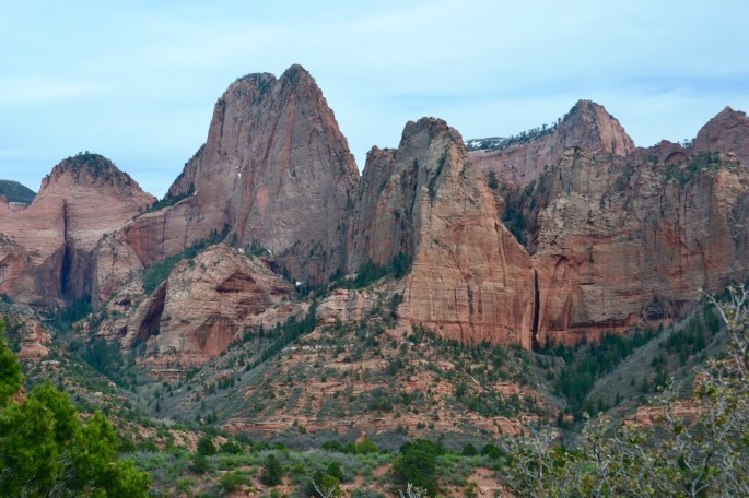
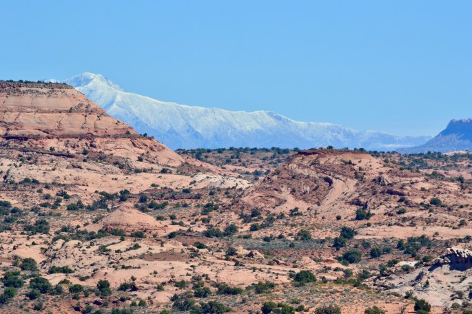
On Tuesday we drove north 40 miles to access the much less visited Kolob Canyons area in the northwestern section of Zion NP. The road is paved and winds up along the western side of the canyon providing spectacular views of Nagunt Mesa, Gregory Butte and Burnt Mountain.
On Wednesday we hiked in the Box Canyon within the Box – Death Hollows Wilderness Area which is located in the Dixie National Forest. The Spring Creek flows through the canyon and requires numerous crossings of the creek to proceed up the canyon. This area is very different from the nearby Escalante desert with a mix of red rock canyon walls and towering Ponderosa Pines. The creek was running high from late winter snow melt so we eventually had to get our feet wet on several of the creek crossings. Our hike took about 4.5 hours in which time Maria and I had the canyon completely to ourselves.
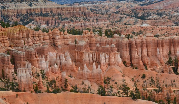
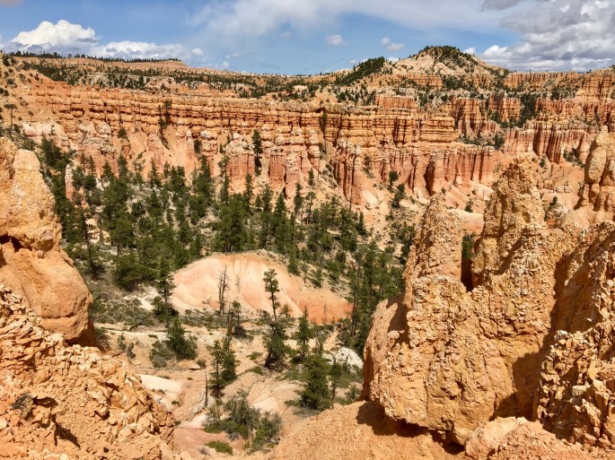
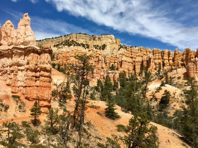
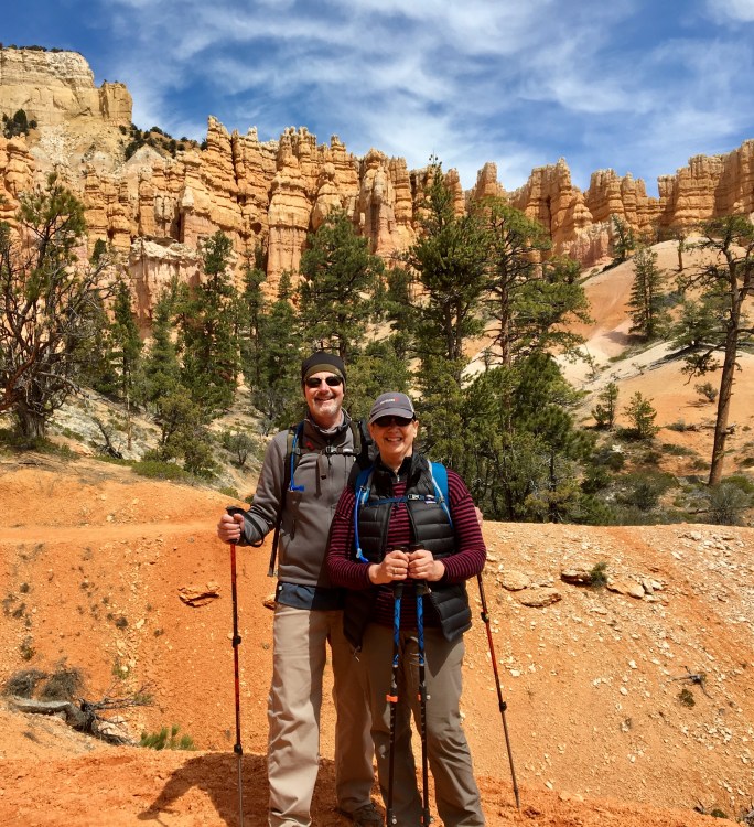
On Saturday we hiked down into the Fairyland Canyon from the rim of Bryce. This is one of a kind scenery with towering hoodoos reaching straight up into the sky throughout the canyon. As typical of Utah at this time of the year at 8000 ft elevation the weather can and does change dramatically within minutes. We started this hike under cloudy skies and then encountered heavy snow as we descended from the rim down into the canyon. Within an hour the snow moved off and we enjoyed blue sky and sunshine for the remainder of our trek through the canyon. This is a long hike with over 2000 ft of vertical but well worth it to experience these other wordly formations.
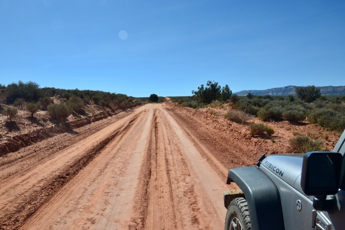
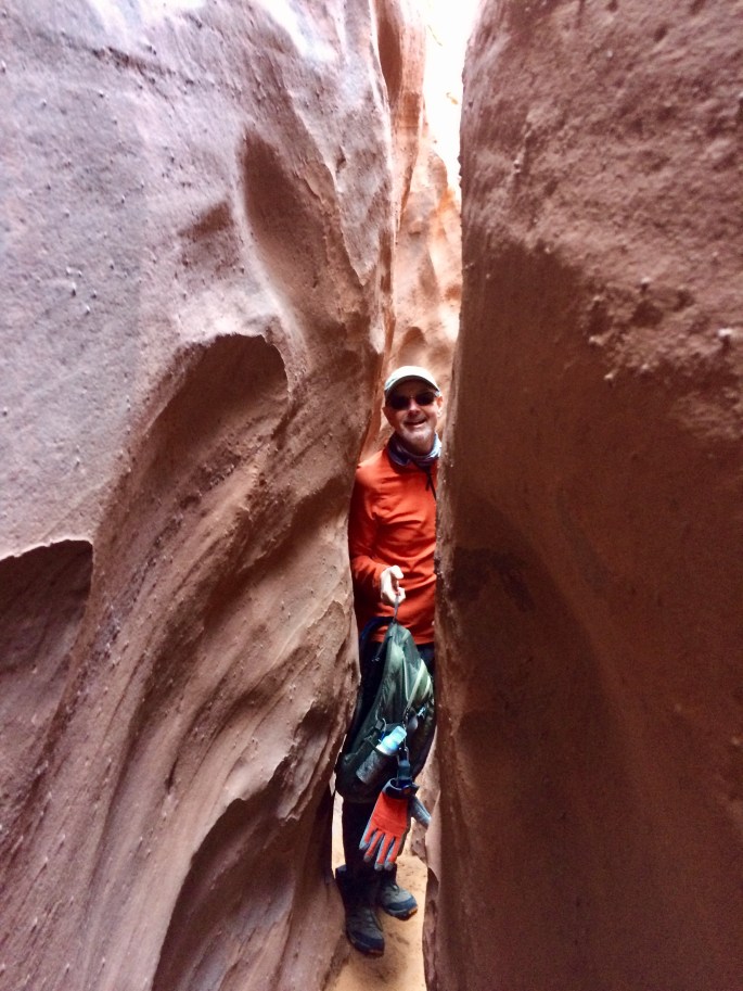
On Wednesday we ventured down the Hole in the Rock Road for 26 miles to canyoneer in several exciting slot canyons. This environment was a dramatic change from the tall Ponderosa Pines of the Box Canyon in Dixie NF where we hiked on Tuesday. The road is a washboarded bone rattling dirt track but fun to drive none the less and provides dramatic views of the Straights Cliffs section of the Fifty Mile Bench and Fifty Mile Mountains. Once at the trailhead we tackled the three slot canyons which can be accessed from the Dry Fork Gulch below the trailhead. We hiked Dry Fork first as an out and back as the slot became impassable due to water. We then made a loop by climbing up through the Peek-a-Boo slot and then traversed across to Spooky Gulch and then down climbed Spooky slot exiting into Coyote Gulch and returning to the trailhead from there. As you can see from the photographs below the slots provide some challenging terrain with the tight spaces and chimney descents but make for great fun and excitement.
Hole in the Rock RoadPioneer Mesa with Henry Mountains in BackgroundPeek-a-Boo Slot CanyonSpooky Gulch Slot CanyonSpooky Gulch Slot CanyonSpooky Gulch Slot Canyon
This afternoon we hiked up the Lower Calf Creek trail under a beautiful blue sky, following the canyon floor. At the end of the canyon we were delighted by the cool mists of the 126 foot falls that feeds the perennial creek. As a result of the creek providing water year round, the canyon is lush with vegetation. Pictured directly below is the creek from above, and below that the falls from the trail.
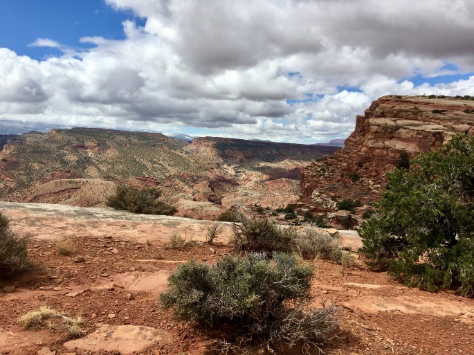
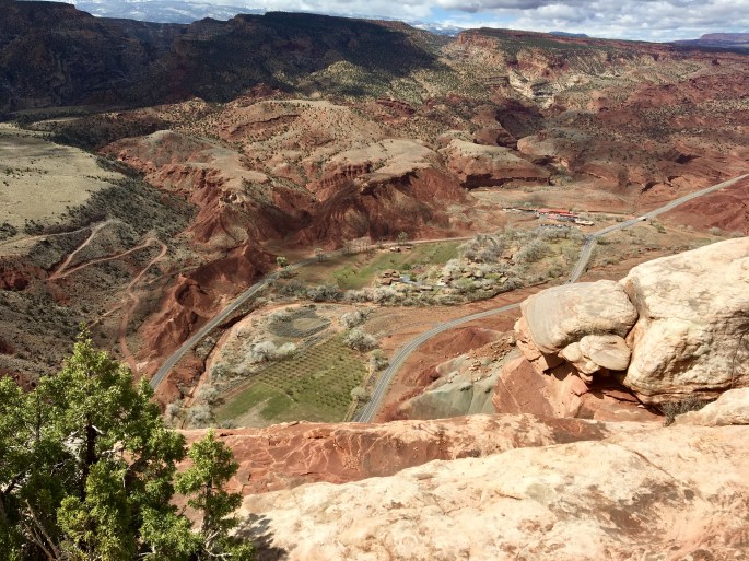
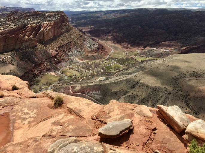
On Saturday we climbed to the Rim Overlook which provides great views to the east, west and south as well as the park directly below the rim. After a break at the rim we ventured further down the Navajo Knobs trail and then ventured up a side canyon before turning back and retracing our route back to the trailhead.
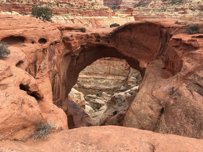
Hickman Bridge is a natural bridge (not arch – bridge caused by water erosion) that sits at an elevation of apx 5700 ft above sea level. A short hike of 2.2 miles albeit the trip out is all climb to reach the bridge. The bridge is 133 feet across and 125 feet above the ground. A nice bridge to visit because you can travel under the bridge as well as climb above for a view from the top of the bridge.
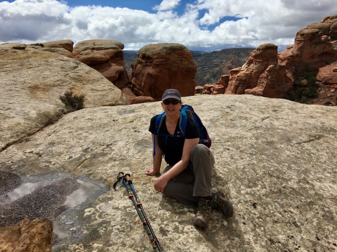
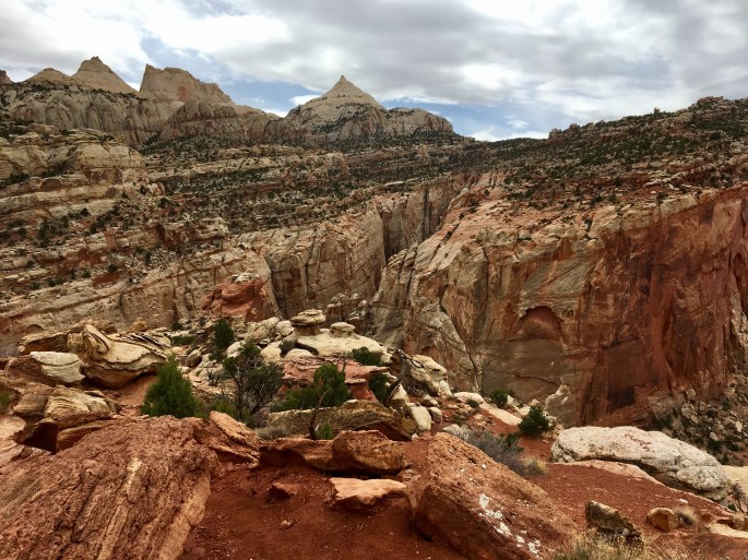
Strenuous hiking today with several miles of moderate to steep climbing but well worth the effort with tremendous views. We first climbed to Cassidy Arch and then continued the hike to the highpoint of apx. 6400 ft on the Frying Pan Trail.
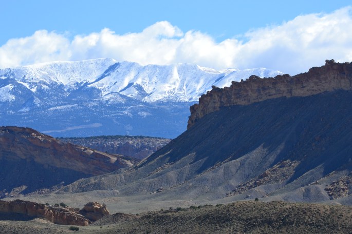
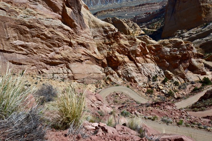
Sunday’s weather provided a beautiful backdrop for our drive and hike within the Waterpocket Fold District within CRNP. Our drive began with a thirty mile trek down the sandy and occassionally muddy Notom Road which provided spectacular views of the Reef and the Henry Mountains. We turned east at the junction with the Burr Trail to drive the incredible switchbacks to the top of the Reef. We then left the Burr Trail to journey up the 4WD track to the Strike Valley Overlook trailhead. After hiking up to see the impressive view of the full length of the valley we hiked back down and then hiked the Upper Muley Twist Canyon stopping at the Saddle Arch before returning to the jeep and back down the wash to the Burr Trail. The Burr Trail becomes paved after several miles and winds its way through numerous canyons ending at Rte 12 in Boulder. Boulder is an impossibly small town 40 miles from any other town but fortunately is the improbable home to a highly rated Zagat restaurant – Hell’s Backbone Grill. We had a great dinner and bottle of wine before heading north over the 9600 ft elevation of Deer Mountain within Dixie National Forest. A great way to celebrate Stephen’s birthday with a beautiful day and a wonderful dinner.
Henry Mountains viewed from Notom-Bullfrog RdOyster Shell ReefBurr Switchbacks