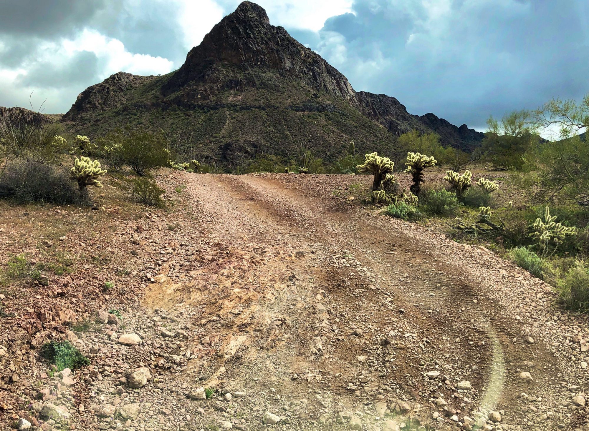
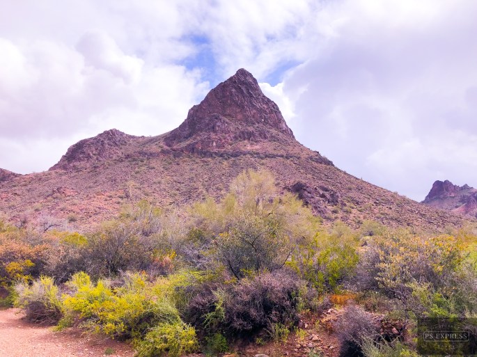
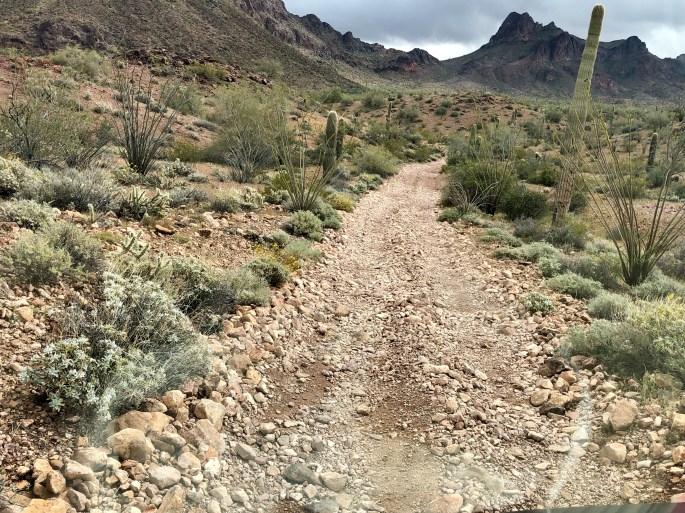
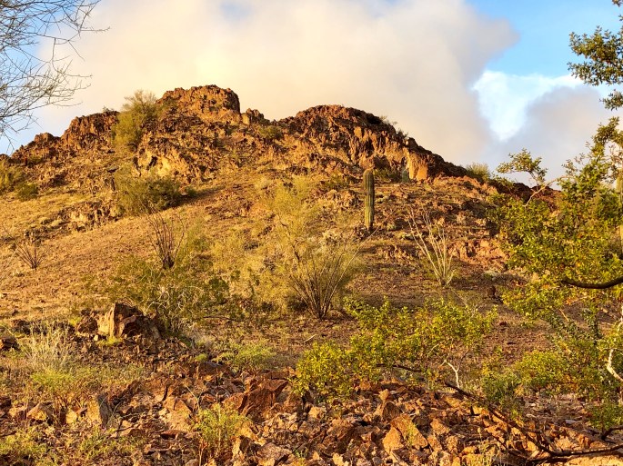
After a two day pit stop in Yuma (warning – no legit coffee!) we drove north for our final Arizona segment. We camped in the Kofa NWR in the shadow of Castle Dome Peak and then journeyed overland via McPherson Pass. As we came across the pass and began our descent into the King Valley we were treated to a panoramic view of the Kofa Mountain Range. The Kofa Mountains are named after the King of Arizona gold mine (K of A) which operated in the King Valley during the very late 1800’s.
A storm moved through during the night bringing cold temperature, high winds and rain. However, we consider that a small price to pay for the solitude and beauty that we experienced while in the refuge, and of course the exhilaration of a 4WD overland adventure.
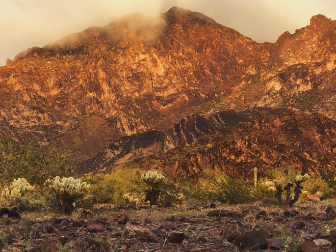
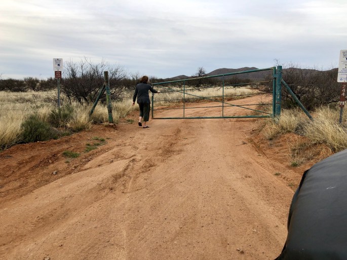
After a taking three days off from the road in Bisbee we have started our journey west to California along the Mexican border. Our first day of travel took as far as the Buenos Aires NWR which lies just west of Arivaca, AZ (pop. 700).
The BANWR was created in 1985 with the purchase of 117,464 acres of land. As with all of the 585 national wildlife refuges in the U.S. the land was purchased under the authority of the Endangered Species Act. In this particular case the endangered specie was the Masked Bobwhite Quail. The U.S. Fish & Wildlife Service which manages this refuge also reintroduced grasses that had vanished from the area and Pronghorn Antelope.
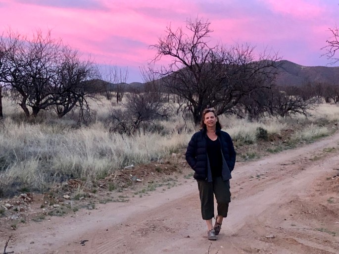
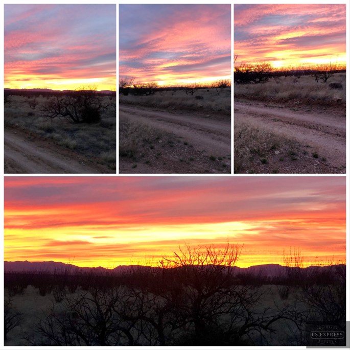
While the BANWR was created to protect an endangered specie this is public land and open for camping, hunting, horesback riding and hiking. We took advantage of the camping opportunity and were treated to a beautiful sunset and dark sky. We saw no other humans during our stay here. From a wildlife perspective we did not see any quail but did see our first javelinas of the trip.
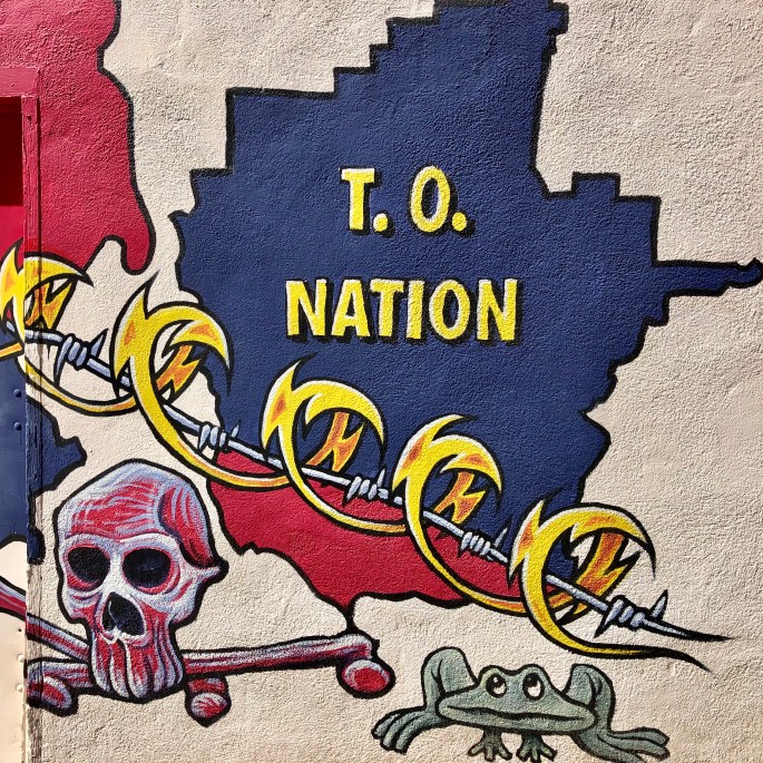
From BANWR we traveled through the Tohono O’odham Nation Reservation. The T.O. Nation is a 2.8 million acre reservation with a current population of apx. 14,000. Tohono O’odham means “desert people”. In this case the desert is the Sonoran desert of southwestern Arizona and Sonora, Mexico.
The T.O. Nation extends into Mexico. The residents of T.O. consider the reservation to be one nation irrespective of the U.S. – Mexico border and believe they should be able to travel freely within the nation. The U.S. Border Patrol disagrees and this has resulted in an ongoing conflict between the two parties. Additionally, the Border Patrol wants unfettered access to the border within the reservation which the T.O. Nation is not willing to provide.
Politics aside, we were fortunate to travel through the reservation at a time when the Sonoran Desert is in full bloom. Purple, yellow and orange flowers lined the highway against a backdrop of cacti and mountains making for breathtaking scenery.
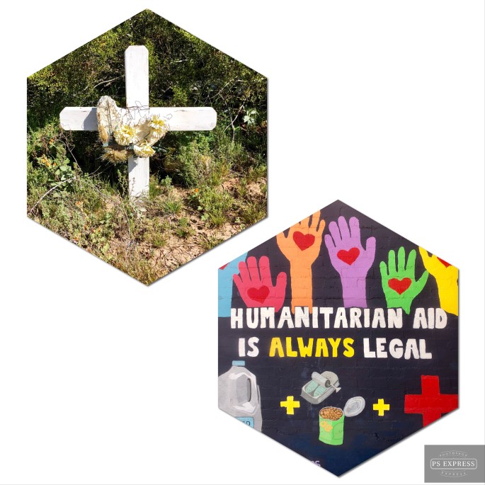
We stopped briefly in Ajo just west of the T.O. Nation before proceeding to Yuma. Ajo was another town which came into existence as a result of a large copper mining operation which is now defunct. The art work pictured below is part of an arts project in Ajo.
Baboquivari Peak – Tohono O’odham NahtionBuenos Aires National Wildlife Refuge
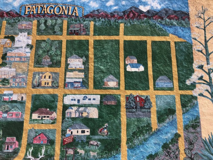
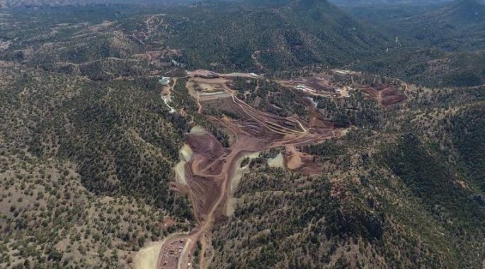
Our various treks have taken us through the quaint town of Patagonia several times. Patagonia is nestled in the Patagonia Mountains and its heritage is mining – not unusual in this part of the world. During our stops in Patagonia we have had the opportunity to chat with a number of people. One thing that became clear during conversations is that there is a lot of animosity between newer residents of the town and long time residents. Many of the newer residents are artists and environmentalists who oppose the current plan to expand the mining operations. The current investment is known as the Hermosa Project and is backed by Australia based mining company, South32. This company has paid $1.3b in order to gain the rights to mine for zinc and copper at this site. Many long time residents work at the mine or are involved in businesses that support mining operations.
Copper mines are not attractive to say the least. The are huge open pit mines. In this case the current mine is a 4000 foot long by 900 foot deep hole, however, it is located six miles from town and is not visible from the road. At the same time there is no arguing that there is a demand for copper and zinc in the technology driven world we live in today.
South32 plans to expand the mining operation underground using environmentally compliant technology they have used successfully in Australia. The newer residents insist it does not matter because all mining is bad for the environment (at least in Patagonia).
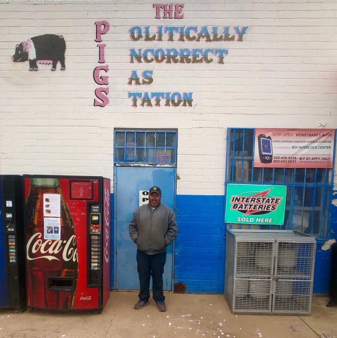
One of the individuals we met is Charlie. He grew up in Patagonia and is the owner of Pat Gas & Services. Charlie voiced support for the Hermosa Project at a town hall meeting. The newer residents then began boycotting his business and his fuel contract with the town was terminated. Charlie is currently trying to sell the business.
We are not smart enough to know if there is a pure right or wrong here in regard to the environmental or financial issues. We do think it is a shame that residents whose families have lived in Patagonia for generations can be driven out of their town by monied newcomers.
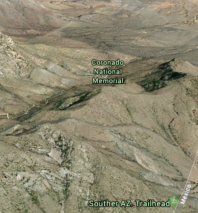
While spending a few days in Bisbee we took a drive to Coronado National Memorial. This NPS managed area bordering Mexico was created to “interpret the Coronado expedition”. As there are no physical remnants of this expedition of conquest within the memorial boundaries we are not sure we understand the rationale for creating this park.
The good news is that we visited the memorial to hike and do some caving. The better news is that we hiked up to the Coronado Cave and spent a couple of hours exploring the cave in complete solitude (and darkness)!
This is one of the few caves within the NPS system that requires no guide and is still in a completely natural state – no lighting, stairs, rails, etc. To access the cave requires a 500 foot climb up Montezuma Peak and then a rock scramble down to the cave floor. The cave is only about 600 feet long but has a number of side and downward tunnels which require crawling to explore.
The cave is not home to bats if you were wondering, but does have growing stalagmites and stalactites.
”I want to be notorious rather than famous. Fame has too much responsibility. People forget you are human.”
”The mud wall is masculine – physically strong and durable. The straw is feminine – delicate as a thread. Its color is sun and gold.”
”Even the team of mules, which came to drag away the dead bull, moved with drama and color I had never seen before.”
– Ettore “Ted” DeGrazia
During our most recent visit to Tucson we visited the studio of Ettore “Ted” DeGrazia. DeGrazia gained fame and credibility as a painter when his painting of young Native American children (Los Ninos) was selected by UNICEF for their Christmas card in 1960. Until that time he had struggled to make a living as a painter and his work was not well regarded in some circles.
DeGrazia was a fascinating and brillant man. He designed and built by hand the beautiful building that houses his collection of paintings. He was a composer, sculptor, writer and actor. He was a completely self made man. He was born in a mining camp in Arizona and then moved to Italy when his father lost his job in Arizona. Upon returning to the United States he attended high school – graduating at 23 years of age. He eventually attended the University of Arizona where he earned two bachelor degrees and a masters in fine art.
The focus of much of Degrazia’s paintings was religous in nature. His largest collections centered around Padre Kino, Cabeza de Vaca and Yaqui Easter. He also has a gallery paintings devoted to the bull fight that he painted after attending a bull fight in Mexico.
Father Kino was the first Spanish missionary to enter what is now Arizona and begin the process of converting indigenous peoples to Catholicism. DeGrazia believed deeply that this was a noble calling and painted many works of Father Kino. One of his paintings of Father Kino is titled “Heathen Indians Receive Kino with Arches and Crosses”.
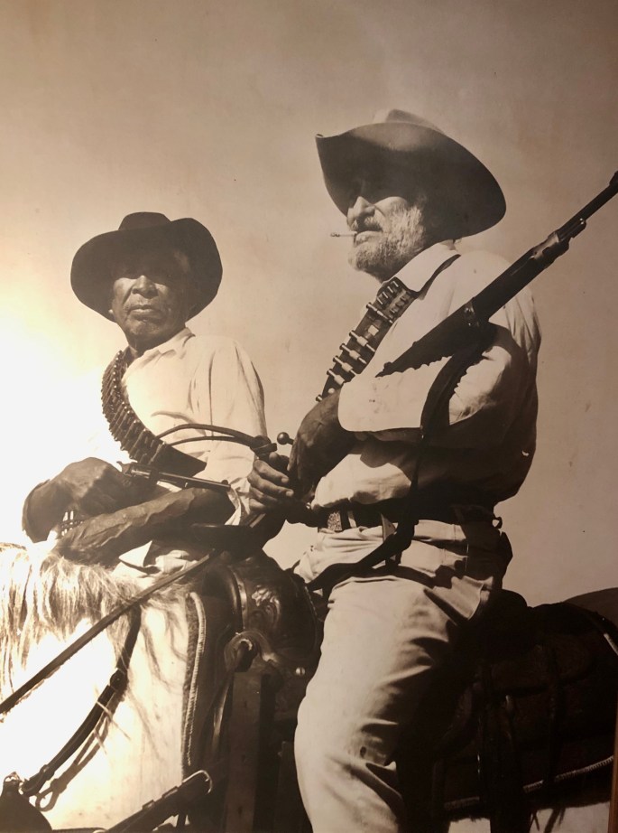
DeGrazia was fascinated with the life and adventures of Cabeza de Vaca. Cabeza was the leader of a Spanish expedition of 600 conquistadors that landed in Florida in 1527.
The purpose of this expedition was to “conquer the Indians, convert them to Christianity, and find the seven cities of gold.” The expedition failed miserably as Cabeza was only one of only four members of the expedition to survive and it took nine years to reach Arizona. The seven cities of gold were never found. But none the less DeGrazia admired the bravery and tenacity of Cabeza and painted an entire collection depicting his adventures.
The photo directly below (obtained from internet) shows DeGrazia burning some of his paintings. As DeGrazia paintings became more valuable and he came to understand that his estate would be taxed on the market value of his works he tried to donate many of the works to various organizations. When that tactic did not work he gathered 100 of his paintings, loaded the paintings onto pack horses and rode into the Superstition Mountains and burned them rather than burden his family with an inheritance tax.
The Gallery in the Sun is definitely worth a visit. The studios and grounds are beautiful, his paintings are as colorful and interesting as the man himself.
Gardens at Gallery in the SunKino at Casa Grande Misa, Padre Kino Collection – 1960
Ectoi Climbs Mountain to Eagle Cave, Papago Indian Legends, 1975
Trincherazo – Brown Bull – Bullfight Collection – 1946
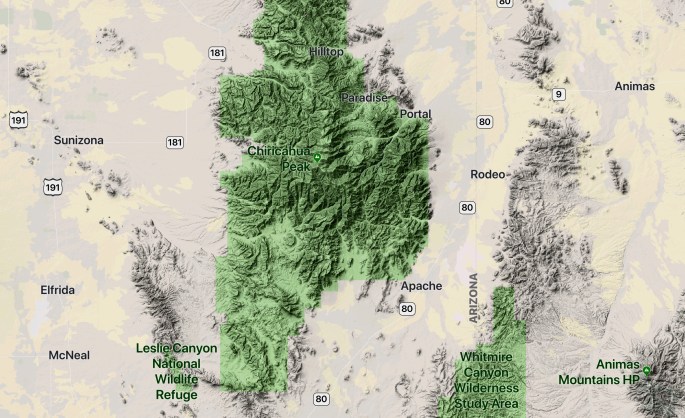
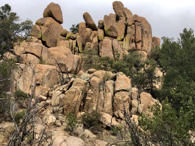
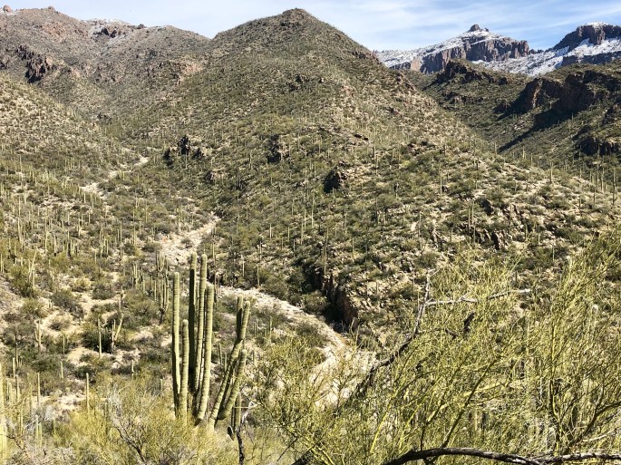
After three days in the Dragoon Mountains we ventured east to hike and camp in the Chirachua Mountains. The Chirachua are about twice the size of the Dragoon Mountains, 35 miles long and 21 miles wide. Chirachua Peak, at 9800 feet, is the tallest peak in the range. The Chirachua Mountain range is an officially designated Sky Island.
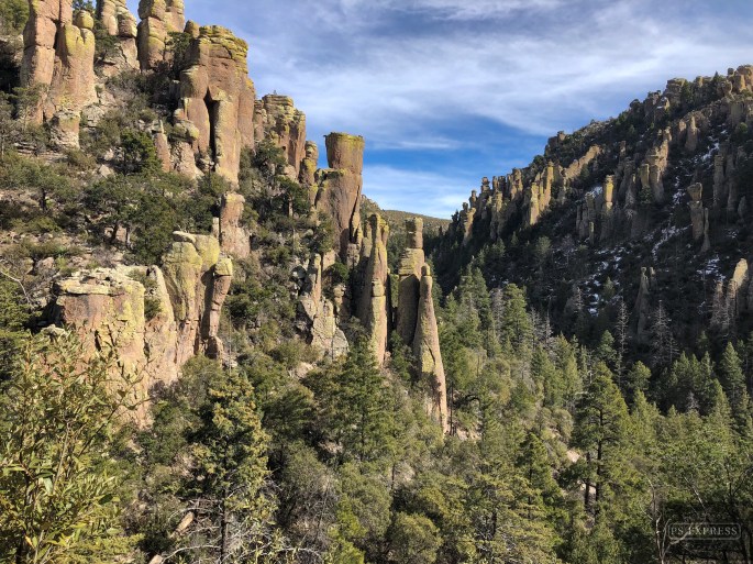
Chirachua National Monument, which is managed by the NPS, sits at the northern end of the range. It contains numerous rugged canyons with a spectacular array of pinnacles, hoodoos, capstones and balance rocks. The hiking is strenuous but the payoff of dramatic scenery and vistas is well worth the effort.
The majority of the mountain range lies within the Coronado National Forest giving us access to dispersed camping close to the trails in the national monument.
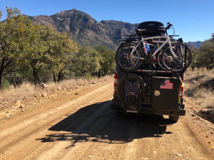
We left from our campsite via Forest Road 42, traversing through the range exiting in Portal, Arizona. We were treated to stunning vistas as we wound our way up through the range and down the western slope toward New Mexico.
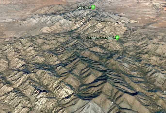
We traveled further east in Southern Arizona to venture into the rugged Dragoon Mountains for three days of hiking and camping. We were fortunate that the Middlemarch Road was in good shape depsite the recent snowstorm, allowing us to traverse the southern portion of the Dragoons through the Middlemarch Pass before proceeding north to an area of the mountains known as Cochise Stronghold.
This mountain range is storied in that while range is only about 15 miles long by eight miles wide it served as the base of operation for Apache Chief Cochise and his band of approximately 1000. Cochise and his band fought a guerilla style war against the both the Confederate Army and the U.S. Cavalry in an ongoing conflict that started in 1861 and ended in 1872 when Cochise agreed to cease fighting. He died shortly afterwards and is buried somewhere within the Dragoons. However, only his blood brother Thomas Jeffords (long since deceased) knew the location which he never divulged.
The hiking in the Cochise Stronghold is excellent. The hikes generally follow the winding canyons, traverse the many streams running through the canyons and gain elevation to provide fantastic views. The solitude factor here is very high as relatively few folks find their way into these mountains to hike or camp.
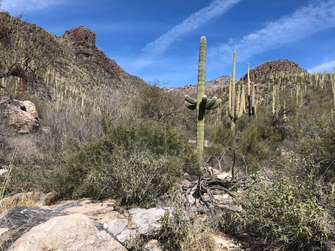
A beautiful day hiking in the Sabino Canyon Recreation Area. Sabino Canyon is understandably very popular with local folks due to its proximity to Tucson and the breathtaking scenery. We opted to head from the visitors center out to Bird Canyon which crosses out of Sabino into the Coronado NF and provided us with relative solitude in addition to the beautiful scenery.
Maria unfortunately picked up a number of cactus spines on her right leg during this hike (always a risk in this part of the world). Post tweezer phase, we are at the gauze and glue phase of removal.
This area of canyons and wilderness stands out in an area with abundant beauty. While it can be crowded we would definitely recommend a hike here when you visit Tucson.
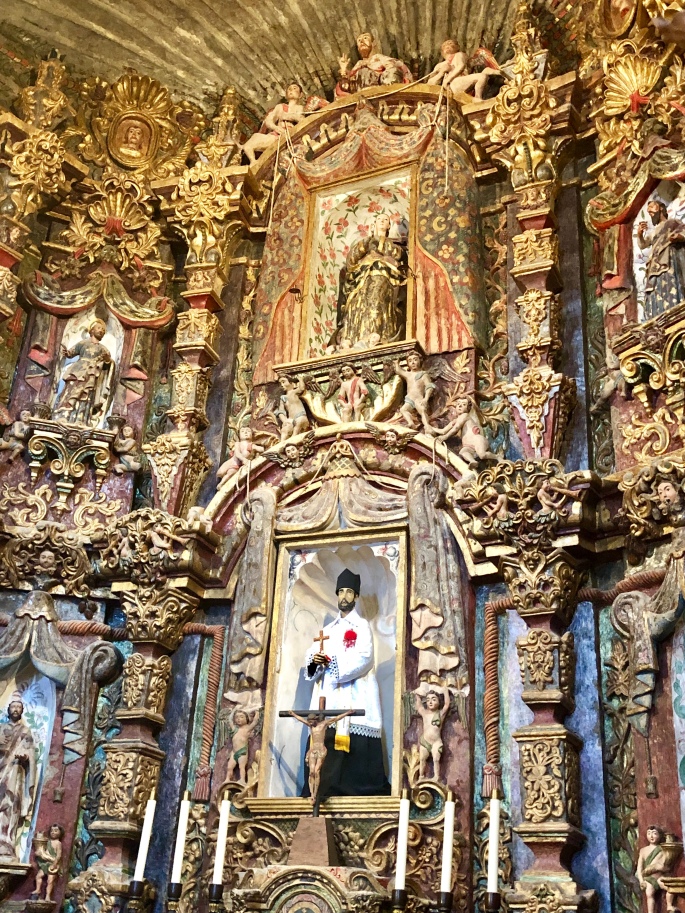
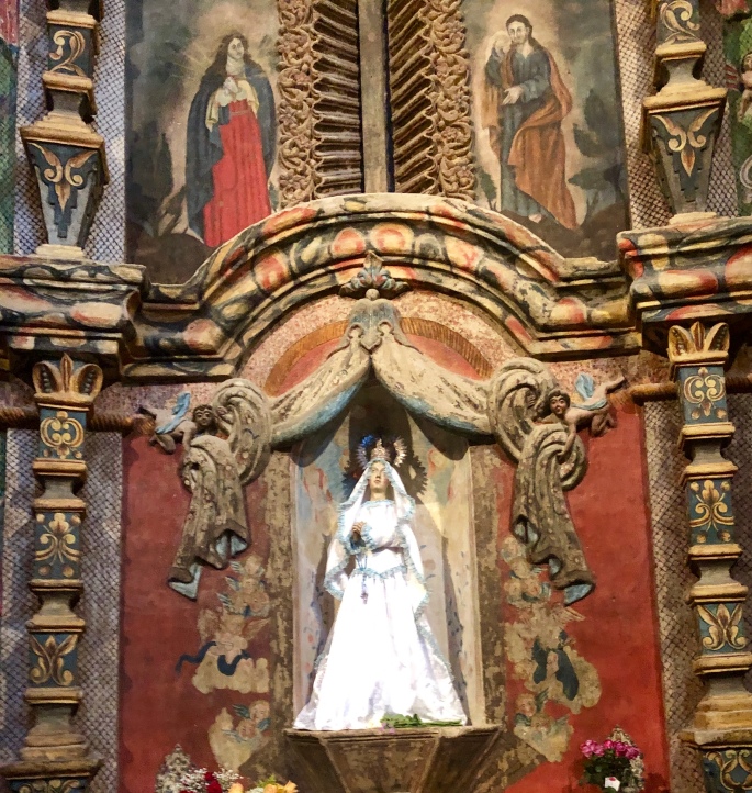
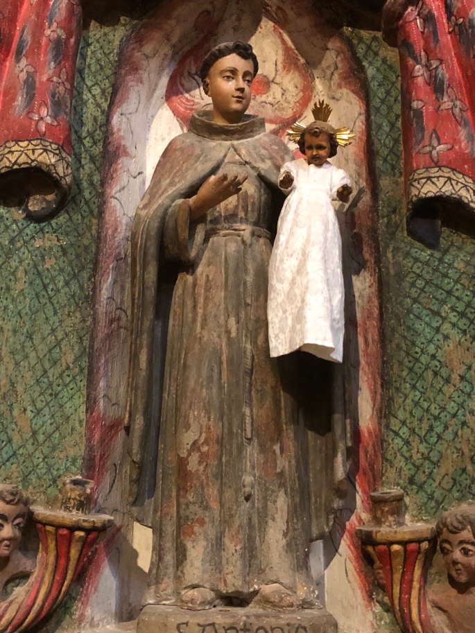
A big thanks to our friends John and Debbie Sahm for the recommendation to visit Mission San Xavier. This mission is a beautiful example of Mexican Baroque architecture. The construction of this building began in 1783 and continued for 14 years until the parish ran out of money. As you can see in the photograph below the second tower was never completed. The Mission was established in 1692 by Father Francisco Kino almost 100 years prior to the beginning of construction of this building. Father Kino’s primary mission was ( of course ) to convert indigenous people to Catholicism.
At the time this territory was part of New Spain. Subsequently, the Mission was on Mexican soil after the Mexican Revolution and then within the borders of the United States after the United States purchased this portion of Arizona in 1854. Today, the Mission sits within the Tohono O’odham Nation as a result of the creation of the Tohono O’odham reservation.
San Xavier remains a fully operational parish including a K-8 school that has been providing education to local children continuously since 1873.
The photographs below cannot due justice to the beauty of the interior but hopefully will provide some sense of the craftmanship and artistry that went into the making of this Mission.
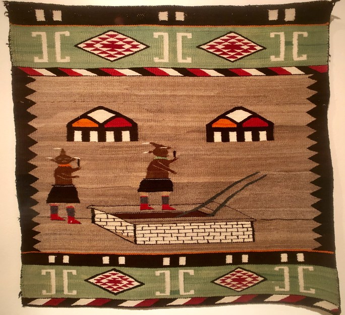
We spent an afternoon at the small but interesting TMA. The museum is heavily focused on western art and southwestern art as might be expected of a small regional museum. The collections are also very inclusive of Native American art forms as well as Mexican and South American folk art. An interesting point that comes through at this museum is the differentiation that does not but should exist in defining all Native American art as a single entity. In fact there are significant artistic differences between the multitude of tribes and Native Americans prefer to be identified as a member of their particular tribe or nation.
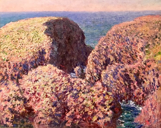
TMA also participates with the Kasser Mochary Art Foundation to bring notable works to the museum as ‘loaned” pieces. The last painting pictured below is one of the current loaned pieces. A beautiful Manet.
Definitely worth a visit when you are in Tucson.
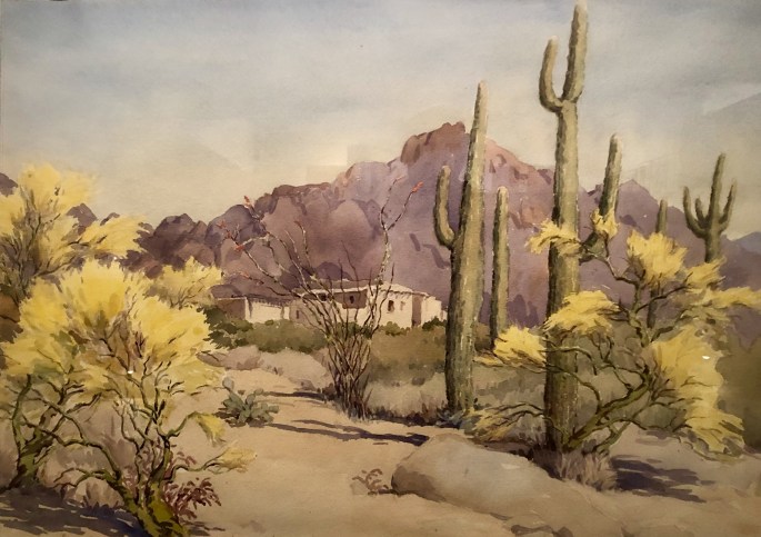
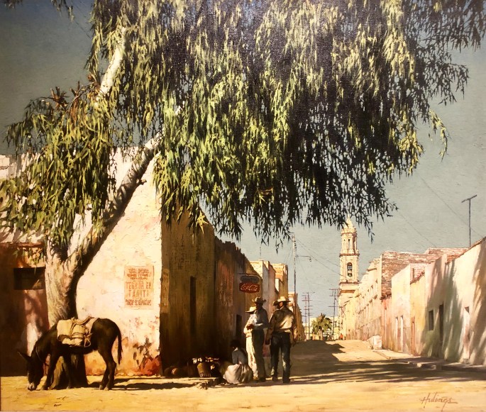
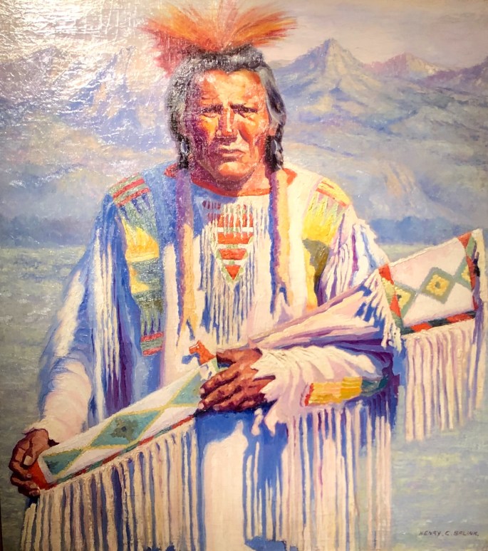
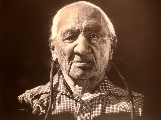
Arizona Landscape, c. 1949 Norma Basset HallEucalyptus Tree, 1965 Clark HulingsMudhead Katsina Motif, 1910 Dine’ (Navajo)Untitled, Henry BelinkWhite Clothes, 1980 Denham ClementsBloc de Rochers, Belle-Ile, Monet