As we swung back westward through New Brunswick (NB) inorder to ultimately re-enter the U.S. through Northern Maine, we decided to pay a visit to Fredericton aka the “Freddy”. Freddy appeared to meet our usual city selection criteria — small to medium in size, coffee options, art, live music, bike trails and a city waterfront.
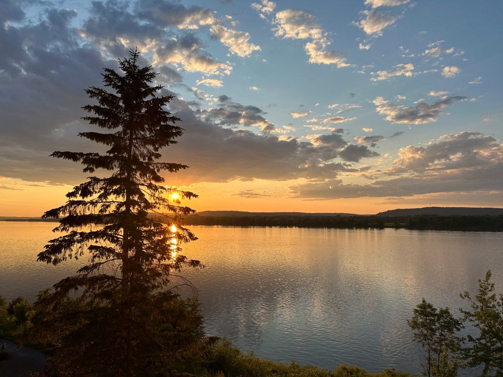
St. John River, Fredericton, New Brunswick
We thought we would need two days but the weather was excellent and so much was happening that we ended up staying four nights; before departing on our wood lands ramble into remote northern New Brunswick (Wood Lands Ramble post coming soon).
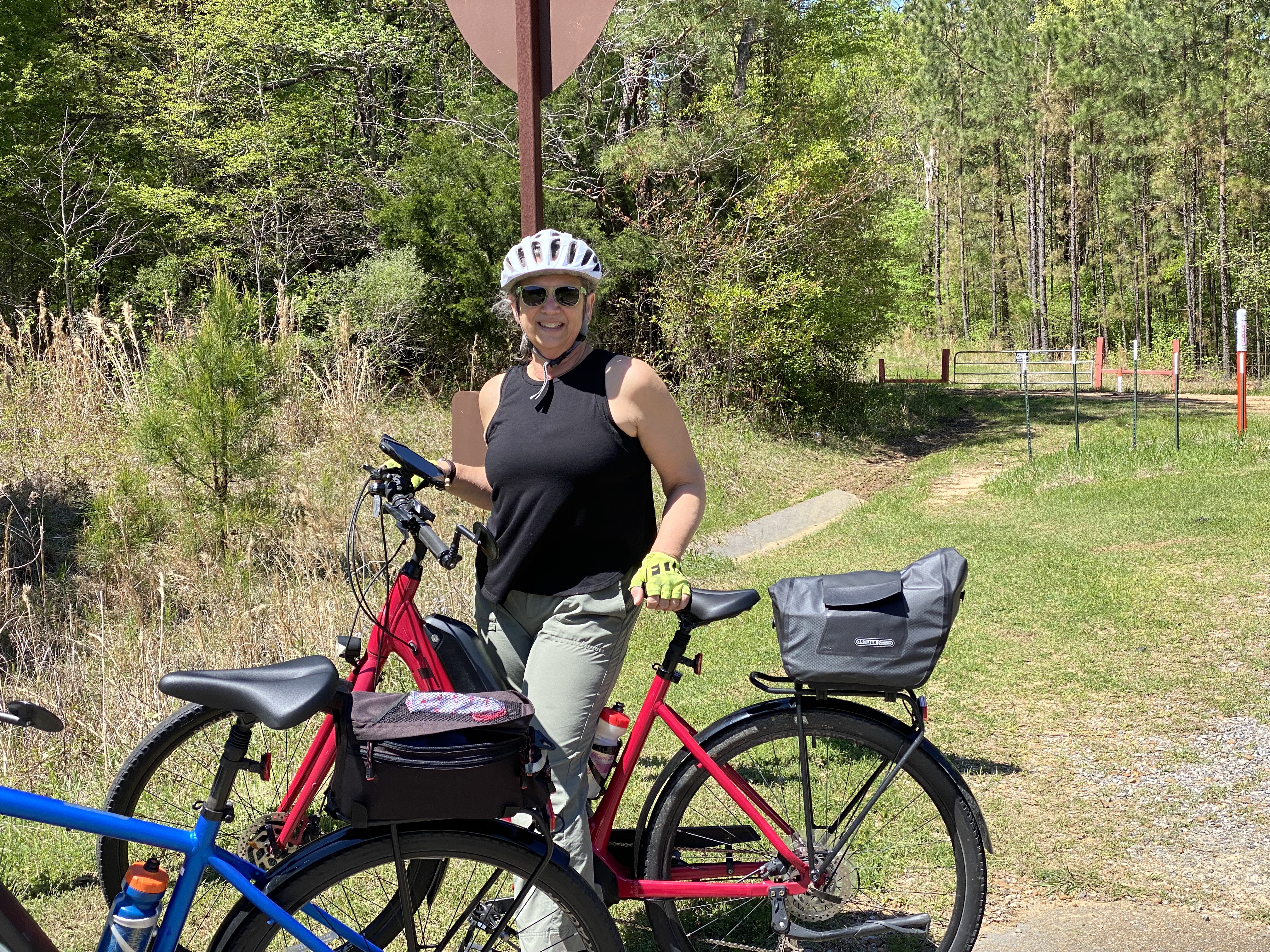
Bicycling
A coalition of volunteers (Fredericton Trail Coalition) began to mobilize after the Canadian Northern Railway abandoned a number of lines in New Brunswick in 1989. The first trail was opened in 1993. In 1996, 377 additional kilometers of abandoned railway was donated to the province by the Irving Family allowing Freddy to connect a number of trails and create today’s connected network of over 120 kilometers of trail. A key aspect of the donation was the inclusion of the 906 foot railway bridge that spans the St. John River — connecting the trail systems on both side of the river.
Fredericton Trail Coalition Map
As a result, folks in Fredericton have a plethora of riding and walking trail options. It is not surprising that Fredericton was named Canada’s 6th most-walkable city in 2019, one of 5 “Great Canadian Bike Cities” in 2021 by People for Bikes, and was #9 on Canada’s Best Small Cities as ranked by World’s Best Cities.com in 2022. We took advantage of the trail system and delightful weather to explore a number of the trails during our stay in Freddy.
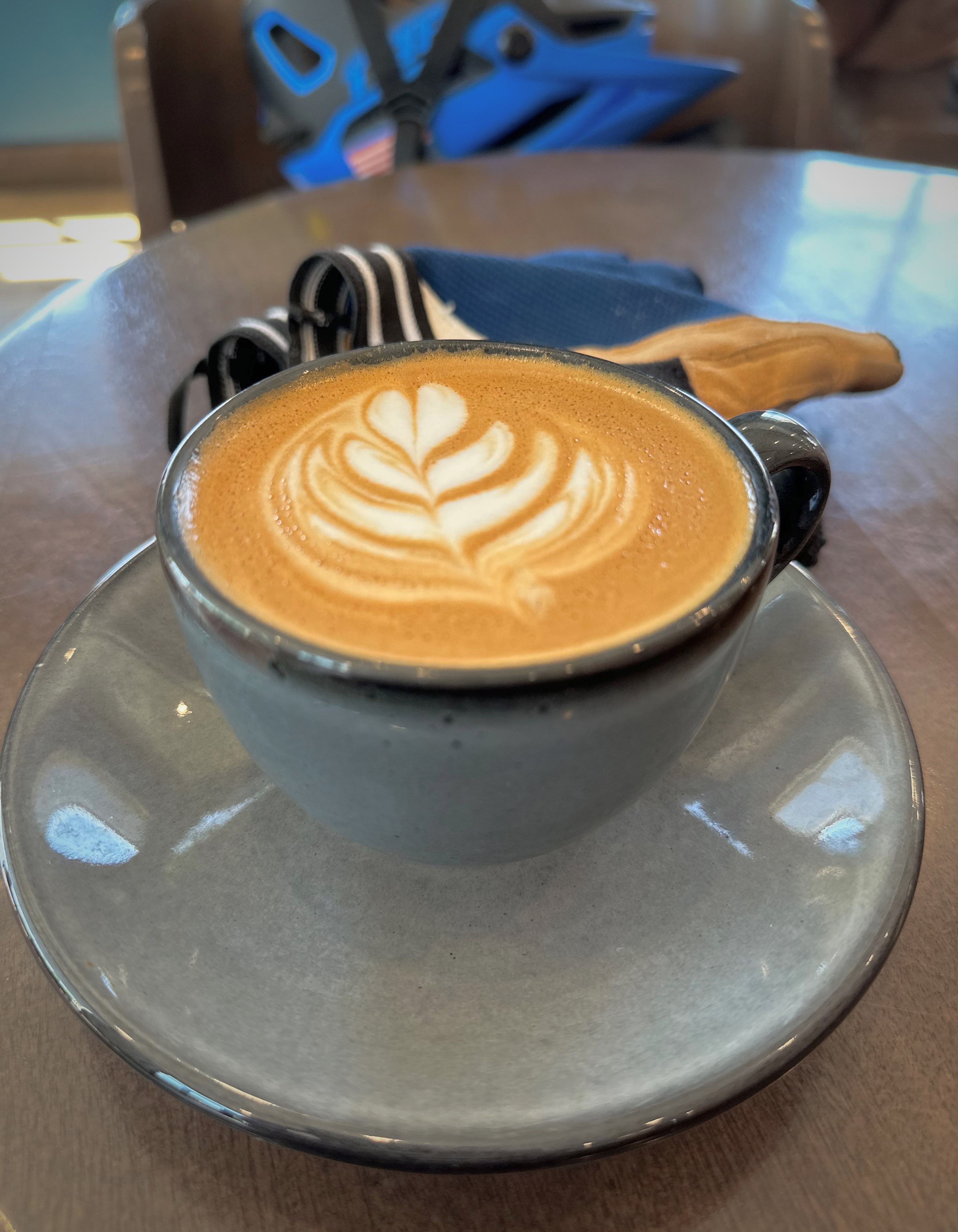
fika
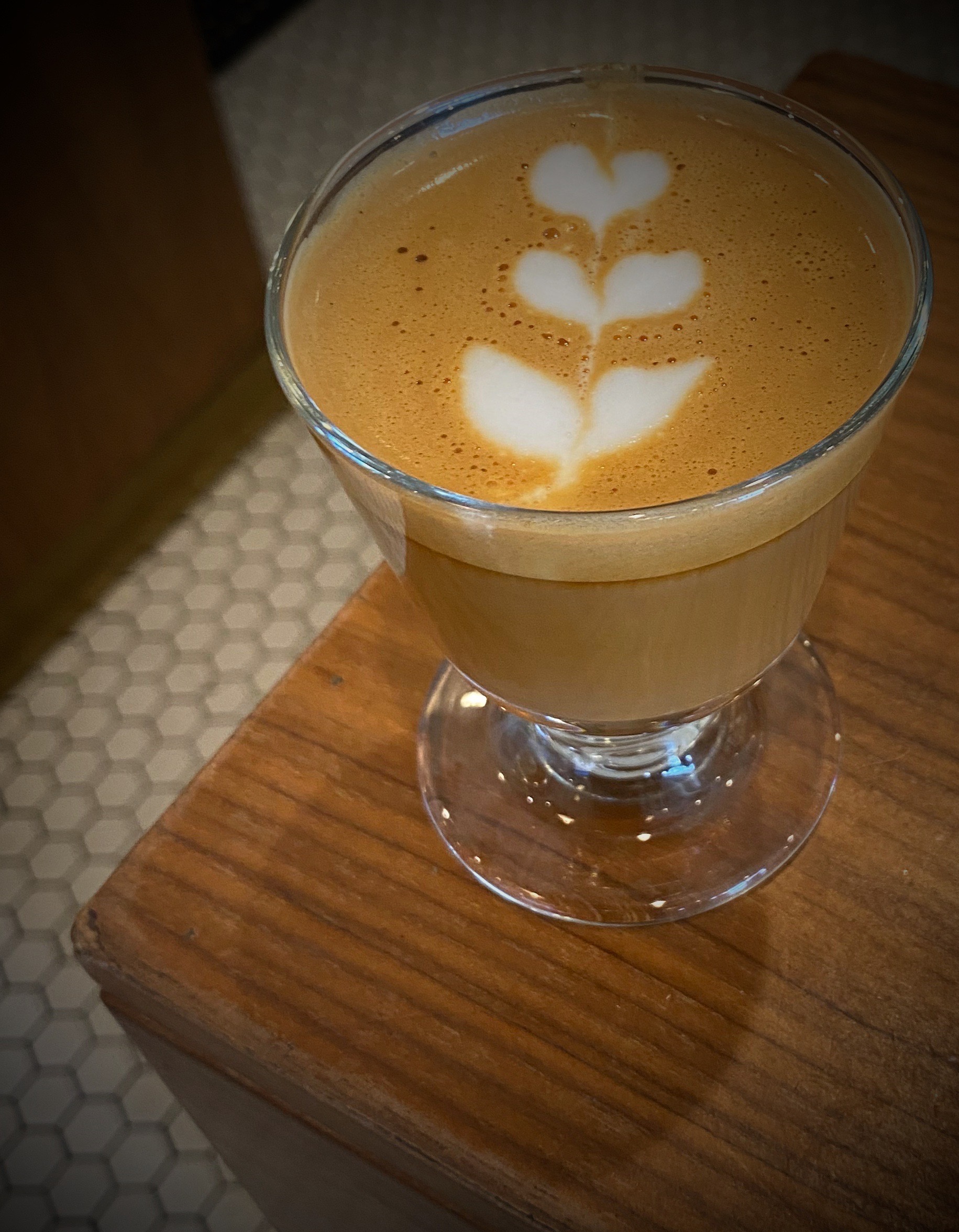
Combining biking with coffee is a double delight. Mill Town Coffee Roasters is conveniently located on one of the trails and we were able to take a coffee break on our way out and back during each ride. Pretty good, eh!
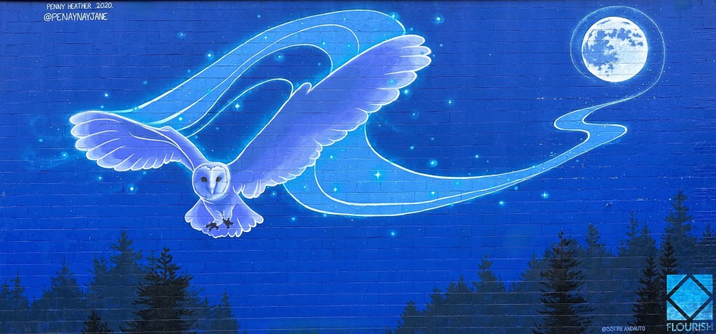
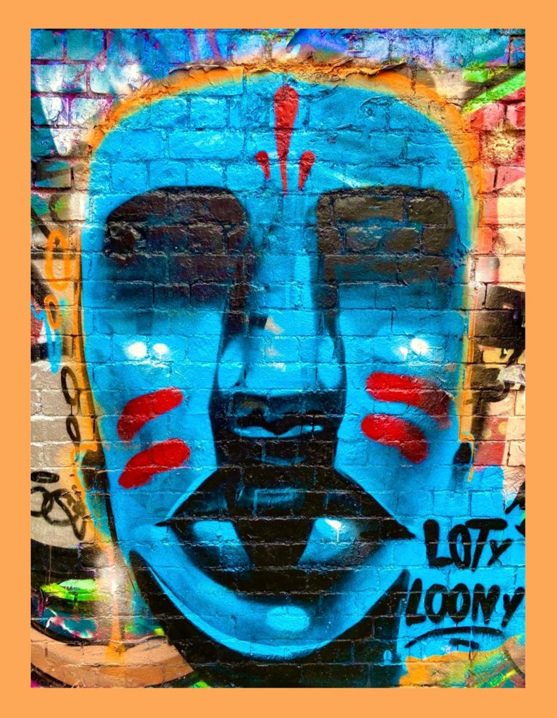
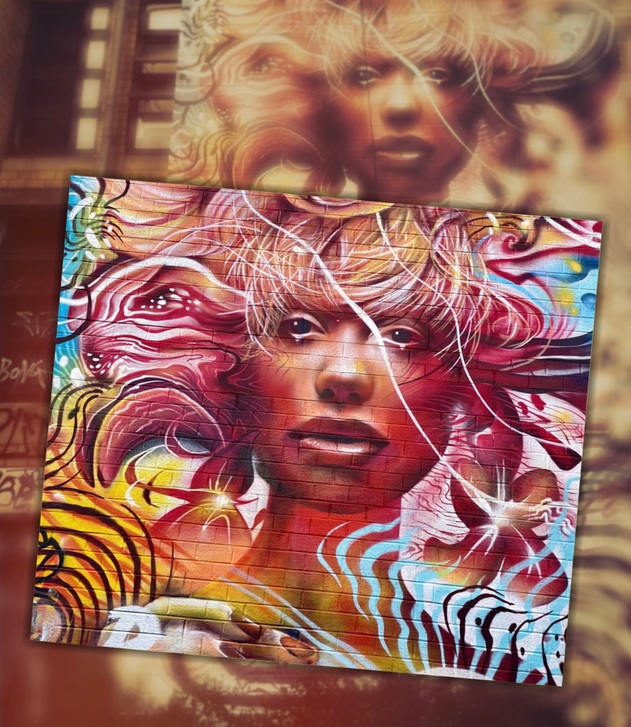
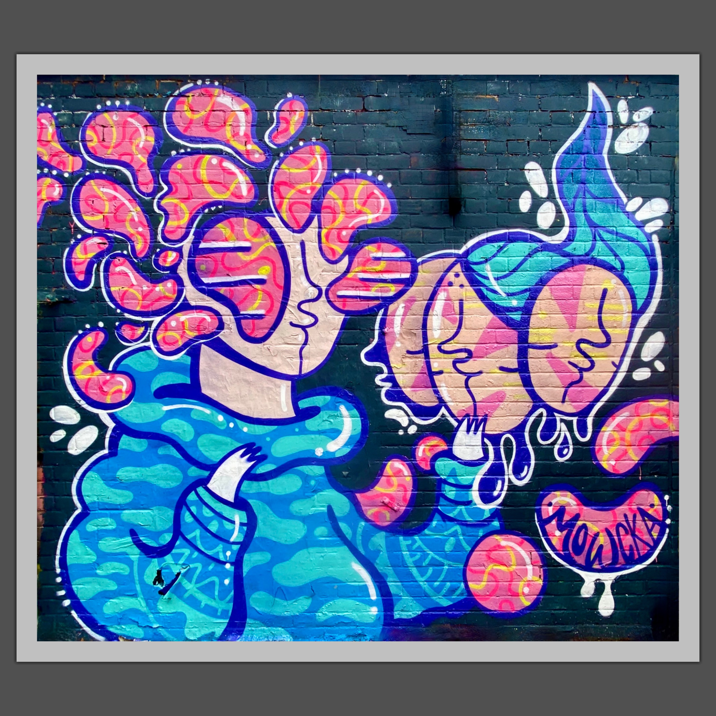
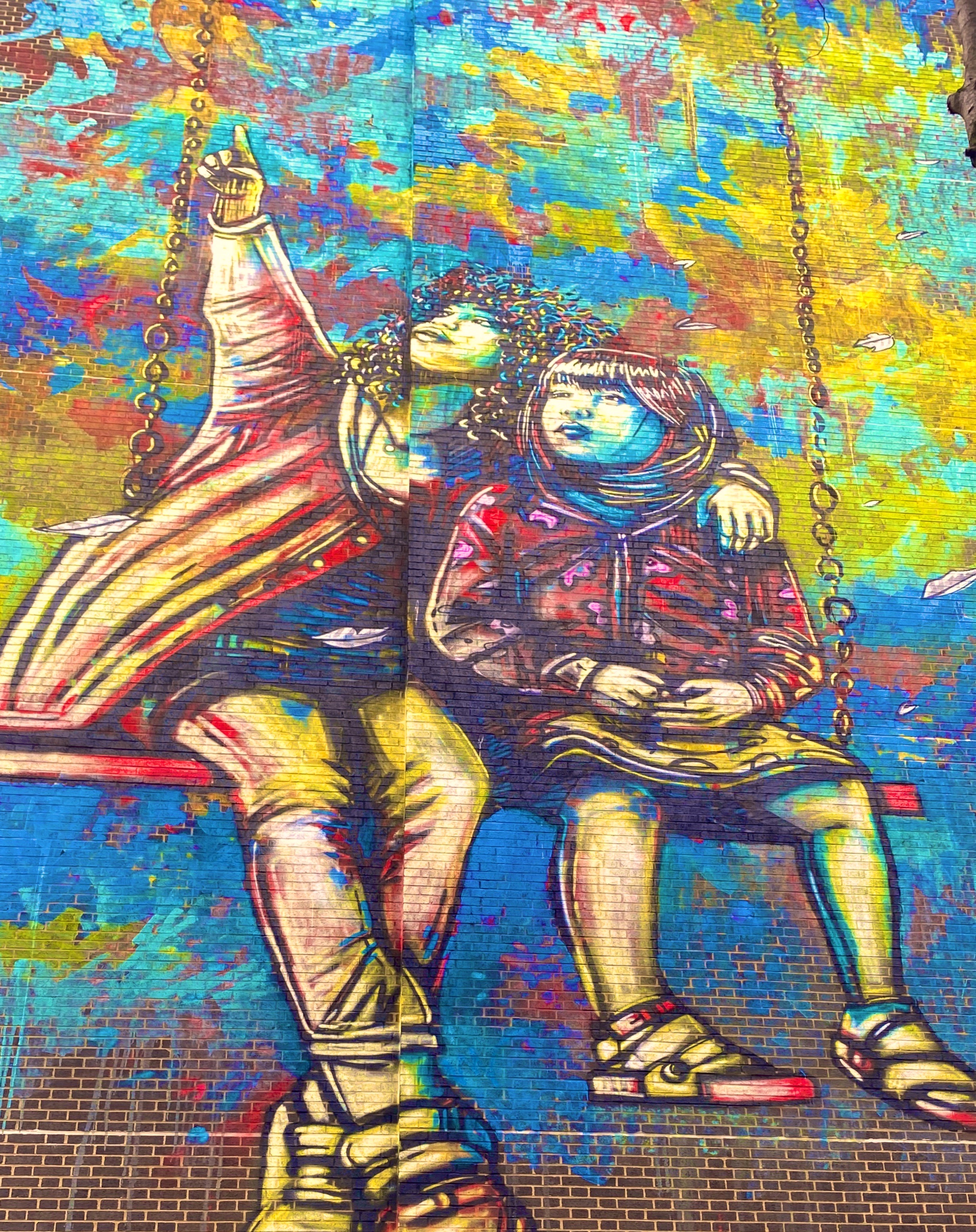
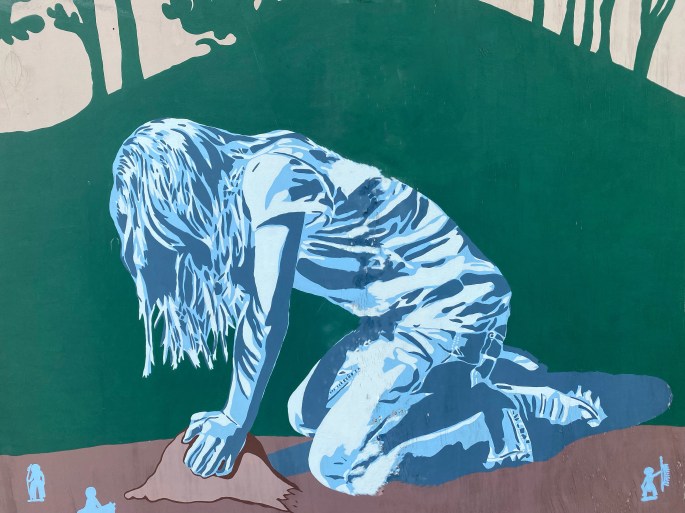
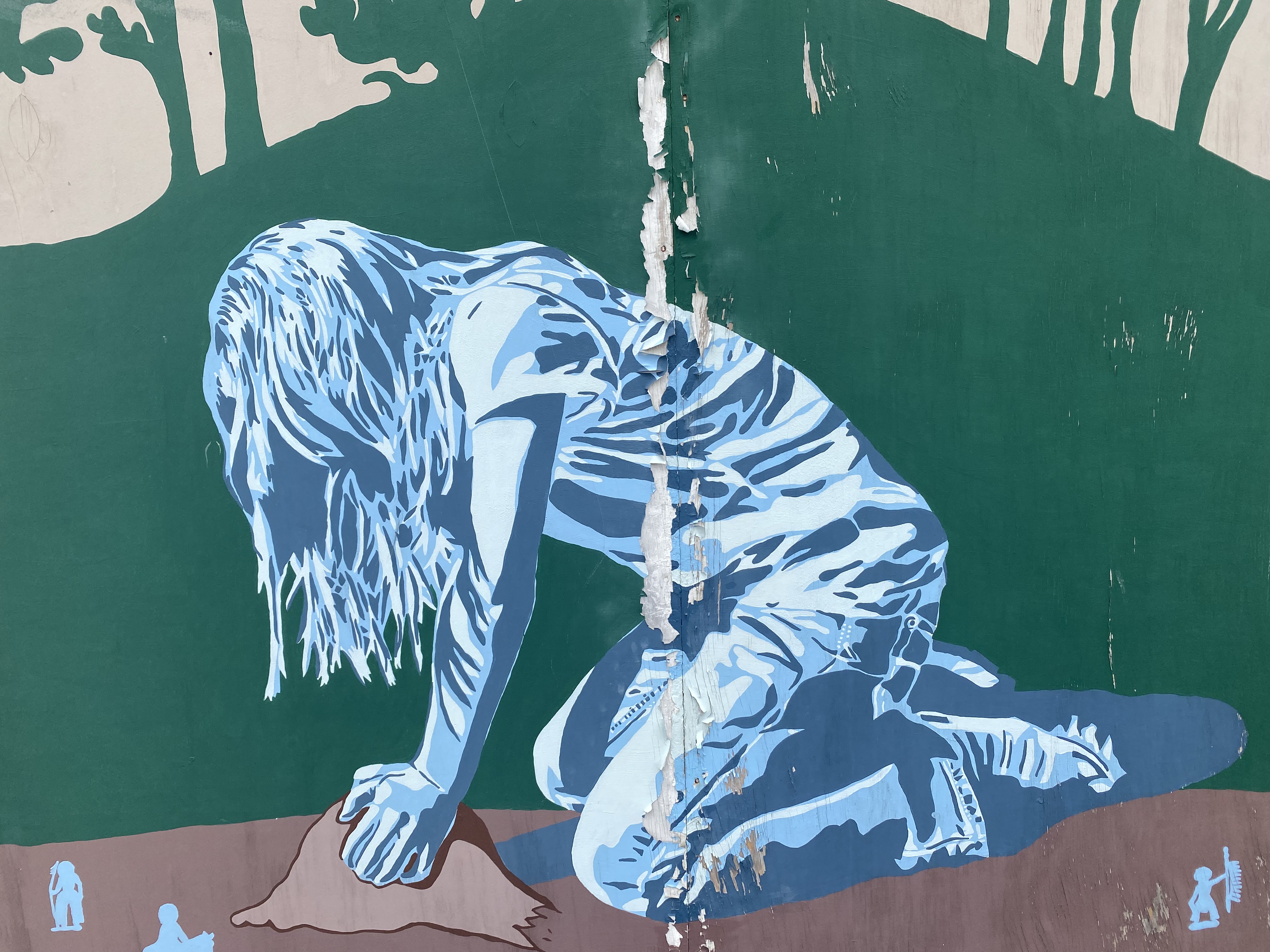
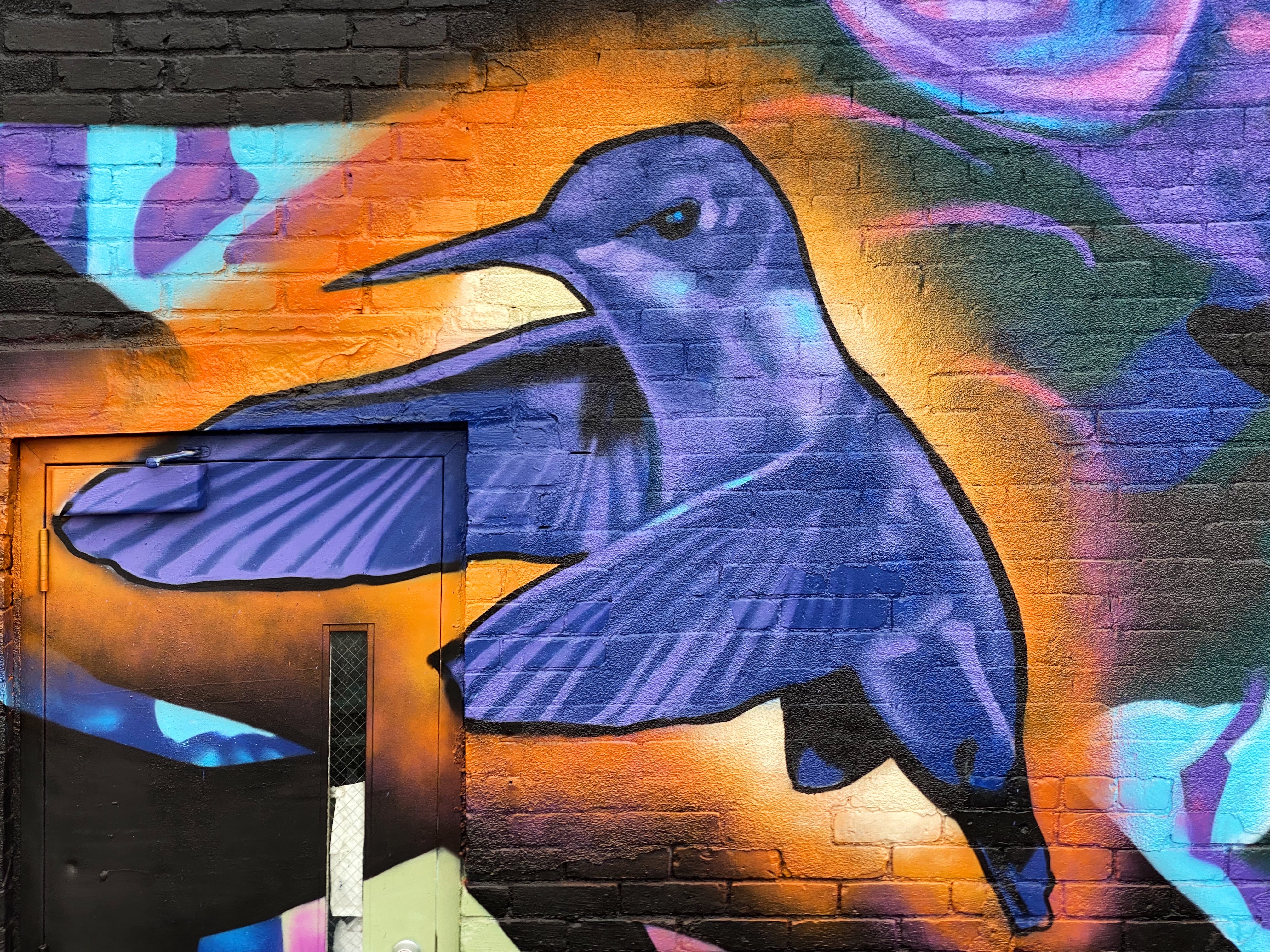
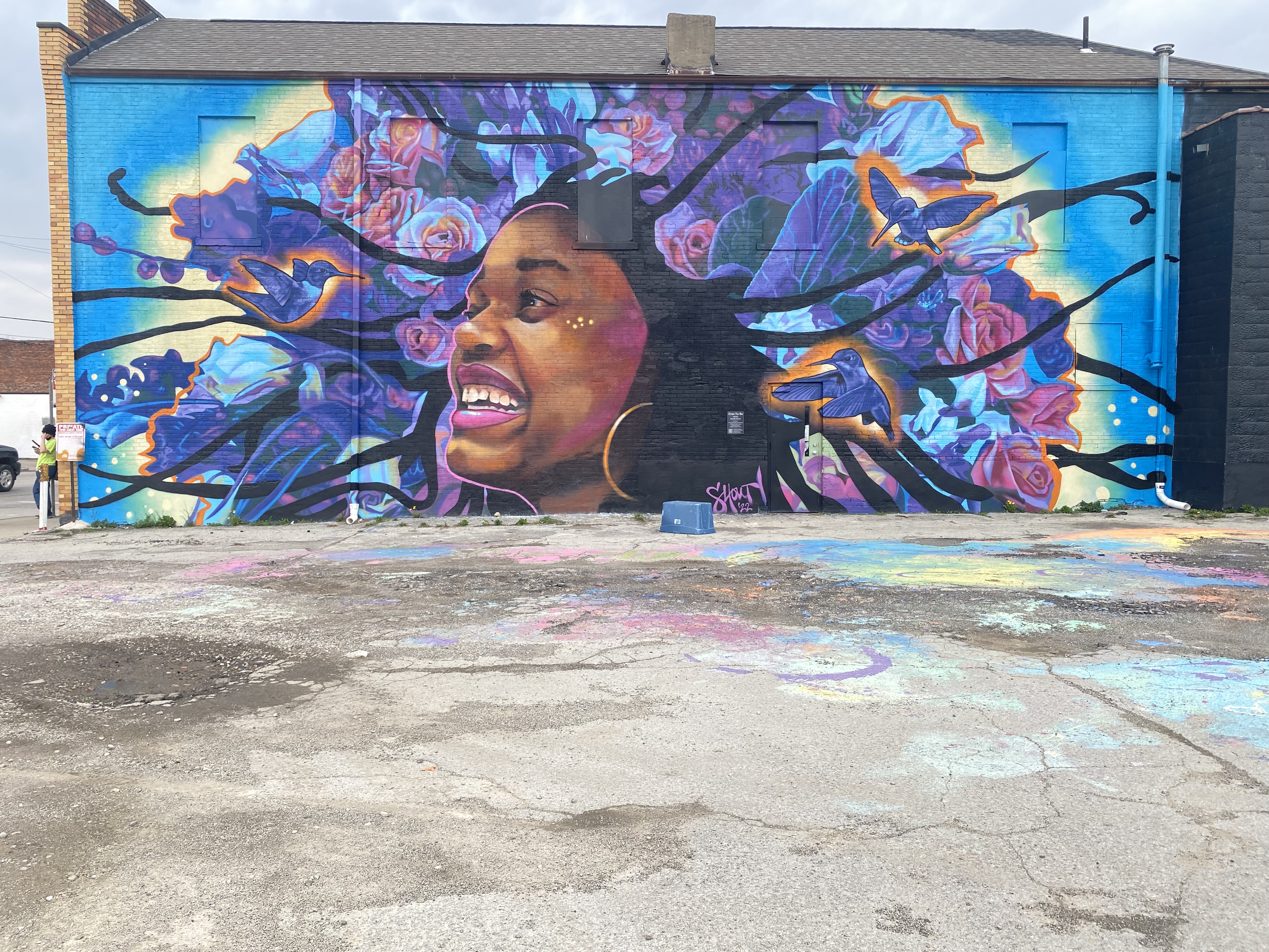
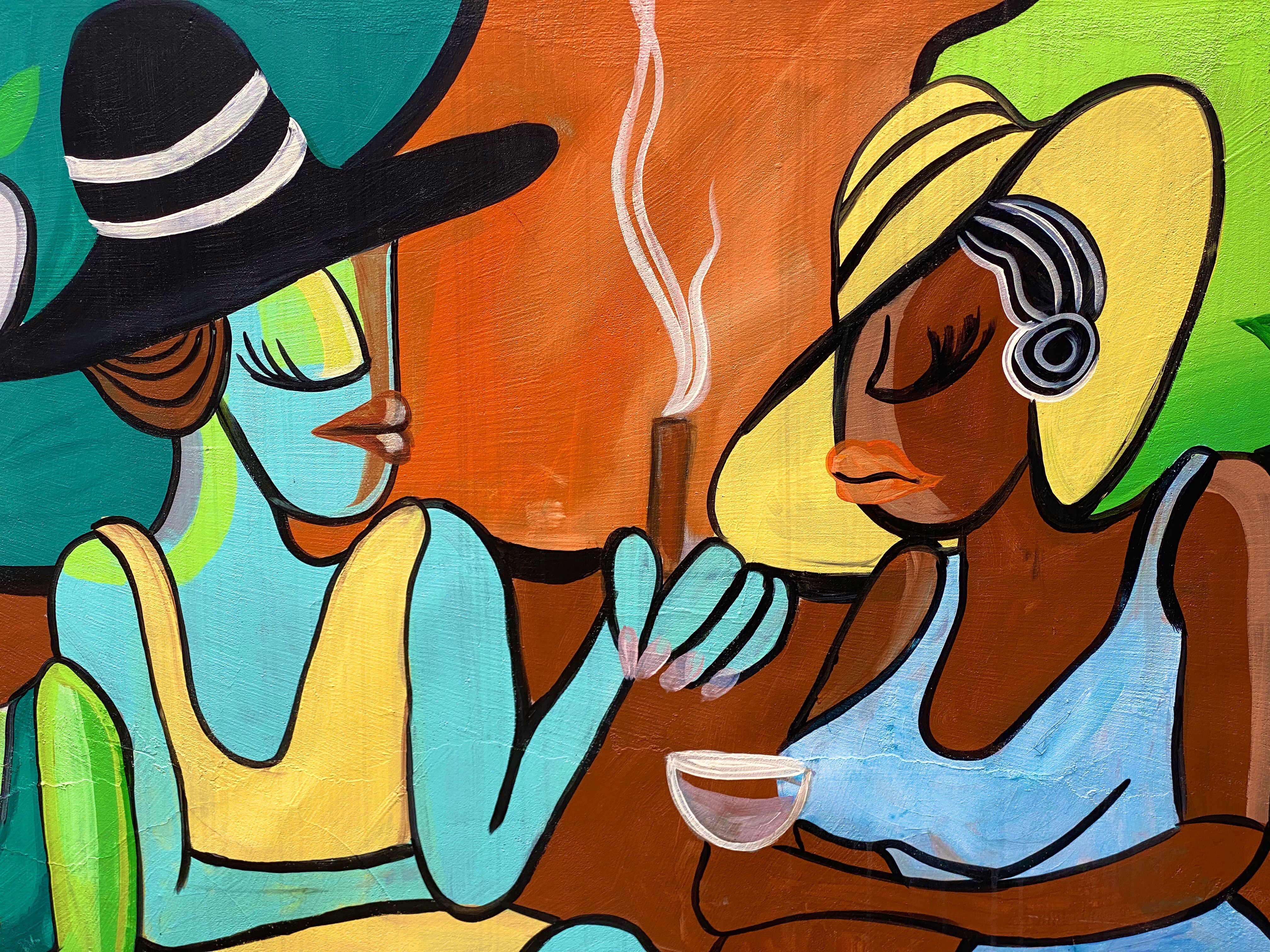
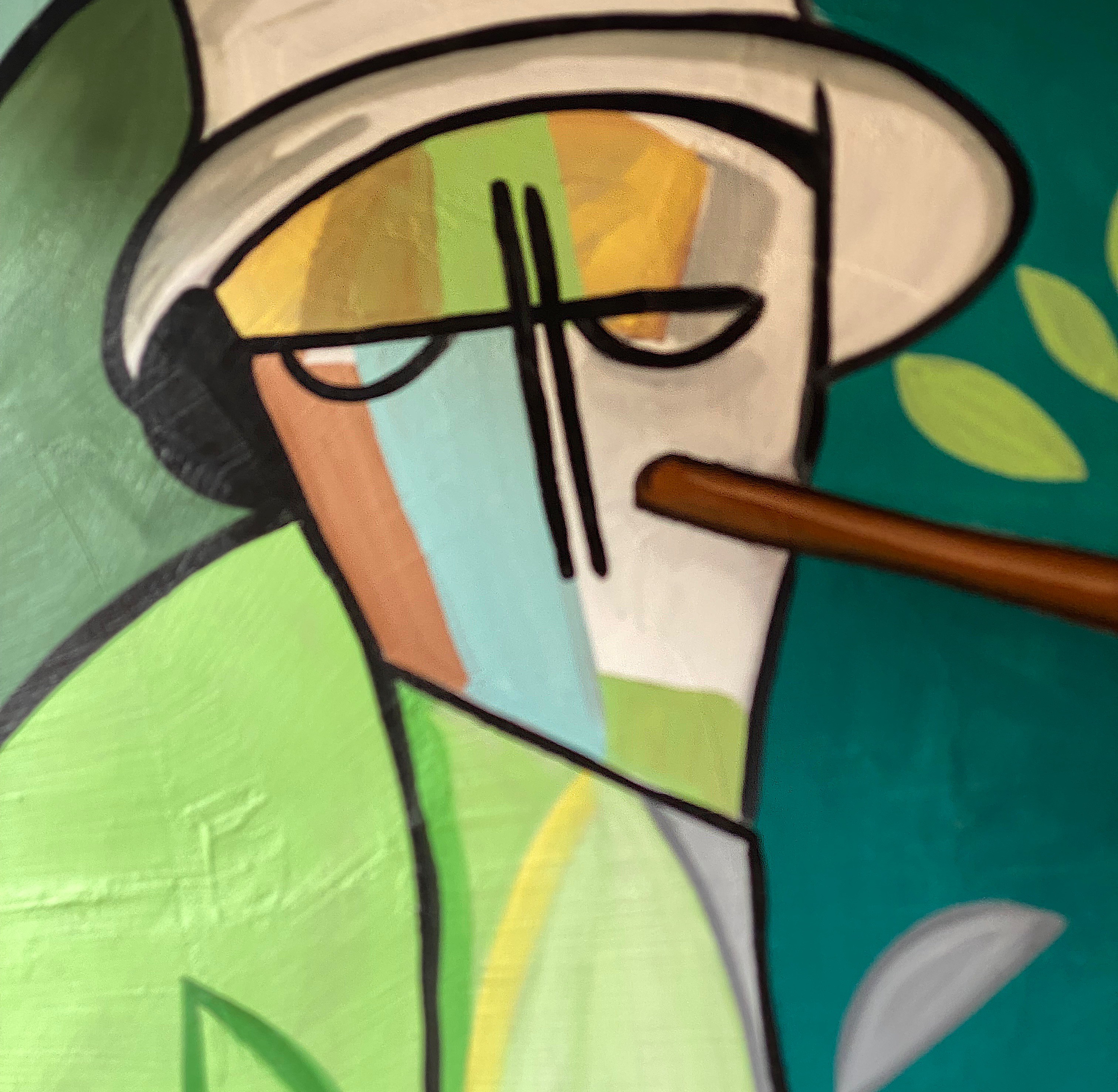
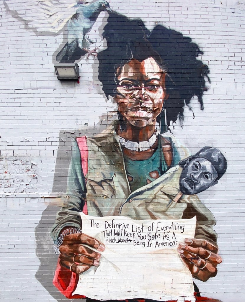
Street Art
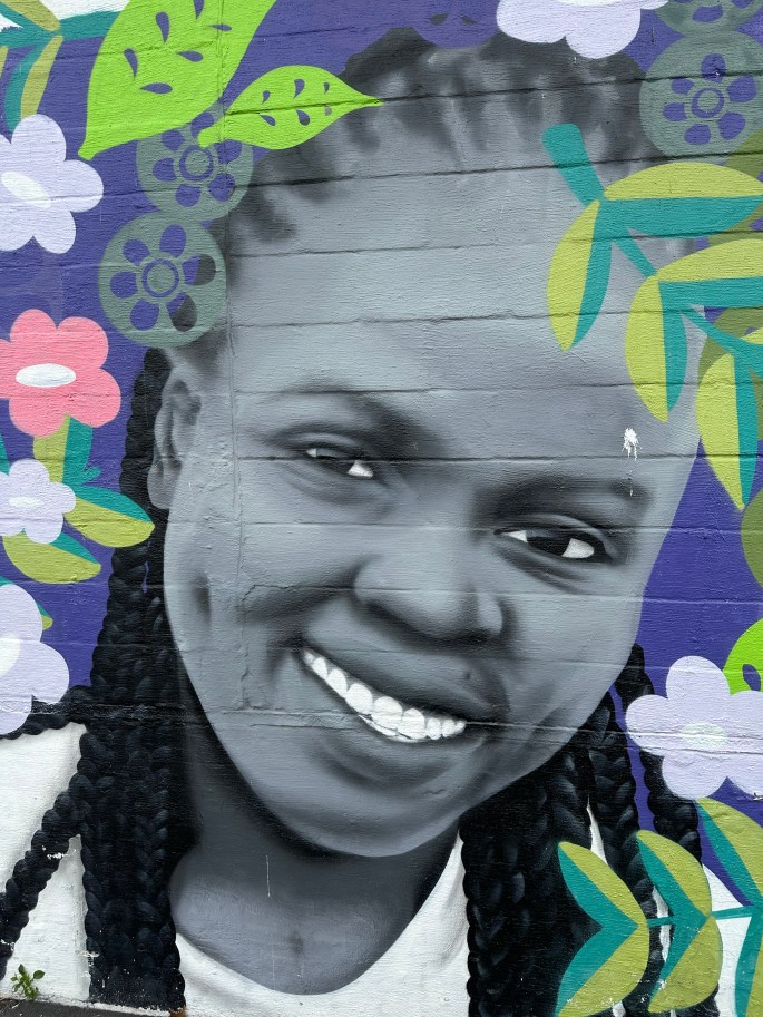
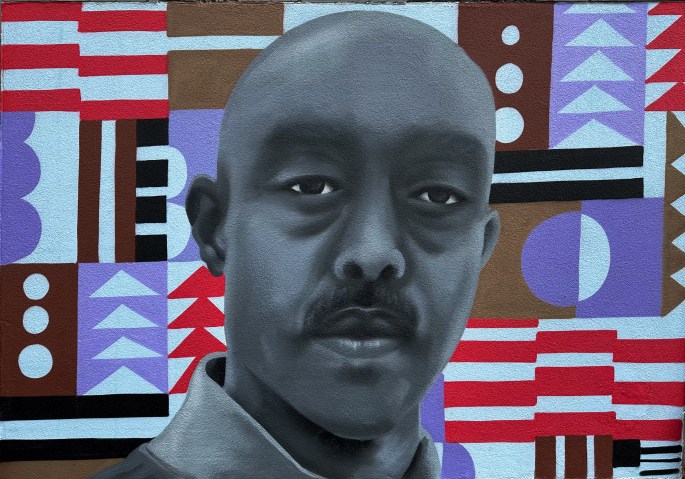
In our humble opinion, public art adds a great deal to a city’s environment. We were glad to find that Freddy has several notable street murals in the downtown area, although we would have loved to find more during our walks through town.
Fine art
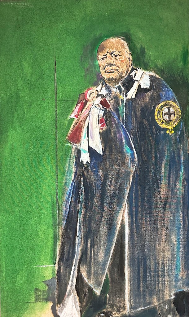
Freddy is very fortunate to have, in our opinion, a very impressive art museum, especially in light of the fact that the city population is barely 60,000. Much of the good fortune is owed to the generosity of one Lord Beaverbrook — who in 1959 gifted the museum building and 300 valuable works of art to a museum foundation he created for the benefit of the public. Did we mention that the museum is named the Beaverbrook Art Gallery?
Lord Beaverbrook
The son of a Presbyterian minister in Miramichi, New Brunswick, the future Lord Beaverbrook, Max Aitken, enjoyed early success in Canadian business. In 1910, he left Canada for England, where he was knighted and elected a Member of Parliament, eventually serving as Minister of Aircraft Production in Churchill’s wartime government. No slouch Sir Max!
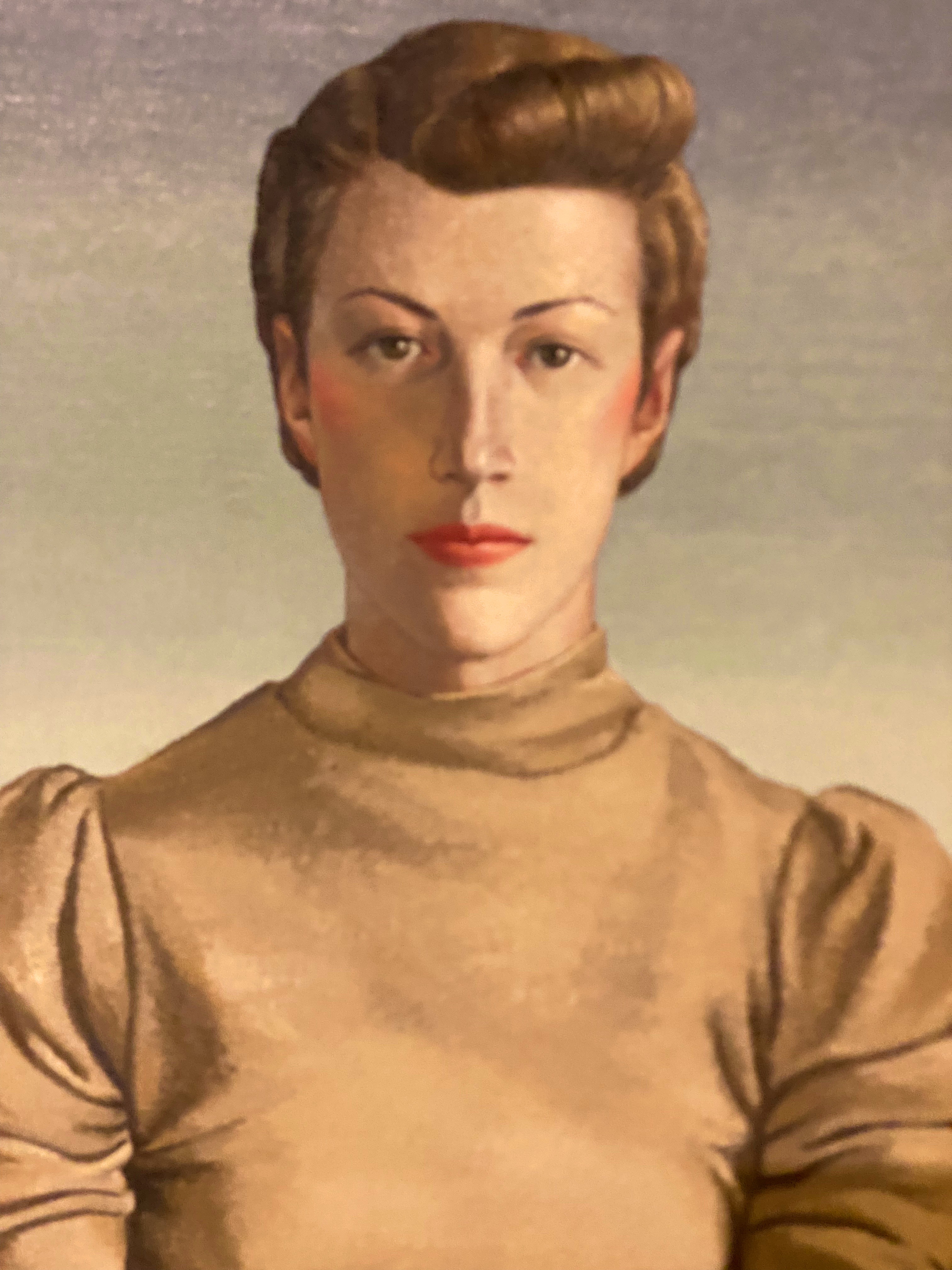
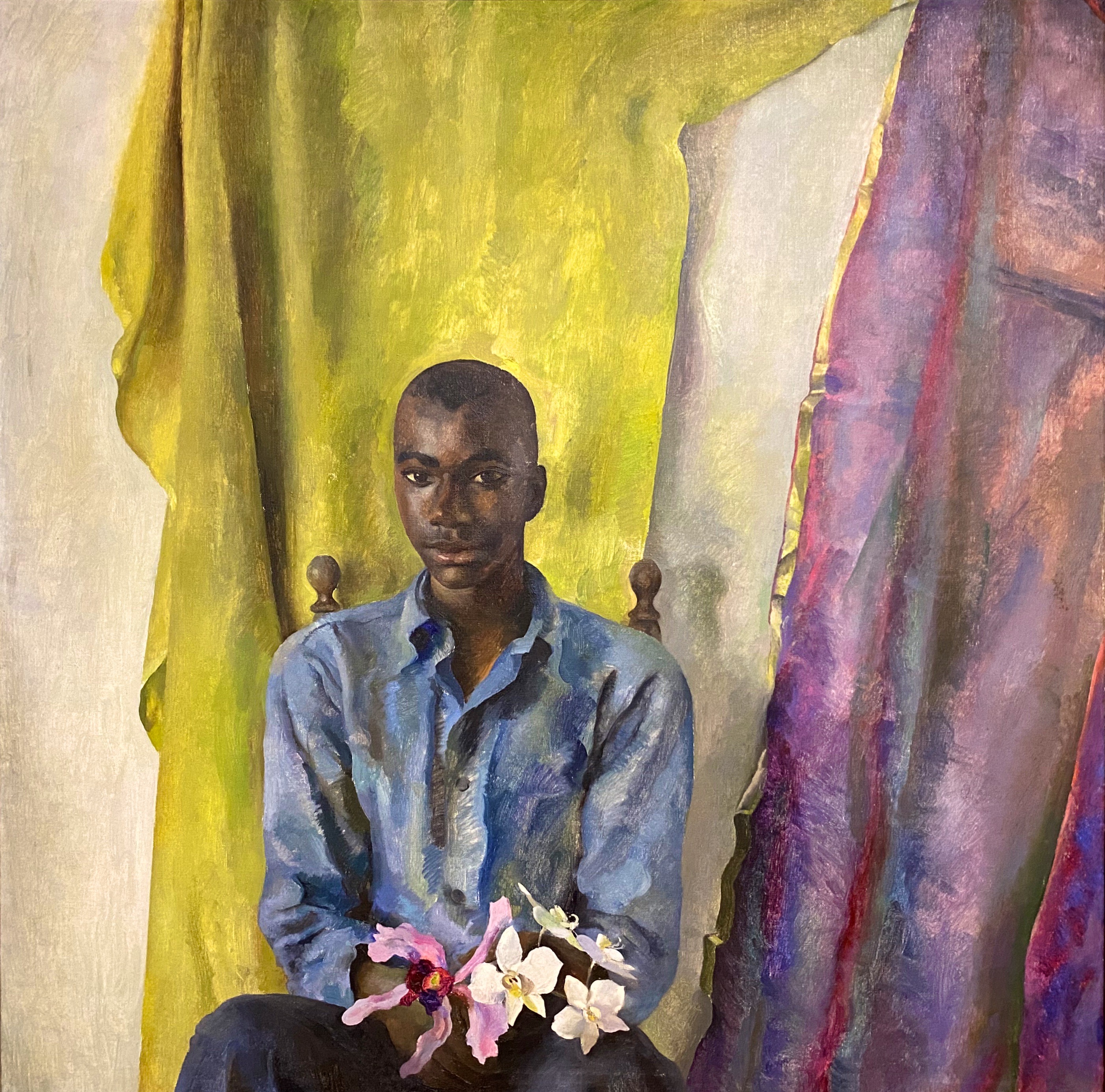
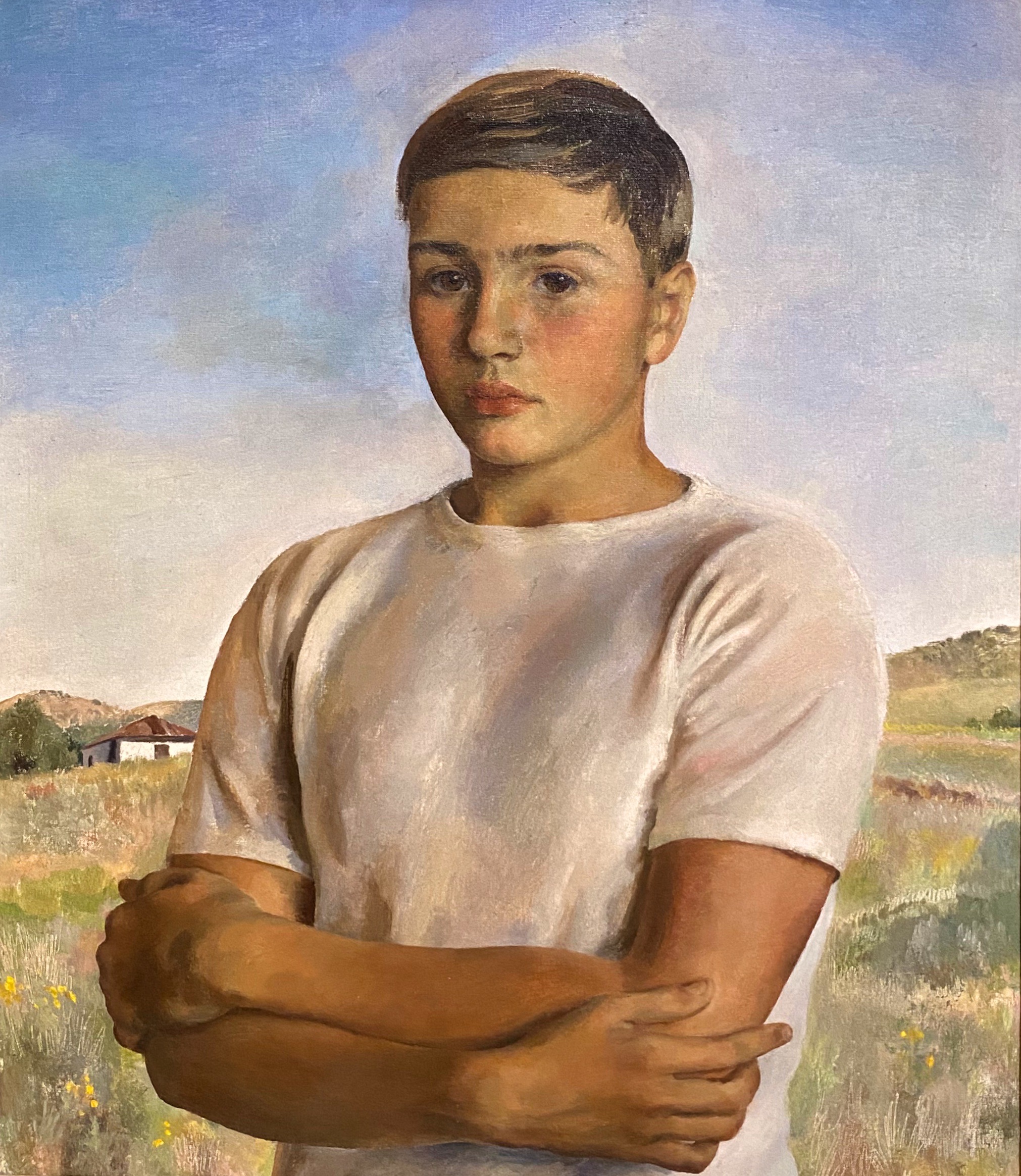
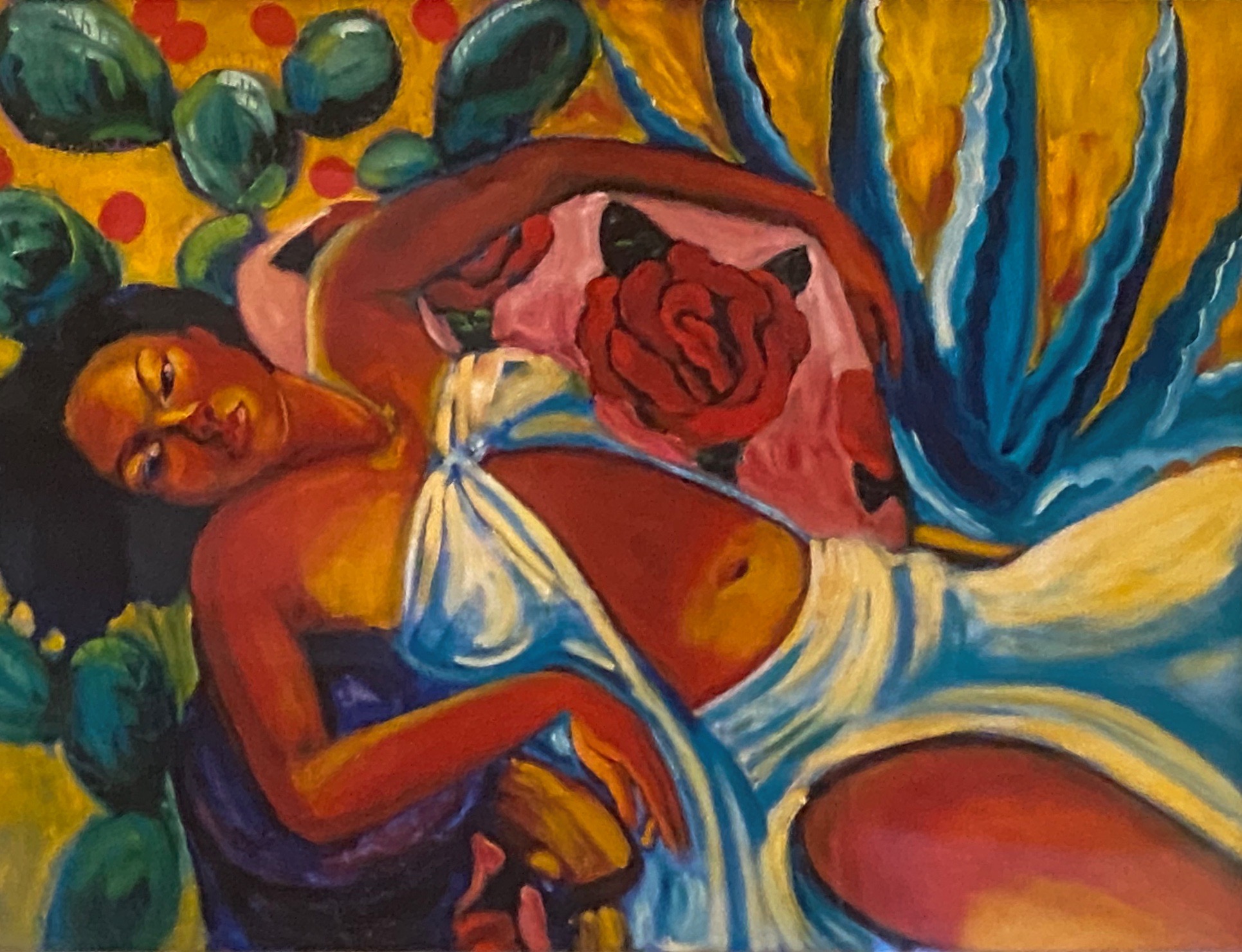
The museum is noted for it’s collection of renowned Canadian artists but also has works by Dali (not fans but still impressive to see a gallery of Dali paintings in Freddy) and Gainsborough and as well as other internationally acclaimed painters. The Beaverbrook became the official provincial gallery of New Brunswick in 1996.
Salvador Felipe Jacinto Dali (Spanish, 1904-1989) La Turbie: Sir James Dunn, 1949 oil on canvas On Loan from the Beaverbrook Canadian Foundation
Medrie MacPhee (Canadian / Canadienne, b./n. 1953) Locke (1987) oil on canvas / huile sur toile
Carol Hoorn Fraser (Canadian / Canadienne, 1930 – 1991) The Guardians, 1976 oil on canvas / huile sur toile
Lucy Jarvis (Canadian / Canadienne, 1896 – 1985) Iris Swamp (1961) oil on board / huile sur panneau
Montreal-based painter Michael Smith (directly above and below) is known for his fluid and impasto surfaces as well as his ability to strike a poetic balance between representation and abstraction. Inspired by art history as well as historic and current events, Smith pulls from various sources to create his energetic landscapes and seascapes. His Sea of Change series includes massive canvases exploding with colour and energy, as well as smaller studies on paper. These were inspired by a serendipitous encounter with a 19th-century painting of the Arctic expedition ship H.M.S. Terror during his time as artist-in-residence at the Beaverbrook Art Gallery in 2018. Layering texture and colour, the familiar with the unfamiliar, Smith’s paintings convey (as the artist writes) “a mix of excitement and anxiety of a land [that] although at times bucolic, is riddled with shadows.” Curated by John Leroux
A little bit of history
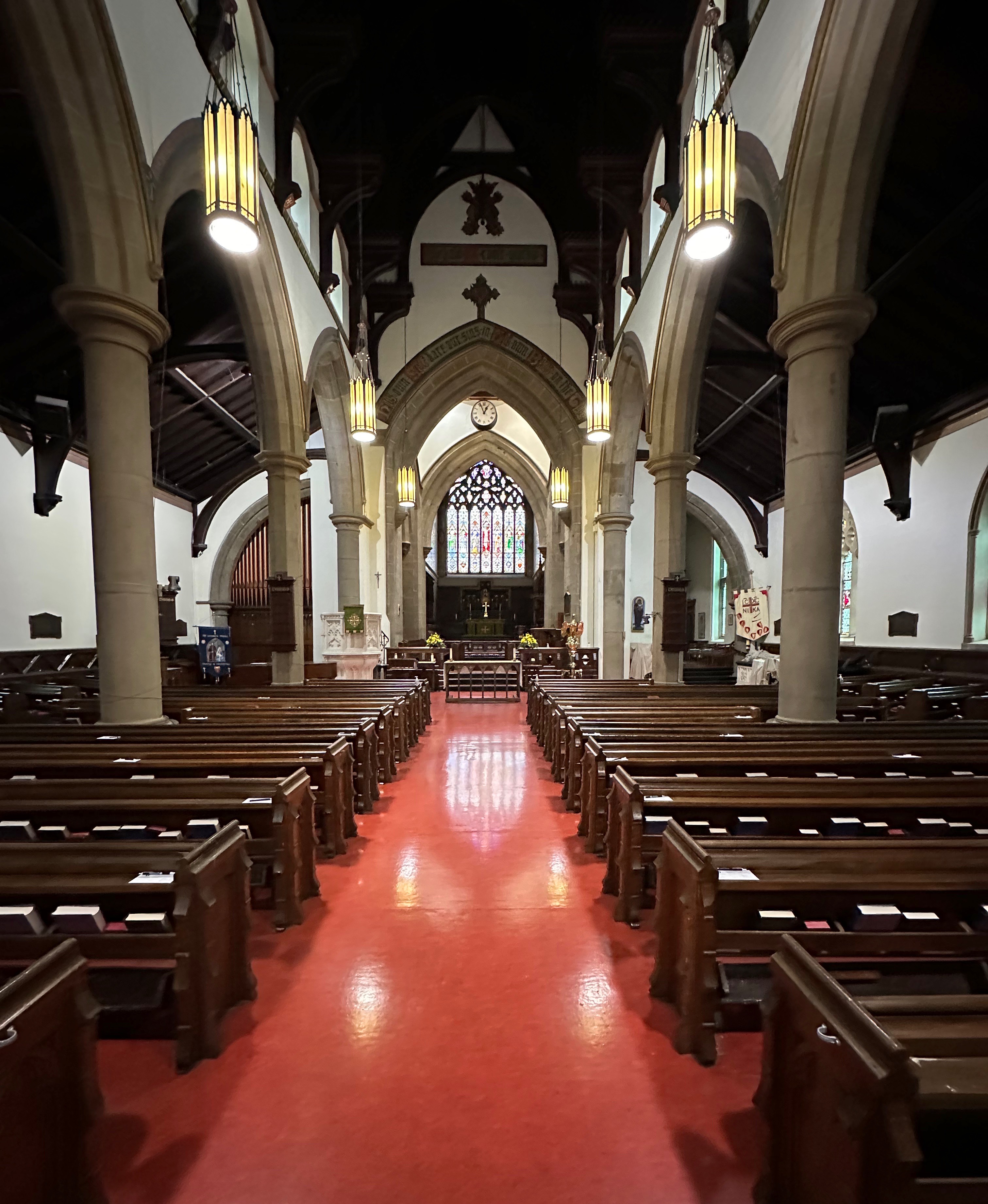
We often find that the early history of a city is intertwined with the creation of the dominate religion of the ruling class. Fredericton is no exception to that pattern. The city was named for Prince Frederick,son of King George III and Queen Charlotte. Subsequently, Queen Charlotte declared Fredericton a Cathedral City (even though its population was too small) so Christ Church Cathedral could be built. The Anglican Church at that time was utilized as a way to impose British custom and law (and to counter Acadian Catholicism) on the inhabitants be they British, Acadian or First Nations.
Christ Church Cathedral, Fredericton, New Brunswick
The Cathedral sits on its own park like island of green at the edge of downtown. The surrounding neighborhoods consist of stately and beautifully maintained homes. By many accounts the movers and shakers in Fredericton were members of this parish and much business was conducted and deals made between the businessmen and politicians who belonged here.
We always seem compelled to add a little bit of history (and an opinion or two) when we report on our travels — oh well!
Music
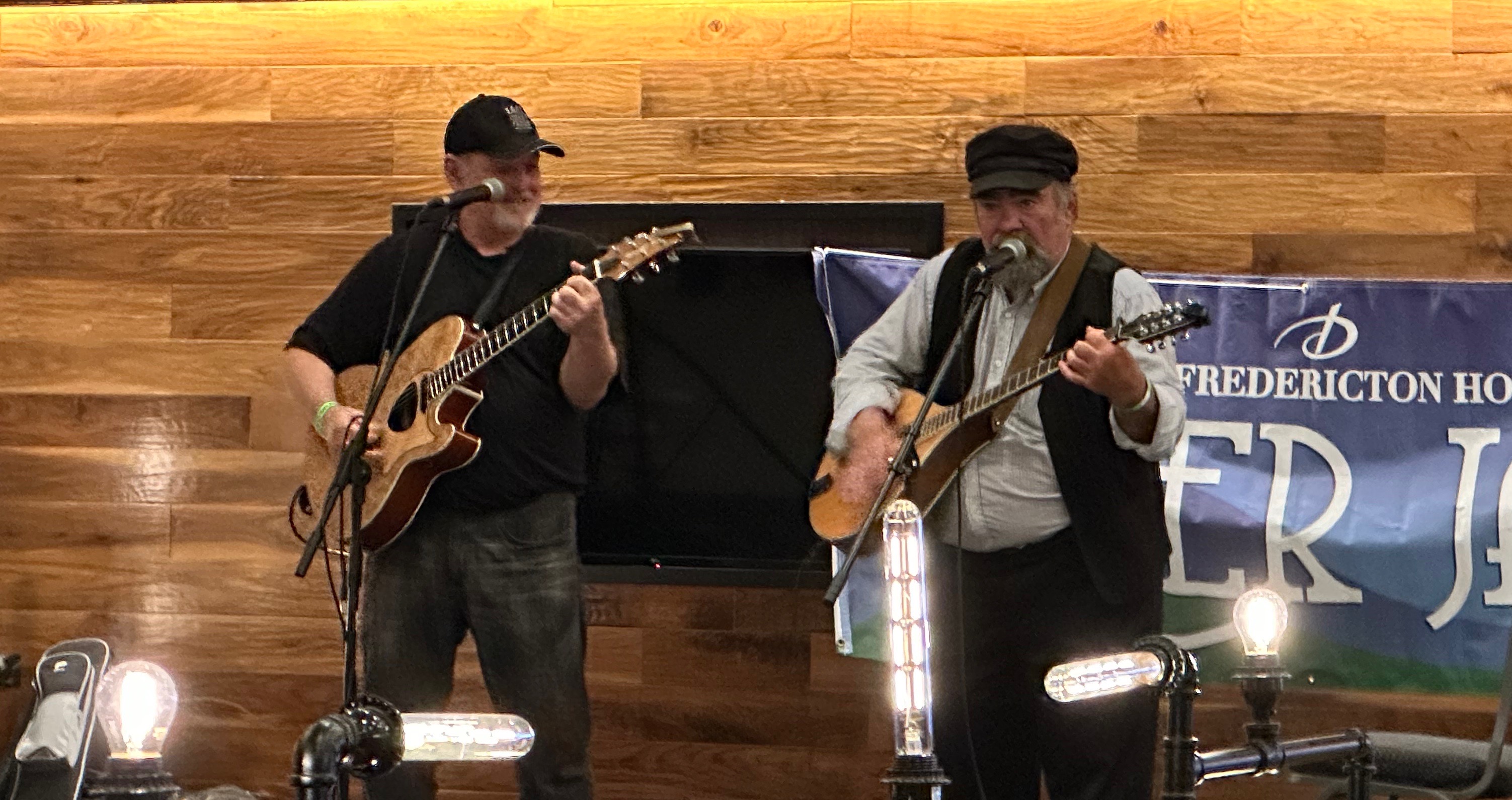
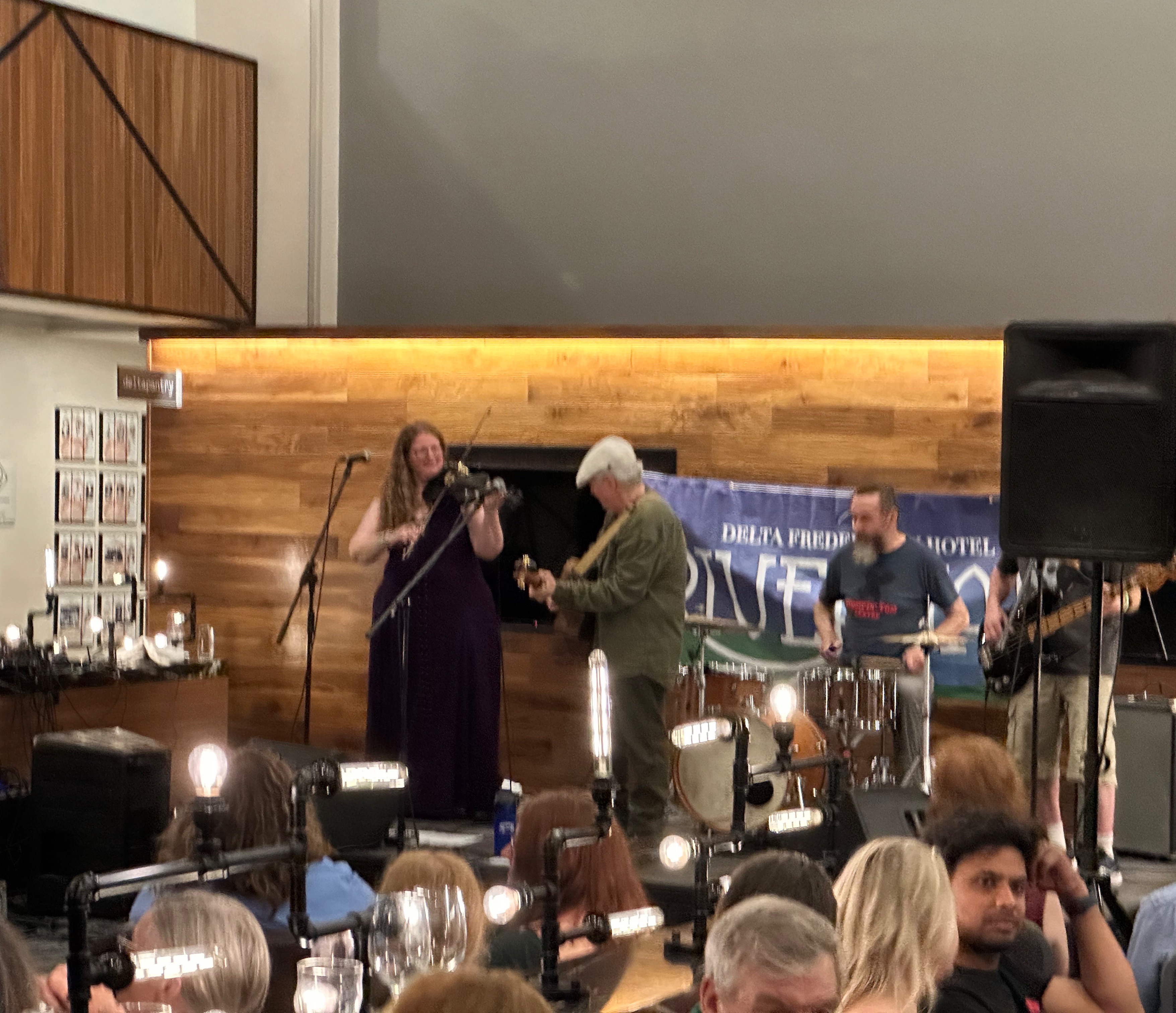
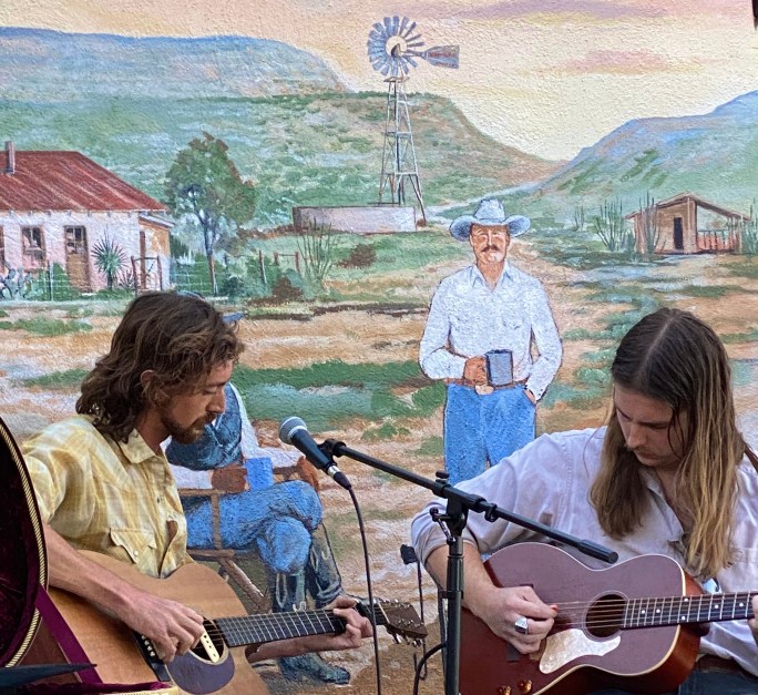
We closed out our stay in Freddy with an afternoon and evening of food and music. The River Jam Music Festival was taking place all around us at our hotel with four or five music acts performing in different areas of the facility simultaneously. We took in a couple of acts, had dinner and camped at the bar (surprised?) to take in the performances in the lobby which ran to midnight. We were treated to primarily traditional music from the Maritimes and the local crowd was up singing along and dancing. So good!
That’s it from Freddy! We had a great visit and look forward to sharing more of our travels soon.
After a year off the road we have embarked on OTR 10.0! As we are headed north through Maine to the Atlantic maritime provinces of Canada we made Portland (PWM ) our first stop of the adventure.
PWM is a city of just over 68,000 but plays so much bigger! The food, coffee and art scene invariably provides something new and interesting to experience every time we visit.
Arriving in PWM mid-afternoon we made straight for Coffee By Design at their Diamond Street location in the East End. CBD is one of the oldest specialty roasters in the city dating back to 1994.
Coffee By Design
After our infusion of caffiene at CBD we worked our way up the hill for cocktails at Hardshore – a local distiller of gin and bourbon. Their gin is very reasonably priced and quite tasty! Our cocktails set us up perfectly to saunter across the street for dinner.
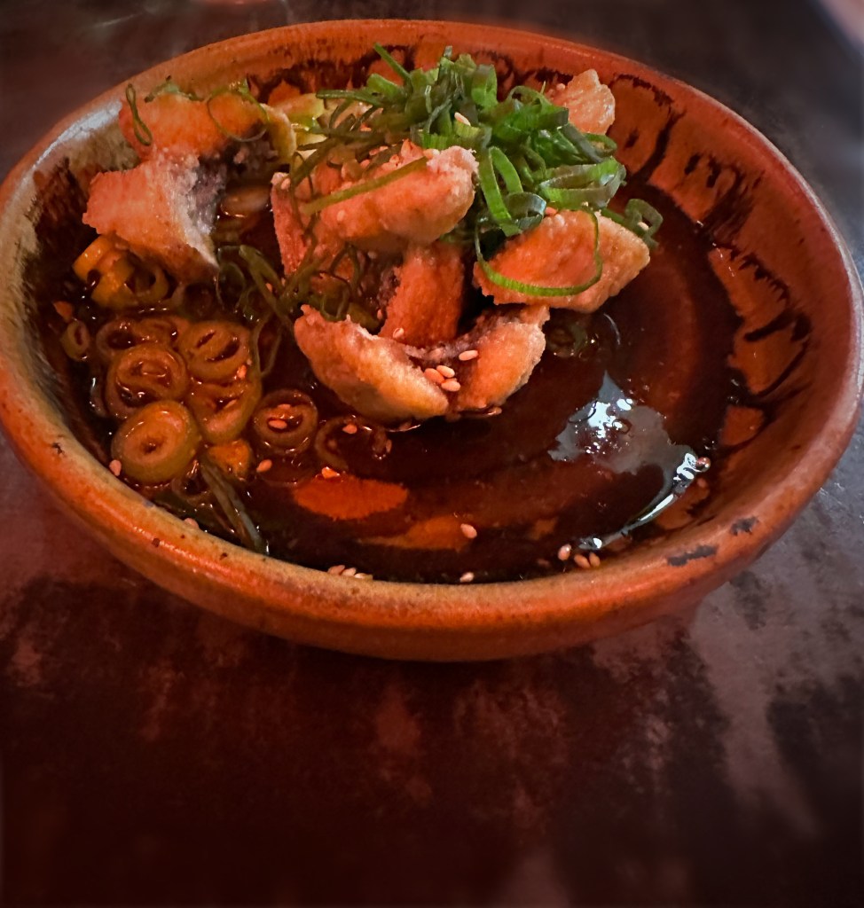
Izakaya Minato is located in the East End of PWM and is styled after traditional Japanese Izakaya. Izakaya (stay-drink-place) establishments are neighborhood bars that traditionally serve small plates and snacks to accompany alcoholic drinks and of course Sake.
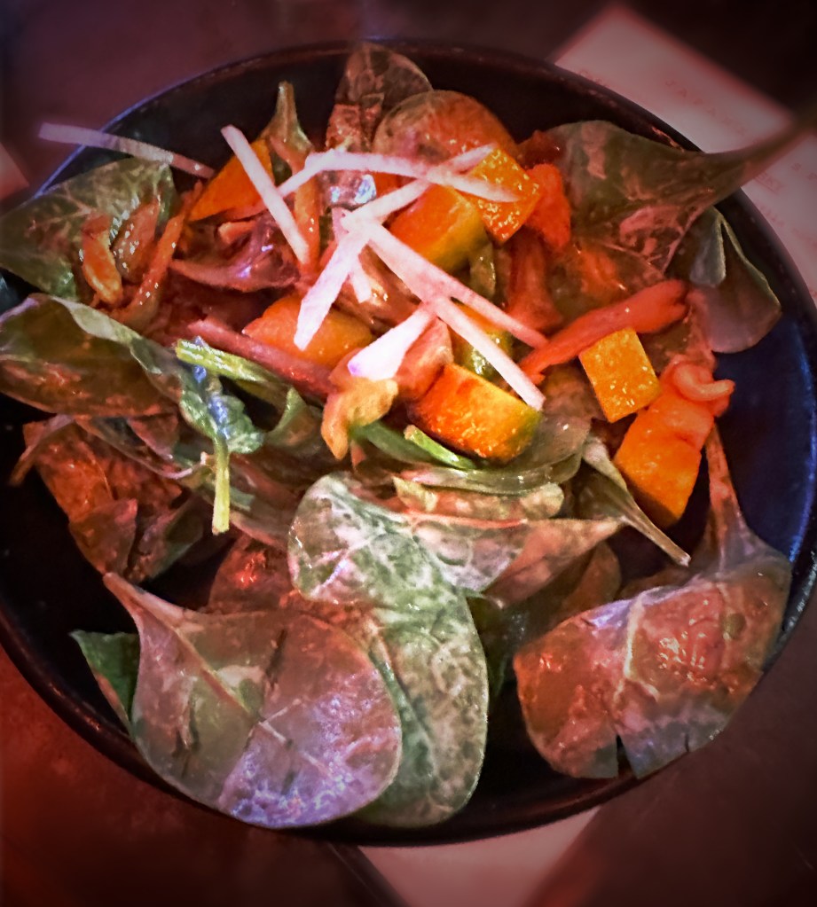
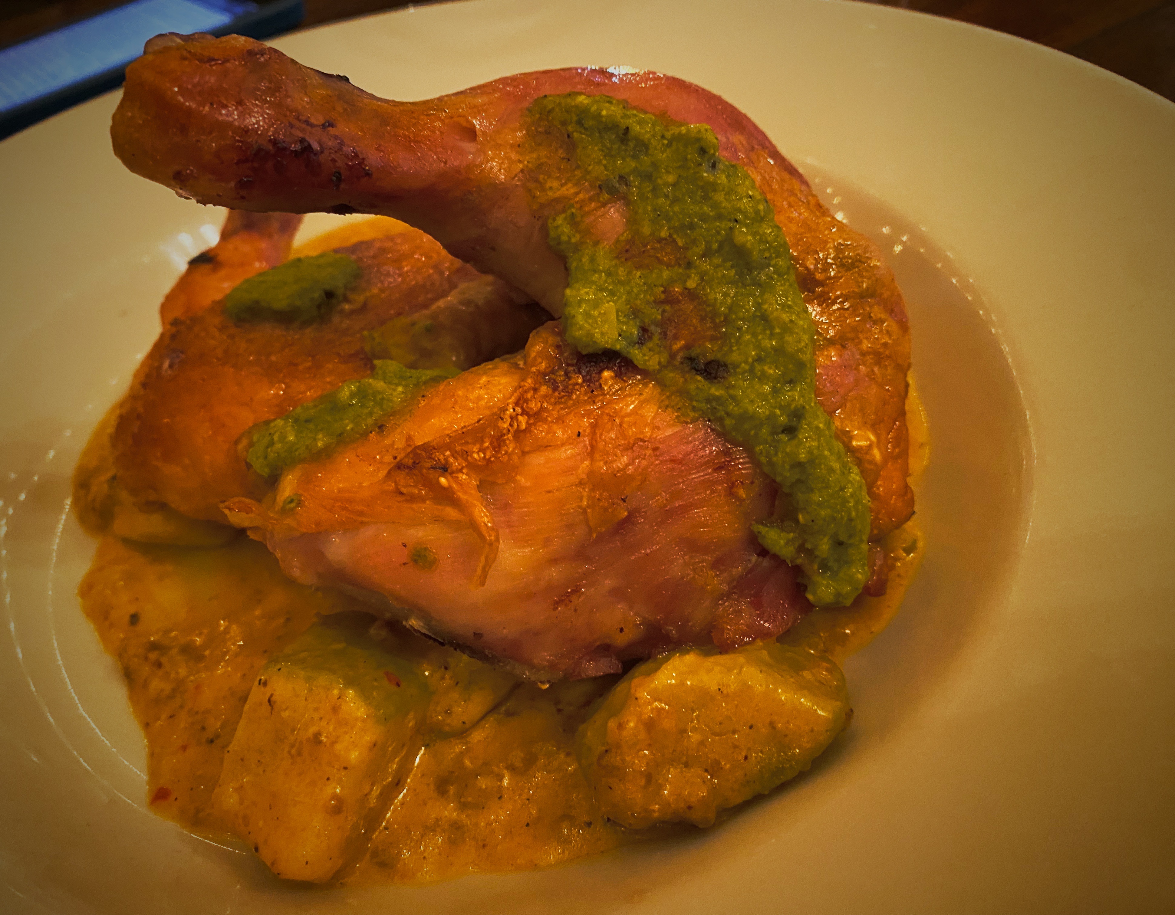
Our meal and drinks were excellent. We tried oyster tempura, fish and chicken dishes with rice and a fabulous spinach salad with the tastiest mushrooms ever. We highly recommend Minato!
Izakaya Minato
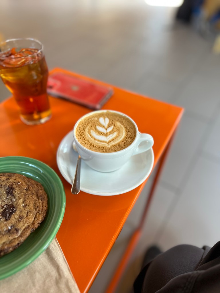
The next morning we ventured back to the East End for Fika but visited one of the other excellent coffee roasters and cafe operators in PWM – Tandem Coffee. Visitors tip — while the bakery is located at the East Congress Street location in the refurbished retro gas station location (very cool) it is always difficult to find parking and seating. The Anderson Street cafe located at the roastery is a low key neighborhood joint with super friendly folks and no problem finding parking or seating.
Hadlock Field
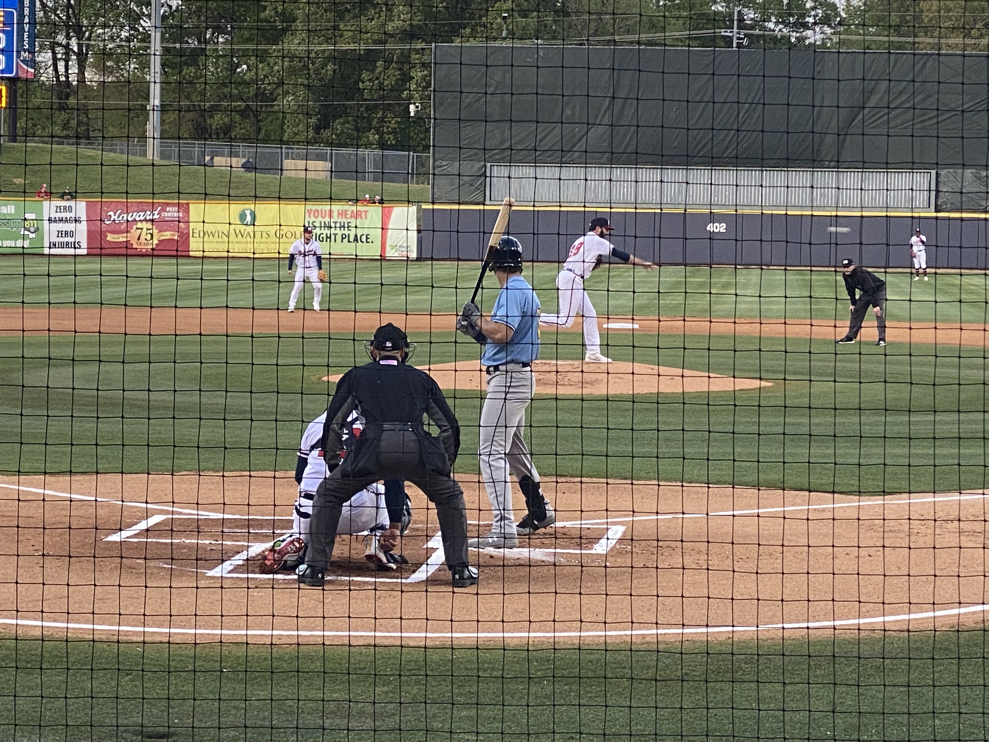
The Portland Sea Dogs Double A ball club was at home during our visit so we spent a lovely late afternoon at Hadlock Field. The home town club had their way with the visiting Hartford Yardgoats. Final score 7–4.
Portland has the three top prospects in the Red Sox system. Prospects SS Marcelo Mayer and CF Roman Anthony were in the line up but did not stand out during this contest. P.S. The Yardgoats are our home team in Connecticut and our record with them in person remains intact as we have never witnessed them winning a game!
After the ballgame we journeyed downtown for a stroll along the picturesque waterfront and a nightcap of gelato! Gorgeous Gelato is one of our favorite gelato spots in all of our travels. The husband and wife owners moved to Portland after graduating from the Gelato University in Milan. https://www.portlandoldport.com/listing/gorgeous-gelato/
Dark Chocolate Whiskey and Pistachio/Coconut Gelato
The street art scene in PWM remains as vibrant as ever. The three murals pictured below are new finds for us since our last visit. They are all located in the East End where we obviously spent a lot of our time during this brief stop in PWM.
“Nicole” Artists—Ryan Adams and Rachel Gloria Adams
“Moon” Artists—Ryan Adams and Rachel Gloria Adams
“Alain” Artists—Ryan Adams and Rachel Gloria Adams
Well, that is it for our first post in a year! Our next stop will be in Penobscott for several days of camping and touring the beautiful Deer Isles.
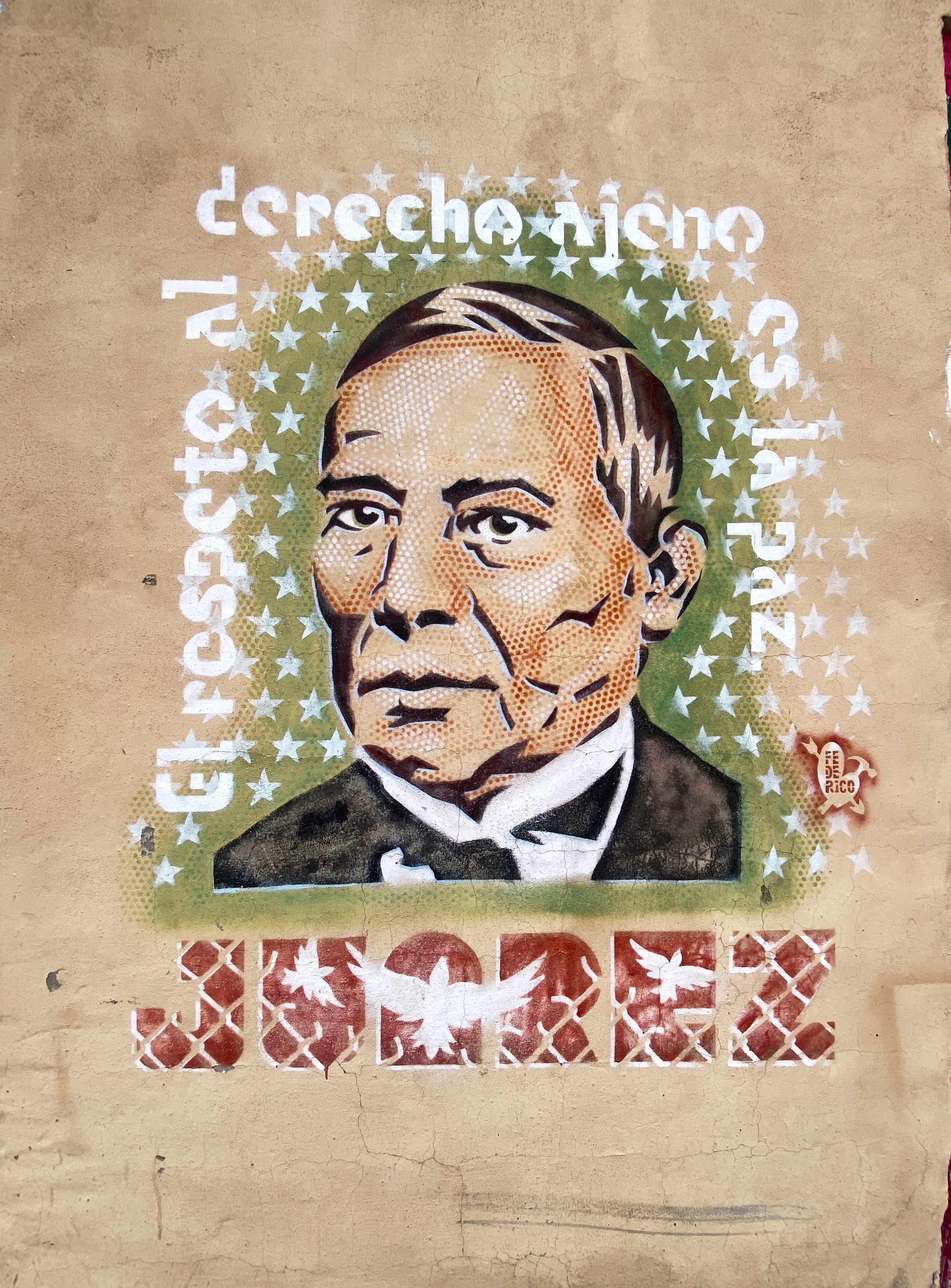
We had been in Texas and New Mexico several times prior to our most recent trip, but for some reason had steered around El Paso (EP). Perhaps the timing was just not right or we were concerned about conditions there based on the reporting regarding the immigration issues at the border. Regardless, we were ready to explore EP as part of our OTR 9.0 adventure and draw our own conclusions about the city.
El Paso, Texas and Juarez, Mexico viewed from Scenic Drive
We made the decision to stay in the city and booked a hotel in the University district for three nights. We are glad we chose this area as it enabled us to walk to a number of casual but excellent restaurants and coffee shops dotting the university neighborhood. This was especially nice as EP is a sprawling metropolis that requires some driving in order to explore the city.
Of course, the first entry point for any worthwhile city visit is COFFEE! We were traveling from the east after our recent visit to Guadalupe Mountains National Park, therefore we were able to vector directly to an excellent specialty coffee shop and roaster on the east side of the city. We were most fortunate that the founder and owner of Global Coffee, Erika, sat with us for quite awhile. She shared with us her family history and the ties with Mexico that exist in a border town that has been a major immigration point for centuries(El Paso del Norte). Erika is a delightful and talented young woman and we wish her all the success she deserves with her business and family. https://globalcoffeeco.com/
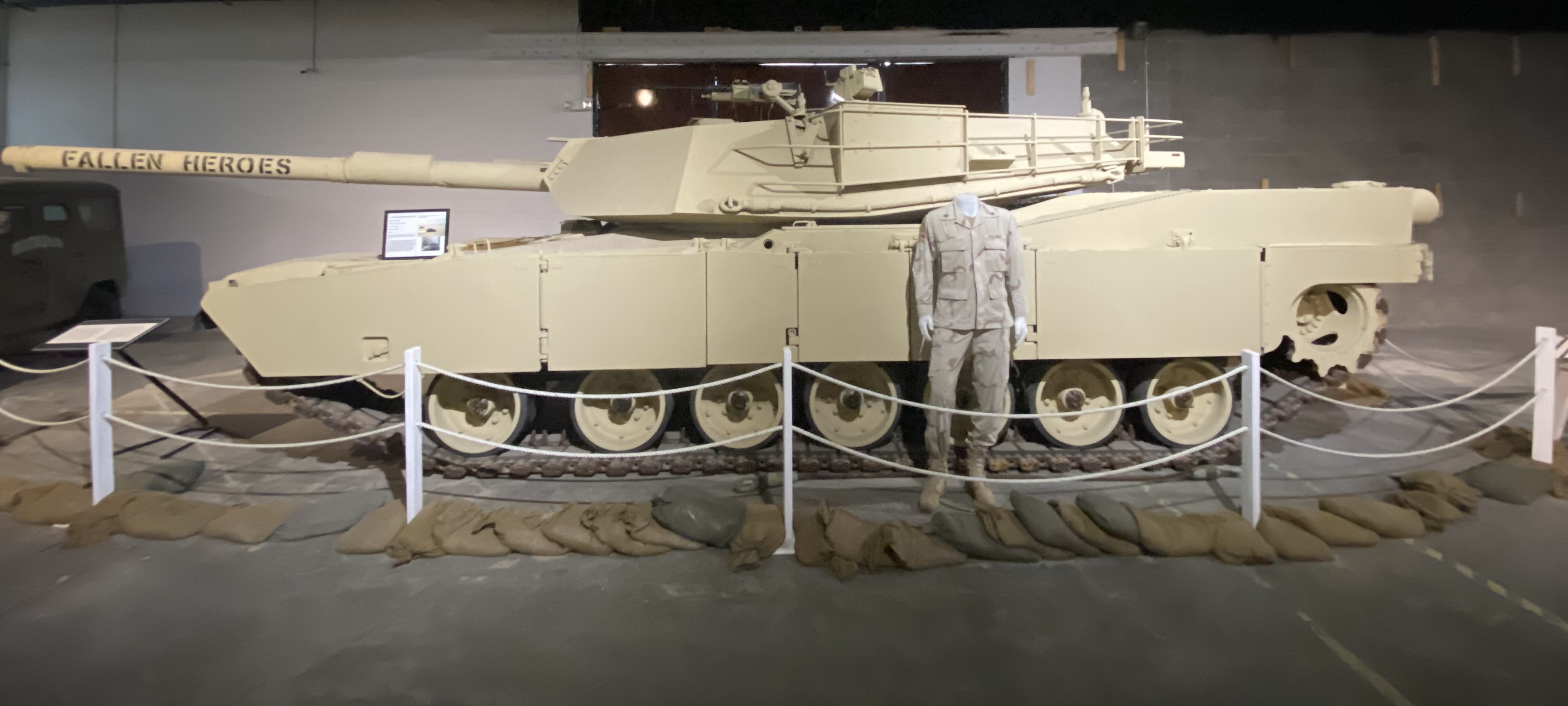
After refueling we went directly to the tank museum, officially known as the 1st Armored Division & Fort Bliss Museum. The United States Army has had a post in EP since 1849, which has served as an infantry post, a cavalry post, an air defense artillery post and currently operates as a maneuver training post. The size of the Fort Bliss training area (965,00 acres) and its mountainous desert terrain have made it a vital training location for the many forces that have been deployed to the Middle East over the last three decades.
The museum chronicles the history of the post and the units stationed there from the the initial mission of patrolling along the Rio Grande before the Civil War through the current mission of the units stationed within the base. From a Western United States history perspective this includes the Indian Wars and the Mexican Punitive Expedition.
The Indian Wars is an umbrella term for the United States Army prosecution and ultimate decimation of the Native American peoples across the Western United States. The Indian Wars were waged throughout the Civil War until 1890 when the last of the Native American bands were imprisoned or sent to reservations. Many of the actions by the federals were in direct violation of treaties negotiated between the federal government and the Native Americans (standard operating procedure).
Another interesting piece of history is the Mexican Punitive Expedition. Between December 1916 and February 1917 American forces under the command of General “Black Jack” Pershing crossed into Mexico in pursuit of Mexican Revolutionary leader Pancho Villa. Villa had attacked a town in New Mexico killing a number of U.S. citizens. The incursion into Mexico was ostensibly in retaliation for the raid. However, the main motivation was to support the Mexican leader, Venustiano Carranza, whom the U.S. was backing. The Mexican Revolution was destabilizing Mexico and jeopardizing U.S. corporate interests. Pancho Villa had to go! The U.S. Army, however, did not capture Pancho Villa and returned to the U.S. after several skirmishes with Mexican Federal soldiers who greatly resented the incursion into Mexico. An early example of the numerous unsuccessful and unwarranted interventions by the U.S. government in the internal affairs of another sovereign nation! P.S. Pancho Villa survived the Mexican Revolution and was granted amnesty only to be assassinated three years later.
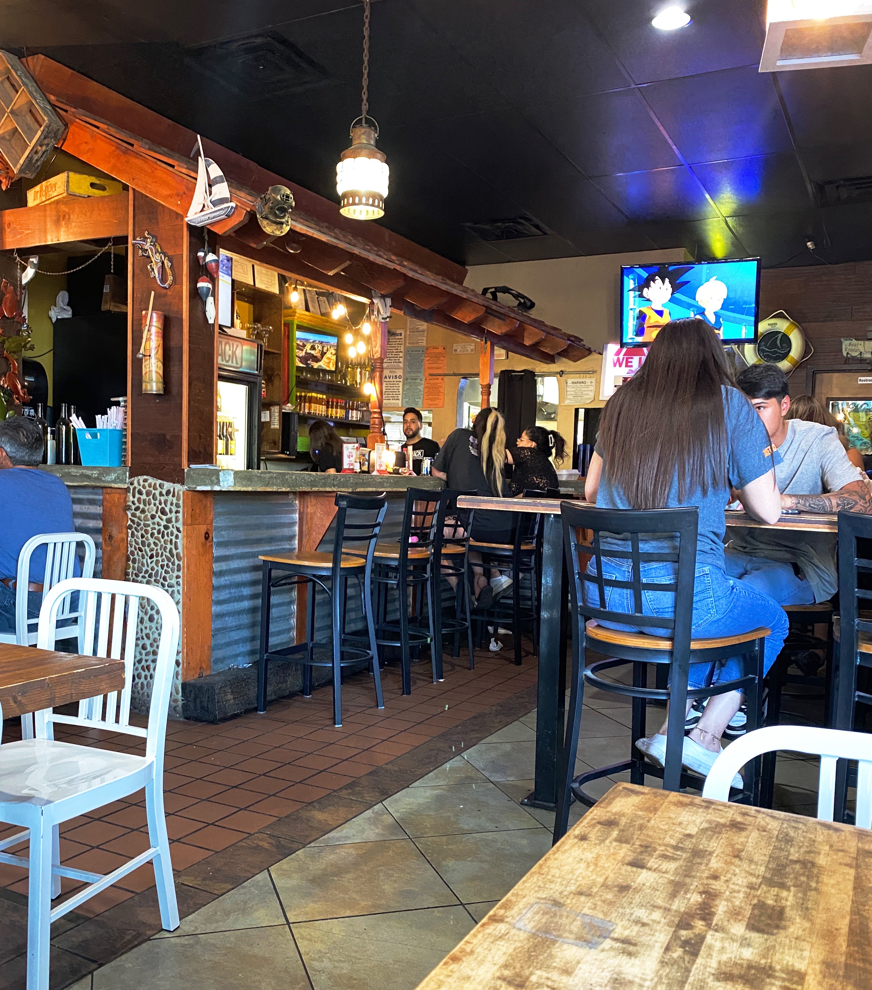
After checking in at our hotel we walked a couple of blocks to have supper at a popular local eatery – The Shack. The restaurant is owned by two brothers – Adrian and Michael Soto – they grew up in the restaurant business working and learning at their mother’s restaurant, Mima’s Cafe. The Shack has a wide array of dishes but we went for the Mexican inspired dishes and had a great dinner at this casual and friendly spot. https://theshackwings.com/
Since our hotel was a considerable distance across town from Global Coffee we opted to try our luck at Casa Cafetzin which was just a five minute drive from our hotel. Erika from Global Coffee had recommended Casa Cafetzin, so we were fairly certain that we would be starting our day on a great coffee and tea note. If we are being honest, we might admit that we would have passed by this cafe due to its location attached to a modest motel. Fortunately, due to the recommendation from Erika, we did not pass up a great coffee and tea experience. Cafetzin was excellent and the baristas were all terrific! Thank you Erika!
After departing Casa Cafetzin we headed downtown for a day of viewing fine art and street art. Our first stop was at the El Paso Museum of Art (EPMA). The EPMA came into existence in 1959 as the result of a large donation of European art by a private foundation. The donated collection became the impetus to build a first class art museum serving the El Paso – Juarez Borderplex. Today the museum houses over 7000 works. The museum has also operated an art school for the last twenty years. Fittingly, the EPMA operates as a bilingual institution, reflecting the heritage and diversity of the Borderplex (75,000 people cross back and forth between El Paso and Juarez on a daily basis).https://epma.art/visit
Artist: Fremont Ellis, El Paso Smelter at Night, 1919
We really enjoyed the portraiture works on display. The painting top left, below, The Telephone Operator (The Weaver of Public Thought), was our favorite. The artist Gerrit Beneker, is probably most well known for the posters he created during World War One in support of the war effort.
The museum’s collection also demonstrates an impressive commitment to diversity and regionalism based on the works on display when we visited. Fritz Scholder (top left, below) is one of our favorites and well known for his insightful depictions of Native American stereotypes. Scholder was a member of the Luiseno tribe.
We were also surprised and pleased to see a portrait, Mrs. Viola Andrews – My Mother (bottom left) by the figurative painter, Benny Andrews. We had the fortune of seeing a number of his works several years ago at the Ogden Museum of Fine Arts in New Orleans (see our post, Fine Art Tourist: Ogden Museum of Southern Art ).
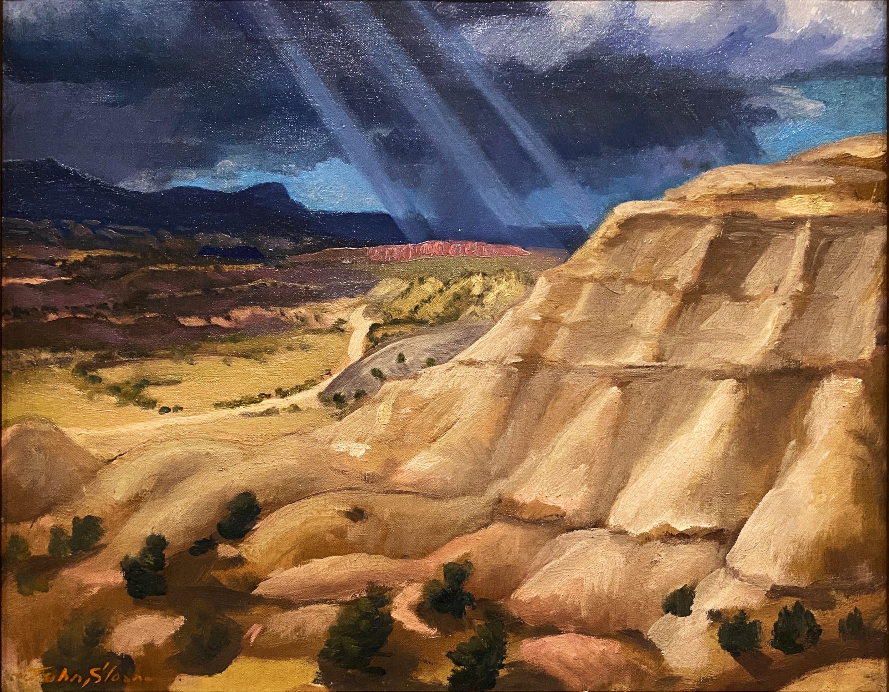
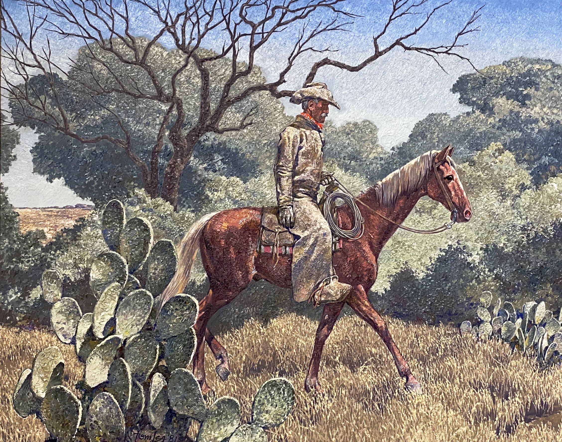
We also enjoyed the works of American art featuring West Texas and the Southwest. The museum has works by El Paso native Tom Lea and many other noted western artists including the self-taught Fremont Ellis.
After departing the EPMA we stopped for some tacos and then went in search of street art downtown. We have included a few of the murals we found there. The art works below are all located on walls on Leon Street, all by different artists.
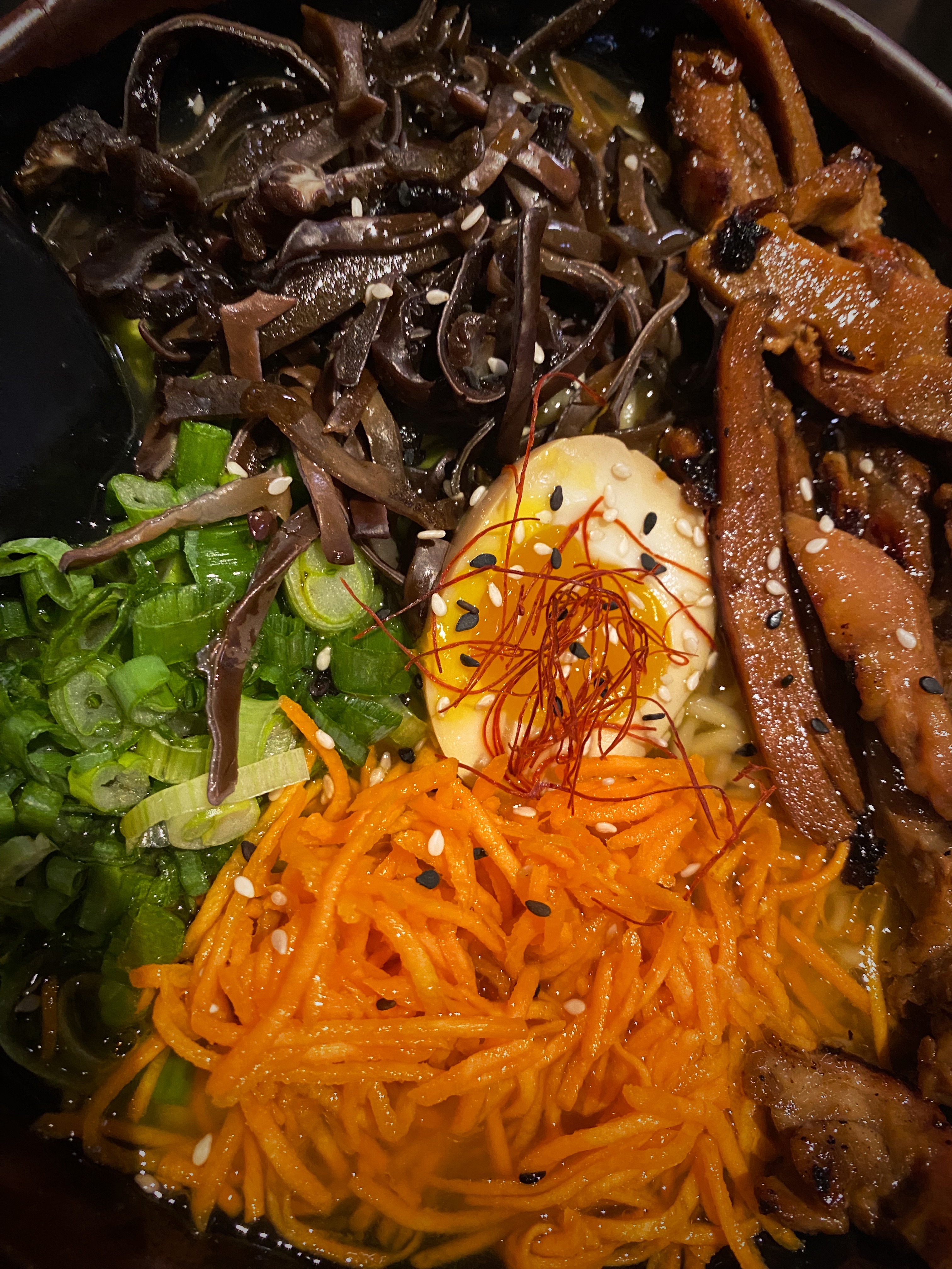
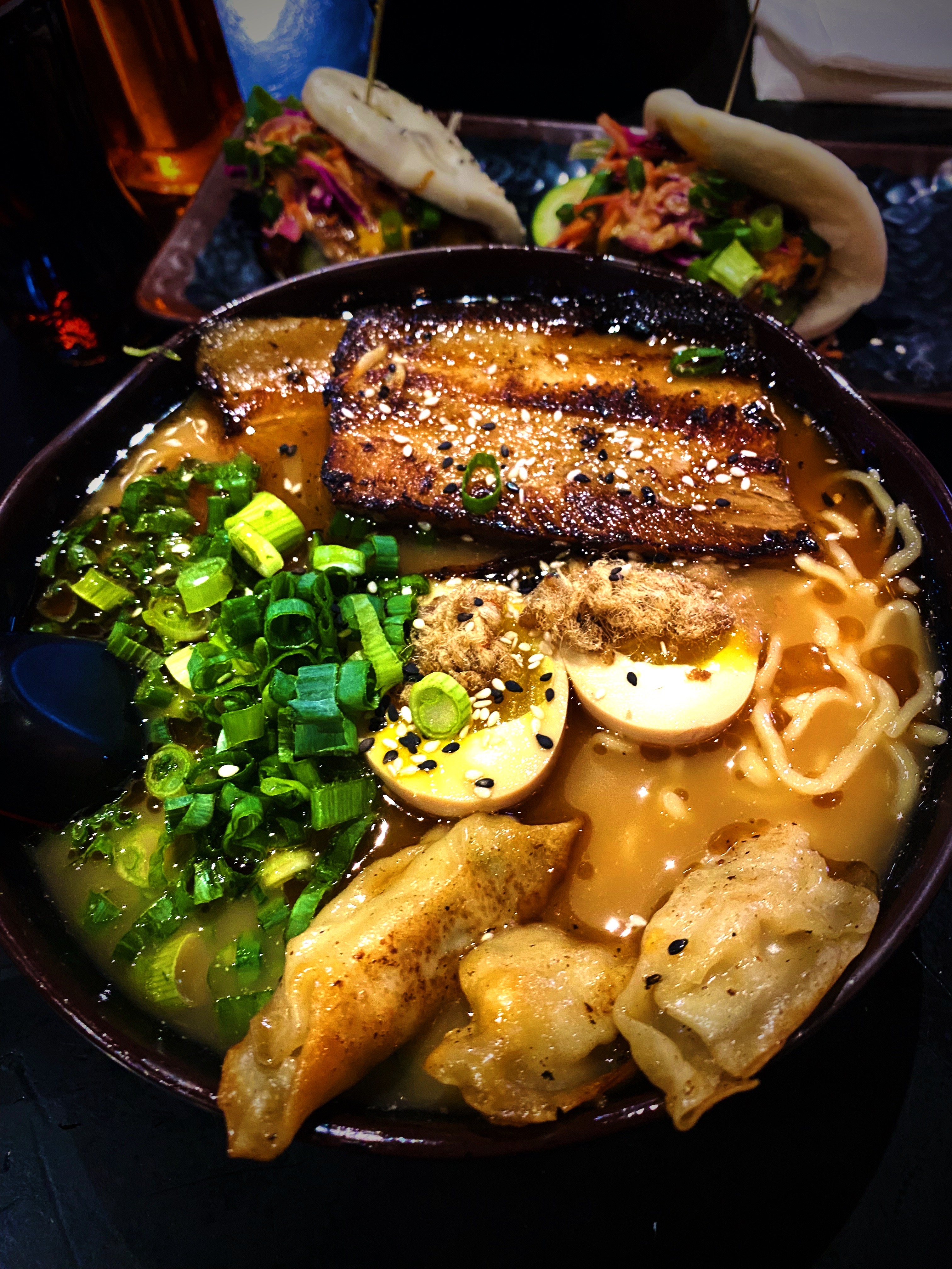
Dinner was another great find for us, a short walk from the hotel, in the University District. Kaedama serves outstanding ramen dishes! We did not think that we would be greedily shoveling awesome Japanese noodle soup dishes into our faces when we arrived in EP. The business started as a food truck owned by two friends – Garbiel Valencia and Andres Romero – and became popular very quickly. The friends decided to open a brick and mortar location and were able to open relatively quickly in part to an enthusiastic response to a crowdfunding campaign. The restaurant even gathered a visit from Food Network Chef and TV host Guy Fieri while he was visiting EP. A great way to finish day two! https://www.facebook.com/Kaedama915/
Artist: @DEKO_UNO, Kerby Avenue, El Paso, Texas
On our final day in EP, we journeyed across town to visit La Mision de San Antonio de la Ysleta de Sur. The Ysleta mission is the first permanent mission established in Texas. The mission was founded in 1680 by Indian and Spanish settlers who fled New Mexico as a result of the Pueblo Revolt of 1680. The revolt was the culmination of more than 100 years of incursions by Spanish soldiers and, of course, missionaries. The indigenous Pueblos killed 400 Spanish soldiers and drove about 2000 Spanish settlers out of the Albuquerque area.
The original mission was built by the Tigua Indians in 1862. The mission has been rebuilt several times due to flooding and fire. The last time was in 1908 after a fire destroyed the roof and bell tower. The Tigua Indians are still active in the mission, celebrating traditional holidays and the Tigua Feast of San Antonio, their patron saint.
As with many other missions along what is now the border, the mission was located in Mexico until the 1848 Treaty of Guadalupe Hidalgo transferred this territory to the United States. While the mission was technically in the United States, it continued to be administered by the Mexican church until 1872.
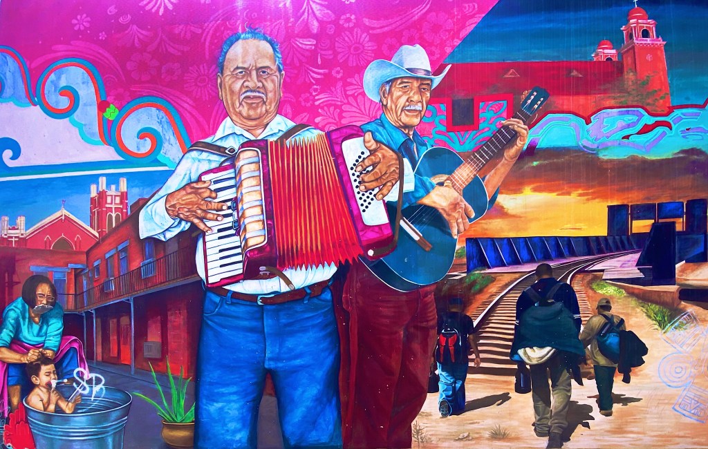
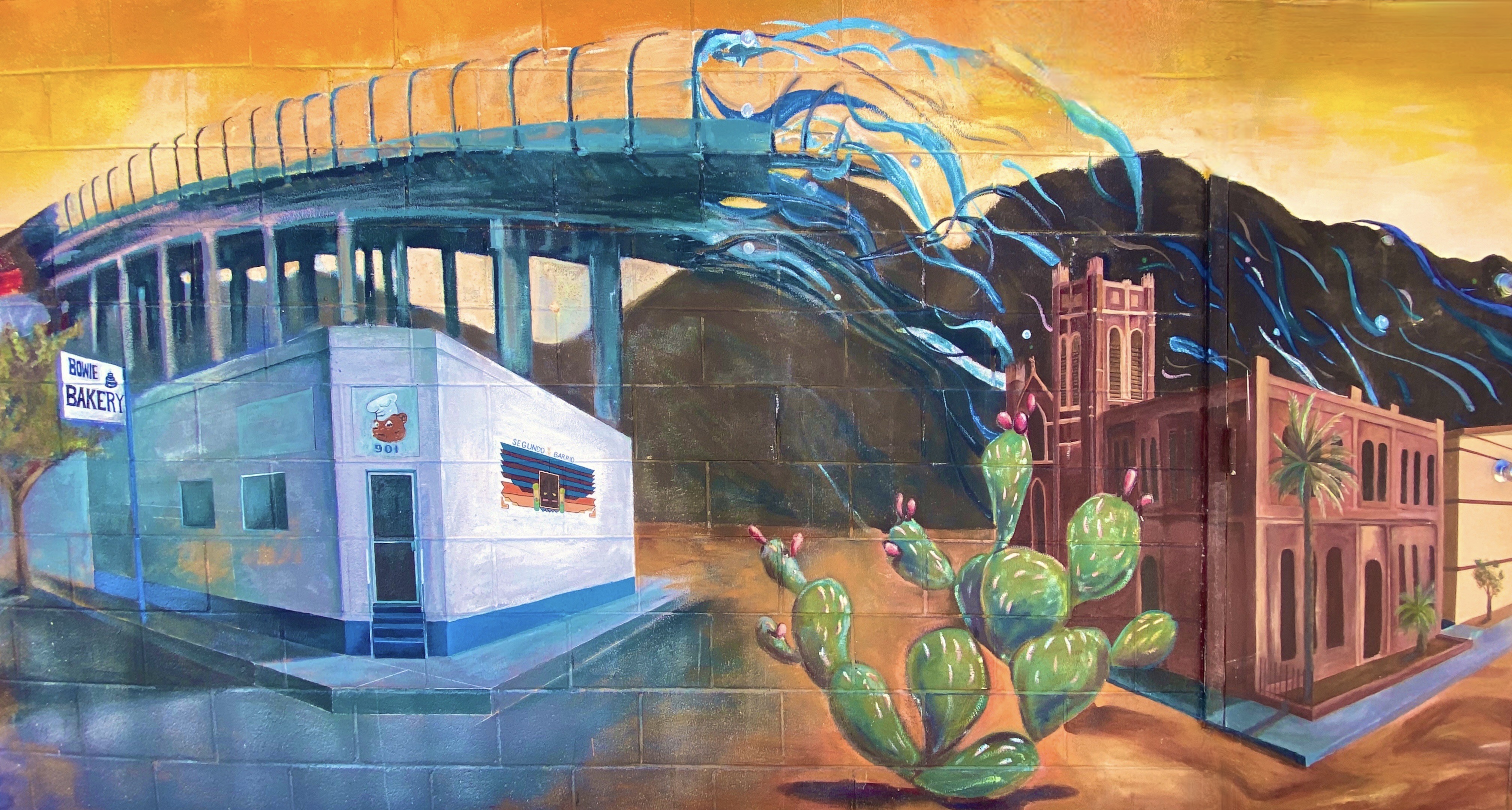
After visiting the mission we found our way to the El Segundo Barrio near downtown to view the many notable murals. As the name suggests the Segundo was the second neighborhood in EP. Since the 1830s this area has been a major entry point for Mexican immigrants coming into the United States. The majority of the immigrants in the barrio were and still are migrant farm workers.
Artists: Jesus Alvarado and Victor Casas, El Segundo Barrio, El Paso, Texas
The Segundo still reflects its Tejano culture and traditions very proudly (we hope the murals we have featured reflect that same sense of tradition, culture and aspiration). At one point, the city planned to demolish much of the barrio as a way to eliminate the significant substandard housing stock instead of addressing the root causes in a humane fashion. Fortunately, civic groups formed and defeated the city’s plan to demolish the historic area.
Unfortunately, the preservation of the barrio has not improved the economic conditions significantly. Many of the Mexican-American residents and immigrants still toil as farm workers. The barrio is poor by any measure, albeit rich in culture, tradition and pride in its heritage.
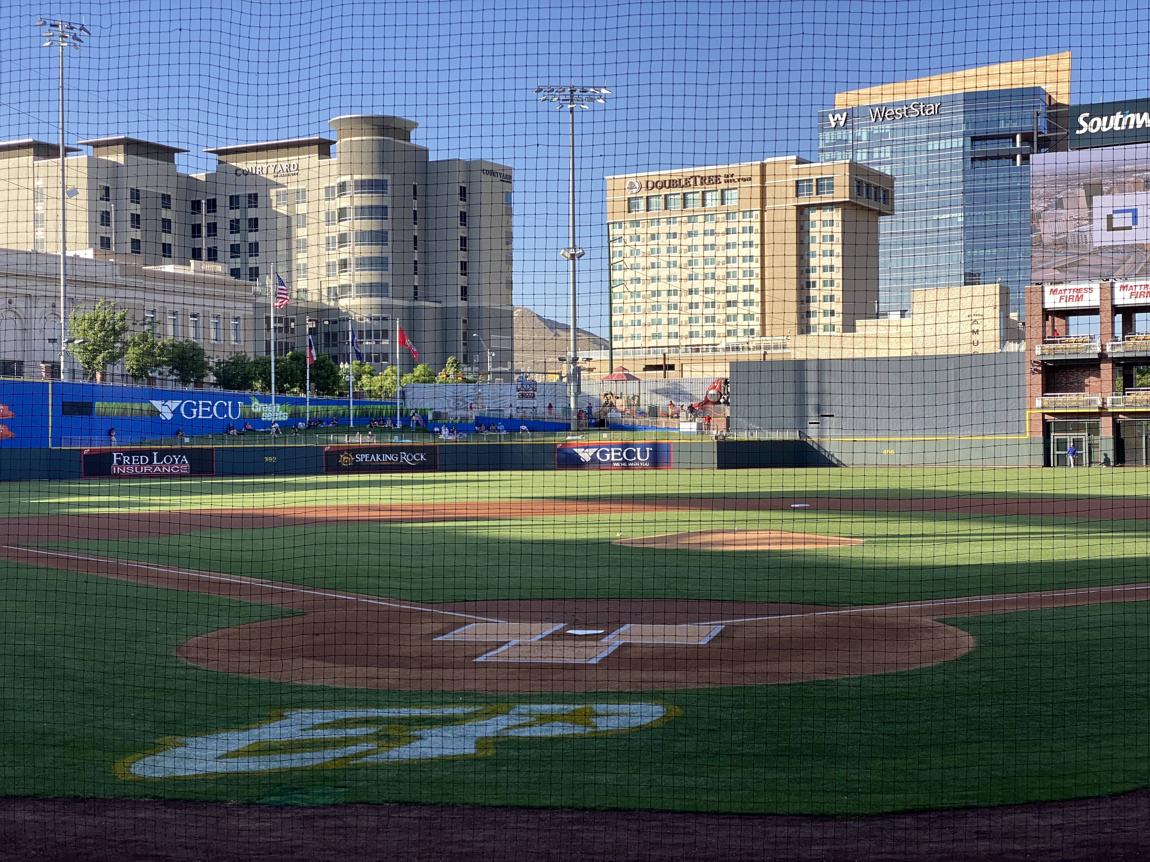
On our final night in EP we took in a ballgame. The El Paso Chihuahuas are the Triple-affiliate of the San Diego Padres and compete in the Pacific Coast League. This team has been located in a number cities (Spokane, Albuquerque, Portland, Tucson) prior to arriving in El Paso in 2014 to play in their brand new stadium. The stadium is very attractive and sits right in downtown.
The Chihuahuas are not having their best season, but to the delight of their very enthusiastic fans, the club rallied late in the game to defeat the division leading OKC Dodgers. Go Chihuahuas!
We departed EP and Texas the following morning to head across the Chihuahuan Desert of New Mexico. We enjoyed our time in Texas and EP and have no reservations about recommending visiting EP. This was our third time traveling across the state and we still have not explored several areas within the state. Everything is bigger in Texas!
We hope you enjoyed this post. Be seeing you! 2023 May OTR 9.0
P.S. You have probably read much about the immigration issues along the Texas/Mexico border. While were in the city we witnesses significant Border Patrol activity along the border fence on the United States side of the Rio Grande. We also observed the large military presence patrolling along the Rio Grande on the river side of the border fence utilizing Humvees and foot patrols.
And yet, we could clearly see immigrants massed on the Mexican side as well as detainees on the U.S. side. Currently around 900 immigrants per day are crossing from Mexico into the EP port of entry and allowed to legally enter the U.S. The city works with a number of non-governmental agencies to provide the immigrants with shelter, food and water. It is quite apparent that the city is doing everything it can do to ensure the immigrants are treated humanely. The majority of immigrants currently entering at EP are from Central and South American countries and Cuba. Venezuela accounts for approximately 70% of the immigrants.
We can only imagine how bad conditions must be in Venezuela and the other countries for individuals and families to risk everything to escape the poverty, crime and repressive governments in their respective countries.
After departing Seminole Canyon, we made our way west to Marathon (Mare-a-thun) to spend a couple of days in comfort, before heading to the Big Bend backcountry. While our attempt to drive the entire way from Seminole Canyon to Marathon via ranch roads was not successful, it did not dampen our appetites. First order of business, Texas style bbq at the Brick Vault Brewery & BBQ. Mighty fine beef brisket (almost as good as Keef’s!). After our hardy and delicious lunch, we strolled down the block to check in at the Gage Hotel.
After checking in, we enjoyed our first hot shower in several days, followed by a lie down. When we awoke we were very thirsty. Fortunately, the White Buffalo Bar is adjacent to the hotel and was ready to serve us cocktails and wine. With our thirst at least partially quenched, we made our way from the bar to the dining room of the 12 Gage Restaurant.
The restaurant markets their fare as “West Texas Cuisine with a gourmet twist”. We totally agree with the description. All of the restaurant’s vegetables and herbs are grown in their own garden. All of the wild game and fowl is sourced locally and the beef comes from the Iron Mountain Ranch about seven miles up the road. All of the food was delicious!
Marathon, like many of the other towns in the Trans-Pecos region of Texas, was founded when the railroad arrived. Railroad workers building east from El Paso reached what is now Marathon in 1882. In this case, it was the Galveston, Harrisburg and San Antonio Railway (later the Southern Pacific). Around the same time, a former sea captain by the name of Albion Shepard had purchased land north of Marathon to develop a ranch (Iron Mountain). Shepard is credited with naming the town Marathon, because it reminded him of the plains of Marathon, Greece, which he had seen during his seafaring days.
Iron Mountain Ranch(Photo Bill Murphree)
The “Long View” Across the Plains to the Glass Mountains
Alfred Gage was a native of the Green Mountain State (Vermont) who ventured to Texas in 1878 at the age of 18 to make his fortune. He did just that – building a 500,000 acre ranching empire. As Marathon became an established shipping center for the ranching industry, he recognized the need for hotel accommodations for business and other travelers. He commissioned the construction of the hotel which opened in 1927. Gage was based in San Antonio but spend considerable time in Marathon, utilizing the hotel as his residence, office and entertainment venue while in town.
St. Mary’s Mission (Founded 1908)
Over the last several years, Marathon has become a destination in its own right. Previously, it was mostly a jumping off place for people on their way to Big Bend NP (BIBE). The current owner of the Gage Hotel (JP Bryan) also owns and operates the White Buffalo Bar, 12 Gage Restaurant, Brick Vault Brewery and the V6 Coffee Bar. Additionally, he has purchased and renovated a number of properties in town for retail space and art galleries. We found that Marathon more than lived up to our expectations for a couple day stay to unwind and enjoy find food and lodging before our adventures in Big Bend NP. We definitely recommend a visit to Marathon on your way into or out of BIBE.
After our stay we drove the 60 or so miles south to BIBE (see our post Three Nights in the Backcountry). After our stay in BIBE we made the drive up the immensely scenic Texas State Highway 118 to spend a couple of days in Alpine. The 118 runs through Study Butte (Stew-dee) and Terlingua before heading north through the Chichuahuan Desert.
Texas State Highway 118
Our first stop in Alpine, unsurprisingly to any of our regular readers, was for coffee and tea. We had spent an afternoon in Alpine in March 2020 before the pandemic lockdown made its way to Far West Texas and knew from that visit that Cedar Coffee and Supply would meet our needs.
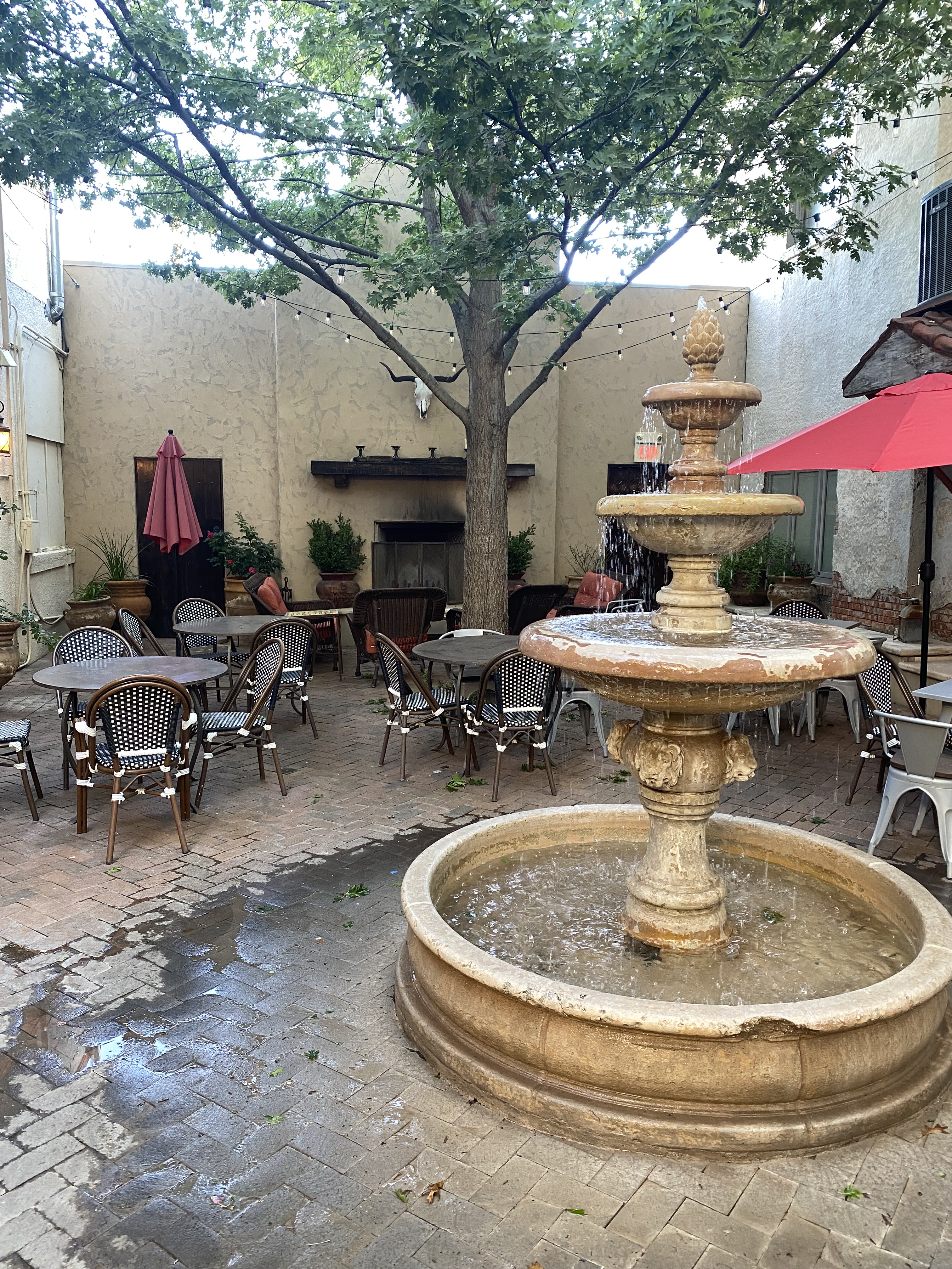
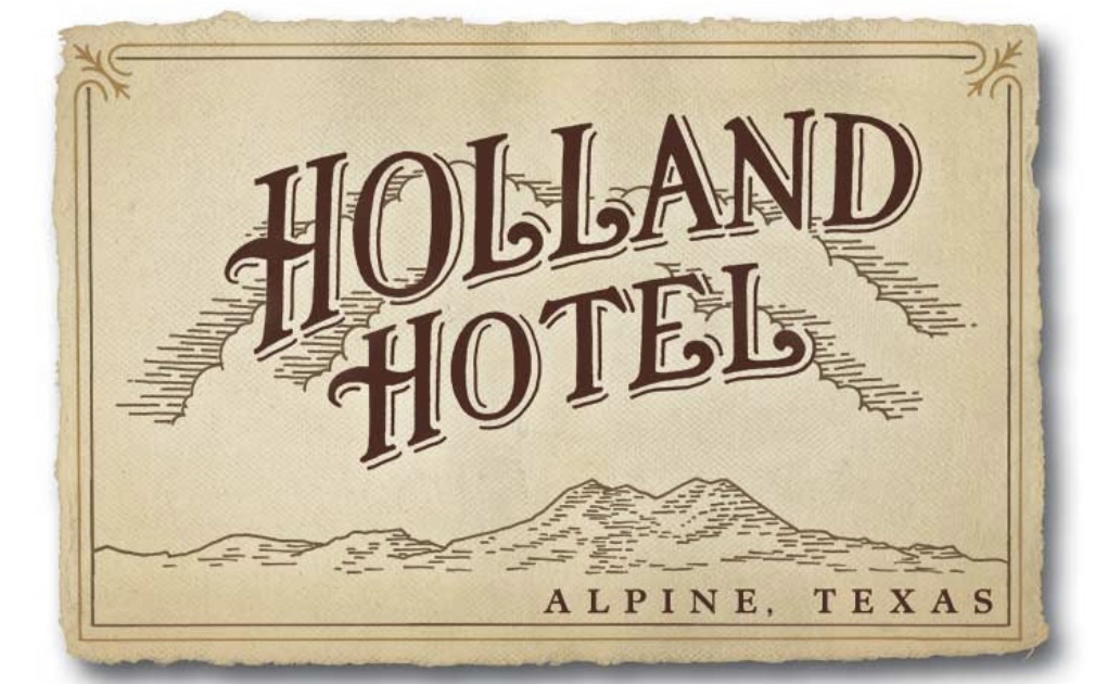
Staying in Alpine provided us with the opportunity to stay at the Holland Hotel, our fourth Henry Trost designed hotel. Henry and his brother Gustavus were early 20th century architects based in El Paso. They were renowned for their Spanish Colonial Revival Style hotel designs – tile floors and roofs, courtyards, exposed beams and wrought iron are used throughout. The lobbies and courtyards are the centerpiece attractions for us – comfortable, wonderful spots to read, drink coffee or wine and perhaps do a bit of people watching.
Alpine’s origins are similar to Marathon’s and many other towns in the Trans-Pecos–cattle and the railroad. Alpine grew from a tent encampment of railroad workers in cattlemen along a spring fed creek in 1882, to a small town. The spring was the key element for the railroad as the locomotives were steam powered at that time. In 1921, the state opened Sul Ross State Normal College in Alpine. The opening of the college brought a significant increase in population and, as an added bonus, the first paved roads in town. At the turn of the century the population was estimated at 300 people. After the college opened the population ballooned to around 3000.
Today, the freight trains continue to chug through town, although they have no need to stop for water as the steam locomotives have long since been replaced. The town is serviced by AMTRAK as Alpine serves as a jumping off point for BIBE for those people that would prefer to travel by rail to this remote national park. The Sunset Limited stops in Alpine six times per week – three times from the west and three times from the east. The eastbound Sunset Limited originates in Los Angeles from the west and New Orleans from the east. The town continues to be anchored by what is now the Sul Ross State University.
On our first evening in Alpine we dined at the The CenturyBar and Grill located in the Holland Hotel. The Century provided us with another fine dining experience featuring delicious regional cuisine. We also had the opportunity to chat with our servers, both students at the university who were actually a couple. They were quite friendly and most knowledgable about the geology and history of the area. We meet the nicest people on the road!
On our second evening in Alpine we decided to take advantage of the live music scene in town. The Petit Bijou bills itself as the “teeniest tiniest wine bar in Texas”, contrary to the usual boast that everything is bigger in Texas. You can see the Airstream bar in one of the photos below – the claim that it is the teeniest tiniest wine bar in Texas just might be valid. We were in for a treat – a jazz show that was canceled earlier in the week due to a wind storm was set to open the evening, followed by a country duo from Austin.
We enjoyed a couple sets of great jazz and country music while getting acquainted with a number of the very friendly folks sitting at our neighboring tables. The food and wine was delicious and we were fortunate to meet and spend some time chatting with Ginger Hillary, the petit Bijou proprietor. As Hans Christian wrote “to travel is to live”.
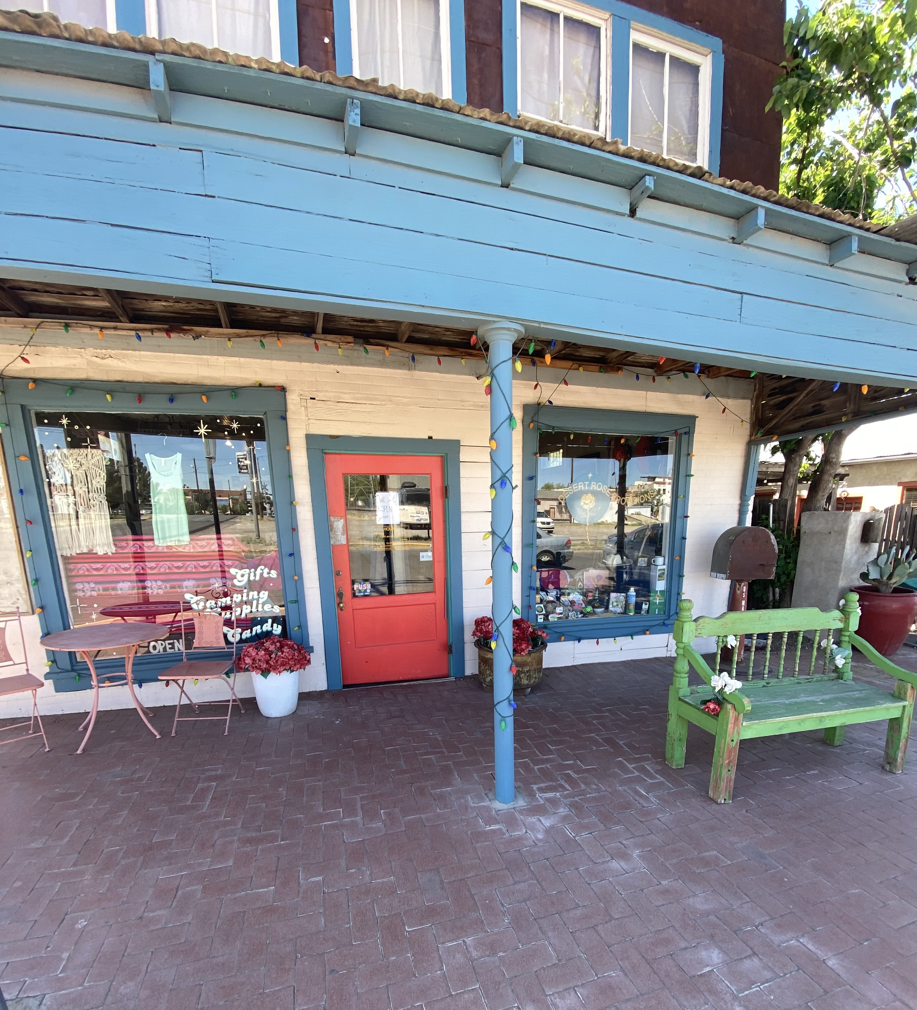
One of the reasons we visited in March 2020 was the town’s reputation as home to excellent street art. We found several murals that we had not seen previously which we have included in the photos below.
We hope you enjoyed this post. As always, we look forward to your comments and suggestions. Our next post will feature El Paso, our last stop in Texas.
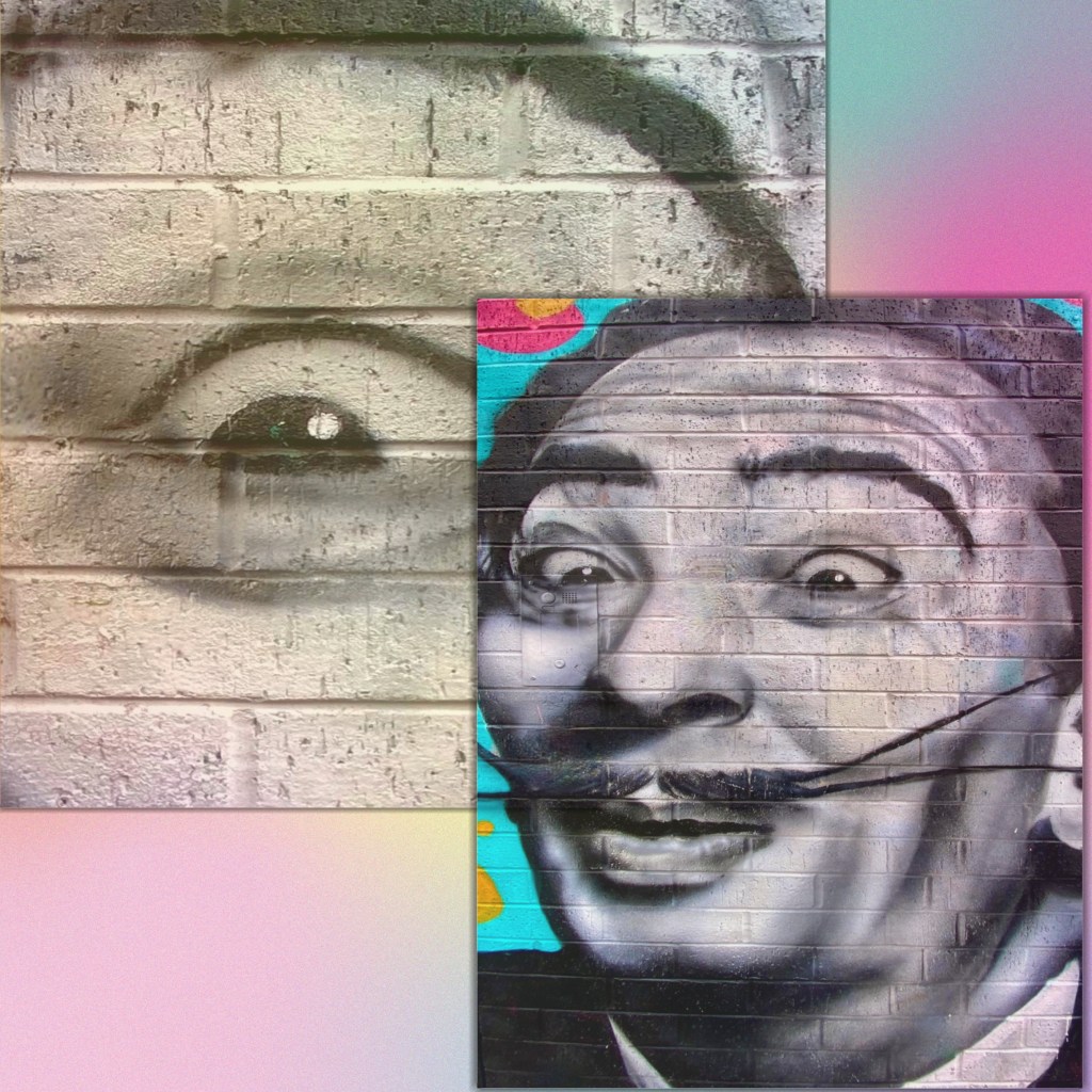
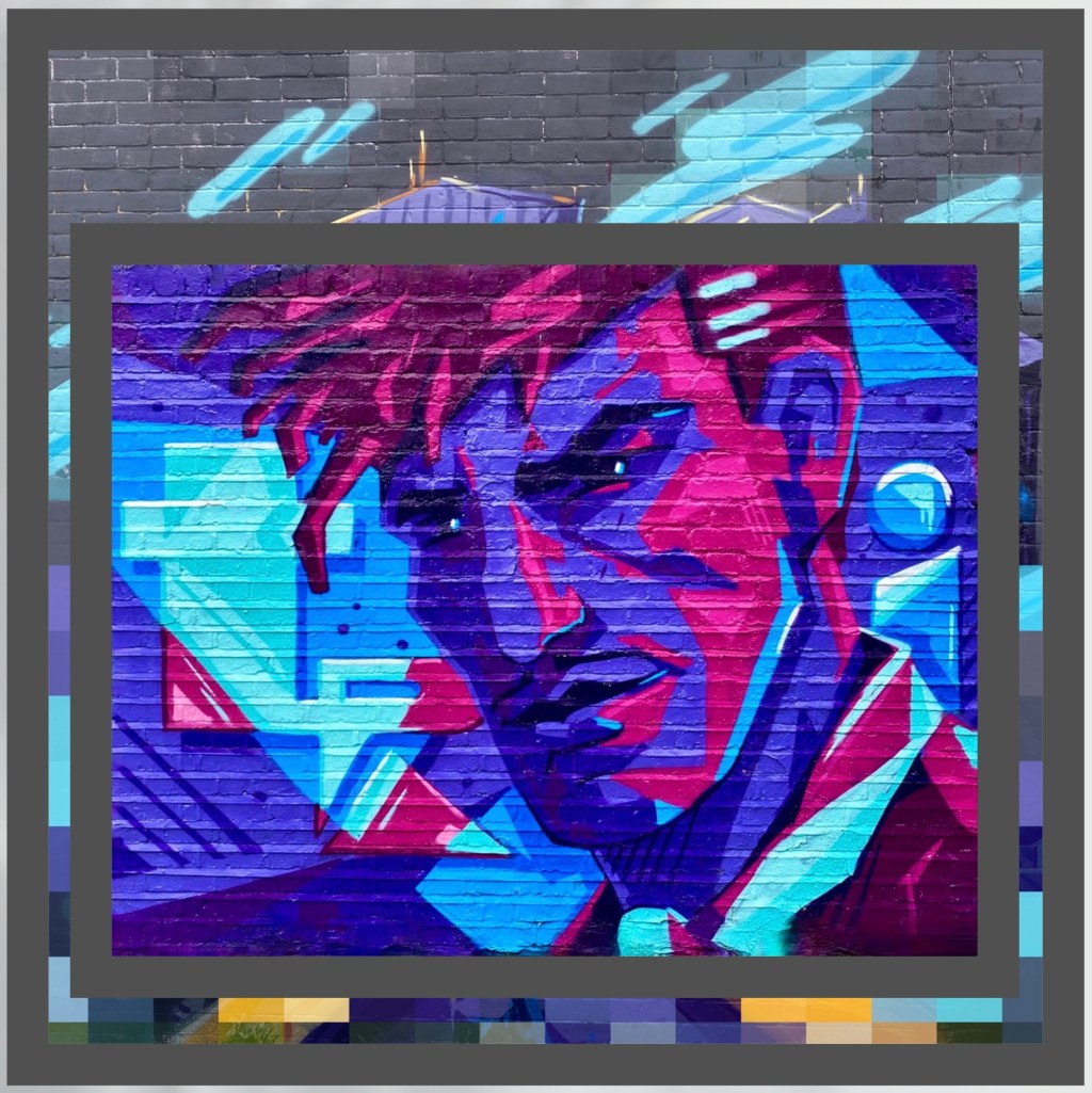
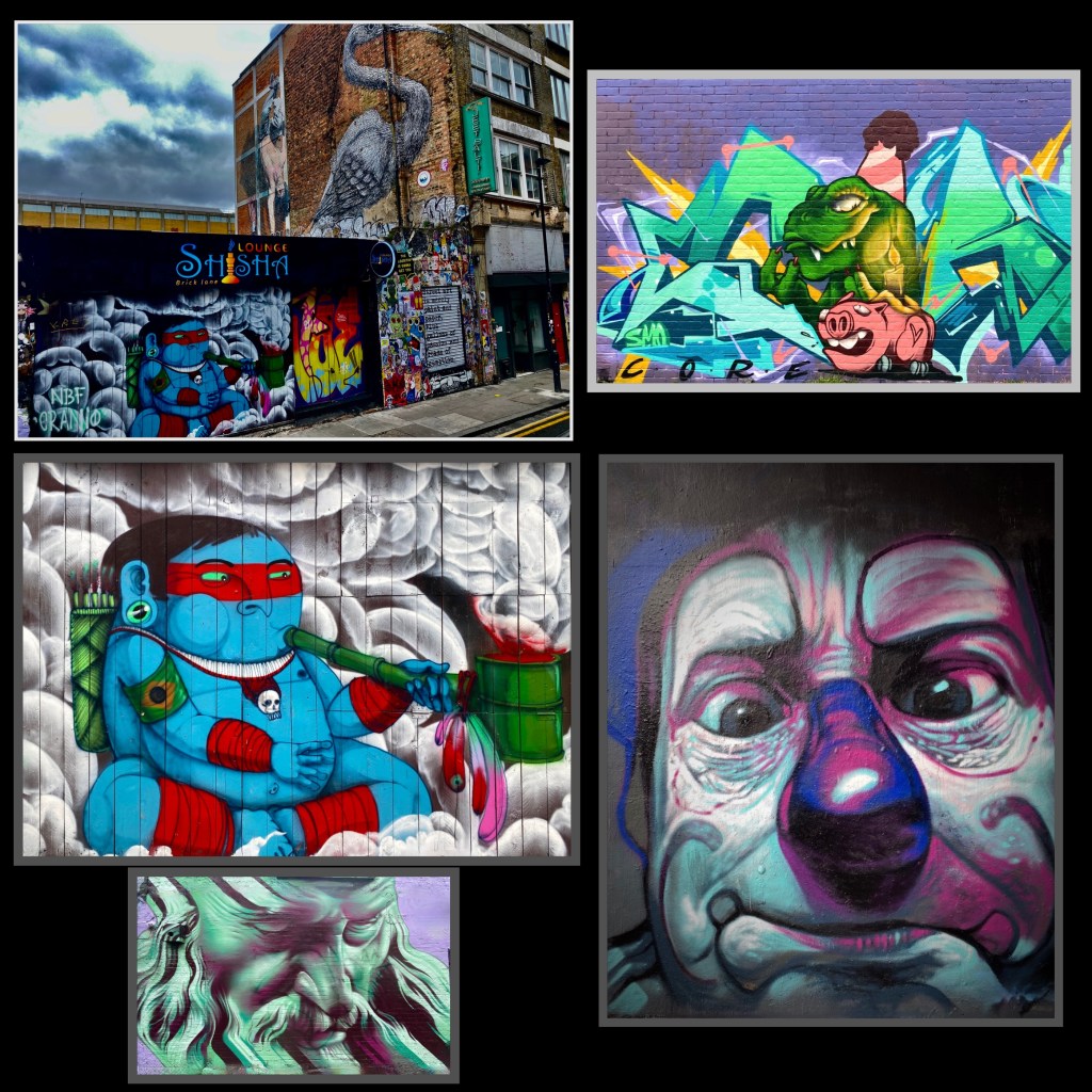
The famous Brick Lane Market was high on our list of must do experiences while in London. The market operates at full tilt on Sundays – accordingly, we made our way there on a chilly, gray Sunday. Of course, of special interest was the opportunity to see and photograph some of the plethora of street art located on and around Brick Lane.
Brick Lane is situated in the heart of the East End in the Borough of Tower Hamlets. The area has been a home to immigrants from many countries over the last 300 years. Most recently, the area has become home to a Bangladeshi community. If you look in the photos above you can see that the street signs are in English and Bengali!
7th Pencil @7thpencil, London-Weavers
Apparan @apparan, London-Allens Gardens
Benzi Brofman @benzi_brofman, London-Weavers
Jill Vigilion, London-Brick Lane
As you can see from the photographs, we found plenty of great street art – it is literally everywhere! We also sampled food from several stalls, did a bit of shopping and made our way over to the Columbia Road Flower Market.
Benzi Brofman @benzi_brofman, London-Brick Lane
Artist Unknown, London-Tower Hamlets
Artist Unknown, London-Weavers
Apparan @apparan, London-Tower Hamlets
The whole area was absolutely jammed with people – a diverse mix of tourists, hipsters, locals, musicians and vendors. In addition to the food vendors, there was a wide range of restaurants offering ethnic cuisines.
The borough is still quite obviously an area of economic diversity. There are sections that are experiencing gentrification interspersed with blocks that appear to be suffering from little or no maintenance.
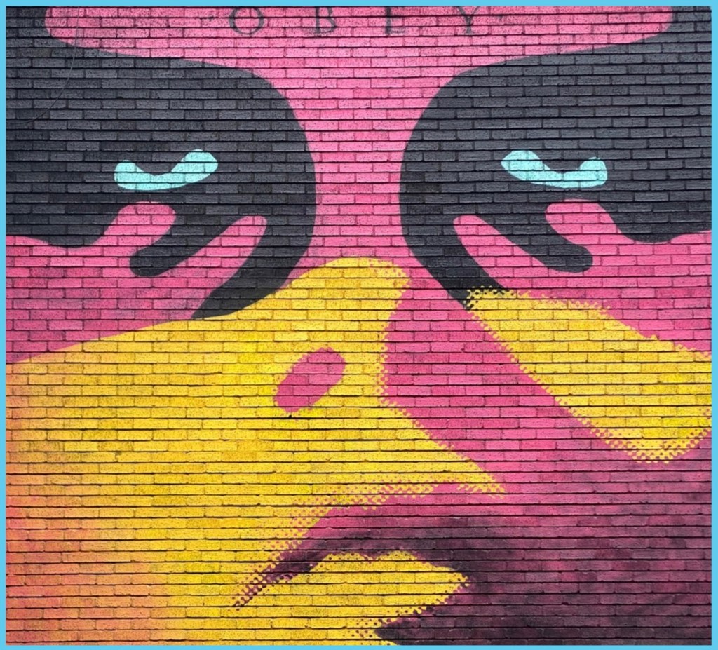
Sheppard Fairy @obeygiant, London-Tower Hamlets
Artist Unknown, London-Weavers
We had a great day exploring the East End and definitely recommend exploring the borough when you visit London. We hope you enjoyed this post ; in an upcoming post we will share some of the culinary highlights from our Londontrip.
We originally planned to visit the Black Canyon of the Gunnison (BCG), Rocky Mountain Nation Park (RMNP) and Great Sand Dunes National Park(GSDNP) while in Colorado. But as we monitored the conditions in Colorado during the trip (and spoke with some fellow travelers who had recently been in Colorado) it became apparent that we would not be able to access significant portions of our original itinerary due to this winter’s abundant snowfall in the Rockies.
So, after several excellent weeks touring western New Mexico, we departed Farmington, New Mexico to traverse Colorado in a northeasterly direction to visit GSDNP in southwestern Colorado, while forgoing the BCG and RMNP.
Durango – Four Corners – Route 550, Colorado
Of course, custom requires that our first meal after crossing a state line consist of burgers, fries and, if possible, a milkshake.Happily (and perhaps unhealthily) our tradition remains intact!
South Fork – Eastern Rockies – Route 160, Colorado
After refueling with burgers and diesel we continued our drive to the town of Del Norte. Prior to Euro-American settlement, this area was occupied by the Utes who migrated to the area from the south during the warmer months of the year. When this territory came under Mexican rule during the early 19th century, Hispanic settlers migrated north to take advantage of land grants offered by the Mexican government. Subsequently, this area was ceded to the United States by Mexico.
In 1859-1860 gold was discovered in the San Juan Mountains in what had been Ute territory for 500 years. Never mind, the Kit Carson Treaty (Ute Treaty of 1868) was negotiated in order to remove the Utes from the gold rich Central Rockies in exchange for land on the Western Slope of the Rockies. This treaty, as with most other treaties between the federal government and Native Americans, was eventually violated by the federal government and after the Utes rebelled they were driven out of Colorado entirely (Meeker Massacre).
Del Norte, Photos, Courtesy Denver Public Library
Today the small town of Del Norte (pop. 1600) is mainly an outdoor recreational hub with rafting on the adjacent Rio Grande and a plethora of rock climbing, mountain biking, hiking and camping options.
After a quick tour of the small downtown we headed west a short distance to find a camping spot in the Rio Grande National Forest. We found a great spot in a meadow which afforded us a panoramic view of Del Norte Peak.
Rio Grande National Forest
Del Norte Peak, Elevation 12,400′
The following morning we set our course due west for the one hour drive to visit GSDNP. The park was declared a national monument in 1932 in order to keep the dunes from being damaged by gold mining or concrete manufacturing. The monument was elevated to full national park status in 2004.
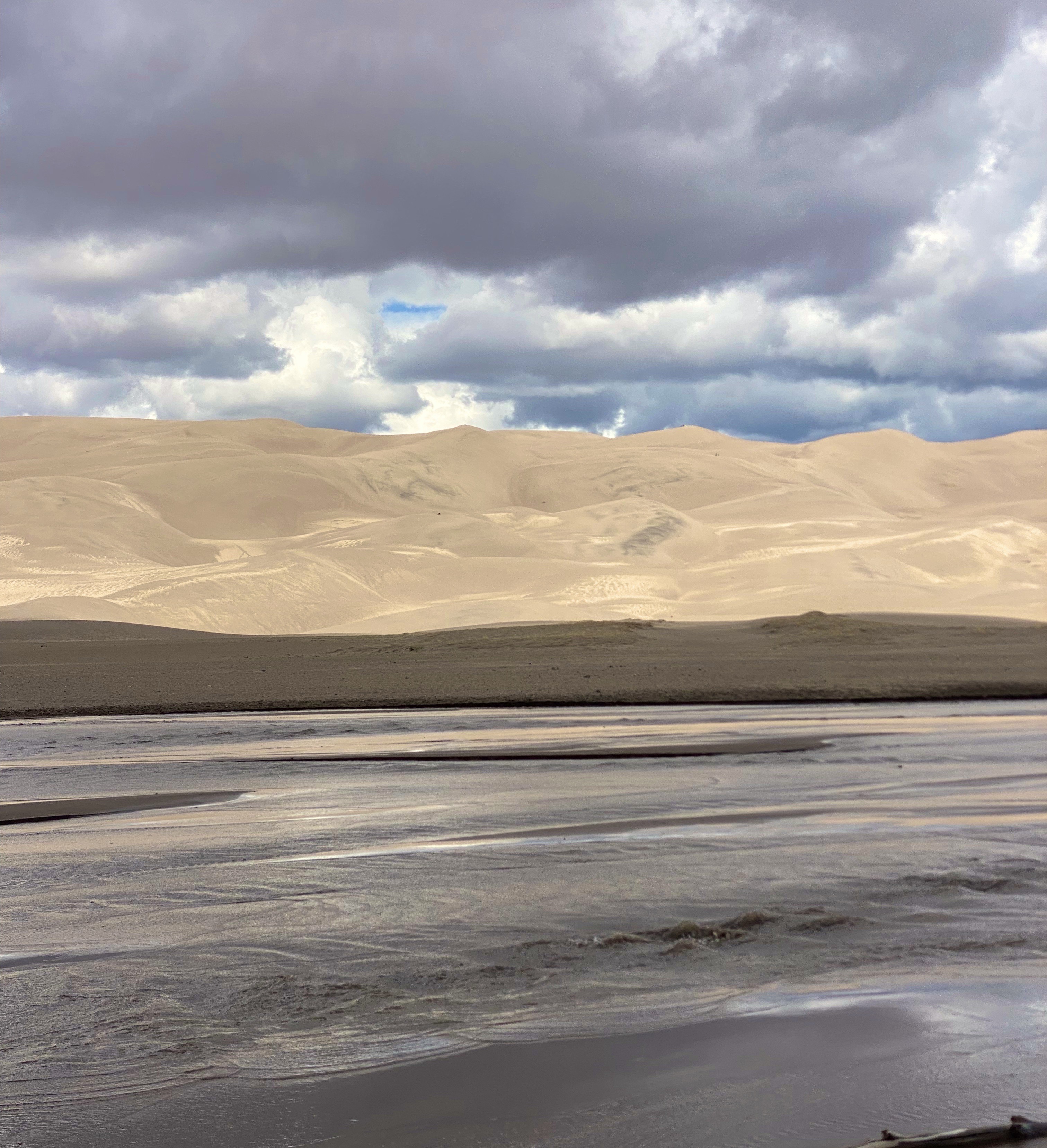
Great Sand Dunes National Park – Sangre De Cristo Mountains
GSDNP presents a fascinating landscape with grasslands separated from a thirty square mile sand desert by Medano Creek. The dunes are tucked in against the base of the Sangre de Cristo Mountains–quite spectacular! The sand dunes at GSDNP are the tallest in North America. Some are as high as 700 feet (Star Dunes is the tallest at 750 feet).
The dunes here are constantly changing as winds from the mountains drives sand down onto the dunes. Weather and erosion form the sand into distinctly identified and ever changing shaped dunes – parabolic, transverse and barchan – as examples.
Unfortunately, our opportunity to explore the dunes was limited due to an approaching lightning storm. One of the park rangers was kind enough to point out the obvious – not smart to be standing on top of a 600 foot dune in the middle of a lightening storm!
Medano Creek
In addition to the fantastic scenery, we were looking forward to driving the Medano Pass Primitive Road. The road is a sandy and rugged 22 mile 4WD road which runs from the base of the dunes up and over the Medano Pass (10,040 feet). The road was not fully open due to the conditions at higher elevation. The road crosses the the creek nine times and the water flow was still too deep due to this years snowfall.We have included a short video clip (below) from our drive on the road to provide a feel for the road and scenery.
Medano Pass Primitive Road
The NPS video below by is about the Navajo (Dine’) People, their four sacred mountains and their relationship to the land that now constitutes GSDNP.
We enjoyed our brief visit at GSDNP and we look forward to returning on a future trip to explore the dunes in depth, boondock up on the mountain and traverse the entire Medano Pass Primitive Pass Road.
Walsenberg, Colorado
On departing GSDNP, we decided to push straight on through to Colorado Springs. Our previous trips to Colorado Springs were business related and we stayed at the world famous Broadmoor. We would not be staying at the Broadmoor on this self funded visit!
The Broadmoor
Colorado Springs sits at just over 6000′ above sea level at the eastern base of the Rocky Mountains. Snow covered Pikes Peak (14,100′) looms over the city to the west creating a stunning backdrop. We did not travel up to the peak on this trip as we had taken the nine mile cog railroad trip on a previous visit (we definitely recommend riding the railroad to the top if the weather is clear -which it usually is in this part of Colorado). The train ride is fun and the views are phenomenal.
Pikes Peak
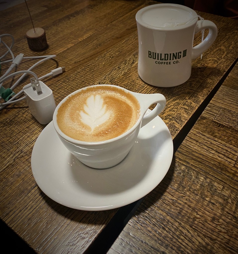
From our pre-trip research we knew that Colorado Springs held promise for specialty coffee and a vibrant street street art scene. Our first stop was Building III Coffee Bar and Roastery – B3 is located, along with a number of other occupants, in a former public school building now known as Lincoln Center – great to see the building repurposed. Excellent coffee, great breakfast sandwiches and uber friendly staff! Extremely popular – it can be hard to get a seat even with the large amount of seating capacity – but it is worth the wait. https://www.building3coffee.com/
Building Three Coffee
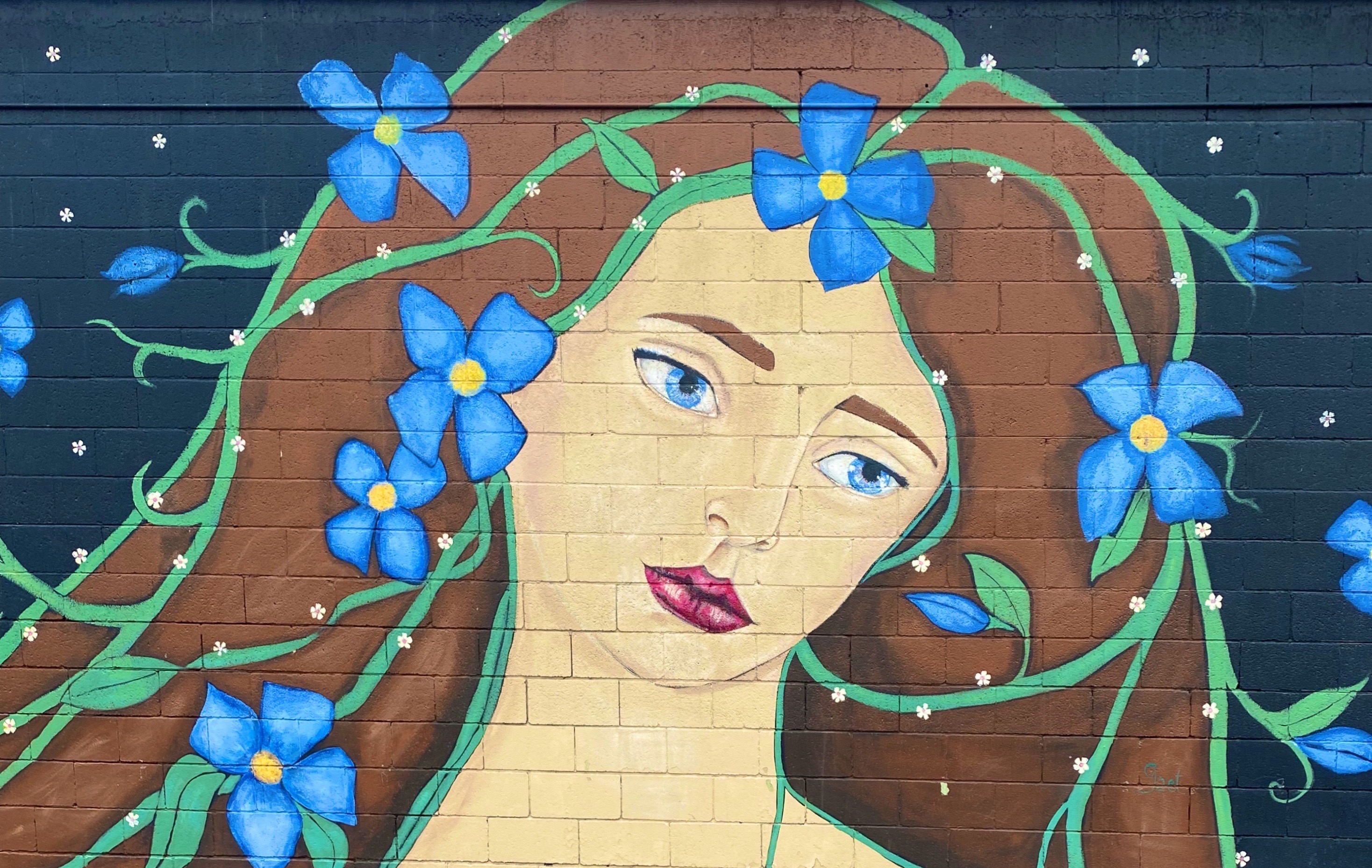
Well fortified with caffeine, we ventured out into the uncharacteristically gray, chilly day in search of street art. We decided to start our pic hunting session in the Knob Hill neighborhood, located a short distance northeast of downtown. We were pretty certain the neighborhood would be street art rich based on reading about the Knob Hill Urban Arts District. The District is a “nonprofit organization dedicated to putting art up on every damn wall we can get our hands on.” Love it!
The photos below are a small sample of the street murals we found in the Knob Hill neighborhood. This group is not kidding about putting art on every wall. We found art in every alley and available nook and cranny. So good! To see more of the street art we photographed during OTR 9.0 in Colorado Springs and other cities see our WordPress blog @streetartfromtheroad: part two.
There are also a number of large scale murals in downtown. The photos below are a few of our favorites we captured while strolling through downtown.
With the cloudy, drizzly weather persisting into our second day in Colorado Springs (coincidently nicknamed “Little London” although not for the weather – there was a large British population in the 1870s) we decided to visit the Fine Arts Center (FAC) at Colorado College. The FAC is located in the Old North End neighborhood – an area of stately late 19th and early 20th century homes and tree lined boulevards.
The Fine Arts Center is home to the art museum as well as a theater school and performing arts venue. The museum was opened in 1936 as an outgrowth of the Broadmoor Art Academy. The Colorado Springs area had become a hub for art on a scale commensurate with the more well known artist colonies in Taos and Santa Fe.
Charles R. Bunnell (1897-1968) March Snow, 1940, Oil on canvas
Victor Higgins (1884-1949) Santa Fe Hills, Date Unknown, Oil on canvas
As with many museums of this size, the collection is regionally (although not exclusively) focused. We have included photos of several paintings which reflect the southwestern focus (and which we really liked). The museum is definitely worth a couple of hour visit when you visit “Little London”.
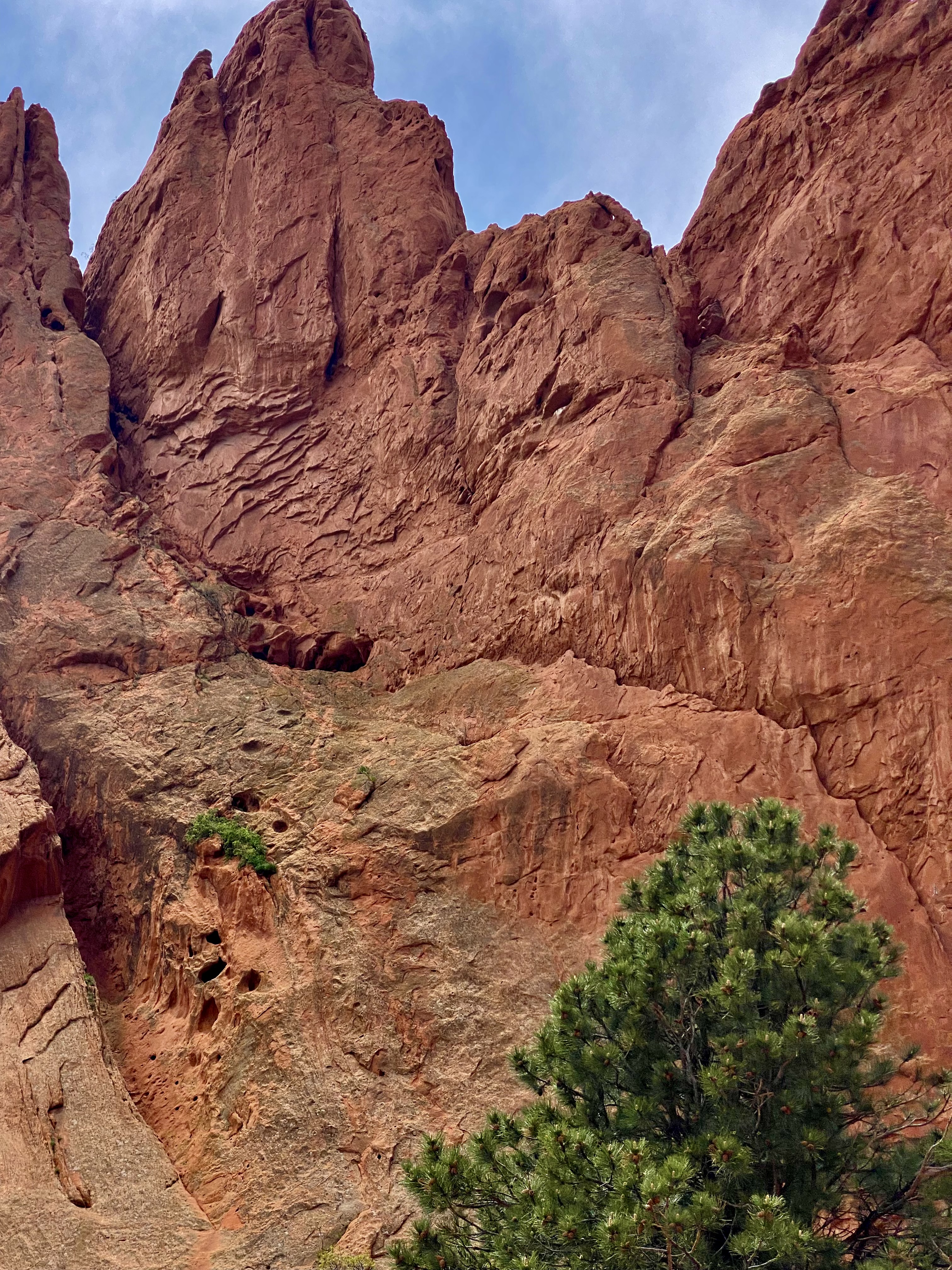
On our final day in Colorado Springs we ventured out to Red Rock Canyon. We had held off visiting earlier in our stay due to some cloudy weather. Unfortunately, it appeared that everyone else in Colorado Springs had done the same (it was also the weekend) and this popular open space was quite crowded.
Still, we managed to find some quiet spaces and uncluttered views as we walked between and around the rock formations. Additionally, there are a number of moderate and longer trails for the more adventurous which usually provide solitude regardless of when you visit.Do visit when the sky is clear in order to see Pikes Peak rising above the red rock formations.
Interestingly, Red Rock Canyon is a city park consisting of 1474 acres of land. The park was pieced together with the multiple purchases of parcels over a period of years during the 1920s and 1930s by private citizens. It was acquired by the city in 2003. What makes the park’s history all the more remarkable is that many of the parcels were formerly quarries, gravel pits and industrial sites which have been reclaimed. There is little evidence of the past use of the space – without reading about the history you would most likely not think that to be the case.
After our walkabout at Red Rock, we popped over to the nearby Old Colorado City neighborhood. The neighborhood was at one time a separate town that prospered as a coal mining town and in the late 19th century as a gold refining location after the discovery of gold nearby. Typical of so many western mining hubs, the boom ultimately became the bust. The final straw was the prohibition of liquor sales in 1914. In 1917, the town was annexed by Colorado Springs.
The brothels and saloons that once lined Colorado Avenue have long since been replaced by art galleries, restaurants, wine bars, coffee shops and clothing stores. After a bit of browsing in several of the art galleries and book shops we took lunch at La Baguette Cafe and Bakery. Yum – the best bread!http://labaguette-co.com/
We were uncertain what lay ahead in regard to specialty coffee as we were about to venture into more rural territory; so we stopped in downtown for coffee, tea and breakfast at Loyal Coffee. First rate in all regards!https://loyalcoffee.co/
The photo below is of our unanimous choice for best vehicle OTR 9.0!
From Colorado Springs we traveled north – camping near Sterling, Colorado for our last night in the state. In future posts we will chronicle our trek across the midwestern plains en route to Connecticut.
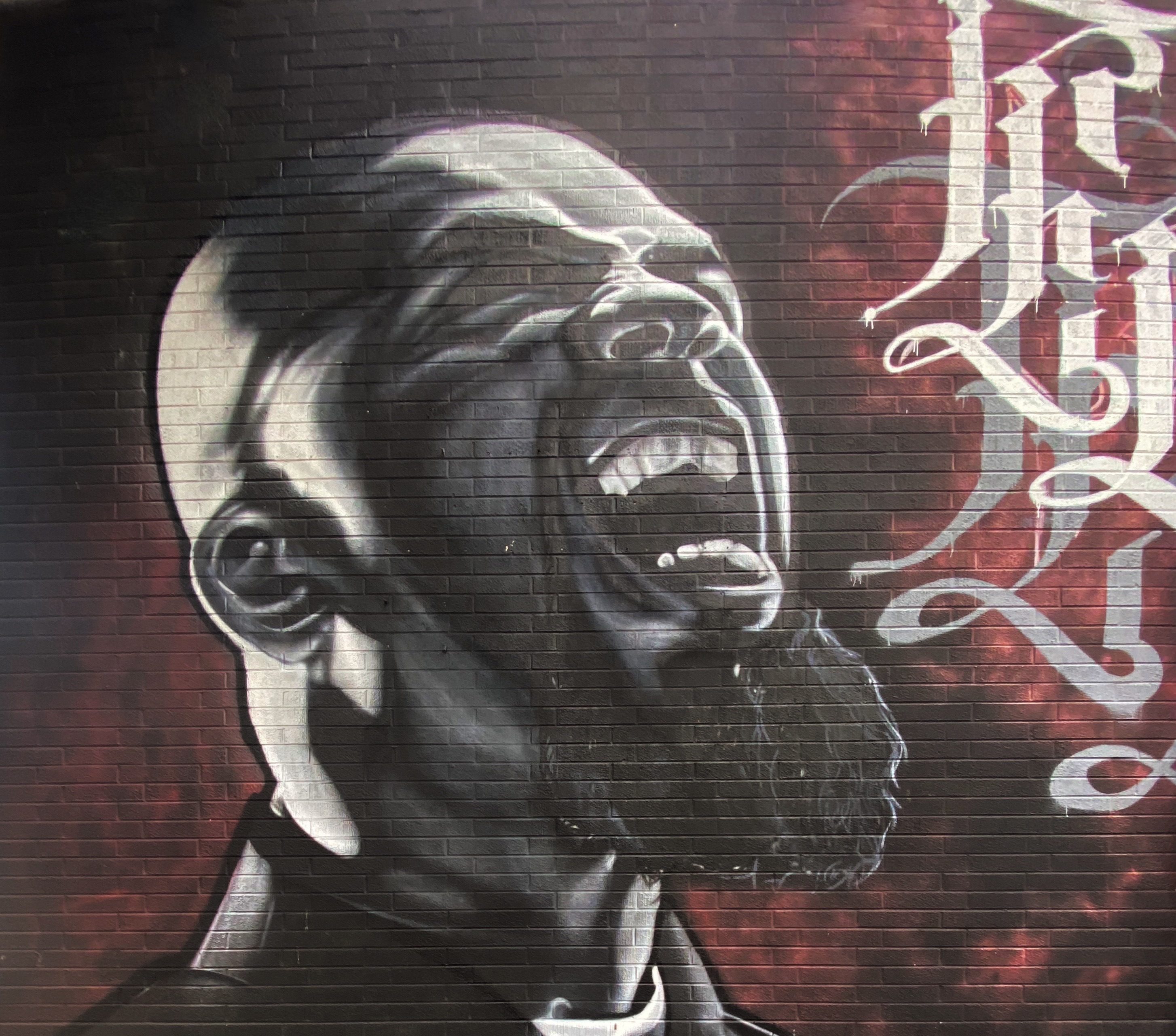
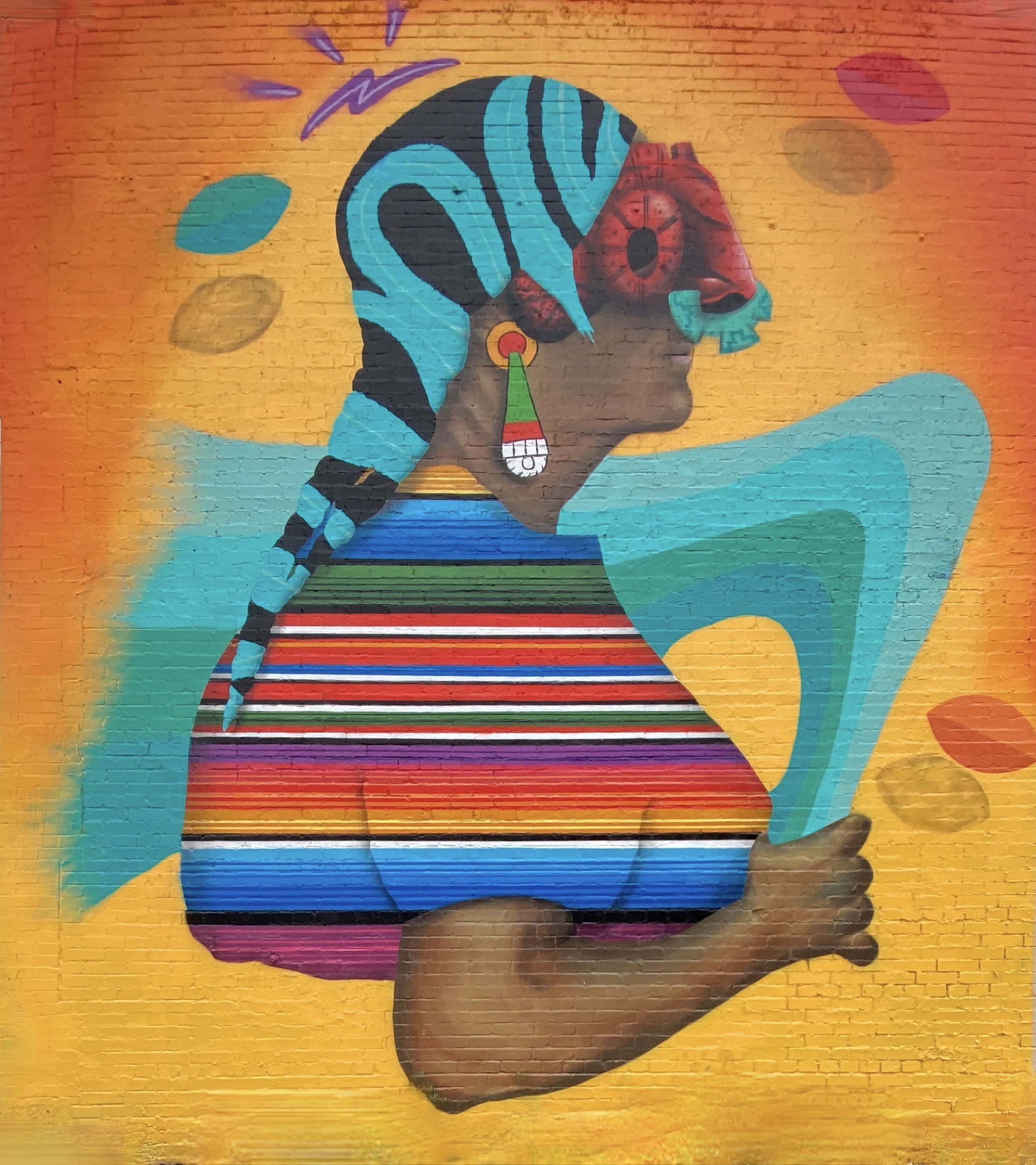
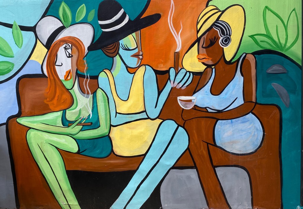
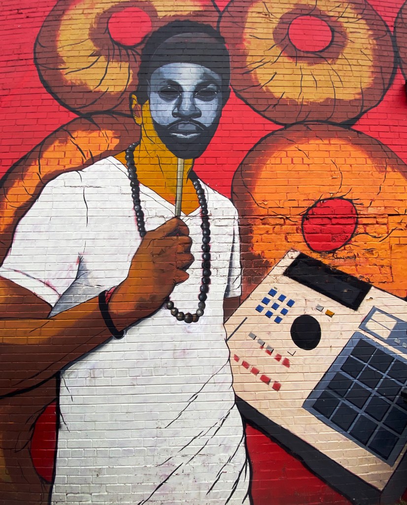
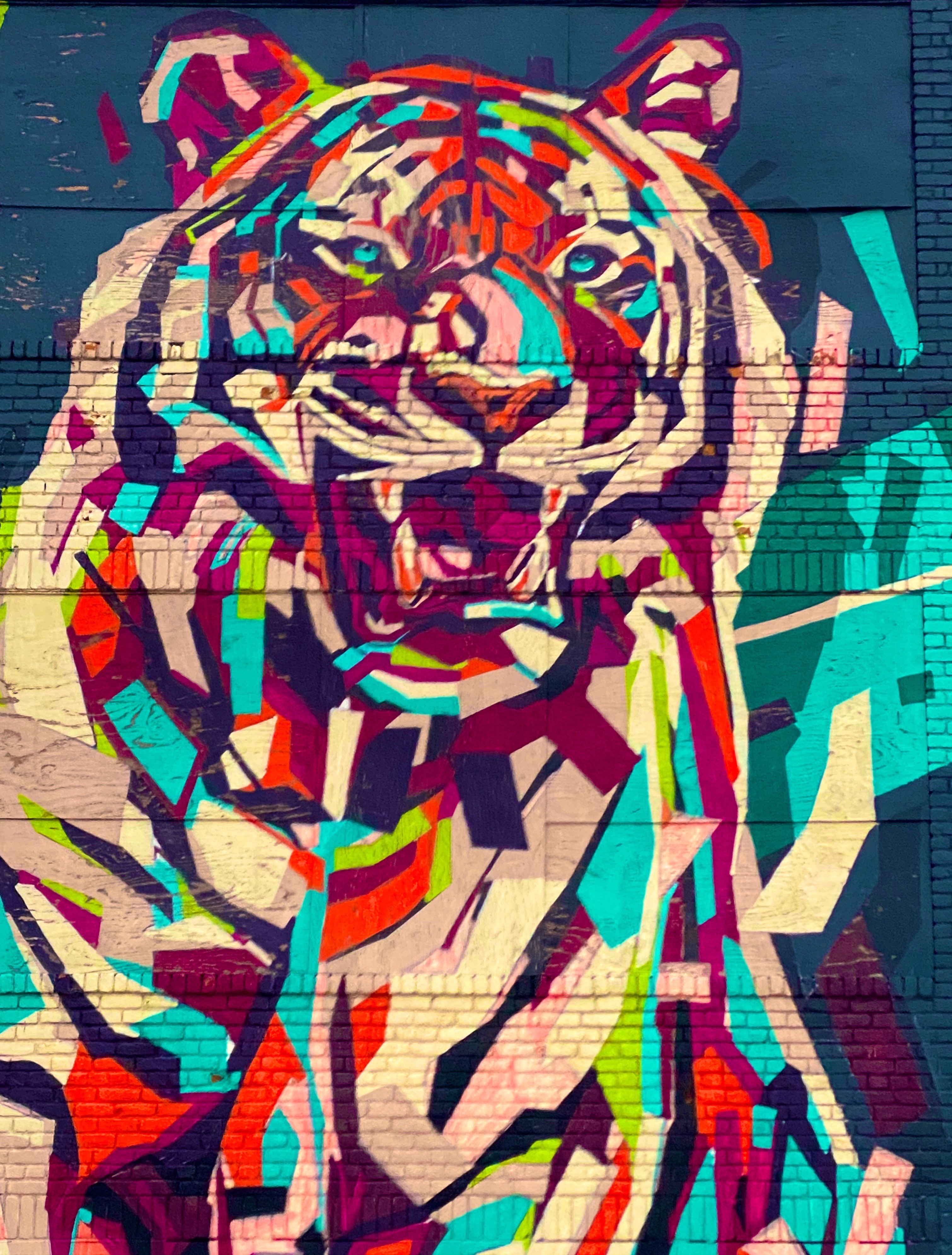
Hello street art fans. This is our second of three planned photo posts featuring street art and murals from our most recent road trip. This post will take us through to our stay in El Paso. We continue to be awed by the amazing artists sharing their talent and creativity with everyone in their communities to enjoy. These works often make a remarkable difference in what might be an otherwise drab or desolate urban landscape. We hope you enjoy the art (we have included attribution for the artists wherever possible).
Artist Unknown – Columbus, Ohio
Sarah Hout @sarahthehout – Columbus, Ohio
“Dream Together” Jeremy Jarvis @jarvjer – Columbus, Ohio
Artist Unknown – Cincinatti, Ohio
Michael Roy @birdcap – Memphis, Tennessee
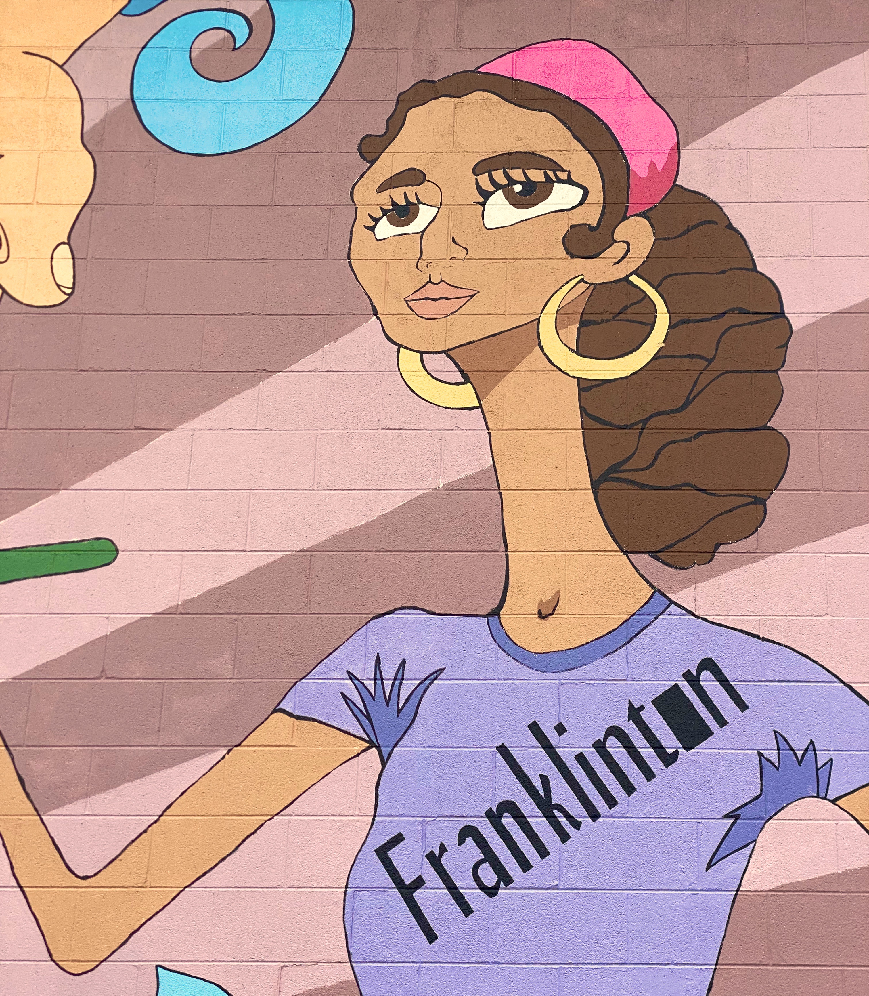
Emily Molly Wood – Argenta Mural Project – North Little Rock, Arkansas
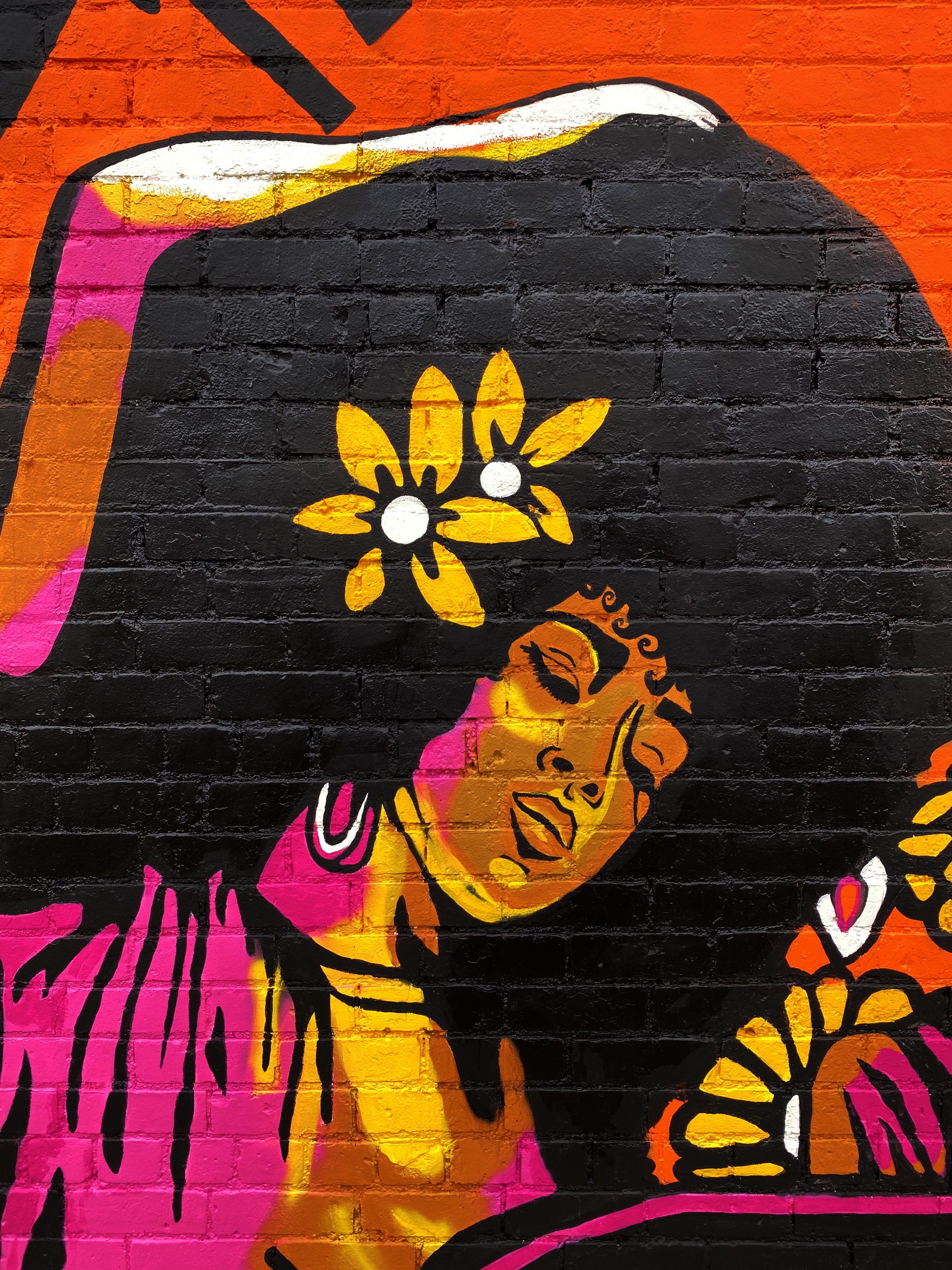
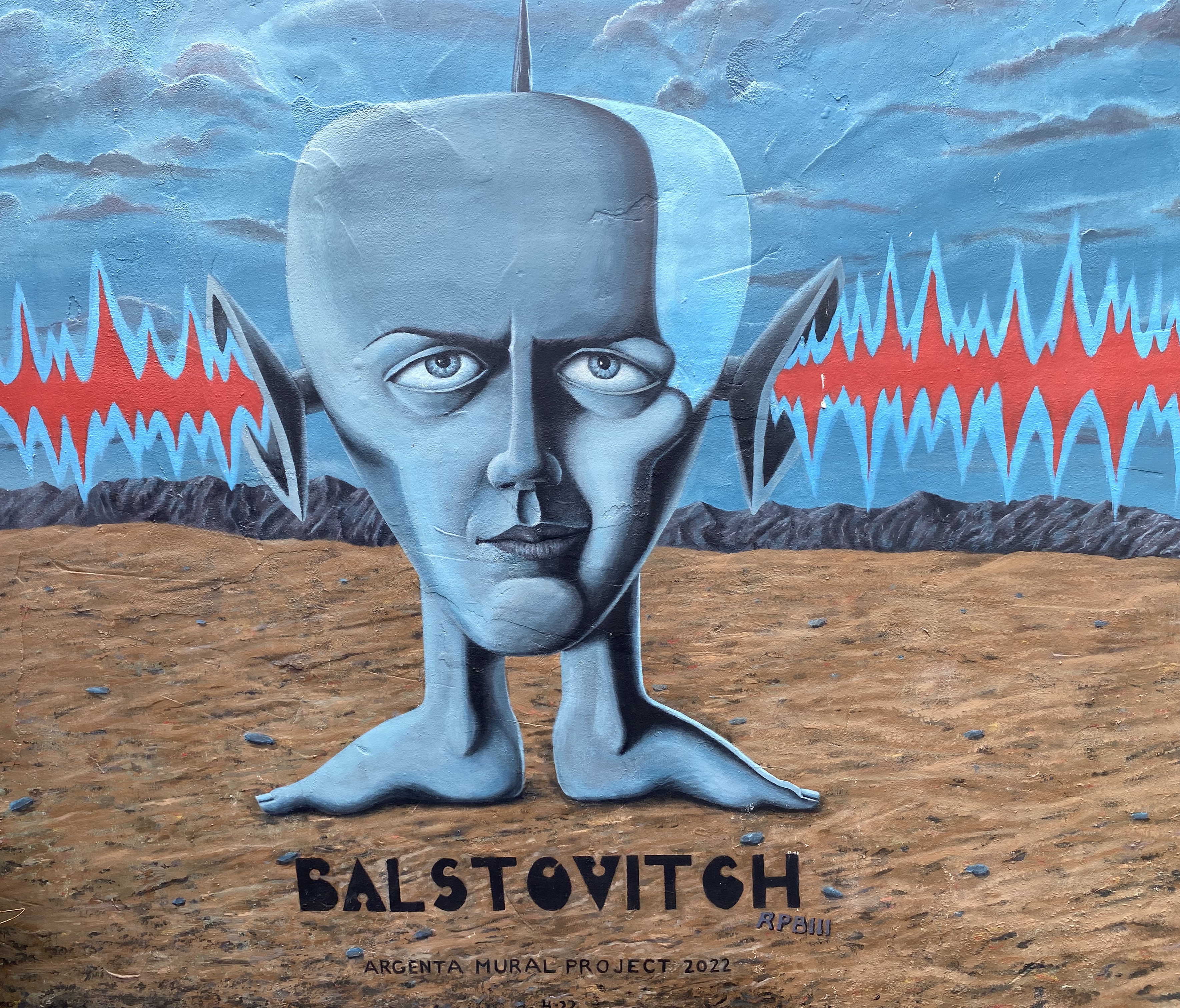
Roland P. Burnham III @balstovision – Argenta Mural Project – North Little Rock, Arkansas
Artist Unknown – Argenta Arts District, North Little Rock, Arkansas
Jes Weiner @magicatmuralist – Texarkana, Texas
@chelsie310 – Texarkana, Texas
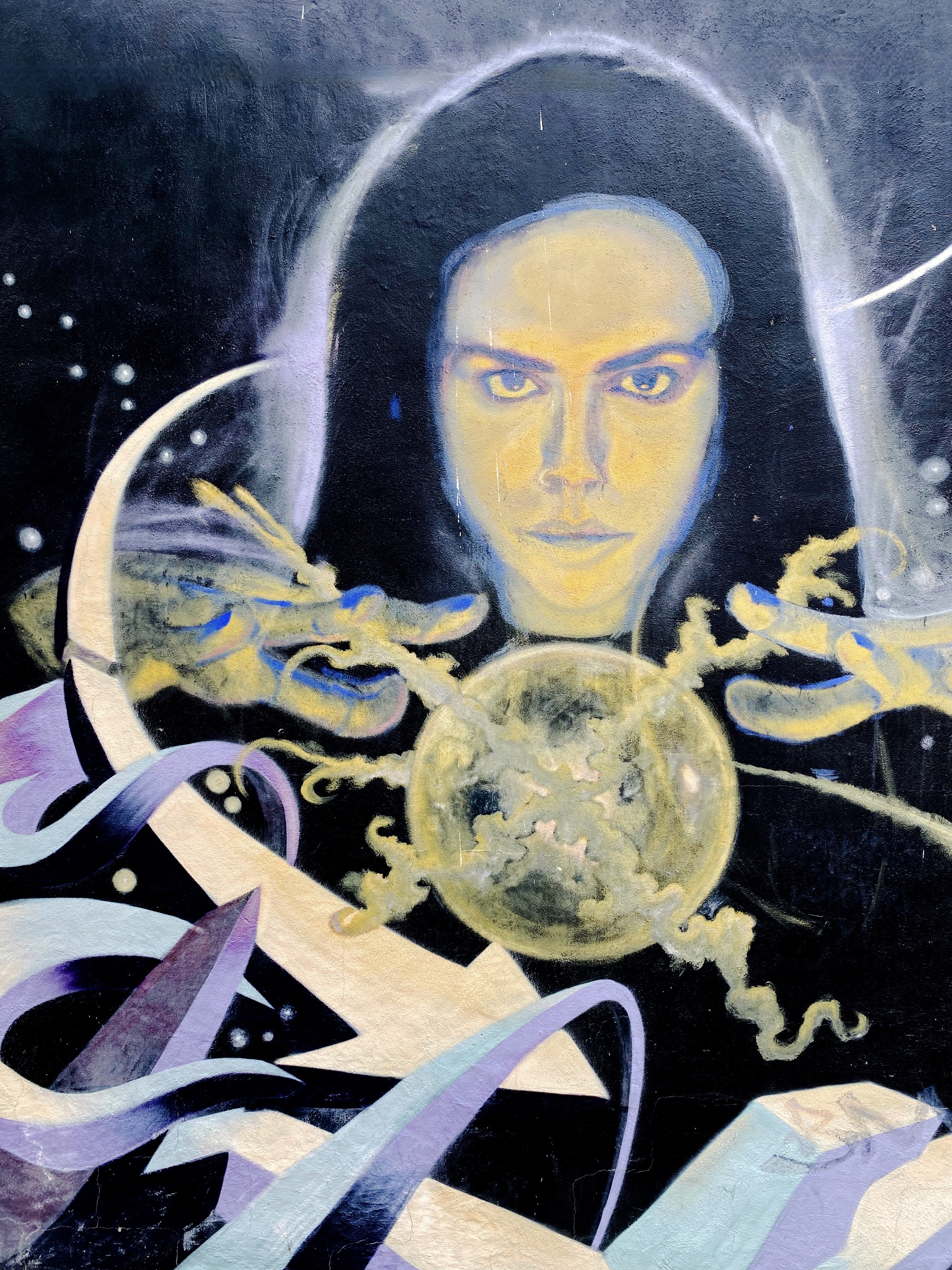
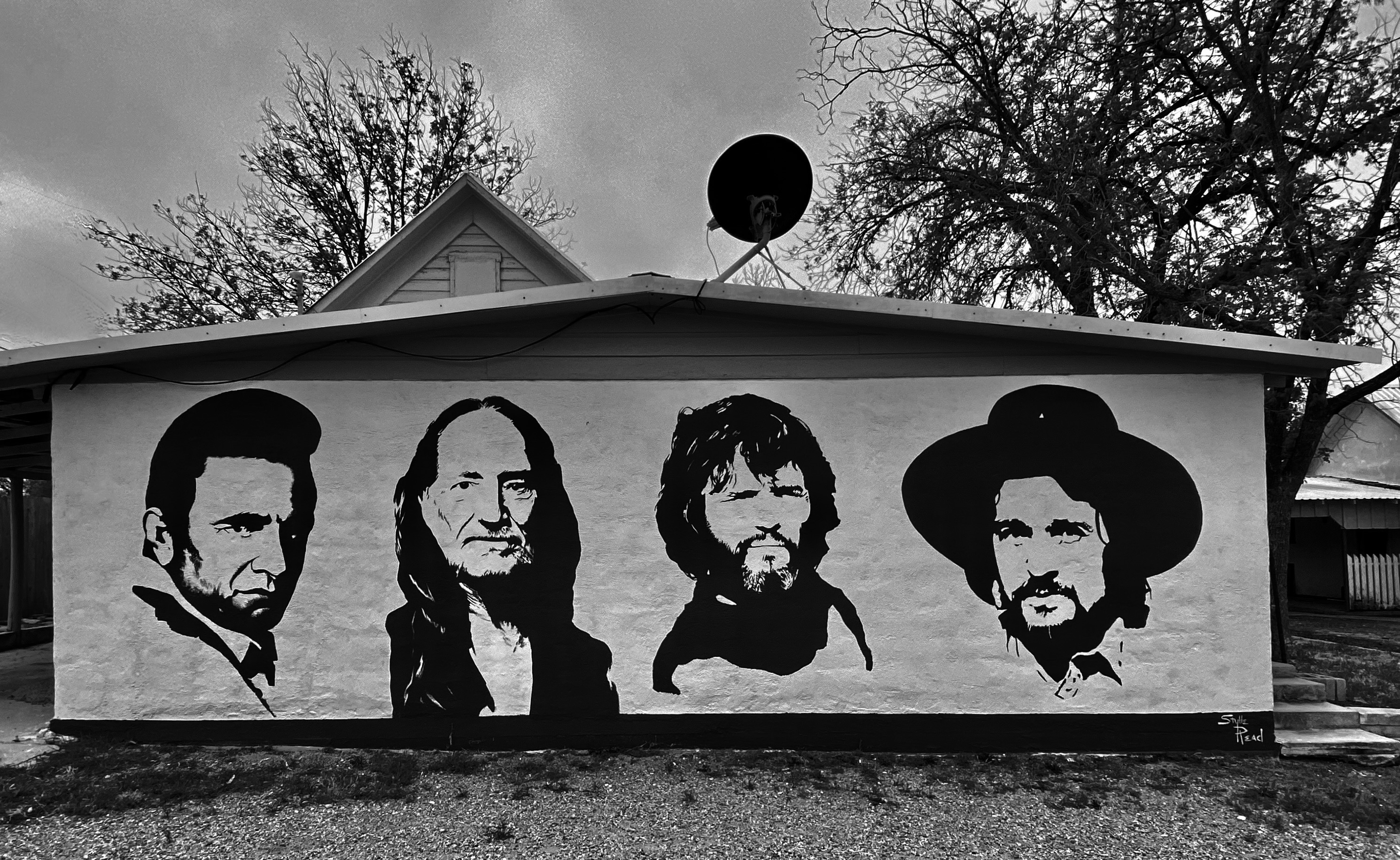
“The Highwaymen” – Stylle Read – Marathon, Texas
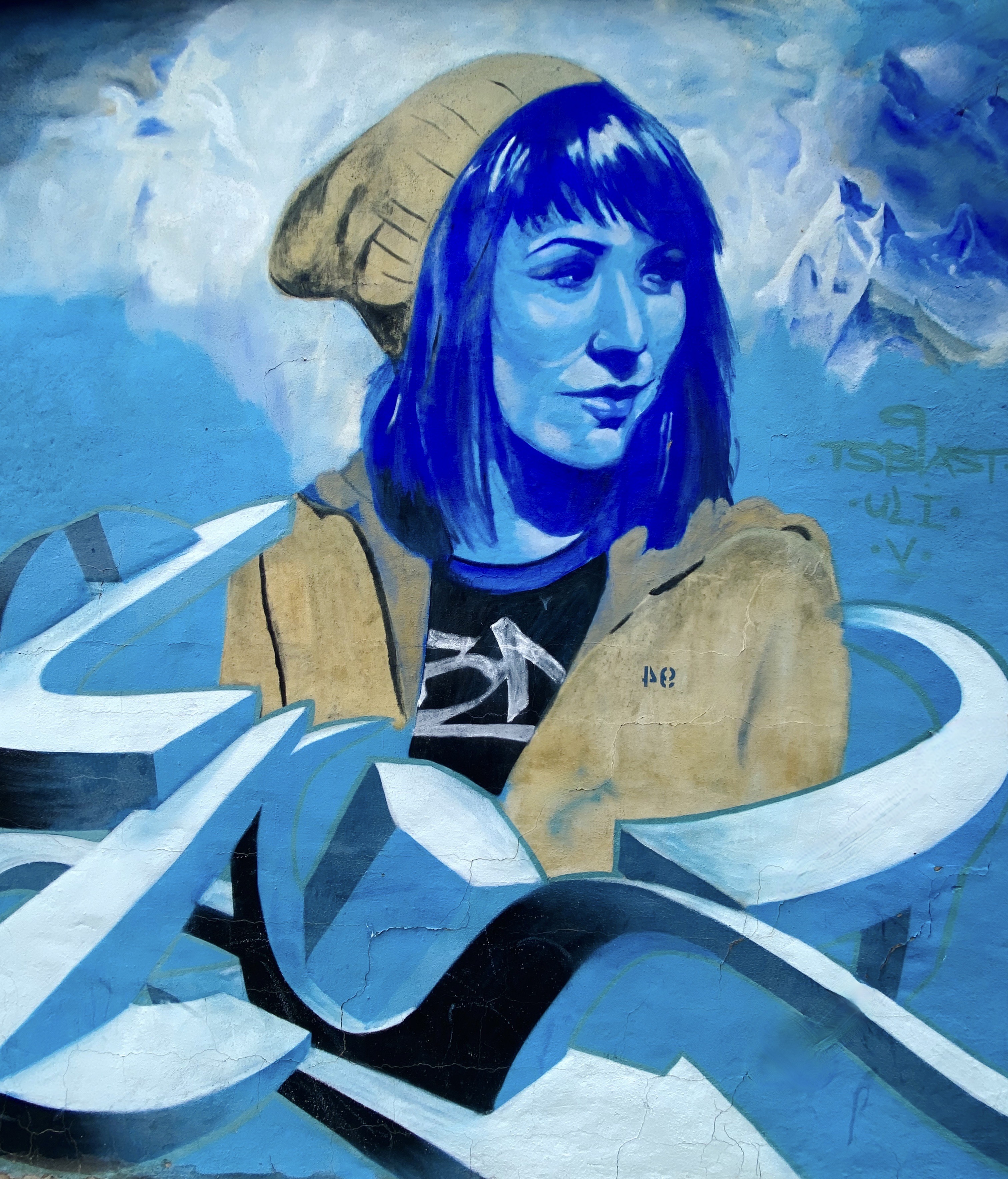
Monty Welt @montywelt – Alpine, Texas
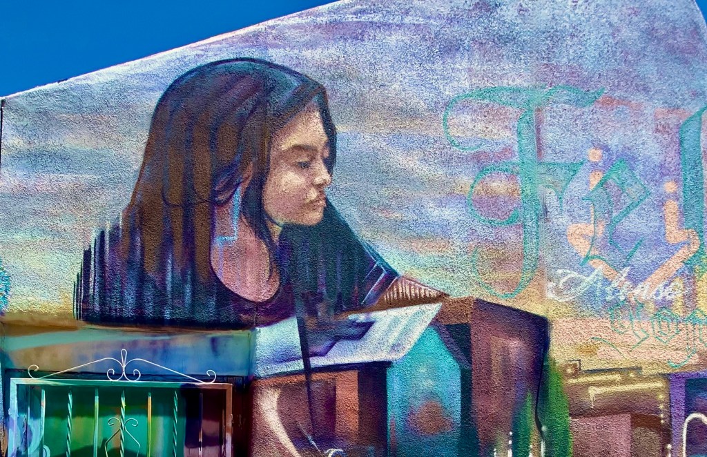
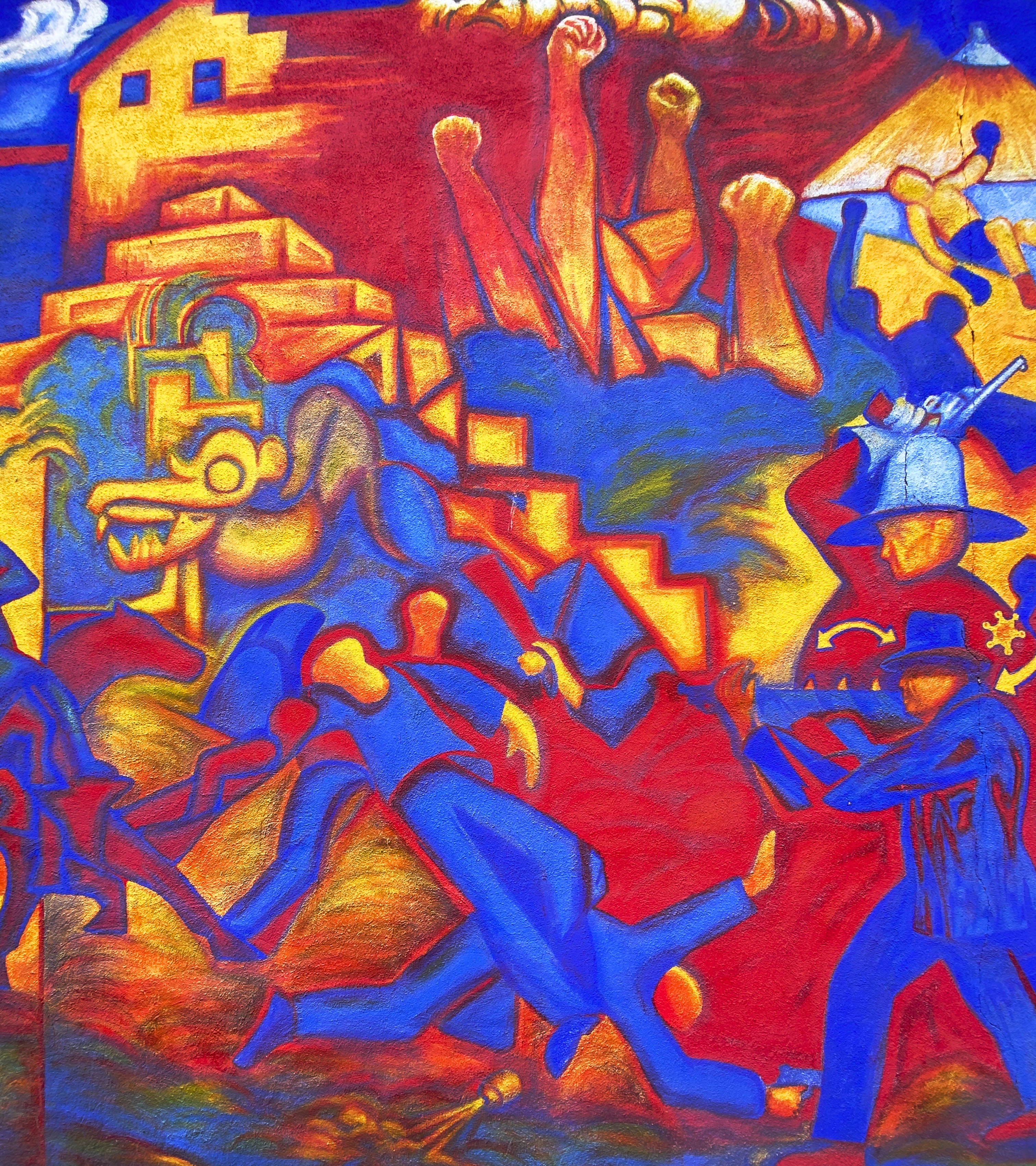
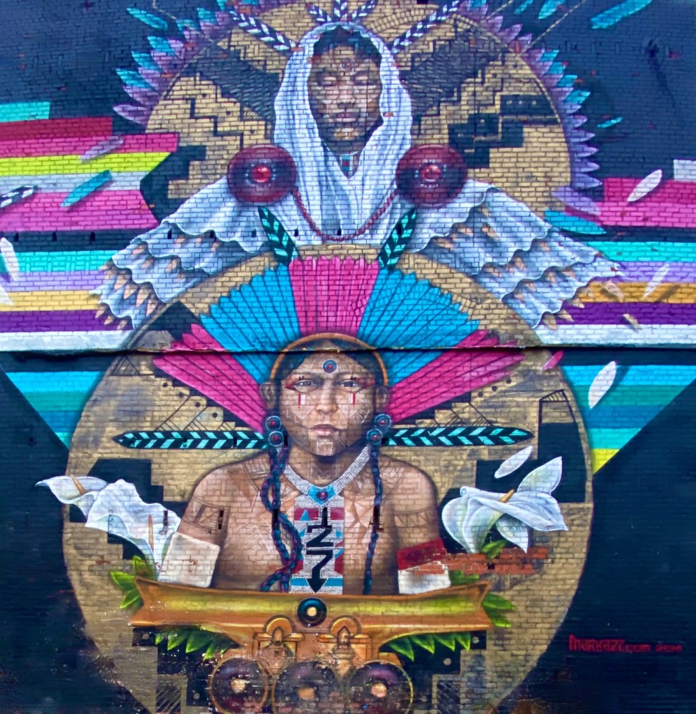
@deko_uno – El Paso, Texas
Artists Unknown – Leon Street, El Paso, Texas
Artist Unknown – Alameda Avenue, El Paso, Texas
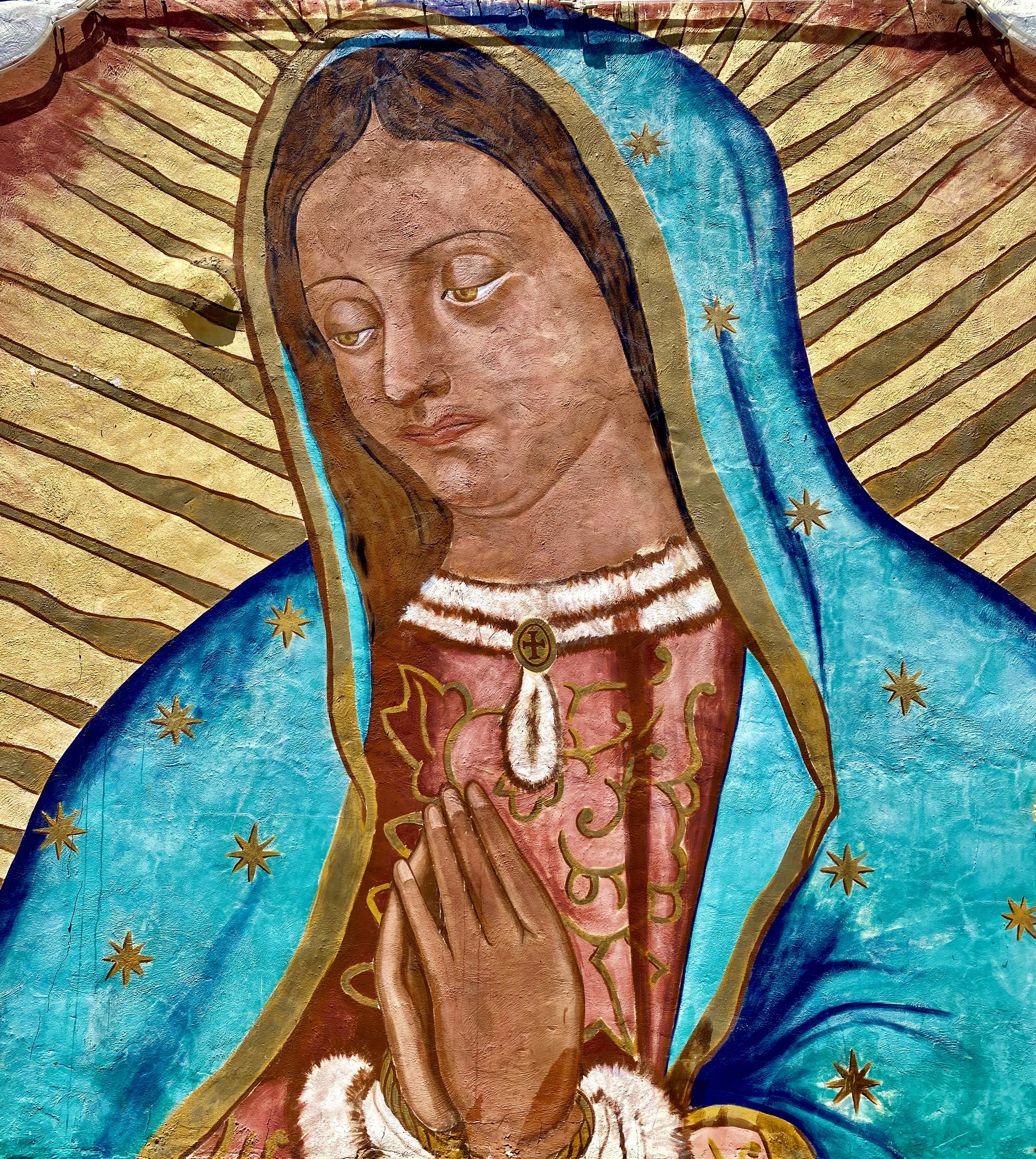
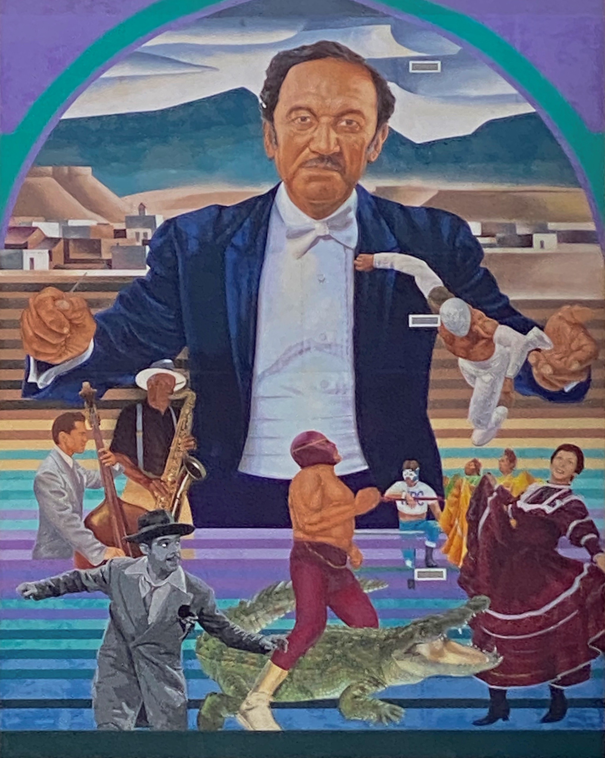
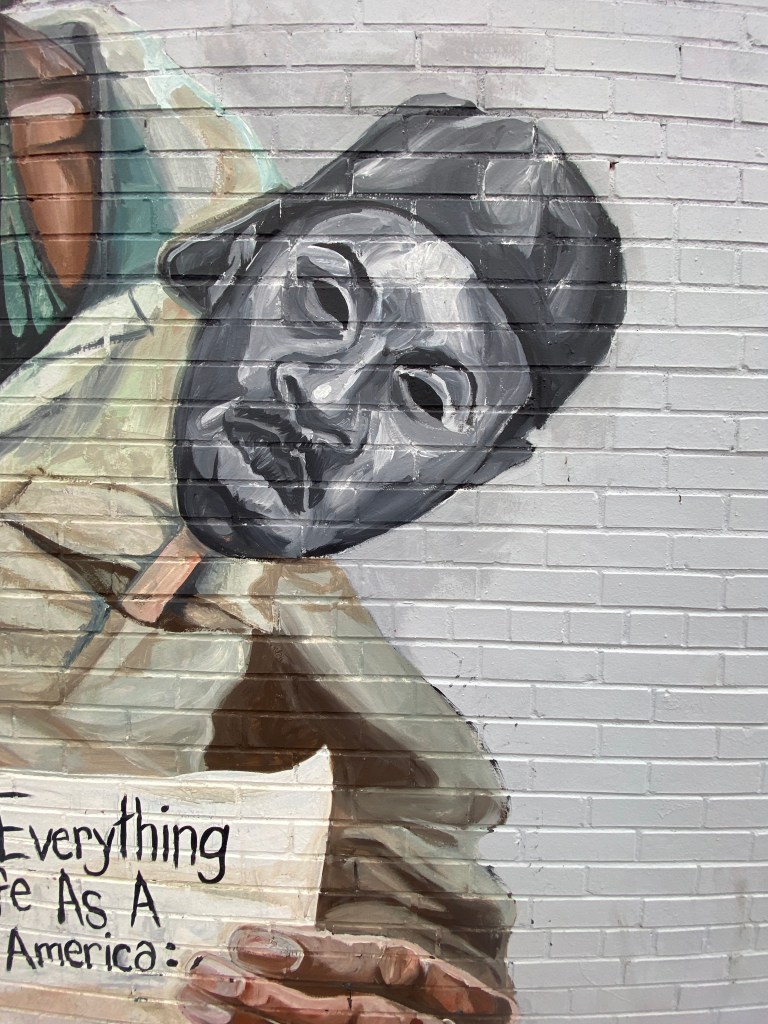
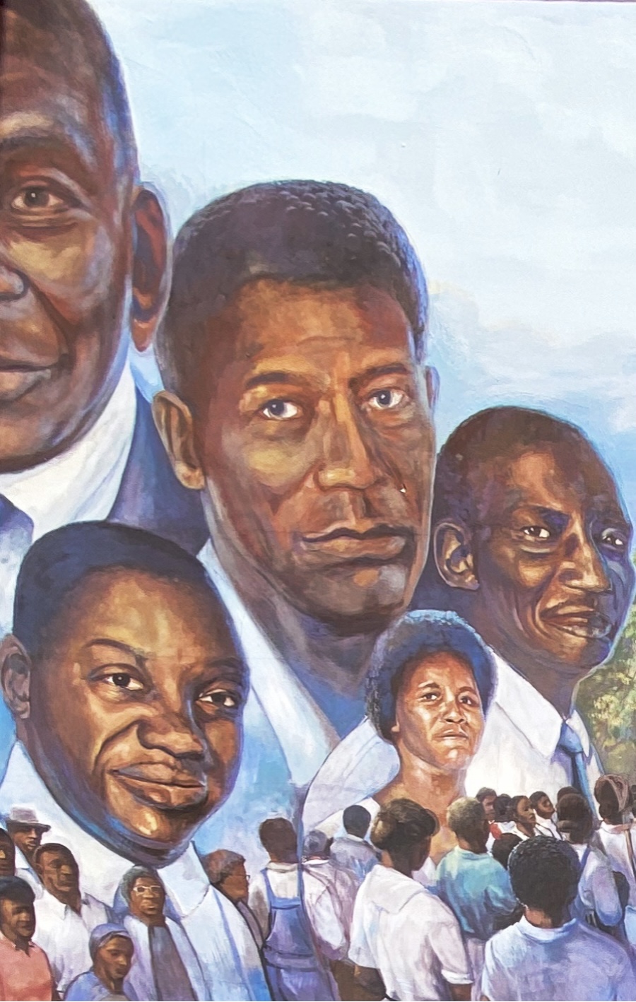
Latino Icons: Don Tosti, Art Lewis, Abraham Chavez, Los Largatos, Rocky Star, Cinta De Oro, Tin-Tin, Rosa Guerrero and Sin Cara – Jesus “Cimi” Alvarado, Martin “Blaster Zubia and Victor “Mask” Casas – Downtown – El Paso, Texas
All of the remaining photographs in this post were taken in the Segundo Barrio. As the name suggests the Segundo was the second neighborhood in El Paso. Since the 1830s this area has been a major entry point for Mexican immigrants coming into the United States. The majority of the immigrants in the barrio were and still are migrant farm workers.
Artist Unknown – Segundo Barrio – El Paso, Texas
The Segundo still reflects its Tejano culture and traditions very proudly (we hope the murals we have featured below will reflect that same sense of tradition, culture and aspiration). At one point, the city planned to demolish much of the barrio as a way to eliminate the significant substandard housing stock instead of addressing the root causes in a humane fashion. Fortunately, civic groups formed and defeated the city’s plan to demolish the historic area.
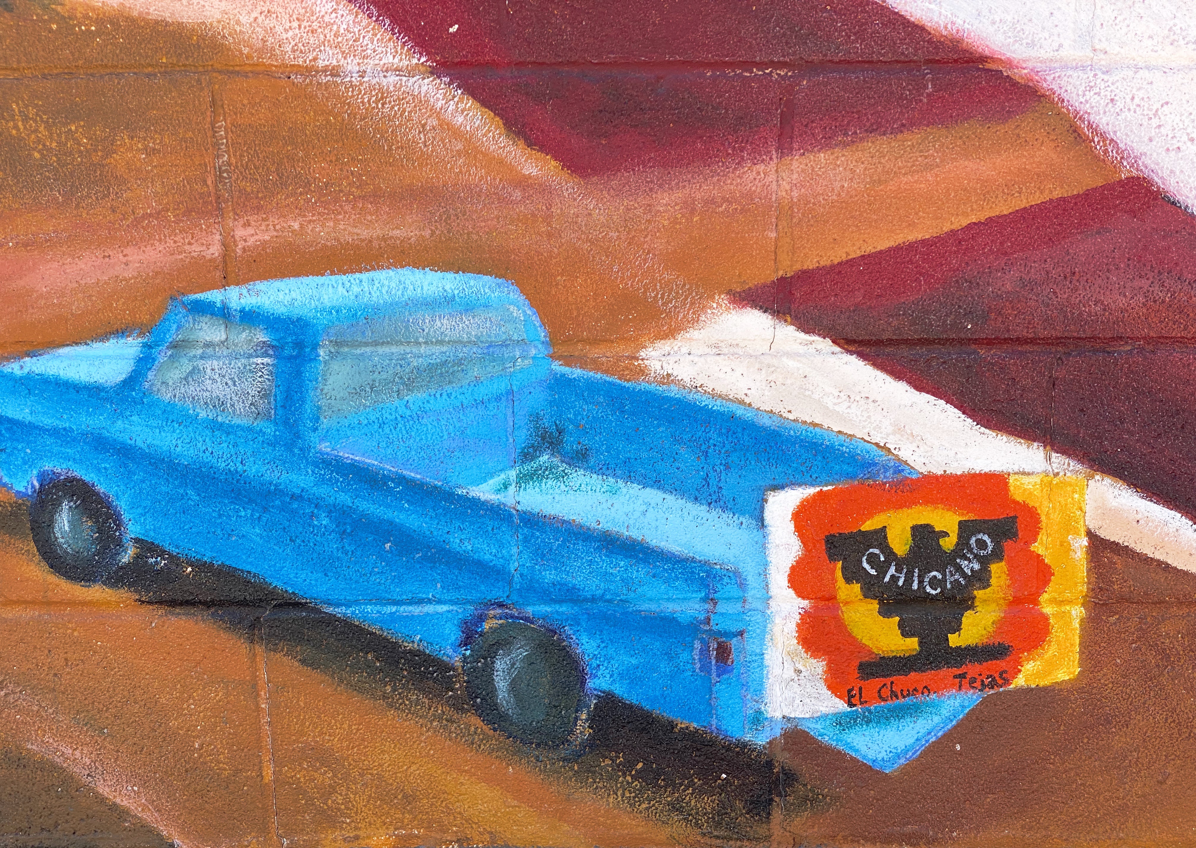
El Corrido del Secondo Barrio – Jesus “CIMI” Alvarado and Victor “Mask” Casas – Segundo Barrio – El Paso, Texas
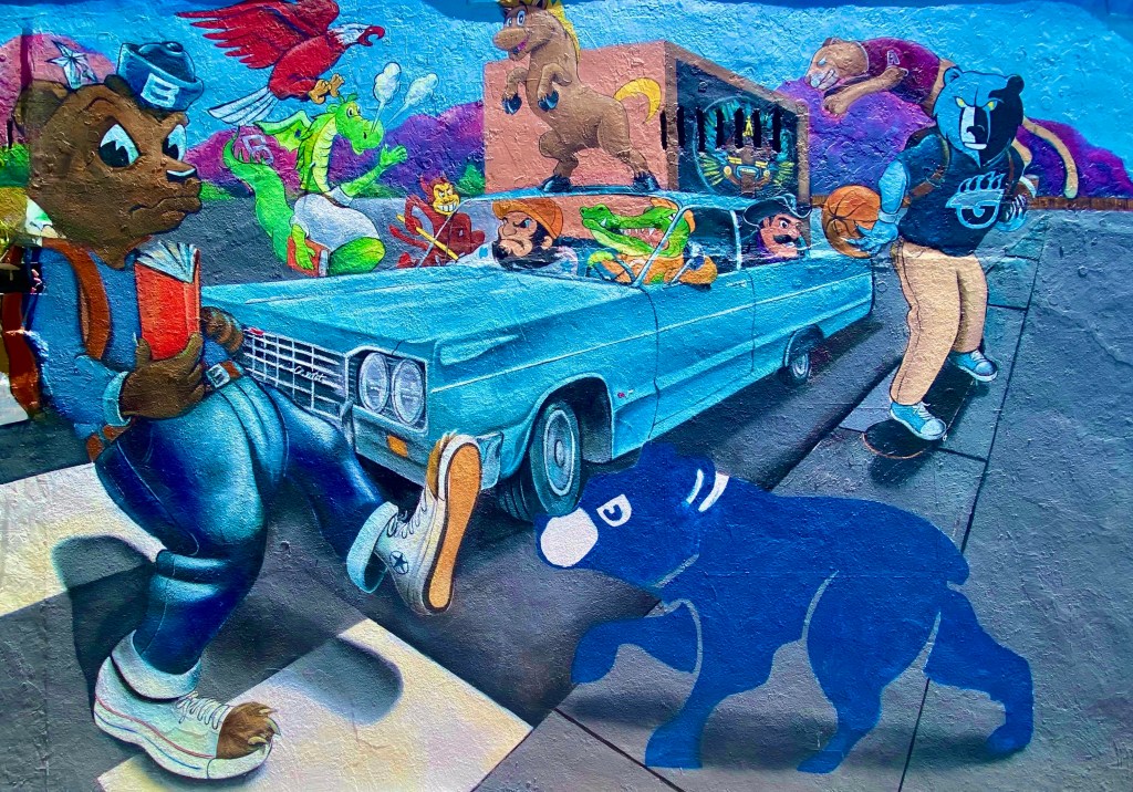
Jesus “CIMI” Alvarado – Segundo Barrio – El Paso, Texas
Unfortunately, the preservation of the barrio has not improved the economic conditions significantly. Many of the Mexican-American residents and immigrants still toil as farm workers. The barrio is poor by any measure, albeit rich in culture, tradition and pride in its heritage.
Our first stop after departing Silver City was Catwalk Recreation Area (CWA) where we were looking forward to hiking through the Whitewater Canyon. The beautiful slot canyon formed by the Whitewater Creek once served as a hideout for Butch Cassidy and the Sundance Kid as they attempted to evade the Pinkerton’s. Geronimo and his warriors also used the canyon to elude the U.S. Cavalry.
During the 1890s, the power of the upper creek flowing through the canyon was harnessed to bring water to the gold and silver mill which was situated in the lower canyon. Workers constructed a pipeline through the canyon which was bolted to the canyon walls about 20 feet above the creek. A series of catwalks were built on top of the pipeline in order to access it for maintenance and repairs. The boom came and went, and the mines and mill were closed in 1913; the materials were sold for scrap. The 200 or so residents left for other parts to find work.
The canyon essentially returned to its original state with no residents or mining operations. In 1935 the U.S. Forest Service (USFS) utilized the Civilian Conservation Corps (CCC) to create a hiking trail through the canyon. The CCC used the existing bolts in the canyon walls to build a new wooden catwalk as part of the hiking trail through the canyon. The trail was opened in 1937 and survived until 1961. It was replaced by a metal catwalk which subsequently was destroyed by storms in 2013.
Fortunately for us and other visitors, the USFS was able to have a new catwalk built and installed in less than a year. Today the catwalk extends approximately one half of a mile into the canyon, then hikers can continue on the canyon surface for another mile — as long as they are willing to make several water crossings. There are plans to extend the trail deeper into the canyon in the future.
After our hike at Catwalk, we traveled north and ventured across the winding single lane Bursum Road (NM59) to visit the town of Mogollon (mo-go-yone). The town sits deep in the Mogollon Range within the Gila Wilderness at 6500 feet above sea level.
Bursum RoadDriving Towards Mogollon
View from Bursum Road to the West
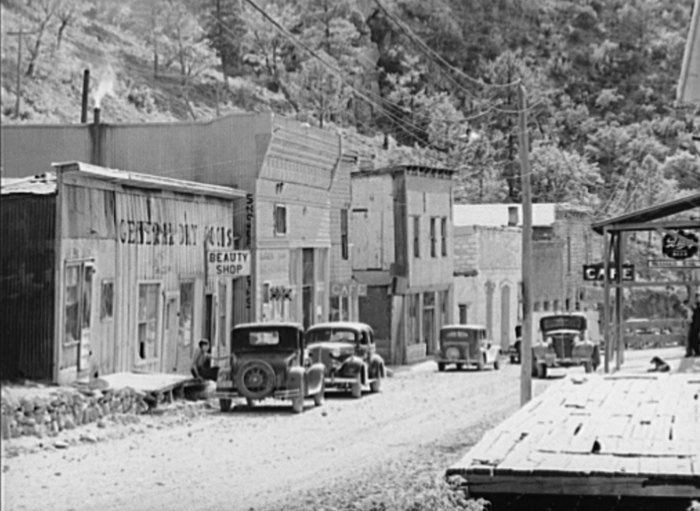
The town is sometimes referred to as a ghost town but it actually has a handful of residents (apx. 15) and several businesses. We saw several parked cars but no people during our walkabout. The town’s history began when gold was discovered in the late 1800s. Gold was mined here continuously until the 1950s. As a result, many of the structures are still standing today which leads to sense of stepping back in timeas you travel through the small town.
Mogollon, 1940, Photo credit Russell Lee
Gold mining brought as many as 6000 people to the town at the height of production at the Little Fannie Mine and several other nearby mines. The town flooded often (sitting on the Silver Creek) and major portions burned multiple times. The town’s reputation (like many mining towns) was that of a rough and tumble place with several saloons and brothels (and no law).
Little Fannie Mine
After our day at CWA and Mogollon we found camping in the Gila National Forest among the pines and the serenading cattle that were roaming around us in constant search of food. The next morning we pushed northeast out of the forest onto the Plains of San Augustin. The Plains stretch 55 miles from the northeast to the southwest and range in width from five to fifteen miles.
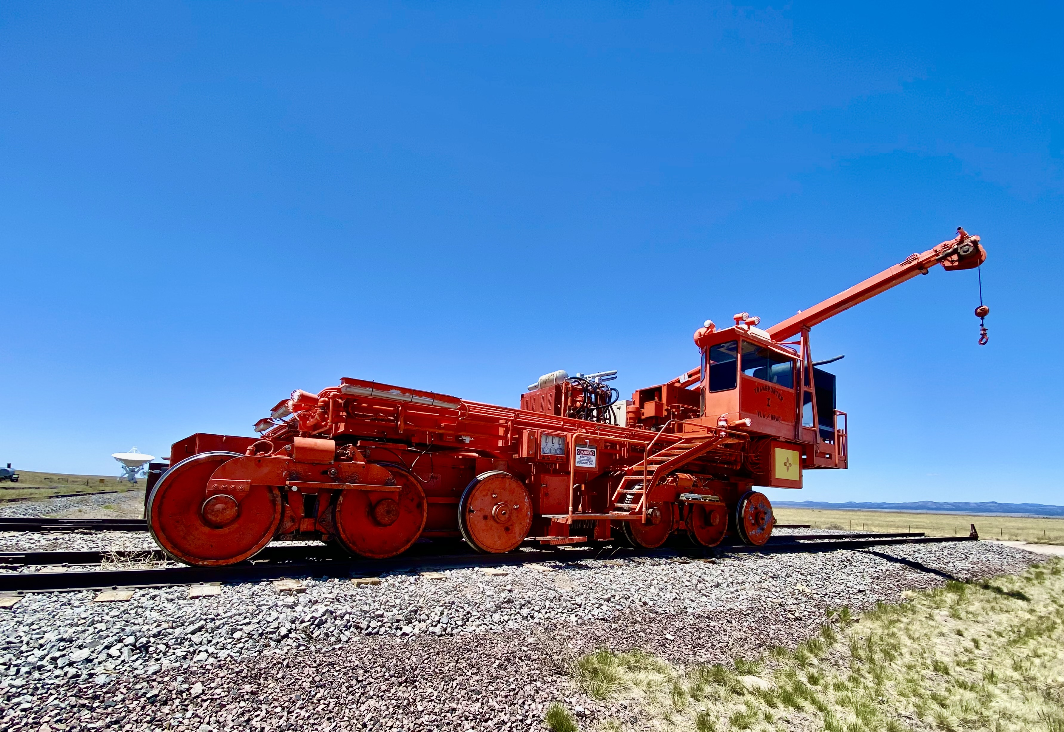
Our primary purpose in transiting the Plains was to visit the Karl G. Jansky Very Large Array (VLA). The VLA consists of 27 radio telescopes positioned across the Plains via railroad tracks. Each of the radio dishes stands 90 feet tall, 82 feet across and weighs 250 tons. In their widest configuration the radio dishes stretch for over 20 miles across the Plains. The Plains are an ideal setting for the VLA as it is far away from any population centers and shielded from light by the surrounding mountain ranges.
The Very Large Array
We won’t pretend for a second to understand how this works but it is nonetheless fascinating to see the array in action and to learn about the many important discoveries made utilizing radio astronomy. The array has captured activity in our galaxy as far away as 150 quadrillion miles!
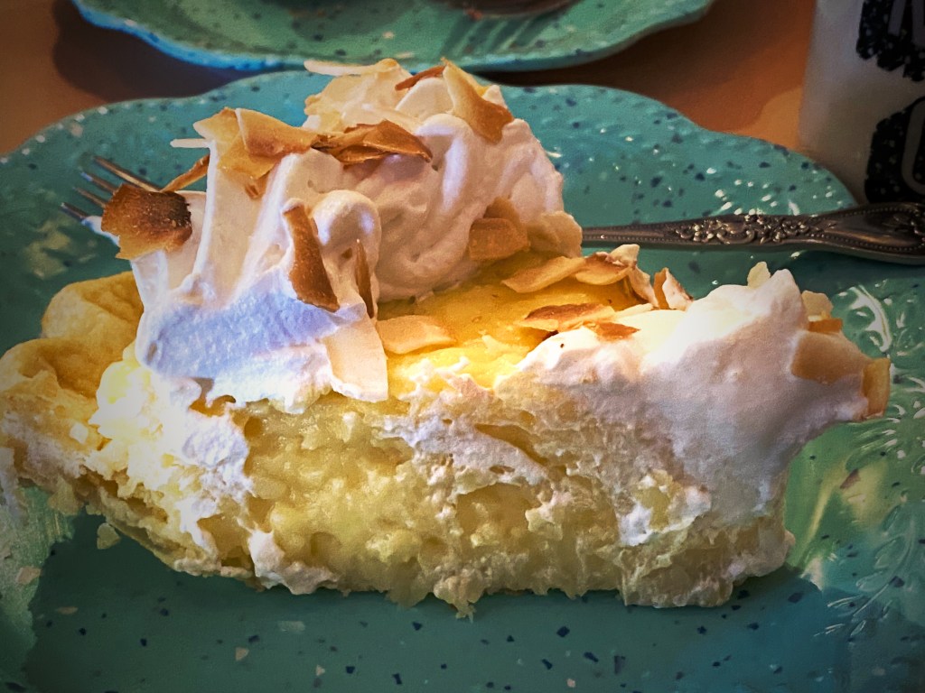
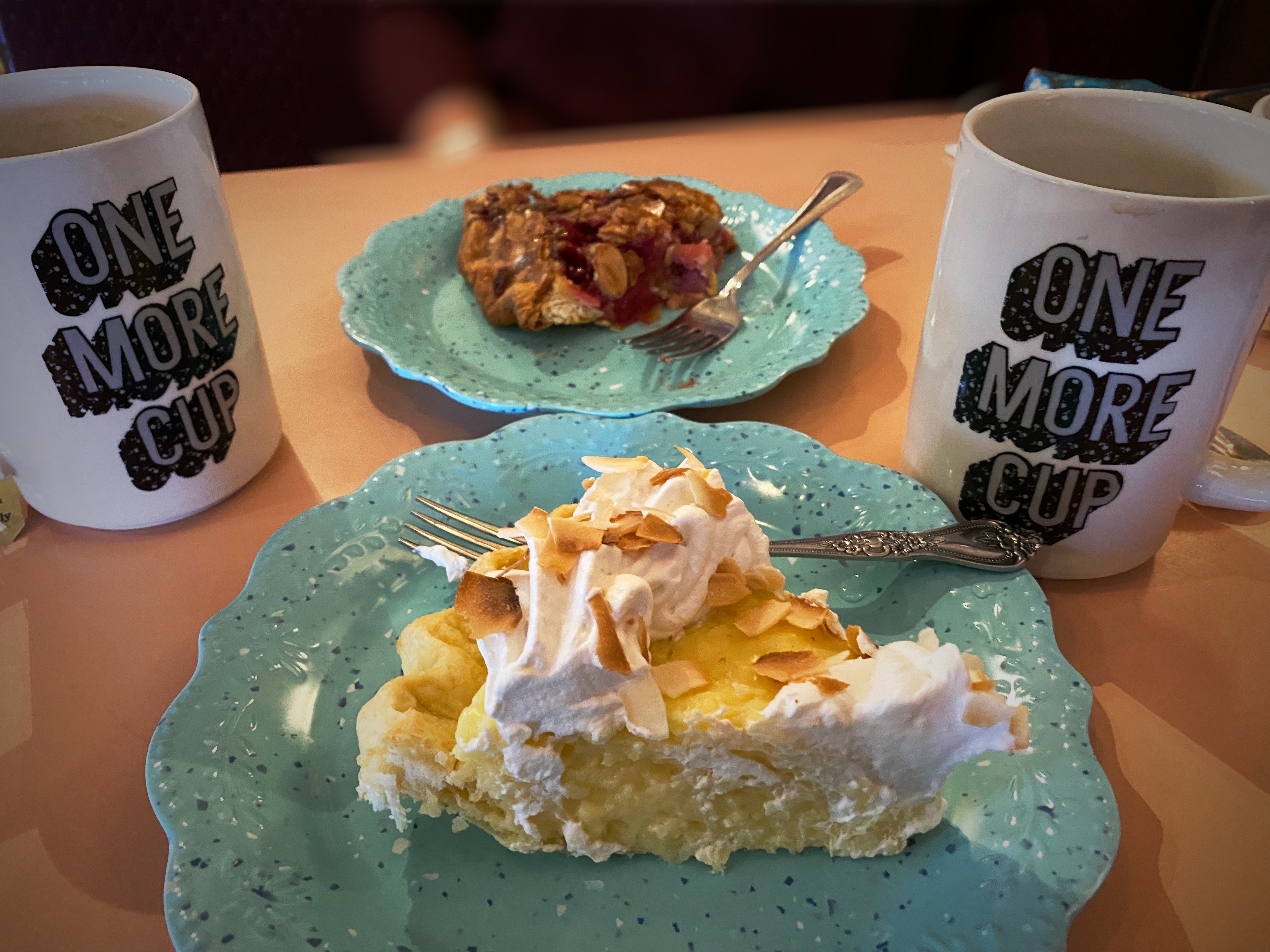
We met a motorcyclist who had pulled over for a break while we were off the road near the VLA adding air to two of our tires with slow leaks. He asked us if we were going to stop in Pie Town – we said yes – he said good, it is a tradition whenever you cross Route 60 to stop and have pie!
Well, we did, and it was dang delish! Maria had the Cherry Almond Pie and I had a piece of the freshly made Coconut Cream Pie. Pie Town establishments did a good business dishing out pies for cross country travelers and local ranchers until the ubiquitous interstate was built and diverted much of the traffic away from town.
Fortunately, about 25 years ago the Pie-O-Neer Cafe opened and it has been doing a booming business ever since. In addition to many travelers that now routinely avoid the interstate, the Continental Divide Trail runs through Pie Town. Many hikers stay at a nearby hostel and consume thousands of calories (based on what we saw) replenishing for the next leg of the journey. The town itself has not grown with a population hovering around 25, but they apparently throw a heck of a pie festival every September.
After filling our bellies with delicious pie, we set north across some dusty ranch country on the York Ranch Road in search of camping near El Malpais National Monument (EMNM). As you can see in the photo below left, the desert can be cruel for those unprepared for the terrain.
We found a beautiful spot to camp just east of EMNM on a bluff which provided great views and a spectacular sunset.
In the morning we made our way north to Grants, New Mexico to have our leaking front tire replaced. From there, we set out for the Big Tubes area to explore. There is only one way in or out – the Big Tubes Road ( NPS 300) – a classic impassable-when-wet mud job. Fortunately, while there had been some rain leaving behind some large ruts, the road was fairly dry and passable. Regardless, we would not recommend this road without 4WD and high clearance.
NPS 300
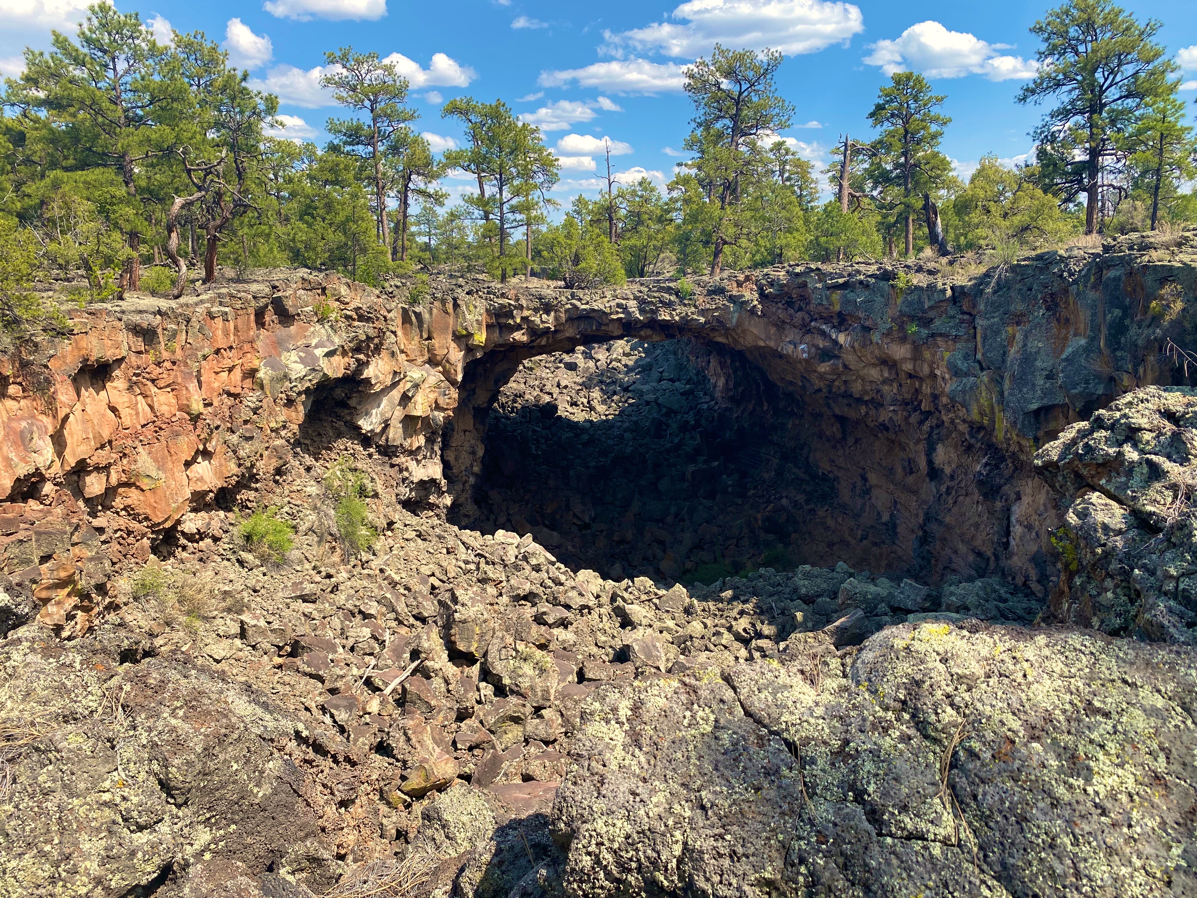
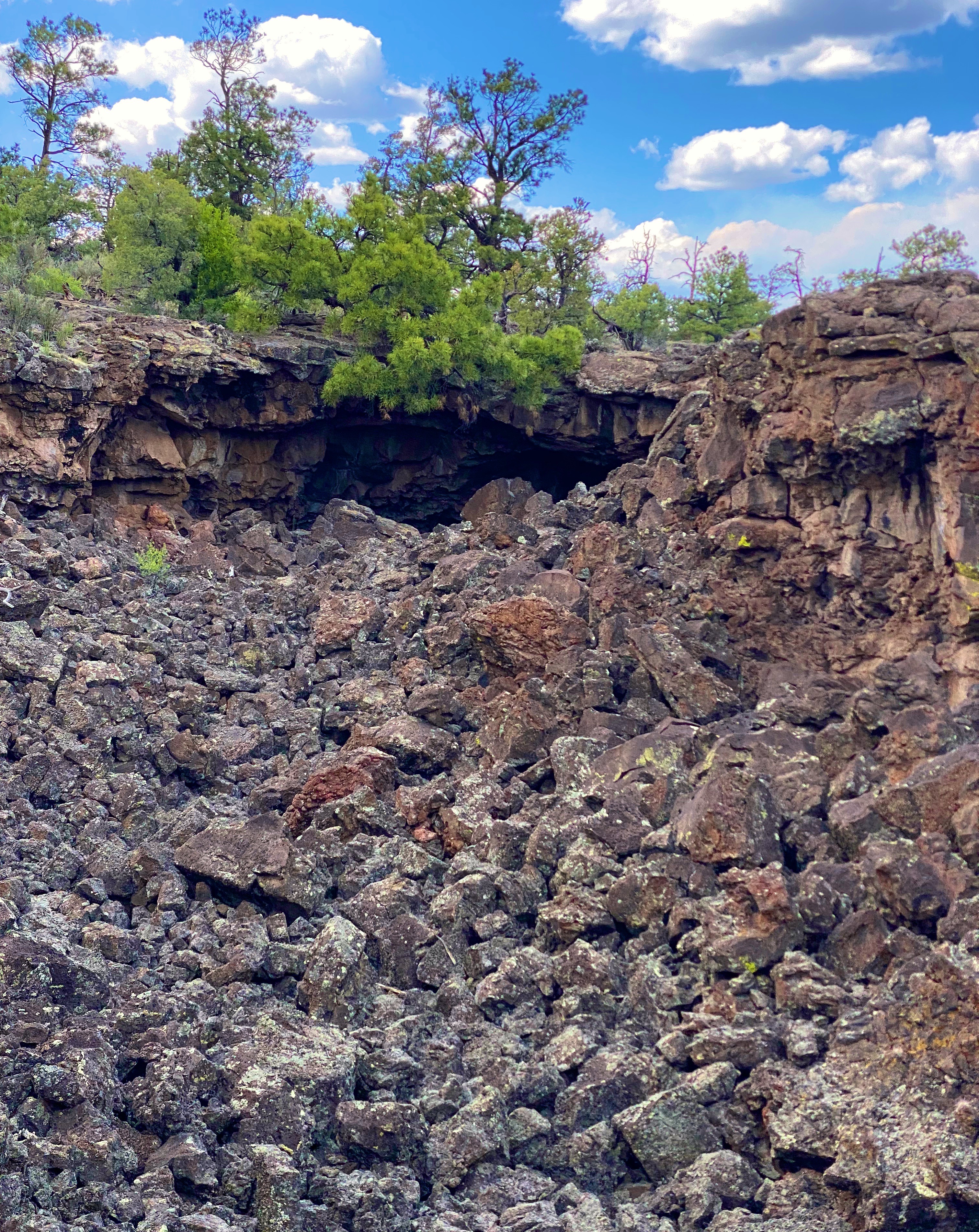
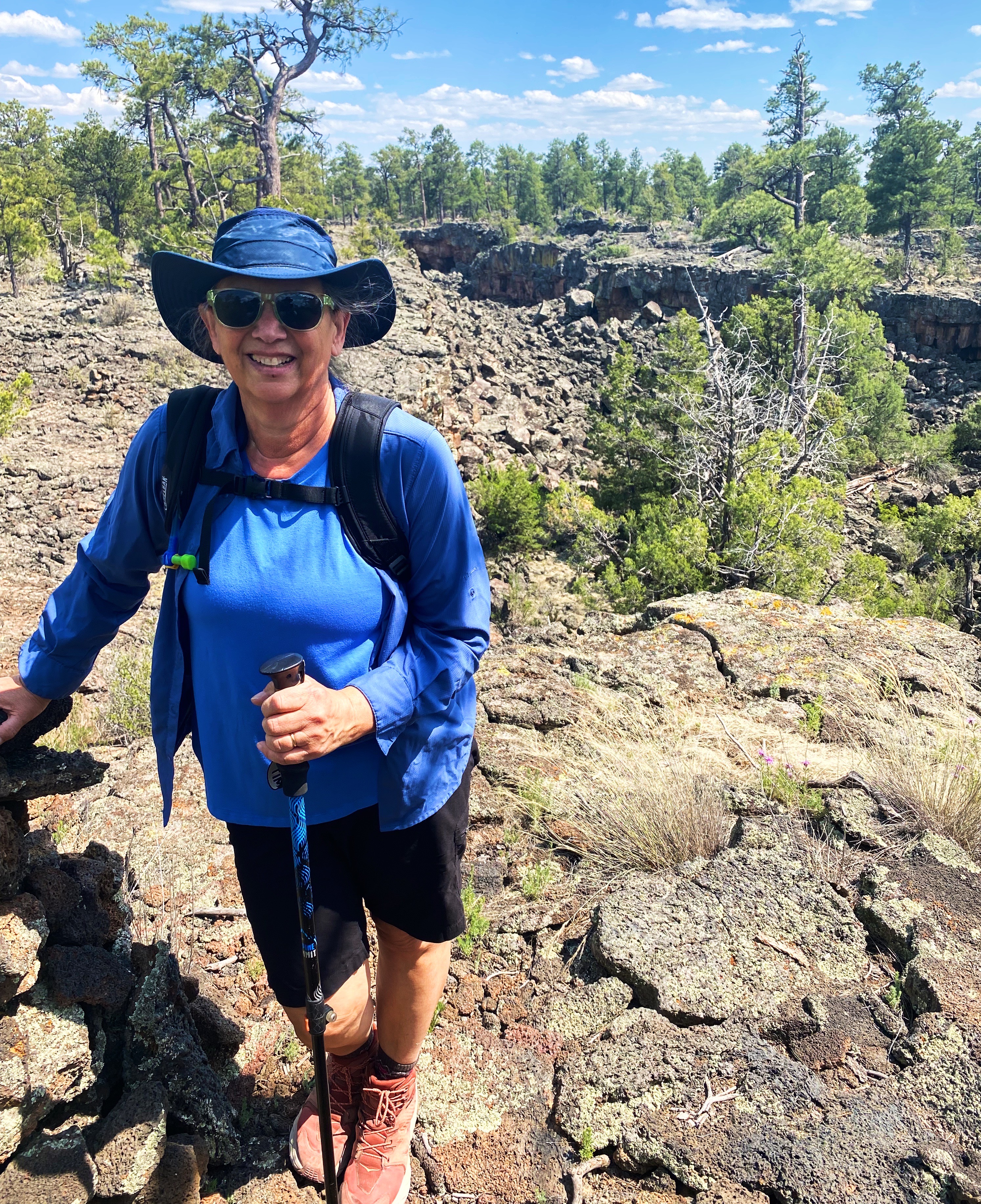
The Big Tubes Area is a massive volcanic landscape that provides the opportunity to explore lava tube bridges, lava tubes, tube caves and lava flows. There are no marked trails, although there are cairns laid out across the field – use the cairns – there are no other usable reference points in this other-worldly place. Even utilizing the cairns we made several wrong turns in hiking out and back across the field.
You are free to scramble down into the tubes and caves and under the bridges. We recommend wearing gloves and a climbing helmet. The boulders in the trenches and tubes are big and sharp!
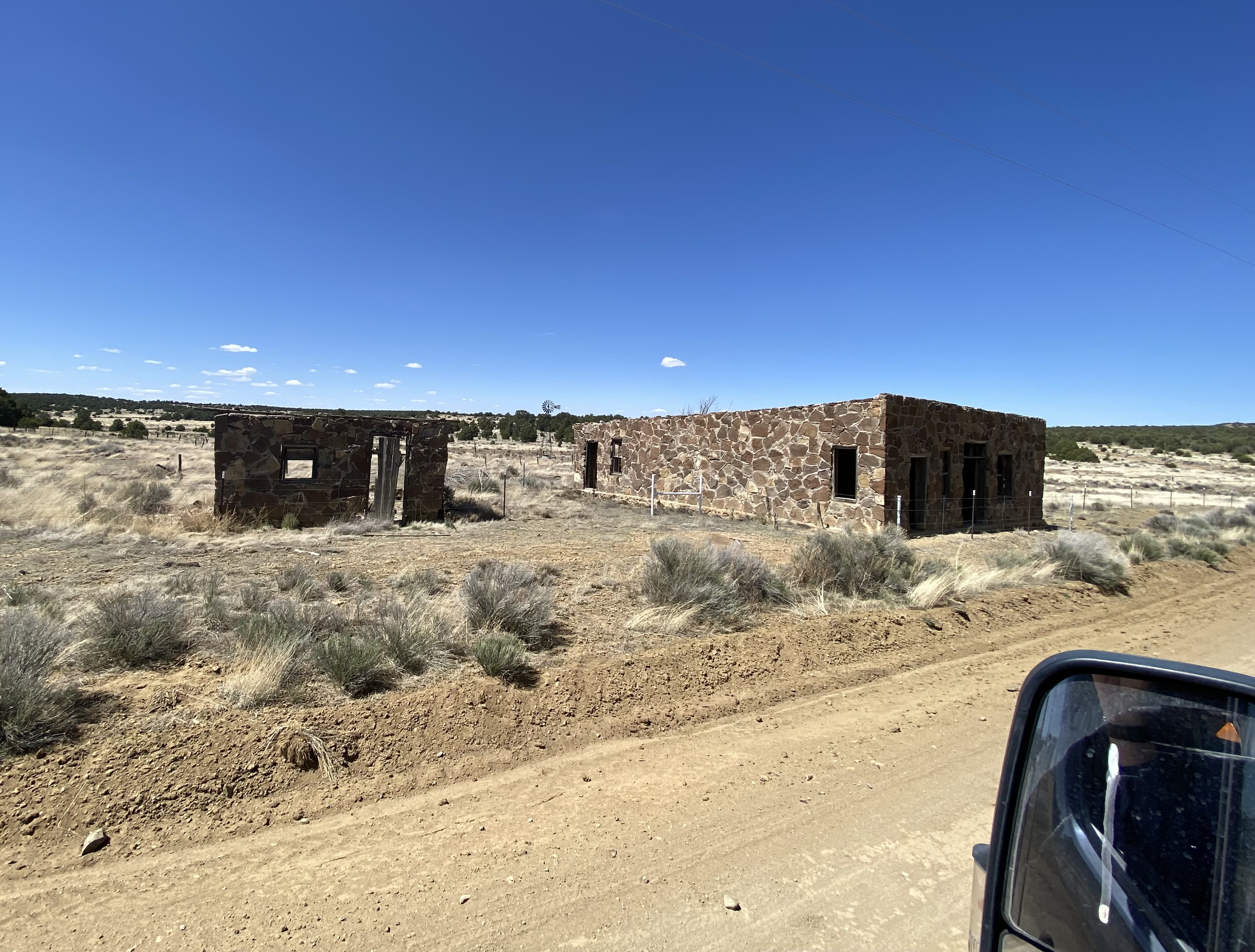
From EMNM we traveled through several portions of the Ramah Navajo and Zuni Indian Reservations on our way north on the 602 to Gallup. We had reserved a couple of nights at the El Rancho Hotel and were looking forward to staying at this 1940s hotel that once hosted dozens of Hollywood stars ensconced here while filming Westerns in the area. Additionally, the hotel sits smack on Historic Route 66 to add even more kitsch. From the photos below you might suspect we were not disappointed with our decision.
Gallup has a storied history that predates the movie making haydays of the 1940s and 1950s. The first white settlers arrived in the area that became Gallup in the early 1860s. This was Navajo land and thus the Navajo attacked the white settlements. The cavalry was dispatched to physically remove the Navajo people from the area. The U.S. Army destroyed the Navajo homes, crops and livestock. The Navajo were then force marched 400 miles to a reservation where they were held for four years. In Navajo history this event is known as The Long Walk.
The town was formally founded in 1881 as a railhead for the Atlantic & Pacific Railroad. The freight lines that ran through the middle of Gallup hauled the high grade coal that was mined in the area. While the coal mining in the area has largely played out, more than 100 freight trains still rumble through town every day.
American Coal Company – Atlantic & Pacific Railcars
Coal miners in Gallup went on strike in 1933. The situation in Gallup was politically charged due to the multi-faceted race issues that existed in the American West. Many of the miners were Mexican and, influenced by their experiences during the Mexican Revolution, were members of the communist National Miners Union. The white miners aligned with United Mine Workers of America. Additionally, by the 1930s, many Navajo Nation members from the abutting reservation had begun working in the mines in Gallup. The Navajo coal miners did not belong to any union and routinely crossed the picket line – they did not consider themselves as members of the world outside the reservation. This act further intensified the significant racism already directed at Native Americans in the West.
The strike turned violent in 1934 and the sheriff was shot and killed by a Mexican miner. Subsequently, the Mexican miners were deported en masse. The UMWA became the sole union, although it took another nine years for a contract to be signed by the coal companies.
Mural Depicting the Coal Mine Riot of 1934
We took advantage of the opportunity to try the local cuisine. Lots of delicious dishes to choose from. The only item we do not recommend is the beef tongue – it’s a texture thing!
We enjoyed our stay in Gallup. Fascinating western history, excellent local cuisine, fine coffee and great street art. However, please keep in mind this is not a trendy tourist town. As a result of the long history of cultural and socio-economic issues there is a legacy of high unemployment, high crime and poor education which is evident within the community.
A quick stop in Farmington, New Mexico for fuel, coffee and groceries and then we headed over the state line for the snow capped peaks of Colorado.
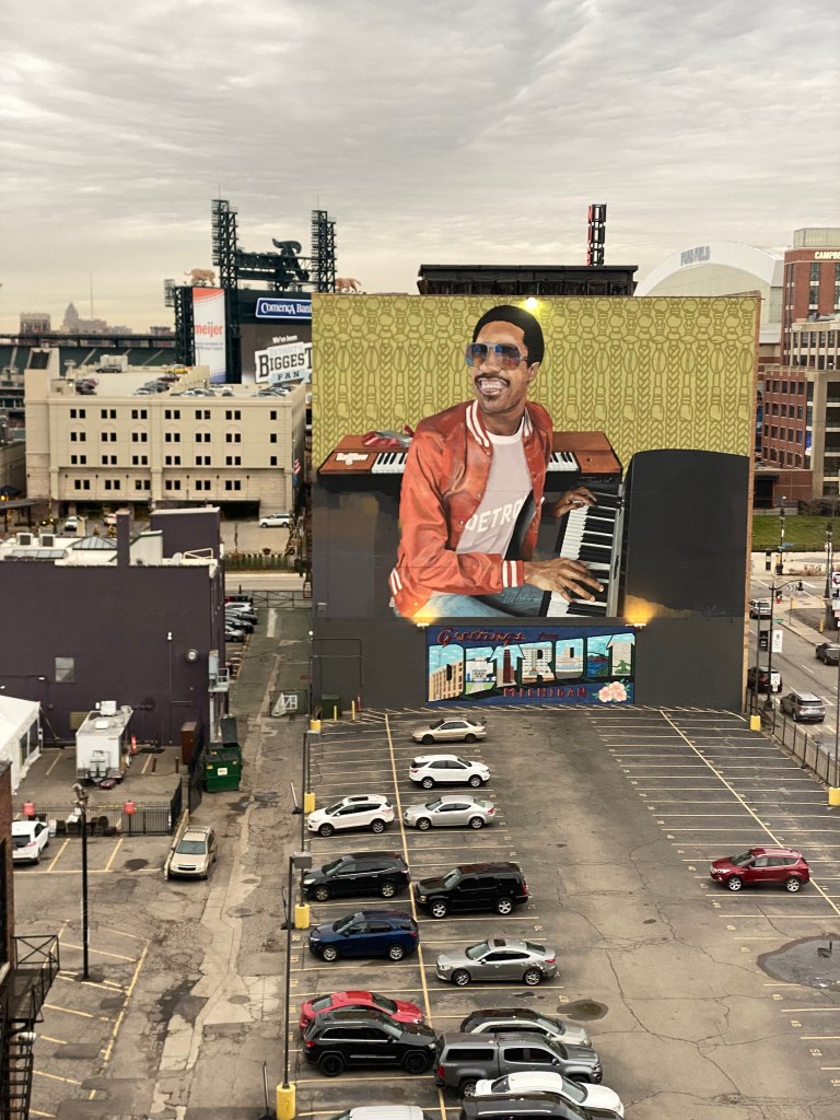
“Stevie Wonder” Richard Wilson @richardwilsonartwork(2019)
@streetartfromtheroad and @finearttourist traveled to Detroit (DTW) in early December to see the Van Gogh in AmericaExhibition at the Detroit Institute of Arts(DIA).This exhibition was originally scheduled for the summer of 2020 but was canceled due to the Covid-19 pandemic. Fortunately, the DIA was able to gain access to the majority of paintings scheduled to be part of the original exhibition. An upcoming post by @finearttourist will showcase this spectacular exhibition.
Of course, while in DTW we took full advantage of the good weather to explore the outdoor museum of street murals scattered throughout the Eastern Market District.In this post we will share some of the fantastic street art on display in the Eastern Market. Disclosure: some of the mural photographs have been edited to eliminate peeling paint and graffiti.
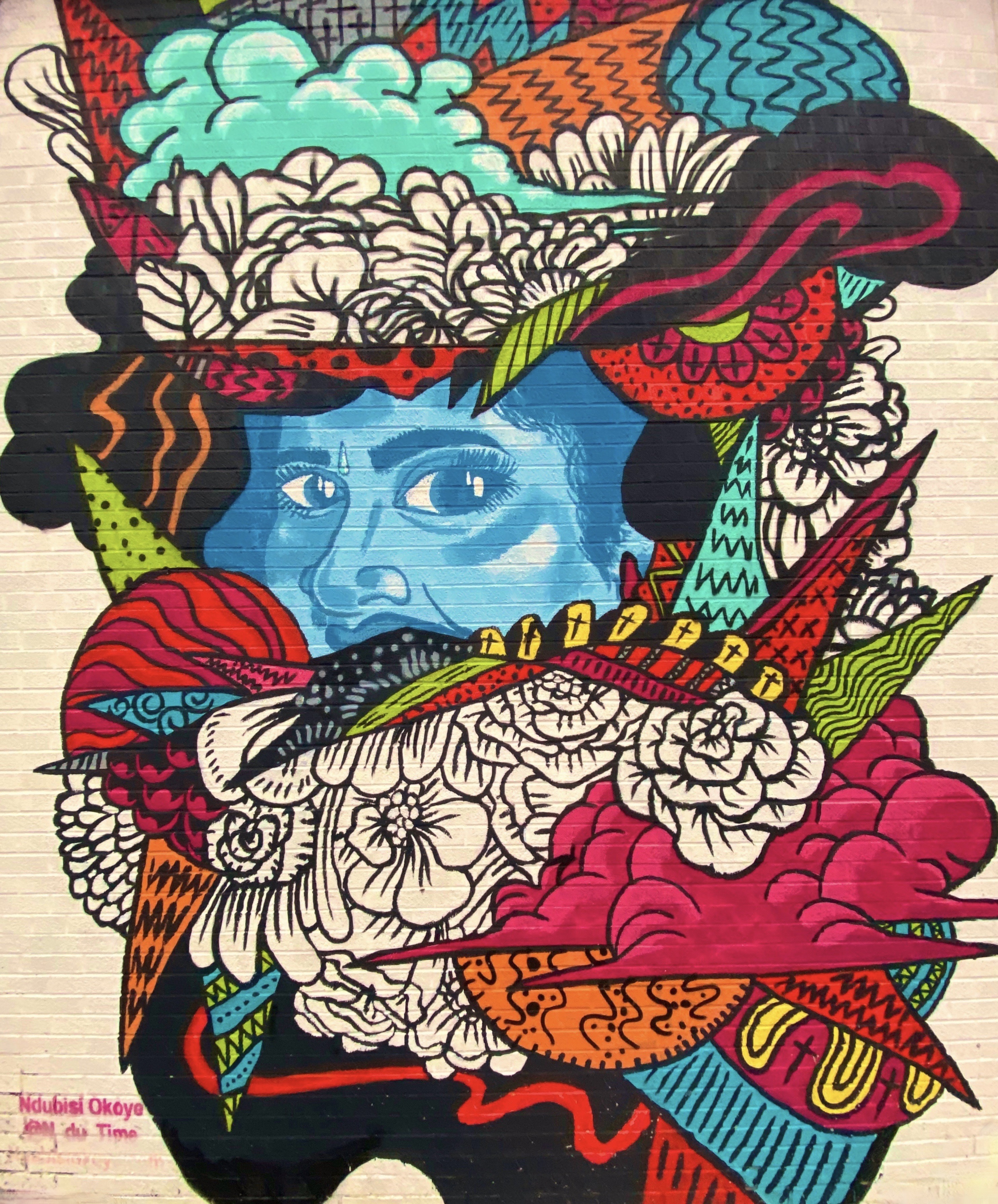
Ndubisi Okay @n_du_time
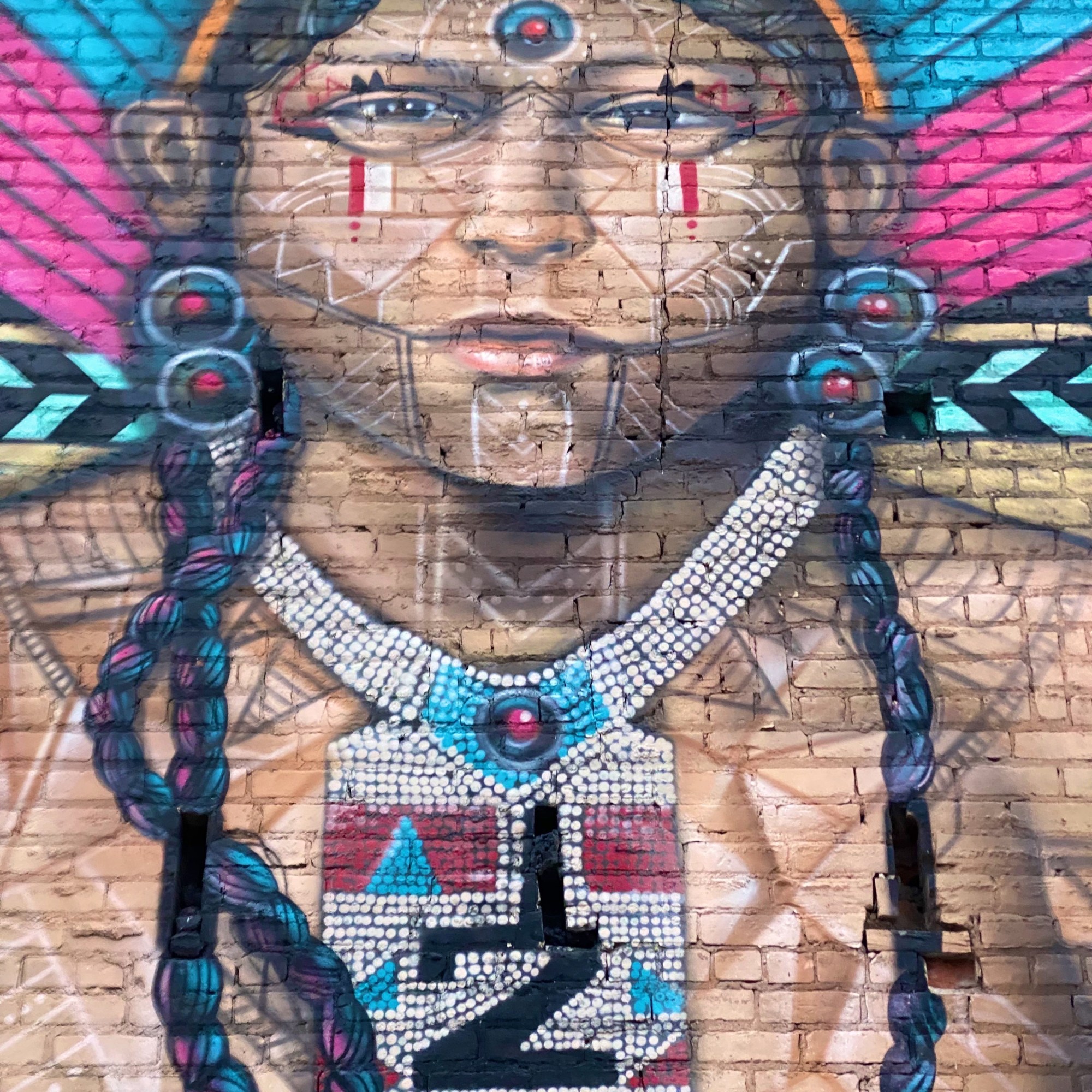
Brandan Mike Odums @bmike2c(2017)
“Dreamers” Jeff Soto @maxxer242 (2015)
The Eastern Market has been in existence for over150 years. After World War 2, the market became a major hub for food processing and wholesale food distribution. The market covers approximately 43 acres just north of downtown DTW.There are still 80 standing structures ranging from fully occupied to abandoned and decaying.
Today, the Eastern Market is the largest open-air flower bed market in the United States. Additionally, there are over 150 firms sellingmeat, spices, vegetables, jams and poultry. There are also a number of restaurants, bars and non-food retailers located within the market district.Lastly, if you are hankering for a corned beef sandwich, a pastrami sandwich or Detroit’s (in)famous “coney” this is the place to go.
Victor Quinonez @marka_27(2016)
Tylonn Sawyer @tylonn.j.sawyer(2016)
Ashley McFadden @mcfadden_ashley (2019)
Sydney G. James (A girl raised in Detroit) @sydneygjames(2017)
Enough SAID (Enough Sexual Assault in Detroit)
Tatiana Suarez @tatunga(2017)
The Murals in the Market (MM) organization has been actively supporting the transformation of the Eastern Market from a wasteland to a cultural destination within Detroit. The organization sponsors an annual mural festival in the Market District. To date, the organization has supported the production of 100 muralsin the District and 200 murals across the city. Additionally, MM supports a number of other arts events (including live music) throughout the year.We hope that this organization continues to receive support from the DTW community as part of the revitalization of DTW.
Arlin @arlin_graff(2017)
Birdman @ed_Irmen (2019)
Joey Salamon @joeysalamon (2019)
Osunlade(2019)
“Mama Maiz” by Ivan Montoya @imontoya_ (2019)
Sydney James (A girl raised in Detroit) @sydneygjames (2016)
Of course, a day of mural hunting requires sustenance. Fortunately, we were able to start and end our pic shooting at Anthology Coffee, which is located conveniently in the market. Anthology roasts their own coffee on the premises.Anthology Coffee.com | Always Tasty
In keeping with the meat packing history of the Market, our mid-day replenishment was taken at Franks’s Deli and Grill. We feasted on a Detroit staple – Wigley’s Famous Corned Beef!https://www.facebook.com/FranksDeliandGrill/menu/
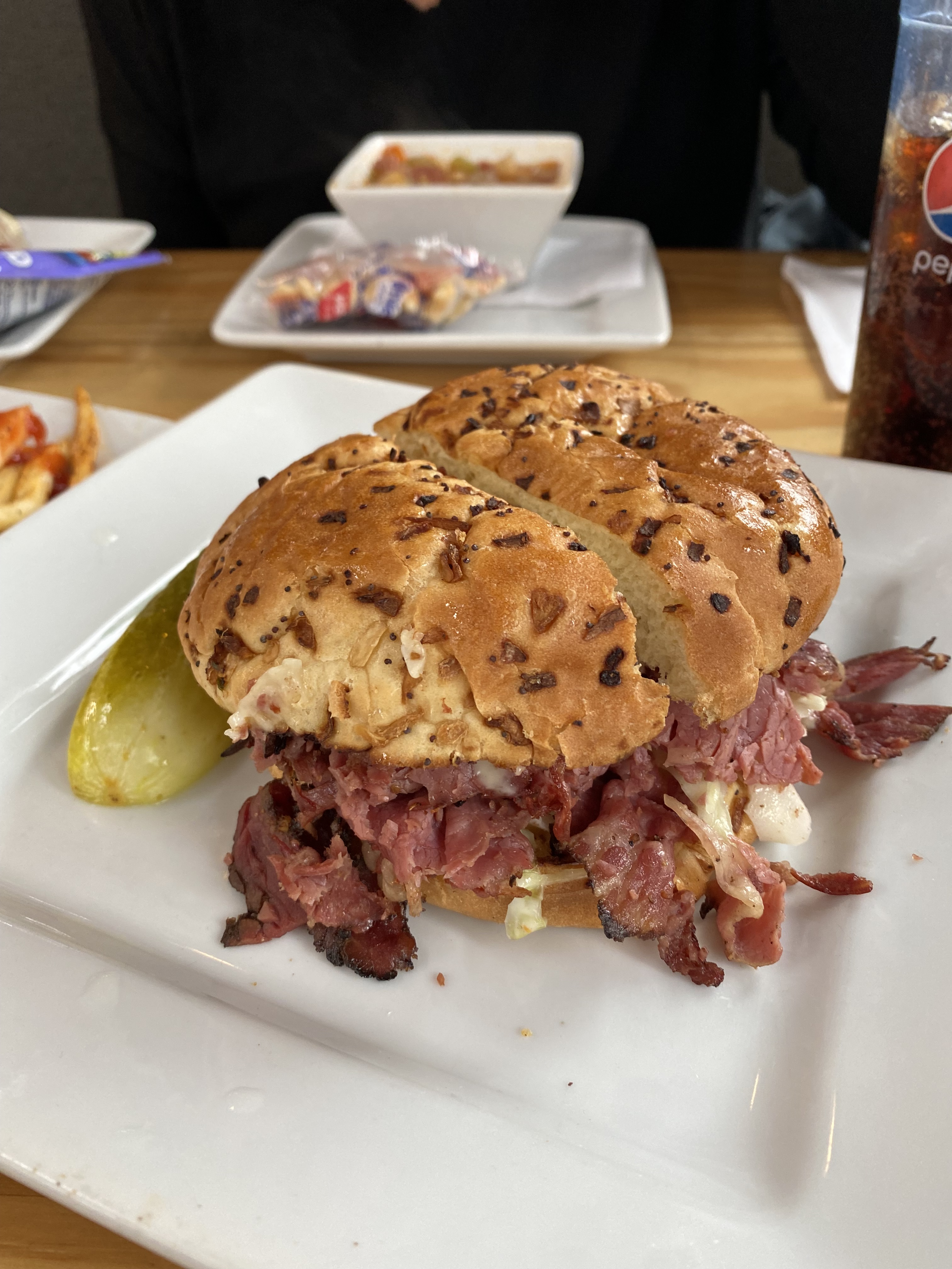
After completing the final portion of the Trans America Trail we traveled to Clarksdale to begin our exploration of the Mississippi Delta. Clarksdale is generally considered to be the home of the Delta Blues with an impressive roster of musicians calling Clarksdale their home in their early years (see previous post: Street Art from the Road: OTR 8.0: Part Two: Clarksdale Music and Artat http://www.ontheroadwithmariastephen.net.
Clarksdale boasts live Blues music every day of the year at one or more of the local blues clubs, bars or juke joints. The town itself is a bit hardscrabble but please don’t let that keep you away. Even if you are not a fan of the blues we think you will enjoy the live performances that take place at the various venues in town, all of which are very intimate and, you will hear the real Blues. Typically, you will pay $10 – $15 for a show that will run from two to four hours!
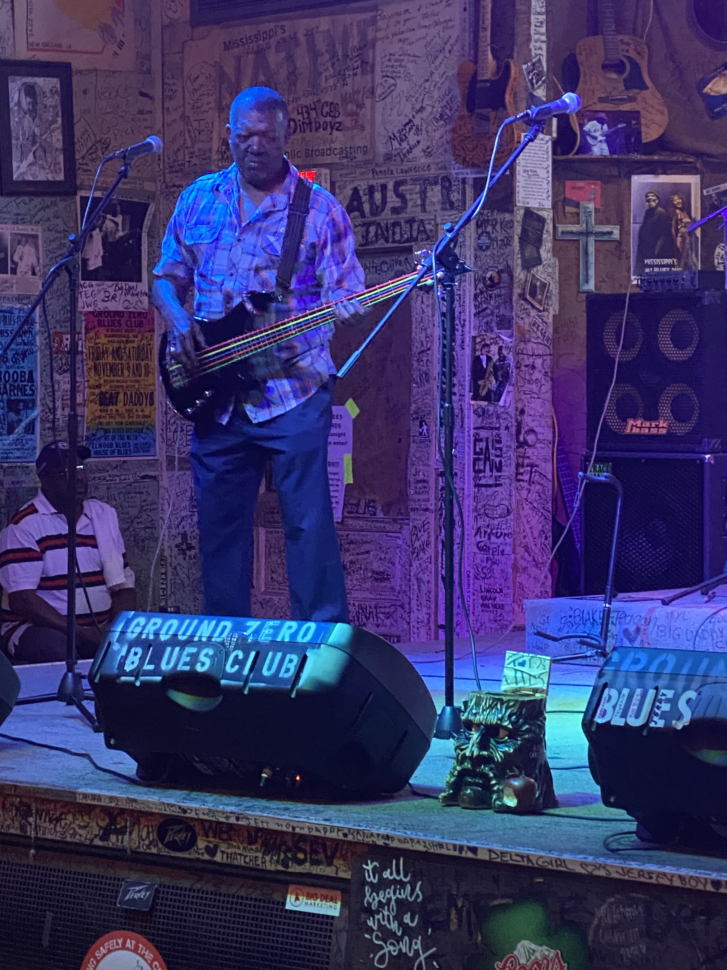
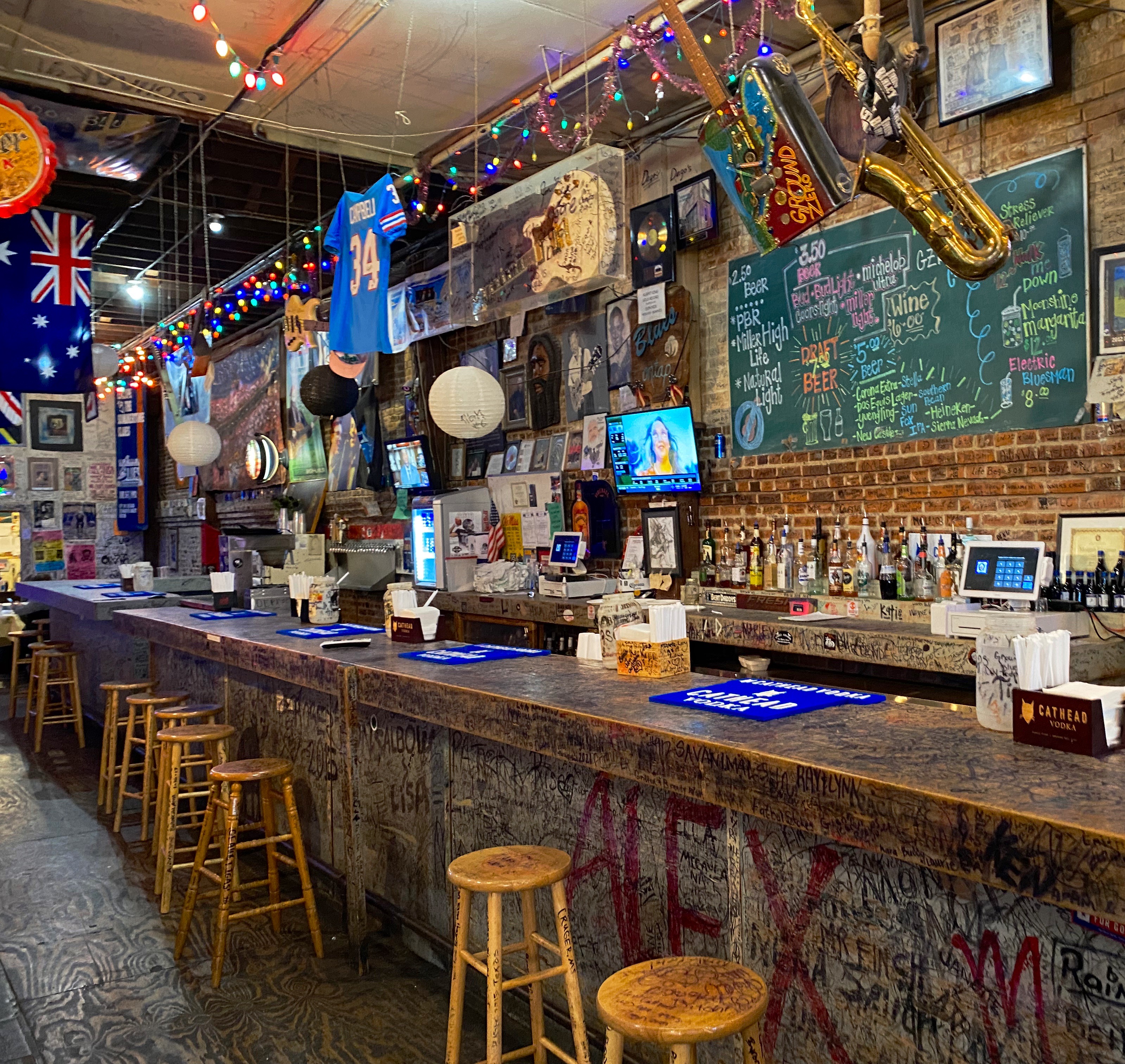
Ground Zero Blues Club
We opted to stay in an apartment above the Ground Zero Blues Club which is convenient-unless you plan on sleeping before midnight. We were in town to hear the Blues, so we figured it was all part of the experience.https://www.groundzerobluesclub.com/
Clarksdale is also home to the Delta Blues Museum. We spent a morning at the museum and learned a lot about the history of the Blues, the musicians and the Blues recording industry. There is a treasure trove of artifacts at the museum including musical instruments and performers’ stage costumes. We highly recommend a visit to the museum when you visit Clarksdale. We don’t have photographs to share with you as they are not allowed in the musuem.
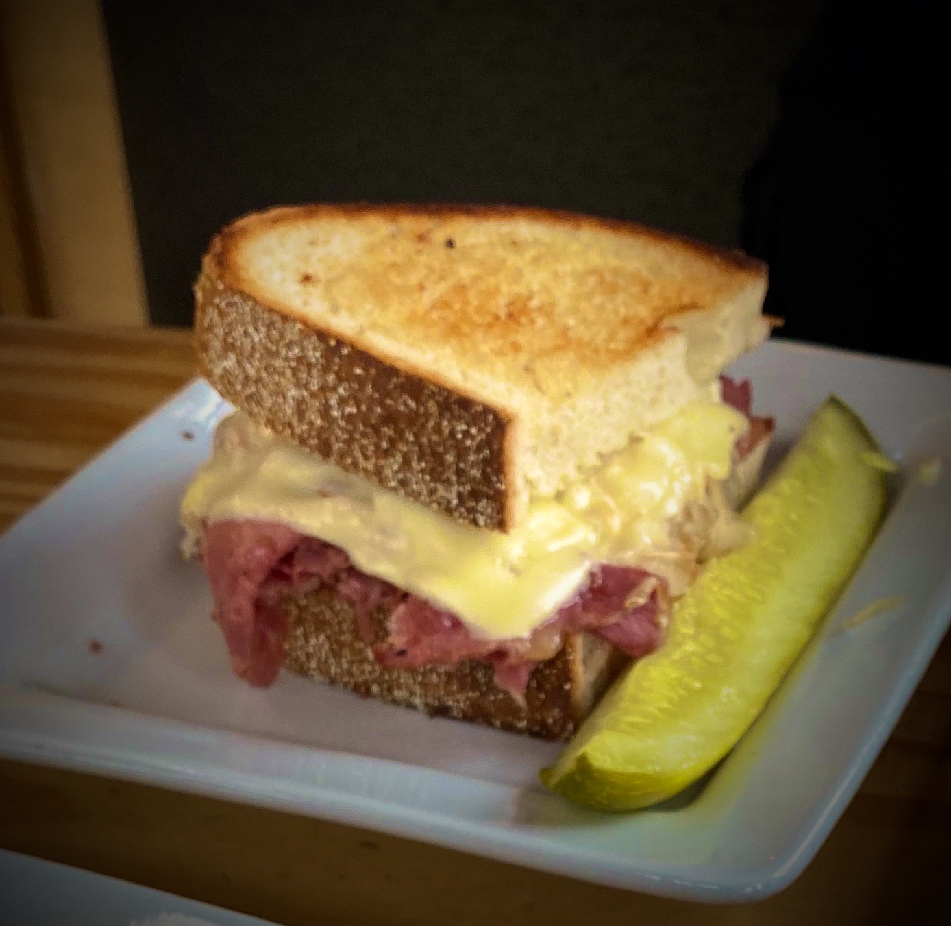
There are several excellent restaurants in town in addition to the customary BBQ. We highly recommend Hooker Grocery & Eatery which is a two minute walk from the museum.https://www.hookergrocer.comP.S. If you like pancakes make sure to try Our Grandma’s House of Pancakes.
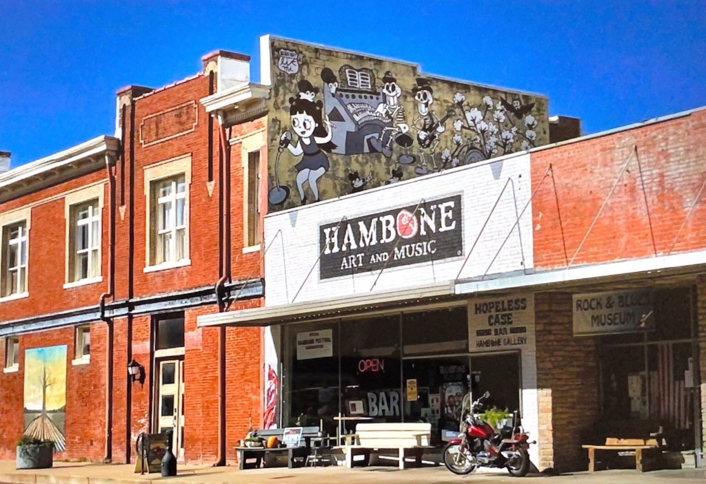
Last, but certainly not least, we recommend a visit to Hambone Art & Music. We popped into this gallery for a quick look around and then spent several hours with the owner Stan Street. He is a transplant to Mississippi and was a touring musician before settling here and focusing on his painting.
Stan bought a vacant building and converted it into his gallery in the front, his studio in the rear and his apartment above. He also operates a small bar in the studio and has a stage for musical performances. We really like his artwork and we were amazed to find out that he is largely a self-taught artist.
Greenville – do not, we repeat, do not get your car washed!
We visited Greenville after reading that there is a state park there with a hiking trail along the Mississippi and a 60 foot tall observation tower that provides fantastic views along the Mississippi River. WRONG! The park was turned over to Greenville and the town has not maintained the park other than the small boardwalk when you first enter the park. This was our first disappointment with Greenville.
As we were leaving town we spotted a self service car wash and pulled in to hose the van off – you may have noticed in our photographs the Beast is in perpetual need of a wash. Immediately, a man told me he was an employee and would wash the vehicle – a minute later another man showed up and informed me he was going to help wash the car and then a third man showed up to help wash the car.
At his point we knew we had a problem – none of these guys worked at the car wash and that this was a shake down. We were able to persuade the third manthat he was not going to get paid (although he hung around circling us). At that point, we told the two guys (taking turn hosing off the van) that we were good. The first of the gentlemen demanded $60.00 for the wash. We settled on a more reasonable amount and left town quickly.
Cleveland, or “fear the okra”
We stopped in Cleveland for coffee at Zoe Coffee. We met some nice folks at the coffee shop and learned that the coffee shop is affliated with Zoe Ministries, which focuses on providing clean water, orphan care, widow care, and education to communities in Kenya. https://zoeempowers.org/
Cleveland is also home to Delta State University. The mascot for the athletic teams is the Okra and the school chant is ”Fear the Okra!”. This is the best mascot and chant we have ever encountered! Look for DSU merchandise by the pool this summer. P.S. The men’s baseball team went 32-15 this year and is currently in Florida for the NCAA Division II regional tournament.
Vicksburg, or, it’s all about the war , no wait, it’s really all about the river
Vicksburg, MS is undoubtedly best known as the site of a major Civil War Battle which was a turning point in the war in favor of the Union.We were keen on visiting the Vicksburg National Military Park (VNMP) to gain a better understanding of this historic battle and see the battlefield.
The Mississippi River was a critical supply route for the Confederacy.Vicksburg sits on a bluff high above the eastern side of the riverand was heavily fortified with artillery to stop Union forces from cutting off this essential supply route. The Union forces knew that taking control of the river would seal the defeat of the South.
After several failed Union attempts to take Vicksburg, General U.S. Grant laid seige to Vicksburg. Grant surrounded the city with over 77,000 troops. The 29.000 Confederate troops dug in to defend the city. Confederate attempts to break through the encircled cityand resupply the soldiers and citizens failed. After 47 days, with all food and water supplies exhausted, the troops and citizens surrendered; the mighty Mississippi was under Union control. For additional information: https://www.nps.gov/vick/index.htm
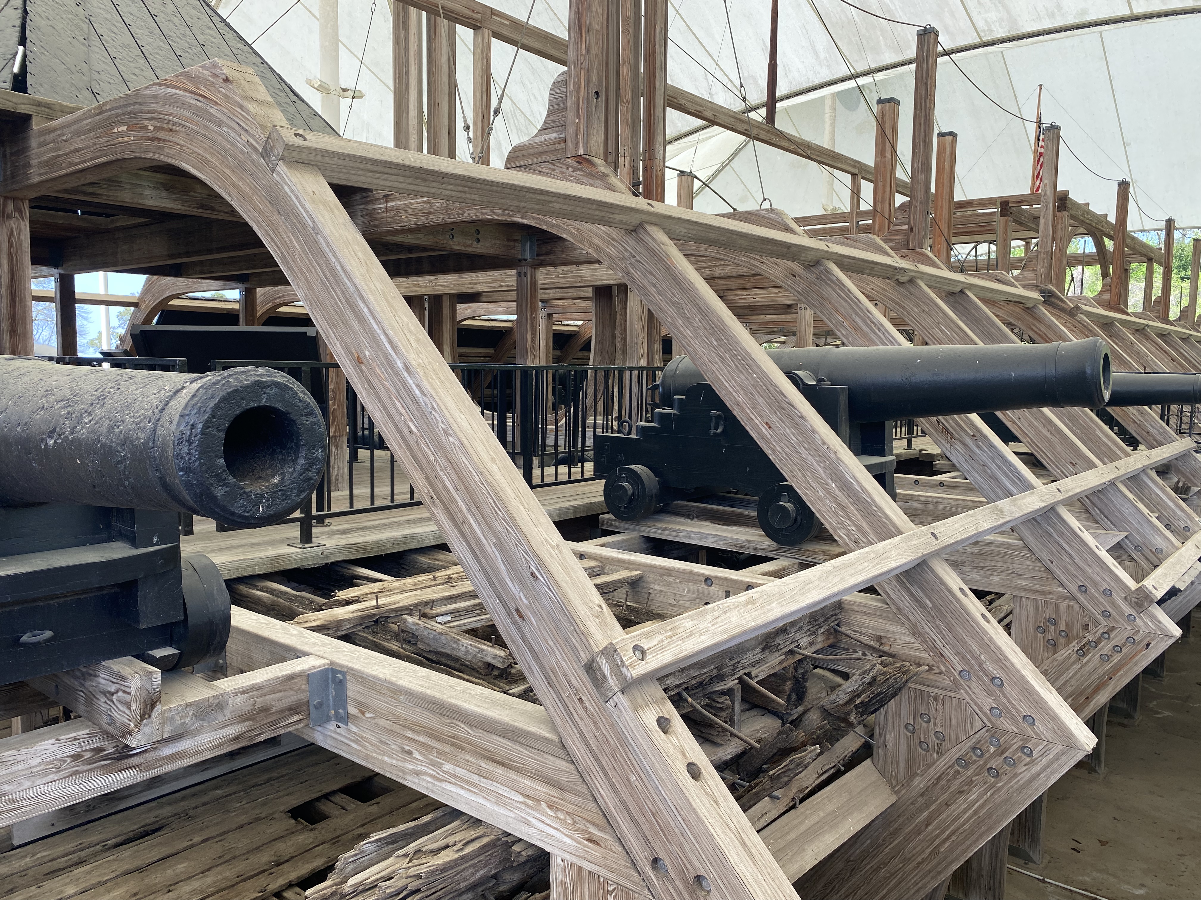
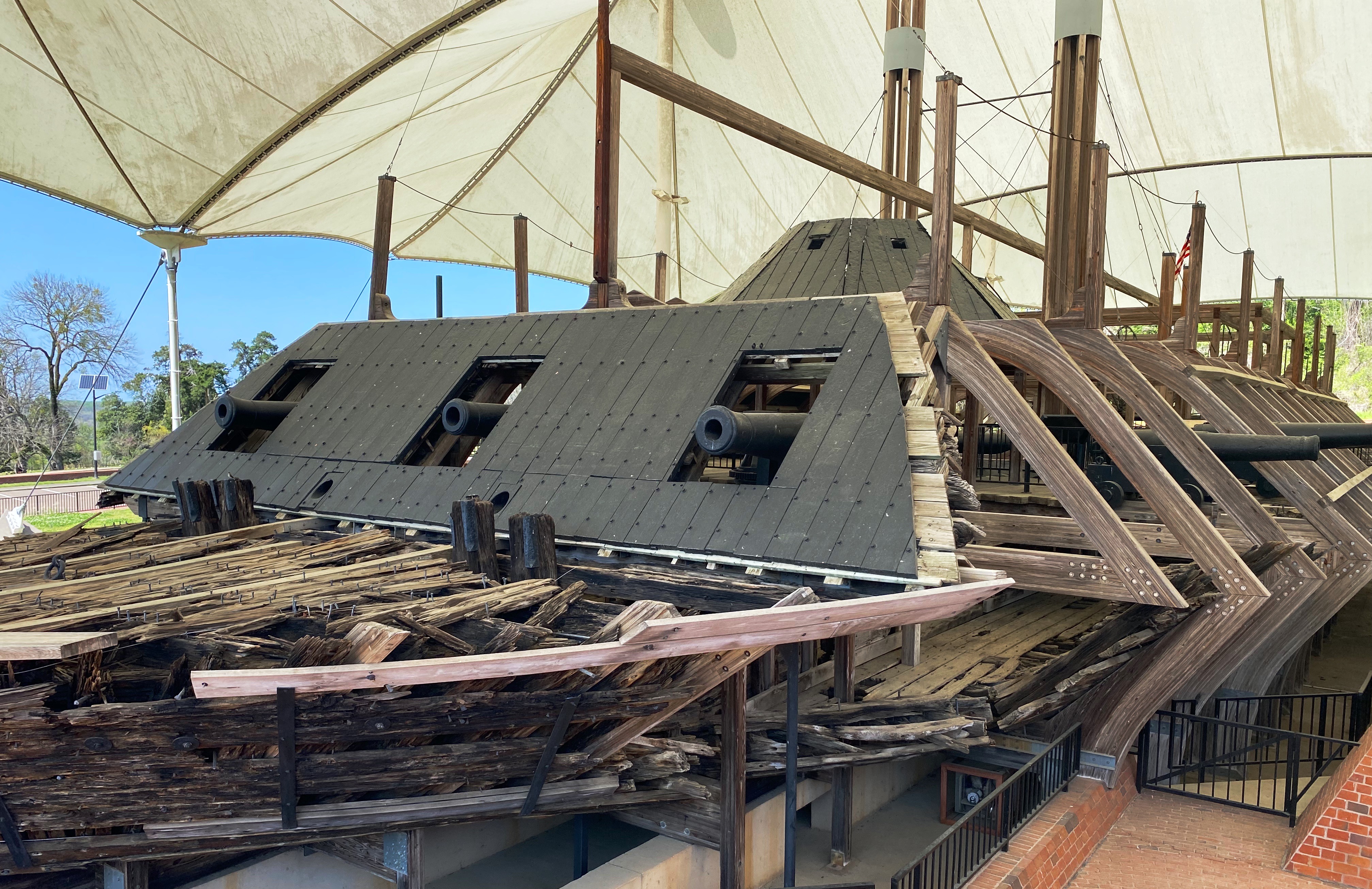
In addition to the battlefield, there is a museum in the park which includes the remains of the Union ironclad gunboat USS Cairo. The Cairo was sunk by Confederate torpedos seven miles north of Vicksburg. It slipped back into the river after being beached and abandoned. Over 100 years later the ironclad was raised, restored and given to the National Park Service. For additional information: https://www.nps.gov/vick/u-s-s-cairo-gunboat.htm
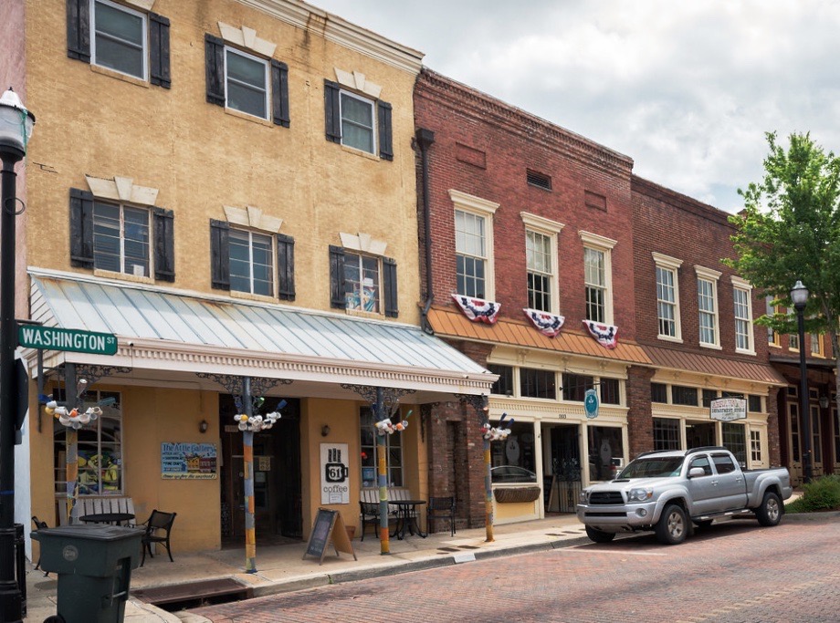
Historic downtown Vicksburg is perched above the river south of the main artillery emplacementsand battlefield. A number of excellent restaurants, rooftop bars and art galleries can be found there. The Jesse Bent Lower Mississippi River Museum, managed by the US Army Corps of Engineers, is on the waterfront and worth a visit.
The Mississippi River is still a vital supply route for the US economy. The Corps, one of the largest employers in the area, is responsible for commercial navigation, flood risk management and environmental stewardship.
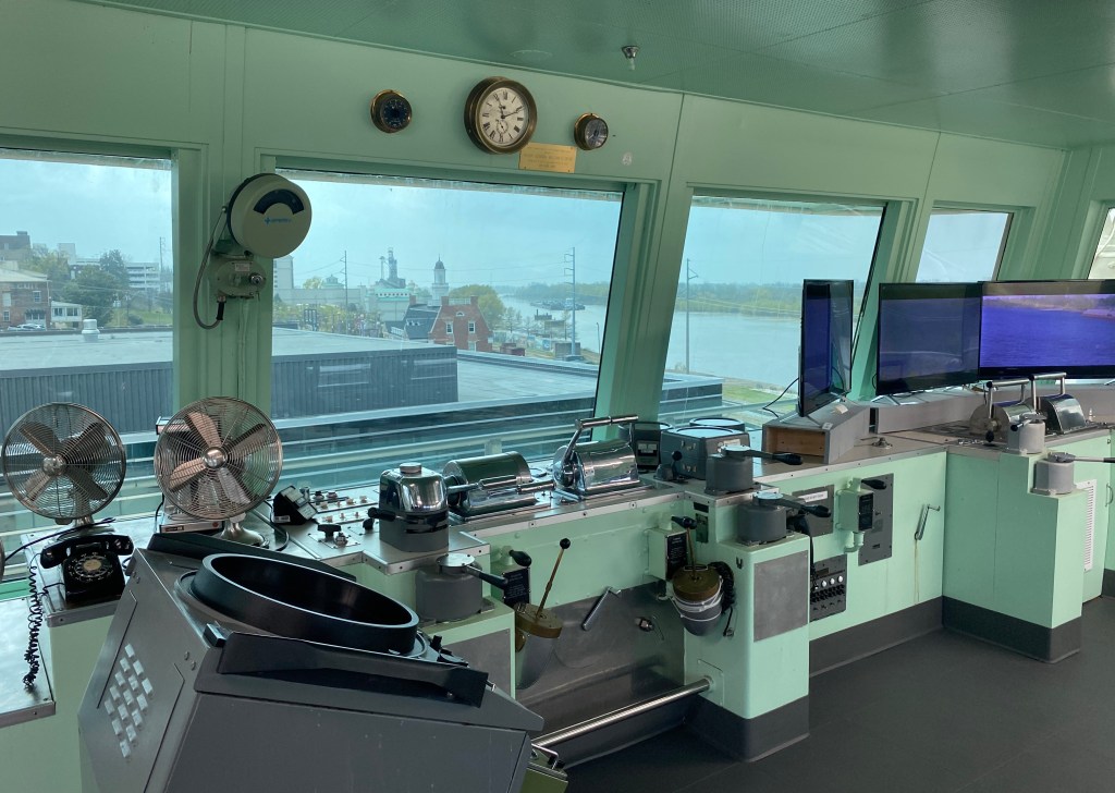
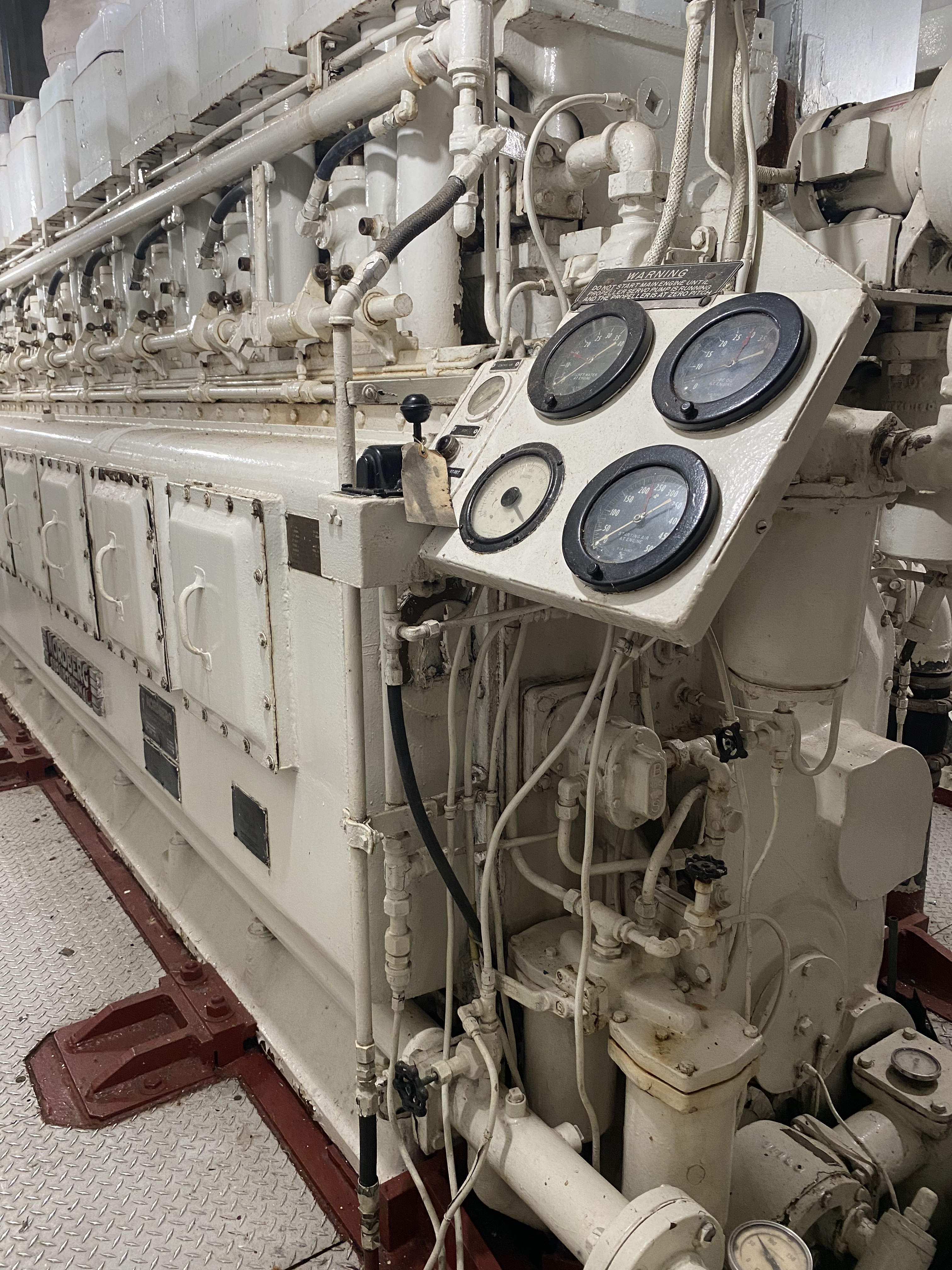
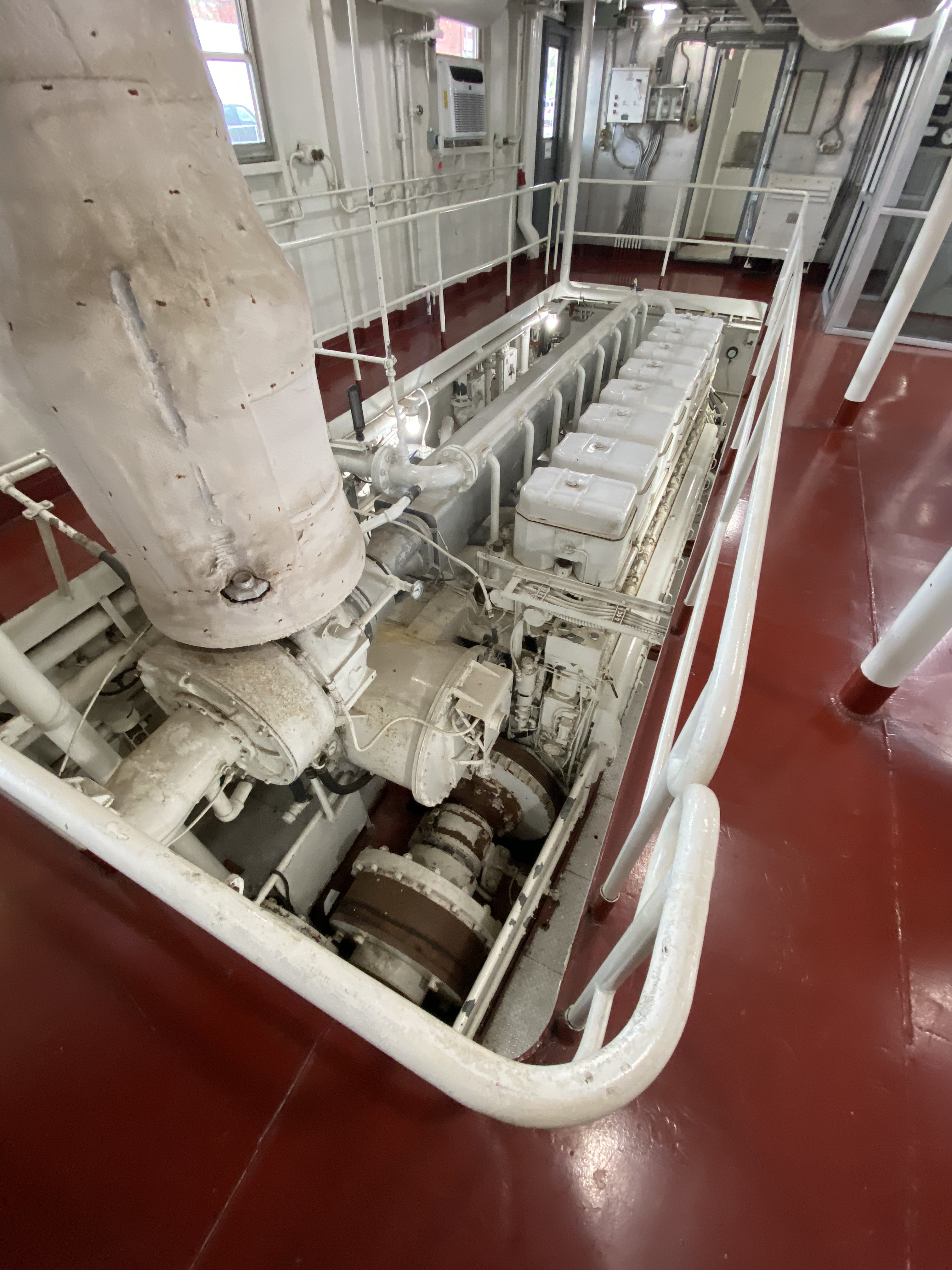
A visit to the museum also includes the opportunity to tour the retiredM/V Mississippi IV. The Mississippi IV was a tow boat used by the Army Corp from 1961 until 1993 when it was retired.
M/V Mississippi IV (Photo courtesy of Army Corp)
Our endless search for good coffee and tea took us to Highway 61 Coffee House in downtown Vicksburg. Highway 61 is a local coffee house with a cast of characters. We immediately ingratiated ourselves with the owner Daniel Boone – yes! – and his cohorts by making a donation to their poporn machine fund.
When Daniel Boone and his friends are not serving or drinking coffee they are the leaders of a local art movie house and amateur theater company. The popcorn machine that they have been utilizing for the last 14 years (on loan) for movie nights is going to be taken back by the owner.
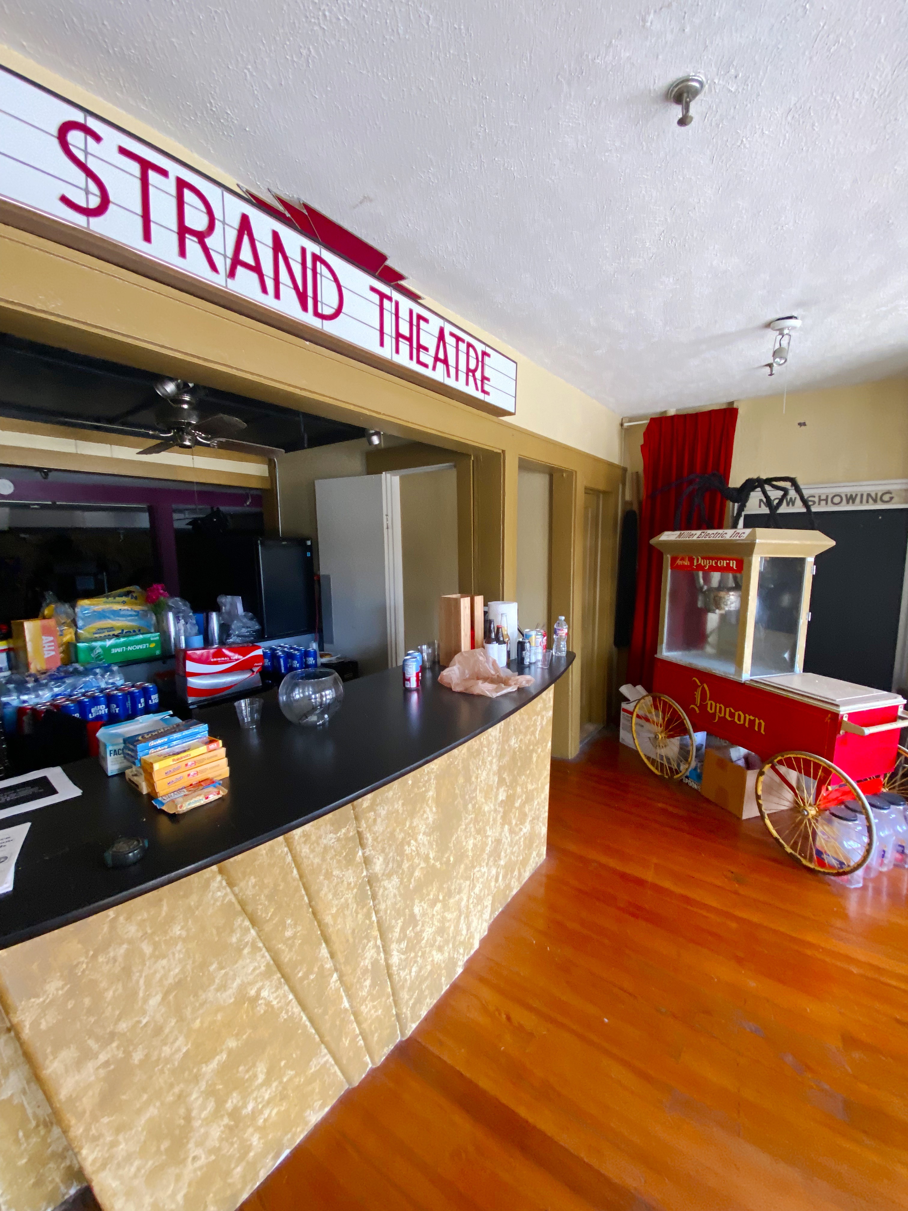
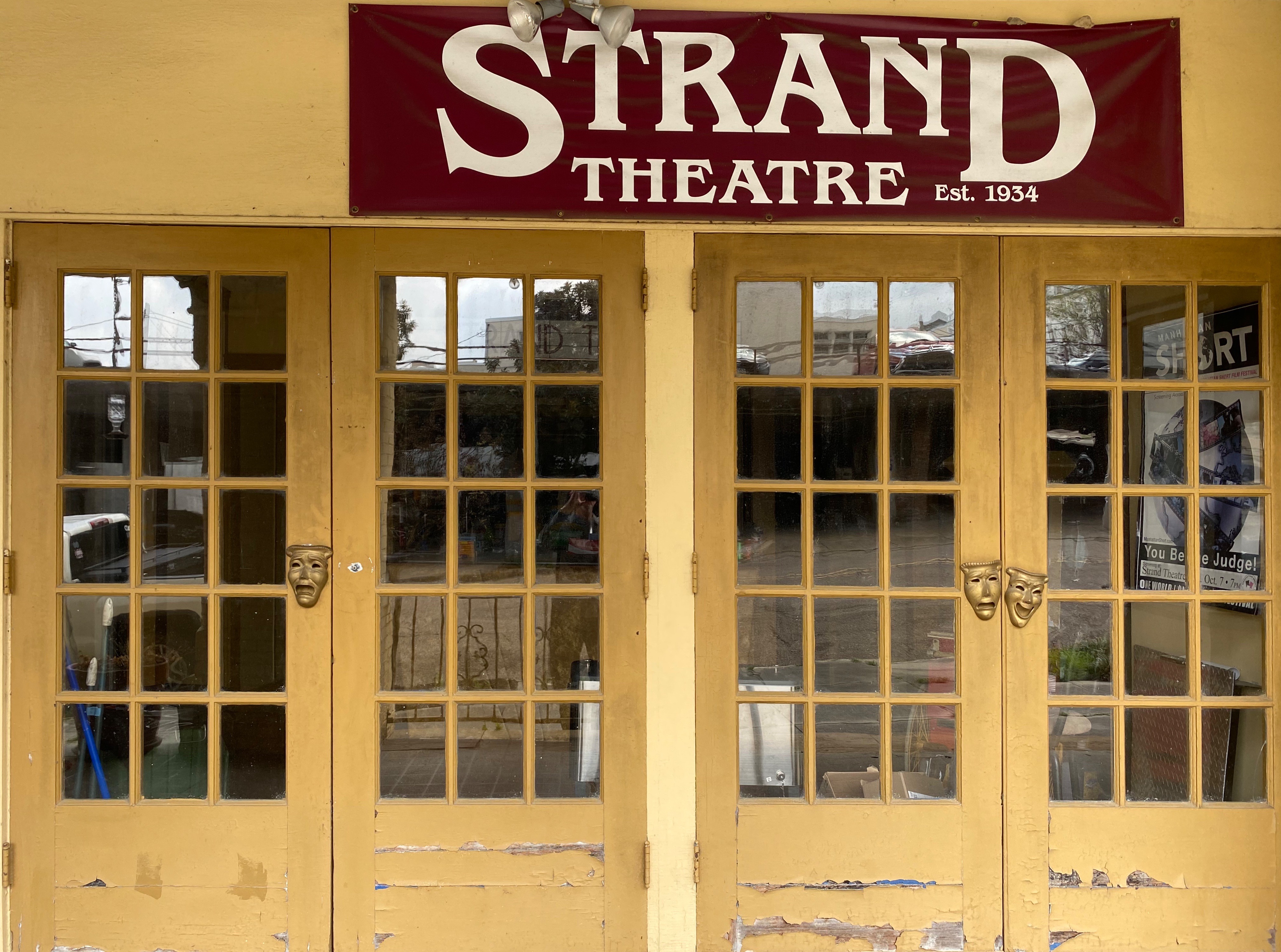
Our donation to the fund earned us a private guided tour of the Strand Theaterwith Jack Burns – a board member and coffee shop regular. The Strand was a movie theater until it closed in 1963. The building remained vacant for a number of years until the theater group struck a deal with the owner to lease the facility for both live theater performances and screening movies. The interior was renovated by volunteers from the community who were very interested in having an opportunity to see art house movies and community theater. An excellent history of the building can be found at Urban Decay: https://worldofdecay.blogspot.com/2011/04/strand-theatre-vicksburg-mississippi.html Strand Theater: http://www.strandvicksburg.com/
While we might attempt to live on coffee, tea, and wine, we are reasonably certain that as pleasant as that scenario sounds it would not work in the long run. So, we went in search of victuals during our Vicksburg visit and found a gem just outside of downtown. The Tomato Place started as a roadside produce stand and evolved into a restaurant and mercantile in addition to a produce stand- all still sitting roadside in a collection of colorful shacks. The Tomato Place is a must when you visit Vicksburg. For more information: https://www.onlyinyourstate.com/mississippi/you-havent-lived-until-youve-tried-the-blt-from-the-tomato-place-in-ms/
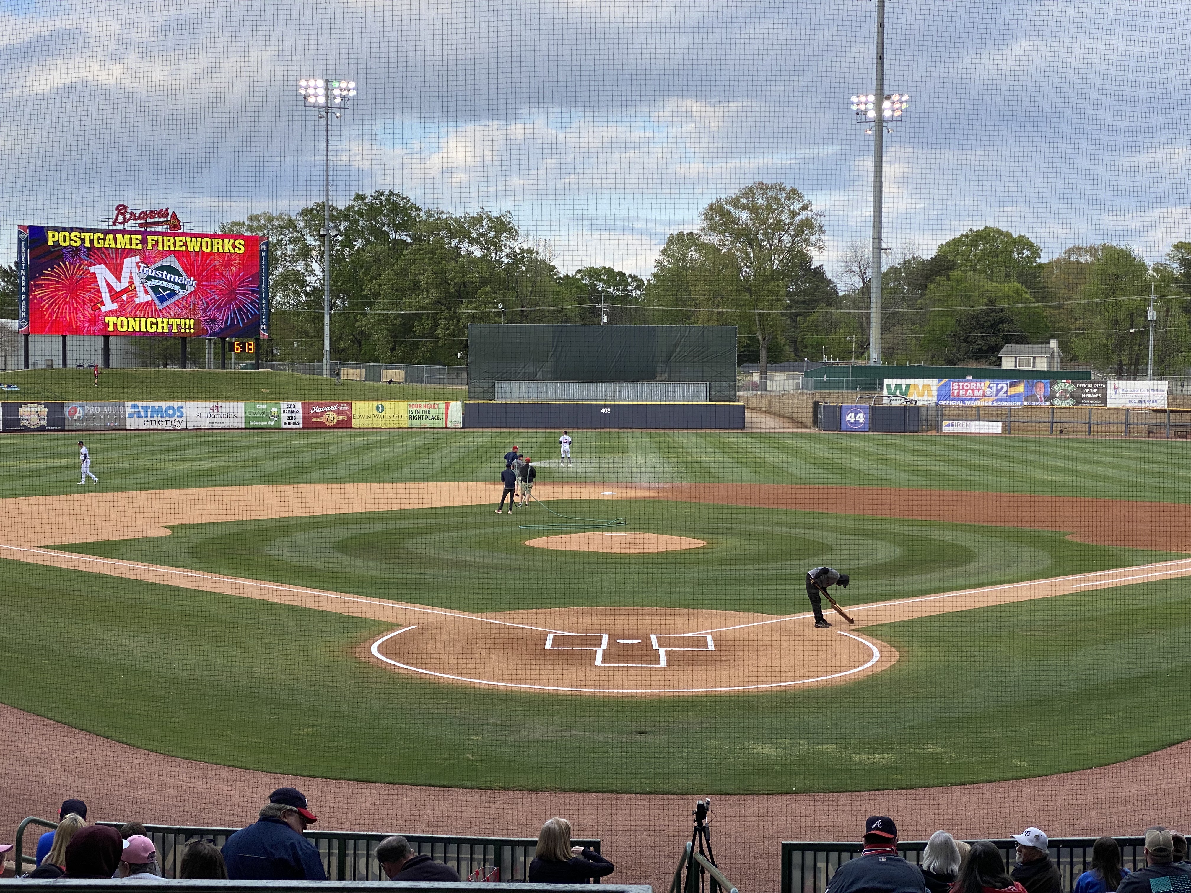
Jackson, or hello, art minton
While in Vicksburg we decided to pop over to Jackson to see some minor league baseball. Jackson is home to the Mississippi Braves – the Double A affliliate of the Atlanta Braves. It also gave us the excuse to listen to the Johnny Cash – June Carter Cash version of the song Jackson for the entire ride from Vicksburg to Jackson. “We got married in a fever. Hotter than a peppered sprout. We’ve been talking bout Jackson ever since the fire went out. Oh, we’re going to Jackson.” Dang, that’s goodmusic!!
The Natchez Trace runs just north of Jackson. We have driven the majority of the Traceduring the course of several trips through Mississippi but had never done any biking as part of our travels along the Trace. Jackson provided a great opportunity to do so as the Chischa Fokka Greenway runs parallel to the Trace for a number of miles. It’s a great trail that cuts through Pine stands and farmland as you head north from Jackson.
ChischaFokka Greenway
We enjoyed our brief stay in Jackson with the added bonus of meeting @art.minton. Art is a fellow van adventurer who lives in Jackson and we follow each other on Instagram. He spotted our van while we were leaving Pig and Pint after having just finished dinner—Serendipity—Very cool!
The road to Rodney
We decided to visit Rodney after reading an interesting article in Mississippi Folk Life about efforts by a local organization to preserve the remains of Rodney. The town was once a thriving Mississippi River port city. Migration from Rodney started in earnest after 1870 – Rodney had been bombarded during the Civil War by Union gun boats, enslaved individuals were emancipated and left the cotton plantations and finally, the course of the river shifted two miles west and Rodney was no longer a port city. For an excellent history of Rodney: http://www.mississippifolklife.org/articles/haunted-by-a-ghost-town-the-lure-of-rodney-mississippi
Getting to Rodney takes a bit of work. The only road to Rodney is a bumpy and muddy dirt road affair but you know we never say no to the chance for a bit of mud on the fenders.
On our way to Rodney we drove through Port Gibson. Like many other southern cities during the mid-twentieth century, Port Gibson’s elected leaders and businesses were still fighting against integration and equal rights for Black citizens. That eventually led to the Boycott of 1966. The photo below from a mural in town depicts the demands. ‘Nuff said!https://mississippiencyclopedia.org/entries/port-gibson-claiborne-county-civil-rights-movement/
We also happened on the Windsor Ruins after departing Rodney. The Ruins was an antebellum Greek Revival Mansion built (by enslaved African-Americans) for a wealthy cotton planter and his wife. Today, 23 of the Corinthian coloumns are still standing. The mansion survived the Civil War (the owner did not) but burned in 1890. It was the largest Greek Revival home in Mississippi. Today it is an historic site and there are plans to complete some restoration of the columns and the grounds. For more information: https://www.mdah.ms.gov/explore-mississippi/windsor-ruins
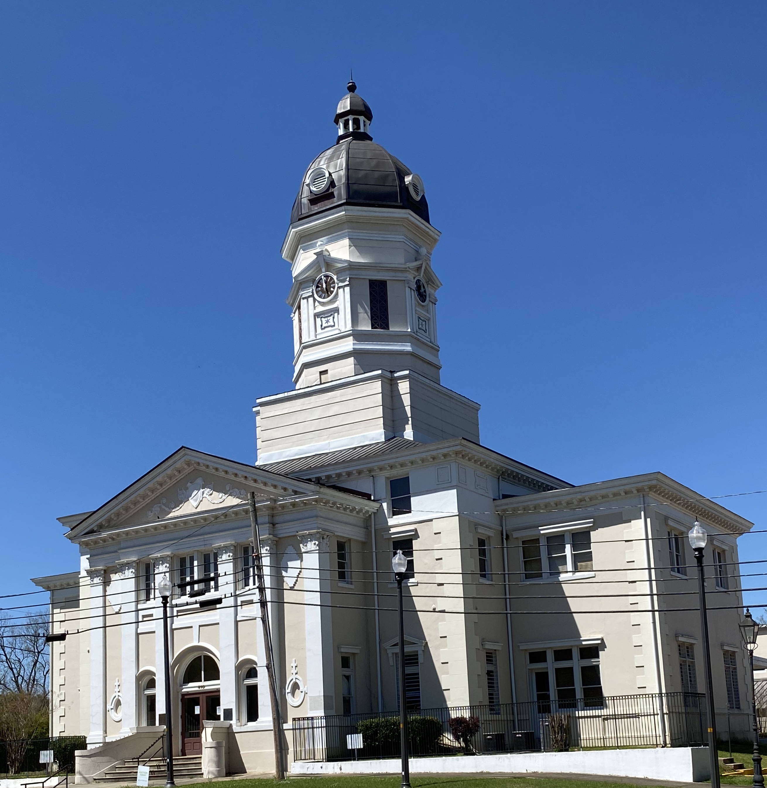
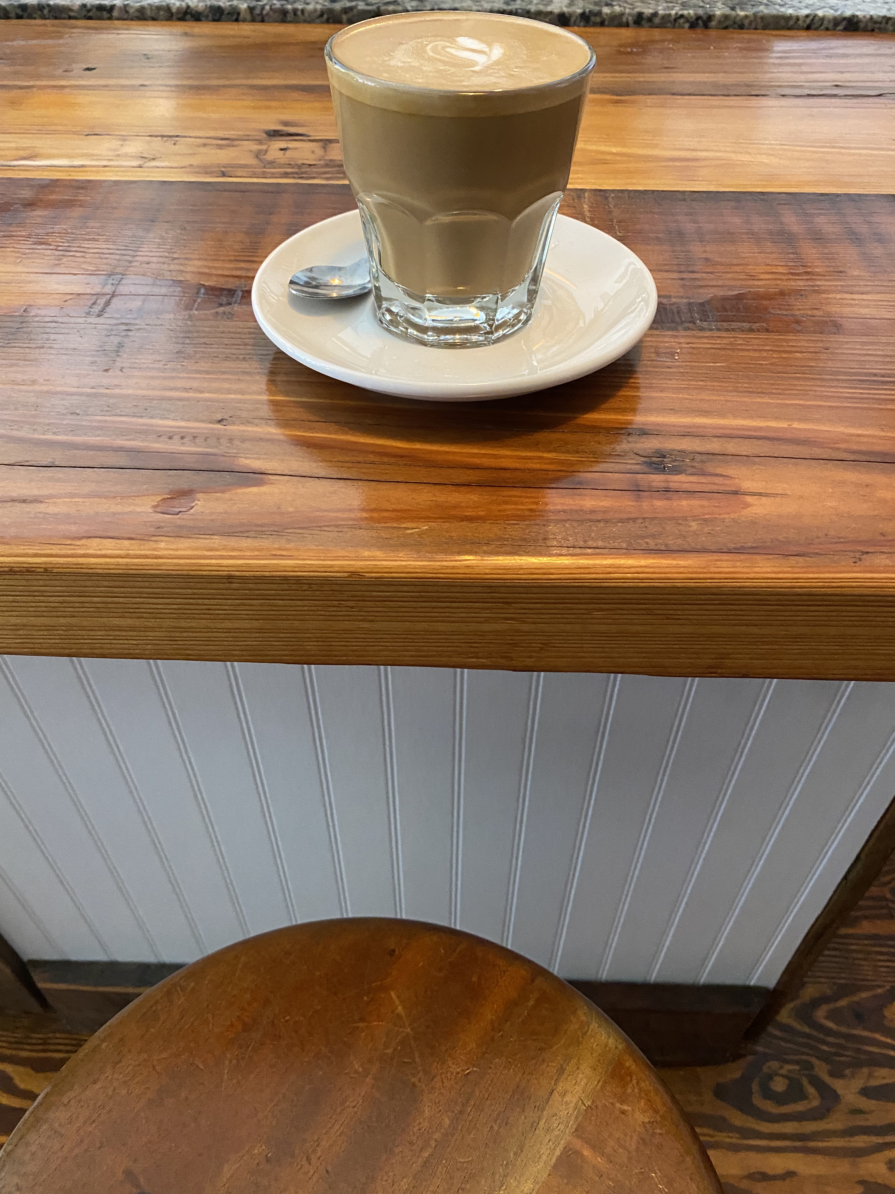
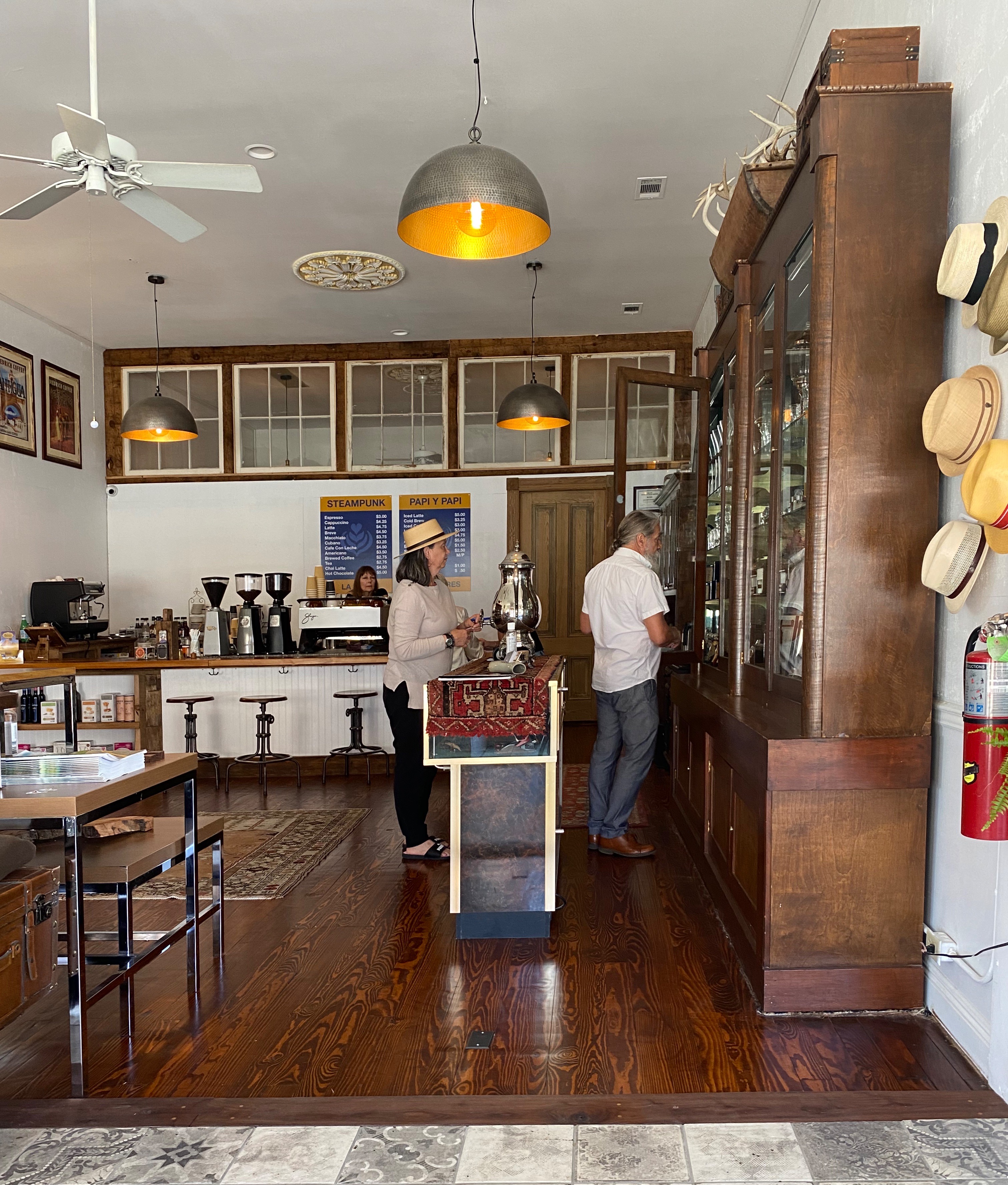
Natchez —— Steampunk anyone?
Natchez was our final stop before crossing the Mississippi into Louisiana. First stop, as always, was for espresso and tea and our research pointed to Steampunk. There we met Dub Rogers, the owner of this unique establishment. Dub Rogers was born in Mississippi but spent 30 years living and working in NYC in a variety of businesses.
Steampunk represents an amalgamation of Dub’s many interests. The shop and haberdashery sells fine cigars, coffee, tea, chocolate, conservas, mixology gear and hats (see Maria’s newest addition above) of which Dub has endless knowledge. Dub is a great host – and we almost forgot to mention that he personally renovated the handsome space that houses his boutique department store, apartment and patio.
Natchez dates back to 1716 when French traders built a Fort on the bluff overlooking the Mississippi. The French settlement came to an abrupt end when the Natchez Indiansattacked the fort, killing several hundred people and enslaving a number of women and children The surviving French left the territory toute suite.
Future President Andrew Jackson built a trading postnear Natchez in 1789. The trading post traded in African-American slaves. This set the course for Natchez to become a hub for slave trading – one of the most active in the South.
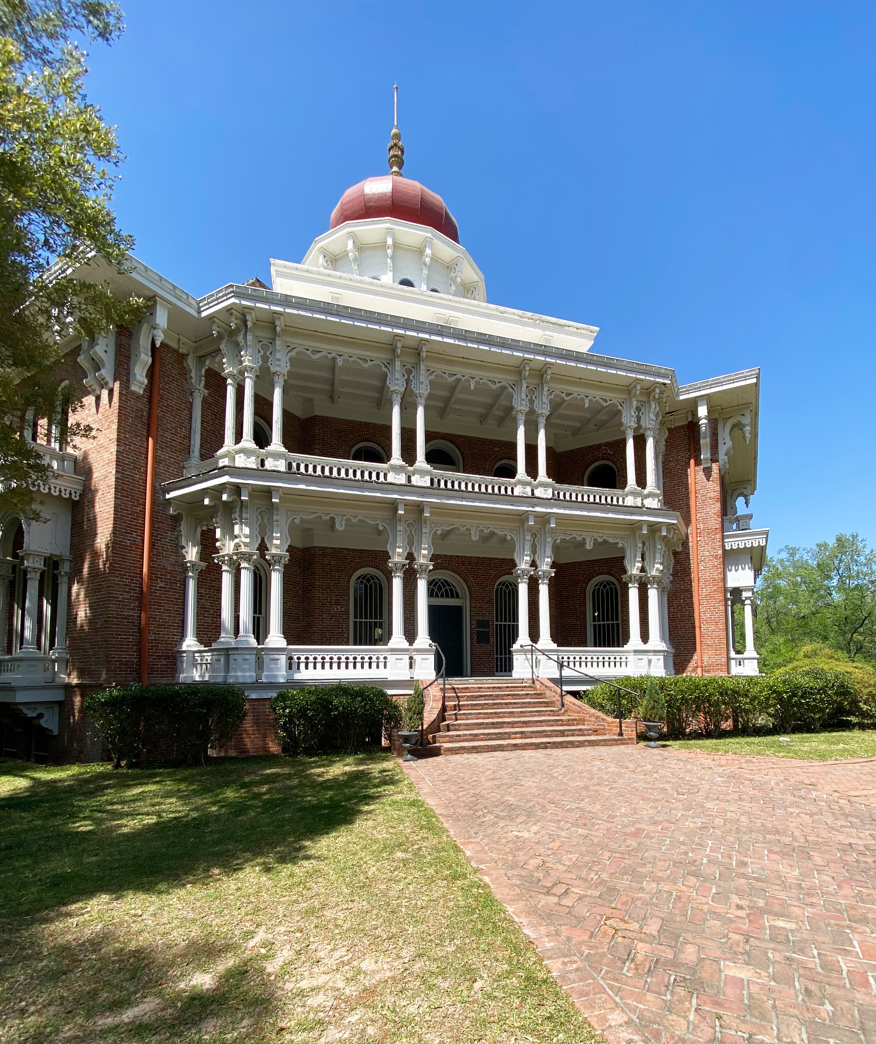
With the wealth accumulated from the slave and cotton trade Natchez became one of the wealthiest cities in America prior to the Civil War. Today many of the lavish antebellum homes are still standing and open for touring. Because Natchez was prized by both sides due to its location, the Union forces did not destroy it when they occupied the city.
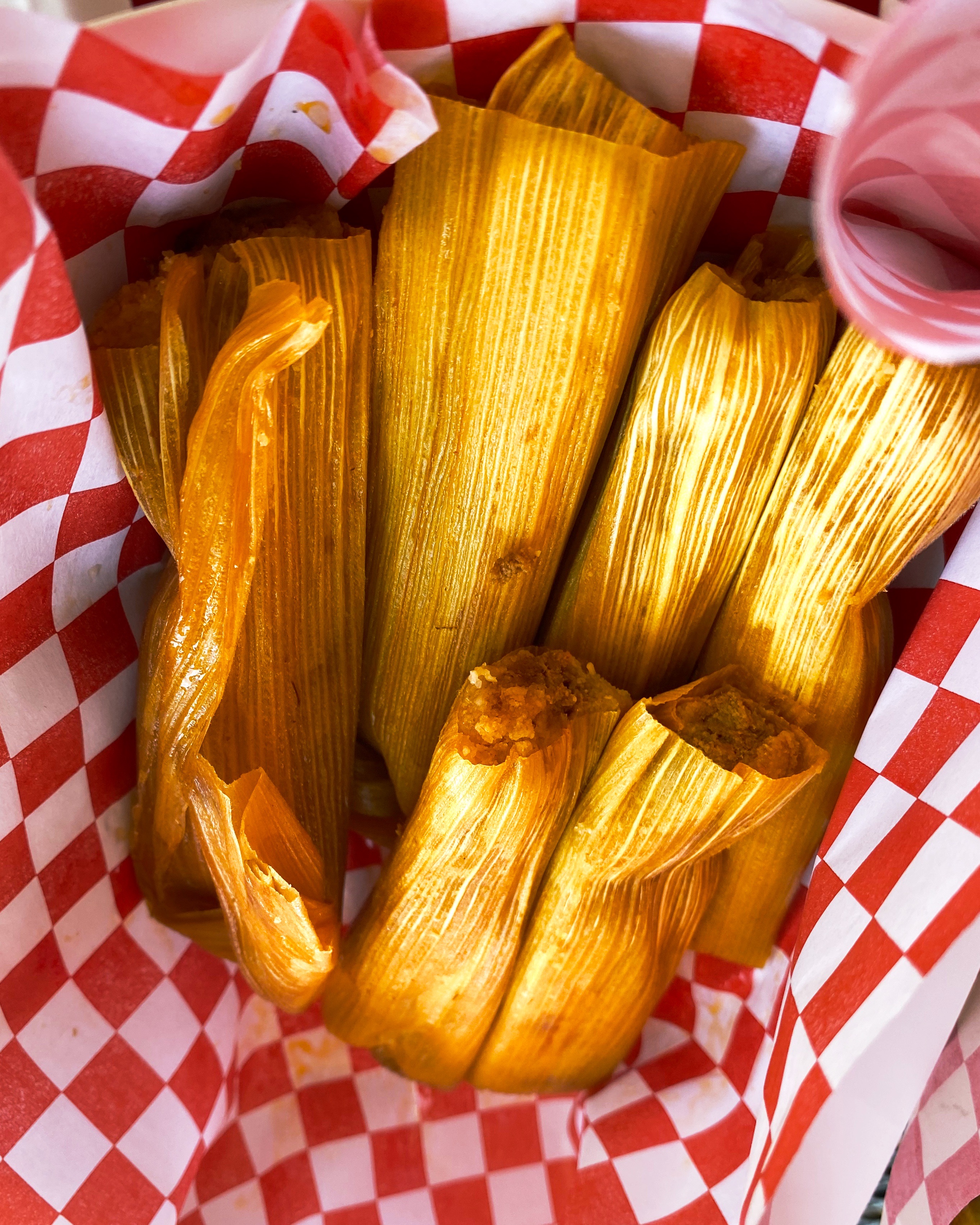
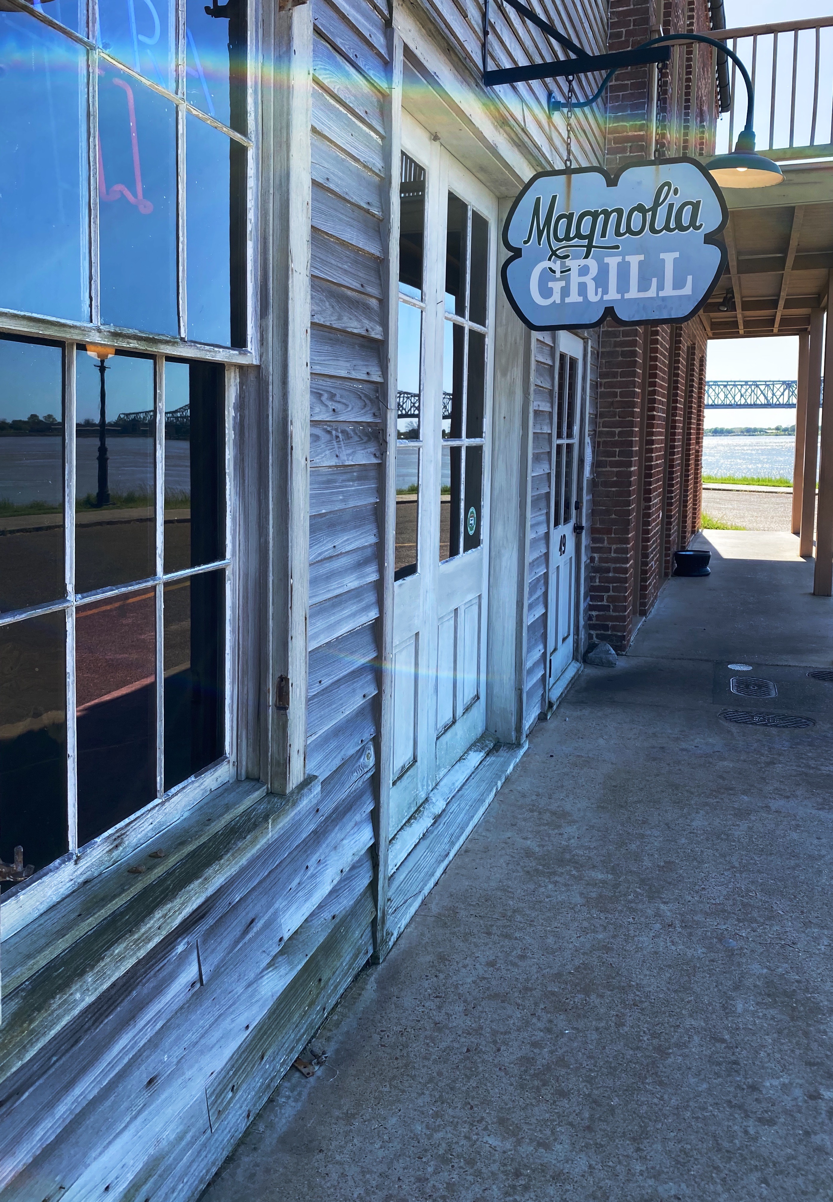
You now know where to go for all your caffeine needs in Natchez. Here are a couple of suggestions for dining: Magnolia Grill, located in the Under-the-Hill section of town down on the river (formerly the vice district of town); and Fat Mama’s Tamalesis the spot for excellent tamales.
Our final foray in Natchez was visiting one of the decidely less glamorous antebellum homes in Natchez. The house is named Longwood but also derisively as Nutt’s Folly. Haller Nutt was a wealthy plantation owner who had an octagonal house designed for him and his family. The house, if completed, would have had 32 rooms.
The outbreak of the Civil War ended the construction of the home as Nutt’s financial position tumbled. Even if he had the funds to continue, work would have stopped because the majority of the craftsman completing the finish work were from Philadephia – they returned to the North as soon as the war began.
The family moved into the basement (originally designed for the house slaves). Nutt died in 1864 and his wife and children hung on to the house for many years with the help of friends and several wealthy relatives. The Nutt family sold the home to the Pilgrimage Garden Club of Natchez in 1968.
The photograph below shows the fingerprints of one of the enslaved individuals who worked on the construction of the home. The Nutt family owned 800 slaves prior to the demise of the family fortune.
Fingerprints of enslaved individual
We hope you enjoyed our final installment regarding our Mississippi exploration, thanks for reading.