Day One: We flew from London (LHR) to Copenhagen (CPH) on British Airways – just a 90 minute hop. As with London we opted for a centrally located citizenM Hotel at Radhuspladen. After checking in at the hotel we walked around the historic inner city for a couple of hours before finishing our first day at the K Cocktail Bar.
Day Two: we walked to the La Cabra cafe on Montegarde. La Cabra is one of our favorite coffee roasters in the world. Having the opportunity to visit their Copenhagen location in person was quite exciting. In the past we have had to settle for buying their coffee and having it shipped to the U.S. (They now have a NYC location but it is just not the same as visiting a location in Denmark.).
The museum chronicles the lives of five individuals in occupied Denmark during Word War II. Some of the individuals were active in the Danish Resistance Movement while others were NAZI sympathizers; one Dane fought with the German Army. A very interesting way to demonstrate the impact of the German occupation on the country and its inhabitants. Well done.
Since Copenhagen is a city of islands – some natural – some manmade, seeing the city from the water is a terrific way to get oriented with the city layout. Also, some of the most notable modern architectural structures in Copenhagen sit on the waterfront. We think a boat cruise or water taxi is a great way to begin your trip if you are visiting the city for the first time.
Day Three: Another beautiful blue sky day in Kobehavn. We crossed the Frederiksholms Kanal onto the islet of Slotsholmen where we passed by the Christianborg Slot (Home of the Danish Parliament). We then crossed over to Christianshavn to visit Vor Frelsers Kirke and Freetown Christiana.
Freetown Christiana dates back to 1971 when several hundred people moved into a deserted army barracks and squatted there. Some of the original squatters and about 1000 other people now call this home and continue to insist that they are not part of Denmark or the European Union. Residency is by invitation only, of course.
Today Christiana has become a major tourist attraction with a number of shops selling food, art and vintage clothing. The main attraction for us was the plethora of street art. Worth at least a short visit – you can get a fine cortado at Cafe Manefiskeren after poking around and checking the out the street art.
After exhausting the inventory of street art in Christiana we set off (by Uber) to the Nordvest District to tour Grundyvig’s Kirke. As you may know we are fans of church architecture and art and this church is architecturally quite different from the many other notable churches in the city.
After lunch we worked our way into the heart of the Nordvest District of Copenhagen. Nordvest was an industrial area until the 1970s when many of the businesses closed due to an inability to compete with foreign manufacturers. The area is now home to a significant block of lower income housing and many small shops and street art. As an added bonus the excellent roaster Kaffedepartmentet is located in Nordvest.
We found ourselves in the mood for “Old School Italian” which vectored us to the Ristorante Italiano for a traditional and delicious dinner. The Italiano has been operating in Copenhagen since 1952. After our dinner we strolled through the area around the historic Vestergarde (sunset is around 2200 at this time of the year).
Day Four: We started our day’s journey at La Cabra. We then strolled through the Kongens Have (not in bloom yet but still lovely) and the small but impressive Rosenberg Castle which is located in the gardens. From there we crossed out of the gardens to visit the Statens Museum for Kunst.
The Statens Museum is very impressive. The architecture is grand and there is a wonderful space which was created when the museum was expanded. The museum has created a set of galleries which trace danish art from the early 1900s through to today. This museum is not to be missed when you visit Copenhagen.
Day Four: We rented bicycles and rode south along the Inderhaven waterfront stopping to visit St Alban’s Church. St Alban’s is the one and only Anglican Church in Denmark, a remnant of the significant sea trade between Great Britain and Denmark. The membership of the church is a mix of English, Danes and Germans. The church quite appropriately sits by the water.
From the church we cycled further south and then crossed over to Christianshavn via the Inderhavnsbroen, a bicycle and pedestrian only bridge (how nice).
We followed the well-marked bike paths crossing a number of canals and waterways through a mix of residential and industrial areas.
Amager Bakke also known as Copenhill is a trash to energy plant with a twist. A year round ski trail winds down from the top of the plant to the ground level. Amager Bakke also has the tallest man made climbing wall in the world. A trip to the top in the elevator also provides fantastic views of the Indre By as well as distant views of the bridge connecting Denmark to Sweden.
After bicycling back to the bike rental shop we walked to the nearby Frederiks Kirke also known as the Marble Church. Fortunately the church was open and we were able to visit the interior which is quite impressive.
After visiting the kirke we walked back to the hotel for a refresh and then strolled across the Radhuspladsen to the nearby Hidden Dimsum for a delicious dinner.
Day Five: Our final day in Kobehavn before a late afternoon flight to London. We succumbed to a bit of shopping bracketed by fika at two Coffee Collective locations. So good!
We really enjoyed Copenhagen. It is a vibrant city with a mix of old and new architecture that works extremely well. The city is very pleasing visually. It is a very walkable city and renting bikes (as we did) is an excellent option (flat terrain) for extending your range without needing a vehicle or an Uber.
There is a plethora of fine dining opportunities, excellent coffee, and terrific museums. Also, there is plenty of street art in the neighborhoods around the city center. Københavnere enjoy a good cocktail and the city is widely recognized as a top-tier cocktail city. There are small cocktail bars all around the city – very handy indeed!
Copenhagen was city six of our 2025-2026 City Tour Series. We hope to extend our series during the fall of 2026. Stay tuned.
Be seeing you!
P.S. As you might imagine President Trump is not popular in Denmark after having made repeated threats to take over Greenland, which is under the protection of Denmark.
P.P.S. Copenhagen is a marvel of bicycle commuting and it is not uncommon to see commuters in full office dress (including high heels!).
Our London post is in a different format than we have utilized in the past. Because there is so much history and culture we were overwhelmed by the thought of providing a narrative of our time in London. Instead we are publishing the London post as a photo essay with dozens of links to what we saw and did while there. Everything that we have included in this post is highly recommended by the team.
For our city tour of San Antonio we selected the historic Gunter Hotel located in the heart of downtown. When the Gunter was constructed in 1909 it was the largest building in the city standing eight stories high.The hotel was quite luxurious by the standards of the day with central heating, four elevators and en suite bathrooms. Four stories were added during the 1920s. As with many other luxury hotels in this part of the United States the hotel was a hub for cattlemen when visiting San Antonio.
Day One: After checking into the hotel we walked along the Riverwalk north to The Pearl District for dinner and a live music performance.
Jazz,TX is a jazz venue located in the basement of one of the buildings at the Pearl (more on the Pearl later in this post). Patricia Vonneis a San Antonio native. She is a musician, songwriter, actor and award winning filmaker who has performed all over the globe. Her music is a unique blend of Tejano and Flamenco sometimes called “ranchera rock ‘n’ roll”. The New York Times described her as the “Renaissance woman of Austin, Texas”.
Patricia put on a great show which included several new songs from an upcoming album. Her 93 year old dad joined her onstage and accompanied her on one of her songs. Very cool.
Day Two: We started our day with a short walk to Vela Coffee. Vela is a relatively new entrant into the San Antonio specialty coffee community. We had an opportunity to chat with the manager who had relocated from Seattle to help open up the shop. A bit of a shock for her from a cultural and weather perspective. Vela is worth a visit if you are in downtown San Antonio.
From Vela we made our way to Mission Nuestra Senora de la Purisma Concepcion de Acuna. The mission is one of five missions built along the San Antonio River under the guidance of Spanish Franciscan friars. The mission was founded in 1716 with construction completed in 1731. This mission is noted for a number of surviving frescos painted over 250 years ago.
Mission Concepcion is still an operating Catholic church with Sunday masses held in the chapel pictured below.
After touring the mission we walked north on the Riverwalk to the King William District, where we departed the trail for afternoon fika at Eightball Coffee.
The KIng William Historic District was named for King Wilhelm I of Prussia (later the emperor of Germany). Not surprising since prior to the Civil War more than 30,000 Germans had immigrated to San Antonio and congregated in this area. The wealthiest of the German immigrants built grand homes in the neighborhood – many of which are still standing today.
We returned to the hotel for our customary late afternoon reset (and perhaps a cocktail at the lobby bar). After our reset we made our way around the downtown loop of the Riverwalk. The setting is quite charming although the loop is quite crowded with tourists dining and drinking at the many restaurants and bars located on this part of the Riverwalk.
We departed the loop walking several blocks south on Alamo Street to dine at NONNA Osteria which is located inside the Fairmont Hotel (Photo below courtesy of the Fairmont Hotel).
We had a fantastic dining experience at NONNA Osteria. Our appetizers and entrees were delicious and the service was impeccable. Our server was very knowledgable about the menu and their mostly Italian wine list. We would highly recommend dining here when you visit San Antonio.
Day Three: We took a relaxed walk around the Alamo area. The Alamo is a BIG DEAL in San Antonio and Texas history and lore. The Alamo is actually one of the five missions constructed by the Franciscan order in East Texas.
Mission San Antonio de Valero (later the Alamo) was established in 1718 and after being abandoned in the late 1700s became a military garrison of the Mexican Army. Of course, what followed was the seige of the Alamo (which was by then occupied by Texans) by the Mexican Army. Every one of the Texans defending the fort was killed!
The defeat at The Alamo became the rallying cry for Texans as they fought for and ultimately achieved independence as the Republic of Texas. Texas eventually joined the Union in 1845 because the Republic was financially in tatters and feared an invasion by Mexican forces to take back the land. The process of joining the union took several years as Texas was a slave state and many politicians were against adding another slave state to the Union.
That evening we dined in at the hotel restaurant – Jots and then walked across the lobby to the Bar 414 Speakeasy to take in a couple of jazz sets by the Aaron Prado Trio. We have noted during our recent travels that the Speakeasy theme (dim lighting, cozy, basement locations, back alley entrances) is quite popular at jazz venues – perhaps because jazz was often featured at the original prohibition era speakeasy bars.
Day Four: After an entirely unhealthy but delicious breakfast at Paris Baguette (located in the hotel) we strolled along the Riverwalk to visit the San Fernando Cathedral.
The cathedral is the oldest standing church in Texas. The history around the cathedral is quite fascinating. The non-native population that settled here were Canary Islanders who had been selected by the Spanish government to populate the area that surrounds the cathedral. Construction of the cathedral was completed in 1755.
In 1835 during the Texas Revolution the cathedral was occupied by the Mexican Army. The army placed cannons on the rooftop and flew a red flag (no mercy) for the benefit of Texas Army soldiers at the Alamo.
The church was in poor repair as one might imagine with all of the going ons during this very turbulent time but fortunately has been beautifully restored.
After visiting the cathedral we made our way north of downtown to the Beacon Hill neighborhood for fika at Bright Coffee. Bright was recommended to us by the barista at Vela Coffee. An excellent recommendation indeed. Bright is a first rate coffee shop with friendly staff and is also an art space with paintings by local artists exhibited on a rotating basis. A very pleasant spot for fika.
The Beacon Hill neighborhood dates back to the 1850s. The neighborhood began growing in earnest as a result of the completion of the San Antonio Street Railway Trolley which ran from the city center through the Beacon Hill area out to San Pedro Springs Park. The park is the second oldest park in the United States (Boston Common is the oldest).
Today the neighborhood is home to about 5500 residents and definitely possesses an artsy “urban forward” vibe. There are many boutiques, galleries, small eateries and street murals. We stopped for lunch at the Beacon Hill Market & Deli and then set off for an afternoon of fine art.
We traveled through several exclusive residential neighborhoods in Alamo Heights on our way to the museum. Alamo Heights is actually an independent, incorporated city physically surrounded by the city of San Antonio. This enclave has its own school district and police. It is also home to multiple museums and the San Antonio Zoo. The city of San Antonio attempted to annex the Heights during the 1920s but was thwarted when residents voted to incorporate. Today this tiny city (2.1 square miles) has a population of approximately 7500 people.
The McNay Art Museumis a fantastic example of the wealth that exists in this enclave. The Spanish Colonial style building that houses the museum was once the home to local heiress Marion McNay. The original house was built in 1927 and contained 24 rooms on 23 acres of land.
As you can see from the photos above the mansion is a beautiful setting for the prestigious collection of art under the stewardship of the museum.This museum is a must see for architecture and fine art fans.
Pablo Picasso | Spanish | 1881-1973 | Portraits of Sylvette | 1954 | Oil on canvas
Edward Hopper | American | 1882-1967 | Corn Hill | 1930 | Oil on canvas
Carl Rice Embrey | American | 1938-2022 | And the Rivers Flow | 1979 | Acrylic on panel
Carl Rice Embrey
After a thoroughly enjoyable afternoon at the McNay we returned to the Gunter via Uber. We treated ourselves to a cocktail at the lobby bar and some Bossa Nova on vinyl before freshening up and heading to Southtown for dinner at La Frite Belgian Bistro.
After a delicious meal we wandered around Southtown a bit before walking back to the hotel. Southtown has plenty of art, shops, restaurants and nightlife and is worth a visit.
Day Five: We decided on a slower pace at the halfway point of our tour in order to recharge for the second half of the tour. We walked around the downtown area checking out some of the historic sites and architecture. Our bonus for the day was the parade of low riders that were in town for a low rider show. The photos below are cars owned by members of the Dallas Low Riders Club.
After a short rest stop at the hotel and a cocktail in the lobby we made the three minute walk toKaedama Battleshipfor dinner and sake. Quite delicious and convenient.
After dinner we took an evening stroll and eventually made our way to The Alamo to see it at night and without the crowds.
Day Six: We strolled along the Riverwalk for breakfast at Commonwealth Coffee House & Bakery Good coffee products (and French Toast) along with a very soothing and relaxing atmosphere.
One of the reasons we chose Commonwealth was that it positioned us for a short walk to the San Antonio Museum of Art (SAMA) just across the river.
The SAMA is housed in spectacular quarters as is the McNay Museum, although of a completely different nature. The McNay is housed in a former mansion while the SAMA made stunning use of the former Lone Star Brewing Company complex.
Lone Star Brewing Company was founded in 1884 and brewed Alamo Beer (of course!). Weirdly, Lone Star Brewing never produced a beer named Lone Star. Today Lone Star Beer is produced and sold by a completely unrelated company.
The brewery started winding down during the WWI as supplies needed for the war effort made brewing too costly and the approaching implementation of prohibition saw sales declining dramatically. The complex sat vacant until the 1970s when local philanthropists funded the purchase and renovation of the complex to house SAMA.
San Antonio Museum of Art
Below are few photos of paintings that we quite enjoyed.
Jesse Treviño | American, born Mexico | 1946-2023 | Señora Dolores Treviño | 1983 | Acrylic on canvas
Clad in an apron and clutching a laundry basket at her hip, a woman stares boldly at the viewer. She is the artist’s mother, Dolores Treviño, whom he honors through a heroic portrait that monumentalizes everyday experience and dignifies her labor as a mother and wife. Jesse Treviño first gained attention in the 1970s for his photorealistic paintings that depict people in San Antonio’s West Side neighborhood and celebrate Mexican American history, culture, and community. After tragically losing his right arm after an explosion during the Vietnam War, Treviño masterfully re-learned to paint left-handed.
John William Hilton | American | 1904-1983 |Time of Growing Shadows | 1961 | Oil on canvas
Florence McClung | American | 1894-1992 | Lancaster Valley | 1936 | Oil on canvas
Julian Onderdonk | American | 1882-1922 | Blue Bonnets at Late Afternoon | 1915 | Oil on canvas
After completing our tour of the galleries we lunched at Tre Trattoria. The restaurant is located within the museum complex and faces the river. A delightful way to finish our visit at SAMA. We highly recommend visiting this museum and dining at Tre Trattoria when you are in San Antonio. Also, another nice feature is the river shuttle stop at the museum which allowed us to travel back down the river to a downtown stop just five minutes from the hotel.
After our obligatory cocktail in the Gunter lobby and our pre-dinner lie down we were both in the mood for a Texas burger. The Esquire Tavern is a short walk from the Gunter and many local folks advised that if we were in the mood for a burger in downtown it was the place.
Originally named The Esquire Bar, the establishment stretches from Commerce Street to the Riverwalk. The bar was in existence before the Riverwalk – opening in 1933 to celebrate the end of Prohibition. The bar itself is reputed to be the longest bar in Texas (see photo above). Yes – the burgers are delicious!
Day Seven: Our mission on day seven was to visit two of the missions on the Mission Trail by bicycle. Of course, all activities require coffee beforehand so we started the day at Halcyon Coffee. Halcyon is located in the Blue Star Arts Complex in Southtown. The arts complex is great place for poking around with a number of galleries, retail shops and restaurants.
The arts complex is right on the Riverwalk and most conveniently has a bike rental kiosk. From Halcyon we biked south to Mission San Juan Capistrano.
Mission San Juan was established in 1731 by the Franciscan Order as part of the six missions authorized by Spain. The Spanish government wanted to establish a firm presence in East Texas to keep the French at bay while the church was desirous, as always, to convert the indigenous population to Catholicism and learn to live as civilized Spanish citizens.
From Mission San Juan we biked further south along the river to Mission San Jose.
Mission San José y San Miguel de Aguayo is known as the “Queen of the Missions”. It is by far the largest of the missions and it is in excellent condition as the result of a restoration completed in the 1930s. The restoration work was done by the Works Progress Administration (WPA).
Mission San Jose was founded in 1720. The church is the most impressive of the missions churches in our opinion from both a size and an architectural perspective. Construction of the church building began in 1768.
Mission San Jose is also well know for the weekly Mariachi Mass held every Sunday at noon. We did not attend the service but understand it is quite interesting with a mariachi band and church choir performing as part of the mass.
From Mission San Jose we biked back to Halcyon Coffee and made the always delightful transition from caffeine to cocktails (in keeping with Halcyon’s motto).
Day Eight: A beautiful day for coffee, street art hunting and live music. We started with fika at the Merit Coffeeoutpost on Broadway in Alamo Heights. Merit operates about a dozen cafes in Dallas, Austin and San Antonio. Each cafe is unique in regard to the interior design and consistent in maintaining quality. So, while they are continuing to add locations this is not a cookie cutter chain in the making.They operate their own roastery in San Antonio.
After fika we secured an electric sit down scooter and set out on our mural hunting expedition. Our first stop was the Hoefgen Street Walls in the near east side of the Lavaca Historic District and from there to the failed Essex Modern City project. These two areas have a large number of murals although many are suffering from neglect. Additionally, the murals at the Essex Modern City project location require some creativity to obtain photos as the project is fenced and locked. Love a challenge!
The area where the murals are concentrated is a mix of warehouses, empty buildings and some single family homes as the planned redevelopment of this area has not gone forward. As street art aficionados this area is the equivalent of finding gold!
The photos on left above and below are the murals in their current state while the photos on the right are our best effort at repairing and restoring the artists’ work and adding backgrounds for our Street Art Tourist volumes.
After wrapping up our mural pic shoot we toured the area by scooter and eventually made our way to Stranded Coffee. The cafe occupies a former Texaco Gas station in the more gentrified area of Lavaca close to the King William neighborhood. Make this your coffee stop when in Lavaca (Southtown area).
After coffee we scootered back to the Gunter for a well deserved Lie Down (even if we say so ourselves). Our evening segment took us to the St Mary’s (The Strip) District for some curry and live music (and street art).
We were not familiar with the curry and barbecue genre and it’s growing popularity prior to dining at Curry Boys BBQ. Curry Boys mix smoked meats with a variety of Vietnamese and Thai curry sauces. Tasty!
We had a fantastic night of listening to authentic Western Swing; we made many new acquaintances with a very friendly crowd of ranchers who are big fans of Sam and his band.
Day Nine: We decided to check out the Pearl District as part of a leisurely last day. We were beginning our walk north along the river but stopped to chat with a river shuttle driver. He was heading to the northern end of the Riverwalk without passengers in order to bring passengers south. So we continued walking north only to have him pull up to us and take us on board.
The driver had spoken with his boss and he had given him permission to give us a lift. So good – we had our own private shuttle ride from downtown to the northern end of the Riverwalk. Our driver was a very nice guy who had just relocated to San Antonio from Atlanta. He was just completing his first month driving on the river.
First stop – you know – coffee. Local Coffee is the original location of what is now Merit Coffee. The owners sold the business but retained the right to keep the Local Coffee name and the Pearl location.
The Pearl complex is another stylishly renovated brewery. The Pearl Brewing Company dates back to 1883 but closed its doors in 2001. Pearl Beer and Lone Star are still sold in Texas with the manufacturing subcontracted to Pabst.
Hotel Emma
The Hotel Emma opened in the former Pearl Brewhouse in 2015 after several years of renovation. The architects preserved a substantial amount of the brewing equipment while creating a luxurious space.
We finished our visit to the hotel with a late luncheon on the patio. Delicious, of course.
San Antonio is the seventh largest city by population in the United States. It feels like a much smaller city to us, perhaps because of its many distinctive neighborhoods. This is a city worth exploring and offers an array of excellent museums, historic sights, live music, specialty coffee, fine dining and street art. Also, our weather in mid March was delightful with 75F to 80F daytime highs and lots of sunshine. Remember the Alamo!
As we grow less inclined to spend the latter years of our aged existence in the damp, cold and snow of New England we were looking for a warm location for our January trip. When we realized it has been over 25 years since our last visit to Miami, we chose it for the January segment of our tour.
The city has grown significantly over the last 20 years. The population in 2006 was approximately 380,000. Today the population is about 500,000. Additionally, much of the population growth has taken place in a revitalizing downtown. Estimates are that the downtown population has grown by 60% in the same time frame.
About 70% of Miami residents identify as Hispanic. The Cuban population constitutes a significant portion of the population as a result of their migration to Florida as they fled the Castro regime,
We chose the citizenM hotel (see previous two posts) due to its location in Mary Brickell Village. Brickell (pronounced Brickle like pickle) is overflowing with restaurants, shopping and nightlife. Brickell is a glitzy area with lots of flash cars, beautiful people and money (nickname “Wall Street of the South”).The attraction for us was our ability to choose from a number of excellent restaurants within walking distance from the hotel. Perhaps as importantly the hotel is a two minute walk to the Metromover station and the Metro Rail station facilitating our longer jaunts across the city.
I am sure you are wondering who the heck is/was Mary Brickell. Mary was born in Yorkshire, England in 1836 (not alive then?). She emigrated to Australia, where she met her husband William. After issuing five girls and three boys, they emigrated in 1871 to the area that is now Miami.
Mary is considered to be one of the founders of the city of Miami. She and her husband purchased significant land on the southern side of the Miami River extending down to the ocean front.This made Mary and William quite wealthy and influential. Mary’s exalted reputation derives from not the family property holdings but from her generosity in helping people in need including African-Americans and Seminoles (think early twentieth century deep south).
DAY ONE – With an arrival into Miami we dropped our bags at the hotel and walked around the corner for fika at Crema Gourmet. After a couple of cortados and tasty breakfast sandwiches we jumped on the Metromover.
The Metromover is an automated and elevated people mover with cars coming every few minutes during the day. There are several different loops allowing riders to access many points in the financial district and downtown in a matter of minutes. We rode the loops and got a good orientation for the area before returning to our hotel. Oh, by the way, the Metromover is free!
After a well earned lie-down we walked across the street for dinner. We had the pleasure of dining al fresco on the roof deck – a real treat for New Englanders during the month of January. Dolores But you Can Call Me Lolita has been in operation since 1923 in a building that was originally a city firehouse. Our meal and service was excellent. The menu is a fusion of Spanish, Italian and American, although the meat maven went straight for the Argentinian Churrasco.
DAY TWO – We woke up to a cloudy day which ordinarily would be disappointing while visiting Miami from Connecticut in January. However, since one of our key objectives on this trip was to photograph street art in the Wynwood and Overton neighborhoods – cloudy was just fine.
As you can see from the photographs above and below the mural scene is quite robust. There are over 200 murals in the 50 block Wynwood neighborhood. This area was one of the largest garment districts in the country during the 1920s but was in decline by the 1950s as companies began offshoring clothing manufacturing.
The three photos below are featured in our latest Street Art Tourist book – Volume Ten: Miami.
The area continued to decline as more businesses closed or left. Additionally, the construction of Interstate I95 further isolated the neighborhood. Over time, artists recognized that the scores of empty buildings were canvases awaiting paint. Today the neighborhood is actually a tourist destination with many visitors coming to see the largest concentration of street art in the United States.
One item to note: you will see a lot of publicity about the Wynwood Walls. The Walls is an enclosed area of murals with paid admission. The murals are excellent and the artists are some of the top mural artists working today. However, this is a commercial operation with an art gallery, gift shop and cafe. You can see hundreds of great murals just by walking west to NW 5th Avenue.
After an exciting time exploring the neighborhood rain moved in so we vectored to Panther Coffee. Panther was one of the early entries into the specialty coffee space in Miami. They have a roastery and a couple of cafes in Miami. Fortunately, for us, one of their cafes is in the Wynwood neighborhood.Boss cortado!
DAY THREE – We had breakfast at citizenM and rode the Metromover to the Perez Art Museum. The museum is conveniently located at the Museum Park stop which was particularly opportune as the heavens had opened up as we were riding the Metromover to the museum.
The museum is named after Jorge M. Perez, a major contributor ($40M) towards the construction of the current museum building and also a significant donor of art works. Contemporary art is the mode with a focus on Latin American, Caribbean and African art and artists.
If you enjoy contemporary art, the museum makes for a good visit. The museum is perched on the waterfront and you can stroll through the adjacent Museum Park back as far as the Miami River.
After our museum visit, we walked to I Think She Is where we took a beverage break before heading back to the citizenM for lie down.
After our much needed lie-down we walked two blocks to The Henry for a late-ish dinner. The Henry serves breakfast (with coffee service), lunch and dinner. The connotation associated with being open all day is often a diner menu but we can assure you that the dinner portion of program is fine dining. The Henry is a small chain operating a dozen restaurants, mostly in the Western United States. Yes, more churrasco!
DAY FOUR – We felt compelled to visit the Vice City Bean (did anyone not watch the Miami Vice television series) location in Brickell. We are not sure what we were expecting but it was not the ultra modern shop in the lobby of an office tower. Having said that, the barista was great and the drinks were excellent.
From Vice we made our way west to spend an afternoon immersed in Cuban culture or at least the version on display in Little Havana. The strip along Calle Ochohas plenty of tourists visiting but is also clearly the home to an authentic Cuban diaspora (and their roosters roaming around the neighborhood).
We poked around the neighborhood which is filled with art and historic monuments commemorating the Cubans that fought as part of the Bay of Pigs Invasion.Two murals from Little Havana are featured in our latest Street Art Tourist volume (see photos below).
Maximo Gomez Park is also known as Domino Park. Playing dominos or chess here requires membership; to be a member an individual must be at least 55 years of age and a city resident. Seating is assigned for players only but visitors are welcome to come and watch the play. We watched for a bit – these are serious players!
After touring the Calle Ocho strip we were thirsty, hungry and in the mood for Salsa music which led us to the Ball & Chain. All three of the aforementioned items are available every day from 1100AM until the wee hours.
After enjoying our Cubano, the music and dancing we made our way back to the citizenM and reset for our evening segment. We dined at North Italia located across the street from the hotel. North Italia is “casual upscale” and makes their own pasta in-house. Very good.
DAY FIVE – With another beautiful day ahead we decided to do a walkabout of the downtown area, then along the Miami Riverwalk and the waterfront.
The first stop on any respectable walkabout is fika at a specialty coffee shop. As we wanted to try a number of independent shops we wound our way through the canyons of downtown to Breezeblock Coffee. Breezeblock is not a roaster, however their coffee offering is from the well regarded Counter Culture. The cafe is in the lobby of the Alea which is an Airbnb-friendly apartment building (which allows owners to rent their apartment for as many as 200 nights a year). Very nice having Breezeblock in the lobby if you are renting an apartment – plus they will deliver coffee to your door! Excellent cortado and a darn good chocolate chip cookie.
We had a delightful walkabout, taking in the water views and gawking at the yachts moored along the river. We also happened upon several fine murals on walls on the under sides of the bridges that span the river.
As we wended our way back towards the hotel we were walking past Tacombi which instantly triggered hunger pangs and a strong desire to relieve the pangs with tacos. Perfecto!
After our fill of tacos and Mexican Coke we finished the walk back to citizenM which led to another well deserved lie-down. We finished the day with a light meal and cocktails at the hotel.
DAY SIX – Back on the museum circuit with a visit to the Rubell Museum. The museum was founded by Mera and Don Rubell who began collecting art in 1965 and amassed a substantial collection. They opened the collection to the public in 1993 and moved to the current location in the Allapattah neighborhood in 2019. The collection is quite diverse and leans heavily toward contemporary art. This is a museum for the adventurous art fan in our view – having said that we found a number of the exhibits interesting.
We had lunch at Jon & Vinny’s (Jon and Vinny are the actual owners) which is located conveniently in the museum. We had excellent Italian fare.The wine list was appropriately skewed to wines from Italy with a nice selection.
Jon and Vinny have six locations in the United States and three in the Middle East. The Middle East restaurants are in partnership with a Saudi hospitality group and came about after a pop-up in Riyadh during 2021 proved to be highly successful.
After our delicious lunch we crossed the street to visit the Superblue | Immersive Art Experience. Superblue exhibits use technology to create some interesting effects but having said that, the Immersive Art Experience seems to be more about Instagram selfie opportunities more than immersion for most of the patrons we saw during our visit. We would not recommend this “experience” unless you want to pop over after visiting the Rubell Museum or you out of rainy day things to do.
After we un-immersed ourselves from Super Blue we decided to walk to The Coffee in Wynwood. Our trek took us through the Allapatah (Seminole Indian word for alligator) neighborhood. The neighborhood is also known as Little Santo Domingo due to its many Dominican and Hispanic residents. This area appears to be at the beginning stages of gentrification spreading outward from Wynwood.
We also walked through a portion of the historically black Overton neighborhood. The neighborhood was called “Colored Town” until the early 1960s. The article in the link details how the construction of Interstate 95 dislocated a large percentage of the residents (80%-40,000/50,000) and further segregated the population of Miami. The highway route devastated the neighborhood economically. Today the population remains at about 10,000 people of which 75% are black.
The photo above is courtesy of Pietro.
We also came across more great murals during our walk through the two neighborhoods. The photos on the left are shots from the location and those on the right are our edited versions for Street Art Tourist.
We have been reading about The Coffee and excited to be making our first visit. The company is trying to combine great coffee (from Brazil) and the minimalist aesthetic of Japan to create a unique coffee experience. The company has 47 stores in 27 countries. The Miami location is the only cafe in the U.S. at the moment.
We are not sure how this concept will work out in the long run as it is a franchise approach opening locations around the globe. We can say that during our two visits (yes we went back) the drinks were delicious and delivered to our table (no barista yelling your name – how nice). While the cortado was not on the menu the barista nodded and made me a perfect cortado when we ordered. Sonkei!
DAY SEVEN – Beach Day – we decided to skip the hub-hub of Miami Beach and Ubered over to Key Biscayne for a relaxing day at Lighthouse Beach. Lighthouse Beach is located within Bill Baggs Cape Florida SP. While the park is located just minutes from downtown Miami we had no cell service – which is great until you try and summon an Uber!
DAY EIGHT – We took advantage of our proximity to the Metro Rail and rode the train to the Coconut Grove (aka the Grove) neighborhood. The train station was about a mile from the neighborhood center which put us in dire need of coffee and tea. Fortunately, Emissary Coffee sits just around the corner from the neighborhood center. It is a very nice shop that is also a wine bar – we are big fans of cafes where you can transition from caffeine to alcohol without leaving your seat.
After fika we poked around The Grove and then walked down to visit The Barnacle Historic State Park. The Barnacle is the oldest house in Dade County still standing in its original location. The Barnacle was occupied by a widower who fled the waters of Staten Island in 1890 for the warmer waters of Florida. The link above provides some interesting background.
After completing our exploration of The Grove we caught the train back to Brickell and regrouped at the hotel, before heading to Midtown for dinner and jazz. We had a delightful evening at Lagniappe House. The Lagniappe is located in a ramshackle house on a side street in Midtown. You can have a full dinner behind the house on a large patio while inside there is a wine bar and live music.They are open seven days a week with live music every evening from 9:00PM until midnight. We had a great meal, tried some different wines and then moved inside to the intimate music space.
On the evening we visited Rodrigo “Digo” Zambrano was playing with his trio. During the course of the evening we were also treated to a trumpeter and saxophonist sitting in with the trio. Capping off the evening was an outstanding vocalist who fronted the band on several songs. Perfecto!!
DAY NINE – The next morning we returned to the Midtown area to check out the Miami Design District. This 18 block area was once a family pineapple farm. By the early 2000s the neighborhood was run down with many vacant buildings. A local property developer purchased many of the buildings and persuaded a number of luxury brands and home designers to locate to the district. The district is now home to 80 high end retail stores and art galleries as well as 70 home design showrooms. This area is not a mixed use development as so many are today – there are only about 1000 residents in the district.
The ultra expensive stores and flash supercars make for quite the show. Of course, we couldn’t walk five feet without stepping into a photo session with an assistant of some sort taking photos of a glam social media influencer. Yikes!
We sought refuge at BIGFACE, a specialty coffee shop founded by NBA player Jimmy Butler. What we did not realize until we were in the shop was that we were having another experience – a “premium coffee lifestyle brand” experience. Who knew? But, hey, the coffee was quite good. We had not however, escaped the influencers as several women, who clearly had consumed too much plastic surgery, were posing for photographs on the stepped seats at the back of the shop.
We found more street art in and around the fringes of the district.Solid.
Our main objective for visiting the Design District was to see the artwork at the Institute of Contemporary Art. The museum is “dedicated to promoting continuous experimentation in contemporary art”. We can vouch for that based on our visit. We enjoyed the museum (entry is free, by the way) finding some of the artists work very appealing.
The works below are from an exhibition by Andreas Schulze. We liked his paintings – we do not know why – so we have included a sample from the exhibit.
Schulze was born in Germany in 1955. He is based in Cologne and still actively painting. Schulze is considered one of the great Individualist (Neo-Expressionism) painters from Germany.
After a reset at the citizenM we ventured back to back to the Grove for dinner at Chop Steakhouse & Bar. The previous morning while having fika at Emissary Coffee we met two nice young women – Kelsey and Macy. They recommended Chop Steakhouse which, as it happens, is where they both work. We are glad we took them up on their recommendation because we had a very fine meal and Macy was our server to boot!
DAY TEN – We had an evening flight so we were able to spend the day exploring. We decided to visit the Vizcaya Museum and Gardens. The property was originally the winter home of James Deering who managed the family business – Deering Harvester Company – which later became International Harvester. The 34 room mansion sits on the waterfront and is surrounded by extensive Italian Renaissance style gardens.
Construction of the estate took place between 1914 and 1922. Deering had retired from the business in 1909 and purchased the property in 1910. He then spent time traveling through Europe searching for materials and furnishings for the estate. The mansion and the furnishings are something to behold and for us bring to mind the enormous wealth that could be accumulated at that time in this country. In fact, there is an entire village complex across the road for the service and estate maintenance staff.
We rode the Metro Rail back to Brickell after finishing our tour of the mansion and the gardens. We had lunch at Rosetta Italian Bakery, collected our luggage and traveled to the airport for our flight.
Next up in our 2025-2026 City Series Tour is San Antonio, Texas.
Despite having criss crossed Texas several times OTR had never managed to visit Austin (ATX). The initial reason was due to Covid 19 as we were forced to cancel a scheduled visit with friends in March 2020. So as we planned our City Tour Series for the autumn and spring of 2025/2026 we incorporated ATX as our second tour stop.The City Tour is not a road trip as we are accessing the cities via rail (see previous post) and air.
ATX is a fast growing technology center; the downtown skyline is now dominated by shimmering steel and glass high rise towers. It also appears that the architects and owners of every new building are utilizing spires, curves, cantilevers and lighting in an attempt to create the most unique and brilliant design.
Pictured directly below second from left is The Independent. At the time the building was completed in 2019 it was the tallest residential tower west of the Mississippi River. The building pictured directly below on the left is the Frost Bank Tower which was visible from the rooftop pool at the citizenM – spectacular in the evening when the spires were lit.
We arrived in the late afternoon after a direct flight from Boston. We made our way from the airport via Uber to the citizenM hotel (see previous post for our review of the brand). The hotel is located in the heart of downtown enabling us to walk to many of our destinations.
After freshening up we were quite ready for dinner and decided to start with barbecue – “fancy barbecue” – at Lamberts Downtown Barbecue. Lamberts is located in the 2nd Street District (a short walk from the hotel) in a handsome brick building constructed in 1873. The building was originally a dry goods store (The Schneider Store) which operated in the building until 1935.
We had a delightful meal – the wild boar ribs pictured above were outrageously delicious – flavored with honey and sambal! We spoke to several life long Austinites and all concurred that Lamberts is the best barbecue in town. Check ! We do not know if it is the best, but we highly recommend Lamberts.
We started our first full day in ATX with breakfast and coffee/tea at the CanteenM in the hotel. After breakfast we departed for an ambitious first day of exploration.
Our first stop was at the Mexic- Arte Museum. This museum features a small permanent collection supplemented by changing exhibitions. The Dia de los Muertos is a prominent theme. The two murals below are part of the museum’s rotating mural program. The murals are located on the outside 5th Street wall of the museum.
From the Mexic-Arte we walked north on Congress Avenue to the grounds of the state capitol. During our walk to the capitol building we found this lovely mural. The mural is painted on the south wall of the Old Bakery & Emporium. Information about the mural and the history of the building are contained in the link above.
Mural | Generational Ties | Artist | Ruben Esquivel
The photo of the mural below is the design we created for our upcoming Street Art Tourist book featuring mural photographs from ATX.
Old Bakery & Emporium (photo courtesy of austintexas.gov)
The Texas State Capitol is open to the public, and volunteers lead guided tours several times each day. After clearing security we took the forty minute tour. Our guide was originally from Rhode Island but all in on his adopted state!He was humorous and knowledgable about the history of the capitol, the operation of the state government and the history of Texas. An article containing a brief history of the building (opened May 1888) is included in this link to Authentic Texas Magazine.
Texas State Capitol | Austin, Texas
As we all know everything is bigger in Texas, our guide let us know right up front that the Texas State Capitol is 15 feet taller than the U.S. Capitol. It is also the largest state capitol based on square footage and the tallest. The dome pictured below rises 300 feet from the floor making it about 100 feet taller than the Statue of Liberty. It is actually an impressive structure.
We think the state capitol is a worthwhile visit for the architecture alone. The history included in the tour is also interesting albeit the state’s subjugation of Native Americans and its slave economy were glossed over quickly. Remember, real Texans love Texas!
We decided to spend the afternoon exploring the South Congress (SoCo) area. However, before we headed across the Colorado River to SoCo we were in need of more coffee and tea and possibly a pastry or two. Houndstooth Coffee was perfectly placed on Congress just a short distance north of the bridge crossing the river. Thank you, Houndstooth.
Colorado River | Lady Bird Lake |Austin, Texas
SoCo has been hipster central for the locals in ATX for several years. There are many eclectic shops, restaurants, bars, street vendors and street murals. However, having said that you can see that it is definitely becoming more touristy (guilty as charged) but not giving up on its Keep Austin Weird reputation.
After poking around the neighborhood, browsing in several of the shops and capturing some mural pics, we adjourned for lunch. We did our best to stay with the hipster flow and dined at Joann’s Fine Foodswhich is part of the Austin Motel. Joann’s serves what the owner describes as Tex Mex Diner fare. We had a delicious lunch and enjoyed the retro decor.
We walked off our lunch literally by trekking from SoCo over to E. Cesar Chavez St. to find the mural of Selena Quintanilla-Perez. Selena was known as the Queen of Tejano Music. Tragically, she died at the age of 23.
We also consumed more coffee atFlat Track Coffee. The Selena mural just happens to be painted on the side wall of the building where Flat Track Coffee and Dogspeed Cycles are co-located. Yes – that is awesome!
From Flat Track we walked to our last stop of the day. No-we are not having a brain scan in ATX. Yes, we are being fitted for a hat at Trovador.
On Friday we took an Uber north to the Hyde Park neighborhood for fika at Terrible Love Coffee. The shop has outdoor seating only which was a tad disappointing, but we secured a shady picnic table. More importantly, our beverages were first rate! Also, if you decide to visit the shop it can be hard to find as it is located in the old boiler room of a former school complex. The retrofitted building is, however a step up as the owner originally operated out of an old horse trailer! A nice article about the owner’s journey by TheAustin Chronicle is embedded in the link.
The renownedBlanton Art Museum (University of Texas) was the next target of our curious minds and needed for its air conditioning!
The Blanton has almost 100,000 square feet of gallery space so we picked our spots in regard to which collections and galleries to view. It is a recommended visit for any fine art fan. The photos below are some of the paintings we found most interesting.
Jerry Bywaters |Oil Field Girls | 1940 | Oil on Board
Yasuo Kuniyoshi | Waitresses from the Sparhawk | 1924-25 | Oil on Canvas
After concluding our visit at the museum we found ourselves hankering for another taste of barbecue. As the day was particularly hot we opted to get a ride from the museum to the Original Blacks Barbecue (Since 1932). Adding to the excitement of more barbecue was the arrival of our vehicle – an autonomous Waymo Jaguar!
After our late and tasty lunch we retreated to the hotel for a lie down and a quiet evening at the pool with cocktails from the roof top bar.
After enjoying a relaxing evening by the pool we decided that a day by the pool would be quite nice (after returning from coffee, of course). We summoned an Uber to convey us to the Houndstooth Coffee cafe located in the East Austin neighborhood of Chestnut.
After a restful afternoon by the pool we strolled down to Republic Square for dinner. We were ready for a break from barbecue and Tex-Mex and figured the highly rated Wu Chow would make for a distinctly different experience.We highly recommendWu Chow.
Day five – first stop Houndstooth Coffee at the downtown location followed by a visit to TheContemporAry. The ContemporAry is very much what you might infer from an art museum with this name. It is a smallish museum that has a schedule of changing exhibitions. We recommend checking their website to see what exhibitions are currently on display before visiting. There were two artists on display as part of an exhibition titled The Canvas Can Do Miracles that we particularly enjoyed.
Hayal Pozanti | This Sudden Smiling | 2024 | Oil Stick on Linen
Hayal Pozanti | Veil Between Worlds | 2023 | Oil Stick on Linen
Ragna Bley | Antarctica | 2024 | Acrylic and Oil on Linen
Ragna Bley | Inter-Waver | 2016 | Acrylic on Canvas
Congress Avenue Viewed from the ContemporAry Roof
San Antonio Street
We had not taken in any live music in a city full of live music, so we decided that it was more than past time to catch some live sets. The Elephant Room was just around the corner from the hotel and had a full evening of jazz on tap. The Elephant Room is a classic basement jazz club and since it was Sunday evening the cover was only five dollars and there was no minimum drink requirement. Oh baby, who is better than us!
We took in several sets by the Chris Jones Quartet. Chris Jones is a well known bassist in the ATX area. The quartet played a number of songs composed and arranged by Chris. An excellent start to the musical portion of the ATX City Tour.
We had been crossing back and forth across Lady Bird Lake during our wanderings but not gotten down to the lake. Retro Boats ATX provided us with an easy and enjoyable way to get on the water and get a great view of the waterfront skyline. Kayak rentals are available but it was just too dang hot – if we are honest. Retro Boats rents vintage speedboats for cruising on the lake. We felt compelled to rent the 1973 Glastron GT-150, which is the same model that was used in the Bond flick“Live and Let Die”. We were not able to get airborne with the boat as Bond did in the film but we are after all not Bond – James Bond!
Live and Let Die | 1974
Ward | Steve Ward | Video
After our voyage on the lake we stopped for lunch at Jo’s and then meandered back to the citizenM for pool time and cocktail sipping. Finito!
When we planned our tour of ATX, we were not locked in on visiting the LBJ Presidential Library and Museum. However, some friends that had visited the library last year thought it was worthwhile.
The five years in which LBJ was president were tumultuous times. The Vietnam War and the Civil Rights Movement were in full swing. The museum provided an historic timeline that brought back many memories from our young adult years.
It was also eye opening to realize how much legislation LBJ was able get passed related to ensuring civil rights, reducing poverty and protecting the environment. It also became apparent how LBJ agonized about our involvement in Vietnam. If you are a history fan, the LJB Presidential Library is recommended by OTR.
After learning a lot about LBJ we were, of course, in need of coffee and tea. We visited Merit Coffee on North Lamar and then went downtown to 6th St (Dirty 6th) for some mural hunting before retiring to the hotel to freshen up for an early dinner at Jeffrey’s.
Jeffrey’s is considered by most everyone (in ATX) as the best place to dine on steak in ATX. The restaurant was opened in 1975 and is still in top form 50 years later. The only reservation we were able to obtain during our entire stay was a 1730 slot on 7 October!
The steaks are dry aged for 32 days and grilled over live oak before going into the 1200 degree broiler. Our sommelier, lead server and support team were all quite professional, knowledgable and friendly (without being overly solicitous). We highly recommend dining at Jeffrey’s when in ATX (book in advance).
The next morning we were definitely in need of burning some calories so we walked to the Seaholm District in southwest ATX. First stop – Merit Coffee’s Seaholm Cafe. The Seaholm District was previously an industrial area that has been repurposed into a mixed use urban neighborhood.
After fika we walked a bit further west to take in the Be Well murals on South Lamar Boulevard and then circled back around to visit the Central Library and view the interesting architecture in the area.
The photos below were edited from the murals above for inclusion in Street Art Tourist, Volume Nine.
The Austin Central Public Library was built in 2018. The building is situated above Lady Bird Lake and provides views of the lake and city skyline.
Austin Central Library (Photo Courtesy of Guide to Austin Architecture)
The open design of the Central Library creates a dramatic space and bathes much of the library in natural light. The library also boasts a rooftop garden and reading stations. Impressive!
Pictured in the photos below is the United States Courthouse. When was the last time you saw a limestone art deco U.S. Courthouse? This structure works beautifully in ATX.
Pictured below is The Independent, a luxury residential tower. The tower is know locally as the jenga tower.
Viewing architecture is inevitably a prelude to lunch. Walton’s Fancy and Staple was close by on Sixth Street so we popped in for a hearty lunch. Walton’s has been operating in ATX since 1969.
After our luncheon break we strolled back to the hotel to relax and recharge for another evening of jazz . We had made reservations at the Parker Jazz Club. The Parker, like the Elephant Room, is also a basement club but a bit more upscale in regard to the club decor and service. Saxophonist Woody Witt was the featured artist on the evening of our visit.
Woody was touring in support of his new CD (Awakening) recorded in Sao Paulo, Brazil. The quartet backing him on the tour were the same Brazilian musicians that recorded the CD with him. The quintet performed two 45 minute sets featuring a number of compositions from the new CD. An excellent night of jazz at the Parker!
Thursday – Day Nine: our last full day in ATX. We opted to spend the morning back in SoCo to hunt for more street art and try the coffee and tea at La La Land Kind Cafe. The cafe is part of a growing chain that is associated with the La La Land Foundation. The Foundation sponsors young people between the ages of 17 and 25 who are in or transitioning from foster care with training and paid internships in their cafes. Quite lovely on all counts.
We made our way back to the CitizenM after a fun and productive day exploring the SoCo and Bouldin Creek neighborhoods. After a brief siesta we set out for dinner and another evening of live jazz.
Taqueria de Diez also known by Austinites as D/10 opened in 2024. This tacqueria has a distinctively Mexican menu as opposed to Tex-Mex. We had a hard time finding the restaurant as the door is in an alley with just a small sign – but don’t give up – it is absolutely worth the effort. Muy delicioso! Thank you to Jeffrey at the citizenM for the tip.
Nica on 4th is a new jazz club and cocktail bar (opened 18 September) with jazz nightly from 1800 until 0100. This was the most elegant of the three jazz clubs we visited and is next door to the Parker Jazz Club. We sampled some of their craft cocktails while enjoying three sets of jazz. The first quartet of the evening consisted of one University of North Texas (UTN) alumna and three current students. UNT has a reputation as one the best collegiate jazz programs in the United States. UNT sponsored a jazz band back in the 1940s which grew into the first college degree program for jazz.
We had a great time in ATX. The city is a lively mix of big city activities and small town friendliness and accessibility. How much time you might want spend here is as always a function of your interests and energy level. The city offers a multitude of opportunities for great dining, live music, fine art, street art, interesting architecture, excellent specialty coffee as well as plenty of recreational options.
That is a wrap on our ATX City Tour. Next up is Miami in January 2026 as part of our City Tour Series.
From Gallup, New Mexico, we motored across a very scenic portion of the I40 stopping in Laguna to visit the Laguna Pueblo.
Pueblo of laguna
ThePueblo of Laguna was formed in 1699 by refugees from several other pueblos in the aftermath of the Pueblo Revolt of 1680. We were most interested in visiting the Mission San Jose’ de Laguna which was constructed between 1699 and 1701 under the supervision of the Franciscans who had returned to the area.
Mission San Jose’ de Laguna, Pueblo of Laguna, New Mexico
This church is still an active parish and, in fact, we visited just as a funeral had ended. Our timing was good in that the caretaker saw us milling around outside the mission and invited us in to see the interior. The caretaker and his wife provided us with some interesting local history about the pueblo and their personal history. The caretaker’s wife, who is Native American, shared some of her experiences of living in an American Indian boarding school.
This church is extremely well-preserved. The hand carved wooden doors and vigas (ceiling beams) are original and demonstrate great craftsmanship by the Spanish and Native Americans that designed and built the church. Quite remarkable. Additionally, the interior church walls are decorated with both Laguna art and Spanish paintings.
While this mission is small by comparison to many of the other Spanish Colonial Missions we have toured, we recommend visiting if you are crossing New Mexico on I40 or historic Route 66. The pueblo is about 45 miles west of Albuquerque.
We continued across I40- stopping in Albuquerque for lunch- remounted and continued across New Mexico eastward, stopping in Tucumacari for the evening. Tucumacari’s origins date back to 1901 when the Chicago, Rock Island and Pacific Railroad built a construction camp there. It was known as Ragtown, most likely because it was a tent city. When the railroad made the location a hub for operations, the town boomed and the name was changed to Tucumacari. The town was a major transportation hub for transcontinental rail traffic until the 1950s. The increase in automobile travel and airline travel after World War 2 significantly reduced rail passenger traffic.
While Route 66 continued to bring many automobile travelers through the city, the advent of the interstate system and I40 ended Tucumacari’s days as a travel hub. The town has somehow maintained a five mile stretch of Historic Route 66 – with all the attendant neon lighting, retro motels and artifacts.
We departed the I40 in Tucumacari to follow United States Highway 54. The 54 is a two lane U.S. highway that runs 1197 miles from El Paso, Texas to Grigssville, Illinois. We have been endeavoring to travel pieces of the old US highway system over the last several years (several of which run coast to coast) to get a feel for highway travel before the interstate system was constructed. The 54 would take us out of New Mexico and through a slice of the Texas Panhandle and then through the Oklahoma Panhandle(did you know Oklahoma had a panhandle-be honest) and into Kansas. The land that now comprises the Oklahoma Panhandle was once part of Texas. Texas had to cede the land to the federal government when it became a state as slavery was not allowed above latitude 36’30’N (and Texas was a slave state). The ceded land was eventually apportioned between Kansas, Missouri and, of course, Oklahoma.
As we transited through the panhandles, the prevalent landscape became rolling grasslands and then flat fields inhabited by massive cattle feedlots (along both sides of the road). The photos below are of Nextgen Cattle Co. which has the capacity for as many as 50,000 head of cattle.
While not an interstate, the majority of traffic on the road were cattle carriers (some were full of cattle heading in our direction and empty heading the opposite way).
After transiting through the panhandles we stopped for the night in the city of Liberal, Kansas which sits just north of the Oklahoma/Kansas state line. Liberal is part of the Golden Triangle of Beef(what a day – two panhandles and a triangle of beef -although we would have to say it is a poor excuse for a triangle).
Golden Triangle of Beef aka Golden Triangle of Meat Packing, Kansas
Liberal is home to one of National Beef’s two meat packing plants that form part of the Golden Triangle. Their other plant is located in Dodge City, Kansas. These are two of the largest meat packing plants in the world and considered state of art (more automation of the processing of carcasses). The concentration of these massive meatpacking facilities has dramatically changed the population and demographics in Southwestern Kansas. As an example, the population of Liberal has grown from 17,000 in 1980 to over 22,000 today. From a demographic perspective the town is now 66% hispanic. This statistic answered our initial question when we entered the town – why were most of the businesses along Main Street clearly hispanic-owned or -themed. This makes complete sense when one understands that meatpacking is the largest employer in town and frontline employees in the meatpacking industry constitute almost half of the workforce.
We had a tasty dinner at Brickyard BBQ & Brew and drove around town a bit more to see the massive meatpacking factory before turning in for the evening.
In the morning we checked out the Cozy Corner for coffee and tea. It is cozy and it is on the corner (and thank you so much for not spelling it Kozy Korner)! More importantly, our beverages were solid and the barista was friendly. As a life long resident she shared with us her experiences of living in a town where the make up of the town and the culture has dramatically shifted over the last ten years. Some were positive and some were not.
From Liberal we followed the 54 to Wichita. Not the most beautiful part of the country in our opinion, but the heartland feeds the United States and much of the world. Thank you!
Wichita was a new city for OTR. Our research had indicated that we would find the necessities of travel in fair measure – bicycle trails, street art, art museums, excellent coffee and tea and perhaps best of all–another home designed by Frank Loyd Wright which was open to the public.Boy Howdy!
The weather was ideal when we arrived so we stopped for coffee and then took a delightful spin on the Arkansas River Bike Path.
We started our ride at the northern trailhead which follows the Arkansas River as it courses through the west end of the city, eventually arriving at the confluence of the Arkansas River and the Little Arkansas River. There are three bridges along the way that provide access to the eastern side of the river and the Keeper of the Plains which sits on a point of land at the confluence of the rivers.
Keeper of the Plains(Photo courtesy of Wichita Tourism)
Wichita (New Salem District), Kansas
Wichita claims to have 120 street murals and we believe that to be the case based on our tour. We have included above and below some of our favorites.
Wichita (El Pueblo District), Kansas
Wichita (New Salem District), Kansas
During our stay in Wichita we split our Fika sessions between two very fine specialty coffee cafes. We usedReveries Roasters in the New Salem district as our base while searching for murals in the vicinity of the cafe (first three mural photos above).
Much to our pleasure, we were able to visit a number of Frank Loyld Wright (FLW) designed properties during OTR 11.0.
Wichita provided us with the opportunity to visit thePrairie Stylehome FLW designed for Henry and Elsie Allen. Henry Allenwas a newspaper publisher and later became the governor of Kansas.
The Henry J. Allen House is located in the genteelCollege Hillneighborhood. The construction of the home was completed in 1918. FLW also designed much of the furniture in the home.
Today the home is maintained and preserved by the non-profit Allen House Foundation.The wonderful photos of the interior are courtesy of the Foundation as interior photography is not allowed.
kansas city, mo (founded 1830, POP. 510,704, ELEV. 909′)
Departing Wichita, we were able to complete another section of U.S. Highway 50 (Atlantic to Pacific) as we cruised east to our next stop in Kansas City (Missouri). Our timing was such that we were able to stay overnight in Kansas City, poke around the city a bit and catch a KC Royals baseball game. The weather was perfect as well, making for a great late afternoon game at Kaufman Stadium.
Kaufman Stadium, Kansas City, Missouri
We had great seats at “the K” and the Royals treated us to a nifty 4-3 come from behind win against the Cleveland Guardians. Now that is Mid-Western hospitality at it’s finest!
We were very much looking forward to our first visit to the iconic Messenger Coffee location in downtown KC. The situation was a bit chaotic during our first visit as there was a large anti-Trump rally underway (and protesters need caffeine)!
Fika at Messenger Coffee did not disappoint despite the hoards of protesters and regulars. Messenger is partnered withIbis Bakery. Ibis shares the space with Messenger at the Grand Boulevard location that we visited. The bakery space is open and you can sit at the bar and watch the bakers work their craft. Nifty! P.S. This is our first coffee cafe with a rooftop space (photo below) as best as we can remember (sad).
After fika we meandered over to the Crossroads Arts District to check out the street art scene, followed by dinner at Lidia’s Kansas City. Some of our favorites from this pic shoot are below.
Celebrity chef Lidia Bastianich opened this outpost in 1998 and it is still going strong. We had a fabulous meal with very prompt and professional service even though this very large restaurant was packed. Well done Lidia and team!
Saint Louis, MO (Founded 1764, pop. 281, 754, elev. 466′)
From KC, it was a straight shot across the I70 to St. Louis to spend the night and catch another MLB ballgame. We would like to thank MLB for accommodating our travel schedule so nicely and arranging for good weather for each of our games.
The next morning we found coffee at Coma Coffee Roasters (excellent) in the Richmond Heights area and then drove to the Lafayette Square neighborhood for a self guided walking tour of this historic gem.
Coma Coffee Roasters, Richmond Heights, St. Louis, Missourri
The Lafayette Square neighborhood dates back to the 1860s while the park itself was platted in 1836. The neighborhood has had its ups and downs throughout the years. The neighborhood was rescued during the 1960s by a group of citizens committed to preserving the park and the surrounding neighborhood. Today the neighborhood is home to dozens of meticulously restored Victorian residences and a number of small shops and eateries.
After our walking tour of the Lafayette Square neighborhood we paid a visit to the Cathedral Basilica of Saint Louis.The cathedral’s Romanesque exterioris an imposing structure. The dome is impressive from the outside but even more so from the interior where it reaches upward for 143 feet from the floor. We personally think the monochromatic exterior diminishes the “curb appeal” a tad.
Cathedral Basilica of St. Louis (Photo courtesy of Apple Maps)
TheByzantine style interior, on the other hand, is spectacular. The mosaics that adorn the interior were completed in 1988 after 76 years of work by 20 different artists! The cathedral was designated a basilica by Pope John Paul II in recognition of the stunning beauty of the interior. If you are a fan of church architecture and art work this is a good visit. You can find detailed information regarding cathedral history, tours and services in the link embedded in the previous paragraph.
Over-The-Rhine, CINCINNATI, Oh
Over-the- Rhine, Cincinnati, Ohio
En route to Columbus we stopped in for coffee and tea at the Collective Espresso located by Ziegler Park(Over-the-Rhine, Cincinnati). This was our first visit to this new location for Collective Espressoand we were quite pleased with the product and the barista. After our fika session at Collective, we took a walkabout in the immediate neighborhood to check out the progress the city is making in revitalizing theOver-the-Rhinedistrict of the city (see our previous post). Fortunately, many of the architecturally significant buildingswere not demolished and many have been beautifully restored.
We are pleased to report that the Clippers were in fine form as was Kenny and the Roosevelt Coffeehouse crew.
After our visit with Kenny we motored to Dubois, Pennsylvania where we stopped for the evening. On Friday 4 April we arrived at the Fort, marking the completion of OTR 11.0 –TheNever Better Tour. Thanks for following along.
The photo above shows our route through the White Mountains of the Apache-Sitgreaves National Forest (ASNF) following Route 191 designated as the Coronado Trail Scenic Byway. The byway approximately follows the route of Spanish explorer Francisco Vasquez de Coronado as he and his band searched for the Seven Cities of Cibola. Coronado, of course, never found the mythical cities but he and his entourage did manage to plunder a number of `pueblos and kill a fair few indigenous people along the way.
Morenci Copper Mine
The photo above is not what most of us would imagine the view from a scenic road looks like (and it isn’t ) but the only way to the CTSR from the south is through the Morenci Copper Mine. This mine is the largest open pit copper mine in North America. As the mine continues to consume more territory, the plan has been to move the state highway so that it would go around the mine. The current section of the road was designated as 191T (for temporary) but a new road around the mine has not been completed. So, travelers have the opportunity to drive right through the massive mining operation and the mining towns of Clifton and Morenci.
Route 191 (In red)
While this mine is one of the largest man-made scars on earth, we were quite facinated by the specatcle of this gargantuan mine and the scale and complexity of the operation (more in a bit).
Morenci Open Pit Copper Mine, Morenci, Arizona (Photo courtesy of Mining Technology)
The town of Clifton sits at the southern end of the mine. The historic Chase Creek Street is 50-60% unoccupied but the buildings are in reasonably good shape. Chase Creek Street once was a bustling downtown street with hotels, saloons, restaurants and mercantiles. It could be quite attractive again for visitors if there were more tenants with shops and restaurants. (For a brief history of the town of Clifton click on the link above).
The town has a rich 150 year history centered around copper mining. In 1983 two events ocurred which changed the town forever. The first was the cataclysmic flood which hit the town on 1 October of that year. The flood wiped away half the town but remarkably no one was killed. The town had never been flooded since its original settlement. (The link above will take you to an article which includes photos taken during the flood).
The second event, which also ocurred during 1983, was the labor strike at the Morenci Mine. At the time the mine was owned by the infamous (in our opinion) Phelps-Dodge Mining Company. Phelps-Dodge was the only copper mining company that would not agree to a cost of living wage adjustment for the miners. The union went on strike until a 1986 settlement, but by then the union workers had been replaced by non-union workers and the union was broken for good.
Sacred Heart Catholic Church, Chase Creek Street, Clifton, Arizona
After our walking tour of the Chase Creek Street area we mounted up and headed north on the 191 to see the largest copper mine in North America. As we referenced earlier in this post, the state highway runs through portions of the open pit copper mine.
Route 191T, Morenci Copper Mine
Morenci Copper Mine is owned and operated by Freeport McMoRan. This company is one of the successor companies to Phelps-Dodge and was formed in 1987. This mine operates 24 hours per day, 365 days of the year and employes 3600 people. The mine produces 225 million pounds of copper annually and is expected to operate until 2041.
We stopped at several points along the road to view the mine and the operations.The mining company has built several viewing areas that allow for safe viewing of the mine. Morenci has also placed a number of helpful informational signs at the viewing areas.
While we are confident that environmentalists will continue to work to eliminate mining due to the impacts on the environment, there is little doubt in our minds that the mining of raw materials will continue unabated. Our modern society and our way of living is dependent on copper and a host of other materials that come from within our planet. Our view is that the best option for now is to ensure that mining companies and other extractive firms are held to strict standards in relation to the environment and the safety of employees.
Morenci Copper Mine Viewed From CTSR
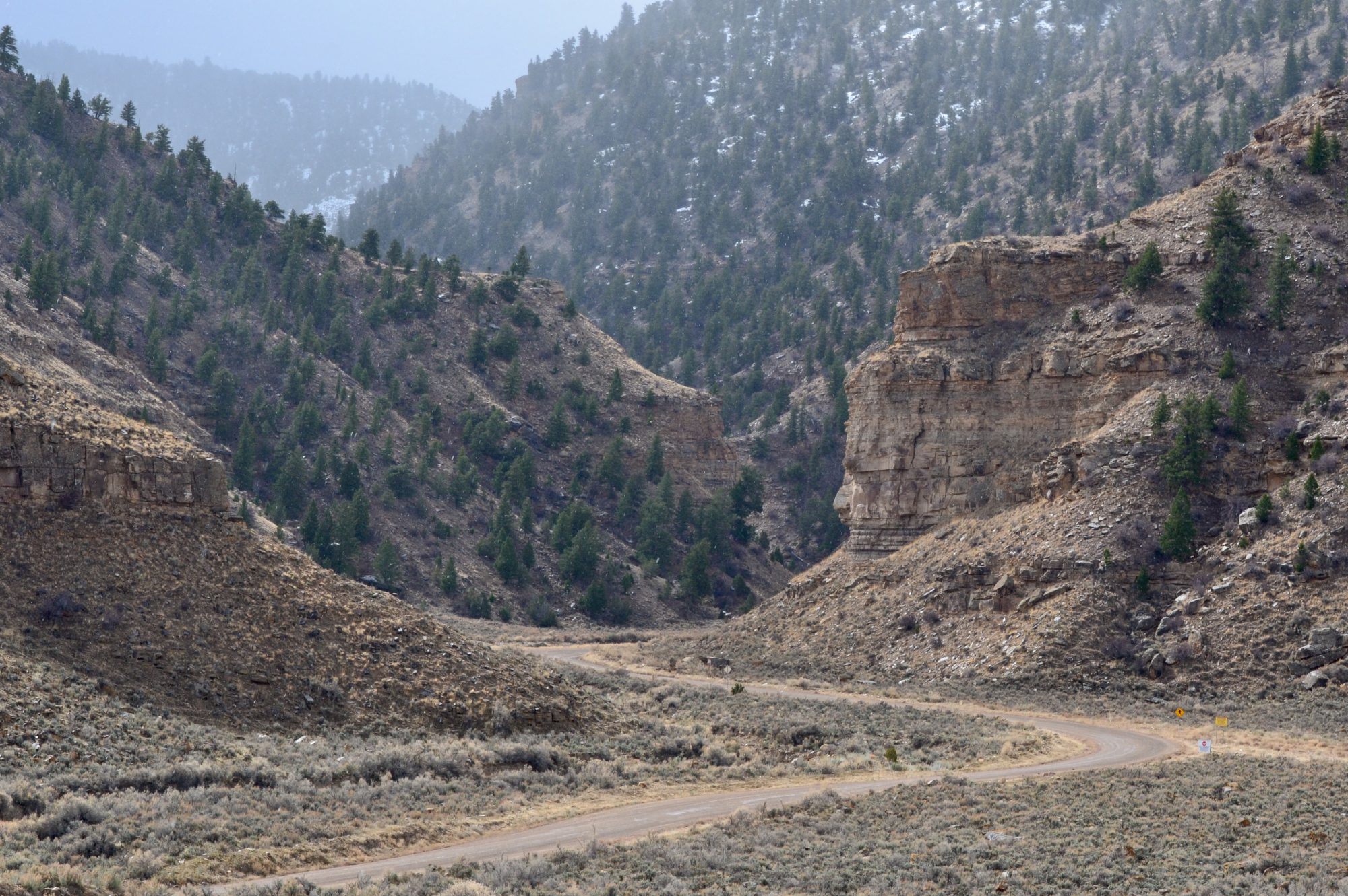
With the open pit behind us to our south we began the climb up into the White Mountains following the narrow twisting byway. We had the perfect day for the drive as the clear blue sky allowed us to take in one stunning vista after another. While the road is narrow and twisty (460 curves in 120 miles) the real challenge to driving this road safely is keeping your eyes on the road.
The first portion of the trail provides great views of the numerous canyons that fan out to the east and west of the trail. A bit further on the scenery turns to savannah-like grasslands which are home to beef cattle. Once past the mesa the trail begins to ascend again providing views of a number of peaks in the 8000′ to 9000′ range. These peaks include Raspberry Peak at 8337′, Indian Peak at 8701′, Rose Peak 8786′ and Blue Peak at 9364′. From a driving perspective we topped out at Hannagan Meadow which sits at 9300′. Quite impressive.
Four Bar Mesa (6578′), Blue, Arizona (Pop. 68)
White Mountains
Coronado Trail Scenic Road, Blue, Aiizona
At Hannagan Meadow we stopped briefly to check out the Hannagan Meadow Lodge. The lodge has been in operation since 1916. The lodge sits in the Hannagan Meadow Recreation Area which is within the ASNF. This whole area is completely unspoilt and,with the exception of the lodge, is completely undeveloped. The lodge operates year-round and is a meca for outdoor enthusiasts. Hannagan Meadow is known for having the first and last snowfall of the season in Arizona due its elevation and location.
From the lodge we continued north beginning to descend the north slope of the White Mountains. We stopped in the tiny settlement of Alpinefor a late lunch. The towns businesses sit along the 191 for the most part. The town is probably best described as rustic. The one school in town is K-8 with 60 students. The closest high school is down the mountain in Springerville (27 miles north). Finally, cementing Alpine as a true country town – you are correct – there are no traffic lights!
Alpine is nestled in the largest Ponderosa Pine forest in the world. The town proper is surrounded by a number of meadows where we observed large herds of elk grazing. Quite spectacular for us city folk. Alpine, while tiny, attracts many outdoor enthusiasts which explains the six lodges in town.
While we had several choices for lunch, the Alpine Grill and Still seemed to demand our trade – maybe the Still part of the name compelled us in that direction – and it did not hurt that the Still also had an ice cream bar (much needed after a giant burger with fries) and a row of working pinball machines! Sound.
We noticed that there were a number of posters in town and at the entrance to the Still seeking information regarding the killing of wild horsesin the area. Additionally, the National Forest Service is rounding up wild horses which are being sold for slaughter in Mexico according to the Arizona Wild Horse Association. Such a shame on both accounts – we have seen many herds of mustangs during our trips in the West and they are magnificent animals (and not a threat to anyone).
After our lunch in Alpine we continued north on the CTSB, descending another 1000′ to Eager, at the northern base of the White Mountains, where we spent the night at the Best Western. Eager is another example of Mormons dispatched by Brigham Young to homestead a wilderness area and create a bounty of cattle, sheep and lumber (brief history embedded in the link above).
The next morning we found coffee and tea at Tin Can Coffee Co, met the owner and her daughter who were handling the morning rush (as it were in Eager). As sometimes happens when we (strangers) roll into a small town in the hinterlands, we were engaged by a friendly local eccentric who eagerly (ha ha) shared some of his theories on how much of what we see or believe is not real. It is hard to fathom that for all these years we had not realized that the moon landing was a hoax -travel can be so educational!
Eager, Arizona, 1934 (Photo courtesy of Arizona Memory Project)
St. johns, Arizona (Founded c.1862, Pop. 3480, Elev. 5745′)
We stopped in St. Johns to take a look at the pleasing church pictured below (earlier version of the church pictured underneath). While walking around the grounds we met the church caretaker. He generously provided us with an oral history of the town. Intially, the town was a Spanish community with an agricultural economy. The town was named El Vadito (little crossing) by Spanish explorers crossing the Little Colorado River.
St. John The Baptist Catholic Church(2025)
By 1879 a significant group of Mormon “pioneers” had arrived looking for a place where they could continue the illegal practice of polygamy. This led to significant conflict and violence as the local folks were not as keen on polygamy as their new Mormon neighbors.
As federal marshals were out actively pursuing polygamists many of the Mormon families fled to Mexico while others sought refuge in Utah. Among the prominent Mormon families in St Johns were theUdalls of American political fame.
We thanked the church caretaker for the enlightening history lesson, picked up the trail north and finished our day bunking down in Gallup, New Mexico (see our post Western New Mexico). Dinner at the El Ranchowas just as good as we remembered from our last visit. Coffee and tea at the Gallup Coffee Company the following morning was as spot- on as we remembered from our prior visit.
Our departure from Gallup marked the beginning of the end of our Never Better Tour of the Southwest.
In our next and ultimate post of the trip we will share our experiences from our road trip through the heartland states of Kansas and Missouri en route to our home base in Connecticut.
This segment of our adventure took us from the Phoenix area across the Sonoran Desert towards the New Mexico border. We headed out toward Superior through a visually jarring landscape, although we were traveling just 65 miles east of Phoenix. We passed through a string of mining towns with their unearthly landscapes, the desolate San Carlos Reservation, the riparian Gila River Valley, the Pinal Mountains and finally, the most impressive Pinaleno Mountains.
SUPERIOR(FOUNDED 1882, POP. 2571, ELEV. 2,888′)
The town of Superior was the first of the mining or former mining towns on this trek. The town was formed in 1875 with the discovery of rich veins of silver resulting in the creation of the Silver King Mine. The silver market crashed within several years, but fortunately for the town folks, copper was discovered and the boom was on again. The Magma Copper Company operated from 1914 to 1996. Back to the bust portion of the program.
Superior, Arizona
Today, the town with its proximity to Phoenix, beautiful scenery, bountiful hiking, rock climbing opportunities and the botanical garden is in the process of becoming discovered.
We stopped in Superior at the Circle K for fuel and firewood before heading up through the Queen Creek Canyon to look for a camping spot in the Oak Flat Recreation Area a few miles east of Superior.
Queen Creek Canyon
The following morning we drove back down through the spectacular Queen Creek Canyon into Superior. First order of business, as always, was coffee and tea. Bellas Cafe appeared as if on cue immediately after we turned the corner on to Main Street. One of the employees we met is a musician and he and his band have played many venues in New Haven.
We fueled up and then wandered around town for a bit. Main Street and the two side streets are not yet entirely occupied, but enough so that town is lively with shops, restaurants, saloons and even a wine bar!
We met one of the artists of the mural below, he owns the building with the courtyard pictured below. He has moved to Superior from Los Angeles and is converting the building (formerly a bar/restaurant) to an art gallery. Bring on the tourists!
BOYCE THOMPSON ARBORETUM (BTA)
After exploring Superior we drove east a couple of miles to visit the BTA. The BTA was founded by Colonel William Boyce Thompson. The Colonel was at the time the owner of the Magma Copper Company in Superior and had built a winter home there in the early 1920’s, Picket Post House. In 1924, Boyce Thompson built the arboretum on 400 acres around Picket Post House. He was an interesting character (click on the link above to read more about Colonel Boyce as well as the BTA).
The BTA covers 372 acres with collections of desert plants from around the world. The collections from diverse desert locations provided us with the opportunity to see desert plants not naturally found in the United States-quite interesting. The arboretum also has five miles of hiking trails which gave us the opportunity to hike up a trail which provided views of the canyon and surrounding mountains. If you ever find yourself in Superior we recommend a visit to the BTA (not so much in the summer). After we finished our visit at BTA we stopped back in Superior for lunch at the Silver King Smokehouse and Saloon.
MIAMI(FOUNDED 1876, POP. 1528, ELEV. 3402′)
From Superior we continued east on U.S. Highway 60which is still intact in Arizona ( Highway 60 at one point ran from Los Angeles, California to Virginia Beach, Virginia) with a plan to find camping east of Globe in the Pinal Mountains.
Miami Copper Mine and Town of Miami, Arizona (Photos above and below courtesy of Arizona Memory Project)
We were not planning on stopping in Miami(this link has an excellent photo gallery of Miami and the smelter) but we were dumbfounded by the size of the mining operations and how the town itself is jammed onto the hills at the base of the mine and across the other side of U.S. 60. So, we found ourselves driving back and forth through town to take in the (to us) surreal scenery. This mine is one of five open pit copper mines in Arizona operated by Freeport-McMoRan(more on that later).
Miami Copper Mine
GLOBE(FOUNDED 1876, POP. 7179, ELEV. 3510′)
Globe is one of the communities along our route east which is in the category of former mining towns. The Old Dominion Mining Company produced copper here for 50 years. The mine had weathered a violent strike in 1917 and reopened in 1919 but only lasted another twelve years as the mine was in poor repair and the shafts were filling with water.
After a slow cruise through downtown Globe (and finding nothing open) we navigated to FR 112 to find a camping spot in the Pinal Mountains.
FR 112, Pinal Mountains, Globe, Arizona
Since we could see that Pinal Peak(7800′) was still covered in snow, we had no illusions that we would make it all the way to the peak. We had pulled off into a layby as the road is a single lane and there was a vehicle coming down (downhill has right of way). He reported through the open passenger window of his mud spattered pickup that conditions at the top were too muddy for our tires We took his word at face value and camped in the layby. No fools, us!
We awoke to a beautiful morning and began the trek back down the mountain to travel east to the town of Safford. If you watch the video below to the end you will see a herd of Javalina crossing the road.
Once we reached pavement we followed Highway 70 east through the San Carlos Reservation and then traveled along the Gila River to Safford.
SAN CARLOS RESERVATION (FOUNDED 1871, POP. 10,000′)
The San Carlos Reservation was established in 1871 and is home to the San Carlos Apache Tribe. The original inhabitants of the reservation were the Chiricahua Apache tribe; they were joined by members of other tribes soon after. The federal government closed the Camp Verde Reservation in 1875 and force marched the Yavapai 180 miles to the San Carlos Reservation. Of the 1400 marched to San Carlos, 375 died en route to their new “home”. Over time the reservation became a consolidation point for a number of different Apache speaking tribes. To make room for the new residents the federal government thoughtfully transported the original Chiricahua Apaches to Florida in 1886.
Apaches Waiting for Rations at San Carlos Reservation (Photos above and below courtesy of Arizona Memory Project)
Today approximately 10,000 of 16,000 tribal members live on the reservation. The reservation was federally recognized in 1934 and encompasses 1.8 million acres (3000 sq. miles). About thirty percent of the members live in San Carlos and the remainder in several other tiny settlements along Highway 70.
Economically, the San Carlos members seem to be worse off than many other reservations. There is, of course, a casino (two in fact) but beyond that there is little industry other than revenue generated from recreation and wildlife permits and a handful of small Peridot mines (open to tribal members only). 49% of the population lives below the poverty line and 36% of working age members are unemployed.
safford(pop. 10,700, elev. 2920′)
Safford was by far the biggest town by population on our route, with almost 11,000 people. The portion of Highway 70 in Safford is lined with the usual “civi town” suspects – fast food chains, Walmart, Home Depot, etc. Fortunately, one block off of the 70, Main Street is intact with local retailers, restaurants and, most importantly, coffee (Ginaveve’s). During our walk around town we also happened upon the local insurance agency, where the big red umbrella is prominently on display.
Agriculture is the primary industry in Safford. The main crop is cotton, which was introduced into the area by Mormon settlers during the 1870s. You are probably familiar with Pima cotton which comes from the fertile soil in the Gila Valley. Latter Day Saints remain influential in the area – about one third of the population is LDS.
From an employment standpoint, many of the residents work in the two mines north of town; the nearby state and federal prisons are also significant employers.
The main attraction for us in stopping in Safford was the opportunity to drive theSwift Trailwhich winds up over 7000 feet through the Pinaleno Mountains to Mount Graham (10,696′). The trail is paved for the first 22 miles and dirt the final 13 miles.
Swift Trail, Coronado National Forest, Safford Arizona
Climbing Swift Trail
The upper elevations of the Pinaleno Mountains are heavily pine forested. So, when Mormon farmers arrived in the late 1800, the trail was built as a wagon route for lumber needed by the farmers and later for the mining operations that were opened in the early 1900s.
The views were as breathtaking as advertised! The drive itself was fun as we navigated the seemingly unending switchbacks that lead around the mountains and eventually up to the top. Once at the top we could see why the Western Apache considered Mount Graham (Dzil Nchaa Si’an) a sacred place. As is often the case, the Native Americans were removed and placed on reservations so that our extraction of natural resources could continue unabated. Fortunately, for all of us, this land is now protected as part of the Coronado National Forest.
Sulphur Springs Valley – Winchester Mountains
Descending Swift Trail
After descending the trail we camped at the base, which afforded us an evening soaking in panoramic views of the snowcapped mountain range – mesmerizing – nature never disappoints!
Pinaleno Mountains
Gila River
In the morning we grabbed coffee and tea at Ginaveve’s and set out to hike along the Gila River within the Gila Box Riparian National Conservation Area.The Gila is a 649 mile long tributary of the Colorado and flows all year through the section within the conversation area creating this green strip through the desert. Below this area the Gila and its tributaries are damed several times. By the time the river reaches the Phoenix area it is usually just a dry wash.
After hiking along several sections of the Gila, we returned to the Beast and made our way back to Highway 70 (The Old West Highway) to make the short drive east to Duncan. The Gila River loops north from where we hiked but we rejoined the river in Duncan. Duncan sits within the Duncan Valley and is another agricultural hub in an otherwise barren land. Duncan, like Safford, is a cotton producer. Cattle ranching and copper mining (about 40 miles north is the largest open pit copper mine in North America) are also found in and around Duncan-three of the Five Cs of Arizona – Copper, Cotton and Cattle – the other two being climate and citrus.
DUNCAn(FOUNDED 1883, POP. 879, elev. 3400′)
Simpson Hotel, Duncan, Arizona
We had read about the Simpson Hoteland it sounded charming (it is – subject to liking cats- which we do) and the location in Duncan was perfect for kicking off our final segment in Arizona (Coronado Trail Scenic Road). The link to the hotel website (above) is a treasure trove of interesting information and worth a look.
The original hotel opened in 1914 as the Hotel Hobbs. Subsequently, the property was owned and operated by several different families. The current innkeepers, Clayton Jarvis and Deborah Mendelsohn began renovations in January of 2006 and opened in May of 2007 after 18 months of demolition and renovation. Deborah and Clayton are wonderful hosts adding to the charm of this classic territorial building’s exterior and art gallery interior. Clayton is an accomplished artist and has a studio in the courtyard behind the hotel. We completed our stay with a pizza pie to go from Humble Pie which conveniently sits about 200 feet up Main Street from the Simpson.
This is our post covering the Superior to Duncan segment of OTR 11.0, our penultimate segment in Arizona. We hope you found it interesting.
The Apache Trail begins in Apache Junction, Arizona on the eastern edge of Phoenix and winds northeastward to the Roosevelt Dam. The trail begins as a two lane paved highway (SR 88) and becomes dirt at mile 22 (which is when the fun begins)! The scenery along the route is legendary and with good reason. This byway takes you up and over peaks and down deep into canyons providing massively gorgeous views of the Superstition Mountains and two lakes along the way.
Our first stop was at Canyon Lake, one of four reservoirs created by damming the once mighty Salt River. The Mormon Lake Dam was completed in 1925 and was the third lake to be created by damming the river. It is the smallest of the lakes at 950 acres. The average depth of Canyon Lake is 130 feet (no kayaking for us – we prefer knee deep). All of the reservoirs created by the Salt River Projectare recreational – allowing boating, water sports and fishing.
Mormon Flat Bridge (built 1924), SR88, Willow Creek
Fish Creek Canyon
At pavement’s end, we began the exciting drive down to the Fish Creek Canyon bottom. It is incredible to think that this was once a stagecoach route (we saw several sites where cars went over the side – maybe the stagecoach was actually safer)! We have included two videos below to provide a sense of the drive down.
Crossing Lewis and Pranty Creek
Bronco Butte
After following the Lewis and Pranty Creek for several miles, the road angles in a more northerly direction and we began to climb out of the canyon and got our first views of Apache Lake.
Apache Lake
Apache Lake is the second largest of the four lakes created by damming. The lake was created by the completion of the Horse Mesa Dam. The dam (660 foot long and 300 feet high) is a hydroelectric generating station capable of producing 129 megawatts of electricity. The energy from here helps power the Phoenix metropolitan area.
Downstream View – Horse Mesa Dam(Photo courtesy of Mark Durben)
Salt River
The final dam along the Apache Trail is the Theodore Roosevelt Lake Dam named after (two guesses only please) a former president. The original dam was completed in 1911, after six years of construction. While it also generates electricity (since the 1996 modernization) it’s primary purpose was to contain water for irrigation in what was arid desert.
Theodore Roosevelt Lake Dam
The dam created the largest lake in Arizona.The resulting lake is over 20 miles long and can store as much as 2.9 million acre-feet of water (one acre foot of water equals 325,000 gallons). We didn’t do the math but we are pretty sure it is a lot of water!
Theodore Roosevelt Lake Bridge
The Theodore Roosevelt (that name again) Bridge is a beauty. The bridge was completed in 1990. The bridge is the longest single span bridge in North America at 1080 feet.Before the bridge was completed, the only way north was to drive over the dam (sorry we missed that experience).
Theodore Roosevelt Lake – Sierra AnchaMountains
After crossing the bridge we followed the western shore of the lake north on SR 188. We found a lovely spot to camp on the beach and enjoyed a cool but beautiful evening. Our site allowed a panoramic view of the Sierra Ancha across the lake to our east and the snow capped Mazatzal Mountains to our west. Quite spectacular, if we’re honest!
In the morning we broke camp and traveled further north looking for coffee before venturing up to the Mogollon Rim. Along the way we drove through our favorite named community of this trip – Punkin Center – which is one of a handful of census designated places in the Tonto Basin. We couldn’t find a population statistic anywhere or any obvious reason for it’s existence, but how can you not like a place called Punkin Center where the main attraction is the bar!
Punkin Center Bar, Punkin Center, Arizona
We found coffee at Common Grounds in Payson. Our barista and her younger brother requested a tour of the Beast and while we were chatting provided us with a number of hiking opportunities nearby. Thank you!
Payson (population 16,000) was founded by gold miners in the early 1880s, but it is timber and cattle that sustained this area. During prohibition the town’s extremely remote location fostered the manufacture of moonshine with 30-40 stills scattered around the area. The moonshine from Payson was known as “Payson Dew“.
(Photo courtesy of Northern Gila County Historical Society)
Payson sits at an elevation of 5,000 feet and offers a multitude of recreational opportunities in the surrounding Tonto National Forest, making it a popular spot for Phoenicians during the summer months.
In addition to a coffee stop, Payson was our starting point for accessing the Mogollon (mug-e-YOHN) Rim which forms the southern edge of the massive Colorado Plateau.
Our timing in exploring central and northern Arizona was once again accompanied by a snow storm in the mountains. Mother Nature obviously didn’t get the memo that we were coming! After checking with the Forest Service and confirming that the Rim Road was open albeit a bit muddy, we fired up the Beast.
The Mogollon Rim (MR) is 200 miles long, extending from Flagstaff to the New Mexico border.The elevation ranges between 7000 and 8000 feet above sea level. The MR is an escarpment which delineates the pine forests and the Sonoran Desert to the south. It was fascinating to see how the landscape changed so rapidly as we climbed from the desert floor into higher elevation – desert vegetation to pine forests in just a matter of a couple thousand feet of elevation gain.
Roberts Mesa
We spent the afternoon taking in the views from the MR and eventually turned around to begin our descent. As often happens after an afternoon of taking in beautiful views and scenery we found ourselves feeling a bit peckish. We stopped at That Brewery in Pine for a late lunch/early dinner or what we call it when we are on the road – a lundin.
After our delish burgers and cocktails we got on the road southward and began to look for a camping spot between Pine and Phoenix. Our ride was interrupted by an Arizona State Trooper who claimed we did not have a license plate. We do, of course, have a license plate – the trooper just did not know where to look on the van. Okay, our bad, our firewood bag had shifted downward and obscured the plate. After a friendly verbal and written warning (and rehanging the bag) we were again on our way south.
Log Corral Canyon, Tonto National Forest
We found a secluded spot to camp not to far off our route south to Phoenix. One of the delightful parts of traveling in the west is that there are almost endless opportunities for secluded and scenic camping that require no fees or reservations. As an example, the Log Corral Canyon where we camped that evening is within the Tonto National Forest which stretches from the MR to the Sonoran Desert (2.9 million acres).
In the morning we returned to Phoenix for two nights and some additional bike riding (and excellent coffee at Peixeto (pay-shay-tow).
After our second stay in Phoenix we again set out for northern Arizona. Our first stop was the town of Prescott (press-kit). We had never visited but had read many wonderful reviews of the town and a number of Arizonians we met during this trip had also highly recommended we go.
Hassayampa Inn, Prescott, Arizona
Our secondary motivation for visiting Prescott was to stay at the Hassayampa Inn. The inn opened in 1927 to provide lodging for the growing number of tourists who had discovered the charms of this former mining and logging town. The inn was designed by our favorite hotel architect Henry Trost.The bottom right photo shows the original and still operational elevator.
By the time we arrived at the hotel it was snowing ( Prescott elevation 5300 feet). We were tucked in nice and cosy at the inn, so a bit of snow was not a concern for us as we had booked two nights. Excellent restaurant, outstanding cocktails in front of the fireplace in the beautiful Trost lobby and fantastic coffee a short walk down the street. Yippee Ki Aye!
Merchant Coffee, Prescott, Arizona
However, our plans to continue north hit a snag when we learned the road north was closed due the weather and that Sedona and Flagstaff were a mess. Flagstaff had received over 20 inches of snow and the temperatures were remaining bitterly cold. Not why we had come to Arizona! Once again, time to revise our itinerary – ah, life on the road.
Realizing that exiting Arizona to the north was not meant to be, we decided to head to Southeastern Arizona where the forecasted weather looked delightful (see photo below).
We are going to start this post with a question. Who thinks the Beast was able to navigate this ledge? We will provide the answer later in this post.
After our trip across El Camino del Diablo and up to the Fortuna Mine we spent a couple nights in Yuma. We cannot say that Yuma is our favorite town but we needed to have our bikes serviced and repaired as a result of the bike rack breaking as we crossed the El Camino. The photo below shows the Beast after we made makeshift repairs to secure the bikes and rack. Note the now oval shaped front wheel on the blue bike.
Our bikes would not be ready for five days as the misshapen front wheel was irrepairable and the new wheel was apparently coming via stagecoach.
Cafecito, which was our home base in Yuma, is on Main Street along with several restaurants, bars, mercantiles, a theater and city governmental offices. Cafecito was the perfect spot for modifying our travel plans with its excellent drinks, toasts and bowls. The space is immense with 10,000 square feet of indoor and outdoor seating. Please find the owners’ bittersweet story in the link below. Here we revised our itinerary to head north to the Northern Sonoran Desert and the KOFA NWR and then loop back south to (hopefully) collect our bikes.
We departed Yuma via 95 North passing through the Yuma Army Proving Ground and the Castle Dome Mountains ( we transited the Castle Dome on a previous adventure) to our east; then turning at Palm Canyon Road. We followed the road until its terminus at the entrance to the Palm Canyon Trail.
Palm Canyon, KOFA NWR
Palm Canyon is a narrow, relatively short but rugged canyon. What distinguishes this canyon from other canyons in the KOFA is that there are California Fan Palms nestled up on the north side of the canyon. These Fan Palms are believed to be the only California Palm Trees in Arizona. In the photo below left you can see the palms tucked into the side of the canyon.
Palm Canyon, KOFA NWR
After hiking back down the canyon to the trailhead we drove back west on Palm Canyon Road to scout out a good camping spot – not to difficult actually!
Every evening and morning is a treat in the desert with spectacular sunsets, starry black nights and gorgeous sunrises.
The next morning we set out to explore the nearby KOFA Queen Canyon Trail. The road is a rocky affair that winds up the narrow canyon with jagged peaks framing the canyon on both sides. The trail itself becomes progressively rougher and narrower. At the eight mile mark the USFWS has closed the trail to make sure people do not try to proceed further as the next mile of trail across the Big Horn Pass is impassable regardless of weather conditions.
Queen Canyon
On the drive out and back we stopped several times and wandered out through several of the many washes that run through the canyon. Beautiful blue sky, a gentle breeze and total silence!
Waking up to another beautiful, sunny, blue sky day with 75F temperatures never becomes tiresome – in case you were wondering. For our third sortie in the KOFA we opted to go a bit further north and skirt the KOFA mountains and follow the Valve 2 Road eastward to the High Six. The High Six Tank is a deep bedrock water pool.
We assume somewhere in the vicinity of this road there is a Valve 2. The El Paso Natural Gas pipeline carries natural gas from the Permian Basin to a number of western states. The pipelines are buried but there are valves above ground that we observed in other parts of the desert.
Valve 2 Road
From our campsite we would need to navigate approximately ten miles with the Beast to reach the trail for the High Six. If we could reach the trail for the tank we planned to make the short climb up to the tank. It appeared based on our reading of the topo map that elevation gain from Valve 2 Road to the tank was only 150 feet.
While ten miles doesn’t seem much like much terrain to cover we were not able to reach the High Six Trailhead.The photos below show the spot where we had to concede on getting to the High Six. We tried several different approaches to tackling this drop but we just did not have the clearance.
With the premature demise of this adventure we quickly regrouped and decided it was time for a cocktail! We backed down the trail until we found a spot for a 100-point K turn, headed west for the pavement and then north seeking food and beverages in Quartzite (about 20 miles north on Highway 95).
Silly Al’s Pizza, Quartzite, Arizona
Silly Al’s Pizza was packed but we secured a hightop in the bar. If we had thought about it, we would have realized that Quartzite would have a crowd on a Sunday afternoon as the town is a major snowbird location and home to many gem and mineral shows during the winter months. The cocktails were excellent – the pizza decent – the restaurant makes their own dough. The problem is no one outside the Northeast puts enough char on the pie!
The following day we made our last foray into the desert before returning to Yuma to collect our bicycles. We opted to head west towards the California border and check out some old mining sights.
We visited the abandoned Gold Eye Mine, which was owned by Lehre Erdman. This not much history other than Erdman started this mine and worked it for 63 years. Erdman died in 1996. The remnants of the stone cottage he built and lived in are still standing at the mine sight.
There are a number of mines in the area we explored. Many are abandoned but there are a fair number of claims being worked on a small scale. If you are interested in mining for gold call the phone number in the photo above!
Our next post will provide a glimpse of our visit to Phoenix.