
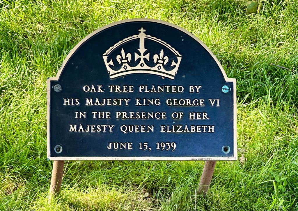
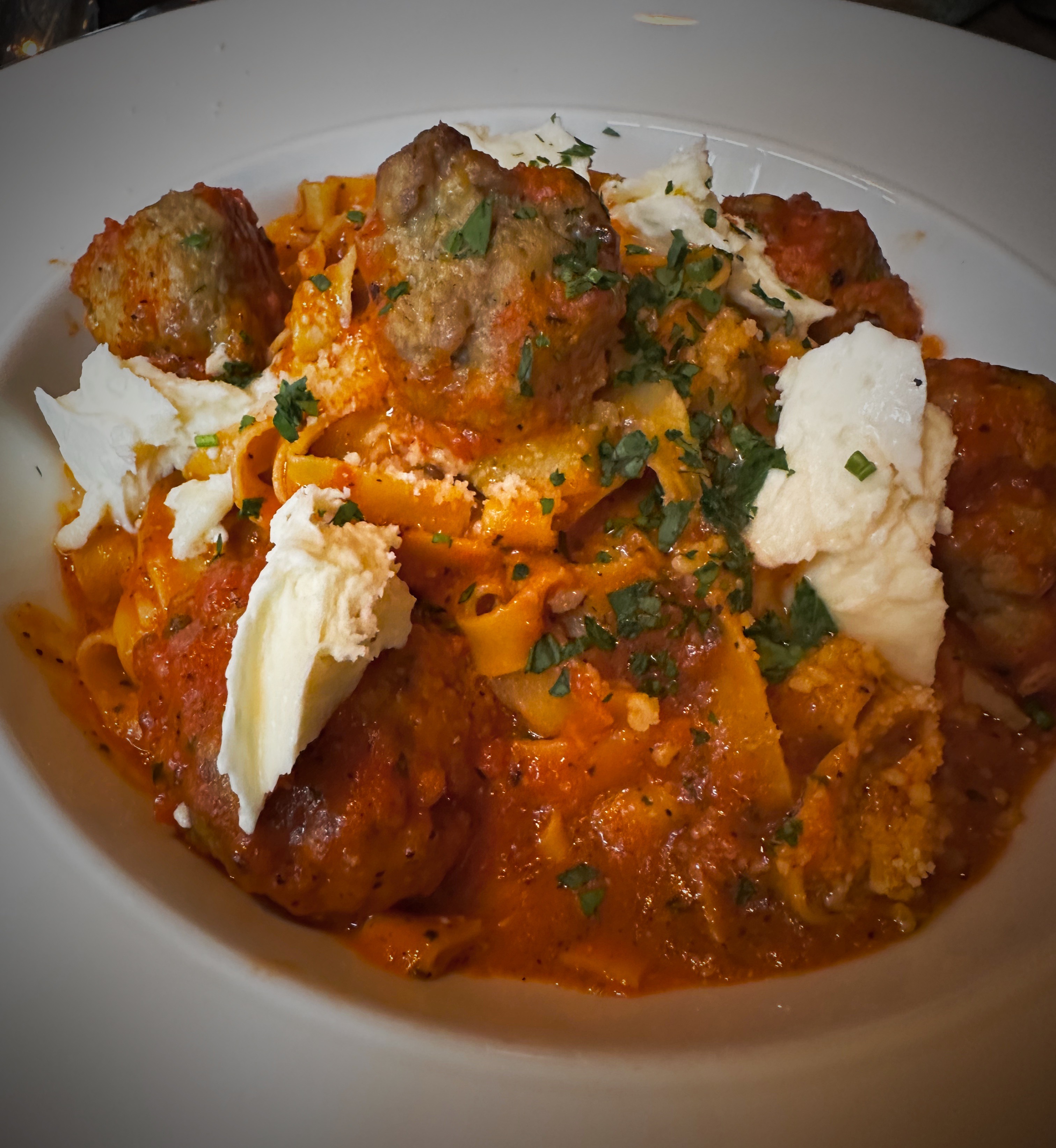
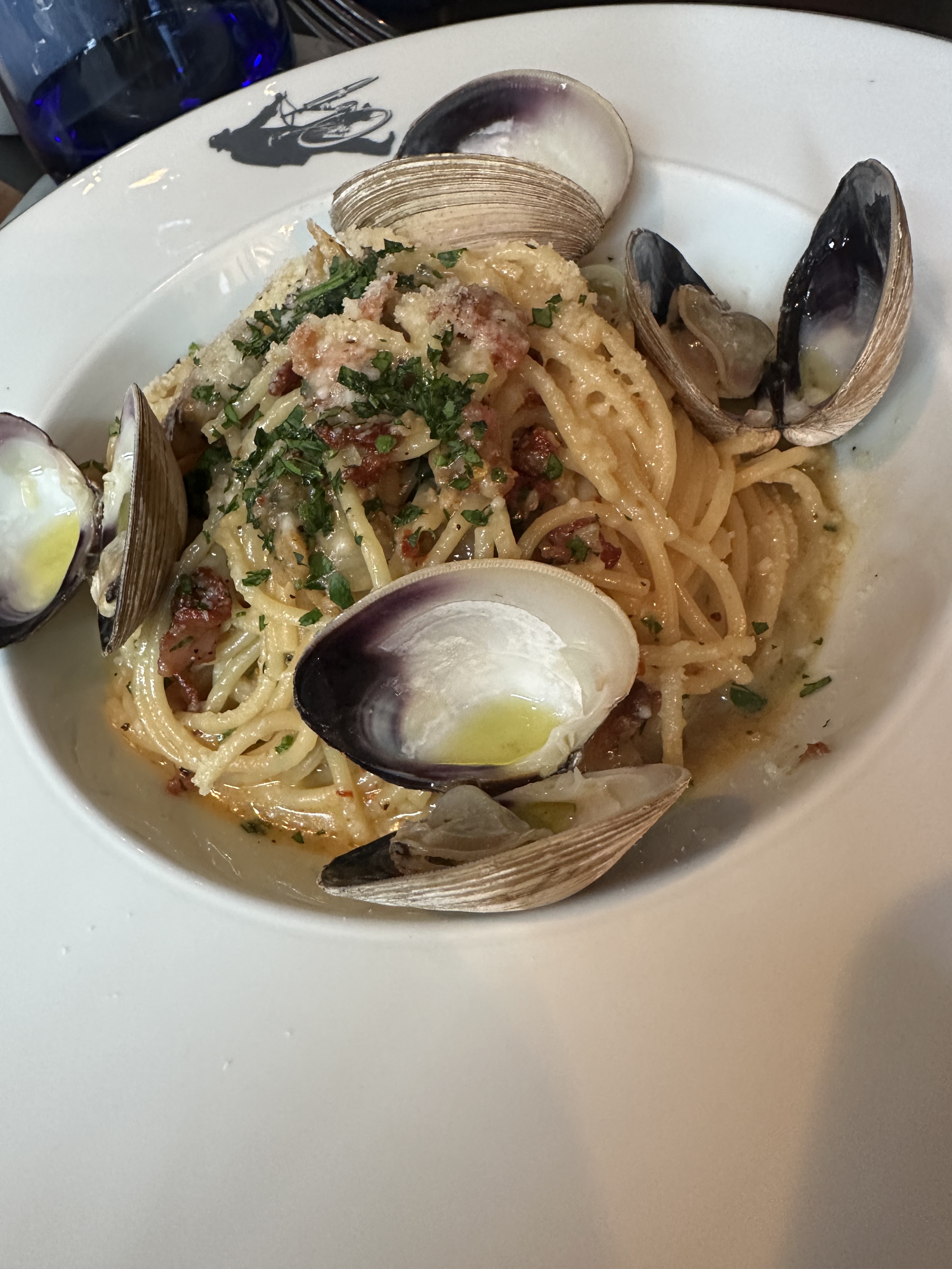
Subscribe to continue reading
Subscribe to get access to the rest of this post and other subscriber-only content.
Subscribe to get access to the rest of this post and other subscriber-only content.
DAY ONE….DAGG EINN
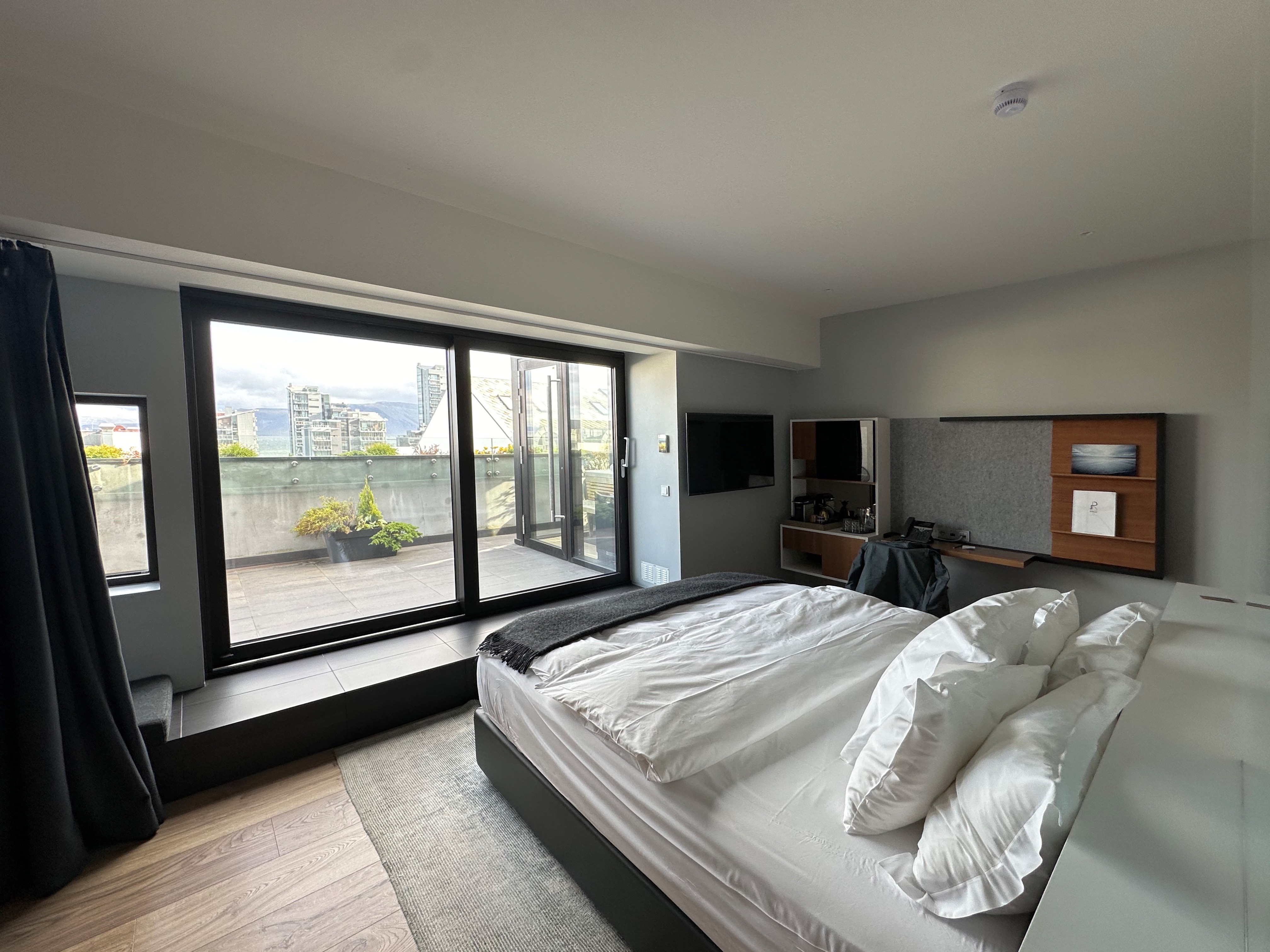

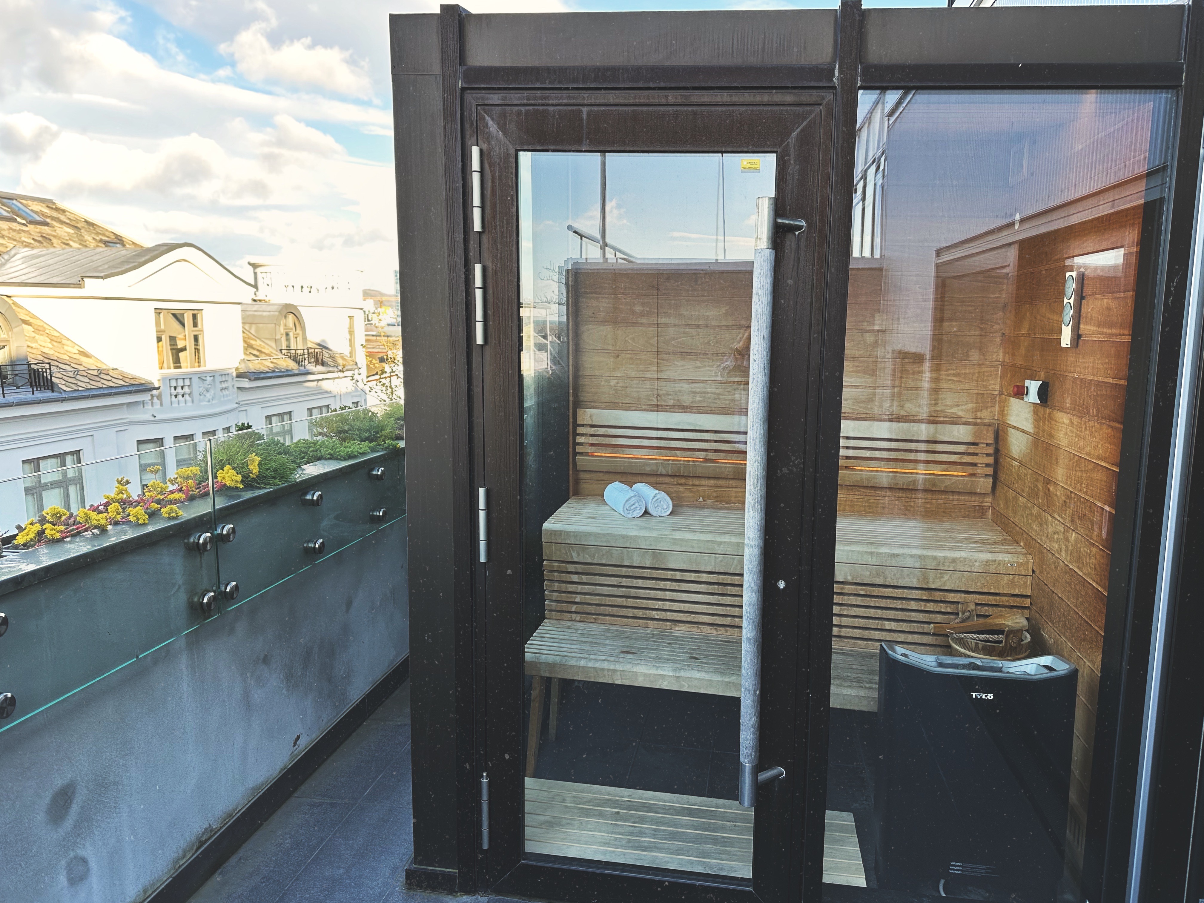
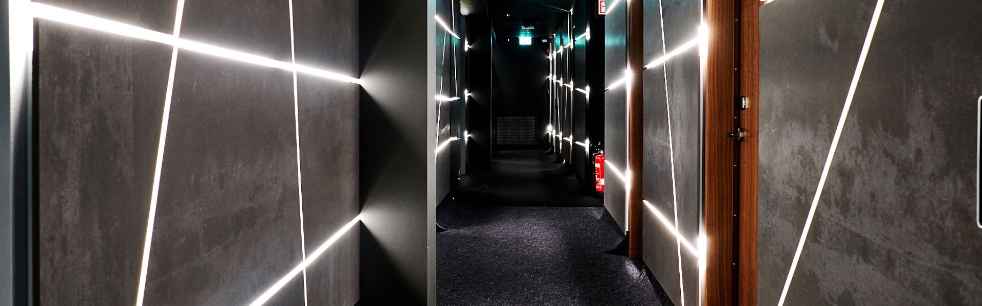

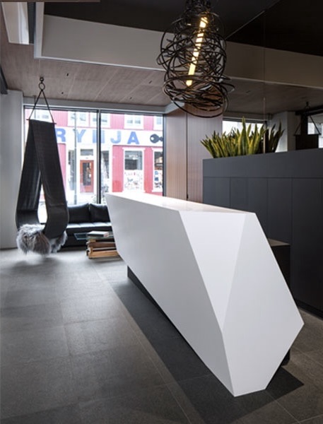
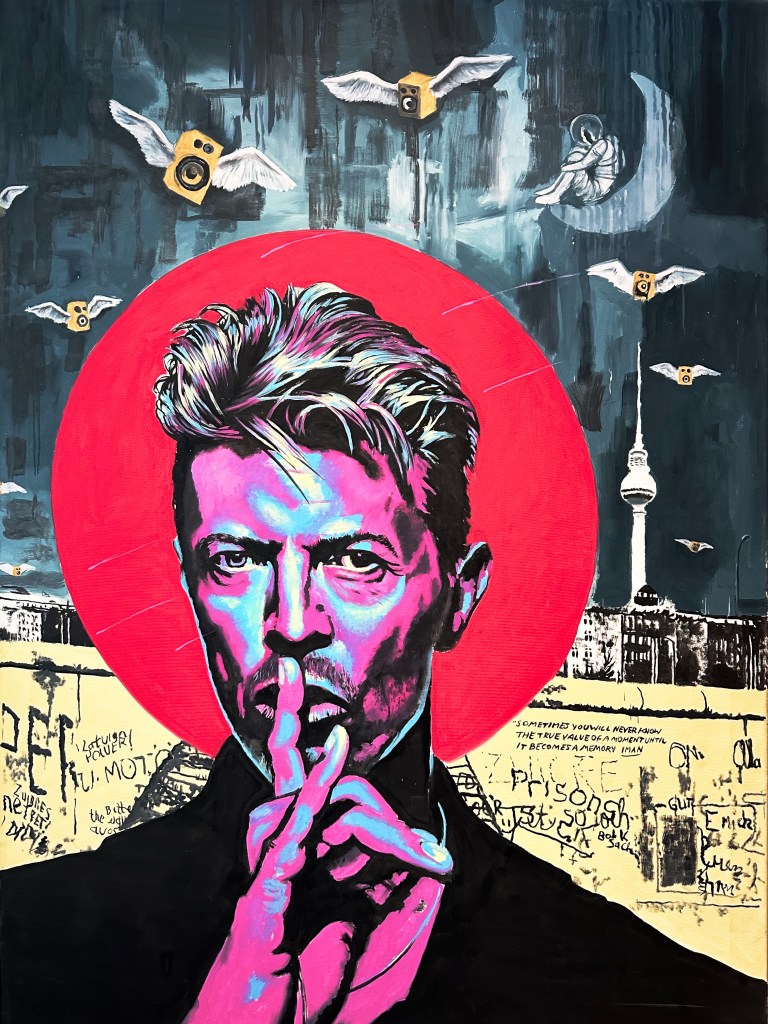
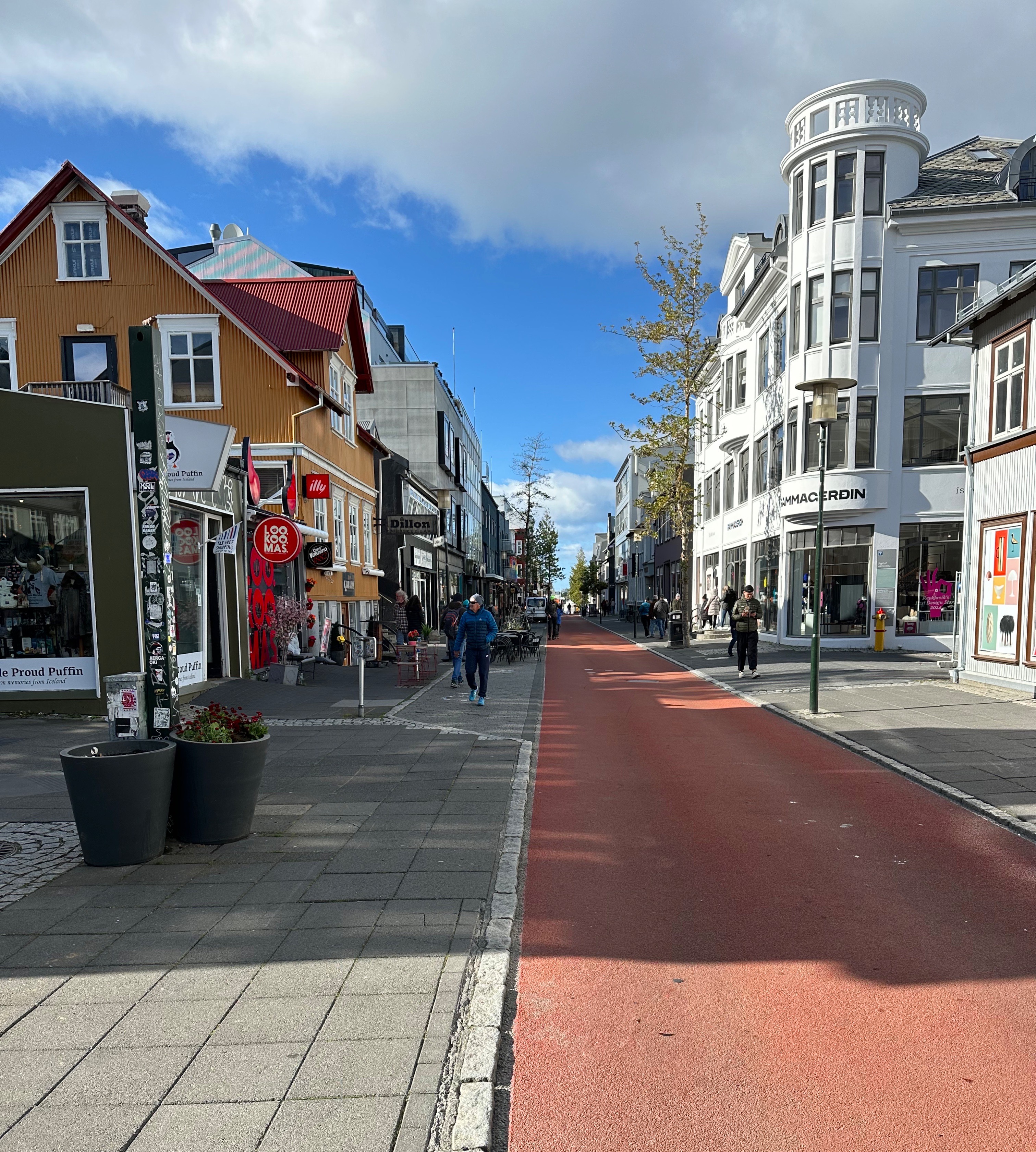
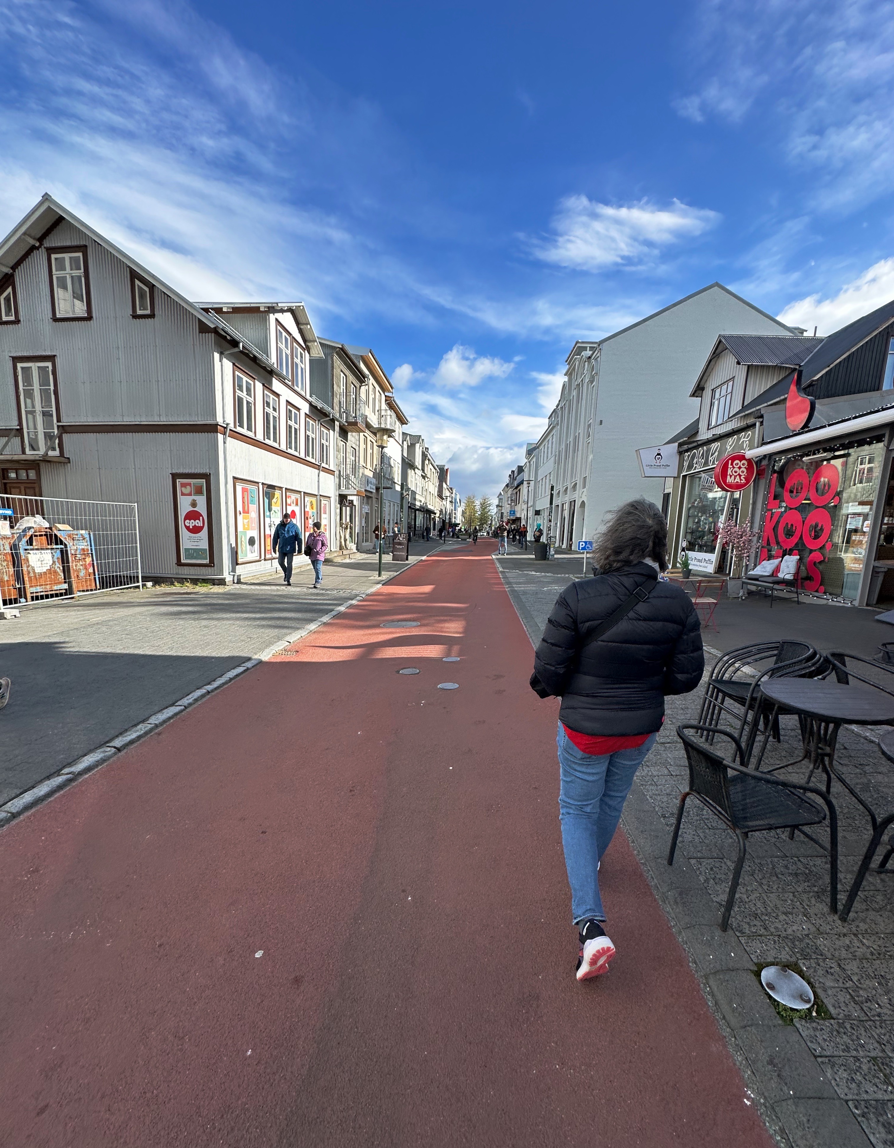
Since this was our first visit to Iceland we decided to stay in Reykjavik and use it as our base for the trip. We selected the Ion City Hotel which would put us in the heart of the city on Laugavegur, which is a bit touristy but has multiple specialty coffee shops and restaurants within a five minute walk. The hotel is small with just 18 rooms and its location provided us a view down to the harbor and the night sky. The lobby is tiny as the majority of the ground floor is occupied by Sumac, a restaurant specializing in Middle Eastern cuisine. We were very happy with our choice based on our stylish room, our view, our private sauna and the very friendly, helpful front desk staff. Lastly, how can you not like a hotel with a painting of David Bowie in the lobby! Takk fyrir.
We crashed at the hotel for a couple of hours after our overnight flight and then went out to do some exploring in the neighborhood.
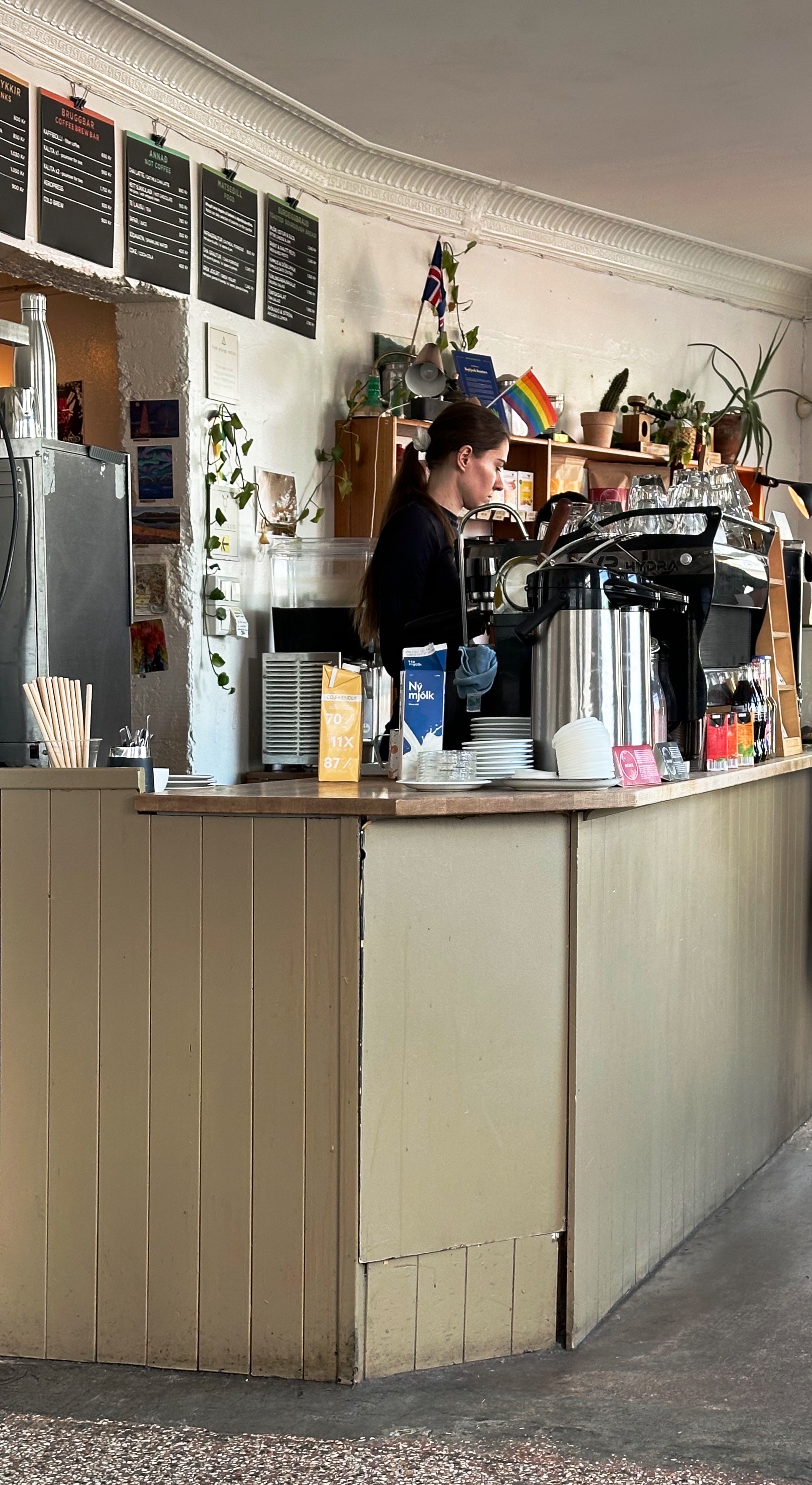
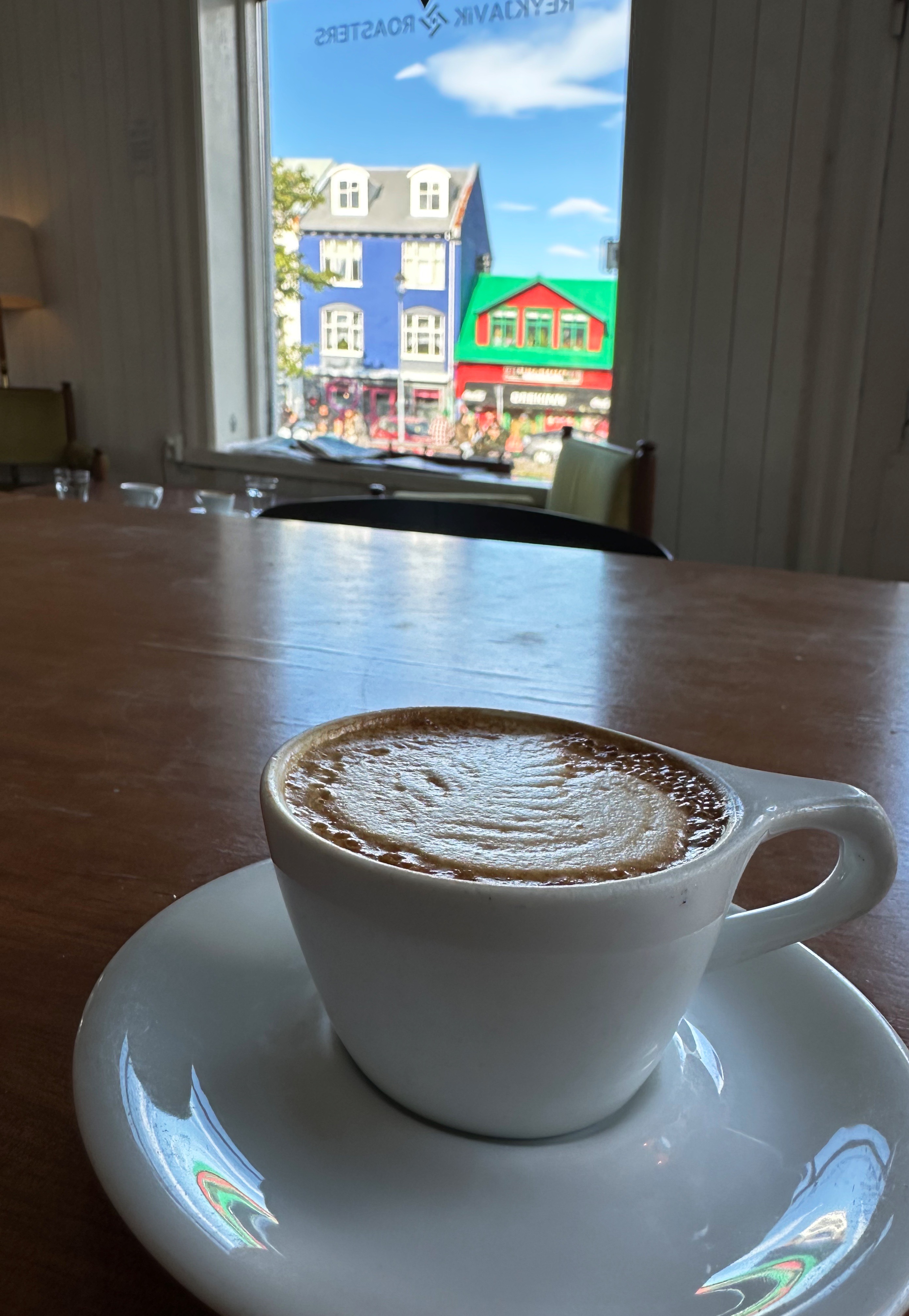
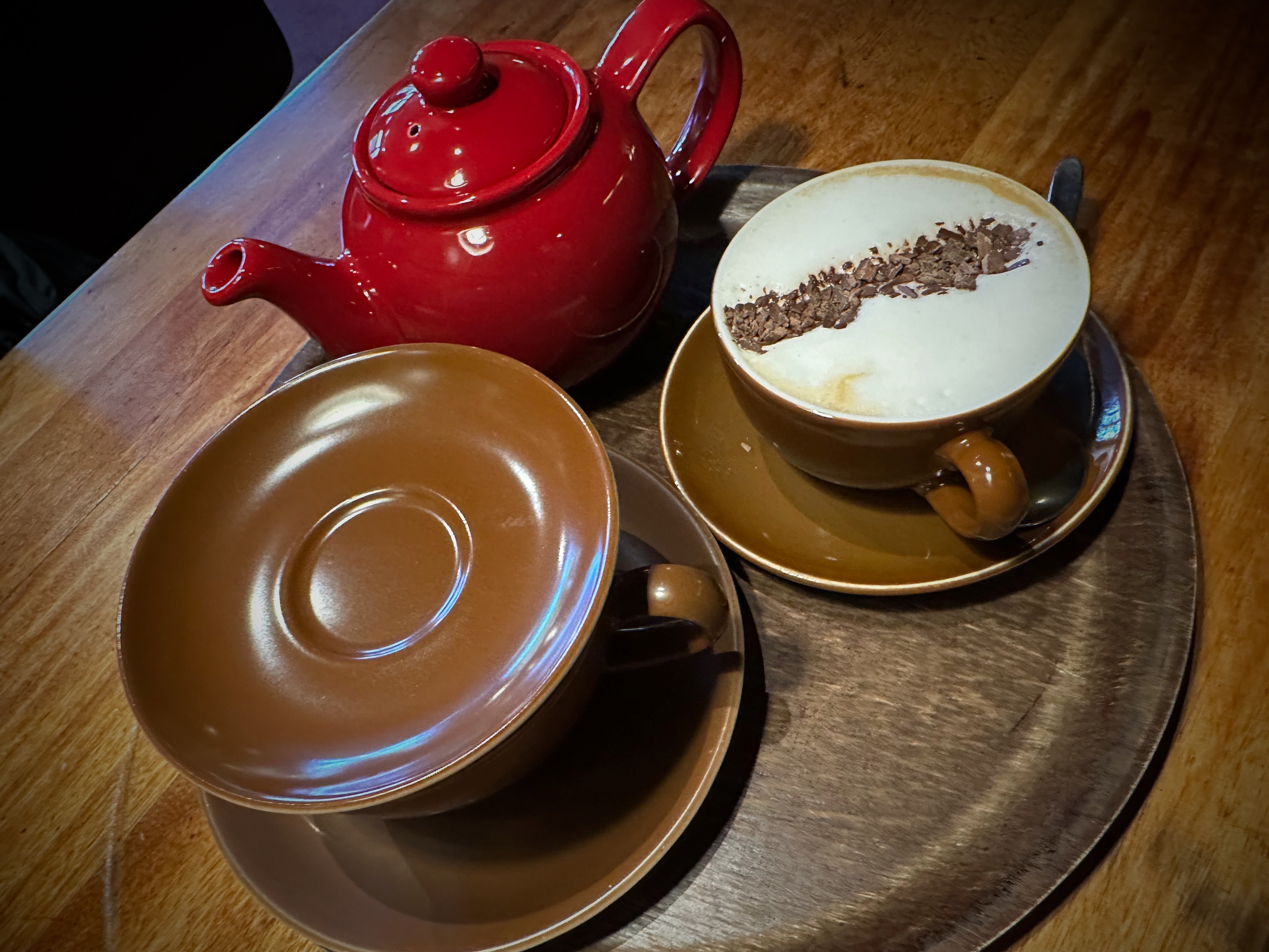
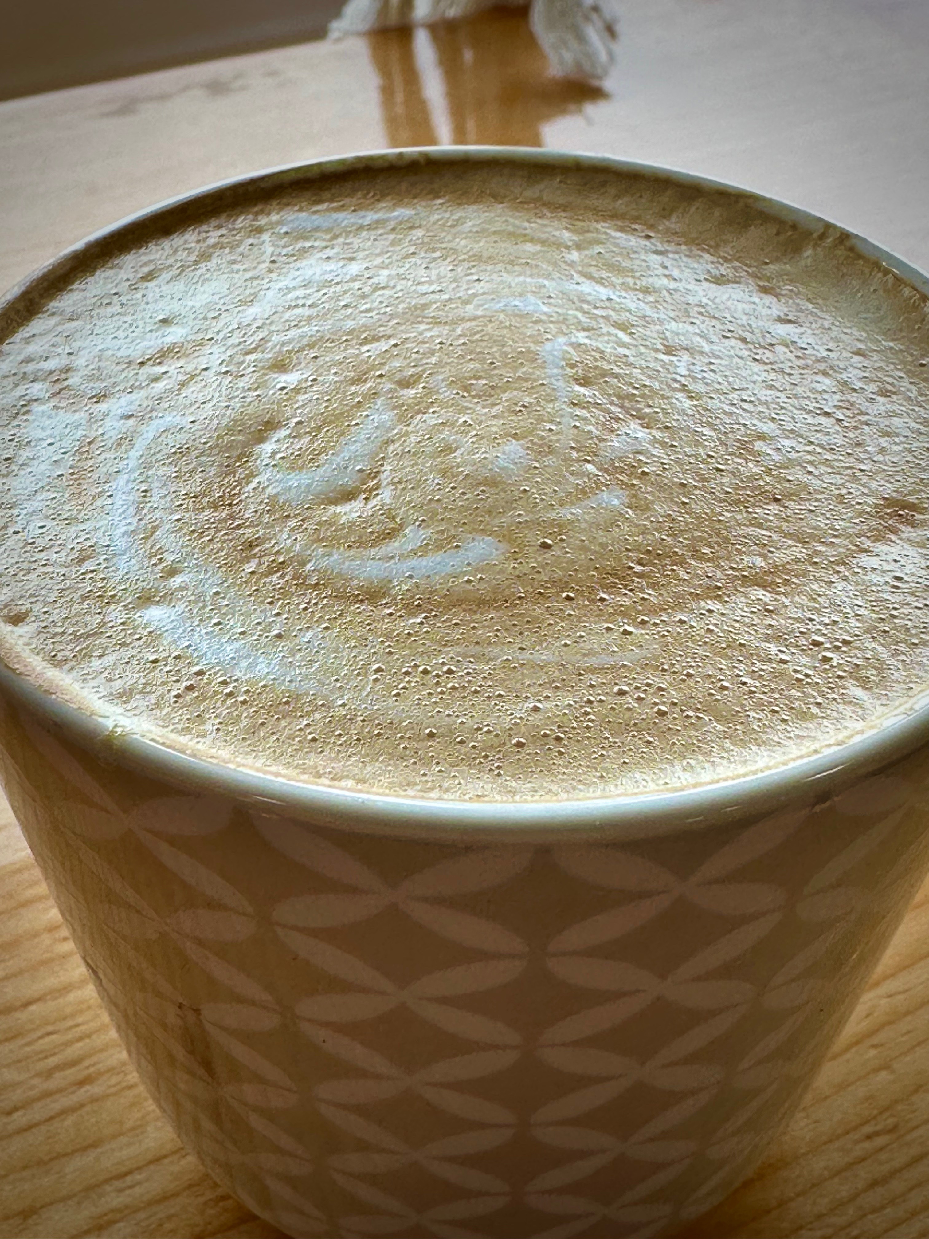
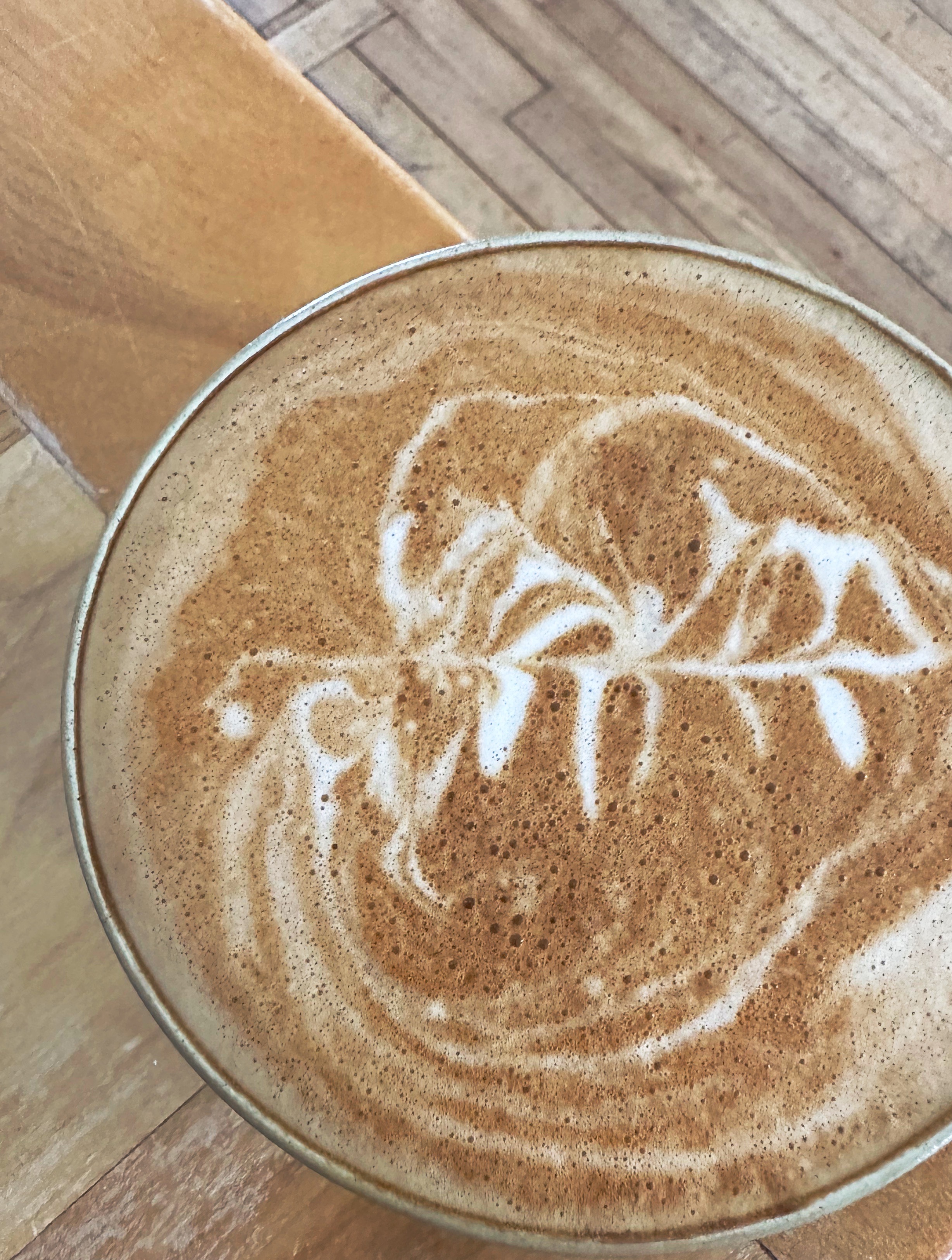
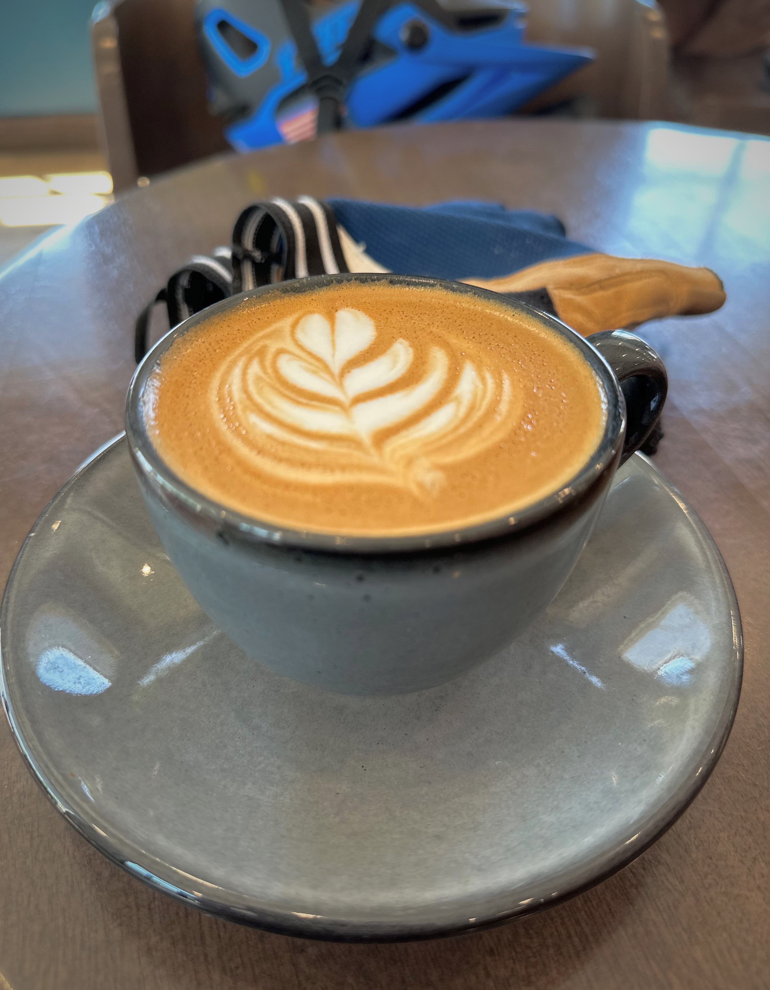
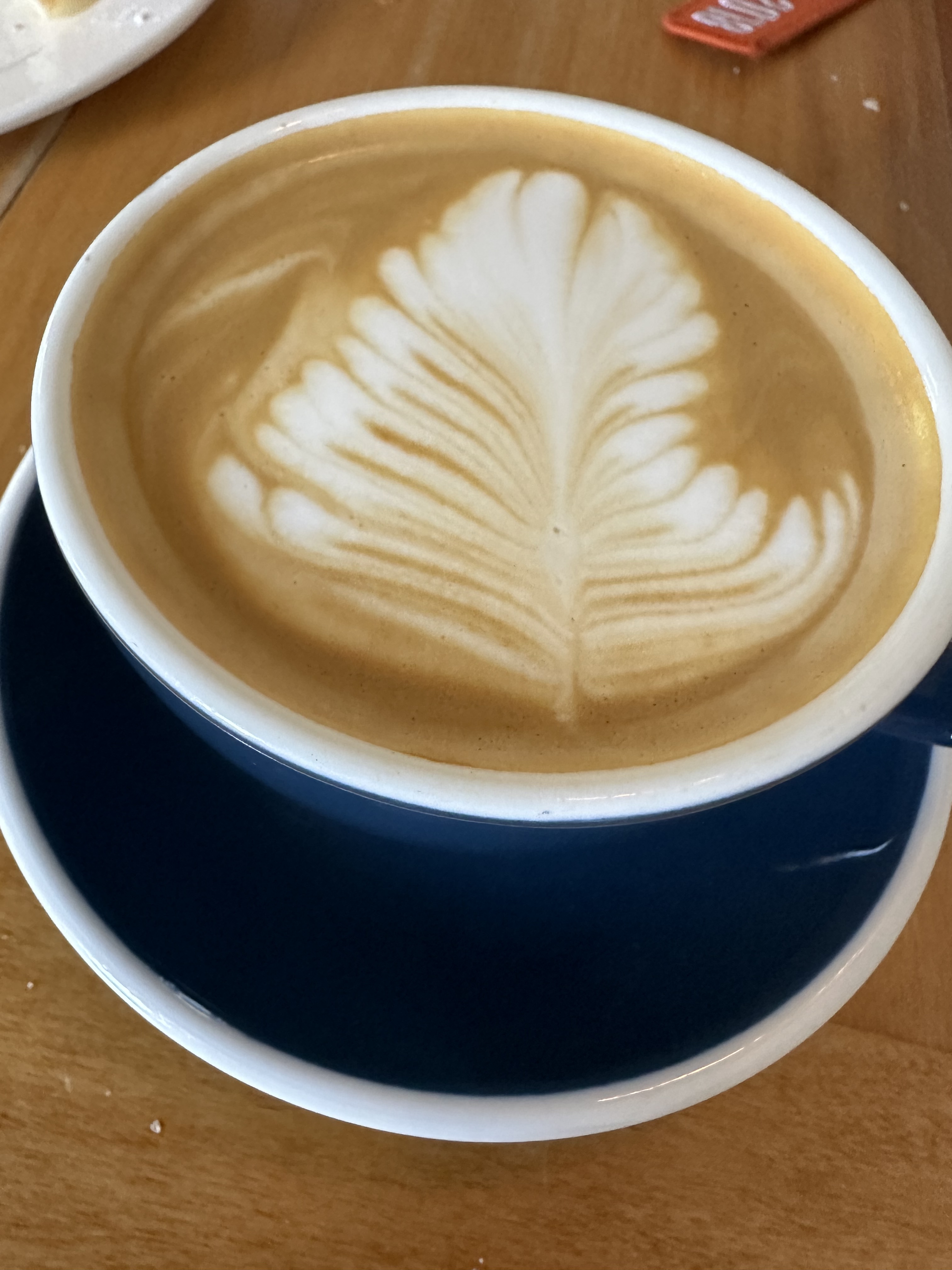
We made our first stop at Reykjavik Roasters, which is just around the corner from the hotel. We know you would expect nothing less of us. RR was founded in 2008 and has been a staple of the Reykjavik coffee scene ever since.

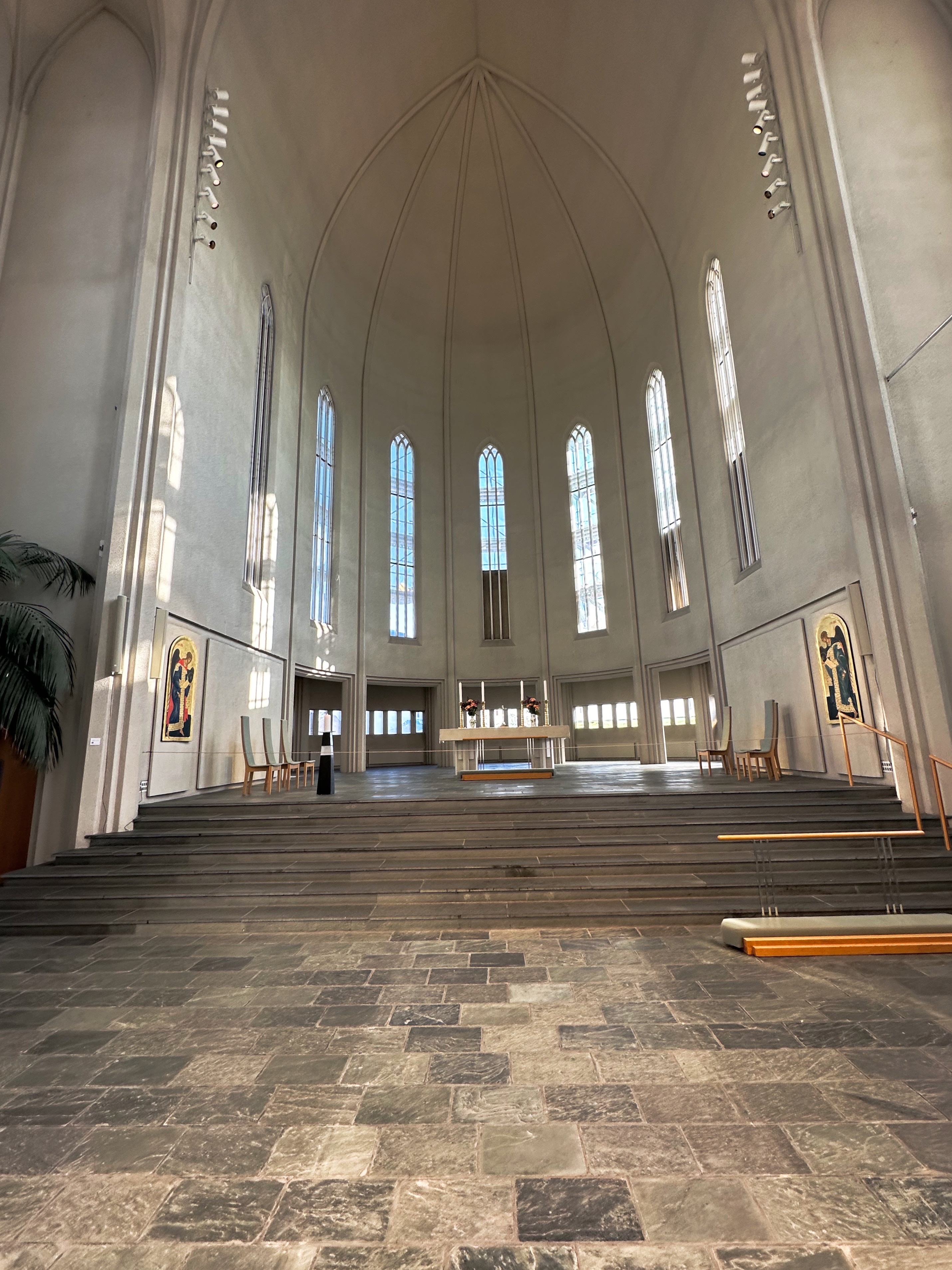
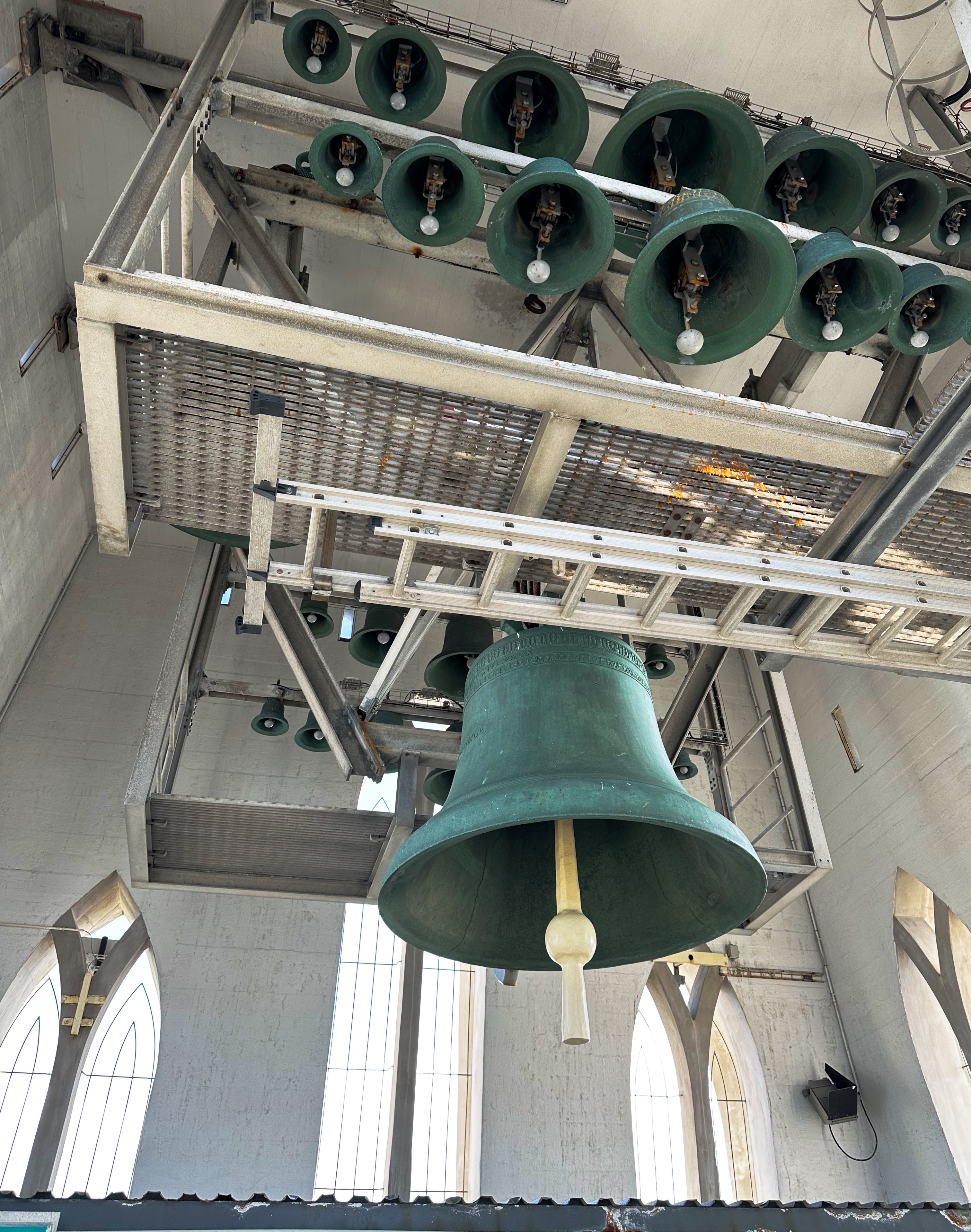
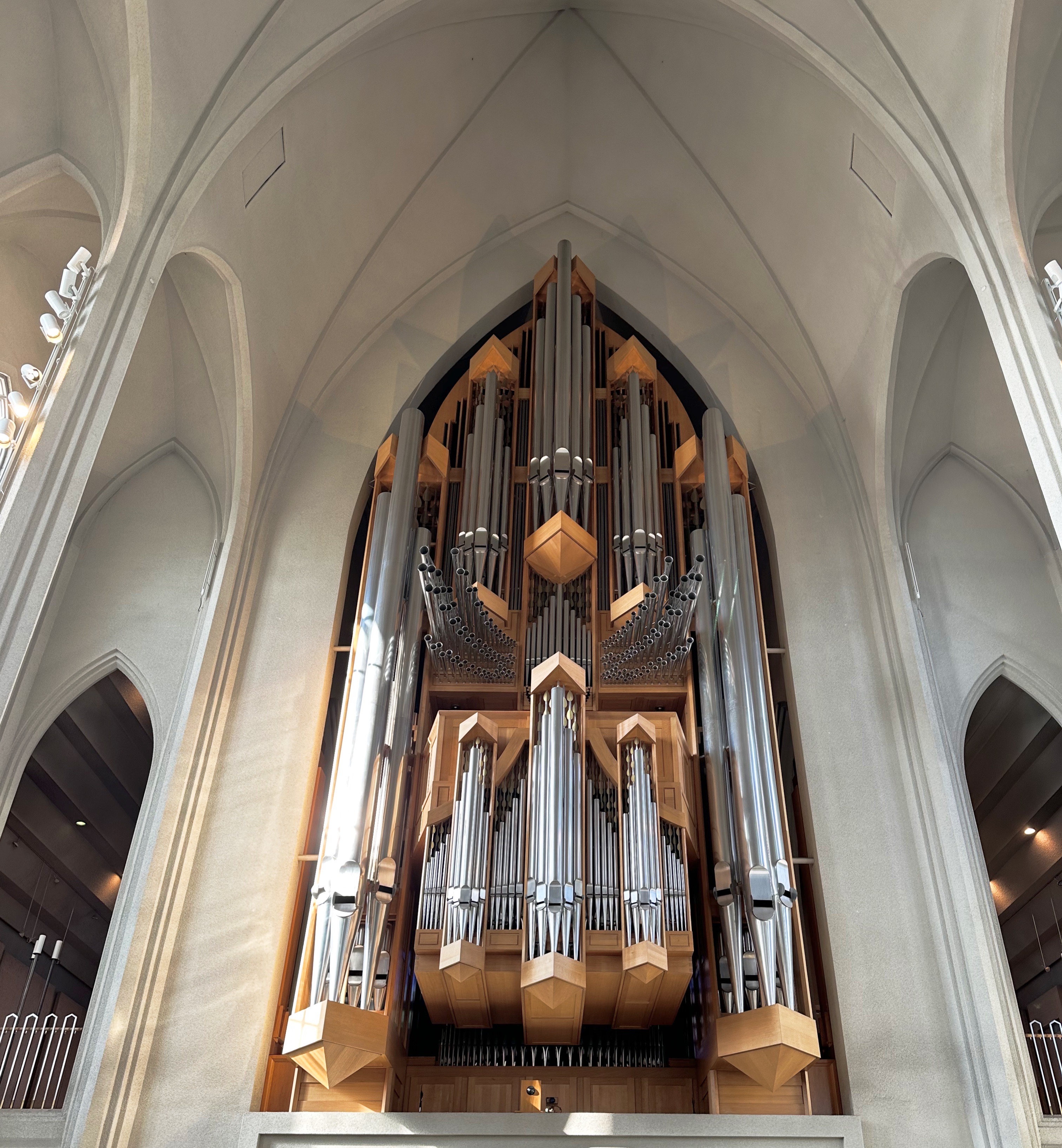
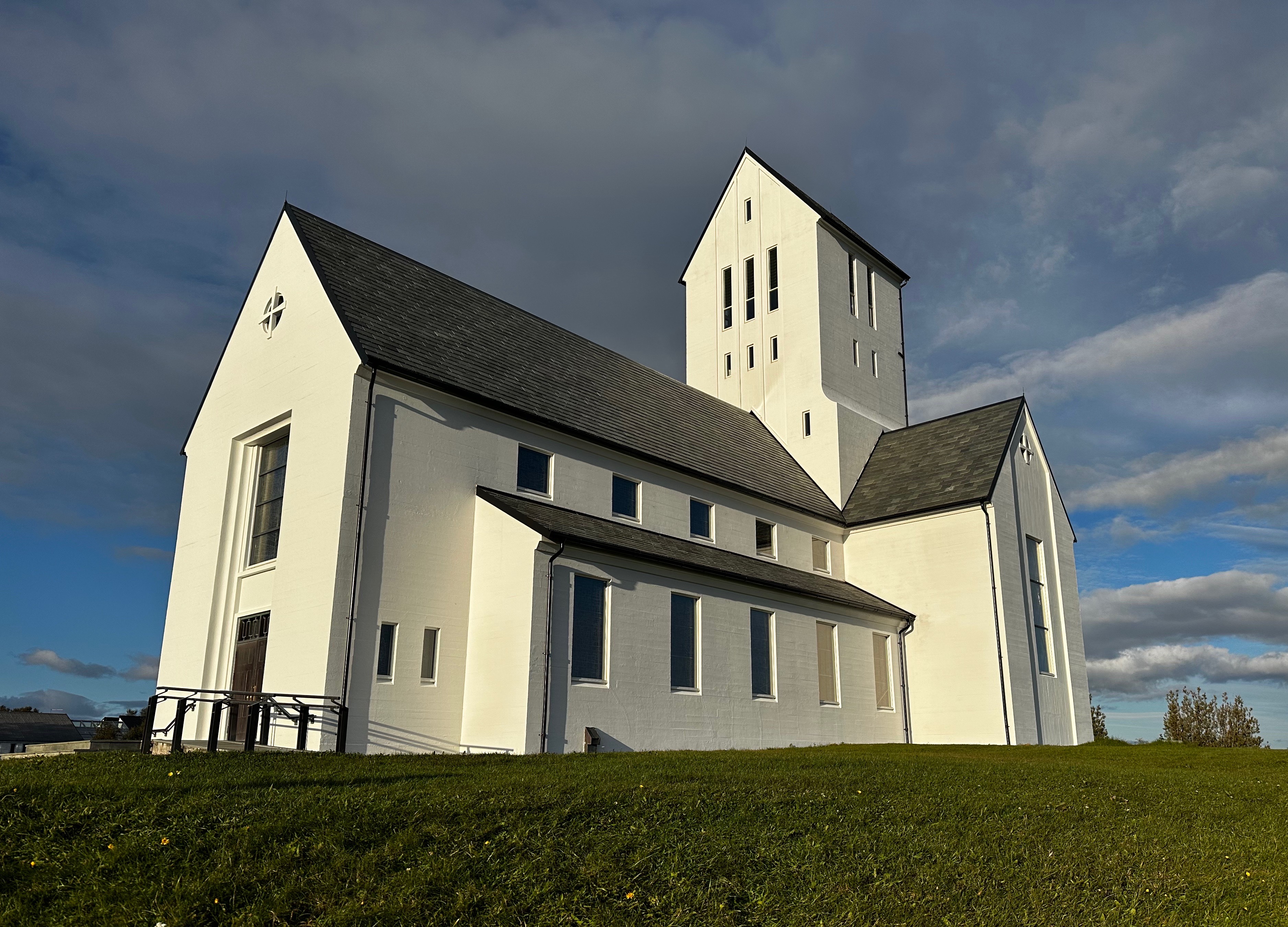
After finishing our drinks (and pastries) we walked up the hill to visit Hallgrímskirkja (the church of Hallgrimur). The church took 41 years to build. Construction started in 1945. Hallgrimskirkja is the tallest church in Iceland and provides fabulous views of the city, harbor, mountains and volcanoes from the top of the 243 foot tower.


Unlike the United States, Iceland has a state sponsored and protected national church – the Evangelical Lutheran Church of Iceland (hin evangelíska lúterska kirkja). There is religious freedom in Iceland and a number of other religious faiths are practiced in the country.
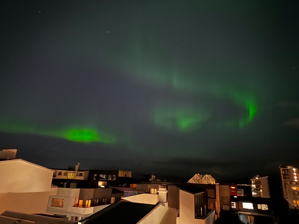
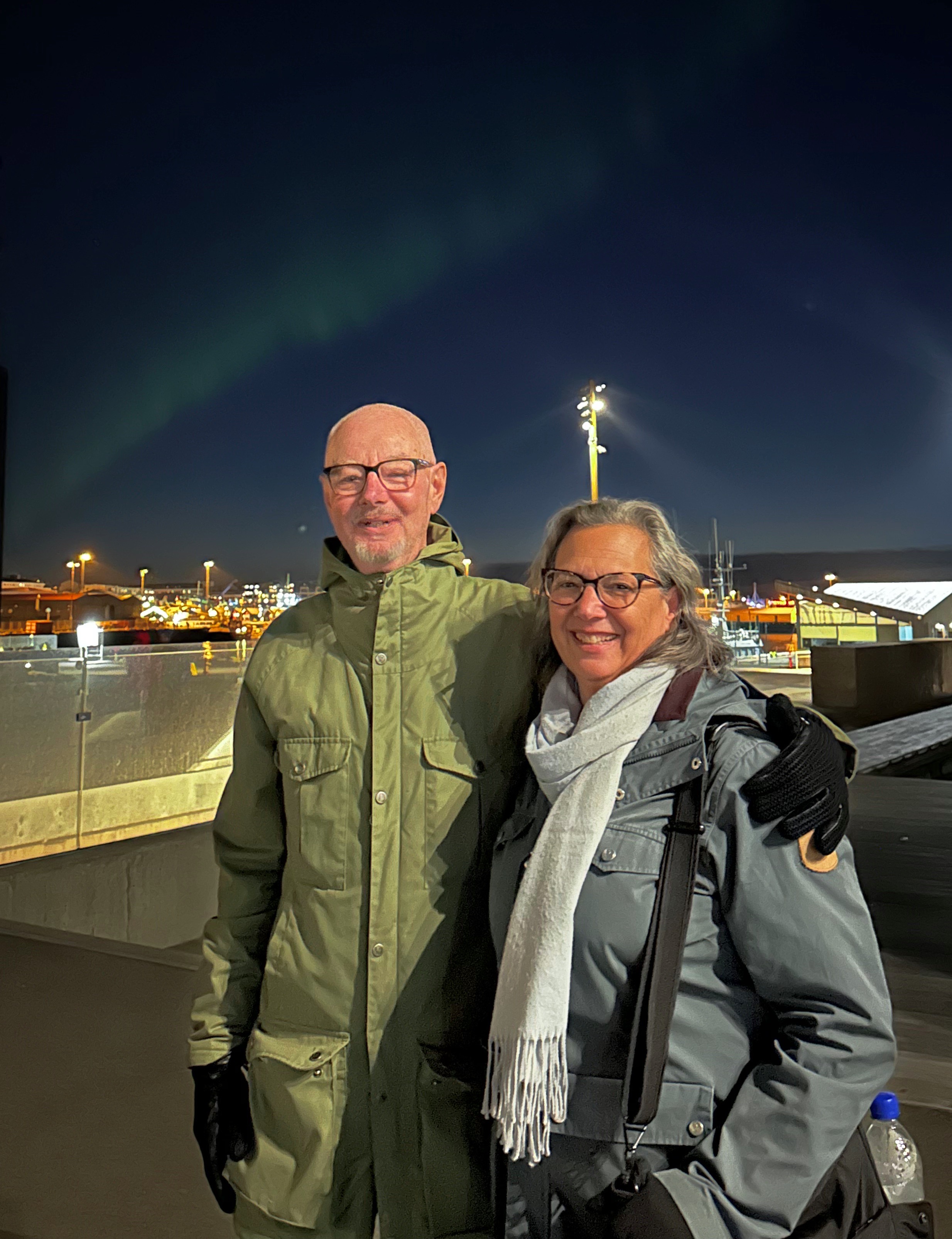
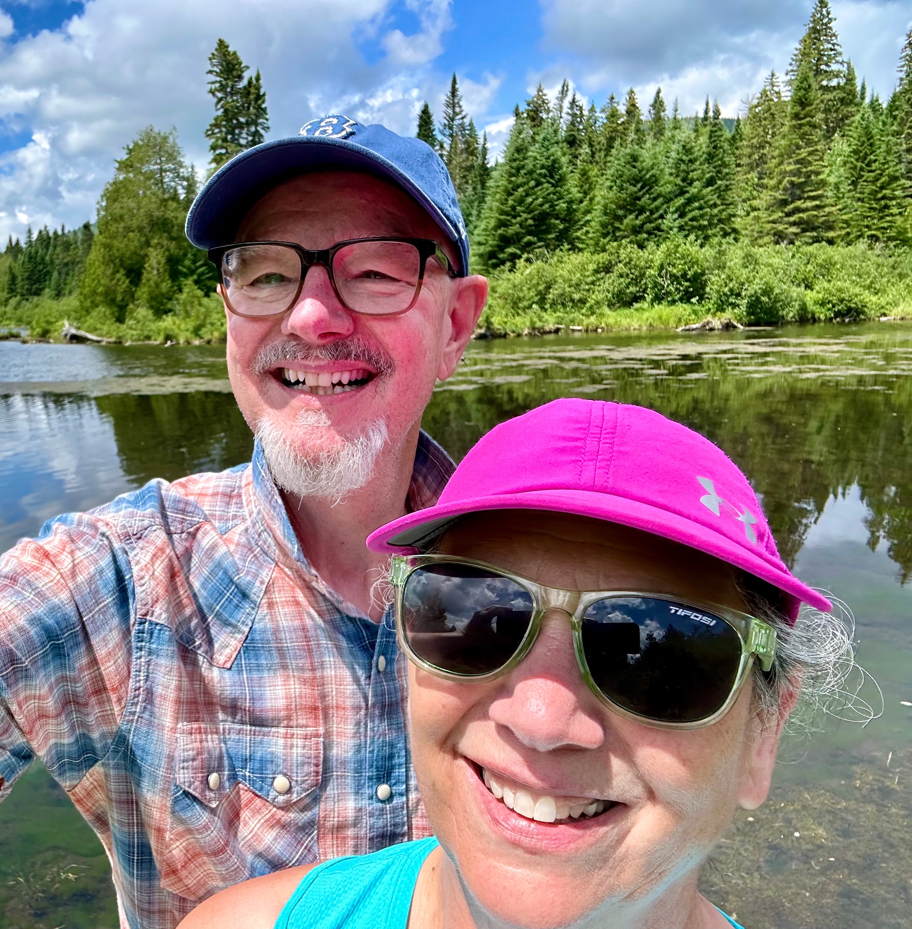
After visiting the church we did a bit more strolling, grabbed a quick fish and chips dinner and went back to our hotel satisfied with a good first day. As we lay in bed, as if on cue, the Aurora Borealis appeared and we jumped up and out onto our balcony to take in the show and snap some pictures. We upgraded our good first day to an excellent first day! Húrra!
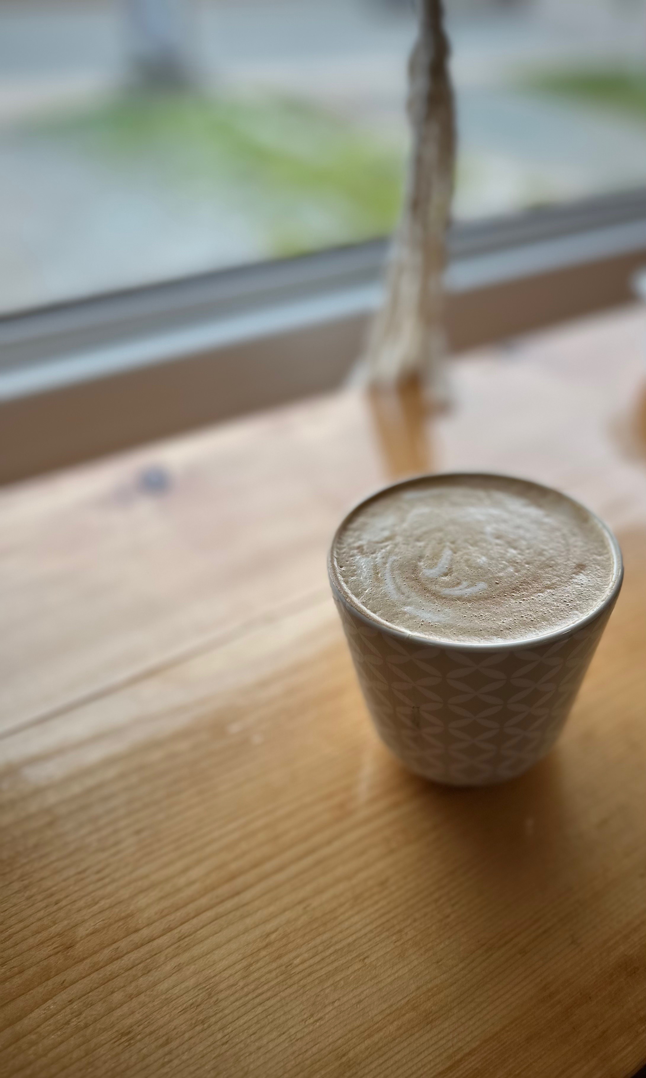
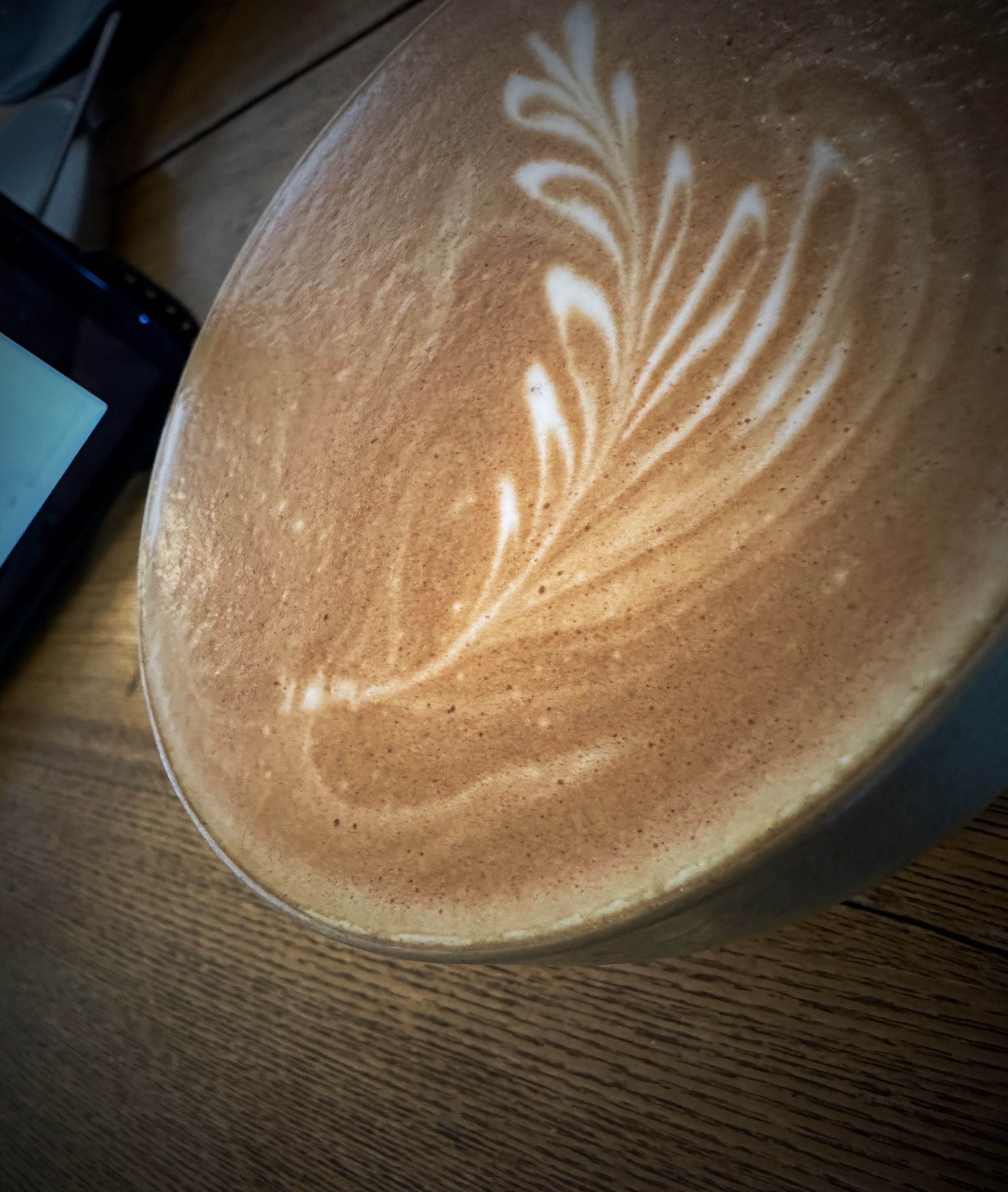
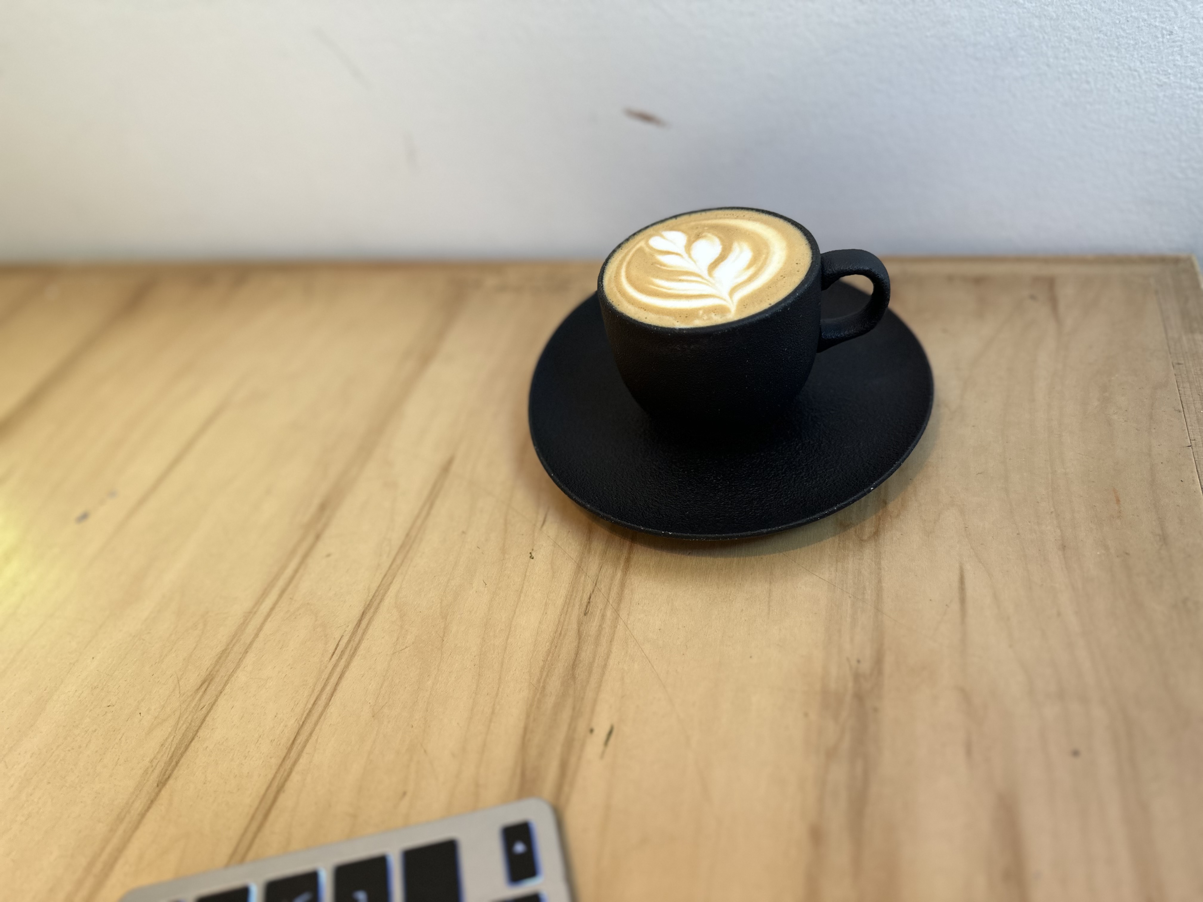
In accordance with Rule One of Travel (all days must begin with tea and coffee) we checked out TE & KAFFI (directly across the way from the hotel). TE & KAFFI was up to snuff and we added the establishment to our inventory of specialty coffee shops for our stay in Reykjavik.


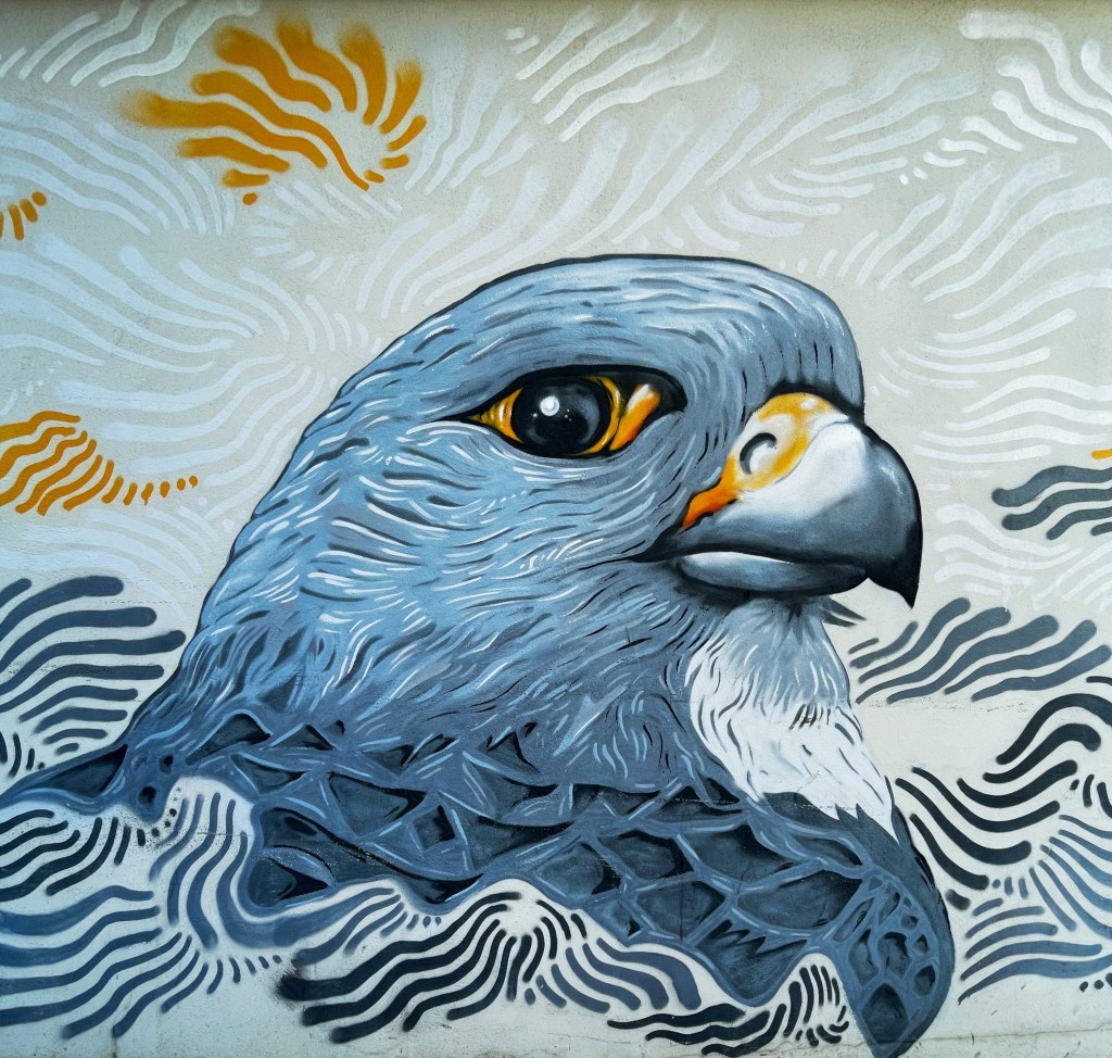
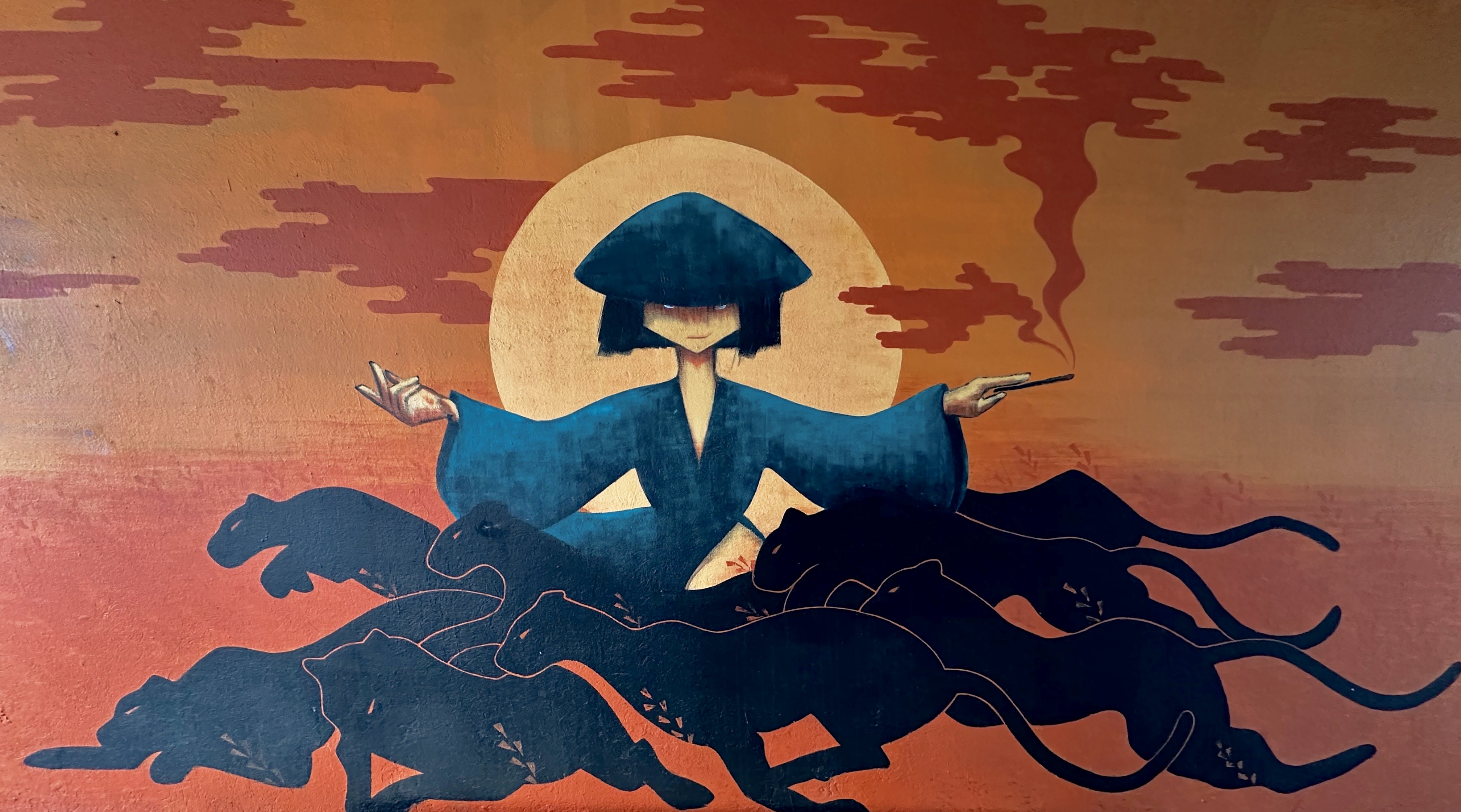
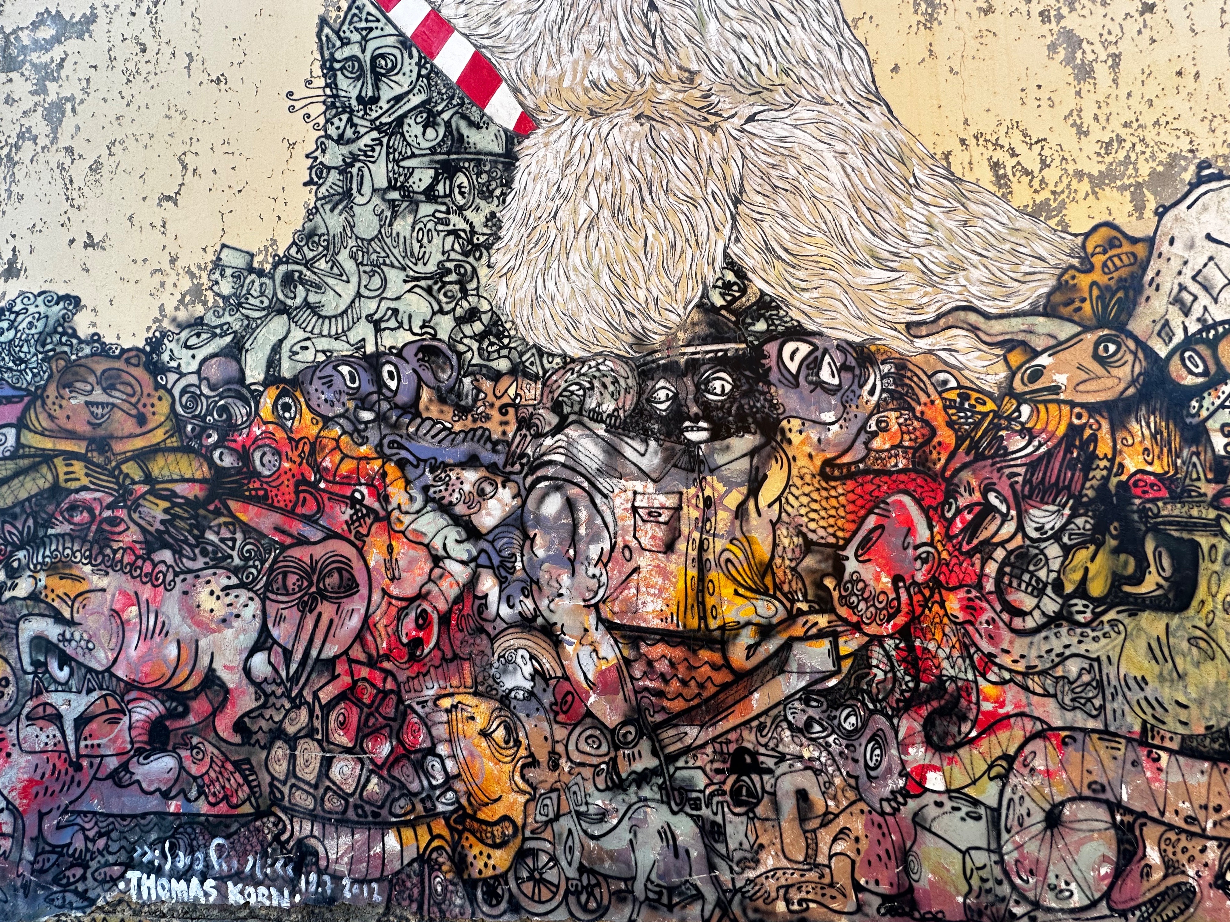
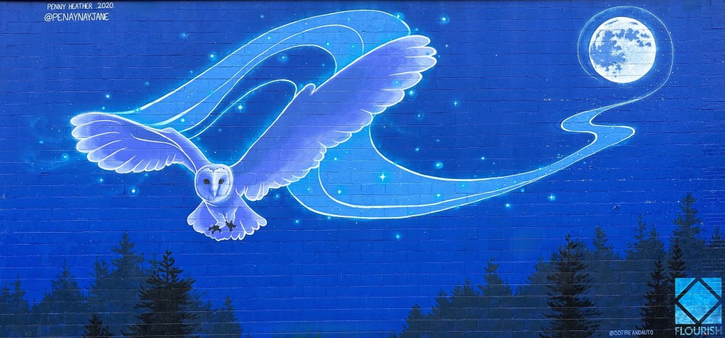
After fika we spent the morning exploring the city on foot and made our first visit to the waterfront. We also happened upon several more excellent street murals. While down at the old harbor we popped into the one of the three Reykjavik Art Museum locations. The exhibitions at this location when we visited were not a good fit for our sensibilities so we did not tarry.


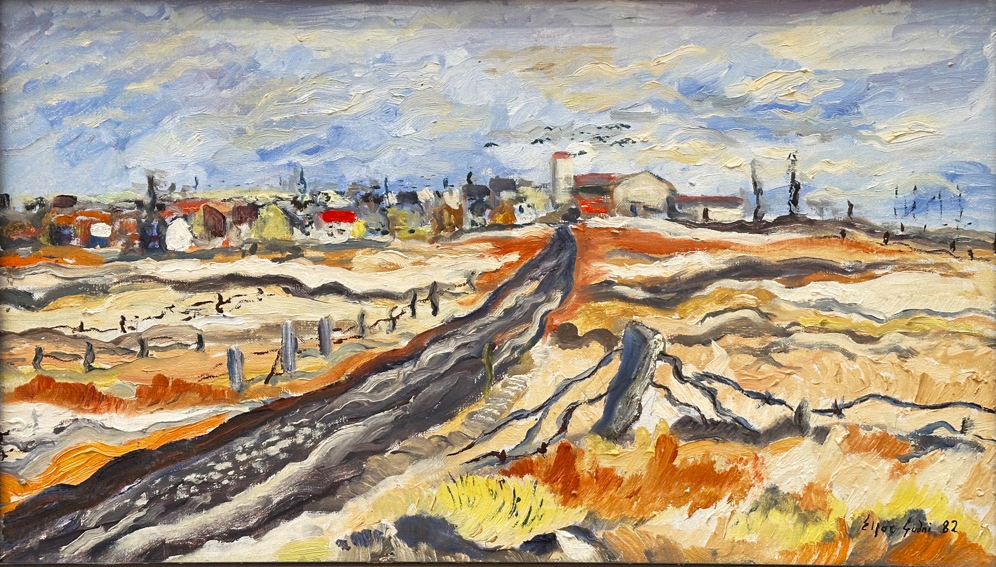
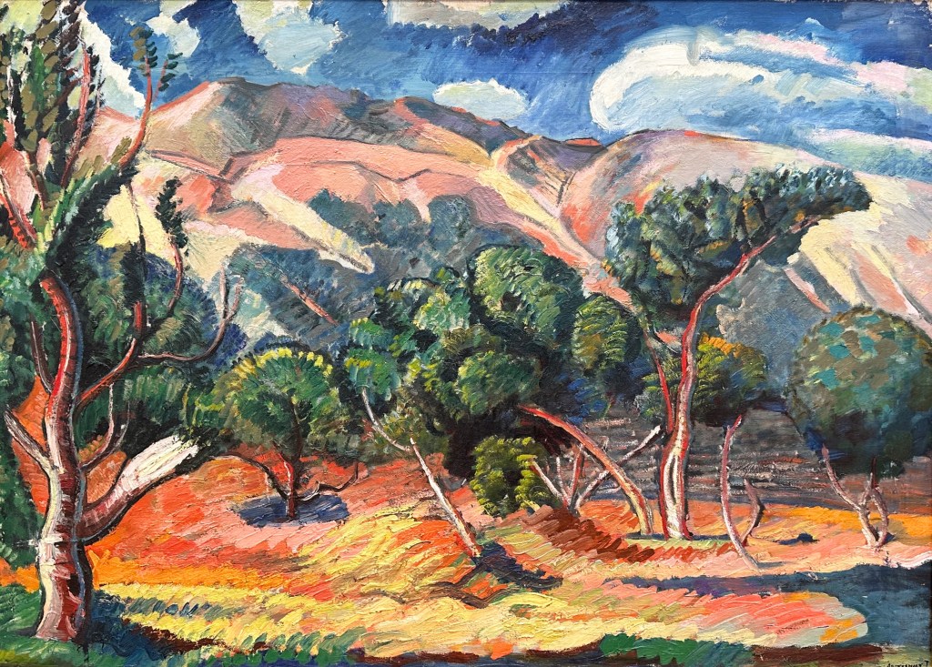
Towards early afternoon we walked back up the hill from the old harbor area to check out one of the other art museums. This museum, Kjarvalsstaðirat, was exhibiting predominately landscape paintings by both professional and amateur Icelandic artists. The museum is named after Jóhannes Sveinsson Kjarval (1885-1972). Kjarval is Iceland’s most revered painter and many of his paintings are on display.

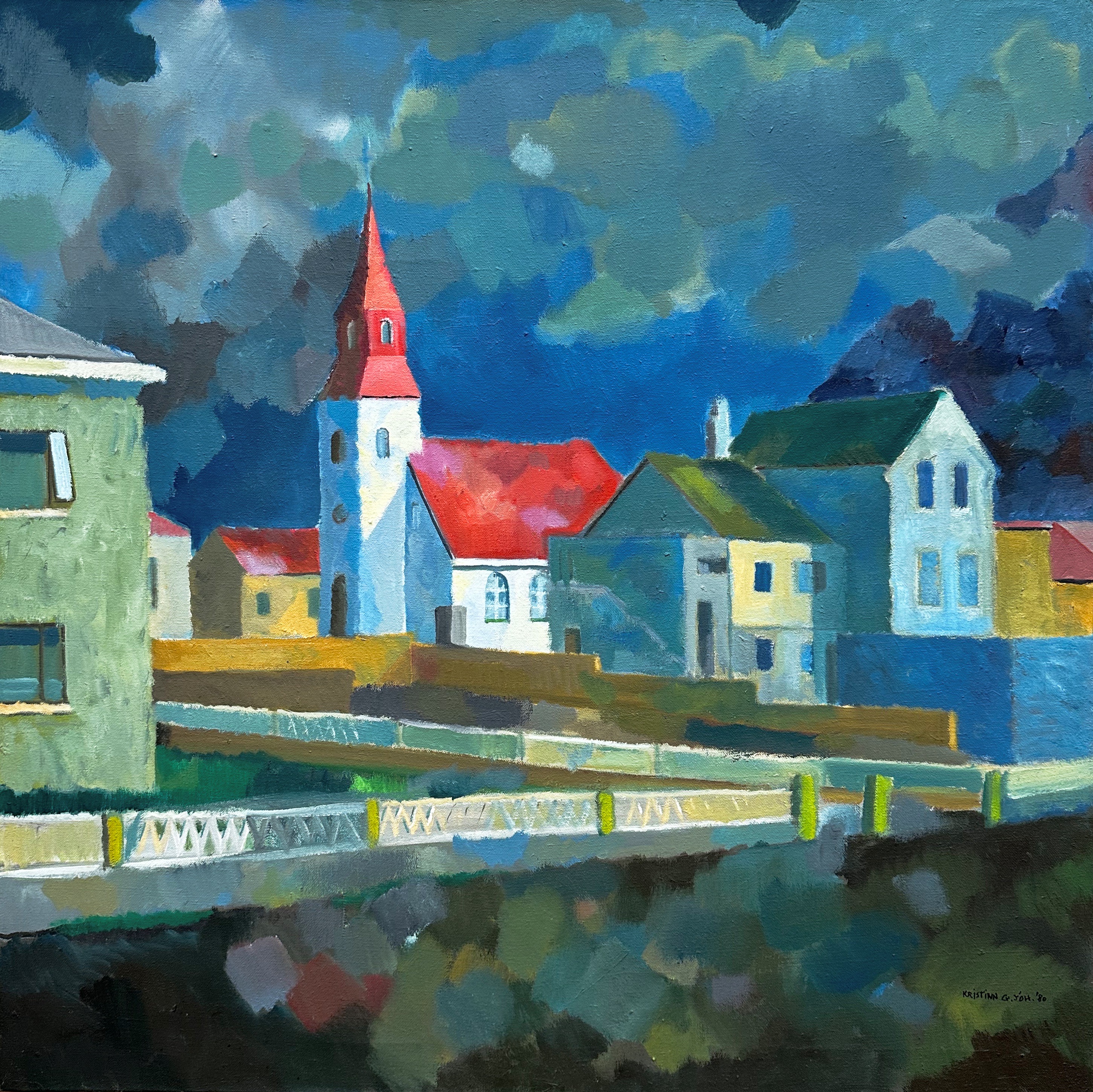


The art here was much more to our liking (or comprehension) and was a lovely mix of colorful renderings of the Icelandic countryside and cityscapes.

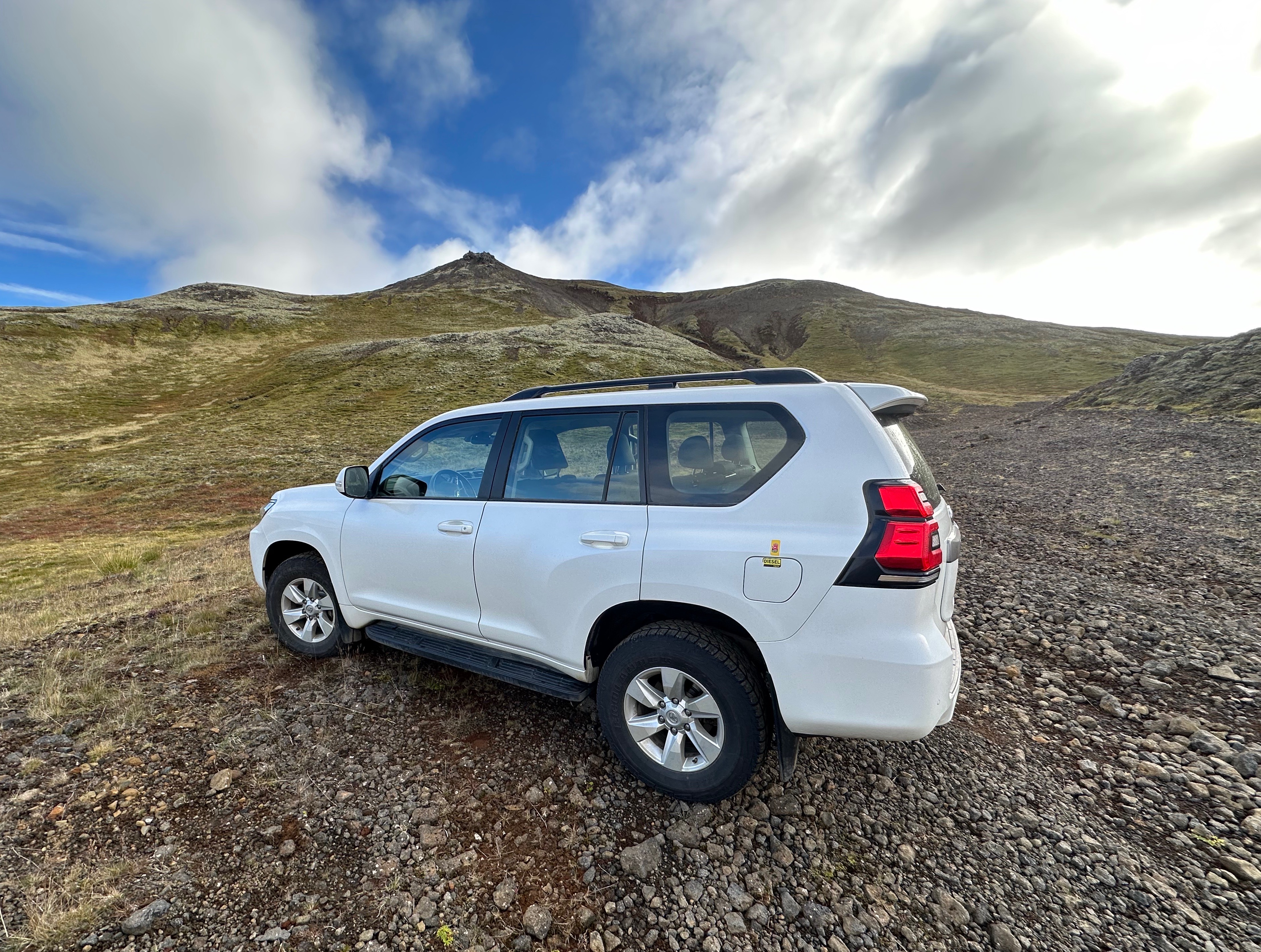
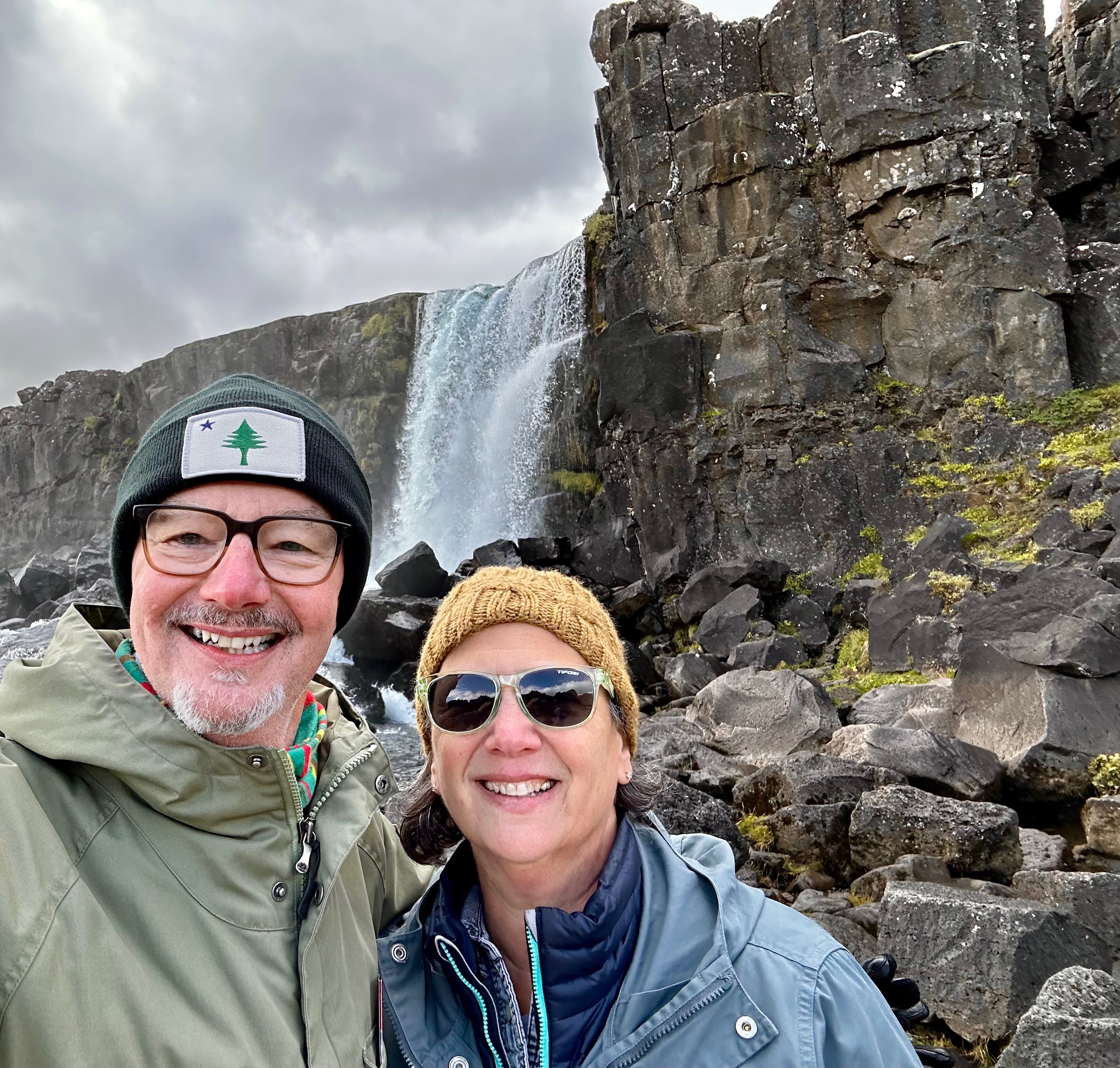
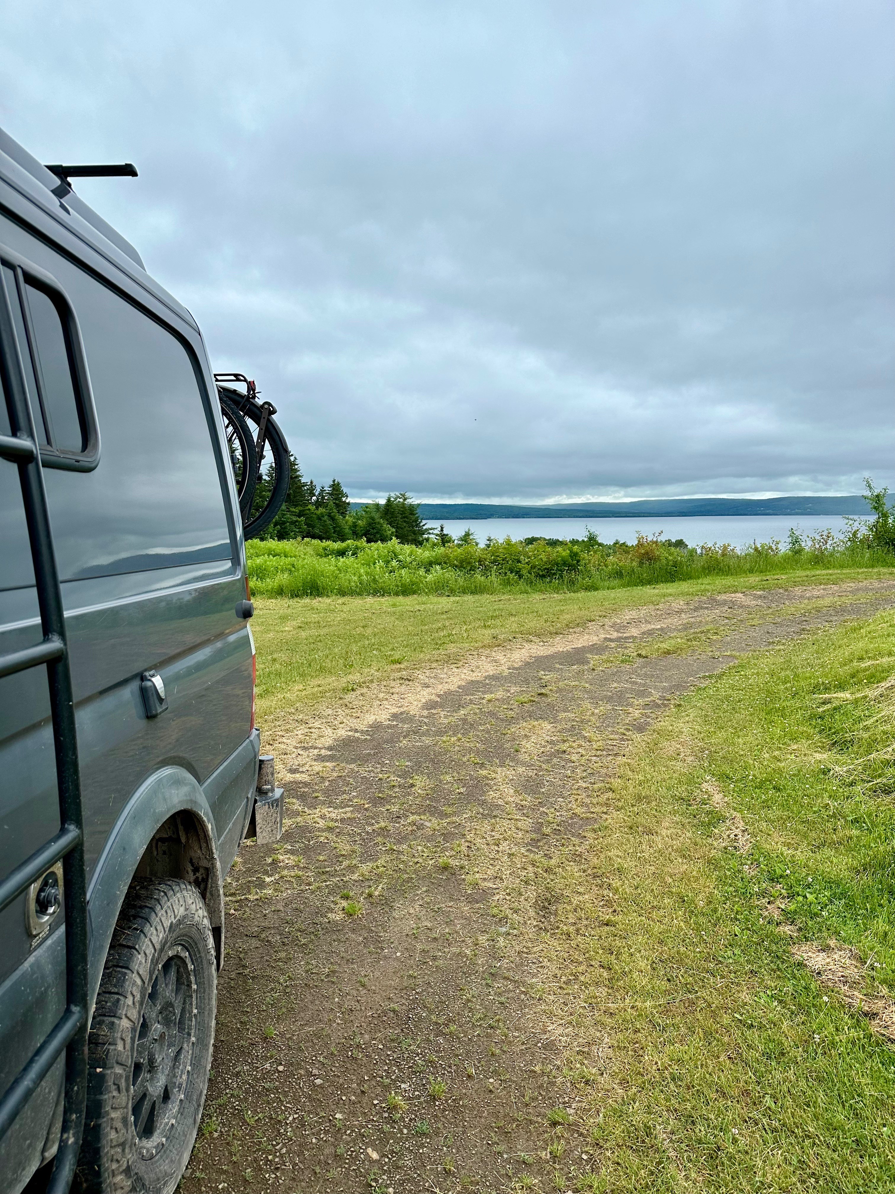
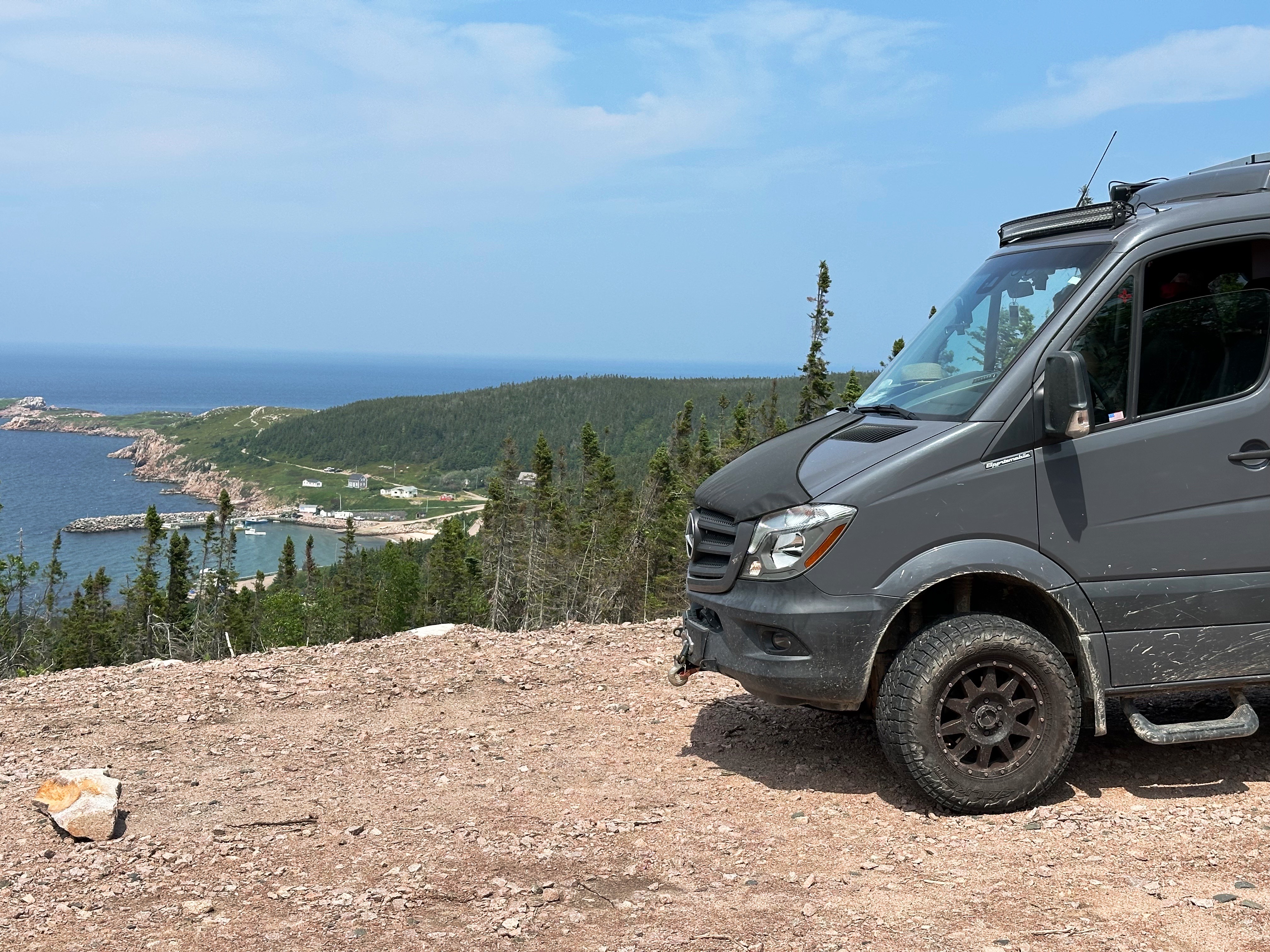
For our third day we hit the road (after coffee and tea) in pursuit of the Golden Circle (GC). We rented a 4WD SUV in case we found ourselves off the pavement in pursuit of getting up close to some of the natural features along or near the GC route. This worked out nicely as you can see from the photos directly below.


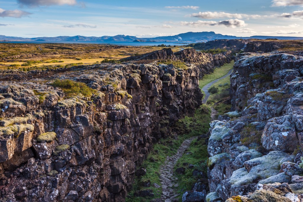
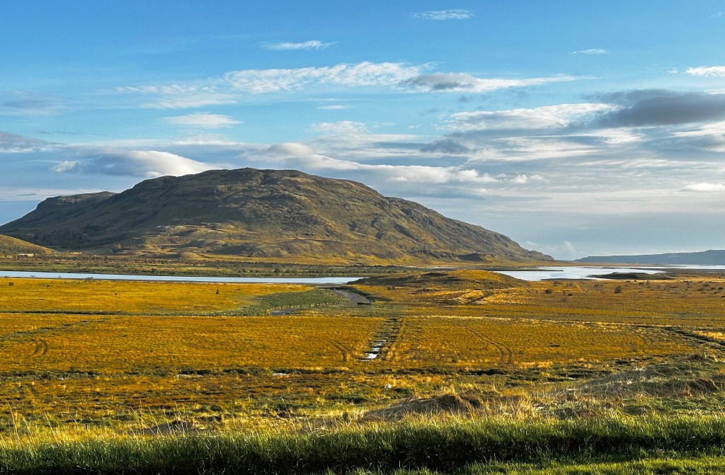
We made our way Þingvellir National Park (PNP) along an alternate route utilizing the excellent skills of our senior navigator. As we approached the park Þingvallavatn Lake came into view. It is the largest natural lake in Iceland. You may notice in the photo above left the large pipeline. In the States you might expect it to be an oil or gas pipeline – not in Iceland – this pipeline carries geothermally heated water. It carries millions of gallons per minute of boiling water and provides heat for most of the residents of Iceland.
The park is historically important to Iceland as it was the location of Iceland’s first parliament, which met there on the open plains from 930 until 1798. The park location is considered to be the birthplace of Iceland.

The other aspect that makes this beautiful park important is that within the park are the rift valleys that separates the continental plates. The rifts run north – south. The plate to the east is Eurasia while the plate to the west is North America. Some of the rifts are dry allowing visitors to walk through while others have filled with water.


After completing our hiking loop at PNP we continued north on the GC. We bypassed the popular Geysir Hot Springs as we have seen many a geyser (including Old Faithful) during our travels in the Western United States.

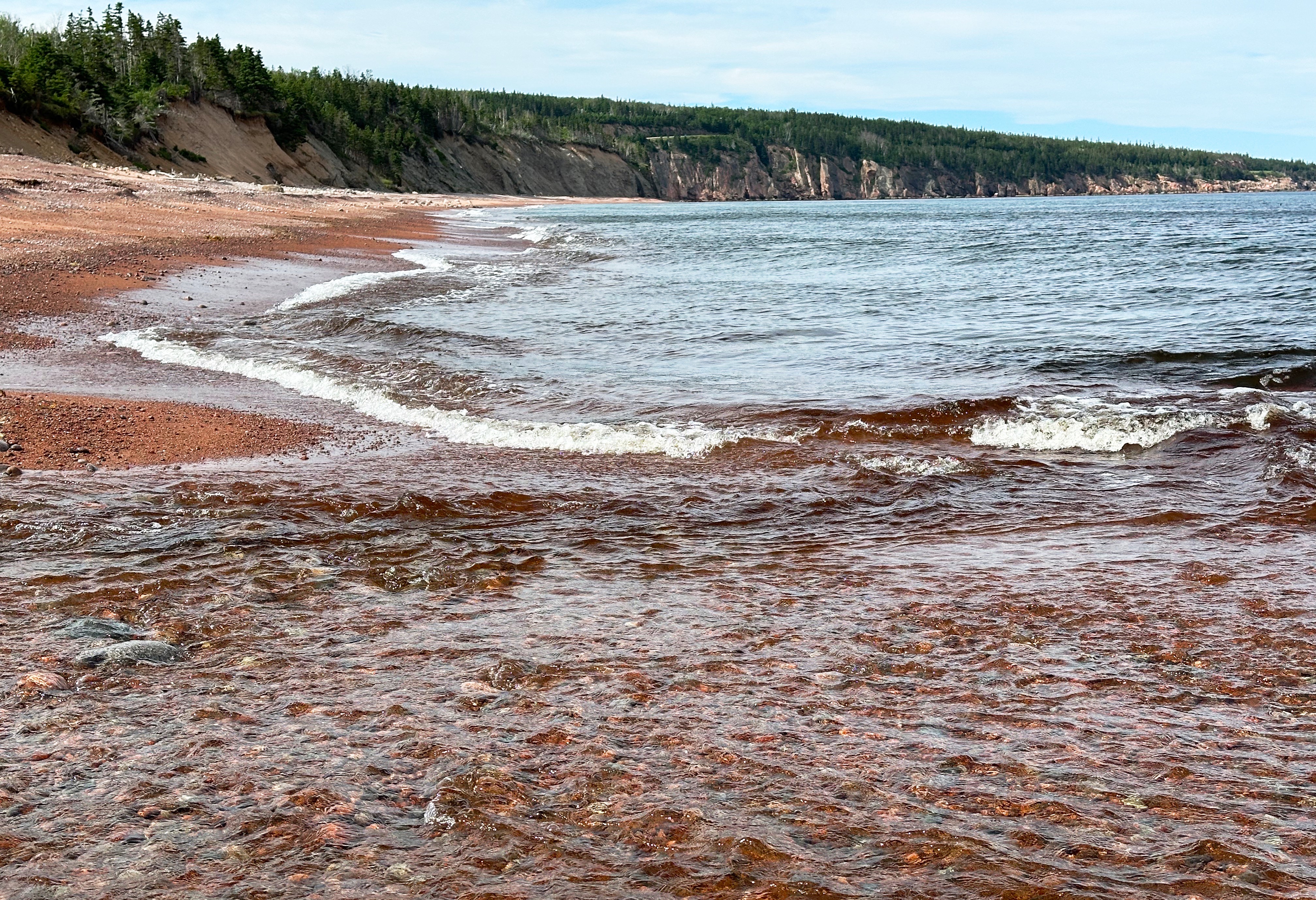
Gullfoss (Golden Falls) is impressive for its sheer force and size – and – it is a traverse waterfall. The water falls 105 feet into a crevice and then flows sideways and then down through a canyon that reaches 230 feet in depth. The waterfall is located on the Hvítá (White) River and is fed by the Langjökull Glacier.

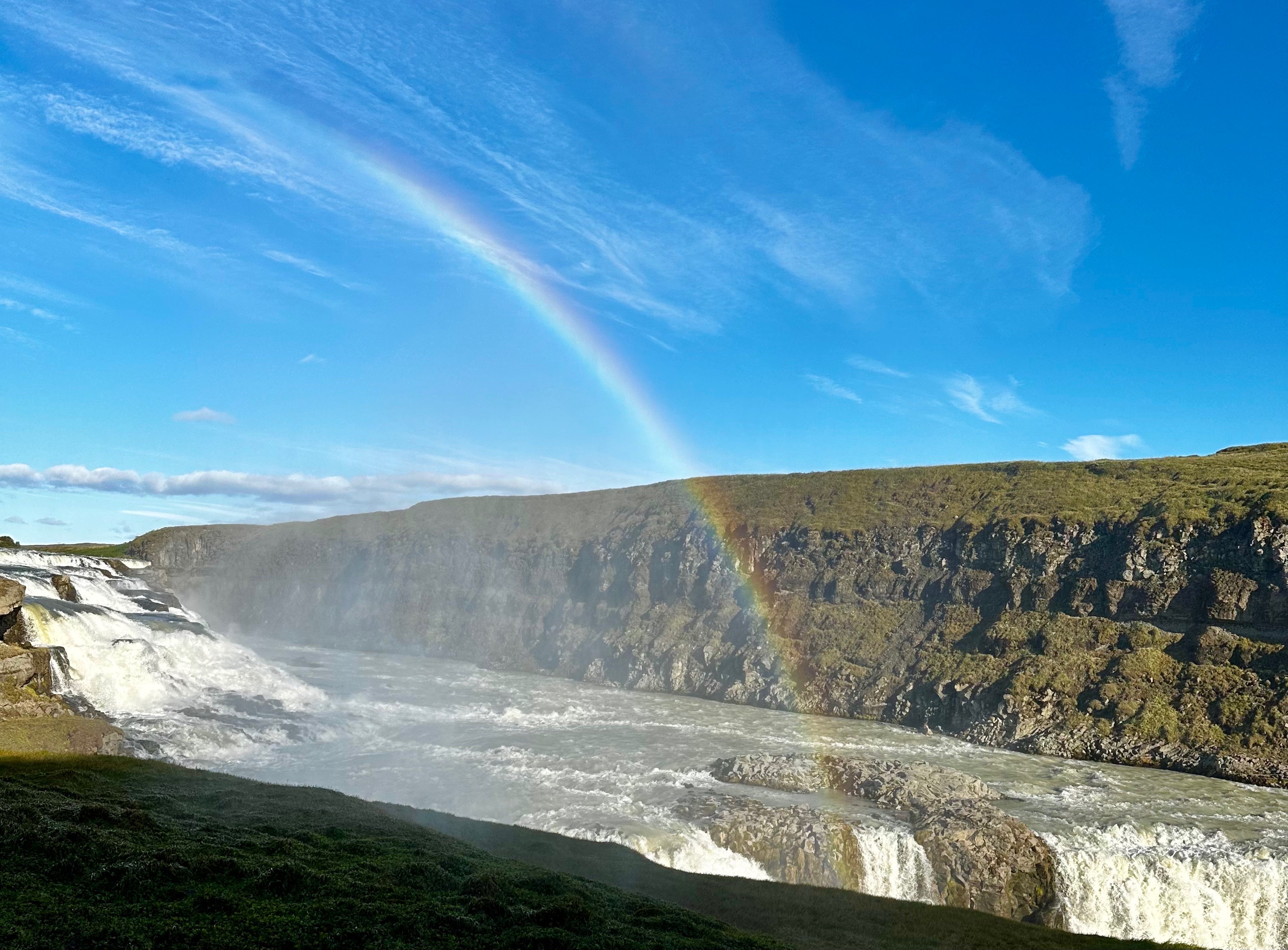
It is hard for us to fathom but Gullfoss was privately owned by a local sheep farmer – Tómas Tómasson. A British firm (it’s always the British) attempted to purchase the property to use it to generate electricity. Fortunately, that never came to fruition and the river and falls remain in their spectacular natural state (owned and protected by the government of Iceland).
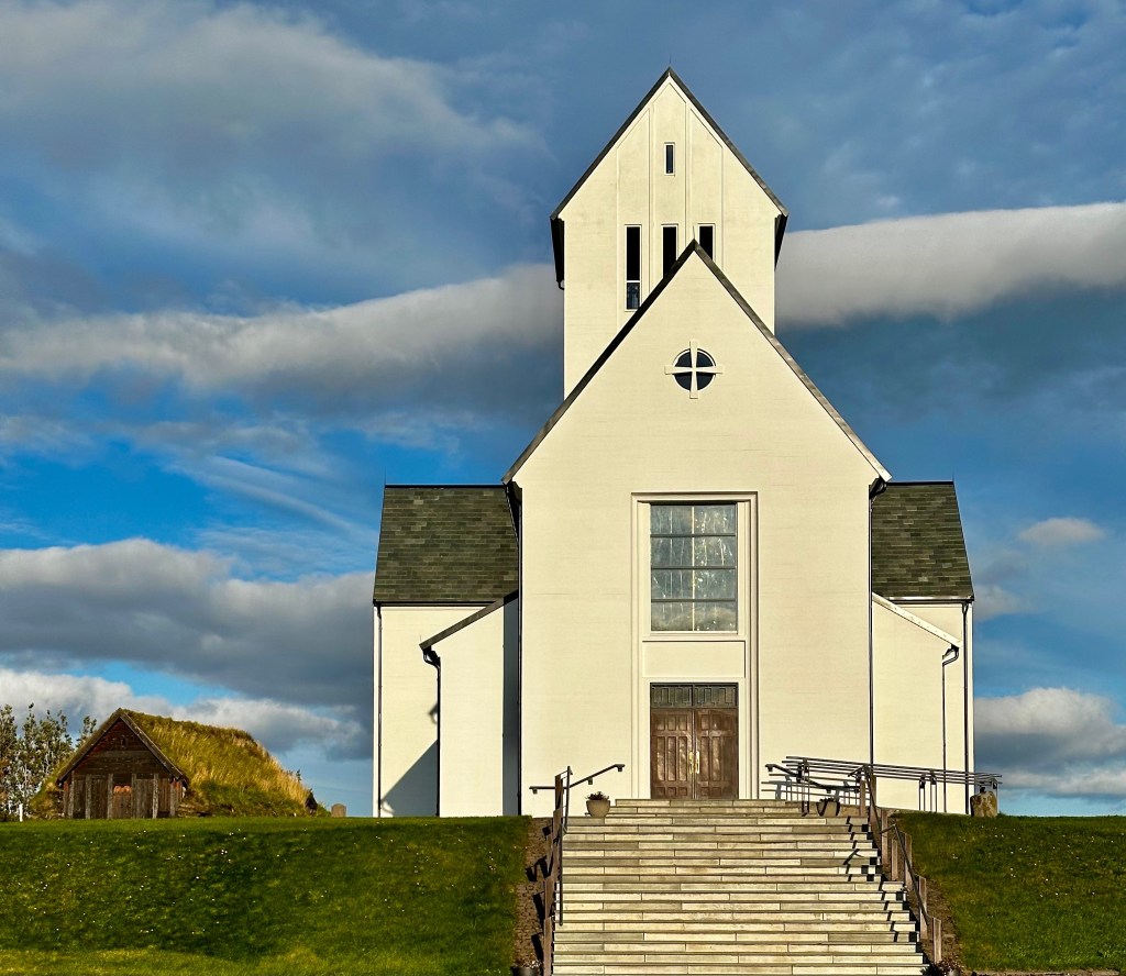
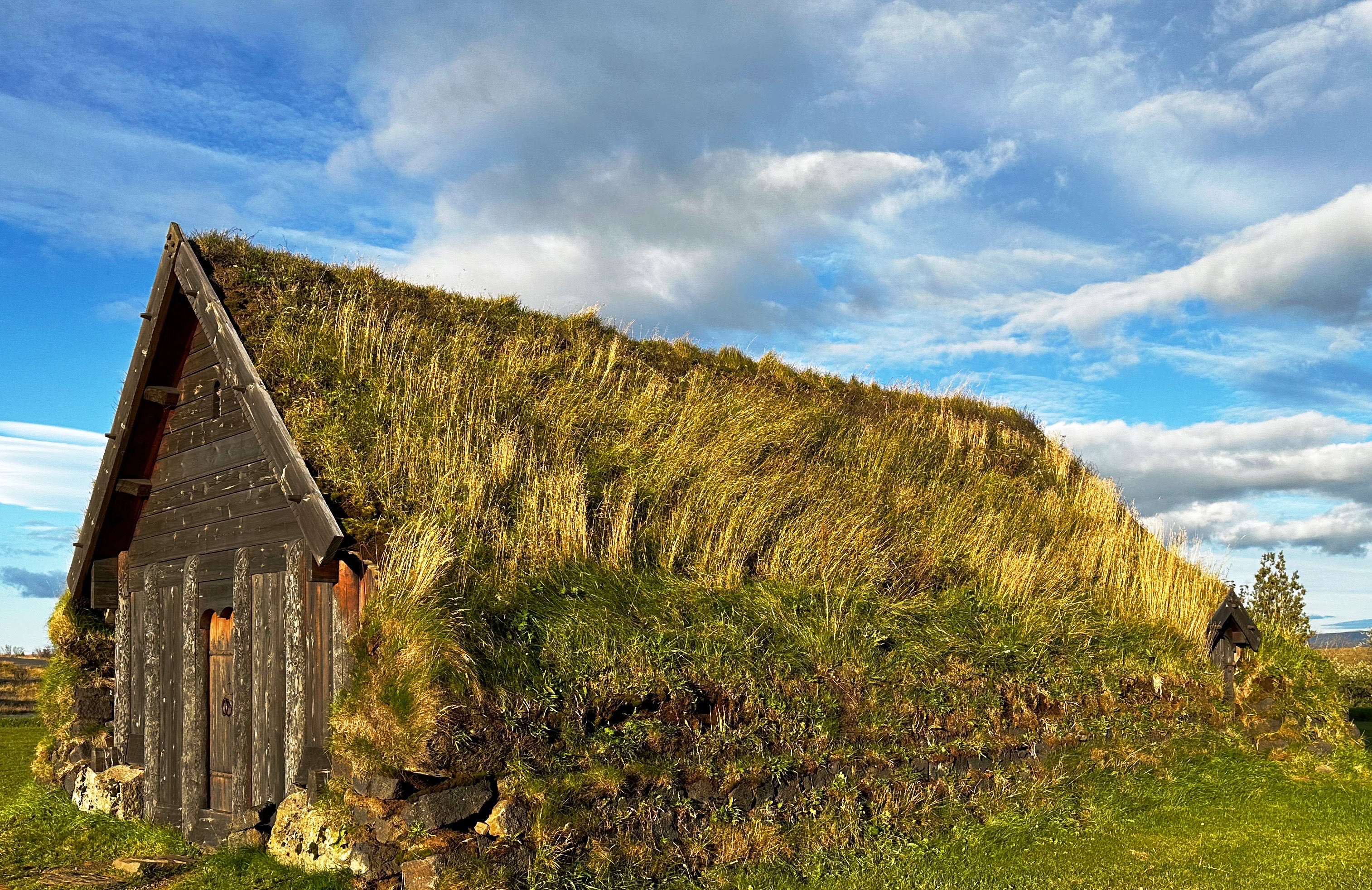
From Gullfoss we started our return to Reykjavik. We detoured across Route 31 to see the Skálholt Church. The first Episcopal church in Iceland was built at this location in the year 1000. By 1550 the Reformation was in full swing under the auspices of the King of Denmark. In order that everyone understood his intent he had Jón Arason, the Catholic Bishop Of Iceland (the last Catholic Bishop of Iceland) and his two sons executed at Skálholt. Lofið drottin! In other news, the current church was built between 1956 and 1963.

We booked a food tour with Wake Up Reykjavik on the recommendation of our good friend Brian. The tour was lots of fun and the food was quite good. The tour included five stops to sample different dishes. We have included below the five stops and a description of the food we sampled. Thank you Brian!
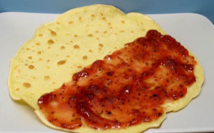
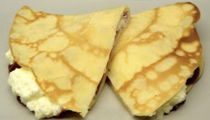
Hotel Borg (The oldest hotel in Iceland) Icelandic pancakes with sugar, jam and whipped cream. Ljúffengur!!

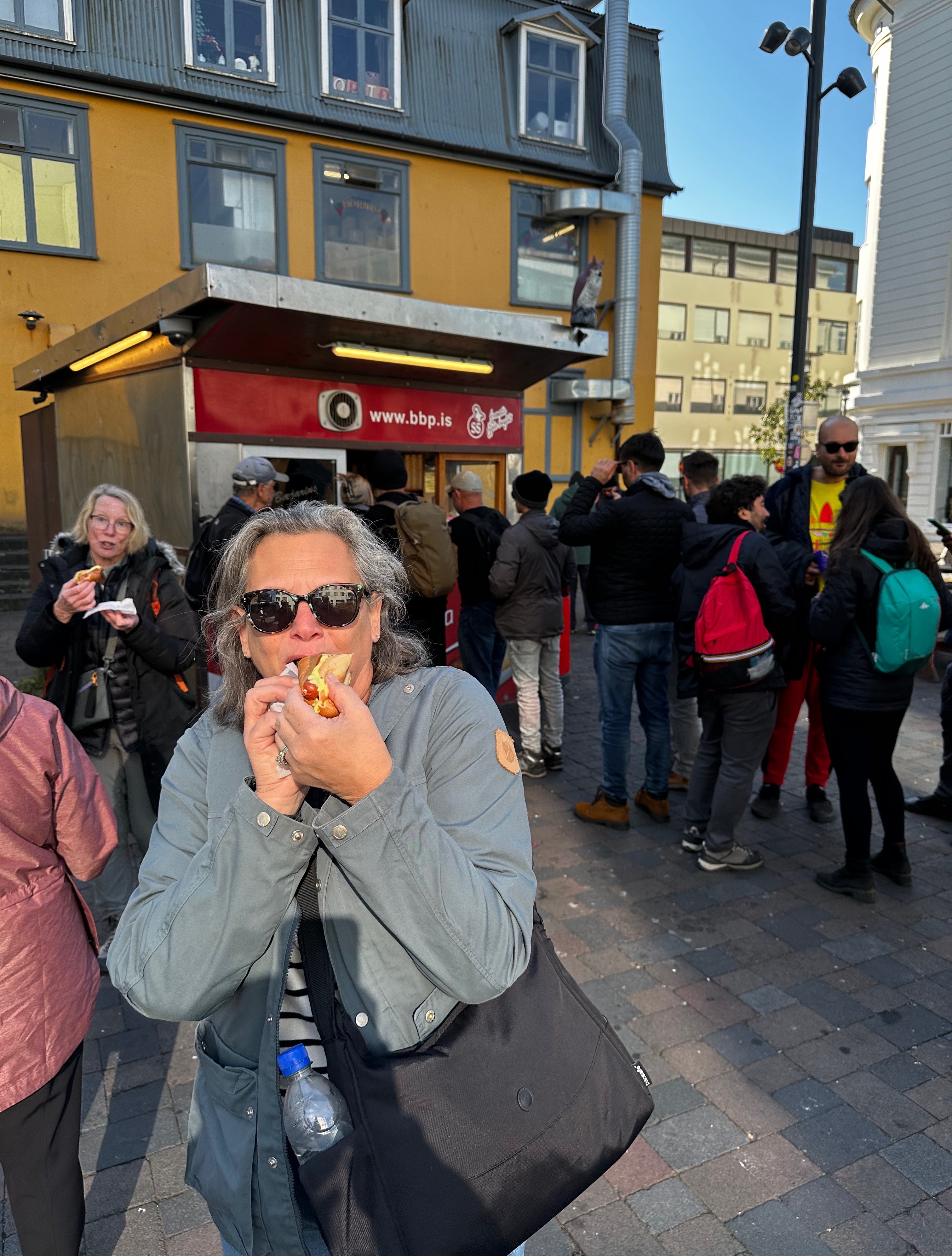
Bæjarins Beztu Pylsur (The Town’s Best Hot Dogs) Traditional Icelandic hot dog with Icelandic ketchup, Icelandic mustard, remoulade sauce (remúlaði), deep fried onions and raw onions. Made famous after Bill Clinton visited for a dog. He had mustard only – now known as a Clinton!

Sólon Islandus (The Salvador Dali place) Lamb chop with mustard umami sauce, mashed potatoes and grilled brocollini


The young woman in the photo (above right) is Alfhedur Kristin Hallgrimsdottir aka Alfie. Alfie was our quite entertaining and informative guide. She is holding the traditional and obligatory sample of fermented shark, which is washed down with a shot of a strong liqueur. The lamb was delicious – the shark is what we would describe as an acquired taste.
Sjávarréttagrillið (The seafood grill) Lobster taco on a soft taco shell with garlic sauce, spinach, pickled red onions, deep fried langoustine, date puree, cilantro and parmesan cheese.

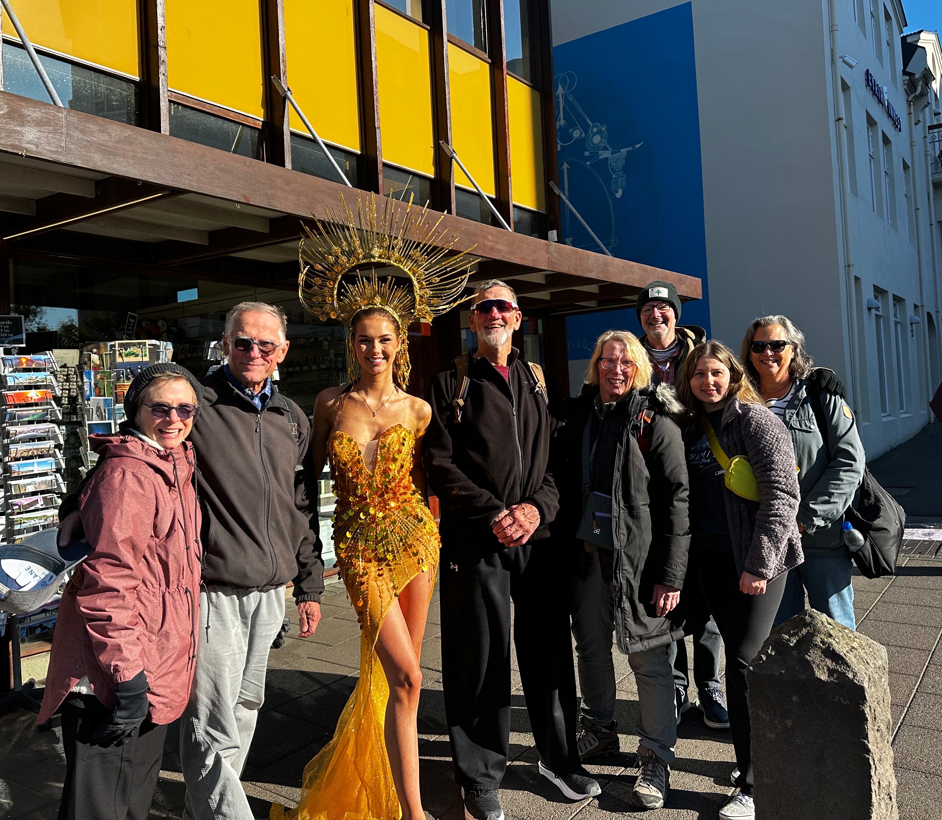
As we left Sjávarréttagrillið we happened upon a former Miss Iceland who was about to do a photo shoot. She graciously posed with our food tour group. She did not appear to mind being outdoors in the 40F temperature without much clothing. Icelanders are tough – and very nice!
Hannesarhollt (The poets/prime ministers cafe) Rhubarb crumble pie – Happy marriage cake! (Hjónabandssæla) Perfect timing as this trip was in celebration of our 45th wedding anniversary!

After our afternoon food tour we were in no need of dinner so we retraced our tour route to photograph some interesting murals we had observed while on the tour and took a break at the hotel before venturing out for an evening of jazz.


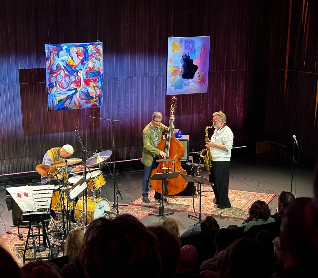
The jazz concert was taking place at the modern and architecturally award winning Harpa Concert Hall and Convention Center. The Harpa was opened in 2011. This stunning facility sits directly on the waterfront and hosts the Icelandic Symphony, Icelandic Opera, Big Band and many other shows within the various venues housed here.

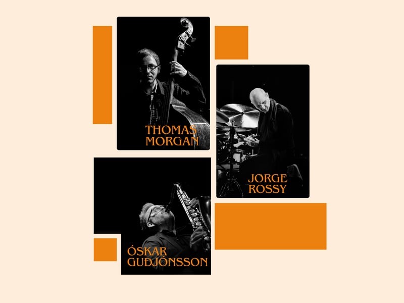
We were quite fortunate that the Trio Óskar Guðjónssonar, Jorge Rossy og Thomas Morgan was performing that night. The three members of the trio are all veteran performers who have toured extensively internationally and played with many renowned jazz bands.
The show was great. The trio played a number of their own compositions as well a several jazz standards. We also enjoyed the polite audience – no talking or videoing during the show! What a treat after experiencing so many disrespectful and boorish audiences at music events in the U.S.

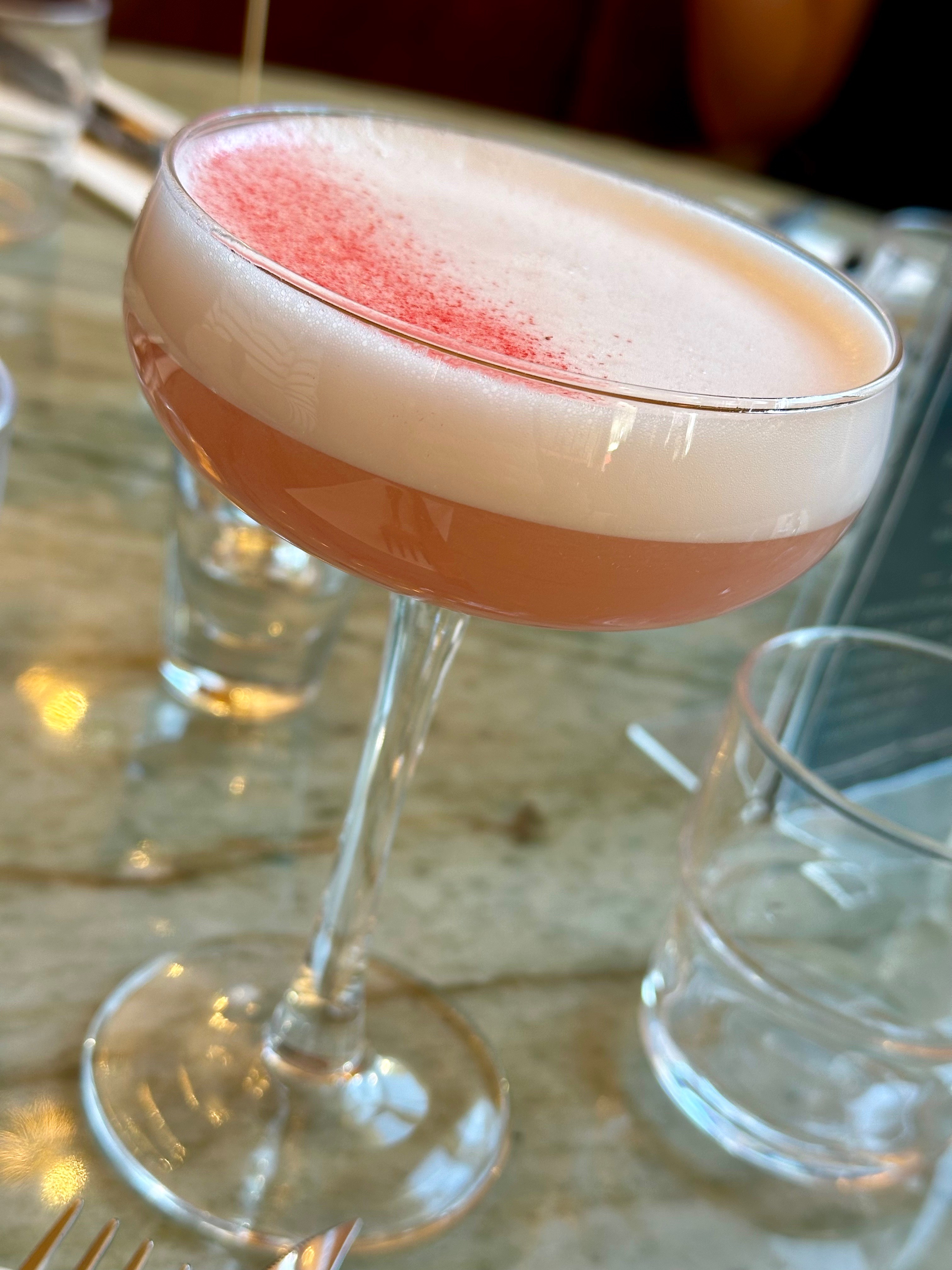
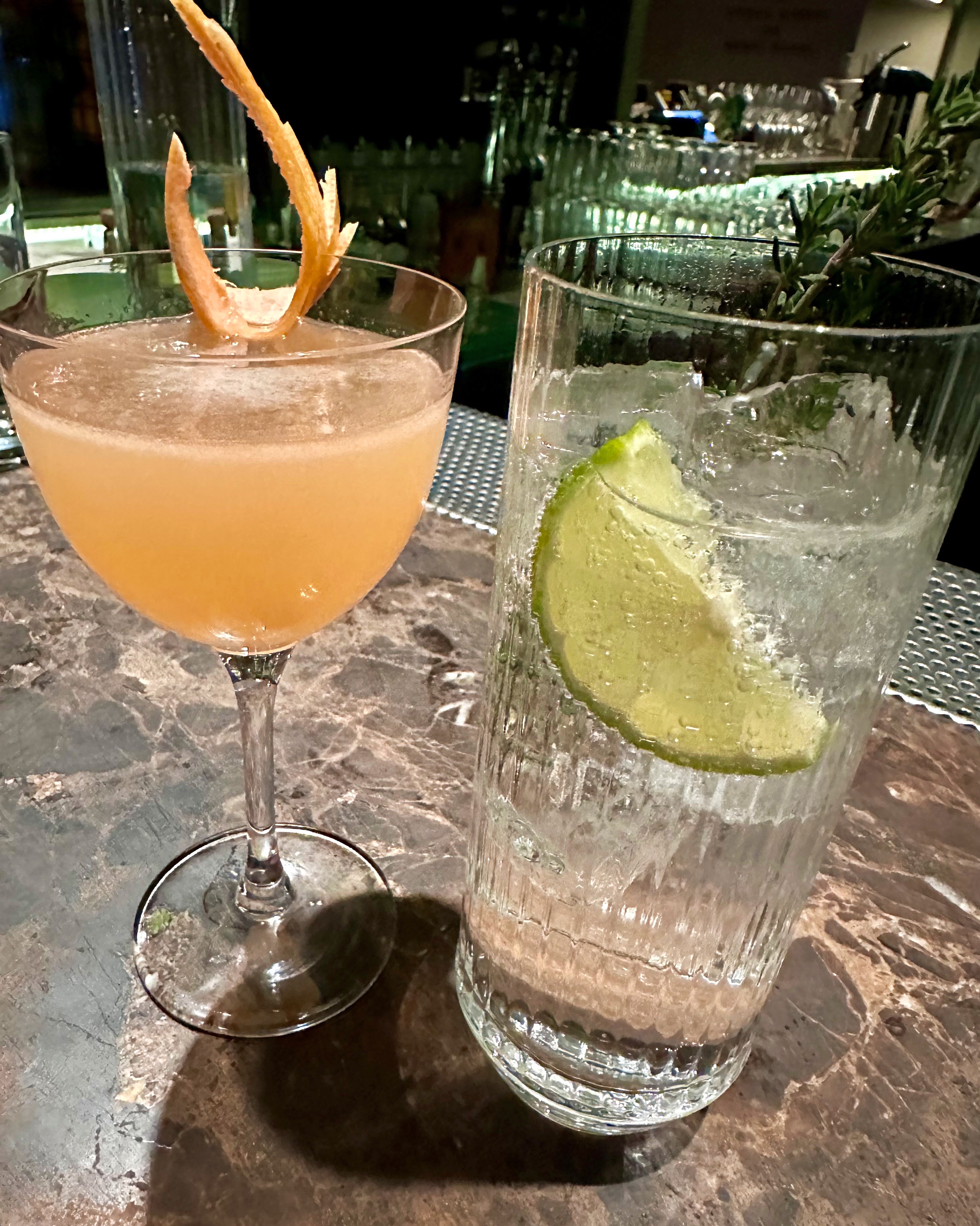
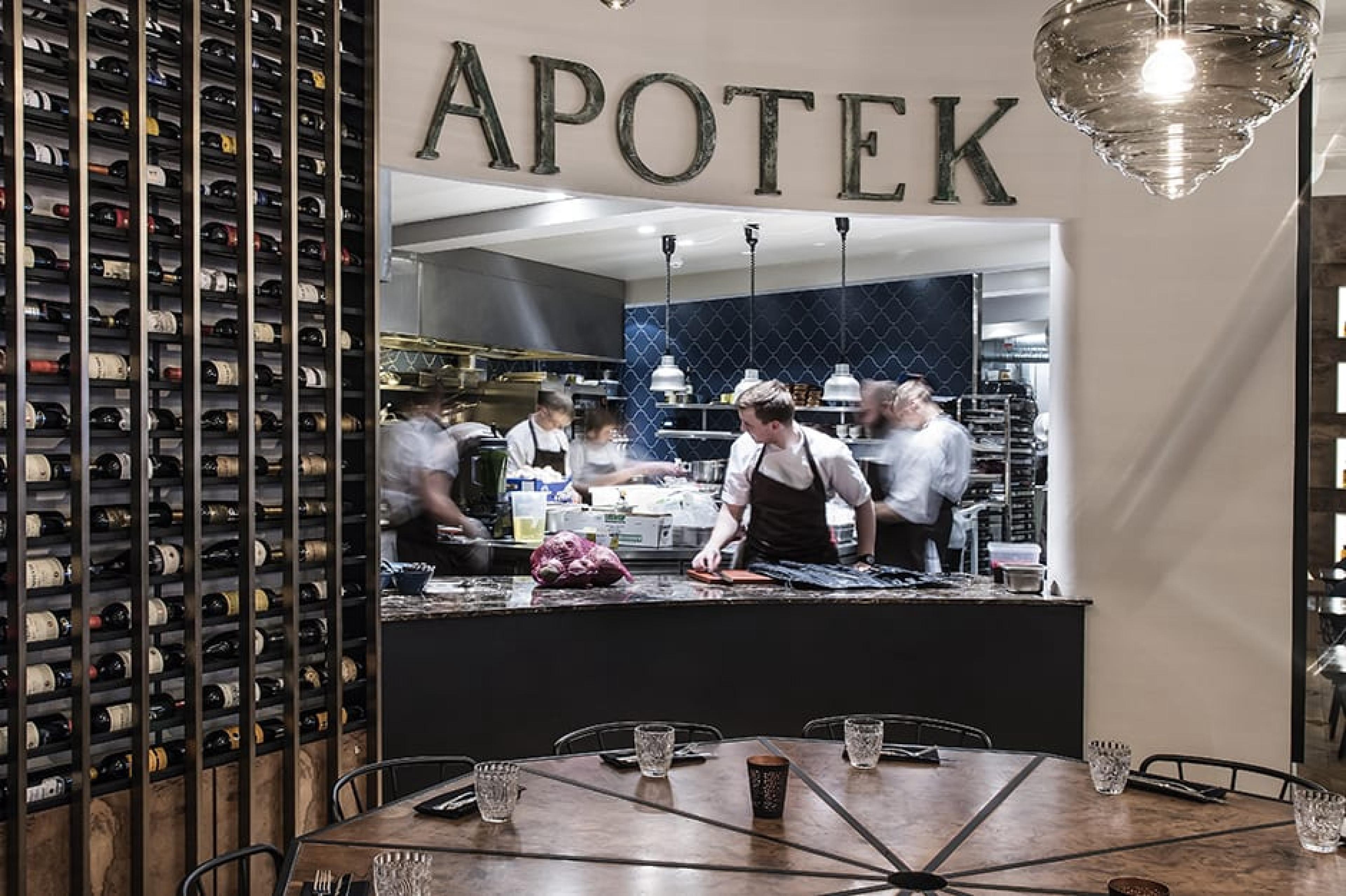
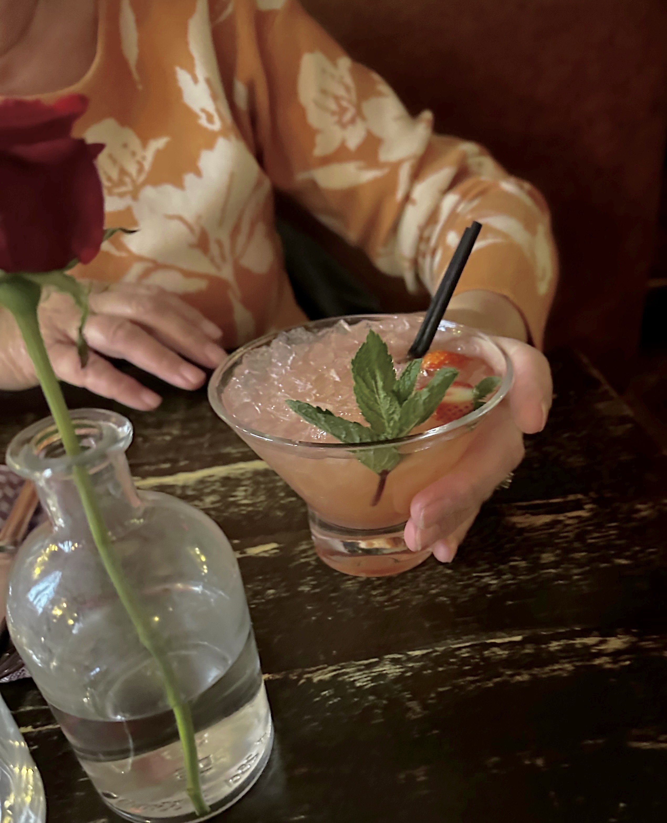
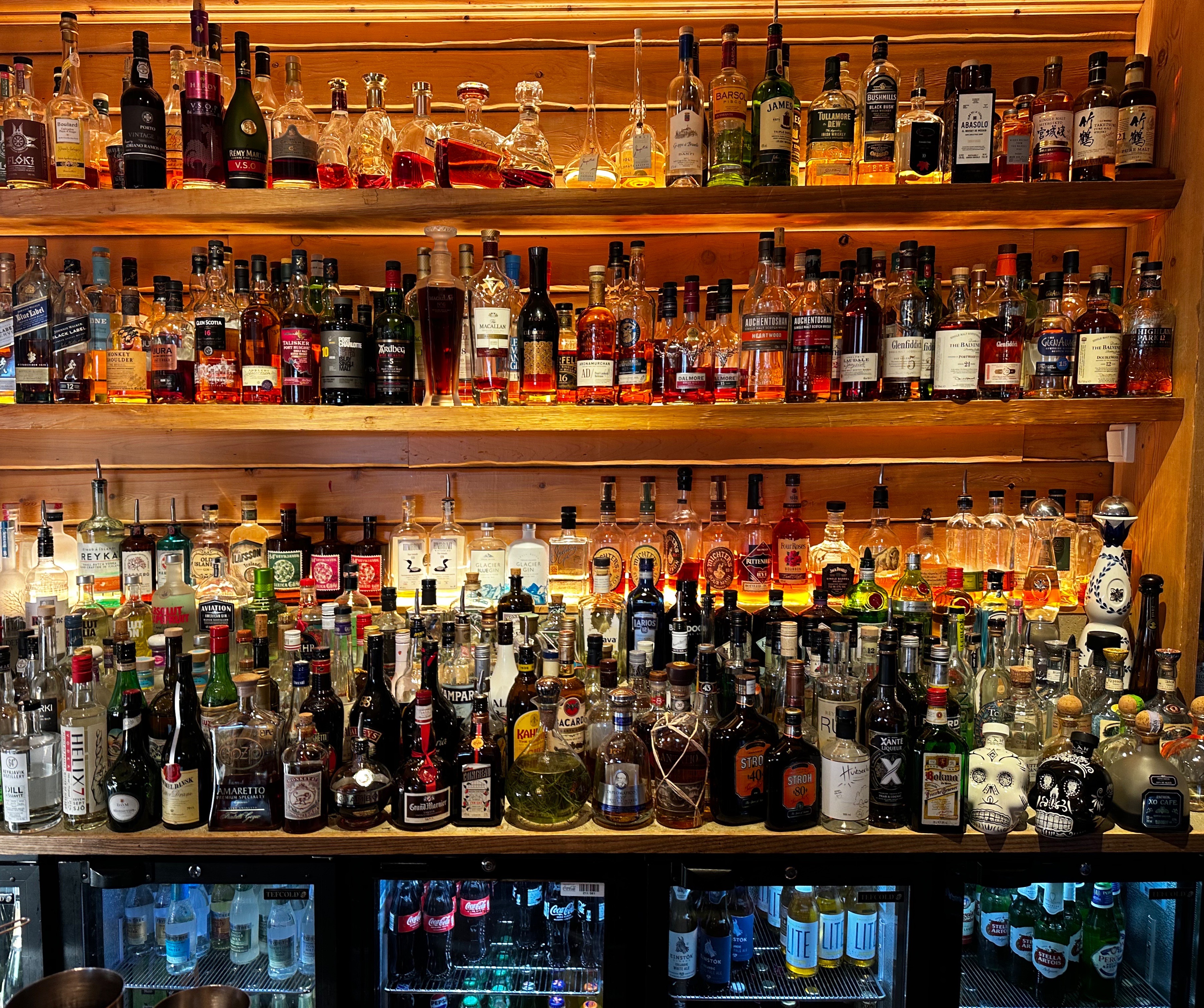
After the show we came outside to find the Aurora Borealis again dancing in the sky over the harbor! If seeing the Aurora Borealis four nights in a row doesn’t warrant a night cap we don’t know what does! We made the short walk over to Apotek. The place was hopping but we were able grab two seats at the bar and have our cocktails and a couple of appetizers. We had a great time discussing the upcoming U.S. election with our bartender – who is probably more knowledgable about our upcoming election than most Americans! Sorglegt!
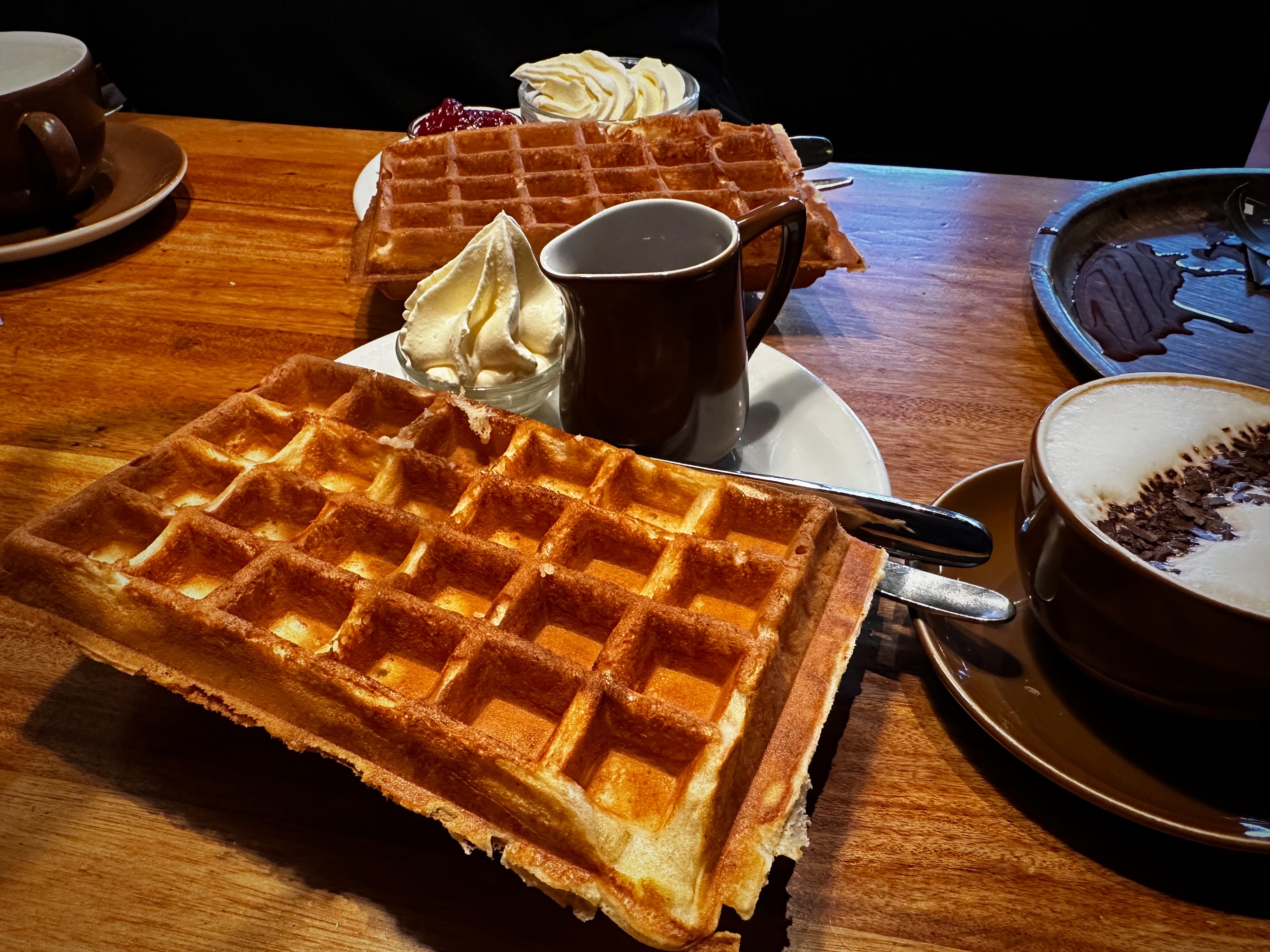
On day five we opted for a slower paced day as we were planning on a long day touring the South Coast the next day. We started our day at Mokka Kaffi. Our intel was that they have the best waffles. We do not know if they are the best in Reykjavik but they were dang good! A bit of shopping in the afternoon completed the day time portion of that day’s program.

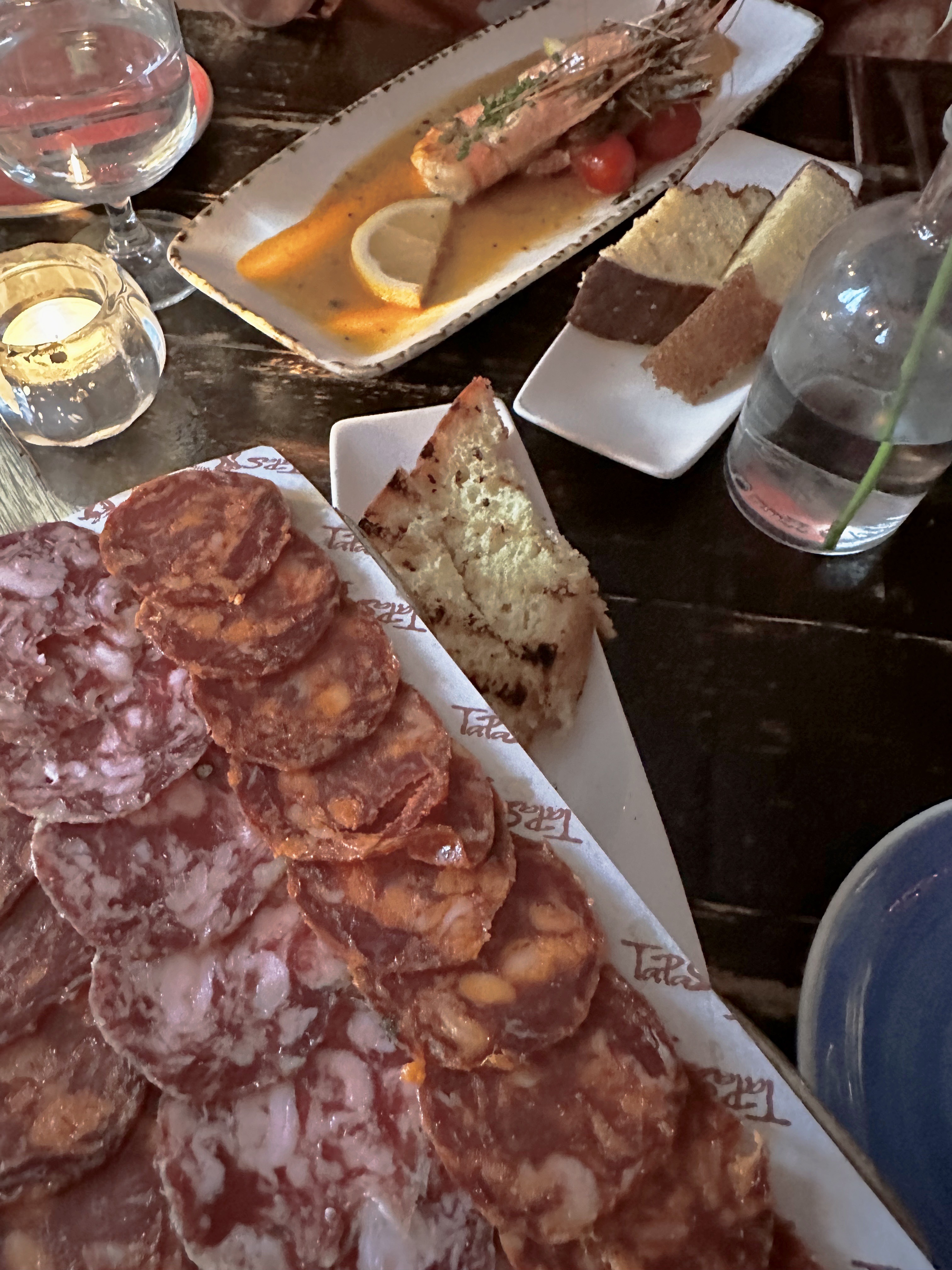
We finished our day with an excellent meal at the highly recommended (thank you Alfie) Tapas Barinn. We ordered several small plates starting with chorizo, followed by prawns, lamb and Icelandic foal. Ljúffengur!


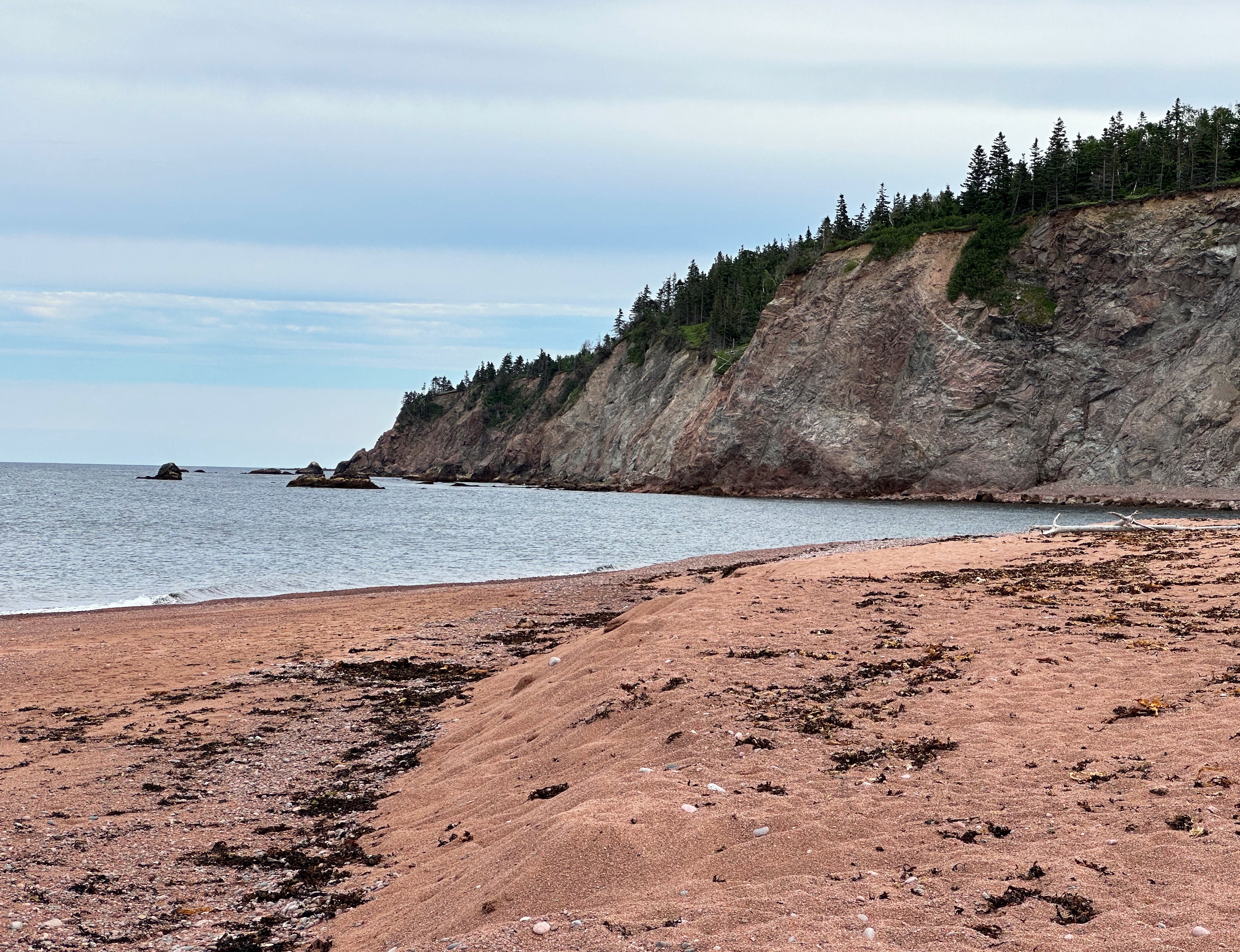
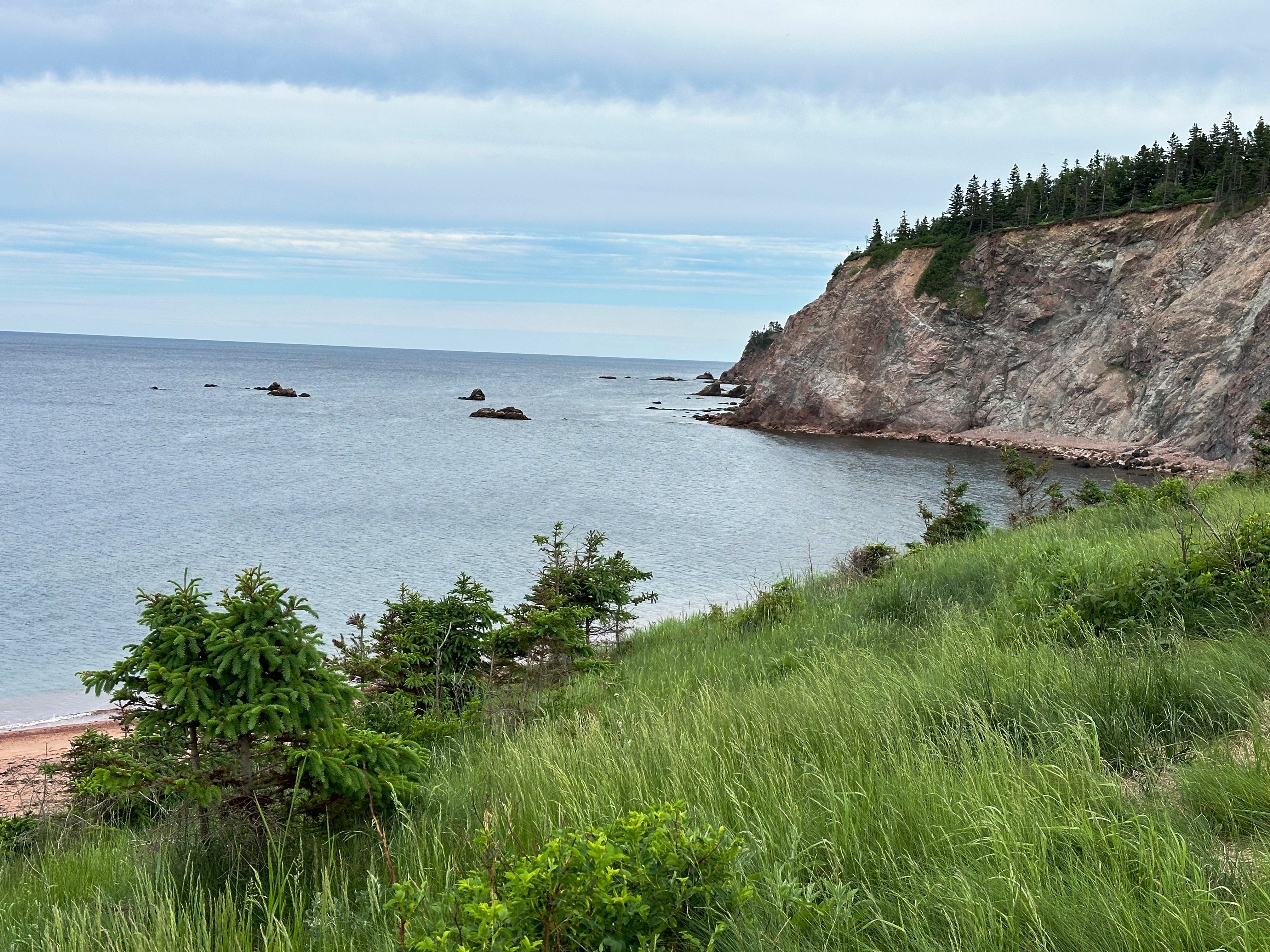
On day six we were back on the road for a tour along the south coast of Iceland following the Ring Road (Route 1). Our first stop was Seljalandsfoss, a popular tourist stop as it is visible from Route 1 and the walk from the parking area to the falls is relatively short and level. At 197 feet impressive, but not the best of the day in our view.
We continued along Route 1 making frequent stops to admire the views on a gorgeous blue sky day.


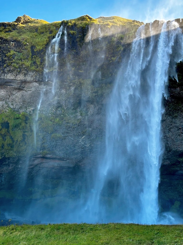
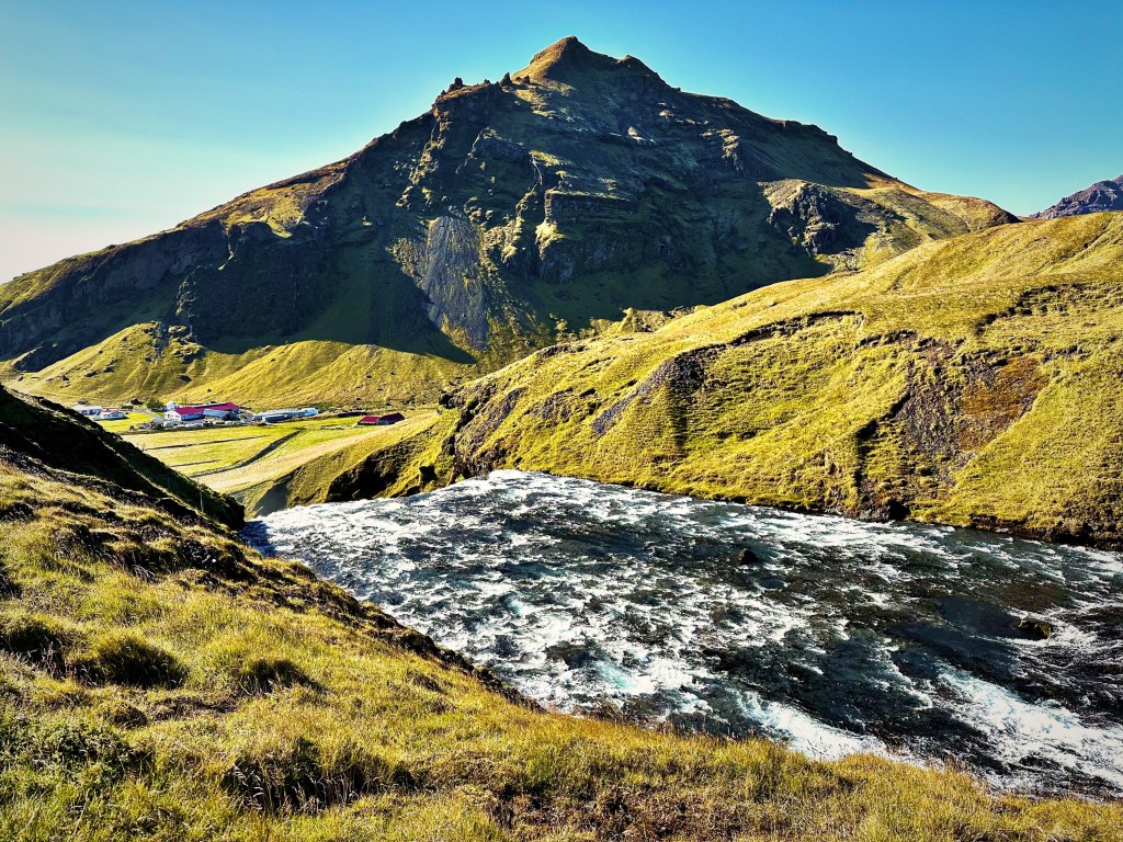
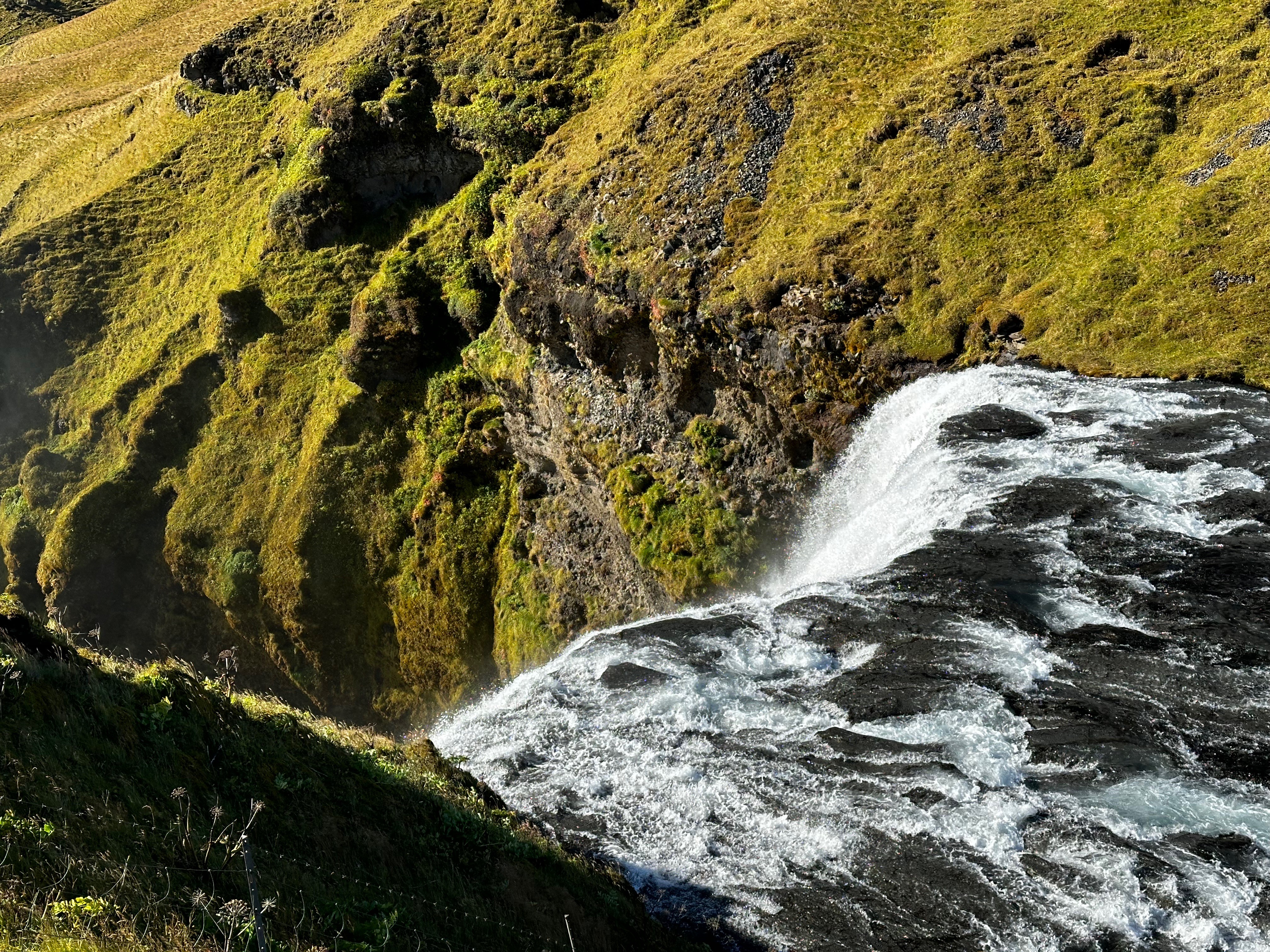
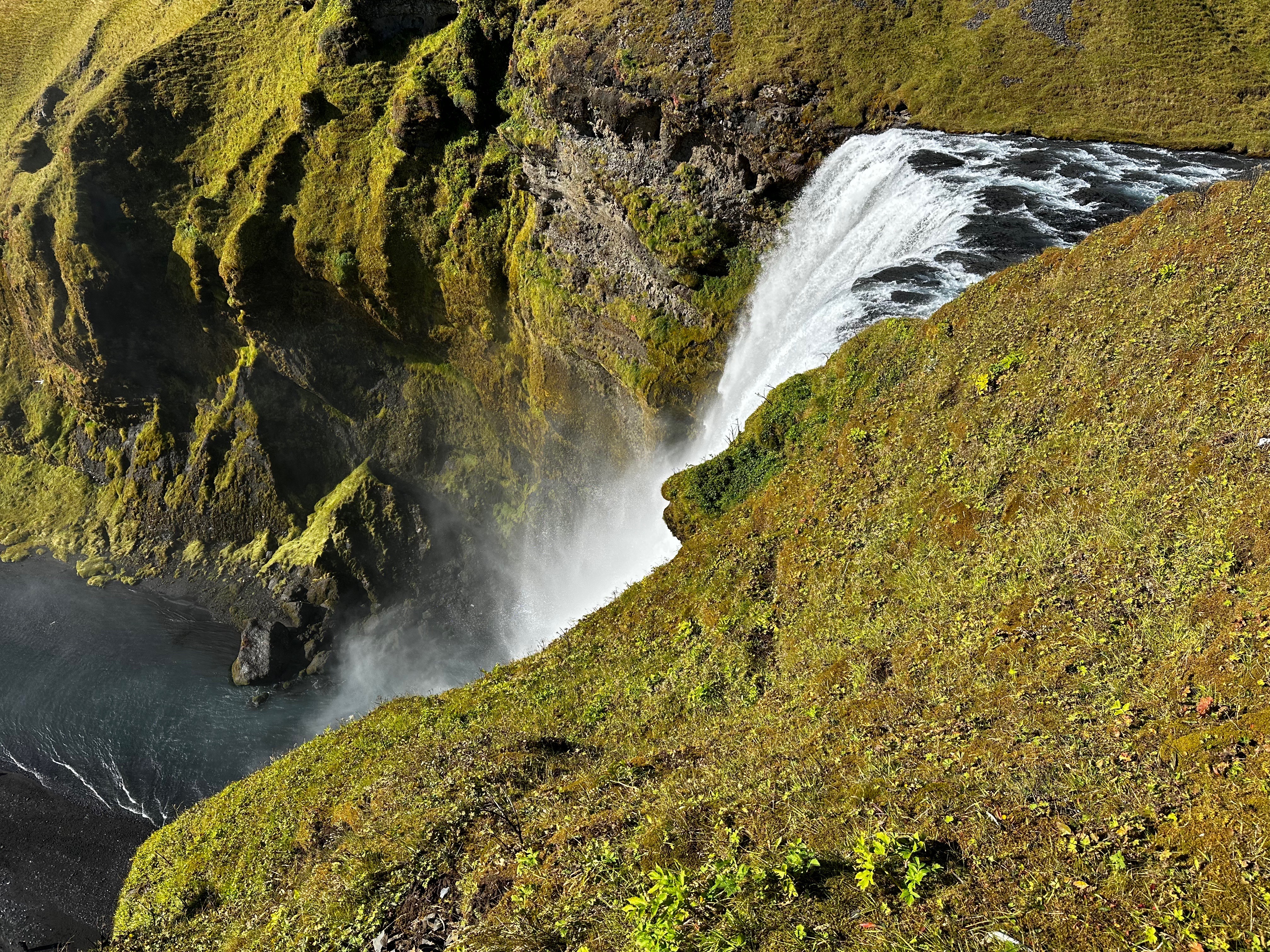
Several miles drive further along the Ring Road conveyed us to Skogafoss (foss translates to waterfall). This waterfall is impressive not just for its height of 200 feet but also its width of 82 feet. You can walk along the Skoga River and stand at the base of this thundering wall of water.


This was probably the waterfall that we enjoyed the most due to the ability to both stand at the base (and get wet) and also at the top of the waterfall via a steep 600 stair climb. From the top there is a fantastic view of the valley below that extends to the ocean. From here, the Fimmvörðuháls hiking trail (summertime only) continues up the mountain along the river providing access to additional waterfalls.


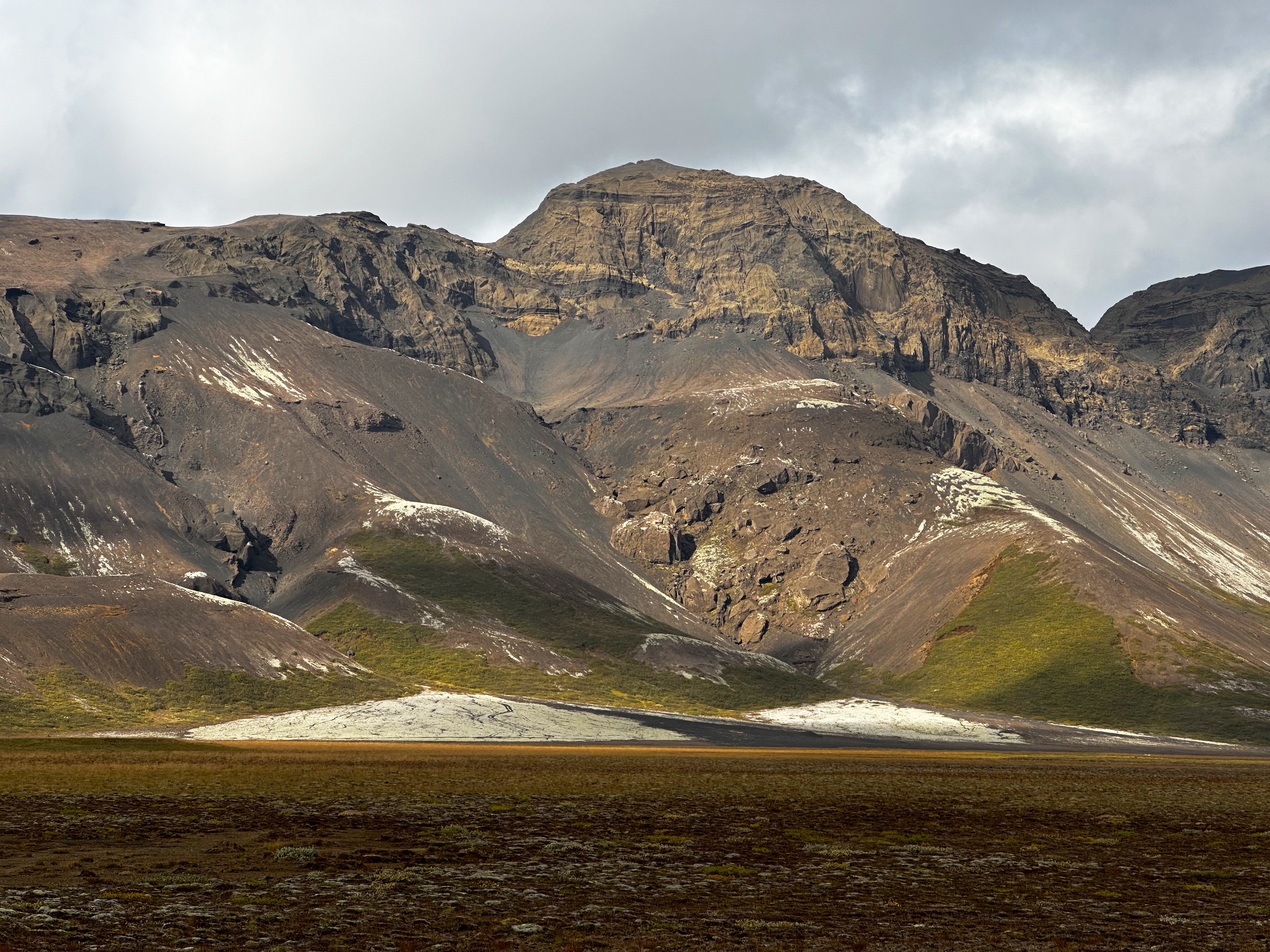
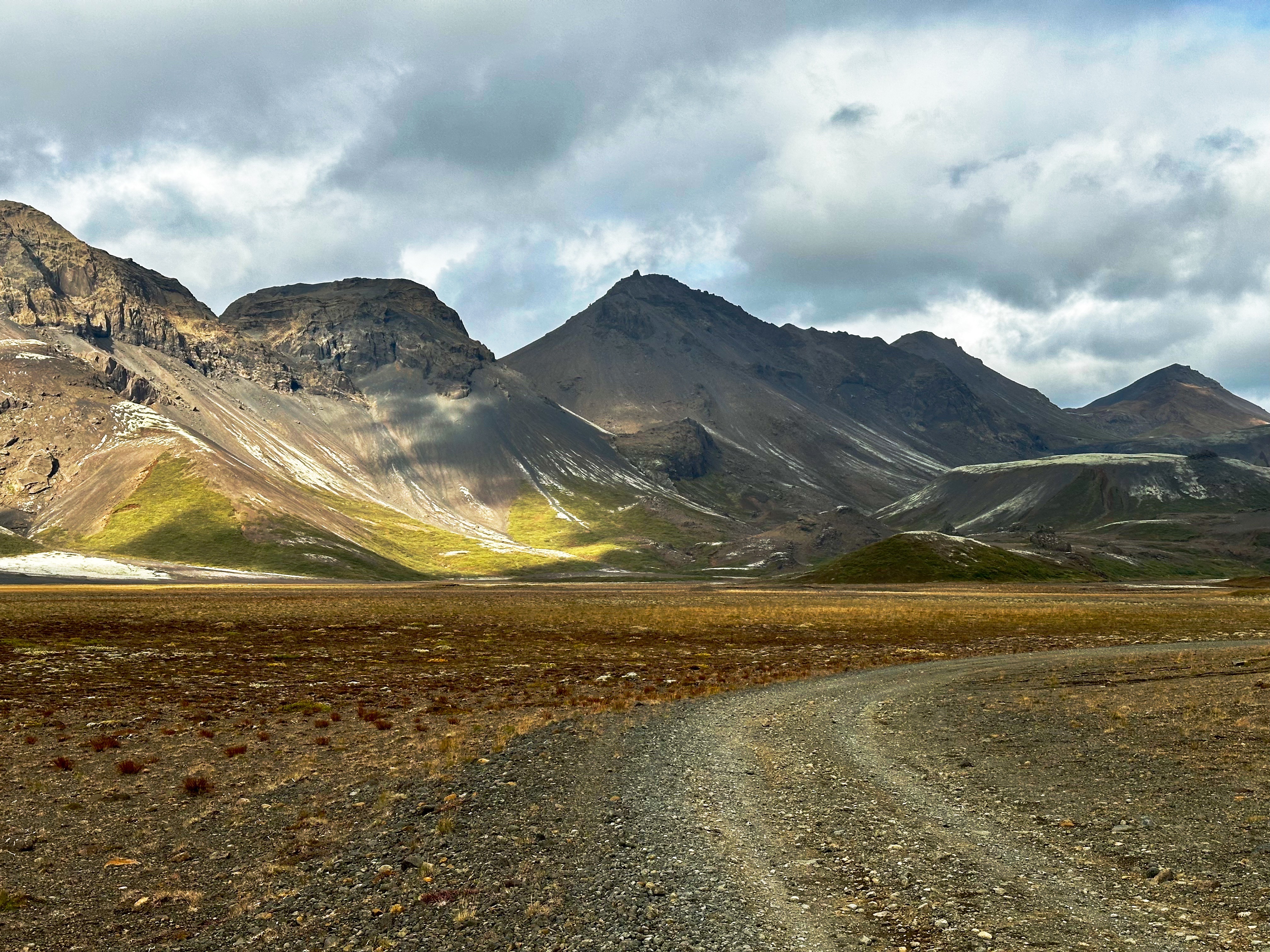
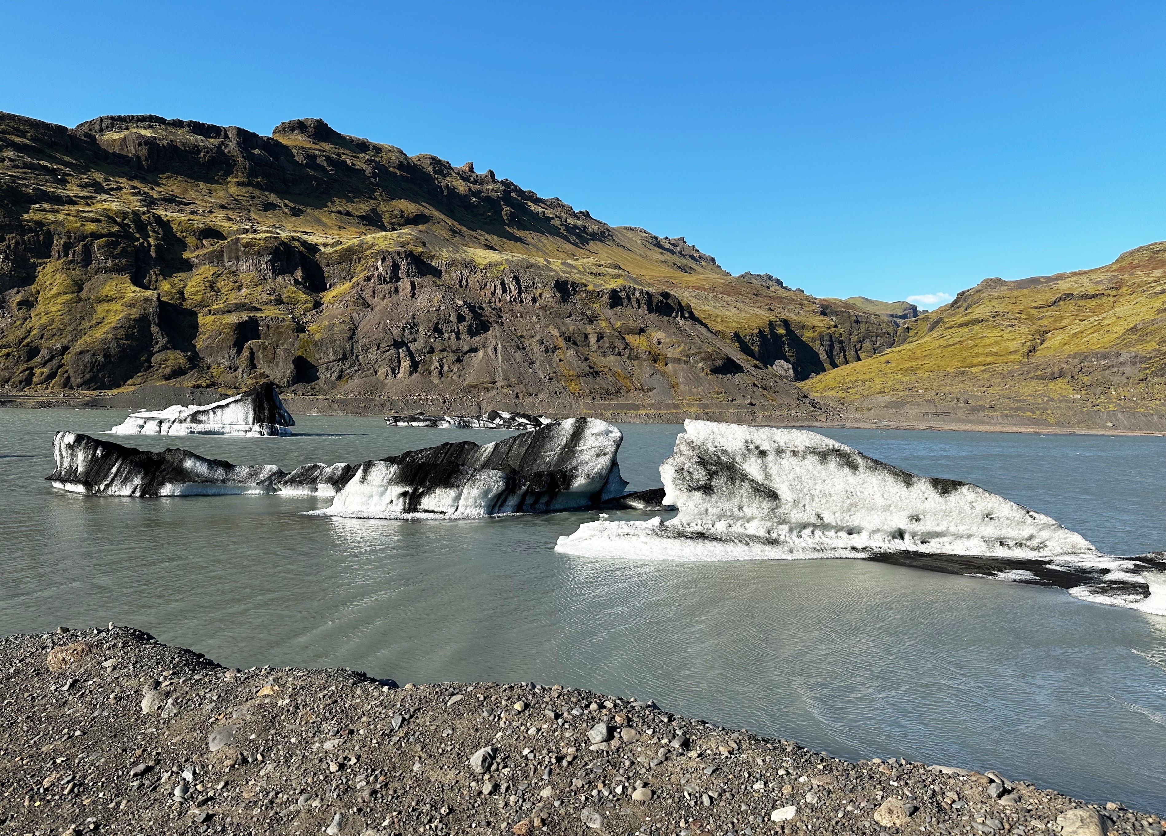
Approximately 15% of Iceland is covered by glaciers. We began to get glimpses of the Sólheimajökull Glacier heading east on Route 1. While we were not prepared to hike on the glacier on this trip (guide required) we wanted to get up close and the hike up to the tongue of Sólheimajökull was doable.
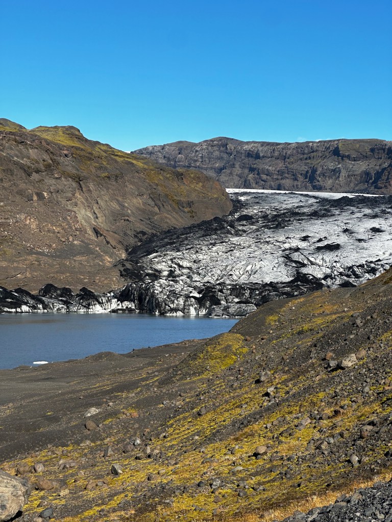
What was immediately apparent as we approached the tongue was that this glacier is currently in retreat. The glacier is currently about seven miles in length. It has had periods of retreat (1930-1969) and periods of advancement (1969-1995). The glacier has been retreating since 1995 and the rate of retreat has accelerated since 2000. Between 2000 and 2015 it shrank by slightly over half a mile. When it retreats the glacier also gets thinner. We hiked by posts indicating where the tongue of the glacier had ended over a period of years. The photo below at the bottom provides a feel for the magnitude of the retreat. While the demise of glaciers in Iceland is not imminent, about eleven million tons of glacial ice is melting annually. Slæmt!


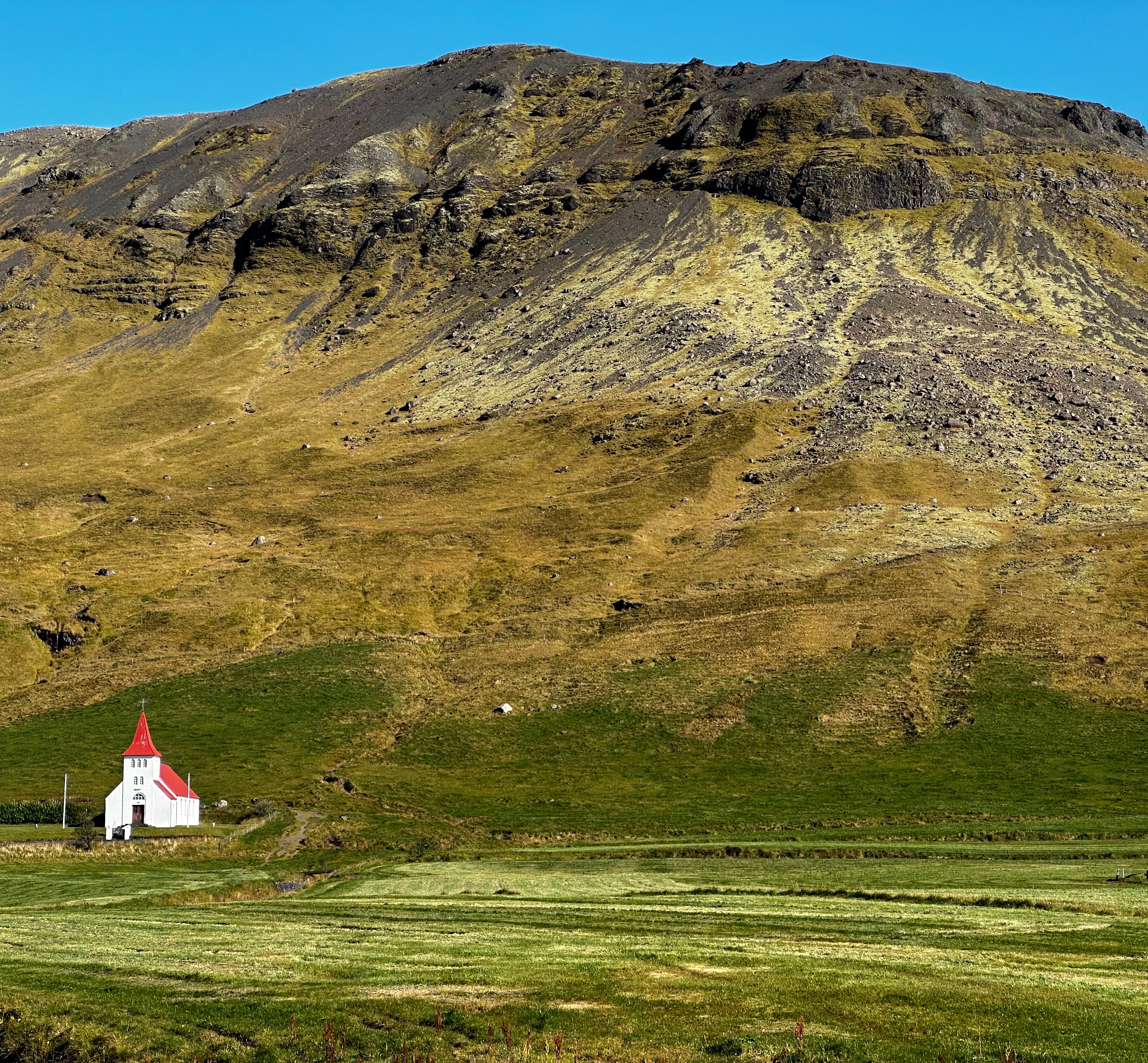
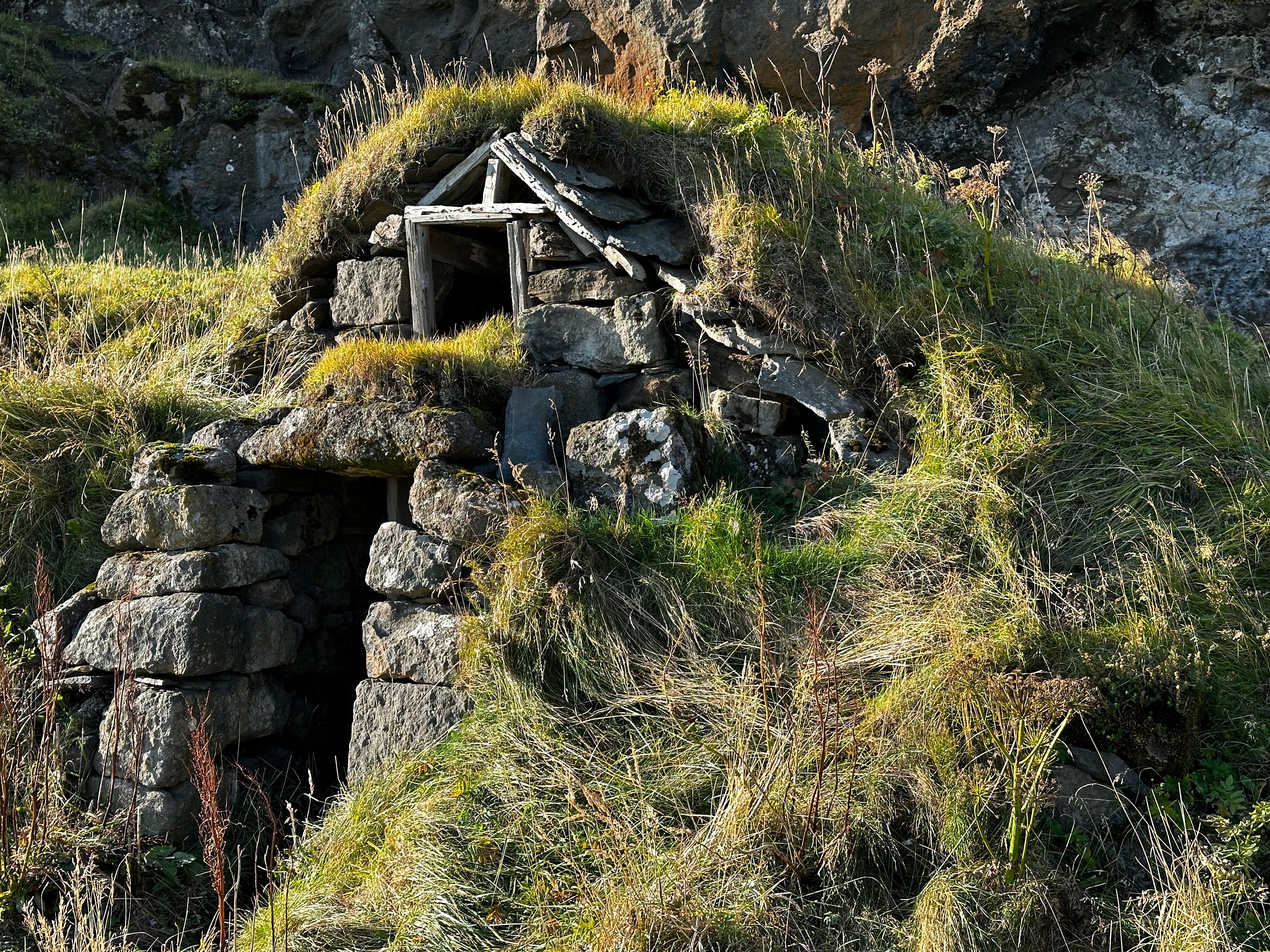
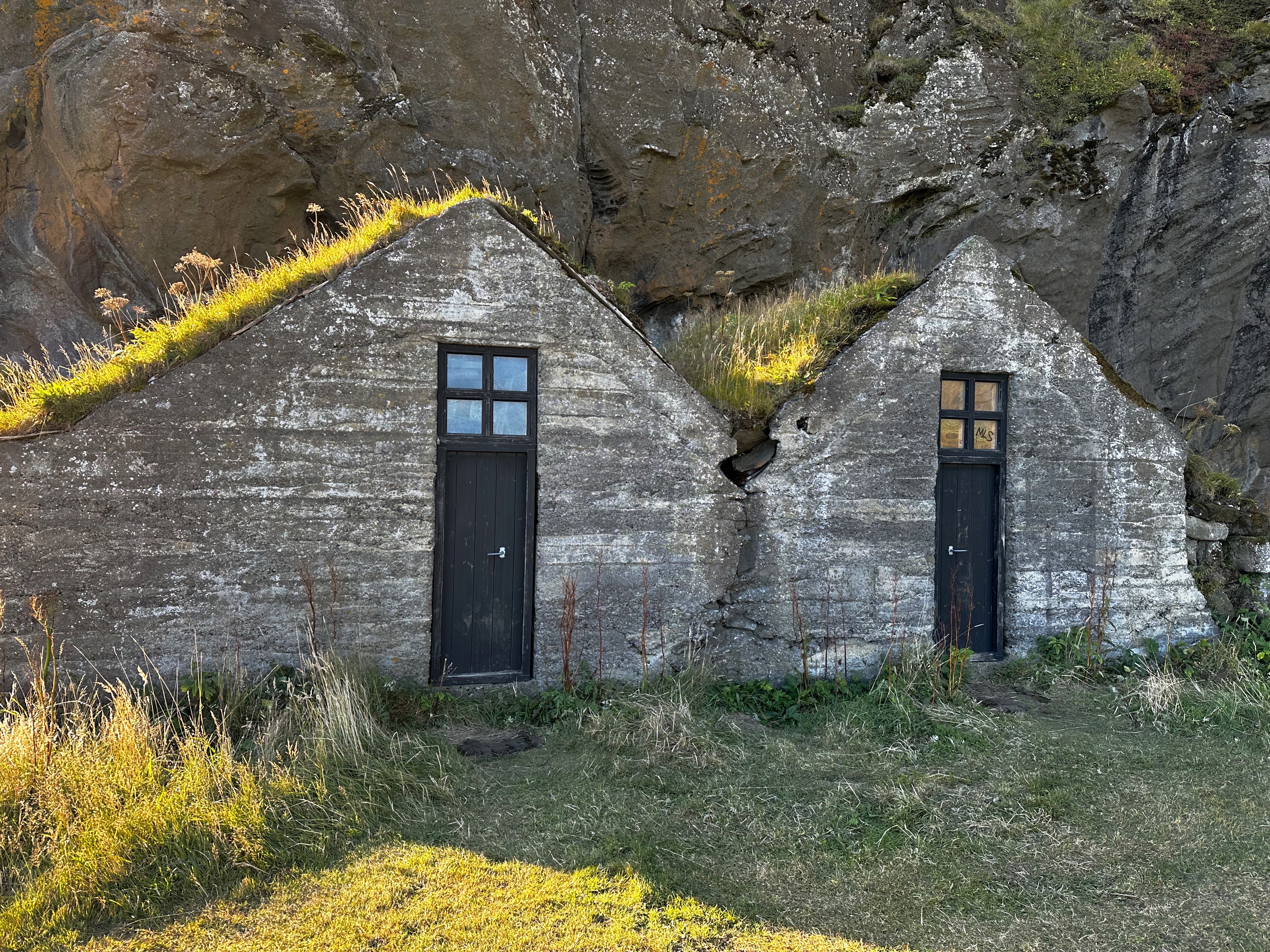
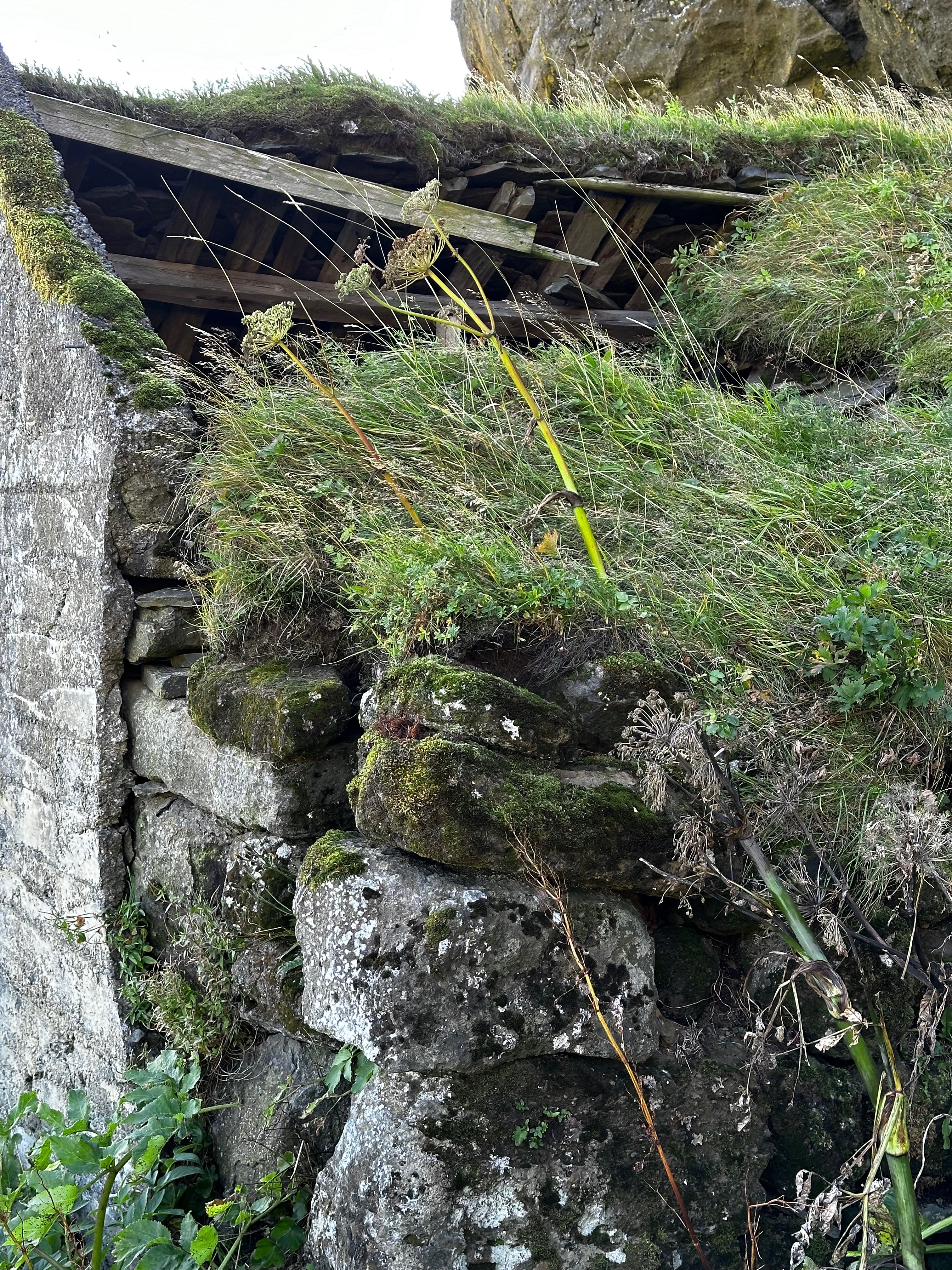
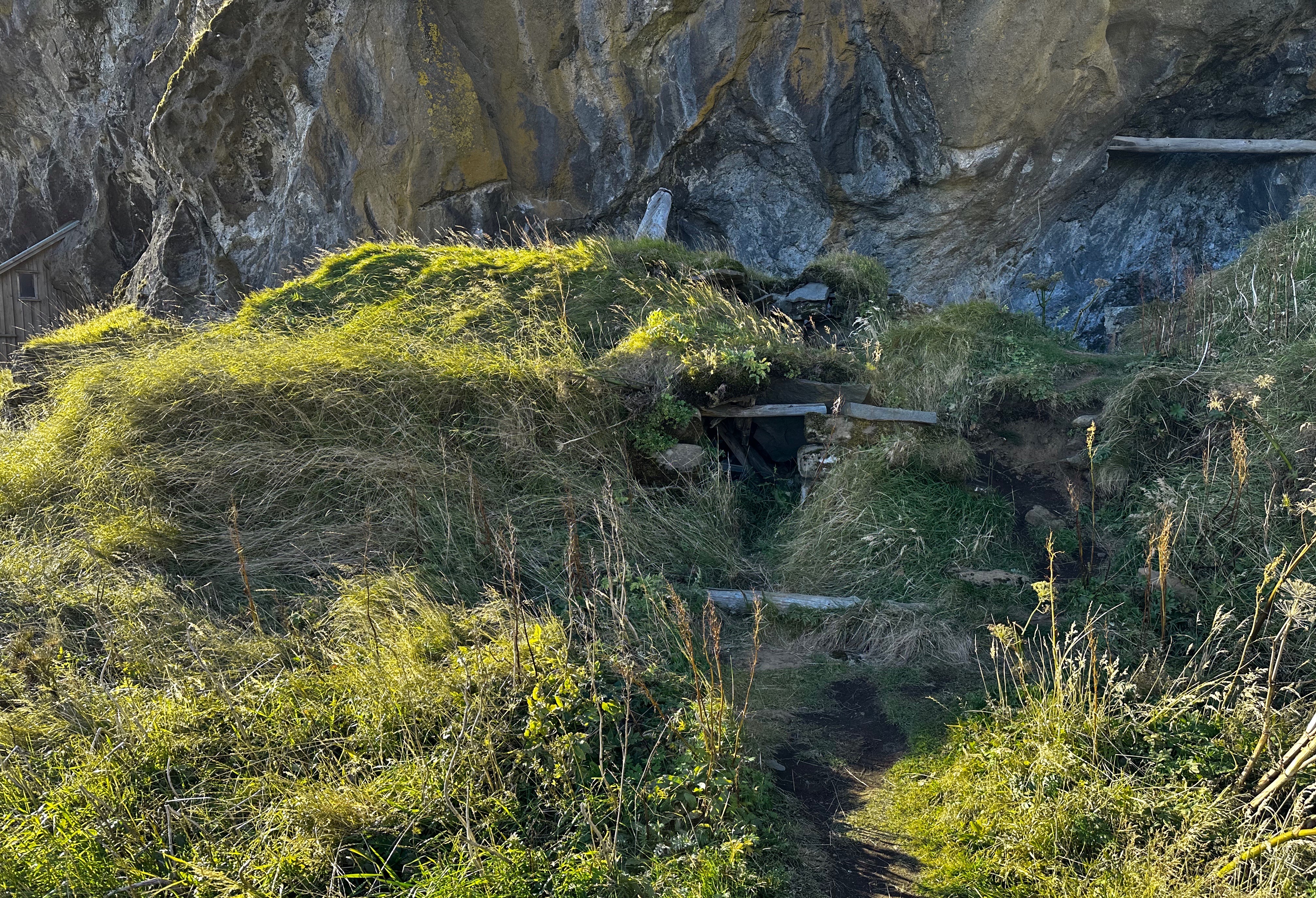
Iceland has a rich history relating to Elves. We visited Drangurinn rock in Drangshlíð. This large rock sits alone in the middle of a field with a backdrop of the Eyjafjöll Mountains. There are a number of cow and hay sheds built into the rock.
The legend is that elves live inside the rock and would tend to the animals at night if a cow was close to giving birth so that the farmers would not need stay in the pitch dark sheds.
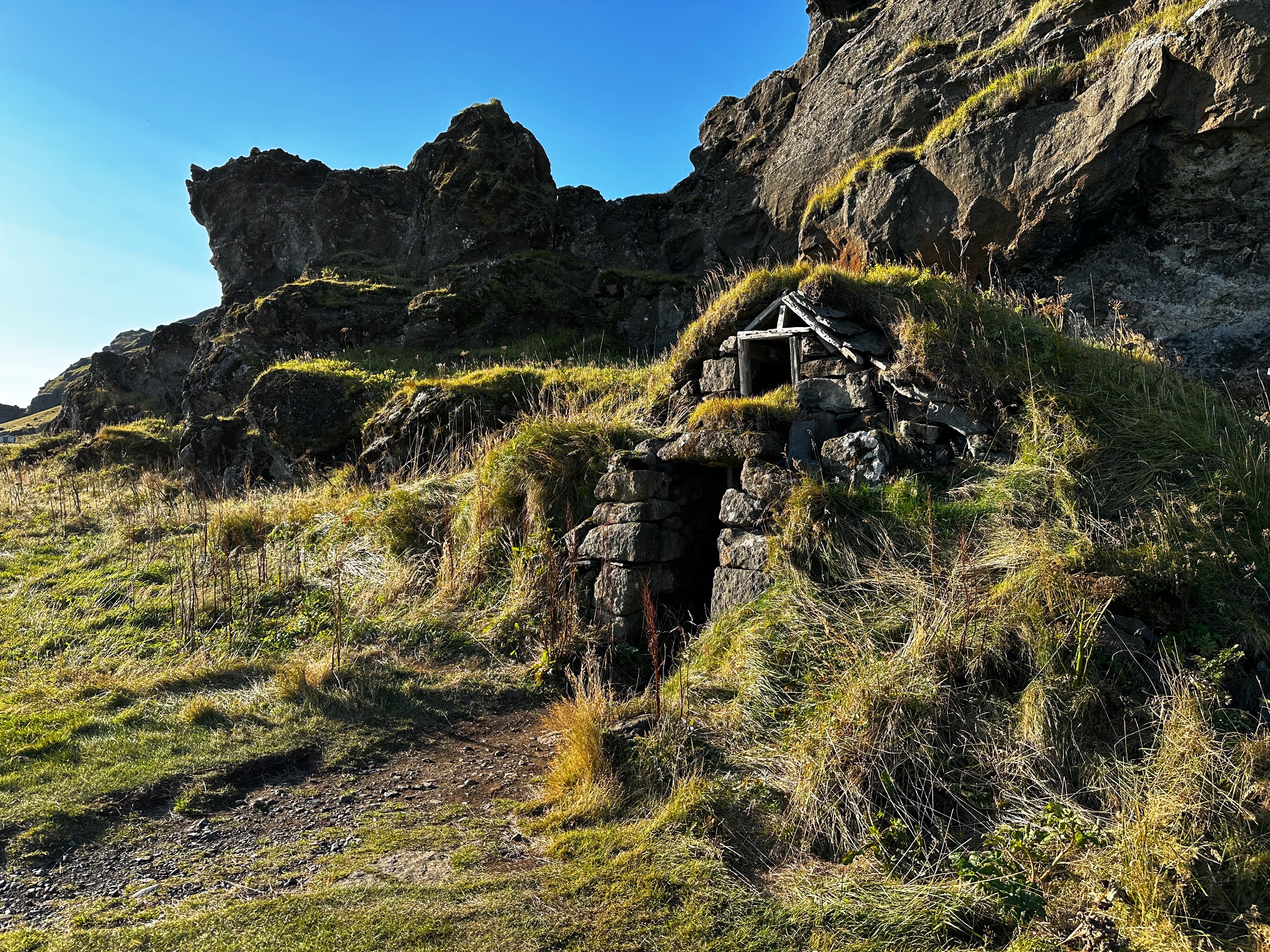


Our favorite tale is about a local farmer who went missing for several days. Upon returning he told the local folks that he had been with the elves in the rock. He also said that the elves were lovely, decent and as handsome as humans. Furthermore, he was going to marry an elf woman. Soon after the farmer disappeared but no one looked for him because they knew he was living in the rock with his elf wife. Ég elska þig!
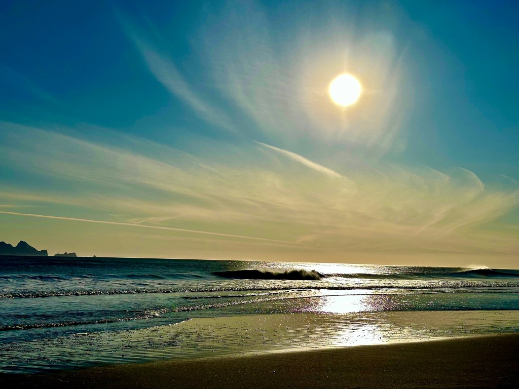
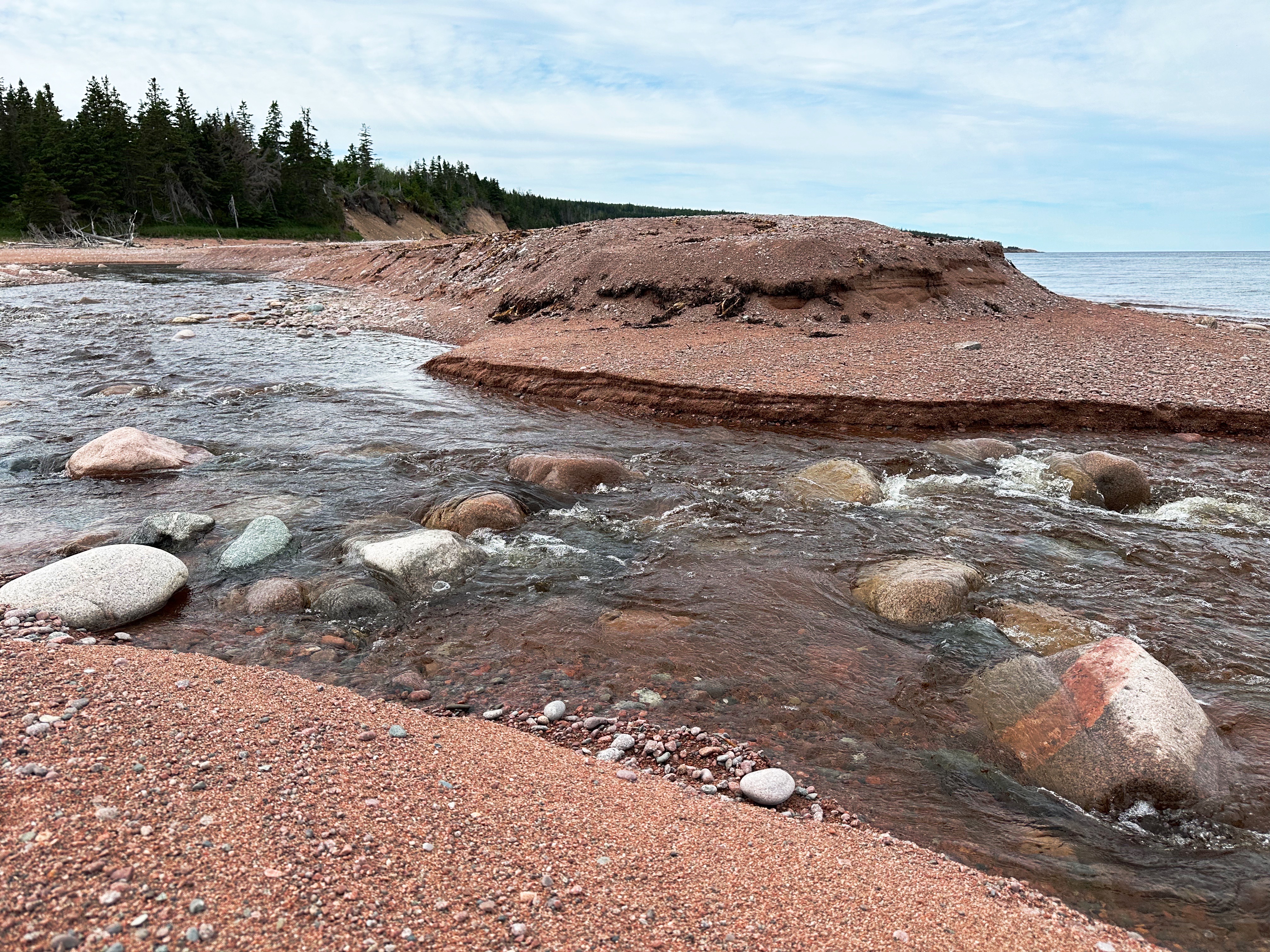
While it was a chilly day we were keen to drive south to the shore and visit a black sand beach. Route 254 took us south along the Markarfljot until we reached the shoreline at the ferry terminal for Vestmannaeyar (Westman Islands). The view from the beach of the sun heading down and the islands in silhouette was mesmerizing. While we did walk the beach there were no shoes off with feet in the water. This is the North Atlantic in September!
The Vestmannaeyjar consist of 15 islands and 30 rock stacks. The islands were created by underwater volcanic eruptions. The population is approximately 4300 people, all of whom live on the island of Heimaey. Heimaey has two volcanoes. None of the other tiny islands are inhabited on a full time basis.


The name of the islands – West Men – is named after the Irish slaves who fled the mainland to the islands to escape their servitude. Ireland was thought to be the farthest land west of the continent – hence West Men. The West Men were, of course, subsequently captured and killed. Frelsi!
Our friends Jim and Sally recommended that we stop at the Hotel Ranga for a cocktail if we were going to be touring the South Coast. The Ranga fit perfectly with our return leg to Reykjavik and of course all the fresh air and sunshine definitely engenders a thirst which can only be quenched by expertly made cocktails.

Takk fyrir, Jim and Sally! Excellent cocktails in a beautiful setting. The Hotel Ranga is definitely on our itinerary for our next visit to Iceland.
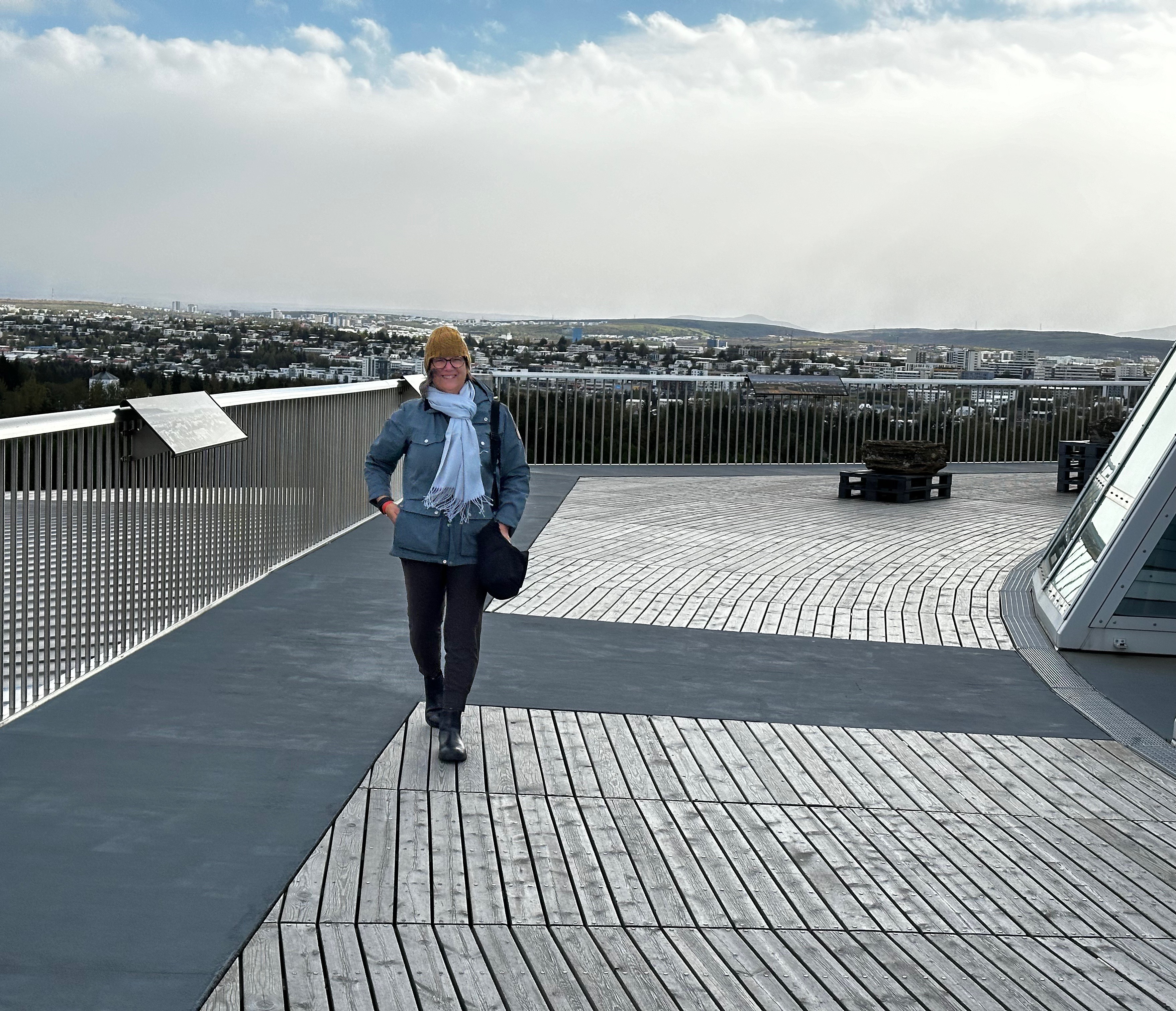
On our final day in Iceland the rains finally came (no complaints from us) so we decided to do what many other tourists do when it rains in Reykjavik. We visited the Perlan (The Pearl).

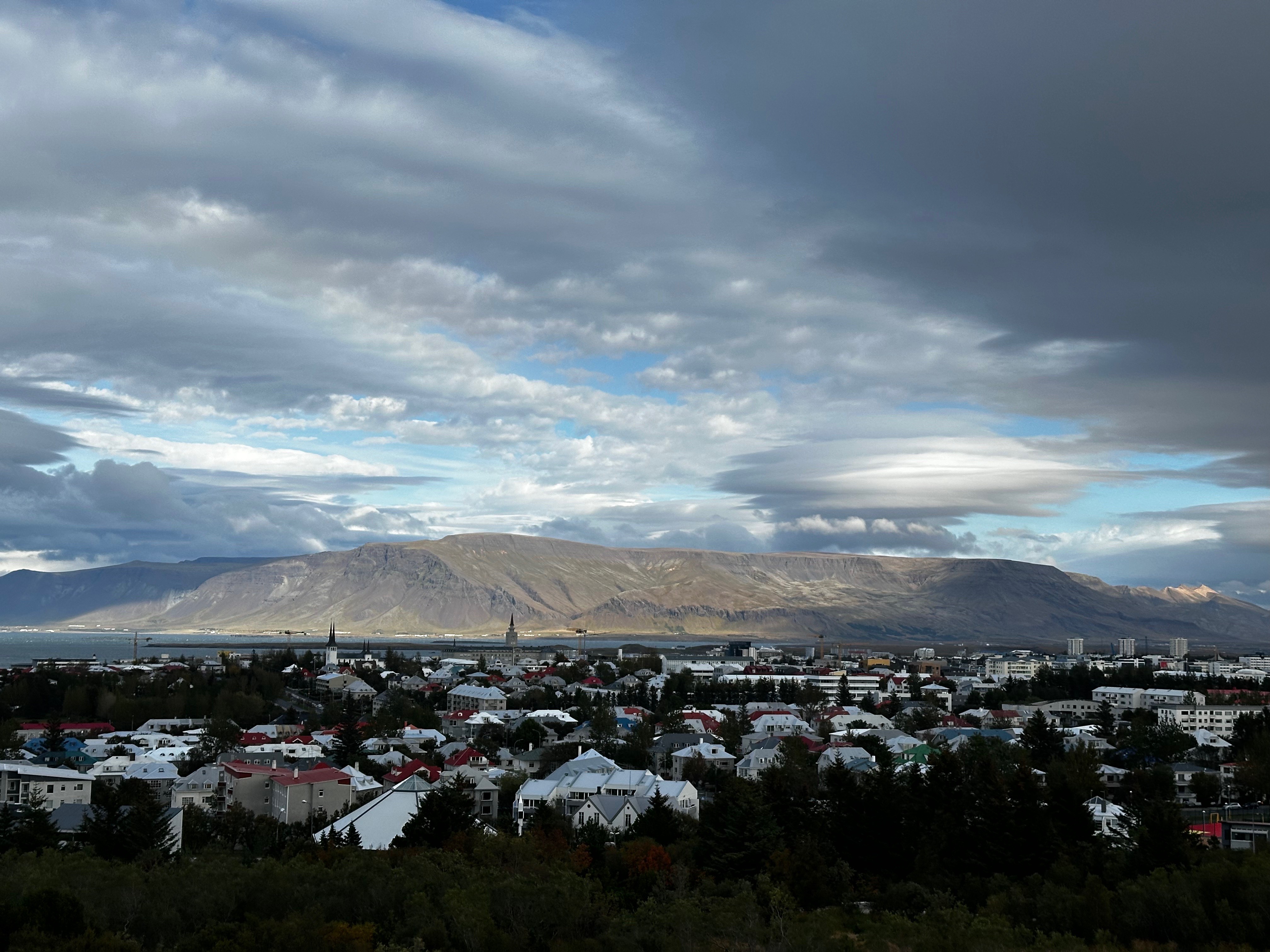
Perlan sits on the highest hill in Reykjavik providing 360 degree views of the city and surrounding area from the roof top cafe and observation deck. The glass dome sits atop six geothermal functioning geothermal water tanks. Quite cool!
The food at the cafe is excellent and they have a full bar. The exhibits are also quite good and entertaining. The focus is on the forces of nature which dominate Iceland’s geography, weather and culture: volcanoes, glaciers, aurora borealis, wildlife and more.

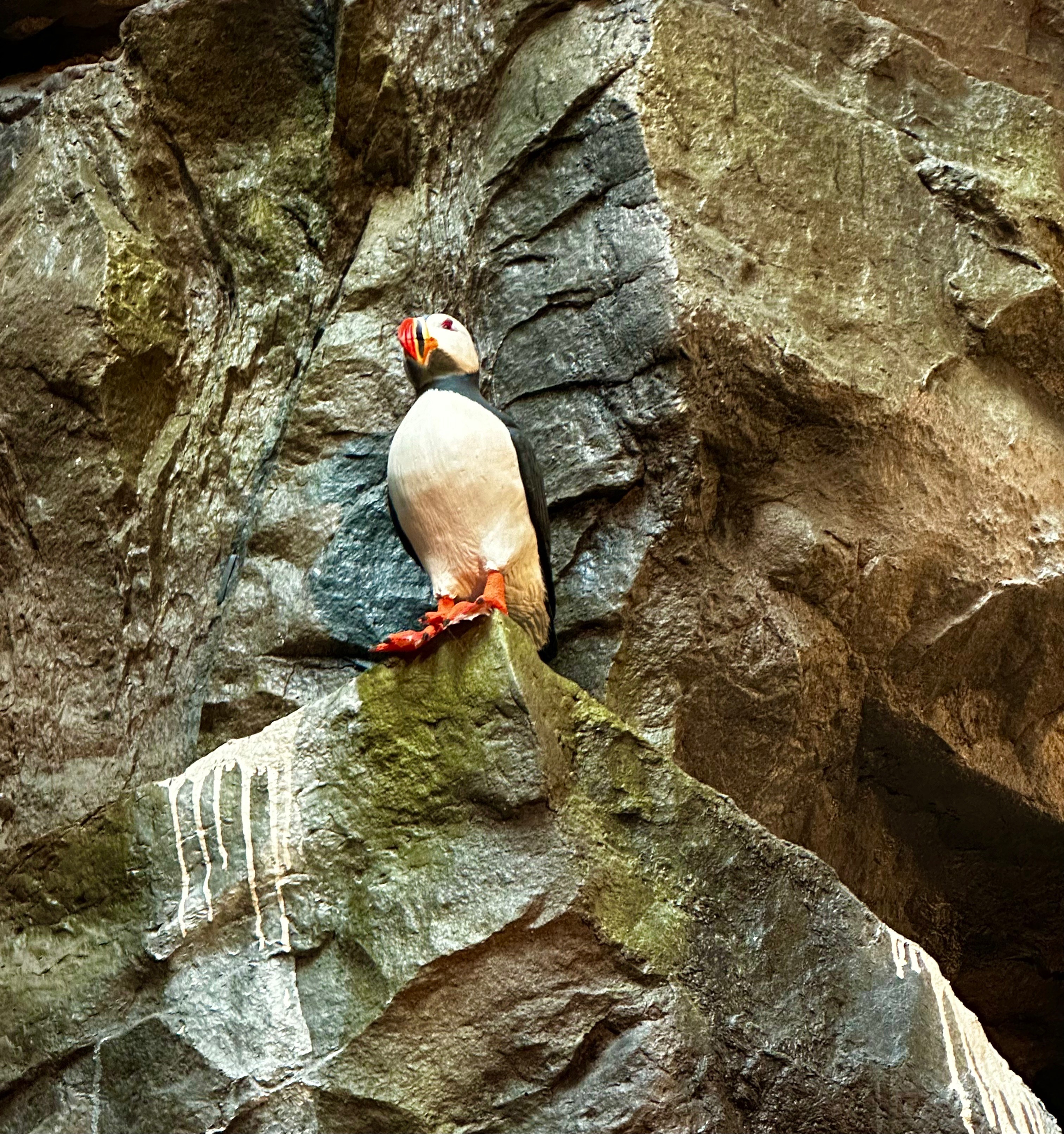
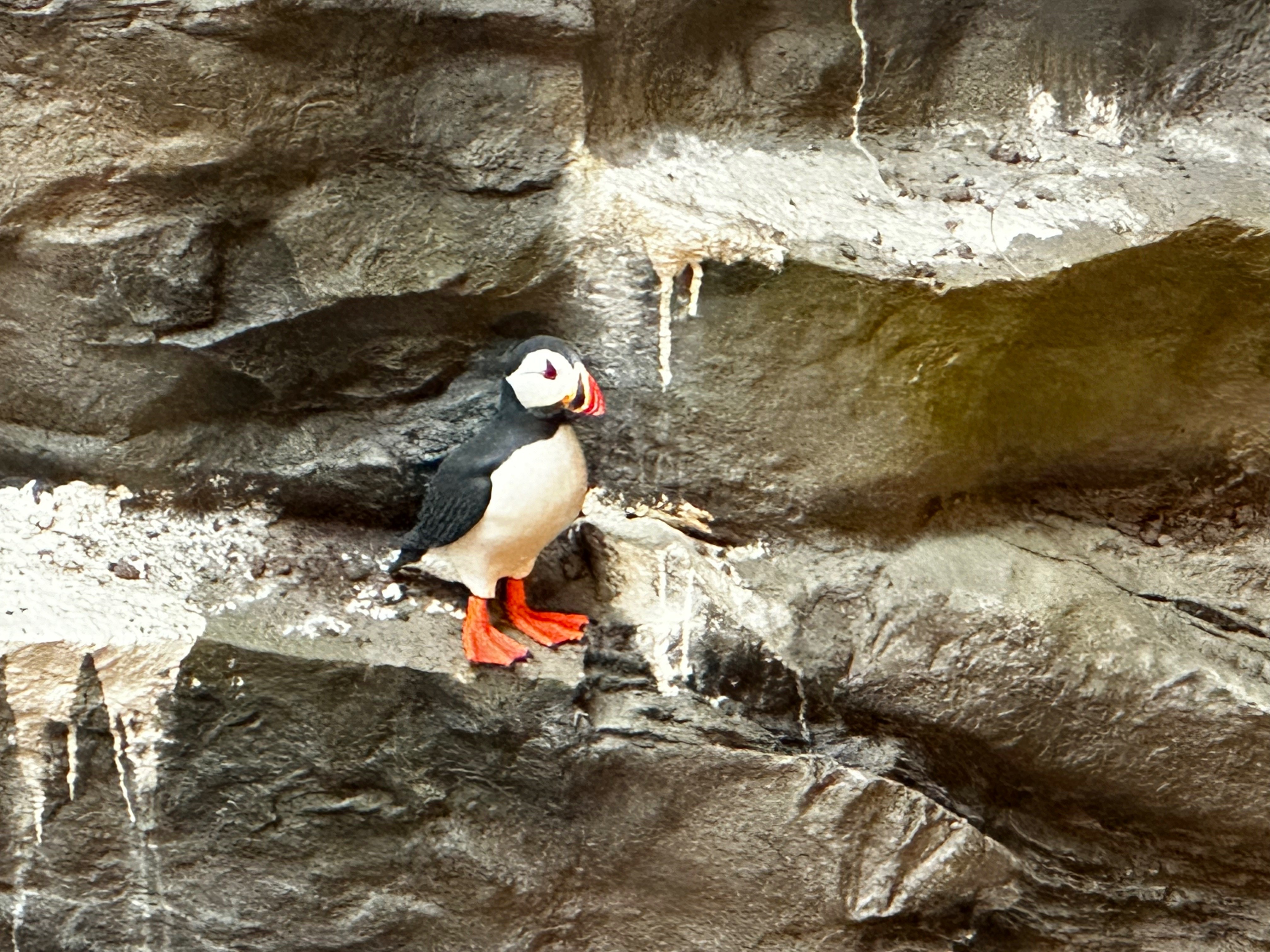
One thing we did not get to see were puffins. But fortunately, the Perlan has a very realistic bird cliff and we have included a couple of photos below with our only puffin sighting, albeit inside the Perlan.
We wrapped up our final day with an Icelandic tradition. A wonderful soak at the geothermal lagoon at Sky Lagoon in Reykjavik. Before entering the lagoon we went through a multi-step ritual starting with a sauna, followed by a cold rinse, a salt paste application and then into a steam bath (we skipped the cold water plunge) and finally the lagoon. Delightful! Oh, did we mention there is a bar in the lagoon – Prosecco please! (Photos courtesy of Sky Lagoon)


That’s it from Iceland…..we had a terrific time. It is a beautiful country with stunning landscapes which reflect the fire and ice theme which dominates. The Northern Lights…. what can we say…. first trip – four sightings….we almost feel guilty. The country is modern yet maintains deep connections to its ancient Viking heritage (including the Icelandic language which reflects the Old Norse spoken by the Vikings).
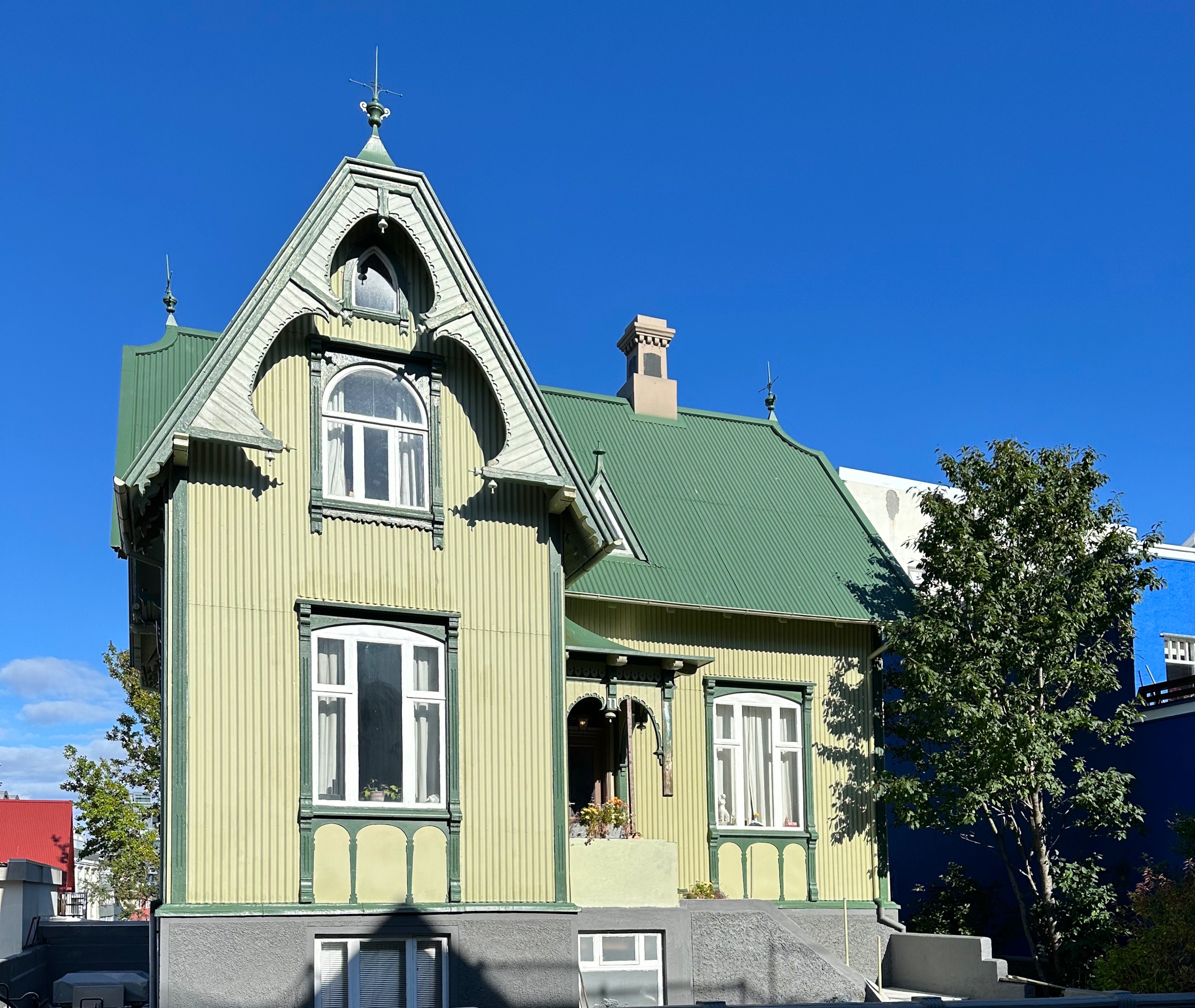
Every Icelander we met was friendly, polite and knowledgable. This is a country that is civilized and humane (with a living wage for all). Iceland is a literate society. Reykjavik is chock full of museums, book stores, galleries, music venues, street art and excellent food (and coffee).


Be seeing you!
On our ultimate day in Canada we followed the St. John River south along the eastern bank after crossing over the river at Grand Falls. This route kept us off the highway and carried us through a scattering of very small farms and towns while keeping the river in view.

After crossing into the United States at Fort Fairfield, we made the short drive to Presque Isle where we had dinner and stayed for the evening.


If you visit Presque Isle, we heartily recommend dinner at RODNEY’S AT 436 MAIN. The restaurant is located on the ground floor of the (yes-hip) Northeastland Hotel in the center of downtown.
https://thenortheastlandhotel.com/dining/
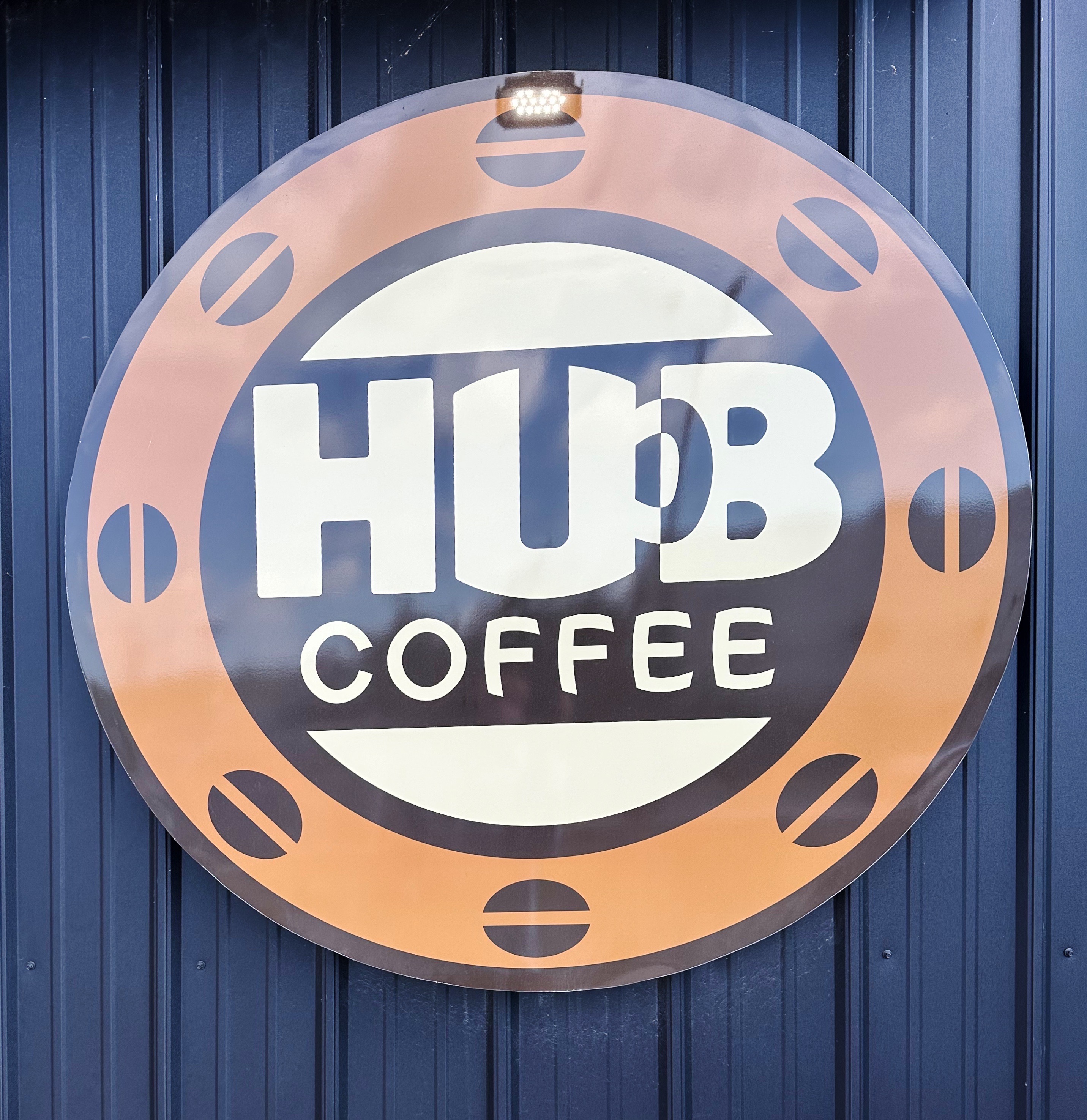
With the Presque Isle campus of the University of Maine nearby we were hopeful that good coffee would be at hand in the morning. Thank you HUB. We suspected that we would be in the coffee wilderness until reaching southern Maine (which entitled us to donuts) and unfortunately that suspicion turned out to be spot on.

From Presque Isle we traveled south on Route 11 through hilly woodlands and farmland to access the infamous Golden Road from its eastern terminus in Millinocket. The forecast for the following day was for heavy rain so we decided to hole up in Millinocket until the weather passed. Driving 100 miles in deep mud and flooded roads and potentially dealing with massive logging trucks (with the right of way) is overrated in our opinion. (Photos courtesy of Down East Magazine)


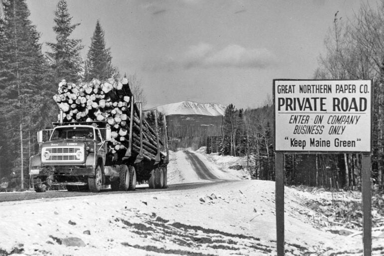
Millinocket was a mill town for over 100 years. The Bangor and Aroostock Railroad completed a rail line in 1894 that made the area accessible. Soon after, the Great Northern Paper Company (GNP) began construction of a paper mill which would become the largest mill in the world. The West Branch of the Penobscot River provided the necessary power. The mill produced newsprint (including for the New York Times) and operated 24 hours a day, seven days week every day of the year. The population grew from 1000 in 1900 to almost 8000 people by the 1960s (400 of the original 1000 were laborers from Italy, hence the Little Italy section of town). The wages at the mill were roughly double that of manufacturing wages in the state, drawing workers from Maine and beyond.


GNP was acquired by Georgia Pacific in 1989, which began the eventual death spiral. The company was sold several more times before filing for bankruptcy. An asset management company purchased the assets and sold them off to various entities. The mill closed down in 2008 with all the mill jobs lost. The population, not surprisingly, declined and is currently 4300. The main industry (really the only industry and reason for the town’s existence) was paper.

Tourism brings some folks through town – the northern trailhead of the Appaclachian Trail and Baxter State Park are nearby. There is also rafting on the West Branch of the Penobscot River. This has helped but the town looks pretty forlorn. A number of boarded up storefronts and the charred remains of a vacant bank building (destroyed by fire in March, 2024) are still standing among the few operating busnesses along the main street (Penobscot). Sadly, this is not a unique story in the old mill towns of New England.
While waiting for the expected rainstorm to pass through we washed ALL of our laundry at the cottage we had rented for two nights. With our laundry project behind us and the rain letting up we walked the two blocks to Penobscot Street. There we quickly settled on the Blue Ox Saloon as our venue to meet some local folks and imbibe a drink or two.
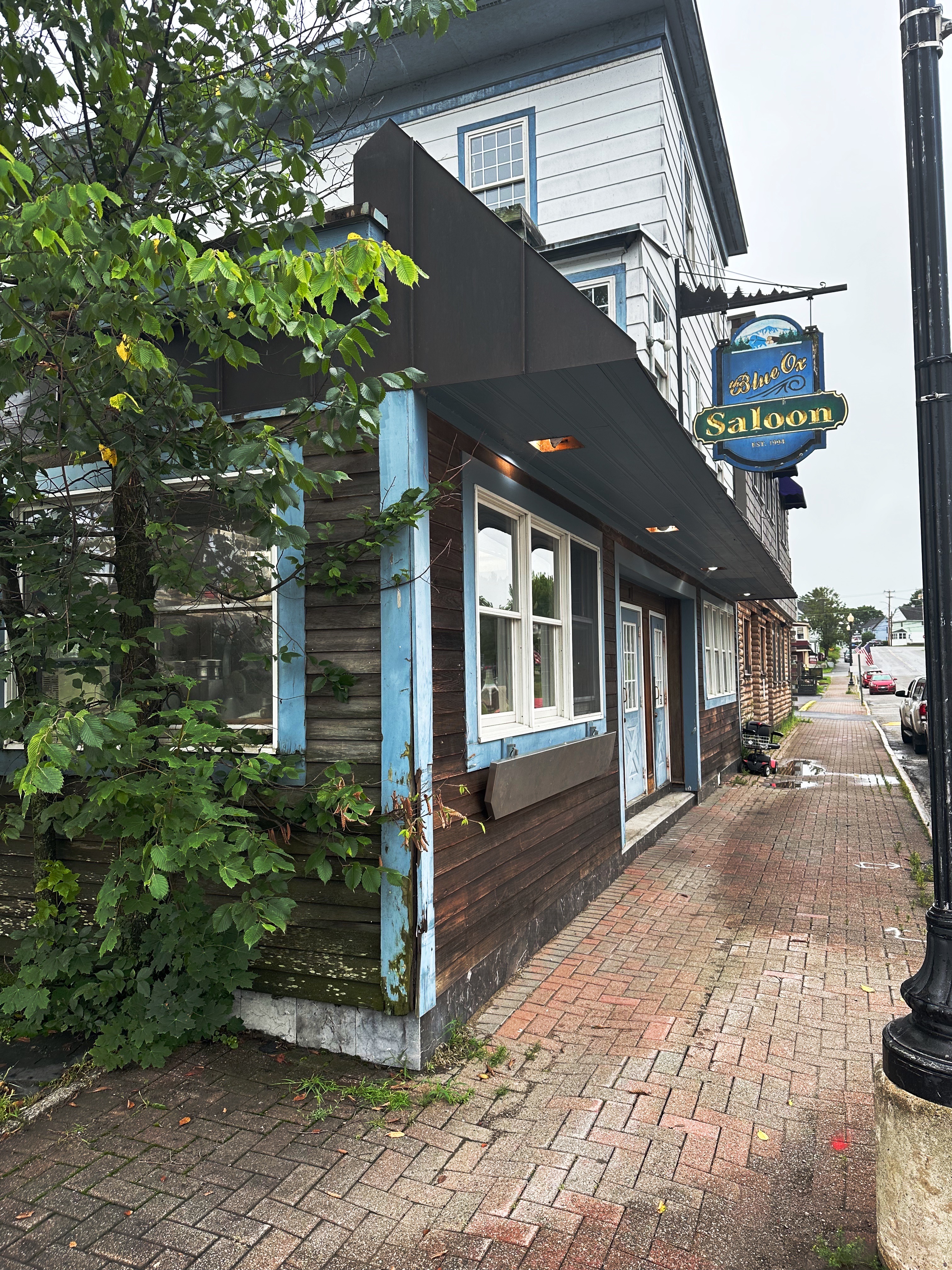

The Blue Ox is old school. Cash only and the pours are extraordinarily large. Don’t even think about asking for wine. The antique cash register is not for show. The bartender/owner is a character and the handful of locals at the bar (5 PM Saturday) were friendly and looking to share their stories with us (and buy us drinks). Some sad stories, photos of first wives, second wives and lots of kids and grandkids. Not surprising as we mentioned earlier this whole town was built around the GNP paper mill and the closing left a permanent mark on the folks here. N.B.: Be mindful that this is Appalachia and the politics and culture of the local folks is very conservative.


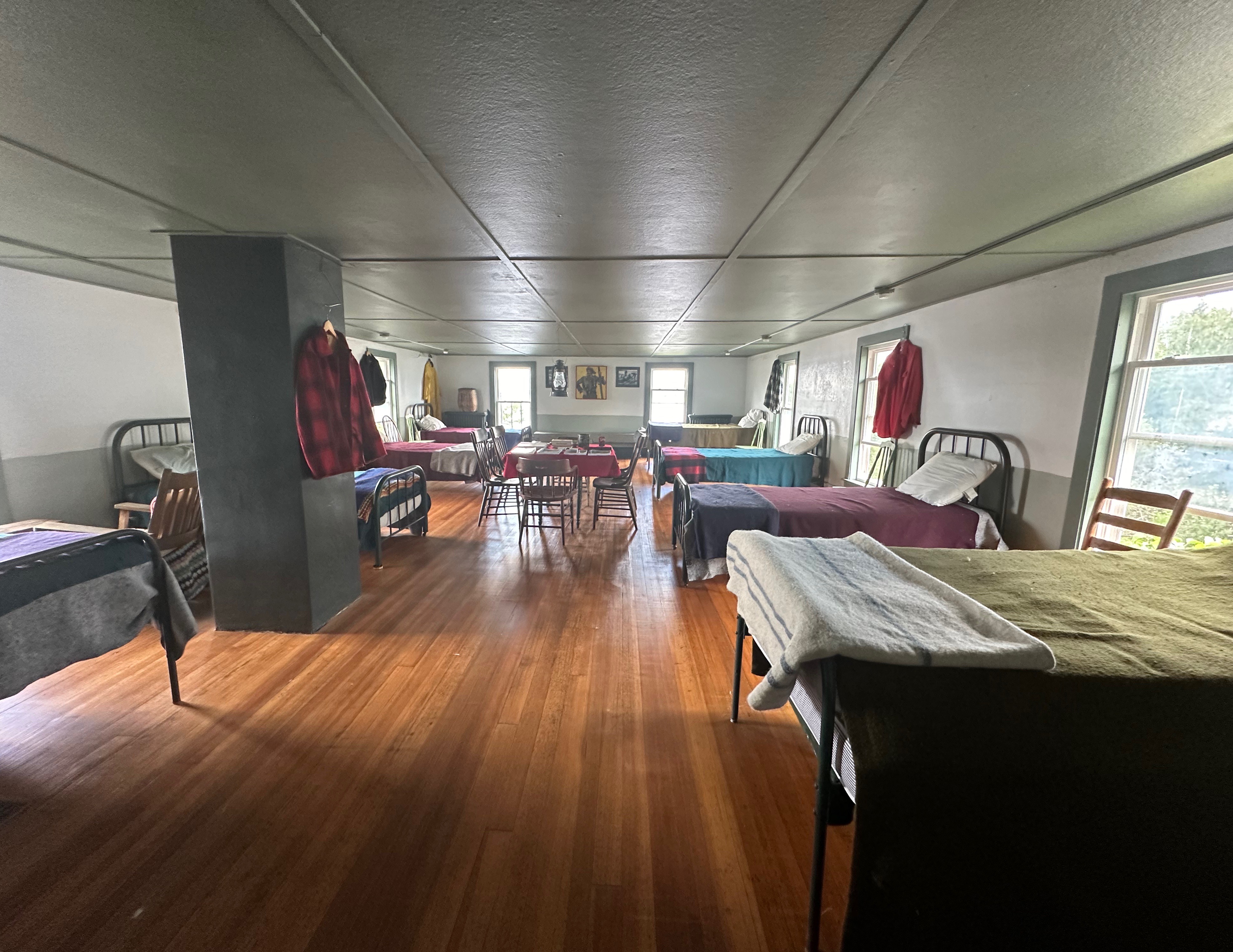
The Chesuncook Boom House sits on a knoll overlooking Ripogenus Lake and Chesuncook Lake with a view to the Katahdin Mountain Range. The house was moved to the current location in 1916 to avoid flooding after the dam on Lake Ripogenus Lake became operational.
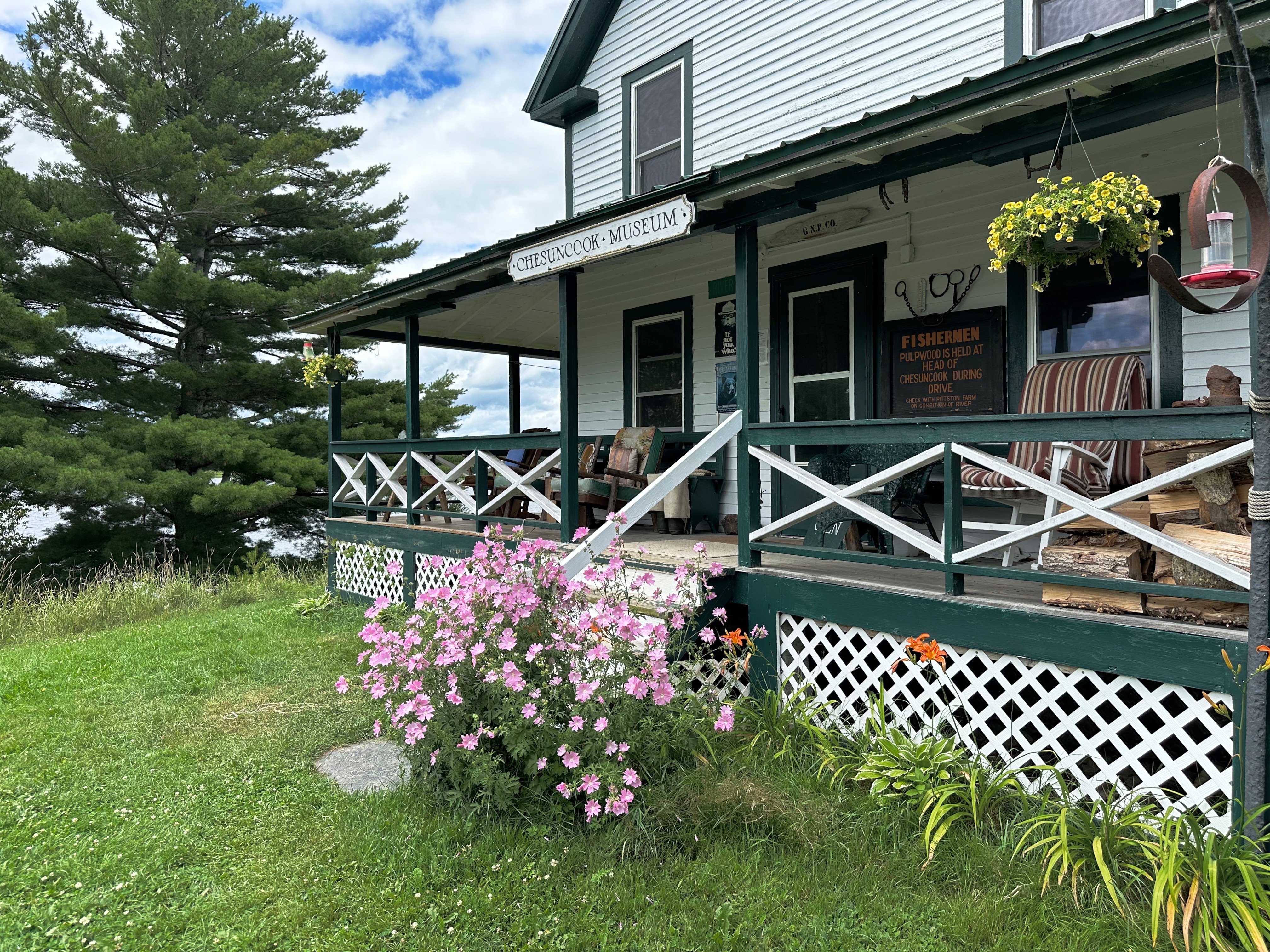


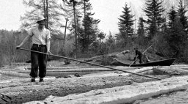
A boomhouse was home to river drivers. The Chesuncook Boom House was where up to 24 river drivers lived and ate when working as log drivers. The link below provides a brief but extremely interesting history of log driving on the Penobscot River. The link also includes a number of archival photographs which provide views of the men working on the logs in the river. You can clearly see the inherent demands and dangers of the occupation. The article was written by the the curator of the Chesuncook Boom House which is open seasonally as a museum. We met the curator, Chuck Harris, while visiting. He worked in the forestry industry for many years. He is quite interesting and knowledgable about the industry and the history of the area. Definitely worth a visit if you decide to tackle a portion of the Golden Road.
River Driving History


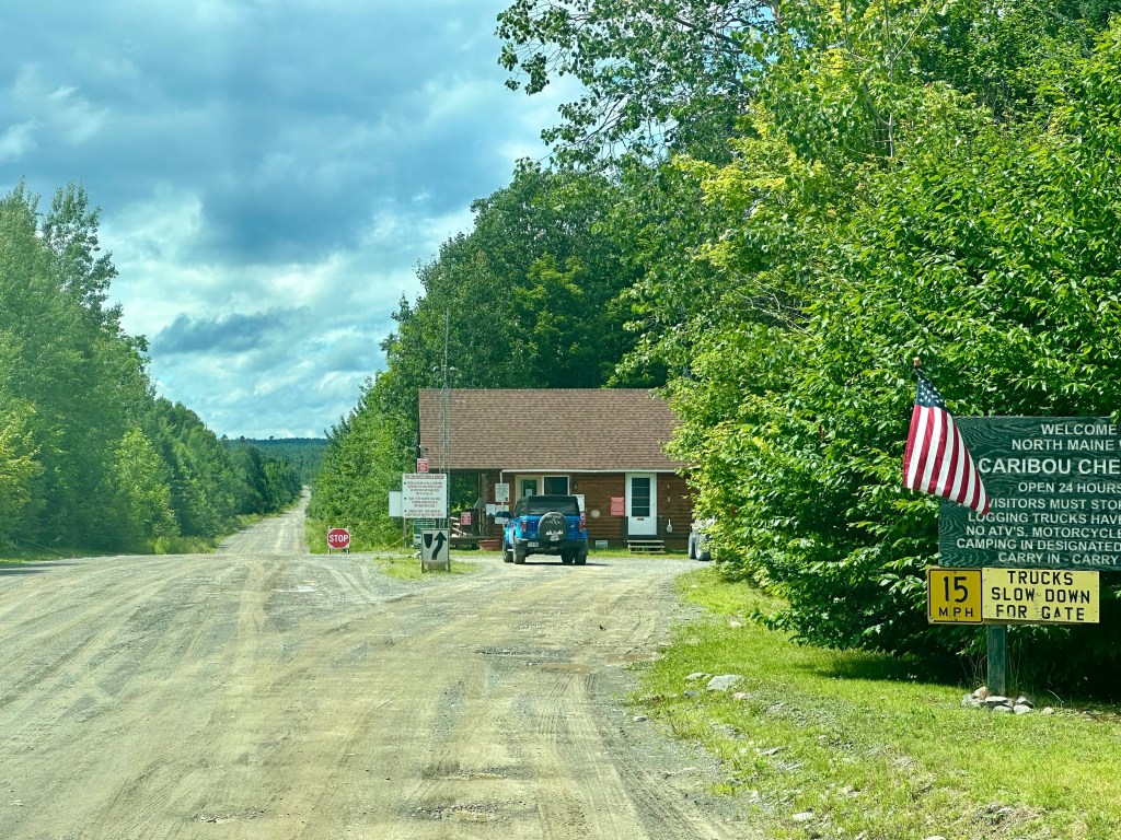
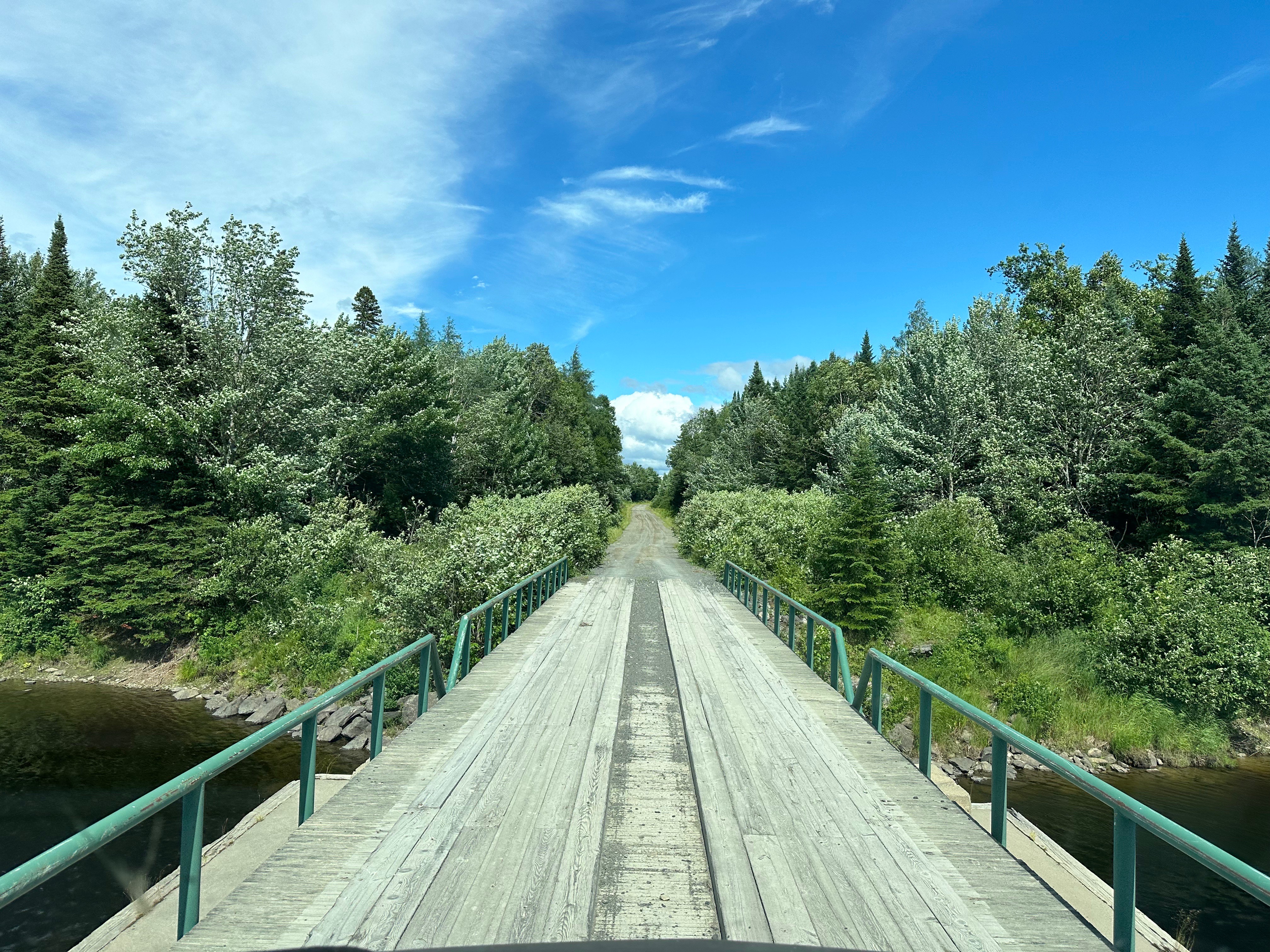
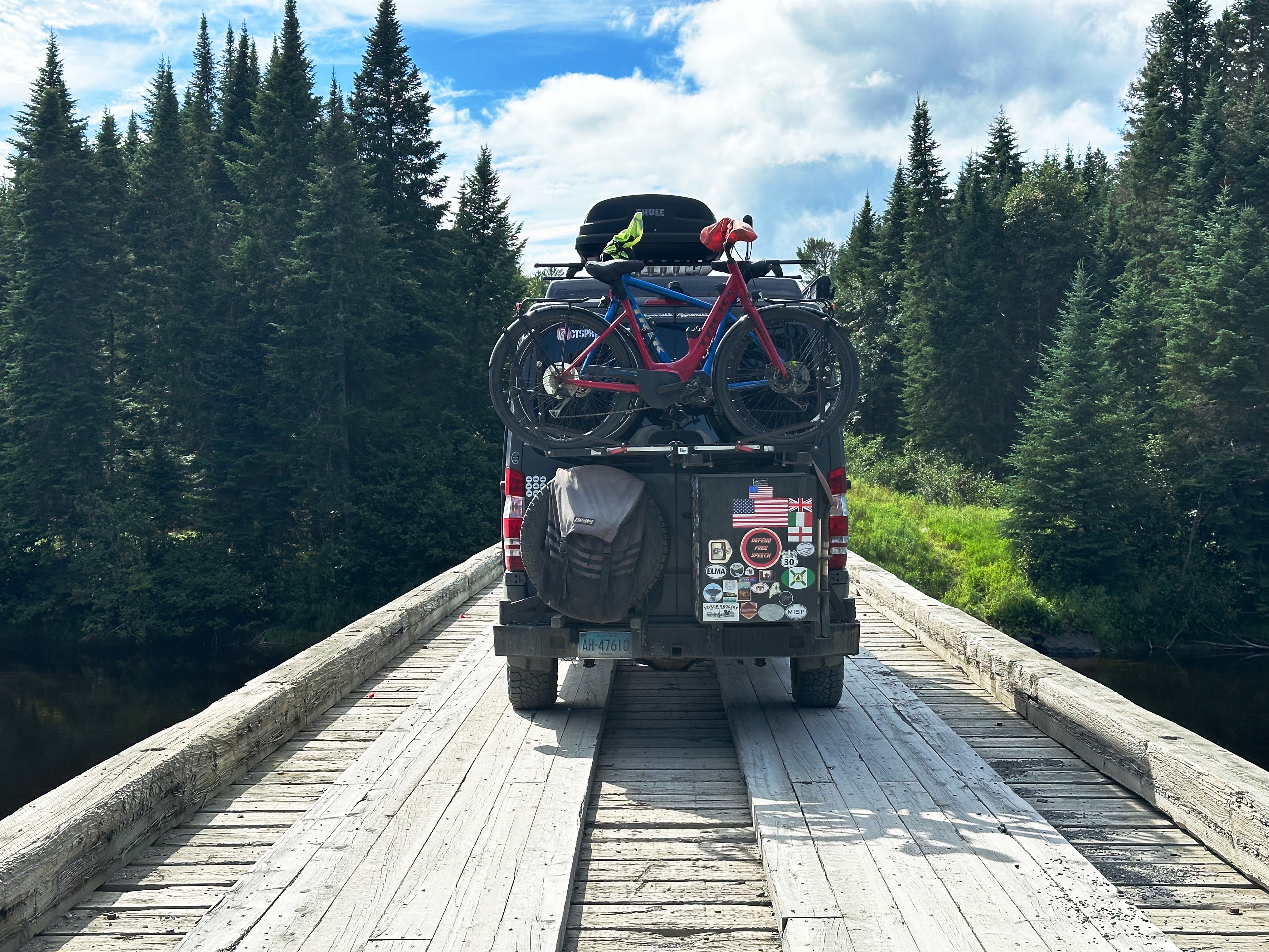
From the boom house we continued east on the Golden Road, venturing deeper into the North Maine Woods until we came to the Caribou Checkpoint. The Golden Road is still privately owned despite the demise of the Great Northern Paper Company. As such, we were required to pay a per person toll, declare our destination and obtain a permit to camp within the privately owned woodlands. Ah, capitalism at it’s best…..


Moose, did we mention moose? Maine has an estimated 76,000 moose. The moose population in Maine is the largest in the United States outside of Alaska. Unfortunately, the moose population in the other lower 47 states is declining. As an example, the moose population in Minnesota has declined by 70% since 2006. Maine’s next door neighbor New Hampshire is also experiencing a precipitous decline which has folks in Maine very concerned. Global warming is the apparent culprit. Tick infestations are worsening and killing more moose as the warmer temperatures allow more of the ticks to survive the winter and feast on moose. Dang it!
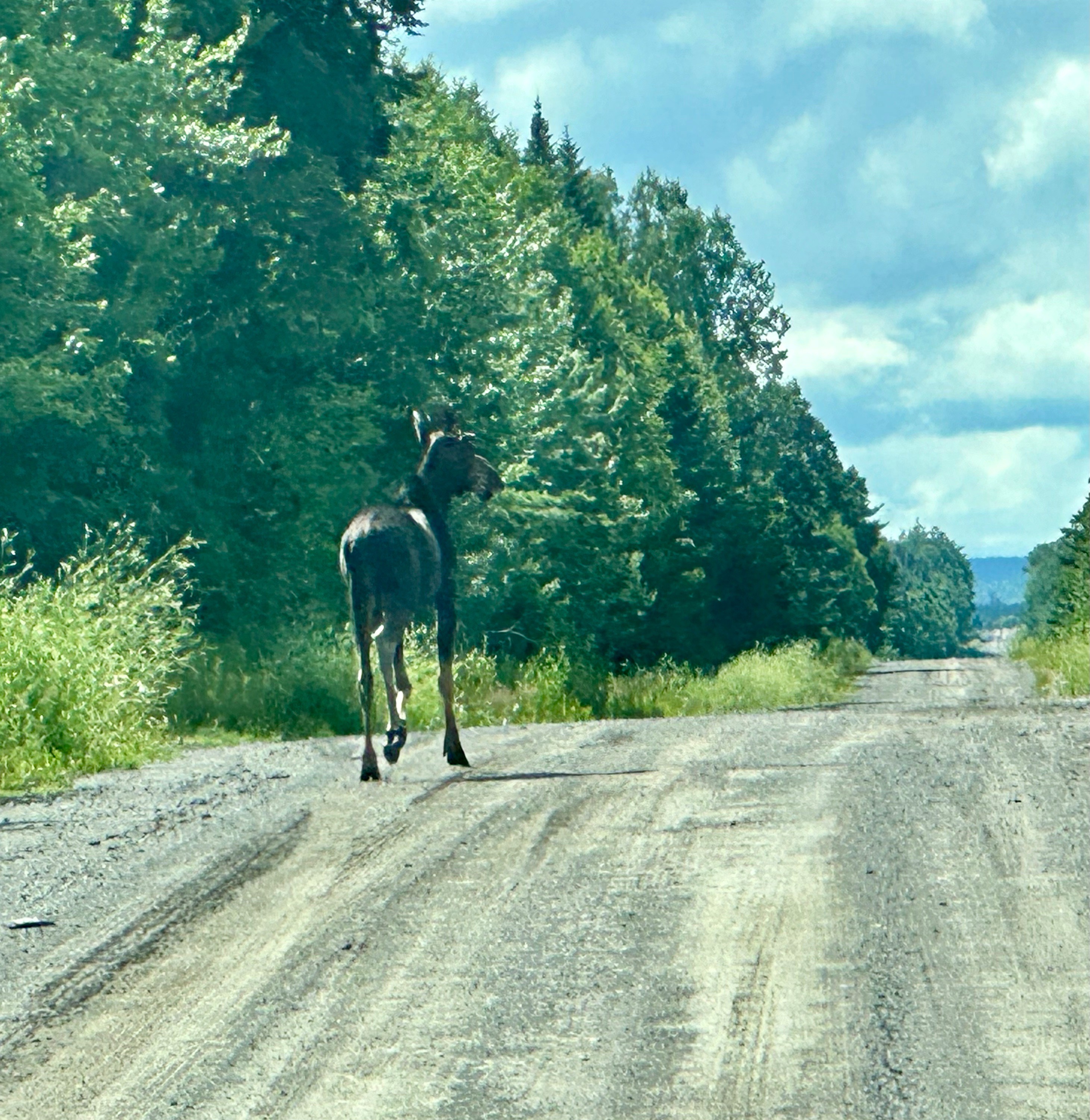

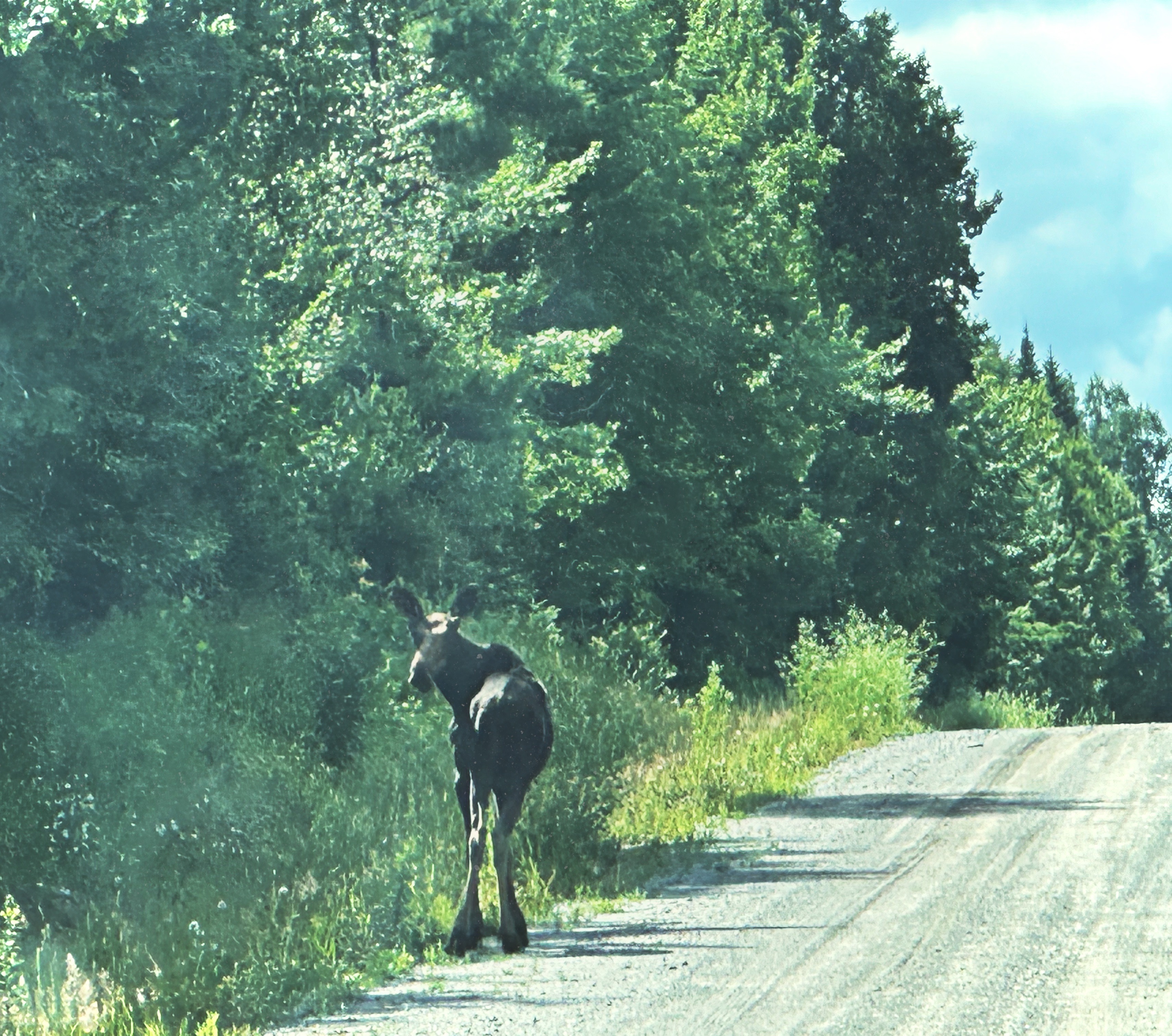
If you have not seen moose in the wild – we highly recommend a visit to Maine. If you are not comfortable setting out into the backwoods on your own there are a number moose watching tour outfits. The males are usually about six feet in height and weigh 1200 to 1400 pounds – magnificent!

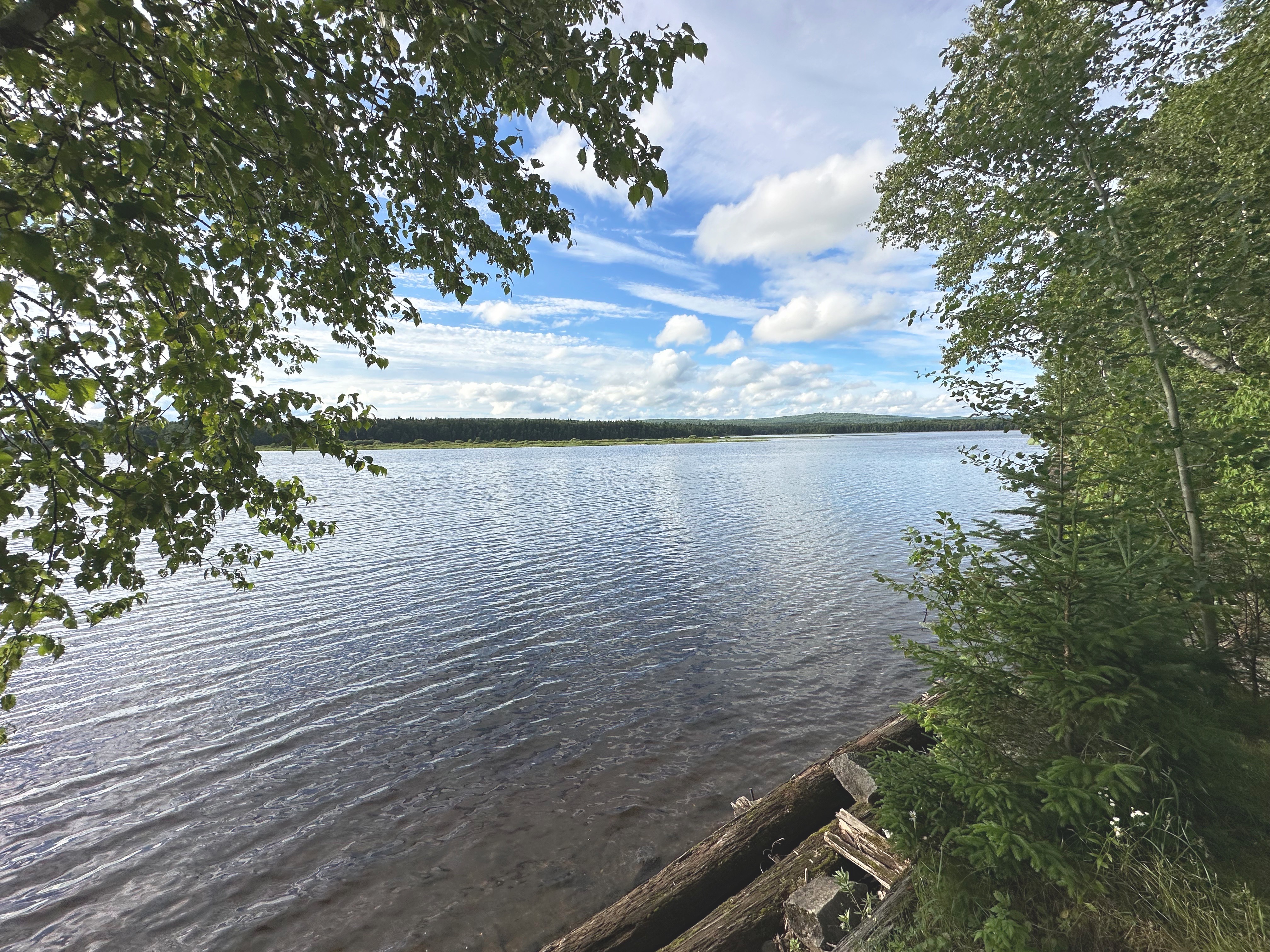

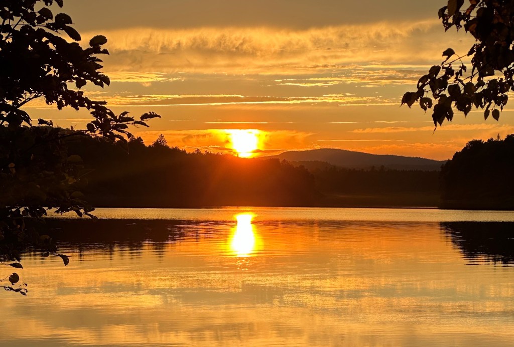
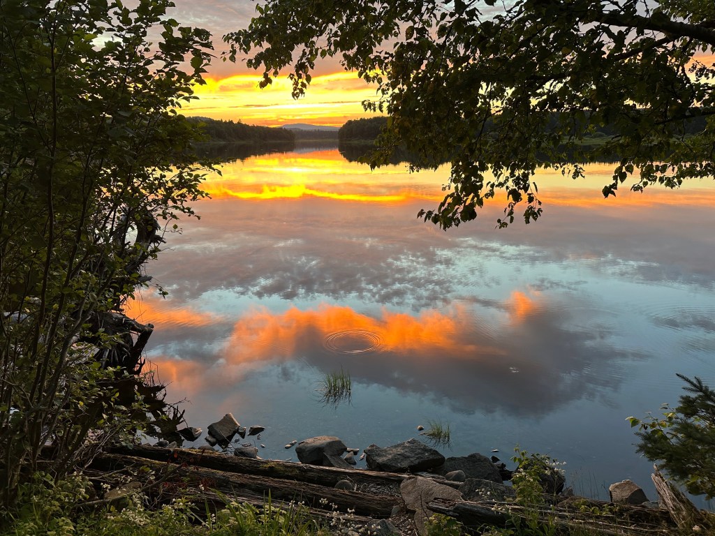
Although we did not find our intended camping location, our last evening of camping was fittingly spectacular. After finding that we had missed the well hidden Nelhedus Stream Trail on the north side of Seeboomook Lake, we were able to navigate around to the south shore and find a spot right on the lake. The lake was beautiful, the sunset spectacular and we were serenaded by the calls of loons echoing across the lake. Magic!
Seeboomook Lake was created with the construction of a dam at the eastern end of the lake which feeds the West Branch of the Penobscot River. The dam was built in 1936 to provide hydropower for the Great Northern Paper Company.

Historical tidbit: during World War Two, German prisoners of war were brought to the area to cut and transport trees as the GNP was short of labor, for obvious reasons. The prisoners were housed on a farm in Seboomook; they were repatriated to Germany in 1946. Seeboomook still exists today as unorganized territory, a couple miles south of the eastern end of the lake, with a population of 23.

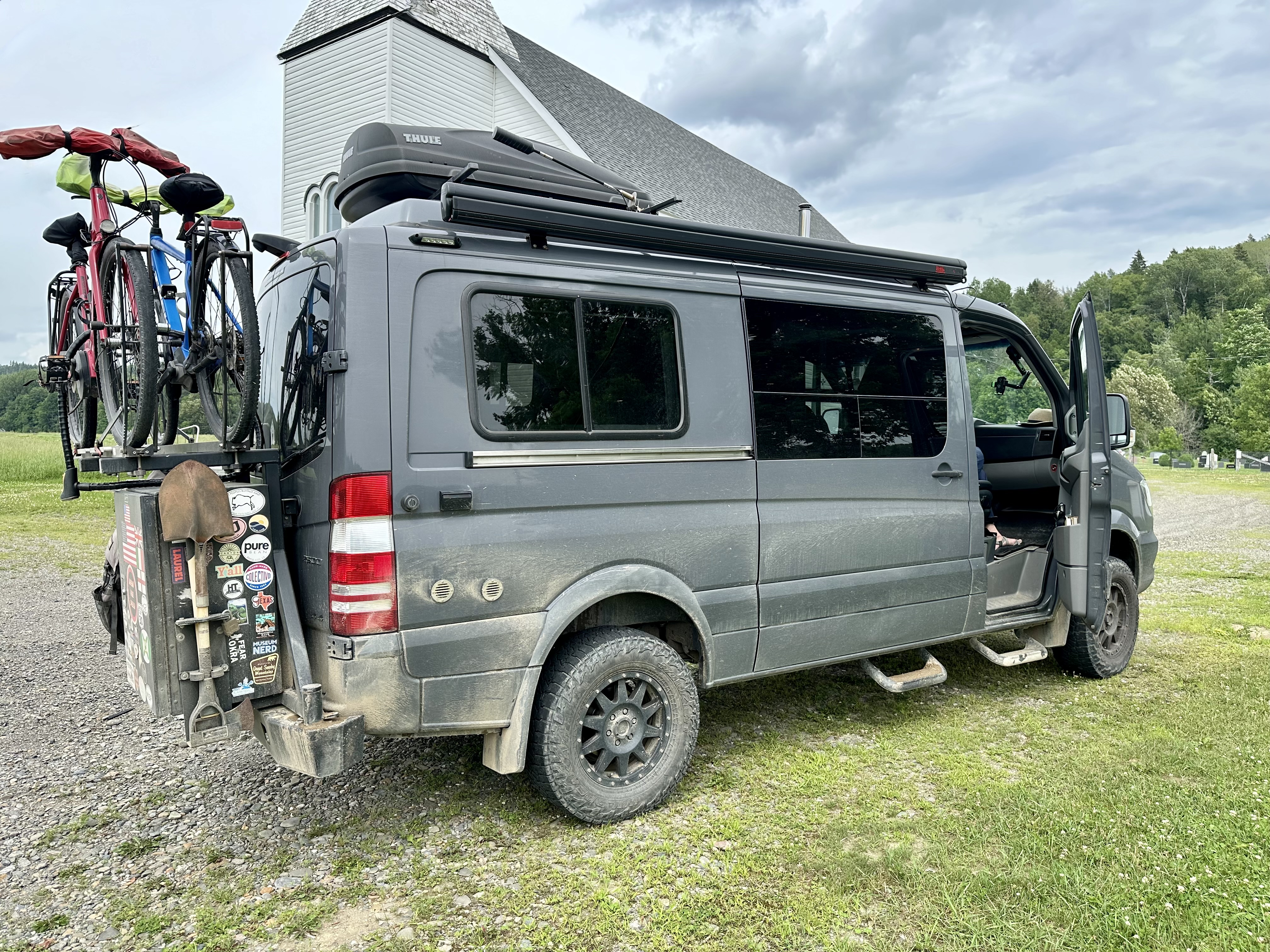
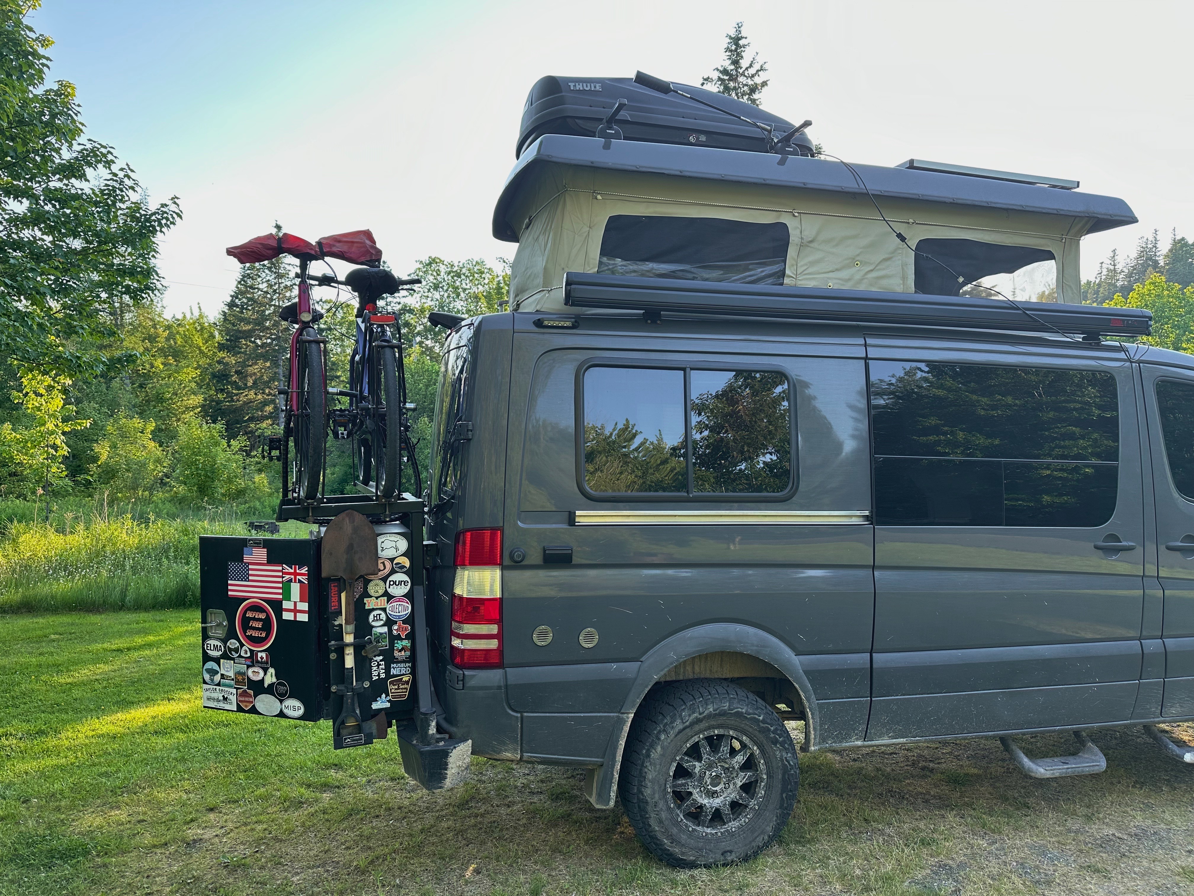
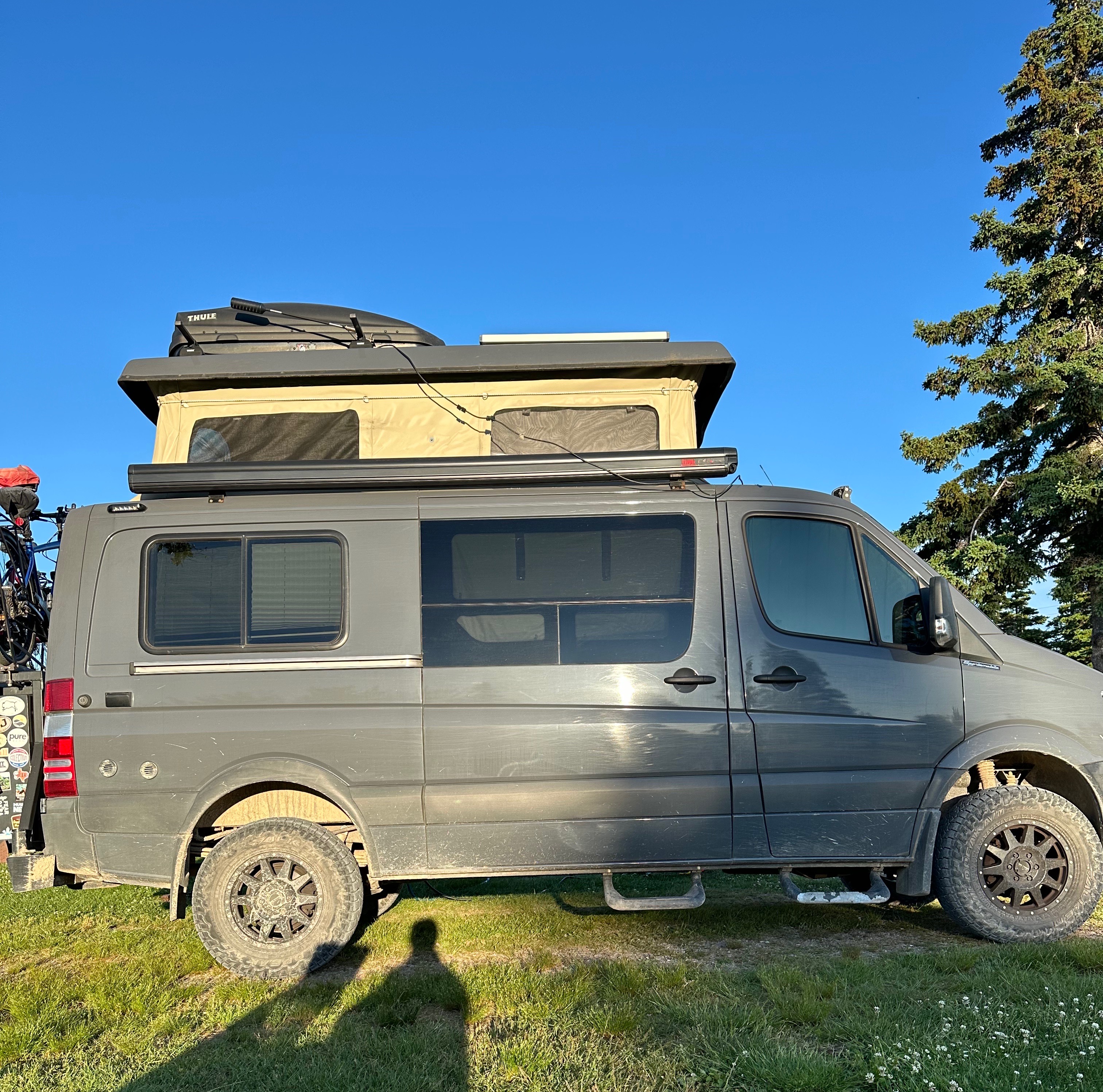
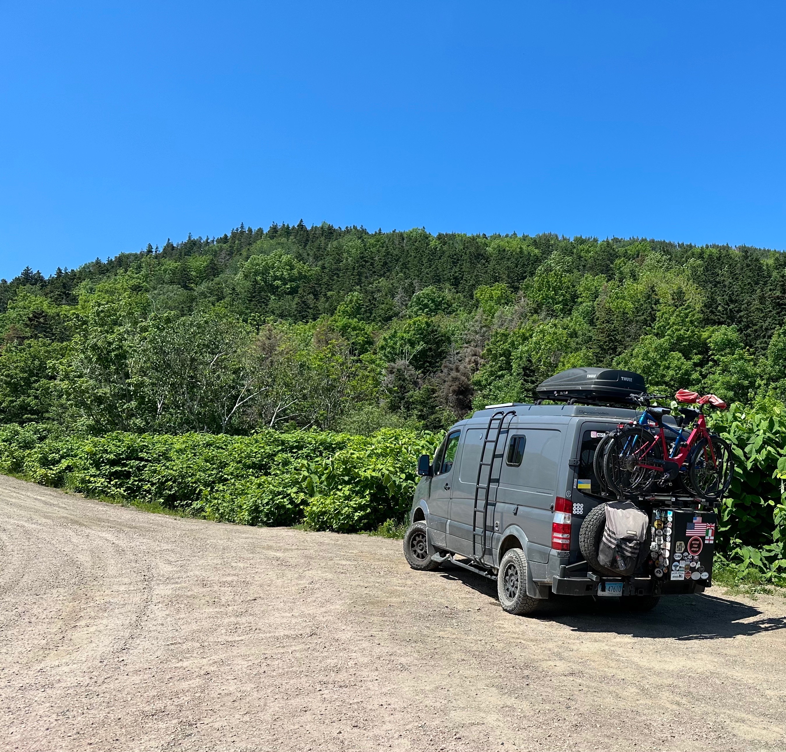
We would be remiss if we did not give the Beast it’s due. The Beast was a bit battered but not defeated at trip’s end. The second alternator and light bar had given up the ghost. Our navigator-side hoop step was damaged during a backcountry ramble. The Beast got us everywhere we wanted to go and to a couple places we probably shouldn’t have gone! Many thanks to our rugged and reliable steed.
This is our last post for OTR 10.0. We had a great trip despite not completing our full itinerary. We were unable to travel to New Foundland and Labrador due to issues with the Nova Scotia to New Foundland ferry. We probably would have ended up being quite seasick anyway (16 hour ferry ride)! Another trip for sure.


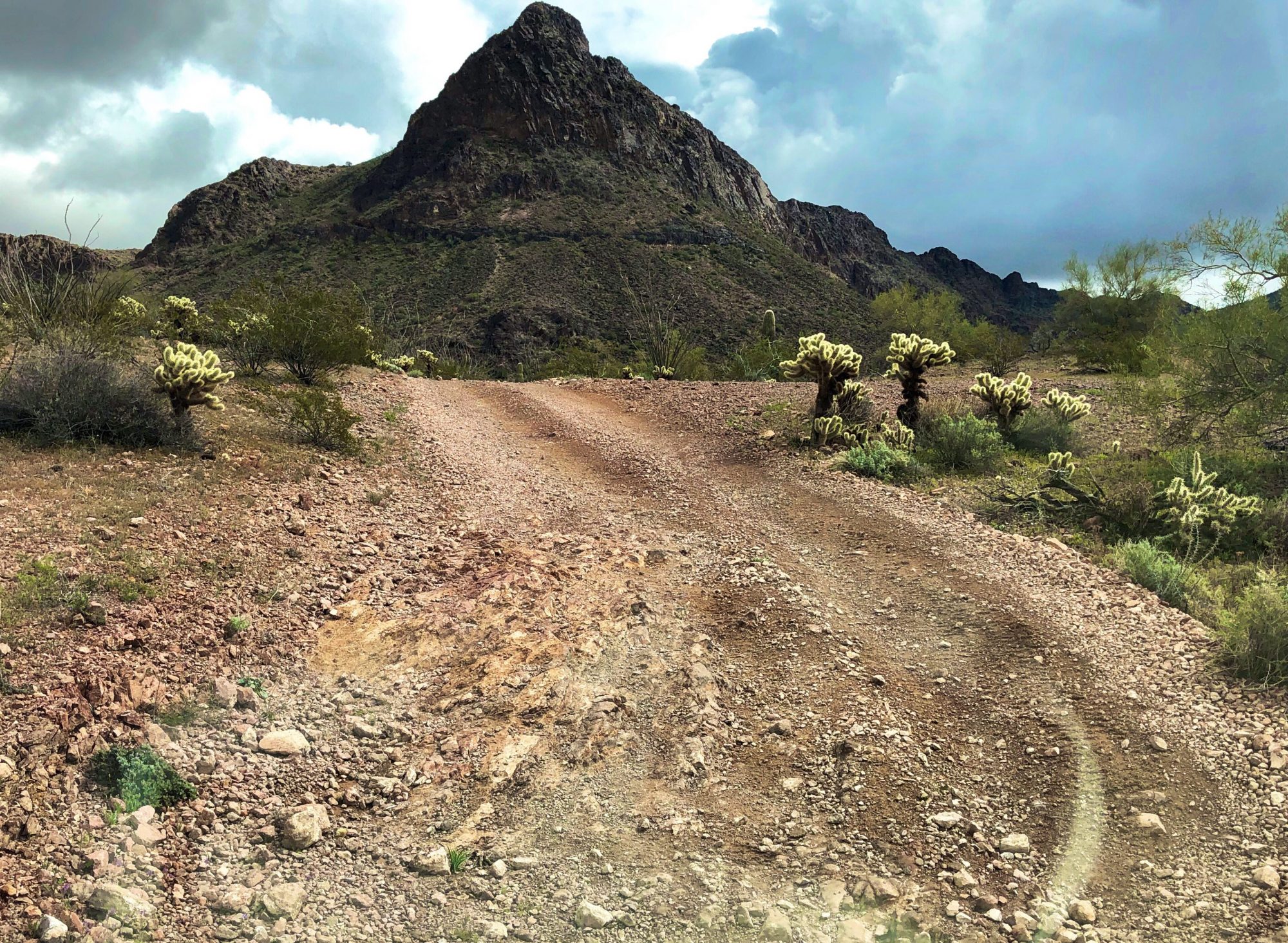
Next up is a visit to Iceland in September. We will be home for the remainder of the fall as Maria recovers from knee replacement surgery. Our current plan is to depart The Fort in mid January (OTR 11.0) for a trip through the Southwest, including several extended overland segments through the Sonoran Desert.
Be seeing you!
Bridge or ferry..not really a question is it?

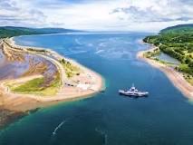
We wanted to take the most scenic and interesting route to Sydney so we crossed the Bras d’Or Lake at the Little Narrows on the Little Narrows ferry. The ferry operates on demand 24 hours a day and is free of charge. Quite the bargain! This is not the smallest ferry we have ever taken with the Beast but we would not venture out into the open ocean on this vessel!
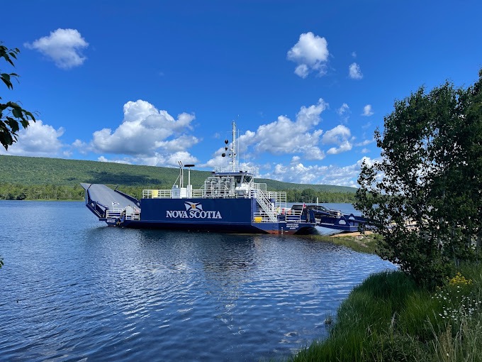
The ferry is a diesel powered cable ferry. This one of four cable ferries servicing Cape Breton and we believe the shortest crossing. The full ride across takes under three minutes. Dare we say it is cute?
After departing the ferry we followed Route 223 to the Grand Narrows where we again crossed a portion of the 62 mile long lake and continued on the Grand Narrows Highway (Route 223) towards Sydney and our appointment with Doktor Luke.


Finally, Doktor Luke’s -silly rabbit – not that kind of doctor! Doktor Luke’s| A Respectable Coffee House… where it is always TIME FOR A DAMN FINE CUP O’ COFFEE.
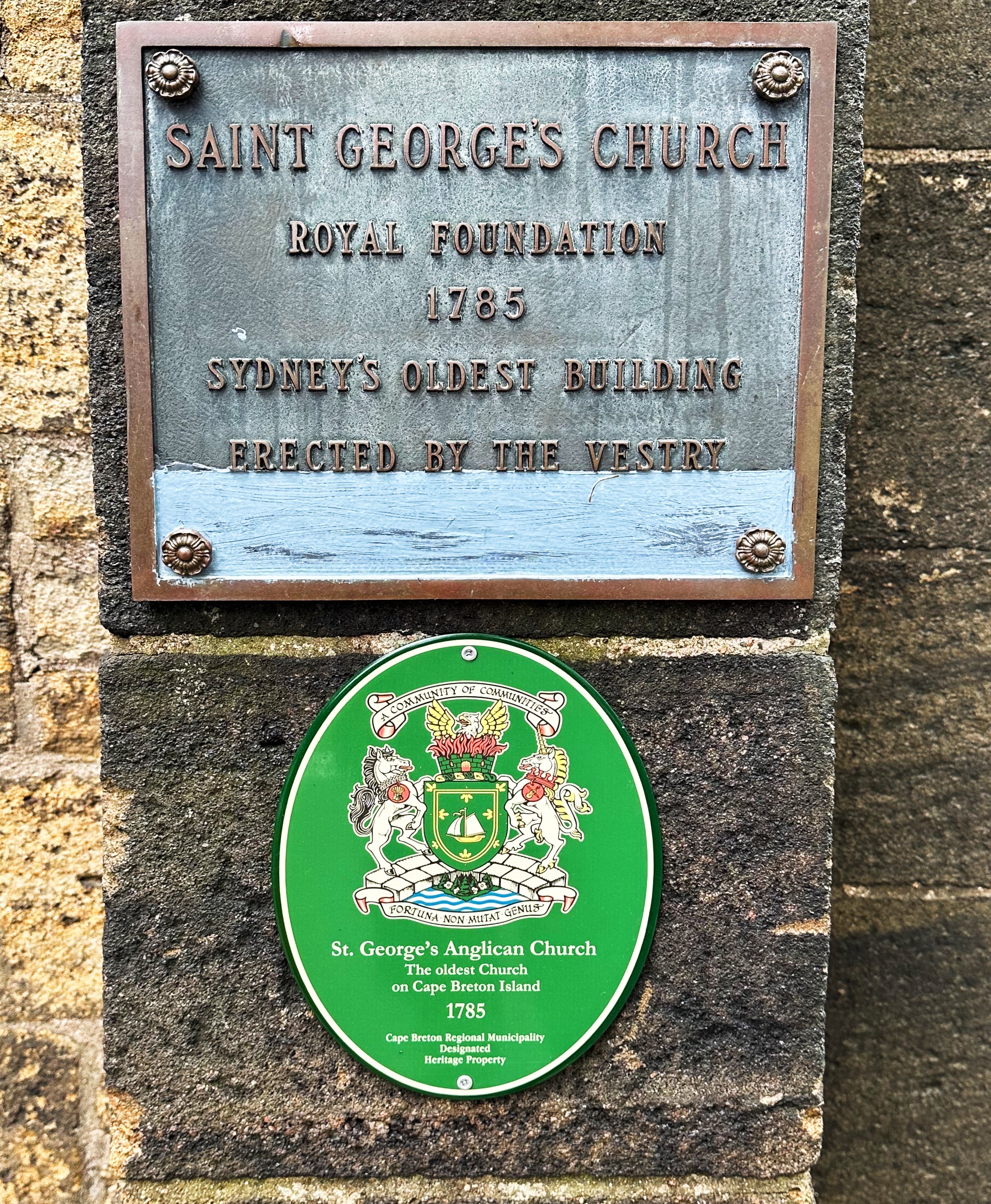
Sydney (pop. 30,000) sits on Sydney Harbour in eastern Cape Breton. The city was named for Thomas Townshend Baron Sydney (Viscount Sydney). The city’s origin is distinctly British as it’s founding (1785) was as a place for British loyalists who remained faithful to the Crown and in opposition to the establishment of the American Colonies as an independent nation. It is estimated that 100,000 colonist fled the American colonies during or after the Revolutionary War (we do not recall that fact being mentioned during history class). About 70% of the loyalists emigrated to Canada. The United Empire Loyalists Association of Canada (ULEAC) is an one of the organizations that continues to actively preserve the history of the loyalists (to learn more click the link below).


Sydney’s early economic engine was coal mining. There were over 100 coal mines in the area and these mines produced more coal than all of the other coal mines in Nova Scotia combined. The vast majority (similar to Inverness-see prior post) of the coal fields were underwater. As with so many places where coal was a major part the economy and culture, the coal industry began winding down in the 1970s. The last of the underground mines in Sydney ceased operation in 2001.
https://notyourgrandfathersmining.ca/sydney-coalfield

In addition to coal, Sydney was also anchored to the steel industry. Dominion Iron and Steel was one of the largest steel producers in Canada. Unfortunately, the company was also responsible for significant environmental damage. Steel operations shut down in 1988. Read a brief history below courtesy of Sydney Steel.
Sydney Steel Corporation is behind one of Canada’s biggest environmental disasters. At the very end of the 19th century, American investors formed the Dominion and Iron Steel Company LTD (DISCO) and began large scale steel production in Wintering Cove, Sydney. The area was ripe for steel production with iron ore, limestone and coal at hand in troves. It also has a good harbour for shipping and a good fresh water supply. Within a decade of opening, the steel mill was producing 800,000 tonnes of pig iron and 900,000 tonnes of crude steel – nearly half of Canada’s steel production. It was also one North America’s largest steel production company.
During production throughout the 20th and 21st centuries, operations had dire consequences for the surrounding environment – in particular the wetlands and harbour adjacent to the plant. The facility was situated directly adjacent to and north of the coke oven operations. These coke ovens produced a huge amount of hazardous materials that flowed freely into the subsequently named Tar Ponds.
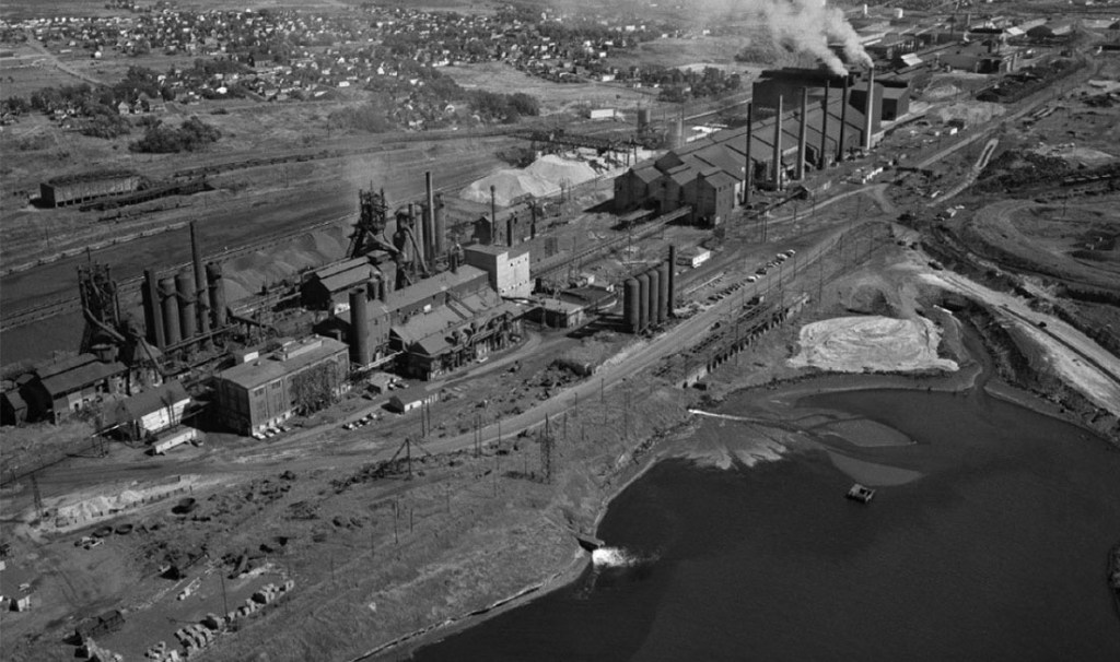
Throughout the 1970s, as environmental activism began to take heed, concerns for the damage that these mills were causing had reached new heights. Environmental groups would consistently uncover evidence that the government didn’t know the damage that the mills were causing to the environment, or they did and were turning a blind eye. In 1980s, scientists discovered polycyclic aromatic hydrocarbons (PAHs) in the lobster caught in Sydney harbour – a direct result of contamination from the Tar Ponds.
Insistent pressure from various sources caused the steel mill to cease operations in 1988, when the Sydney Steel Corporation turned into an electric arc manufacturer. Industrial production ceased altogether in 2000.
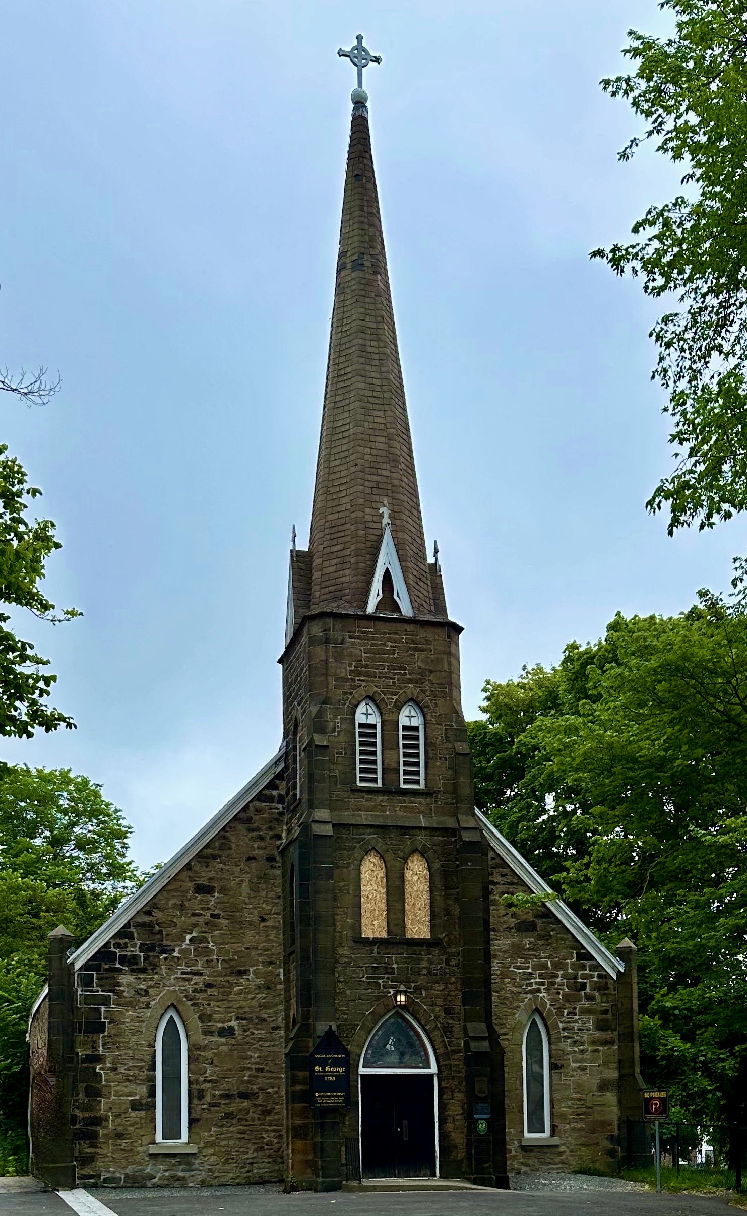
After our Damn Fine Cup O’ Coffee at Doktor Luke’s, we set off on a walkabout through the historic district. Our first stop was at Cossit House Museum. This house is the oldest standing residence in Sydney. It was built by Reverend Ranna Cossit in 1787. Cossit was the first Anglican minister in Sydney. The arrival in Sydney of an Anglican minister at this time is not surprising based on Sydney’s loyalist origin.


Cossit moved from New Hampshire as part of the establishment of the Anglican parish. He was accompanied by his wife, Thankful Brooks, and their six surviving children. Thankful provided the good reverend with another six children before departing for the next life while delivering their 13th child. The well used birthing room is pictured above.

The Cossit House Museum was well worth the visit. We had two period costumed guides who were both informative and interesting.
https://cossithouse.novascotia.ca/
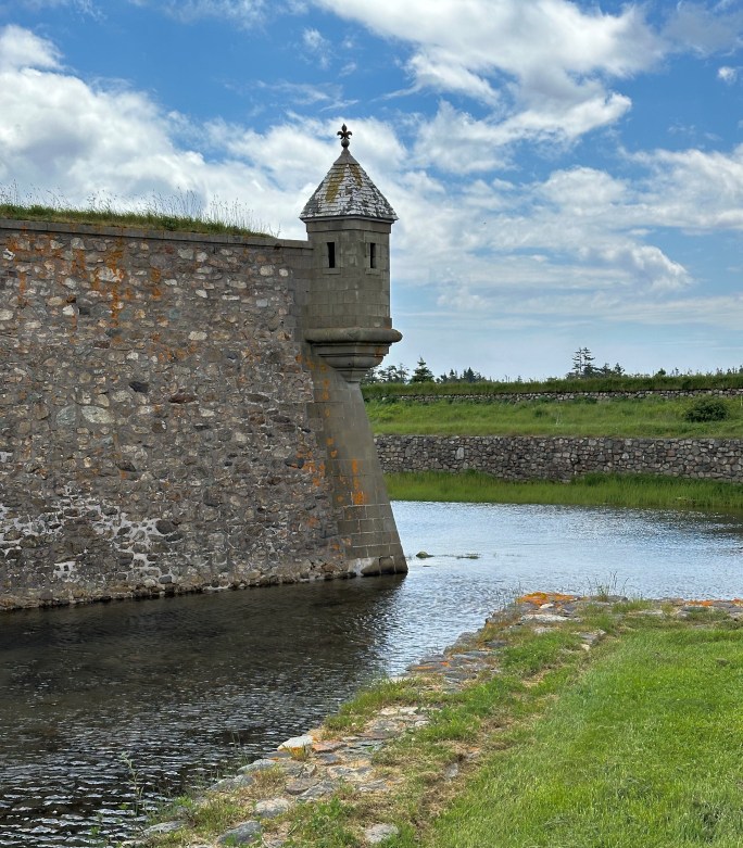
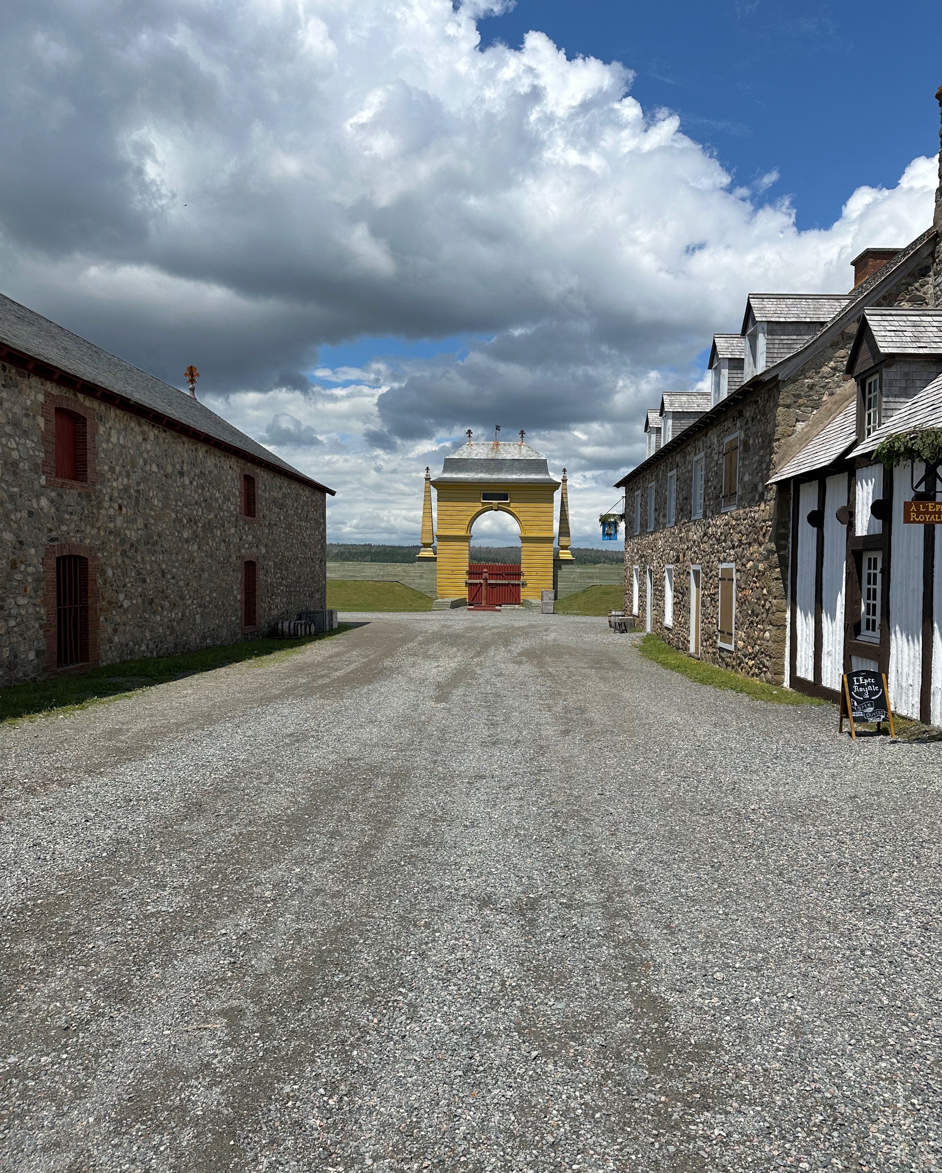
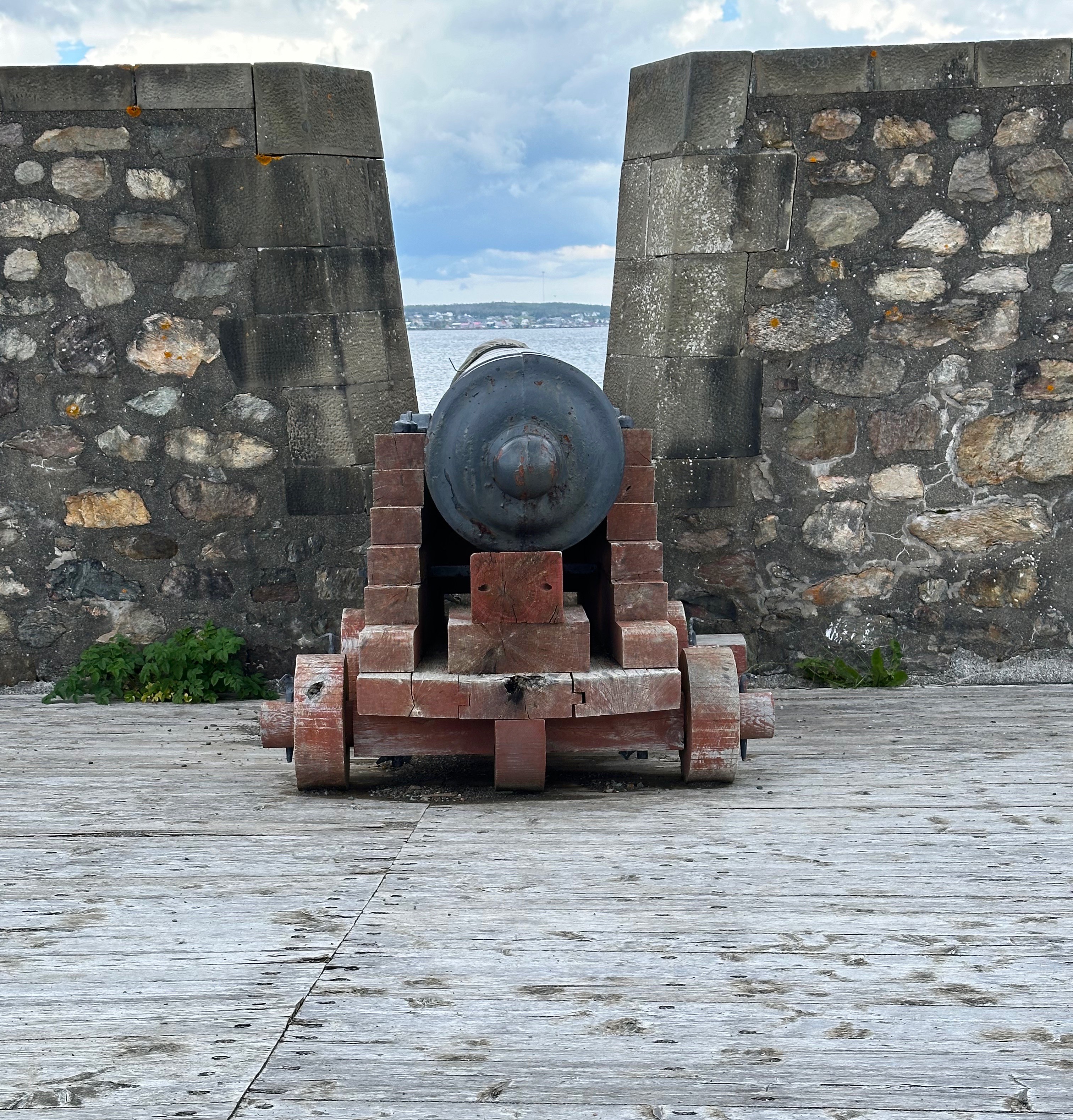
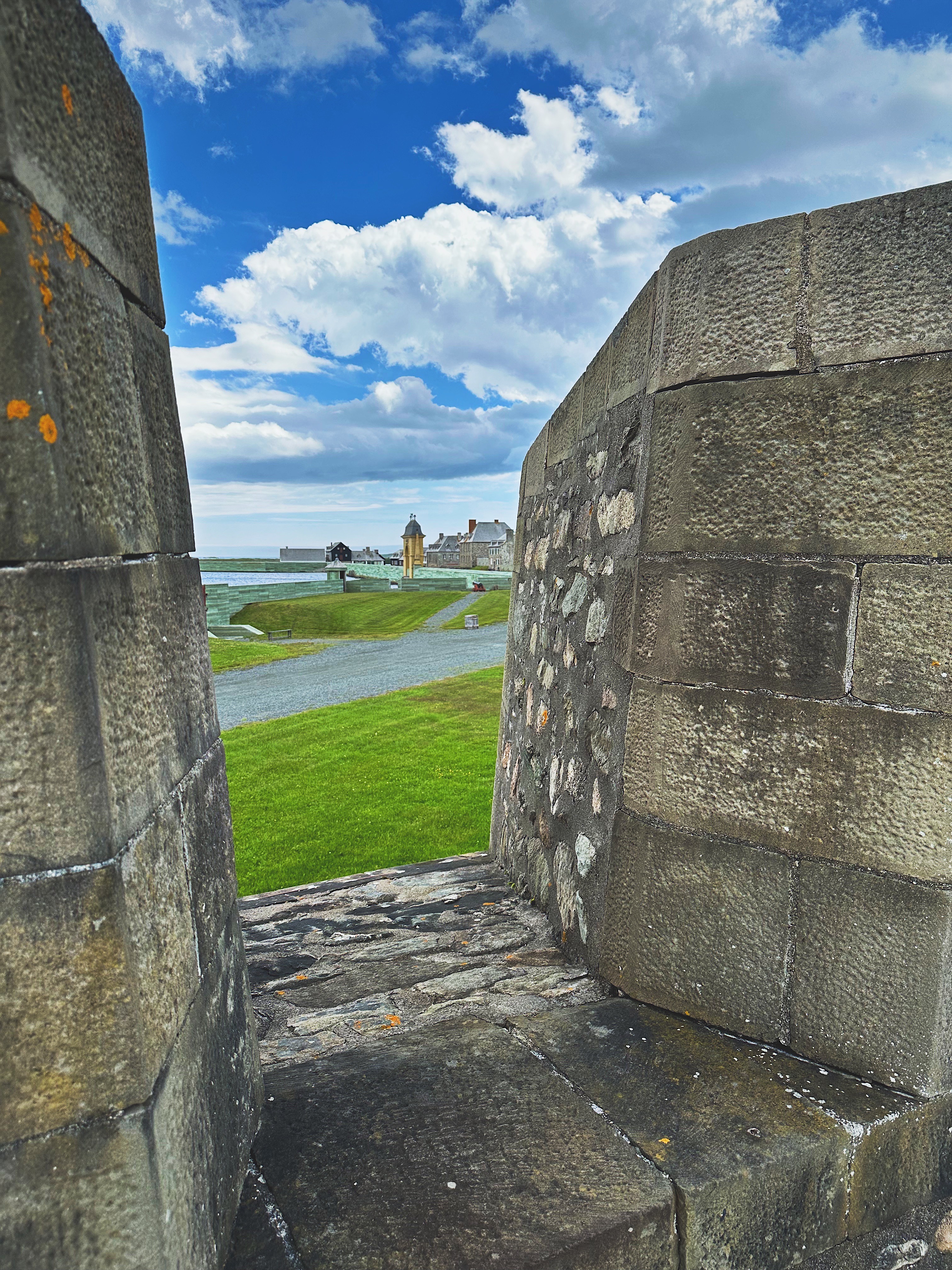
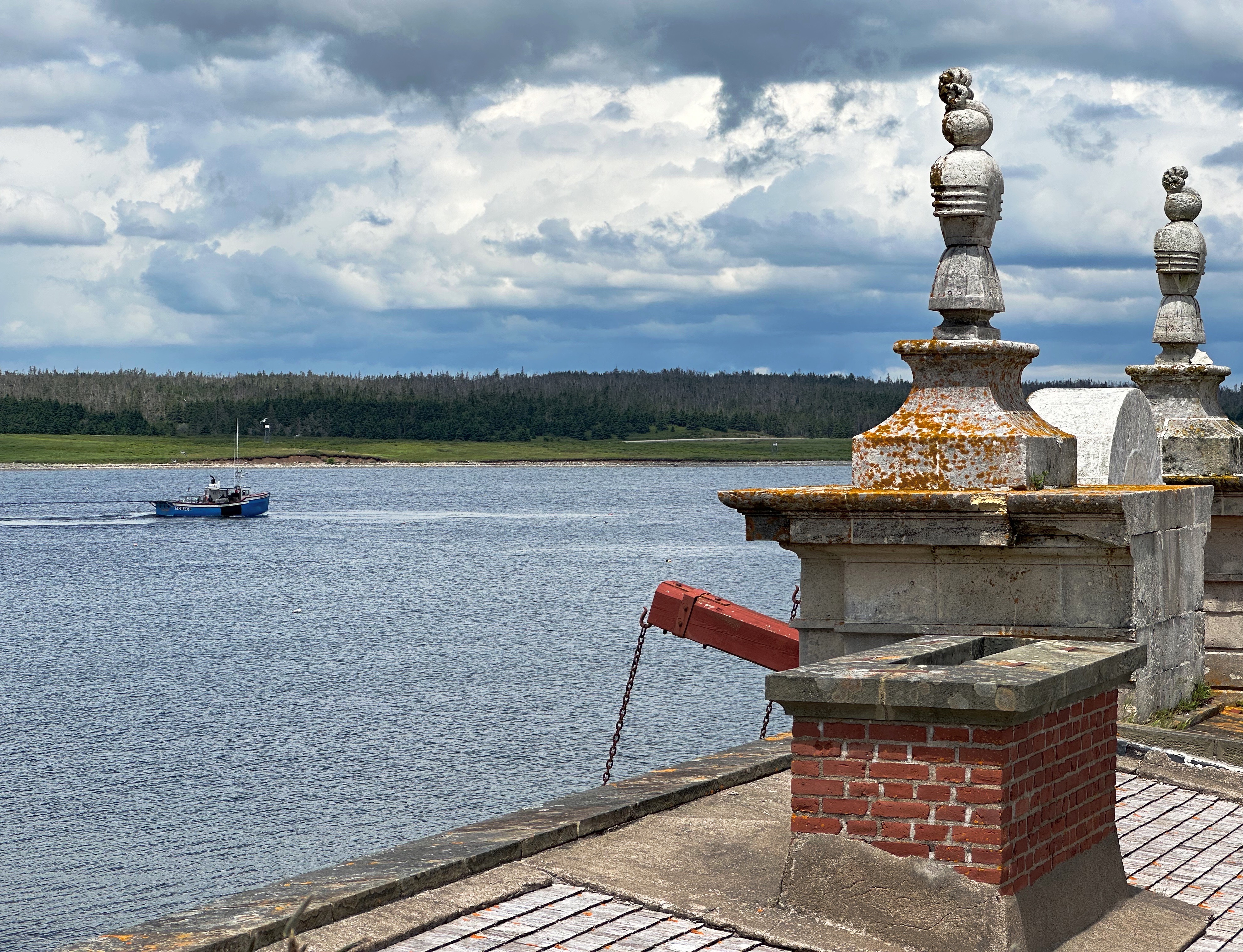
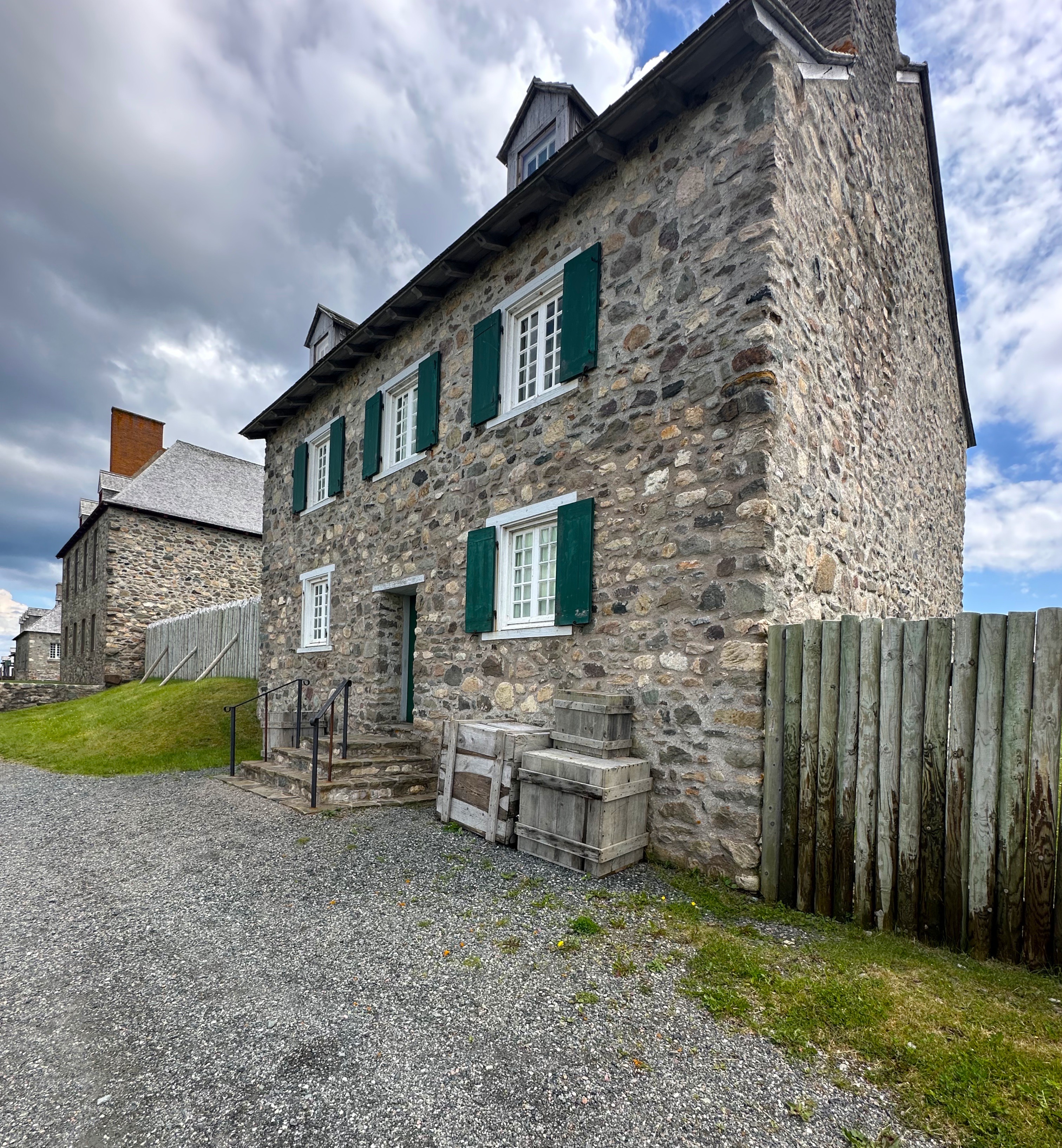
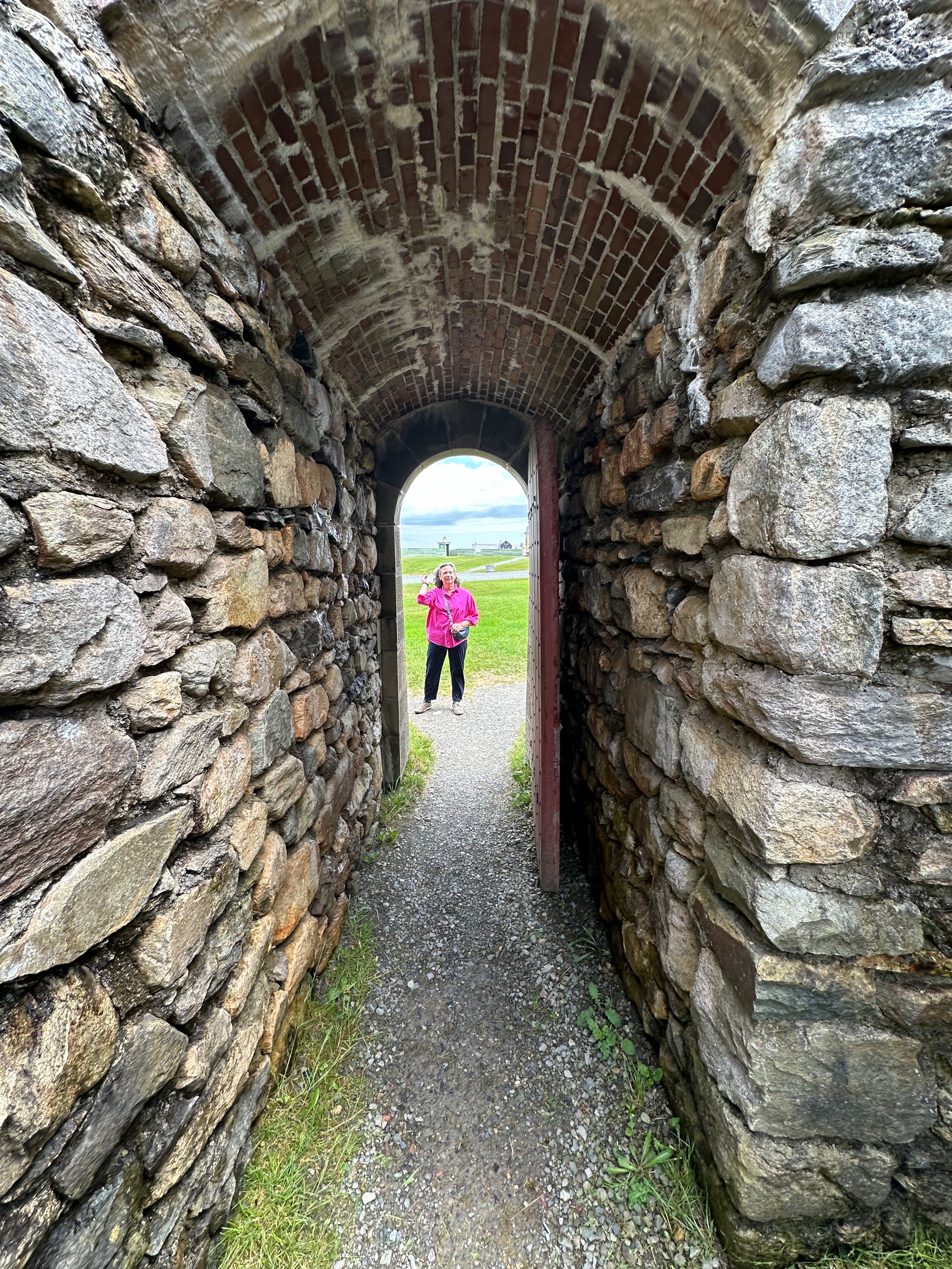
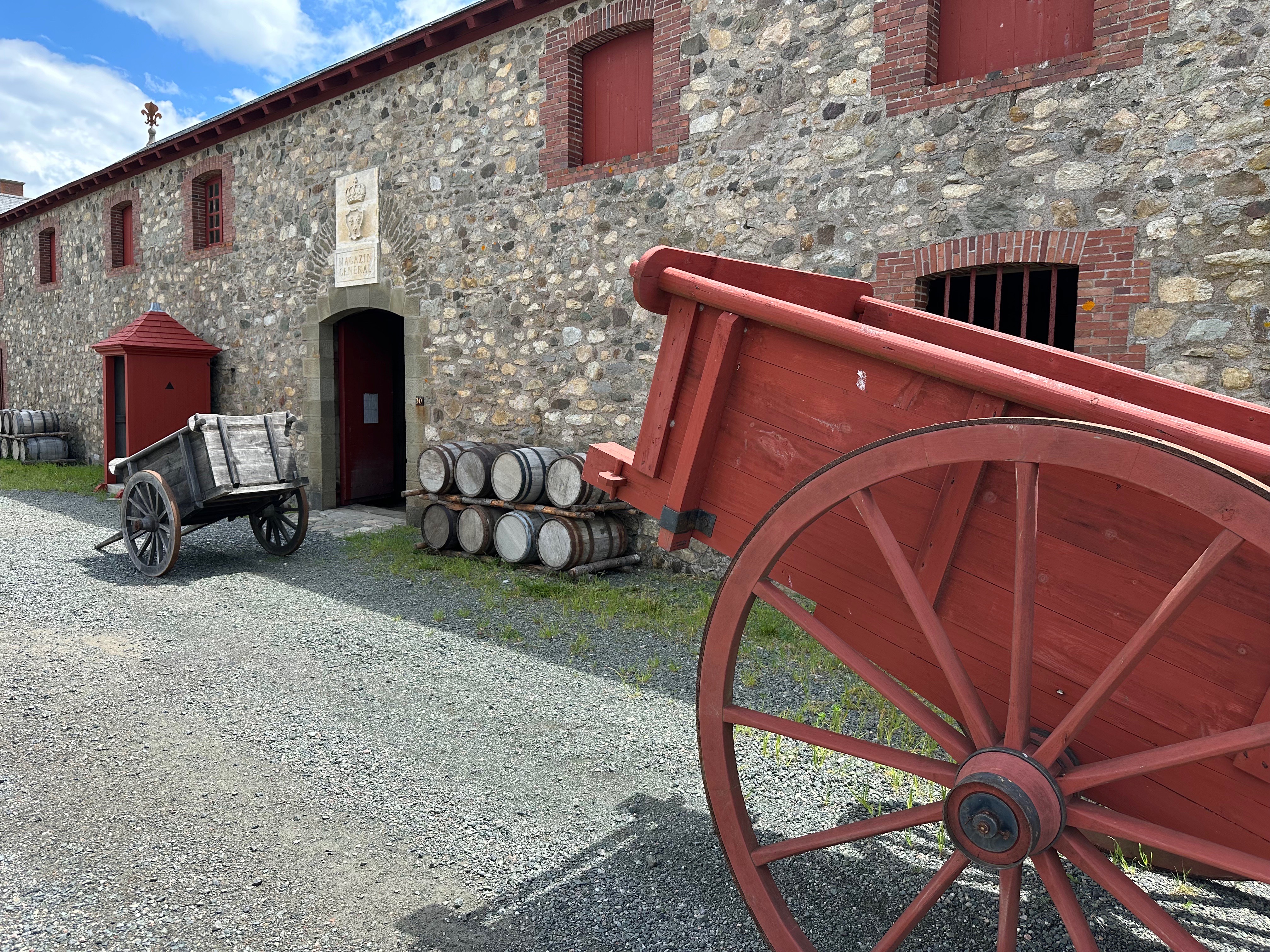
After another damn fine cup o’ coffee the next morning at Doktor Luke’s we set out to visit the Fortress Of Louisbourg (pronounced Lewis-Berg). The fortress is a national historic site located about 20 miles south of Sydney just outside the the fishing town of the same name (pop. 1000).
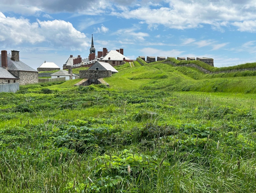
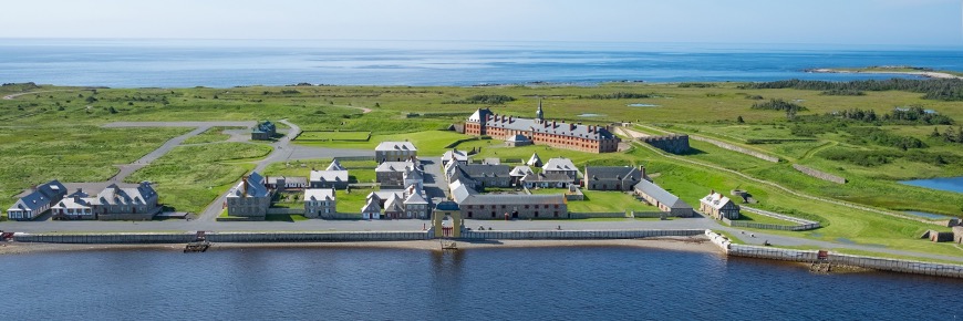
The construction of the fortress began in 1719 and was completed in 1745 by the French who came to this area after Newfoundland and Acadia were lost to the British in 1713. The settlers, who were primarily fishermen, were able to continue fishing the Grand Banks from Louisbourg. The cod fishery was the primary economic industry and was lucrative. The cod was dried and exported to France in exchange for goods.
Unfortunately, peace and prosperity were not long lived as the British and French went to war in 1745. With troops frm New England leading the attack, the British laid siege to the fort soon after war was declared.


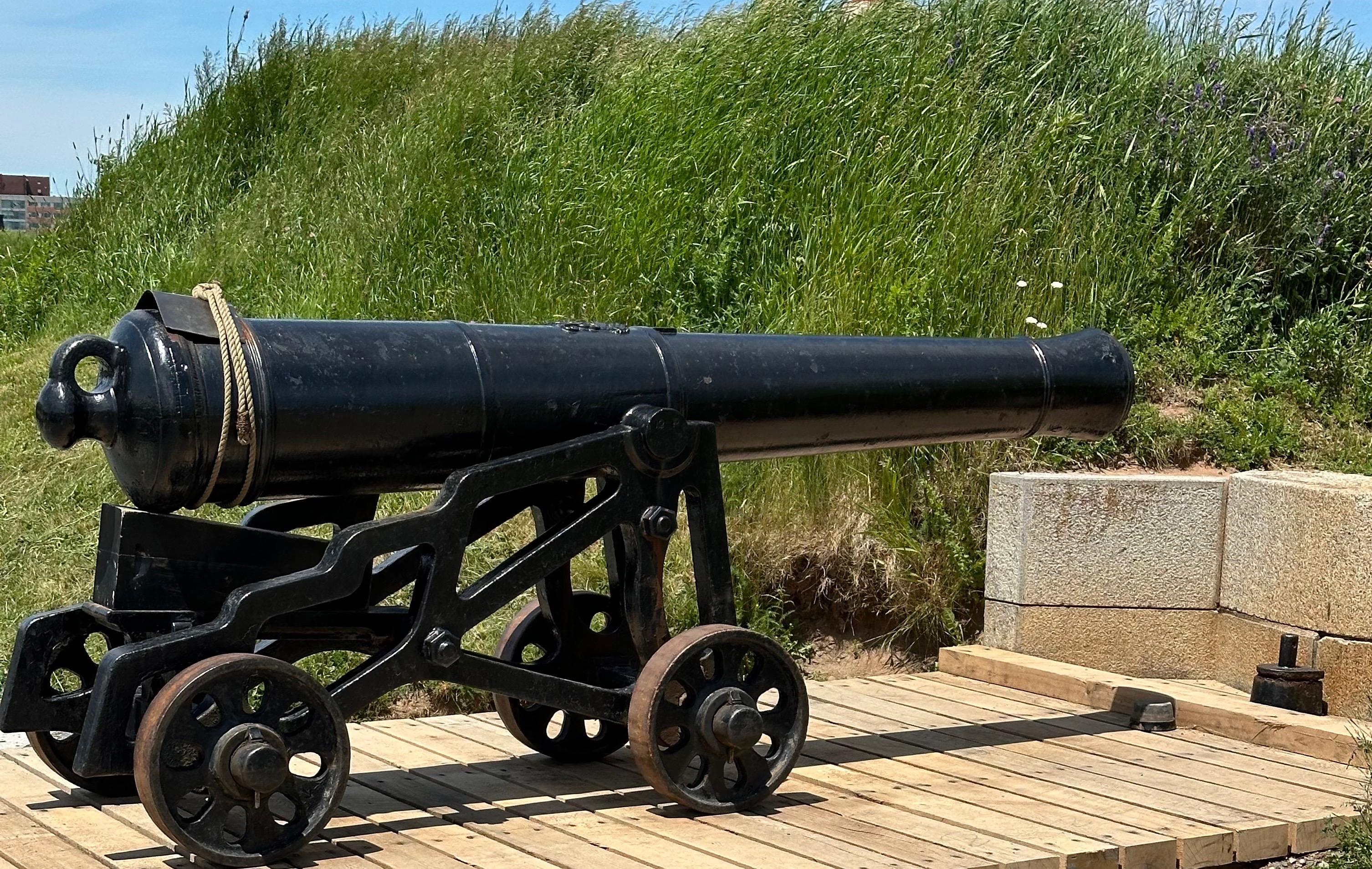
While the fortress is impressive to look at and the harbour side was well defended, the surrounding hills made the fortress vulnerable to the British batteries. The New Englanders captured the fortress in just 46 days.
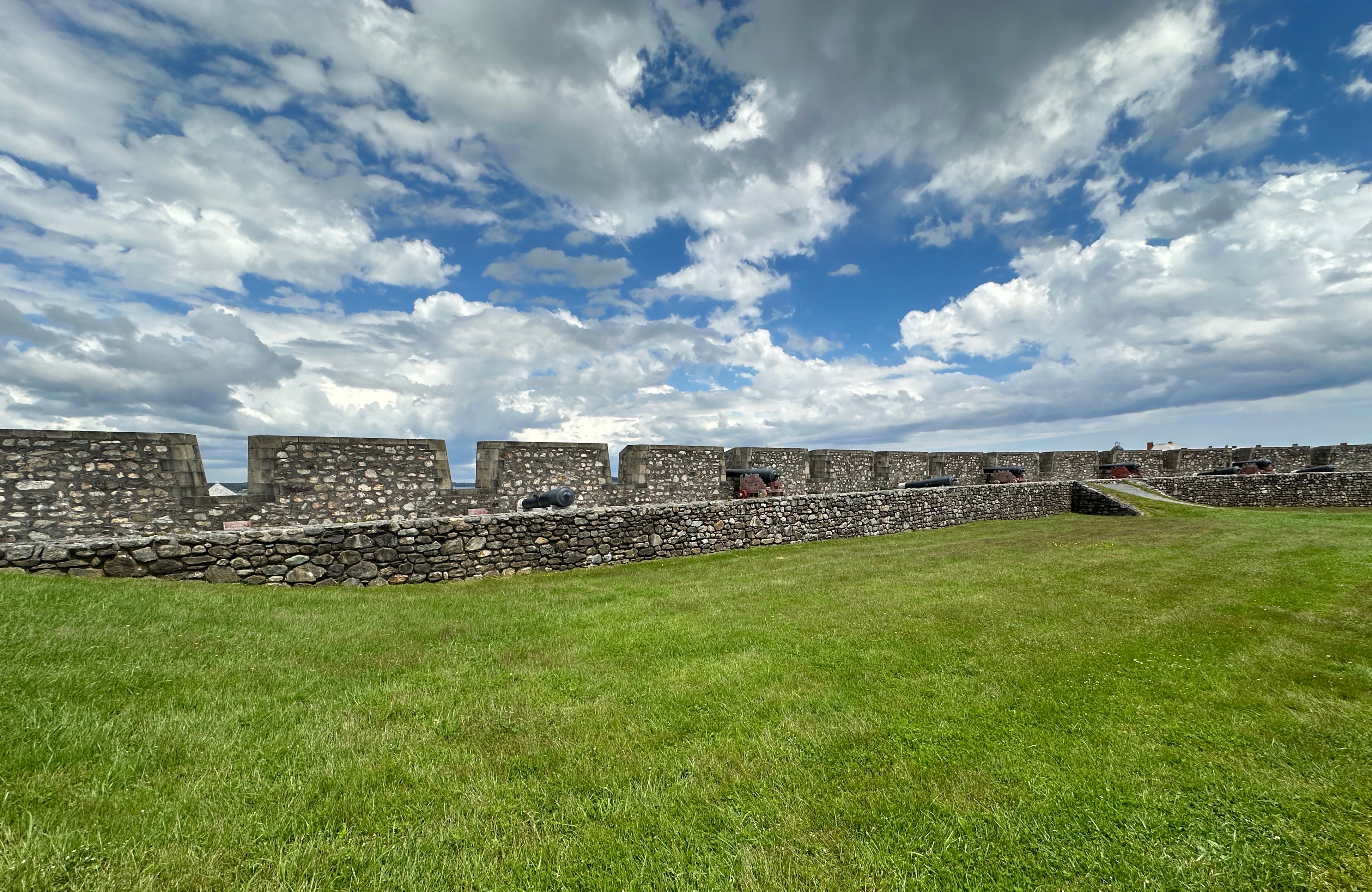

A treaty signed in 1748 restored the fortress to the French. The French carried on for the next 13 years until once again the British and French were at war. The British attacked the fortress with a massive force of 13,000 soldiers supported by 14,000 sailors on board a fleet of 150 ships. The battle was over in seven weeks with the overmatched French losing once again. The British who were determined that the fortress would never be useful to the French at any time in the future completely demolished all of the fortress walls!
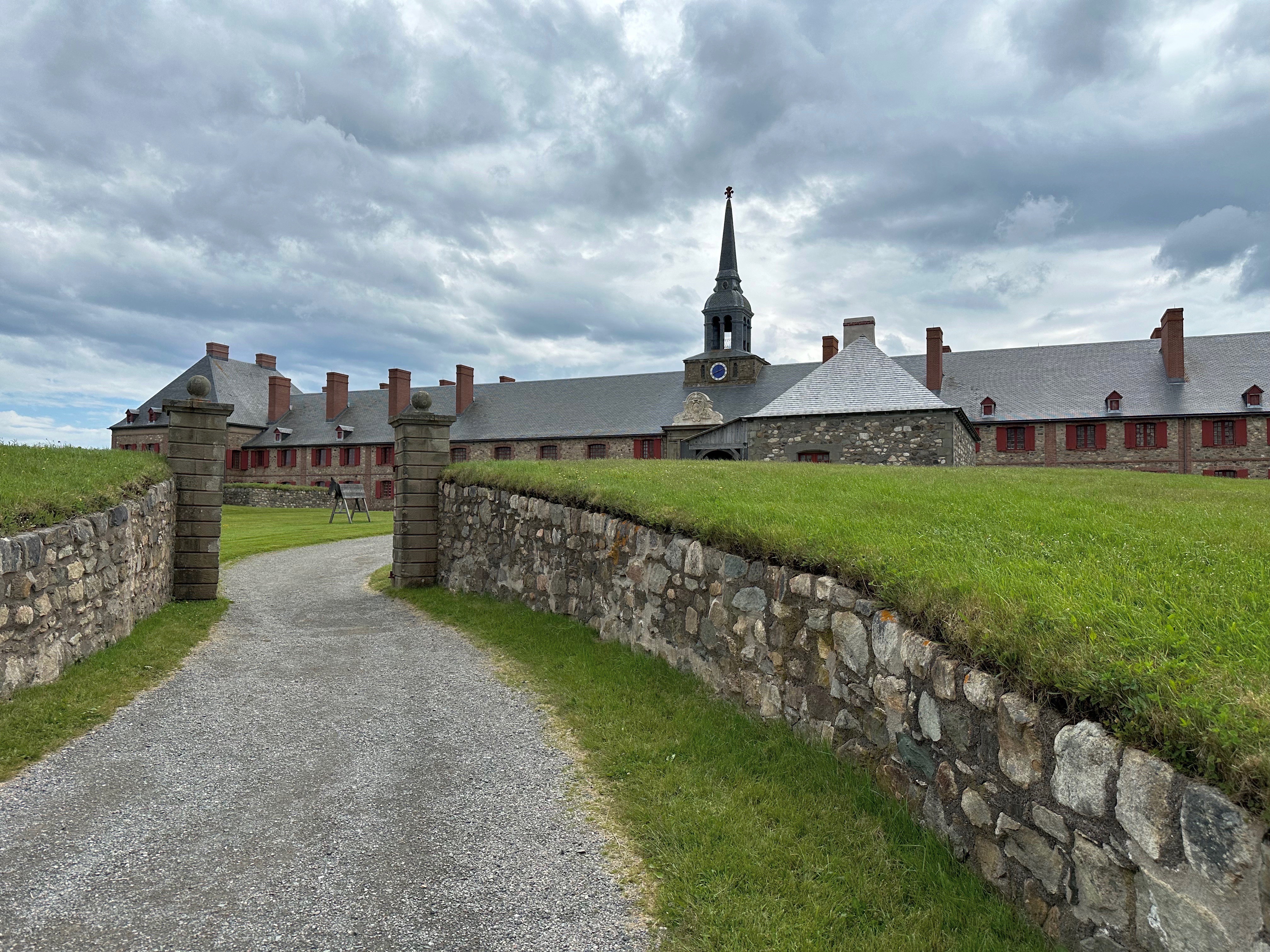


The photos in this post are of the re-created fortress and village. The fortress and 50 of the original buildings have been faithfully reconstructed to the specifications in the many documents left by the French. This is quite remarkable as not a single structure remained when the work began to re-create a portion of the village and fortress. The majority of restoration took place over a 20 year period between 1960 and 1980. Quite impressive!


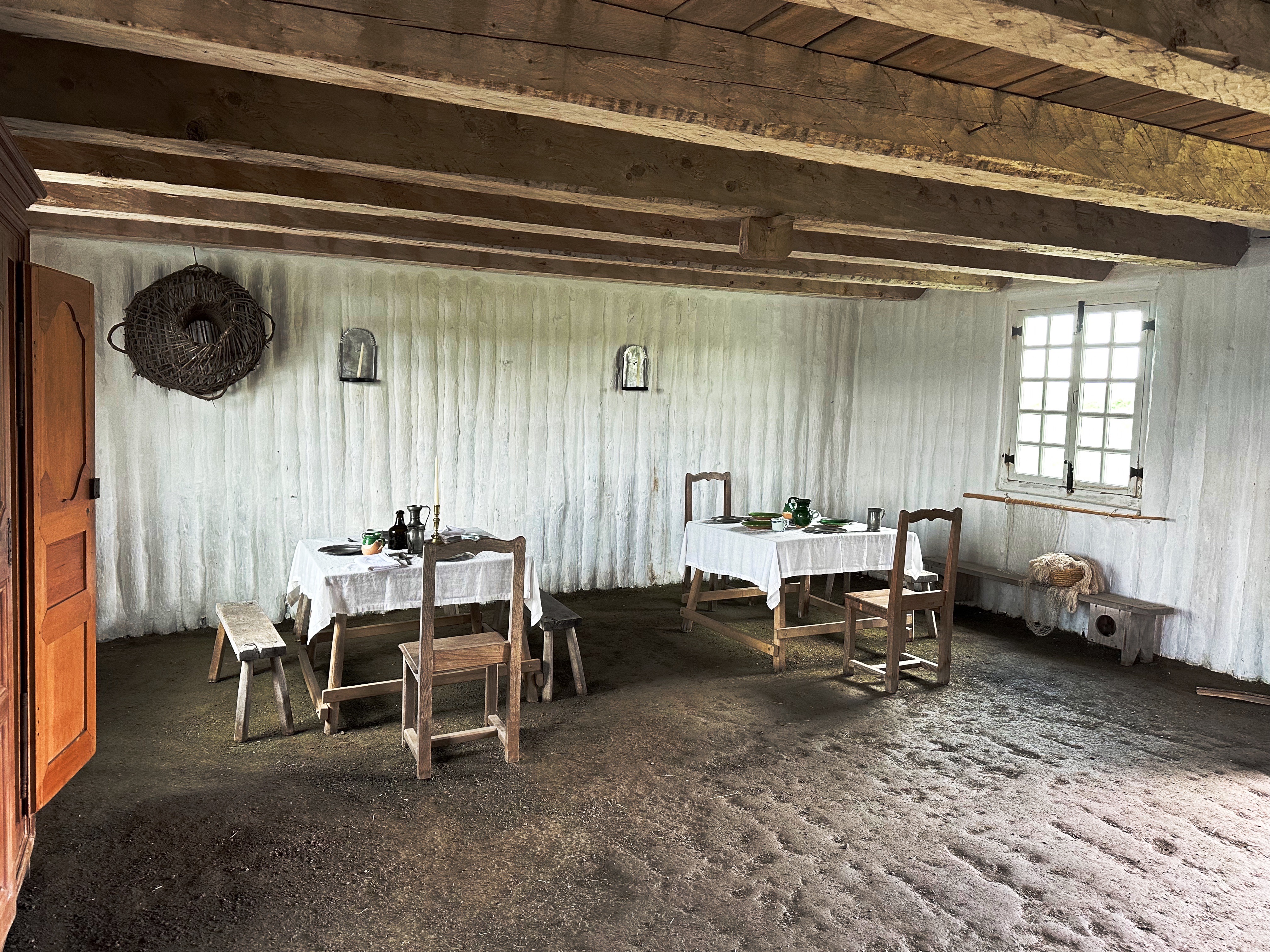
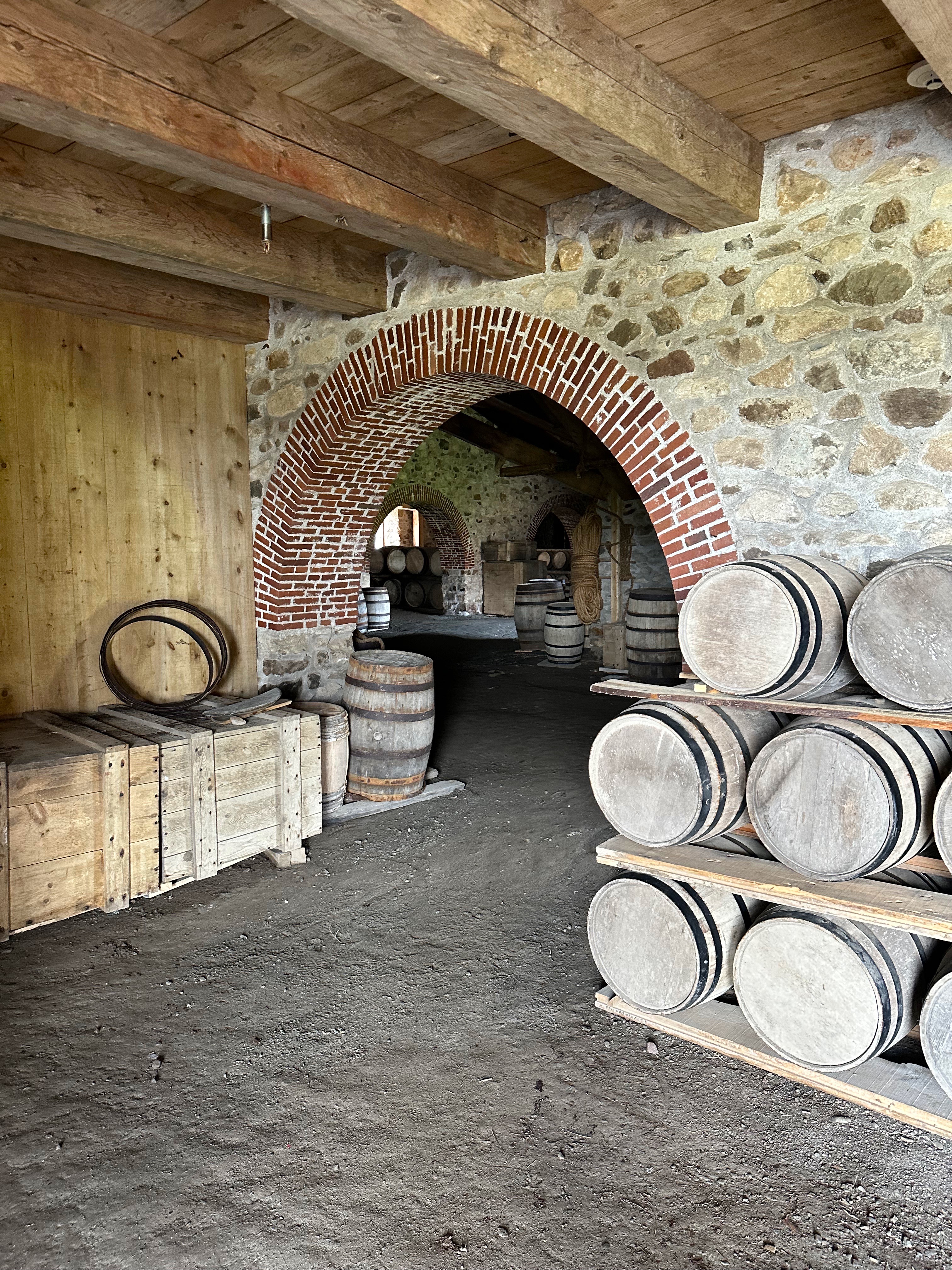
The fortress is a fascinating look back into the history and lives of the French in this area of Cape Breton. The park is staffed by very knowledgable and friendly guides who are dressed in period costumes. We highly recommend spending a day at the Fortress of Louisbourg Historical site.
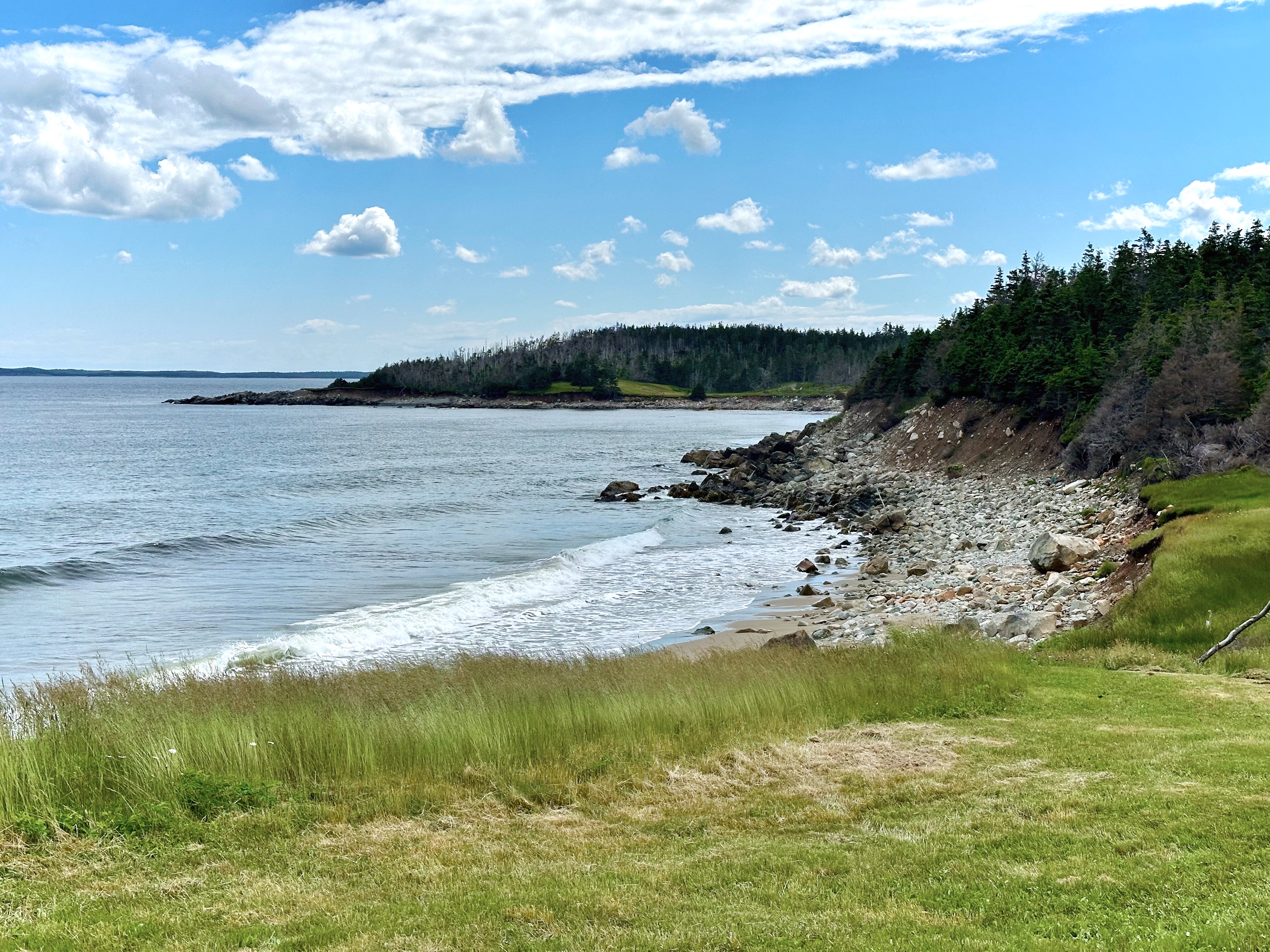
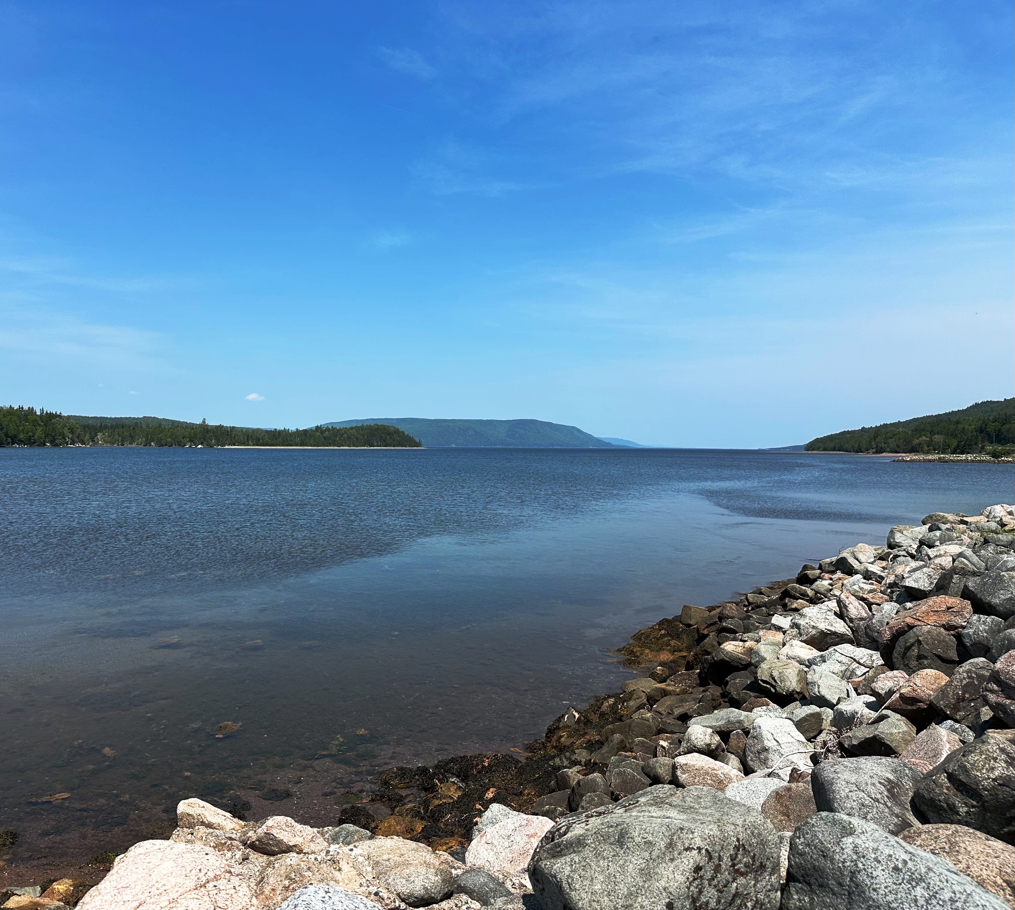
After finishing our tour of the fortress we departed for Battery Provincial Park. It appeared on our atlas that we would be able work our way down the coast on backcountry trails. However, we were ultimately thwarted by a locked gate and had to retrace our way back towards the fortress and pavement. Not all bad news because our back road jaunt did bring us to the beautiful Kennington Cove (photos below) where we paused and took in the marvelous views and the sound of the surf. It is all about the journey!

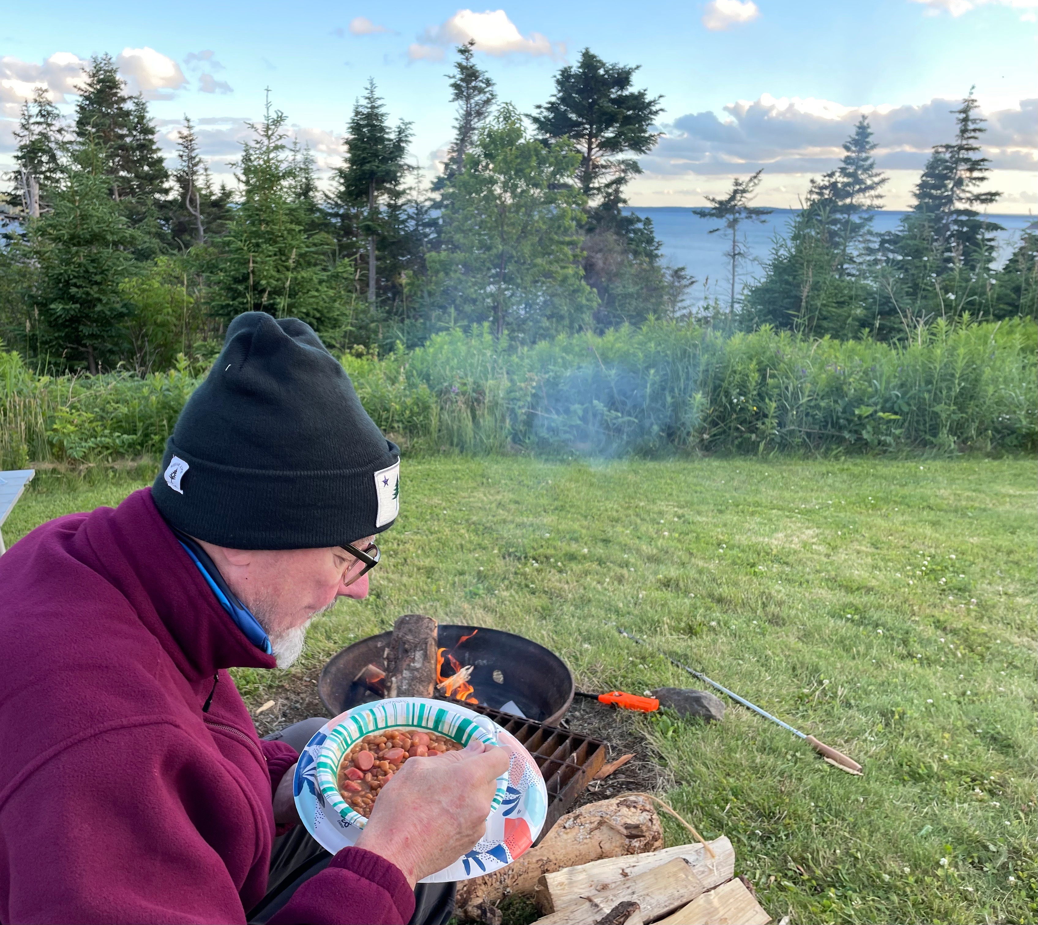
Back on pavement, we drove to Battery Provincial Park to camp for the evening. The park sits on a bluff above the historic St Peter’s Canal, which allows passage between the Bras d’Or and the Atlantic Ocean. Yes, those are franks and beans!


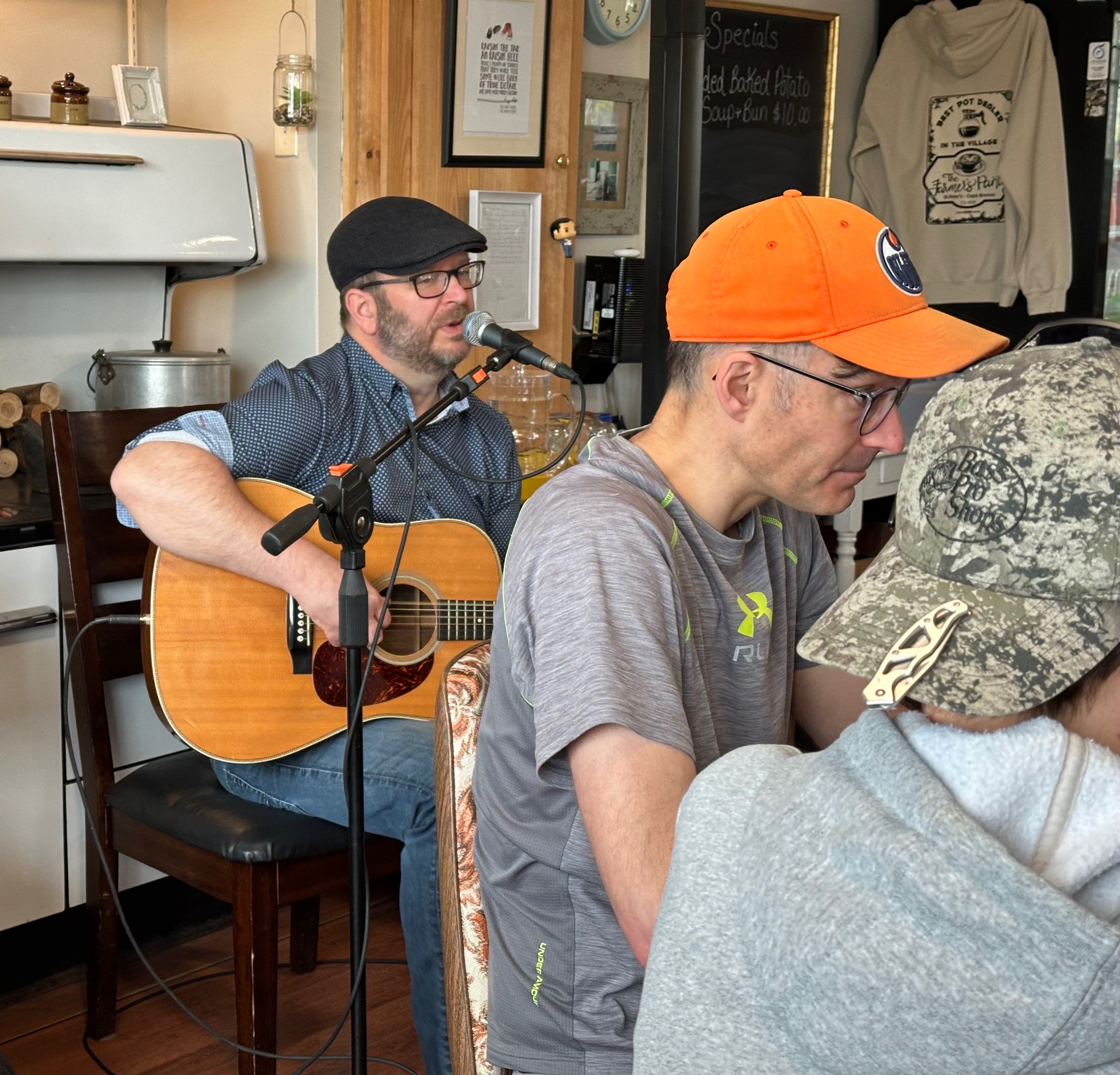
The next morning we were treated to coffee and music at the Farmers Pantry in St. Peter’s. Steve MacIntyre is a singer/songwiter who hails from Part Hawkesbury. Steve performed a set of original songs and covers of traditional Cape Breton music. Who doesn’t like live music with your first cappuccino!
Well, that’s a wrap from our travels on Cape Breton. We hope you found it interesting and perhaps helpful for your future travel plans. We enjoyed the scenery, people, history and music of Cape Breton immensely. We have one more post to publish which will chronicle our trip back through the Maine North Woods as we return to Connecticut.
Be seeing you!
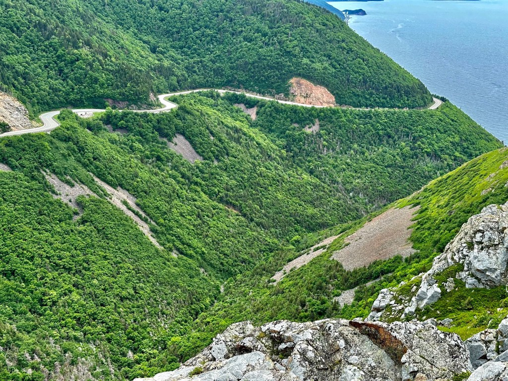
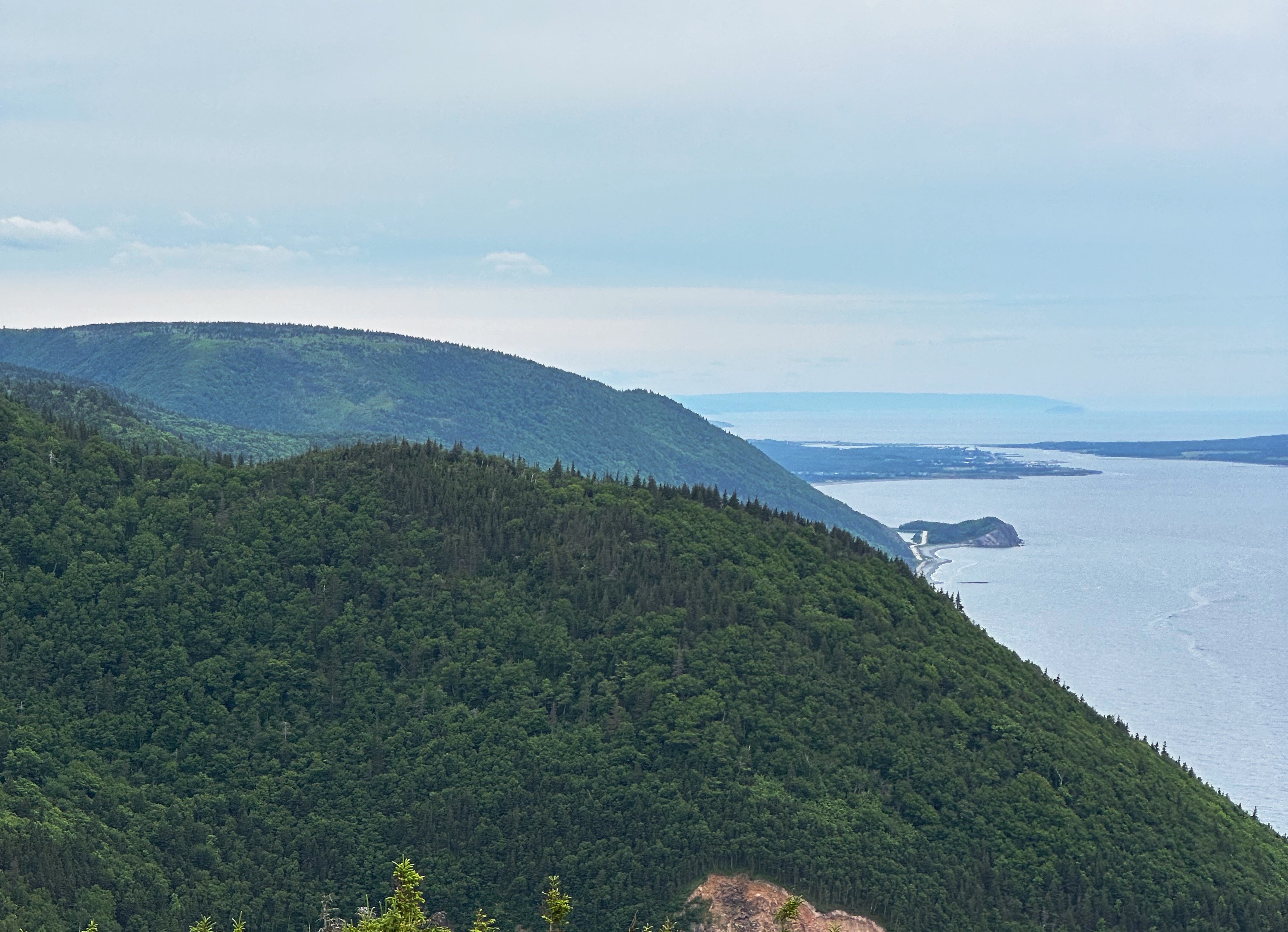
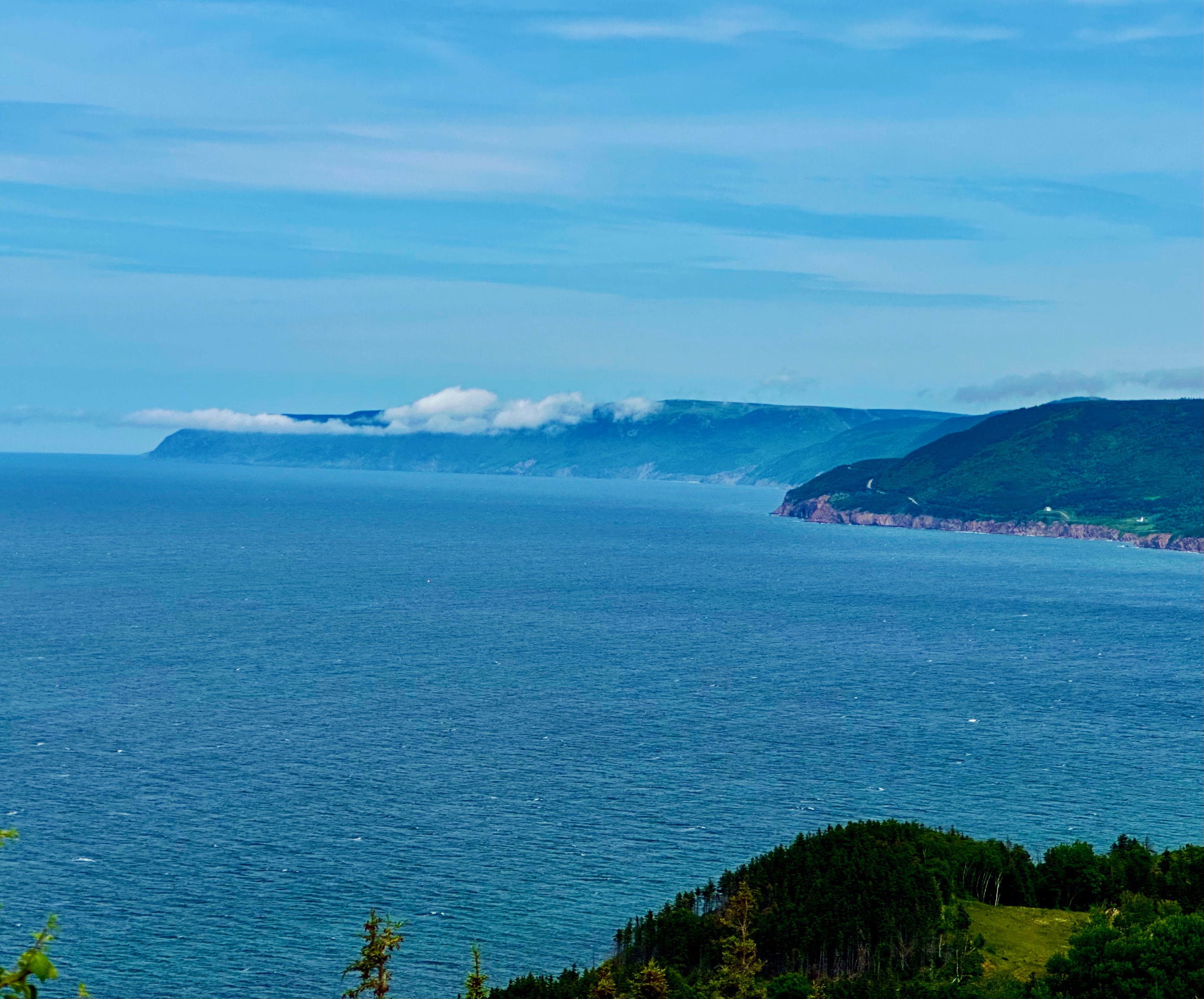
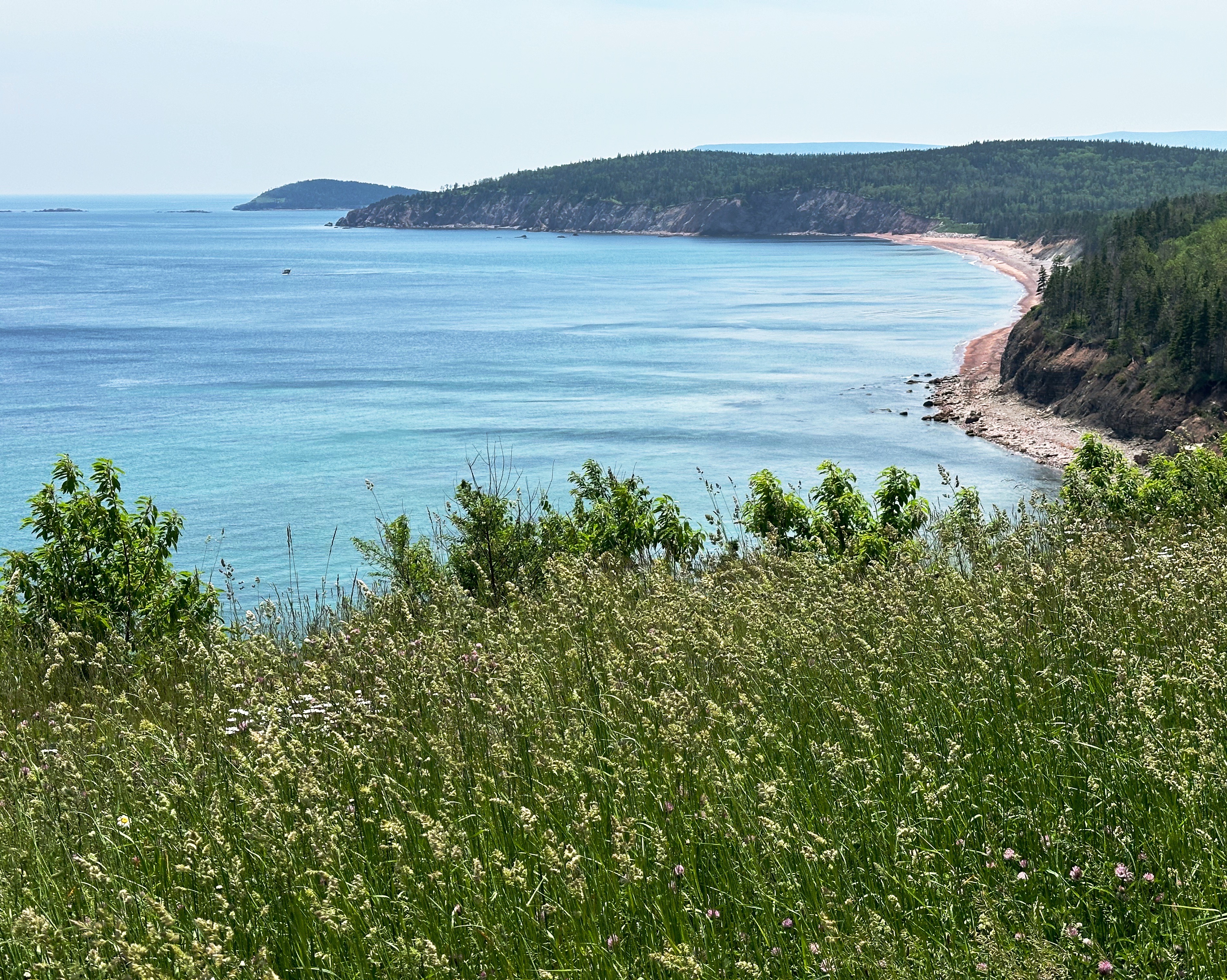
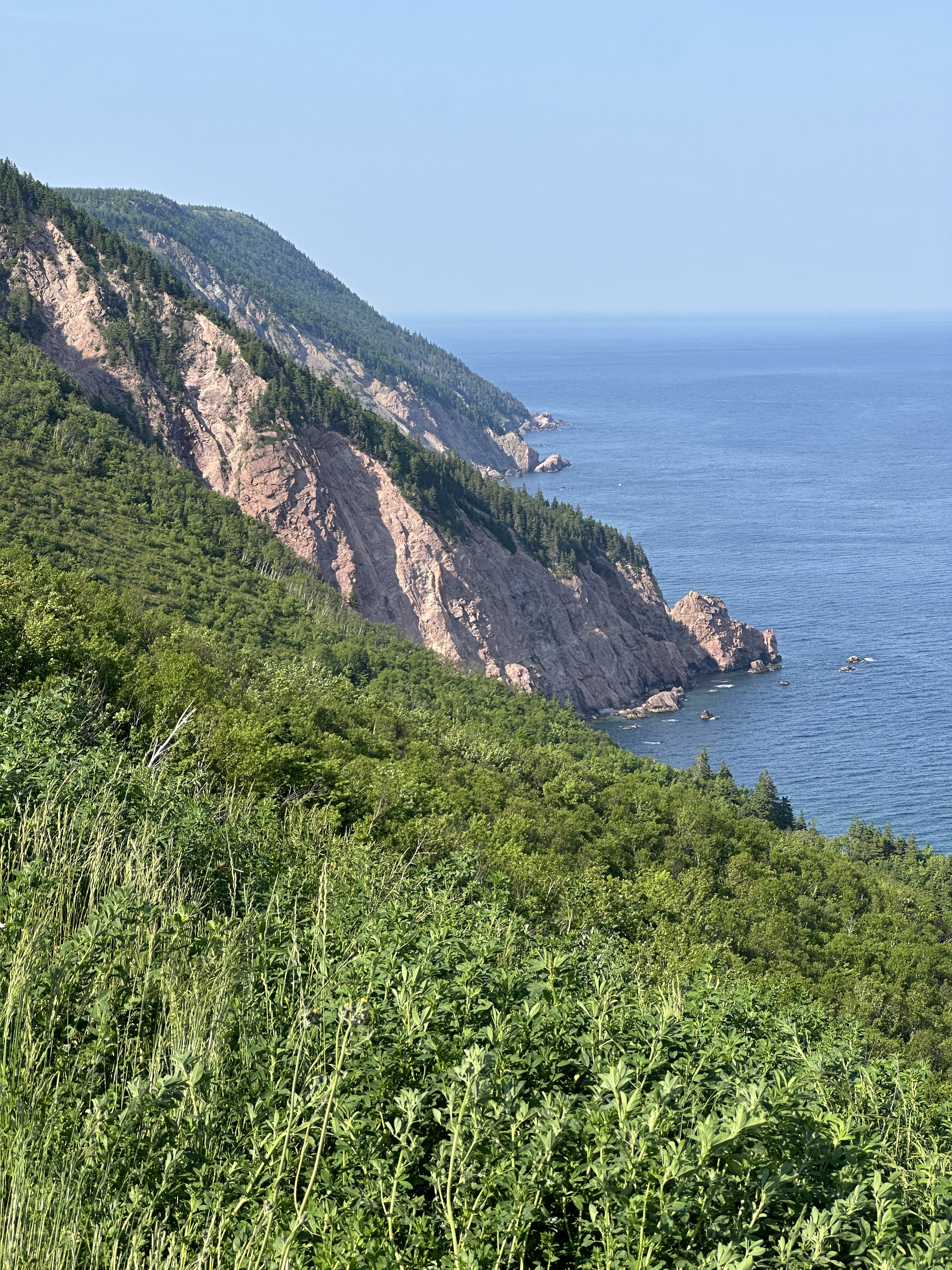
After departing Broad Cove we followed the Cabot Trail (CT) west along the northern perimeter of the Cape Breton Highlands National Park (CBHNP). This route took us up into the heart of the highlands and then back down along the western slope where the highlands meet the North Atlantic. As always, lots of spectacular scenery and driving.
Along the way we stopped to hike the Skyline Trail, considered one of the best hikes in CBHNP. The trail leads out to cliffs providing dramatic views of the mountainous coastline and the ocean below. Although the weather began closing in during our hike, we were still able to see for several miles up and down the coast.

From the Skyline Trail we journeyed south on the CT to the Acadian community of Cheticamp. We had booked an AirBnb for two nights with a deck overlooking the harbour. Unfortunately, the rain moved in that evening squashing our plans for cocktails and nibbles on the deck (rough, eh?). We made the best of it— washed our laundry and got a good night’s sleep.


The next morning was still drizzly, so feeling chipper after a hot shower and wearing freshly laundered duds, we set off for coffee at Marguerite Boutique et Provisions. In the ‘it’s a small world’ category, we met a retired long-haul truck driver (J.P. — Jean Paul) who had lived in Meriden (our home base) for several years-and-a young man from Hamden, Connecticut (on a two year solo journey). We also met some folks from California and New Hampshire — all in all, an enjoyable fika segment!
https://www.boutiquemarguerite.com


After fika we poked around town a bit before returning to our our cottage for an afternoon lie down — perfetto on a rainy gray day. We capped off the day with a delicious dinner at L’abrie Restaurant, Cafe et Bar. This restaurant was recommended to us by our barista at the Periwinkle Cafe in Ingonish —thank you very much!
L’abrie is owned by the same partners that own Marguerite. You can read more about the partners, their mission and the restaurant by clicking on the link below.

Chéticamp is an Acadian region on the shores of the Gulf of St. Lawrence, on the western slope of Cape Breton Highlands in Nova Scotia. It is located between Cape Breton Highlands National Park to the north and Grand-Étang and Montagne des Écureuils to the south. These magnificent sites stretch for many kilometres along the Cabot Trail. It’s settlement began in the decade following the signing of the Treaty of Paris in 1763, ending the Seven Years’ War between France and Great Britain. Chéticamp takes its name from a Mi’kmaq expression meaning “rarely full”, presumably in reference to Petit Étang (small pond) in La Prairie (the prairie) near Buttereau at the foot of Grande Falaise (big cliff) in the estuary of the Chéticamp River. All these names are the legacy of a rich heritage in the heart of a landscape where wild habitats and the sea merge with extraordinary beauty.
Learn more about the fascinating history of Acadian communities around the world at: acadie-on-the-roads-of-the-acadian-people-map-articles-and-references-about-the-acadian-communities
We departed Cheticamp traveling along the coast on the CT through the scenic villages of Grand Etang and Margaree Harbour. At Margaree Harbour we said our final farewell to the CT and our widdershins loop of CB. From there we followed Route 219 to Southwest Margaree, then we veered inland to explore some of the interior of Cape Breton in the distinctly Scottish heritage area around Lake Ainslie.


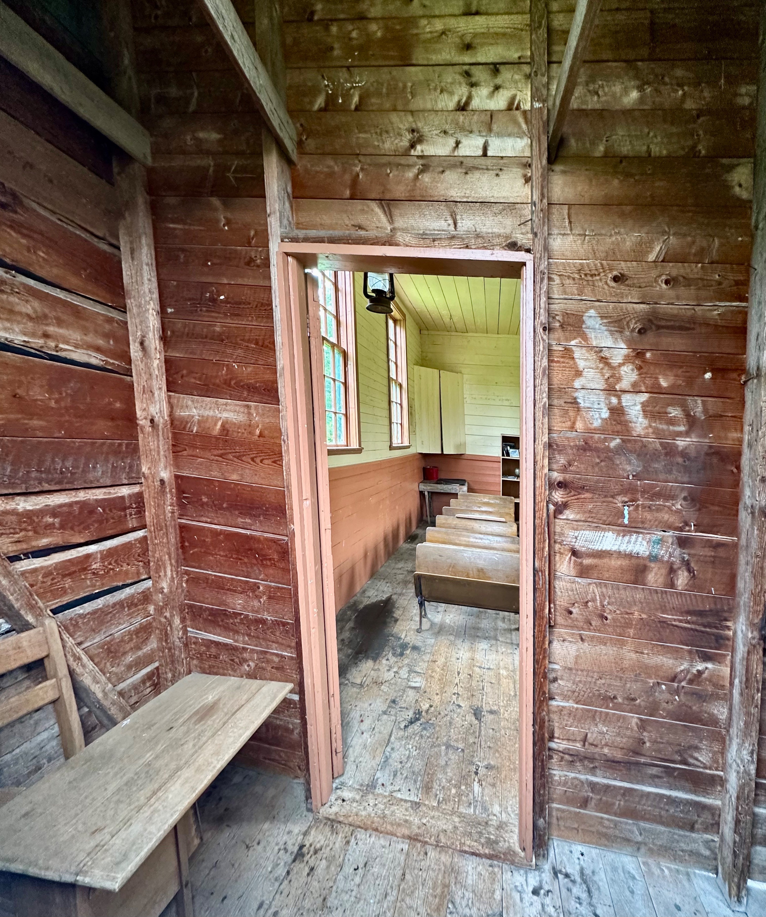

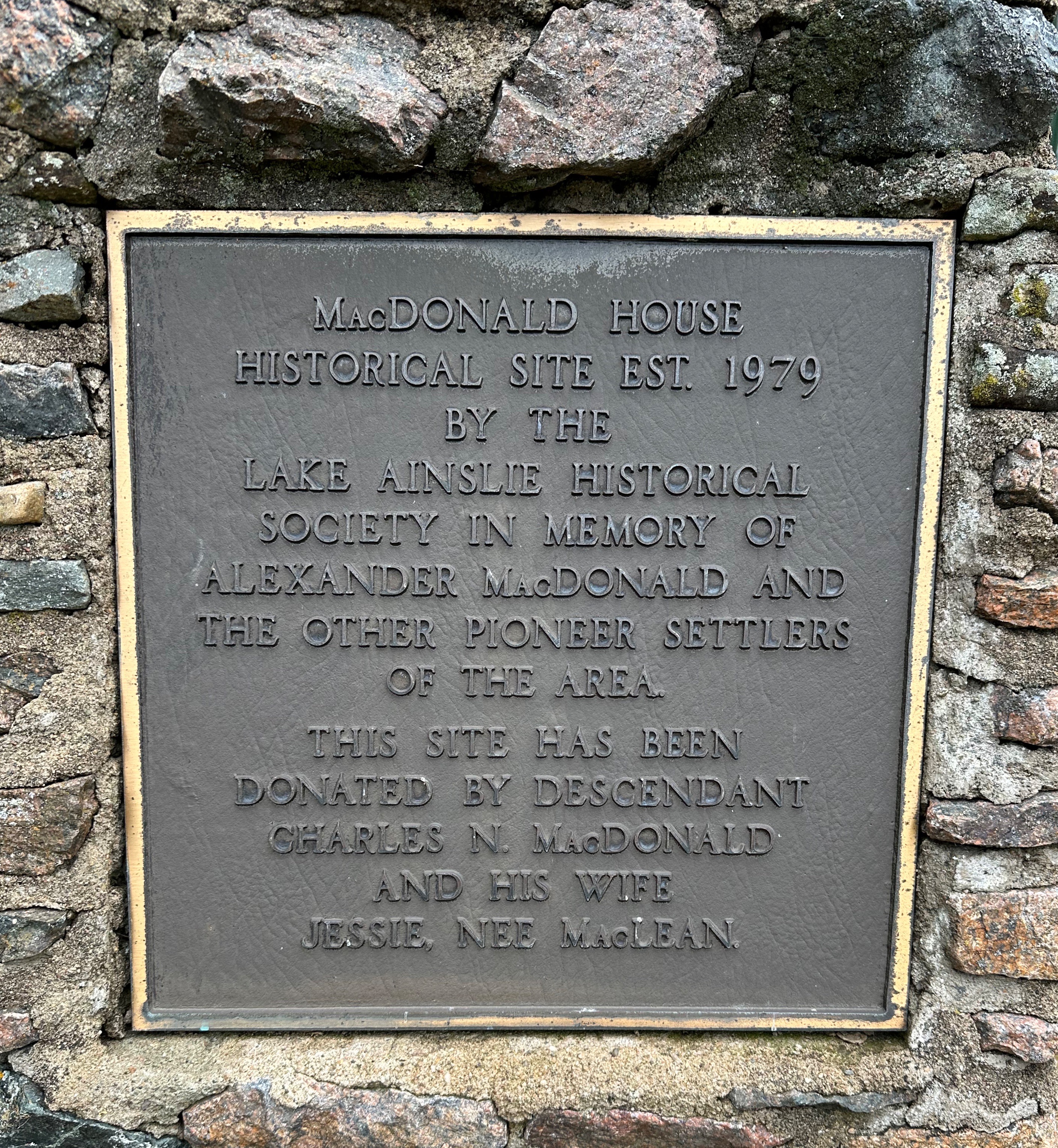
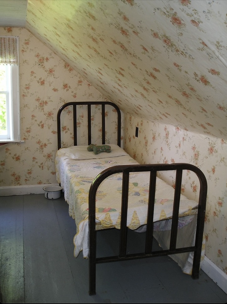

The photos above are from the MacDonald Farm in East Lake Ainslie – now operated as a museum by the local historical society. Alexander MacDonald emigrated from the Isle of Mull, Scotland in 1823 – receiving a land grant of 518 acres. His son Charles started the first mercantile in the area in 1848 and built the present house during the 1850s. He also established the first post office in 1876 – Charles also being the first postmaster. The post office operated until 1956!
After exploring the farm we pressed on further into the interior on what appeared to be logging roads which eventually gave way to farmland.
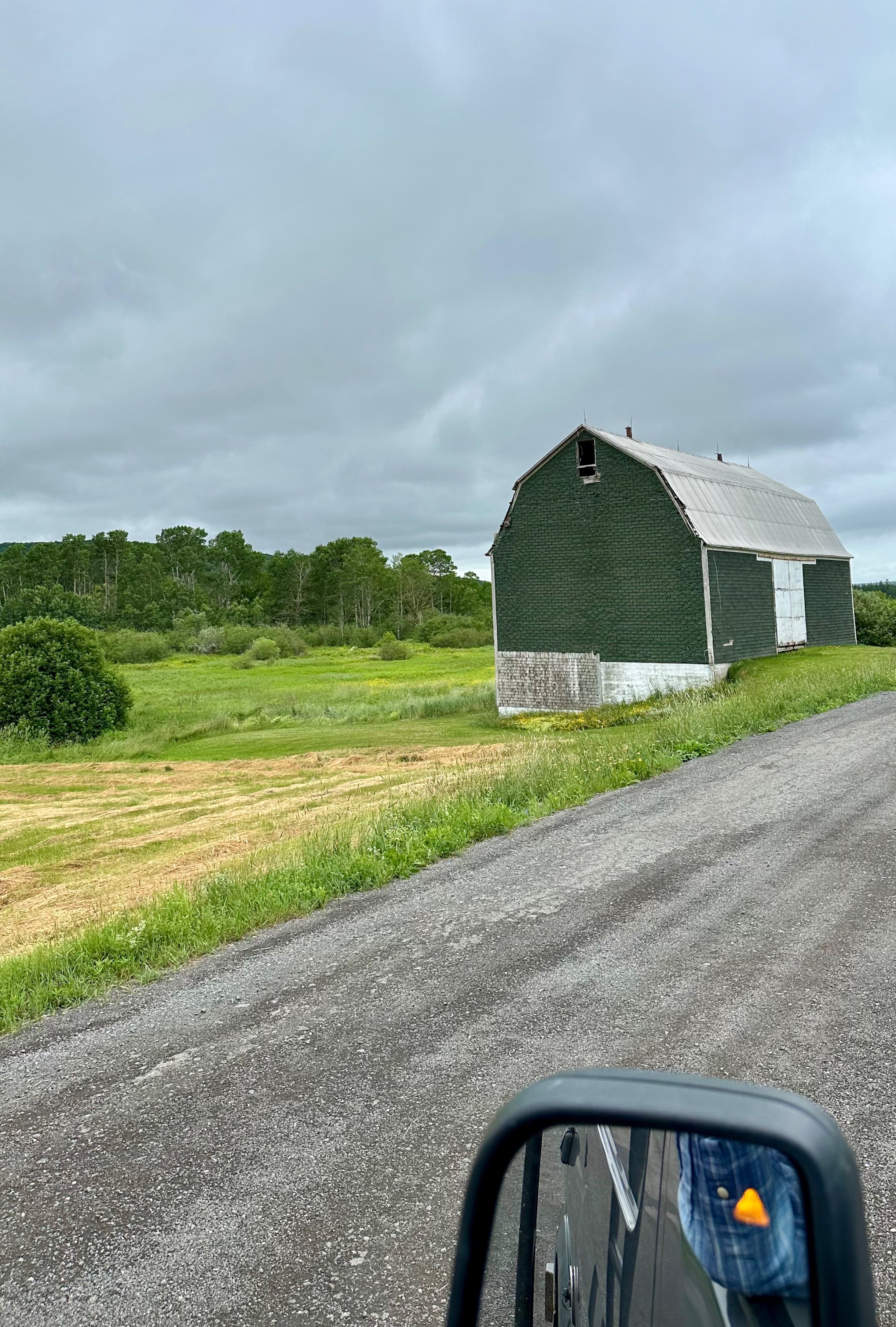
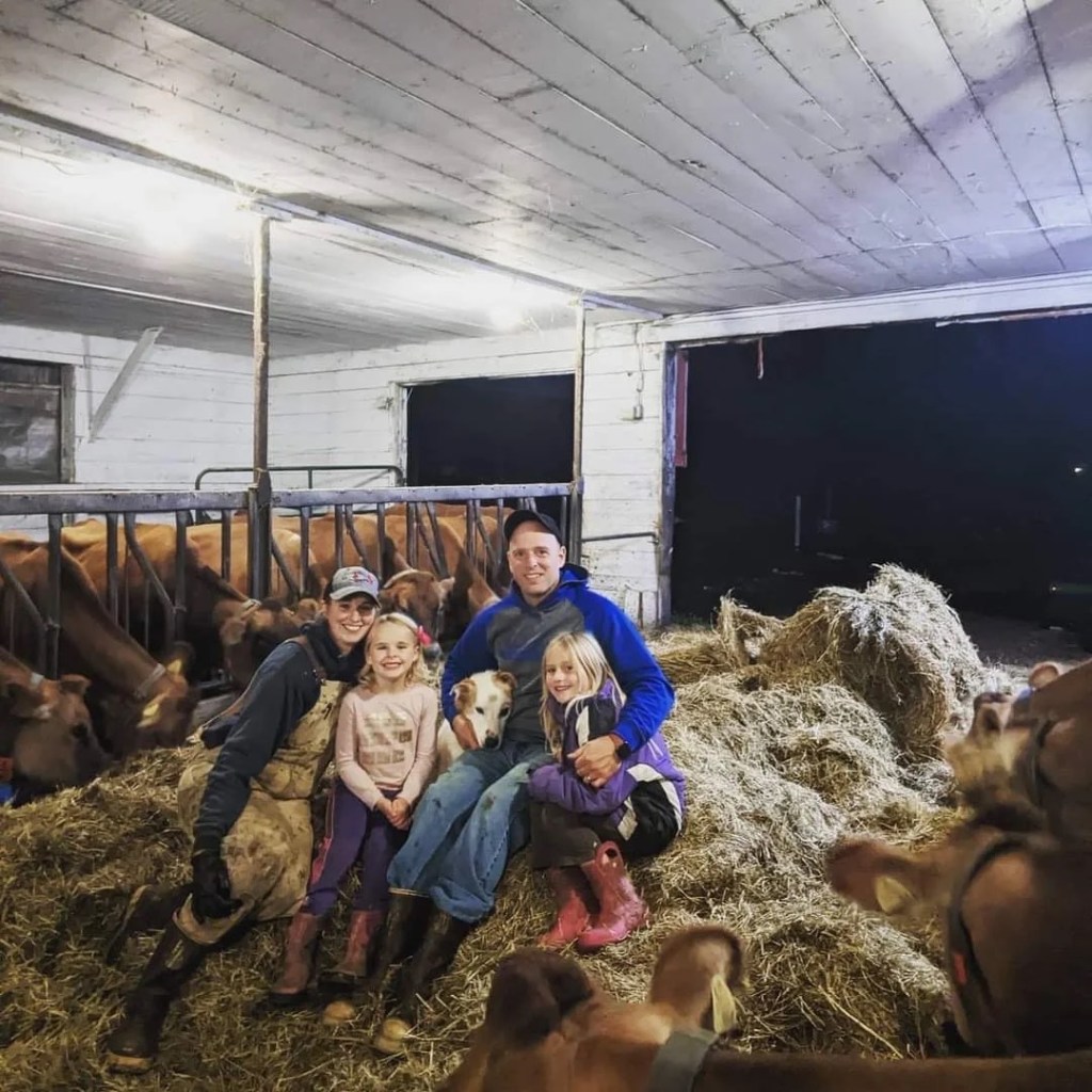
Much to our surprise and pleasure, after cresting a rise in the road, we found ourselves staring at a bright red building housing the Skye Glen Creamery! We crossed our fingers in hopes that the creamery was open. Fortunately, we had chanced upon the creamery a few minutes before closing and we met one of the owners, Meghan. She and her husband bought the dairy farm (jersey cows) in 2020 and opened the creamery soon after – lucky us! We bought cheese and delicious chocolate gelato. What a tasty way to finish a ramble.


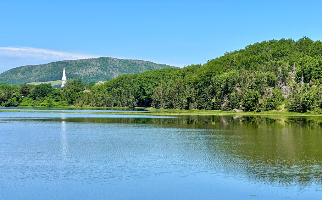
From the creamery we found our way to pavement and to the settlement of Mabou (Mi’kmaq for place where two rivers meet). Mabou was a definite on our itinerary due to its proximity to the Celtic Shores Coastal Bicycle Trail and the Red Shoe Pub. We checked in at the Mabou River Inn and then made the short trip across the river into town to dine and enjoy live music at the Pub.

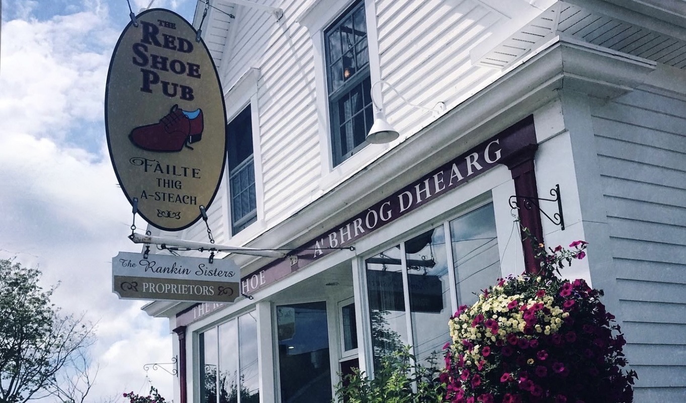
The pub is owned by the Rankin Sisters, members of the multi-award winning Rankin Family musical group. The first generation of Rankins began performing during the 1970s. The Rankin family hails from Mabou and it is a big deal when the sisters drop in to perform at the pub. The pub boasts live music everyday and we were fortunate to hear the Campbell Sisters perform on the evening we dined at the pub.
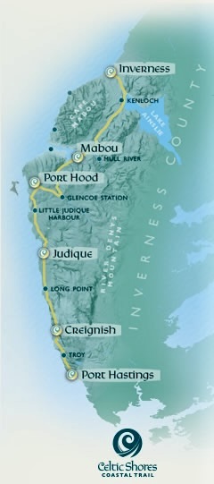
American Loyalists were the first to settle in Mabou during the 1700s (as usual, if you exclude First Nations). The Loyalists were followed by British and Irish settlers but it was the Highland Scots that came to the forefront during the first half of the 1800s (emigrating as a result of the Highland Clearances). While fishing has always been part of the economy along with agriculture, a notable economic driver in Mabou and Inverness County was mining coal and gypsum. Coal mining persisted into the 1960s but was never successful on a large scale because the coal was under the ocean floor and was prone to flooding (not taking that mine tour!)The bike trail that we were looking forward to riding came about because of the abandonment of the rail line (I&R Railroad) as mining wound down.
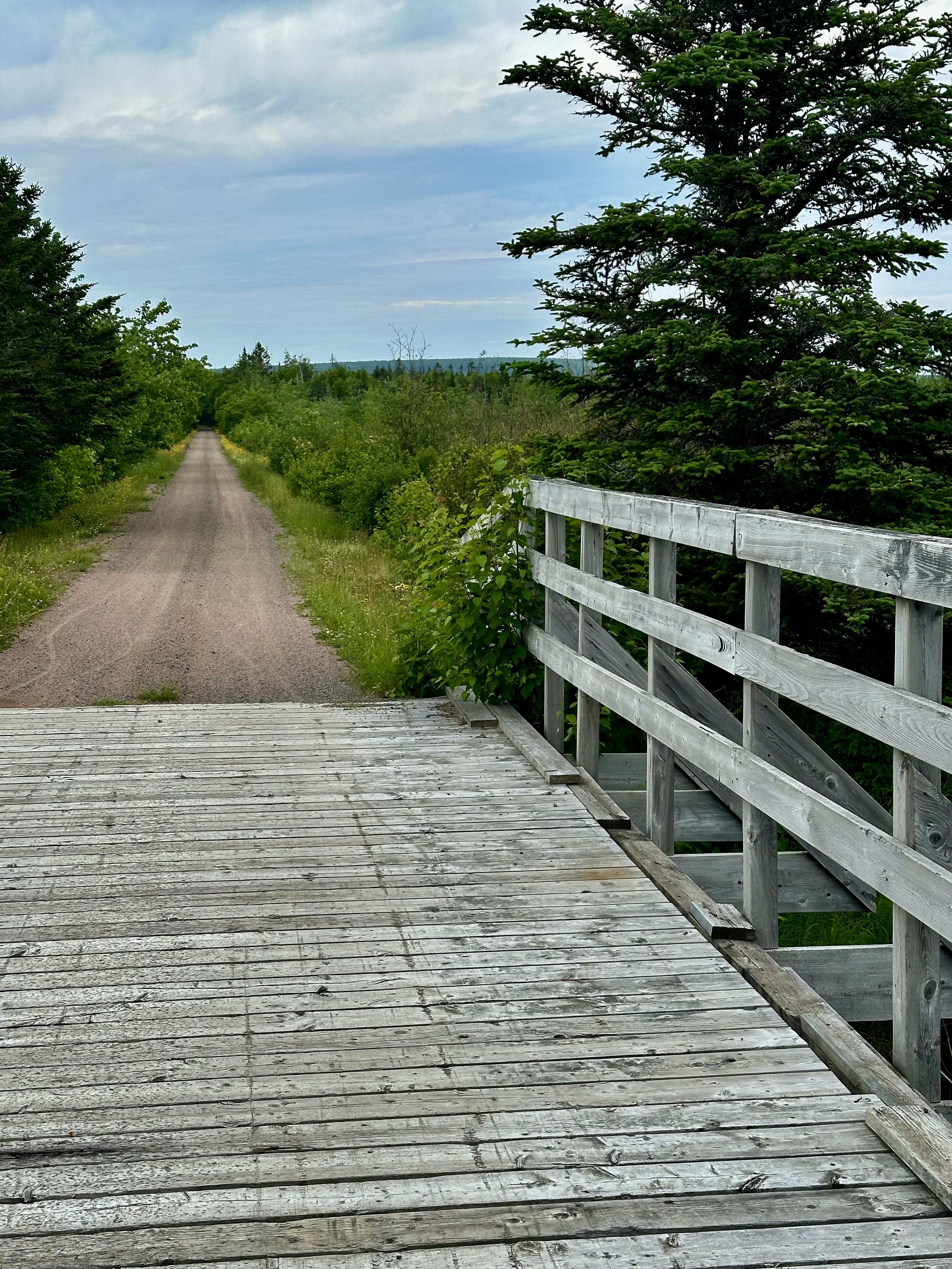
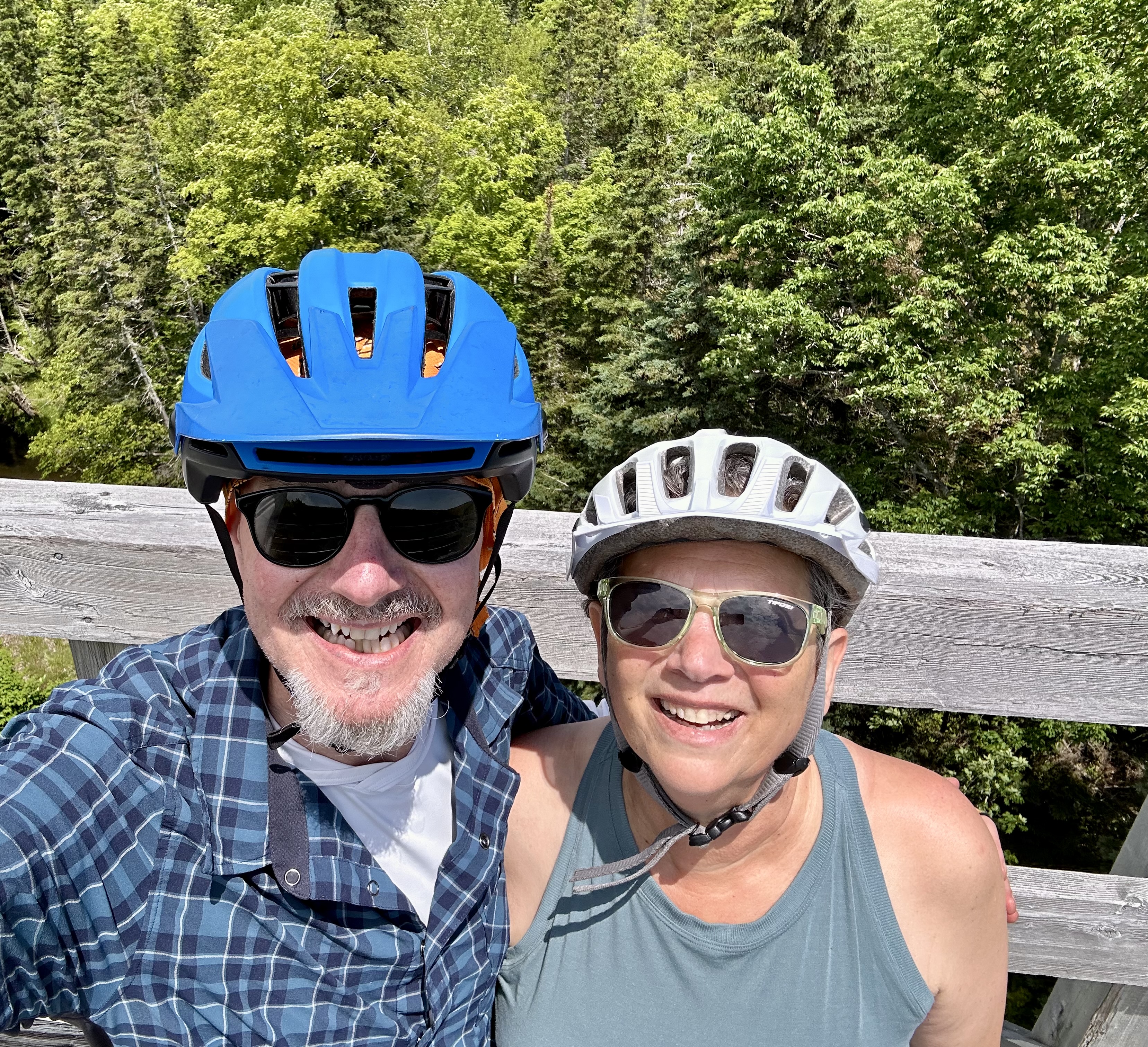
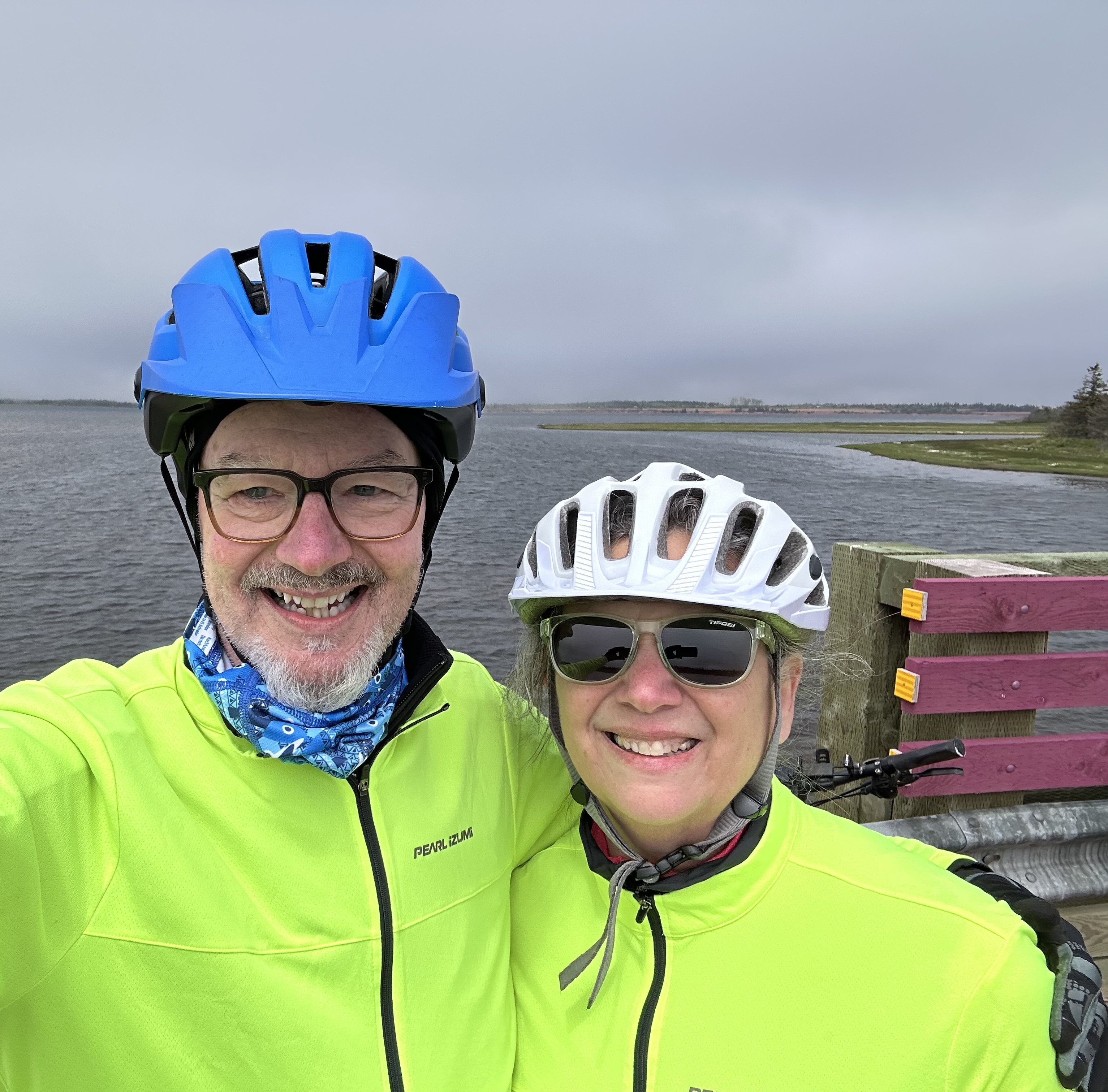
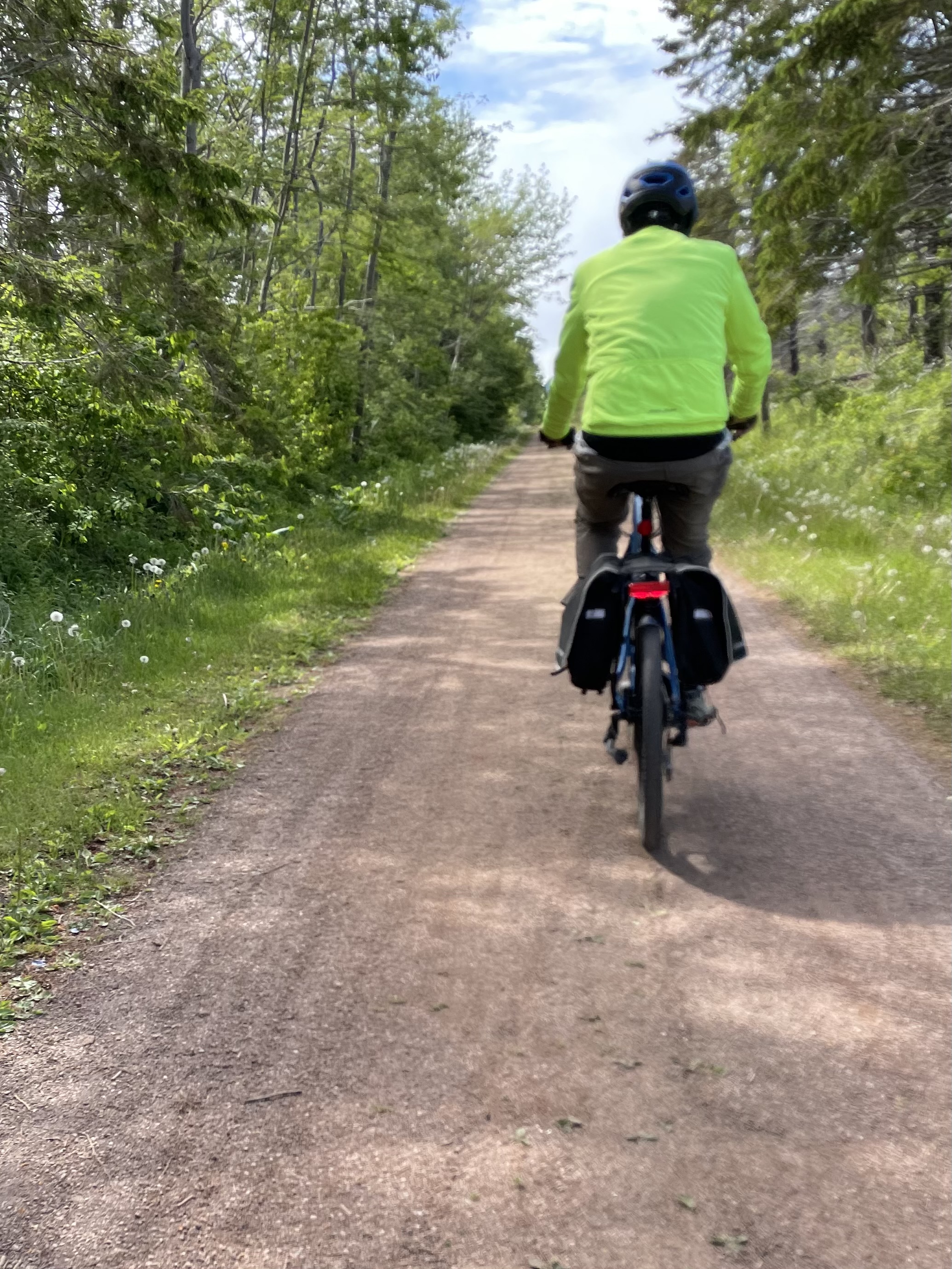
We set out the following morning to bike the Celtic Shores Coastal Trail (CSCT) from the Mabou Rivers trailhead north to Inverness (and back). The trail is 57 miles one way – our ride from Mabou Rivers to Inverness and back was approximately 34 miles. Inverness is the northern terminus of the trail and sits right on the ocean.
The trail is not paved but for the most part is smooth hard-pack and level. We chose this portion because segments to the south are quite windy making the riding difficult from both a wind and trail erosion perspective. The trail has very few road crossings (always a plus) and we only encountered one other cyclist over the entire 34 miles. We had been looking forward to riding this trail and we were not disappointed.


Upon arriving at the end of the trail we sought out lunch to refuel before riding back to Mabou. We felt it only right to dine at the Coal Miners Cafe & Lounge as the establishment is Biker Friendly. Good grub, definitely friendly and best of all – a Red Sox pub!


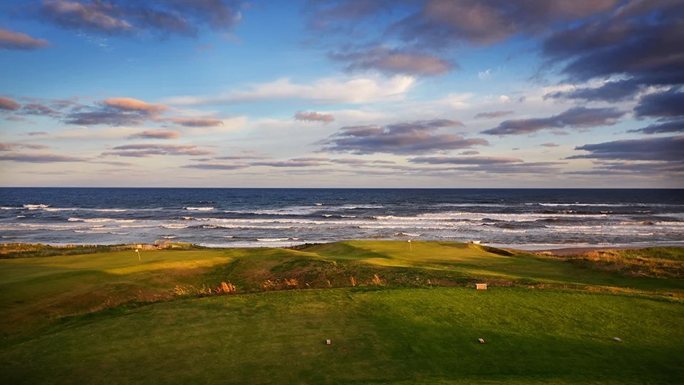
On our way back south we stopped to take in the view at Cabot Links Golf Course, which is adjacent to the trail terminus. We are not golfers but the course is laid out along the ocean and the combination of the course and the ocean view is quite magnificent (that’s for you Dorothy). The course actually sits on top of one of the reclaimed coal mines. Cabot Links is ranked as the 35th best course in the world while its sister course Cabot Cliffs is ranked as the 11th best. One of the people we met while at Marguerite for coffee had played at Cabot Cliffs – Twilight Round – nine holes at $350.00. The photos below are courtesy of Not Your Grandfather’s Mining Industry and Cape Breton University.


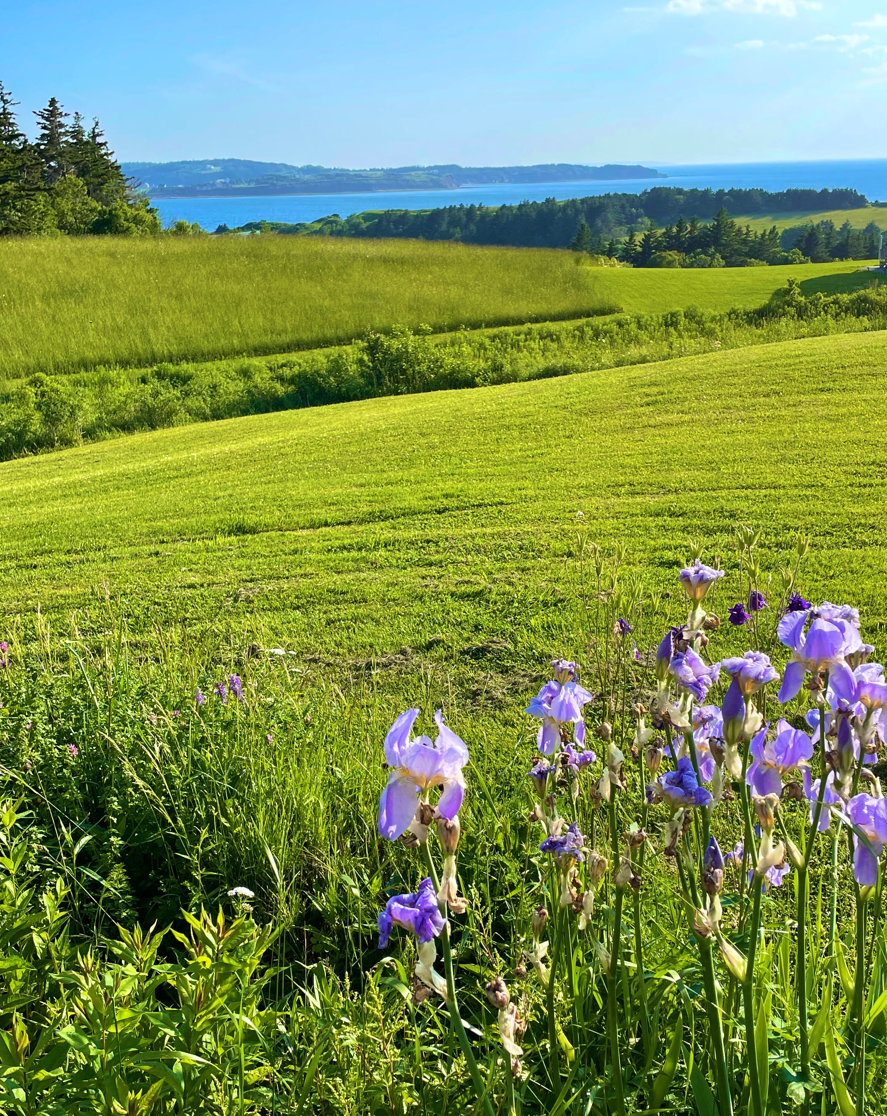
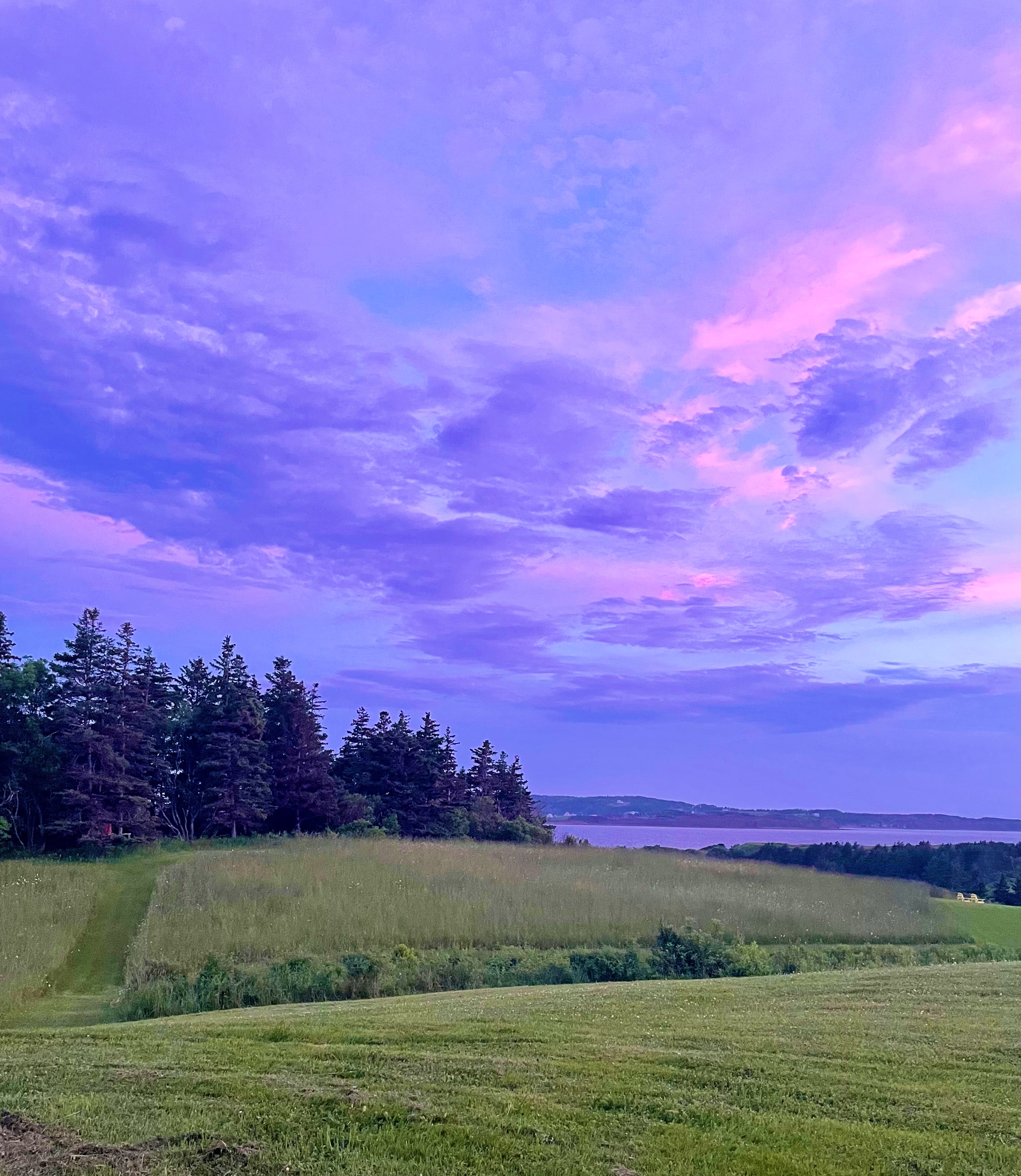
After completing our ride back to the trailhead at Mabou Rivers we made the short drive to Marble Hill and spent a relaxing evening watching the sky as the sun set over the Northumberland Straight.


We will pick up the final leg of our journey on Cape Breton as we drive two hours for a much needed consultation with Doctor Luke in Sydney. More on that in our next post.
Be seeing you!
After departing the bustle of Halifax we made our way east to tour the island of Cape Breton. We had become quite enamored of the beauty of the island and friendly folks we met along the way, we stayed two weeks before crossing back over the Canso Causeway onto the mainland of Nova Scotia. One of the major tourist draws is a loop auto route around the island known as the Cabot Trail (CT). While we drove the majority of the CT during our stay we spent considerable time poking around on the numerous side roads and back roads that led us to many scenic and uncrowded places.

The morning after crossing onto the island we met Bill who asked us if we were going to drive the CT. We said sure – he replied that you will miss a lot of the beauty and culture of the island if you just follow the trail. We assured him that we would explore well beyond the trail. In retrospect, it was excellent advice – Bill had grown up on the island and moved away to serve in the military and was back visiting family – some of our best experiences were in little harbors and settlements we happened upon while rambling off the main roads.

After spending our first night camping at Whycocomagh Provincial Park, we drove a few miles along the coast and joined the CT at St. Anns. After a bite at the Lobster Gallery (with a view up St. Anns Harbour- photo above right) we drove up and around the bend to visit the Great Hall of the Clans at the Gaelic College (Colaisdena na Gaidhlig).
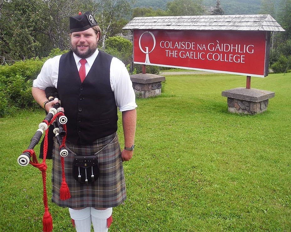
We toured the exhibits in the Great Hall and we were also treated to several demonstrations and performances taking place in the hall. There was of course, the obligatory Bagpiper along with a kilt maker. The kilt maker demonstrated with another guest how to properly put on and wear a kilt along with the appropriate accessories – actually quite interesting. We also watched a demonstration of a milling frolic and, finally, some good Cape Breton fiddling. We have included below background on the milling frolic (courtesy of Gaelic.com).
A milling frolic is a social event that was born of necessity, and is carried on today for enjoyment. After wool cloth is woven on a loom, it is necessary to shrink the cloth in order to make it warmer and more watertight. In the Scottish Highlands [in pre-industrial times], cleansing and shrinking the newly-woven cloth was done by hand in local communities. It was a social event of shared labour, made enjoyable by singing songs which maintained the work rhythm, preserved traditions, and encouraged original compositions with jokes about local events and personalities.
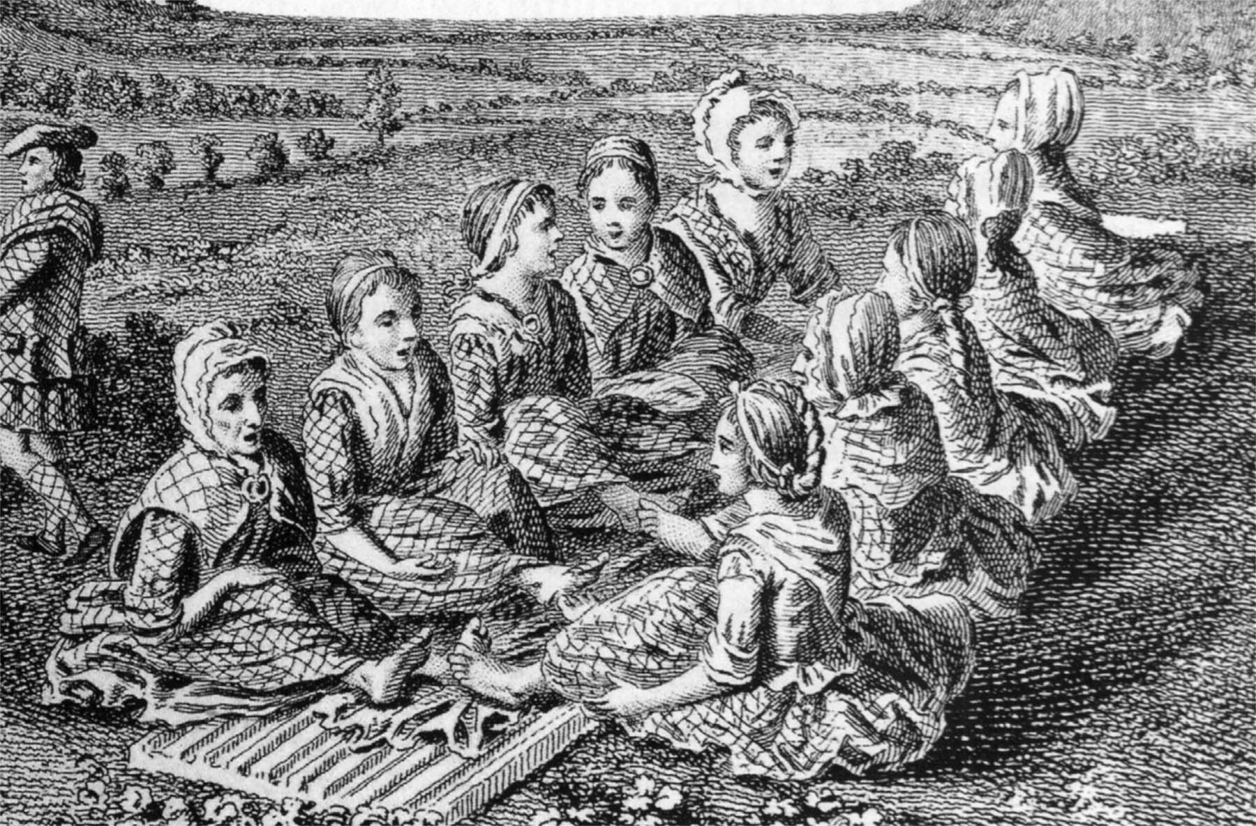
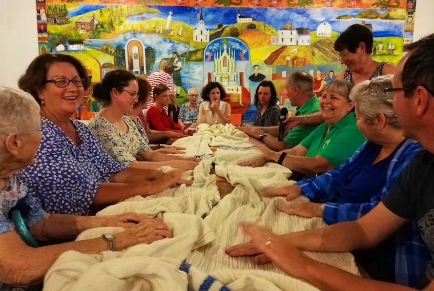
Nowadays the real milling is done in factories, but the milling frolic has continued as a social event in Nova Scotia Gaelic communities. This contrasts with Scotland, where you might see a milling frolic performed on a stage or as a historical re-enactment, but not as a social event in the village or church hall. Milling frolics involve special work songs which are known as “milling songs” in Nova Scotia (and “waulking songs” in Scotland). Some milling songs are shared with Gaelic Scotland, but quite a few were indigenously composed in Nova Scotia. There is a good but short collection of these songs on a Memorial University folklore website.
From the college we followed the CT along the breathtaking coast on a day made even more beautiful by blue skies, white puffy clouds and brilliant sunshine. Wow!


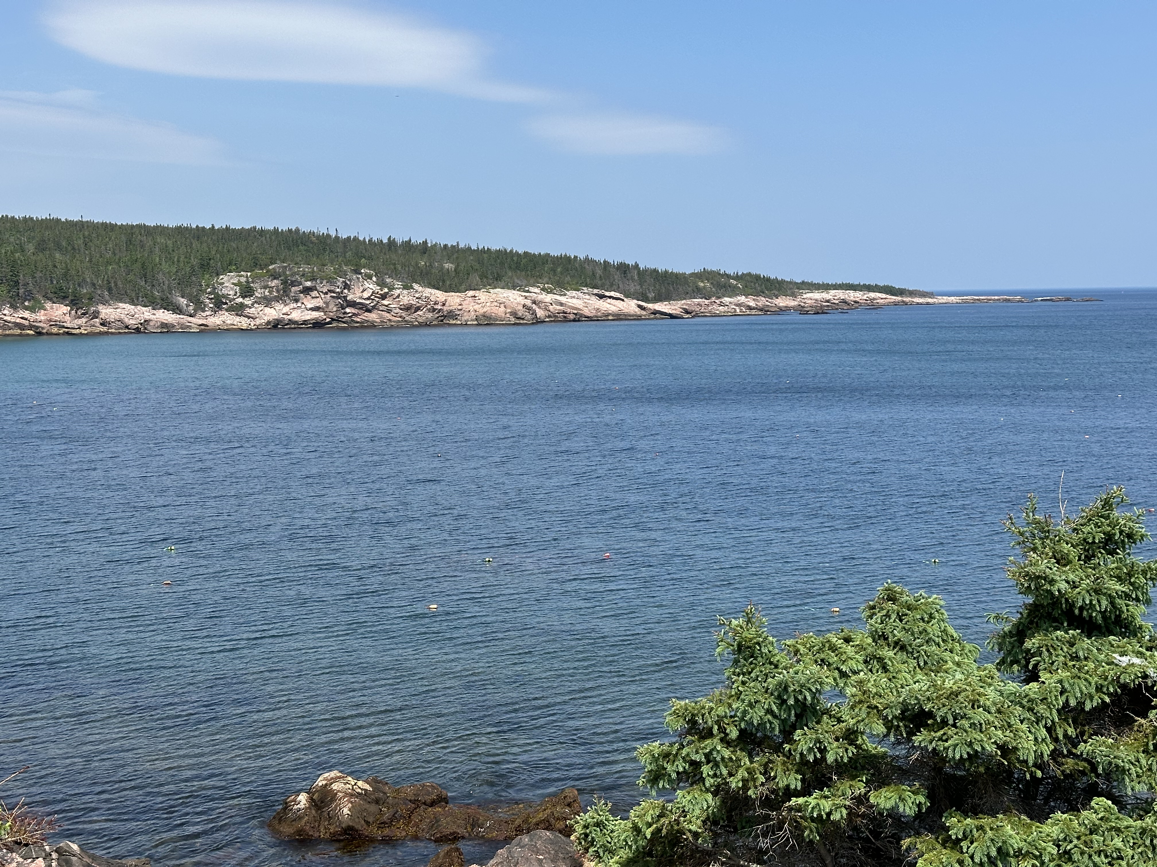
We camped for the next four nights at the Broad Cove Campground within the Cape Breton Highlands National Park (CBHNP). The site was on an open field (not great) but we were just a ten minute walk to the spectacular Broad Cove Beach (photos below). The location was also a great base for some nearby hiking and exploring back roads. Most importantly, it was under a ten minute drive to first rate coffee and “brekkie” sandwiches in Ingonish. Hot diggity!

Periwinkle Cafe, Ingonish (Ingo) – pre and post activity base camp while camping at Broad Cove.


While camping at Broad Cove we hiked at nearby Warren Lake which sits at the base of Broad Cove Mountain. Warren Lake is the largest lake in the park. The trail closely follows the shoreline providing views of the lake from varying perspectives. It was a scenic hike with easy terrain albeit lots of water crossing and muddy patches. No bears or moose spotted during our hike but plenty of waterfowl and birds.


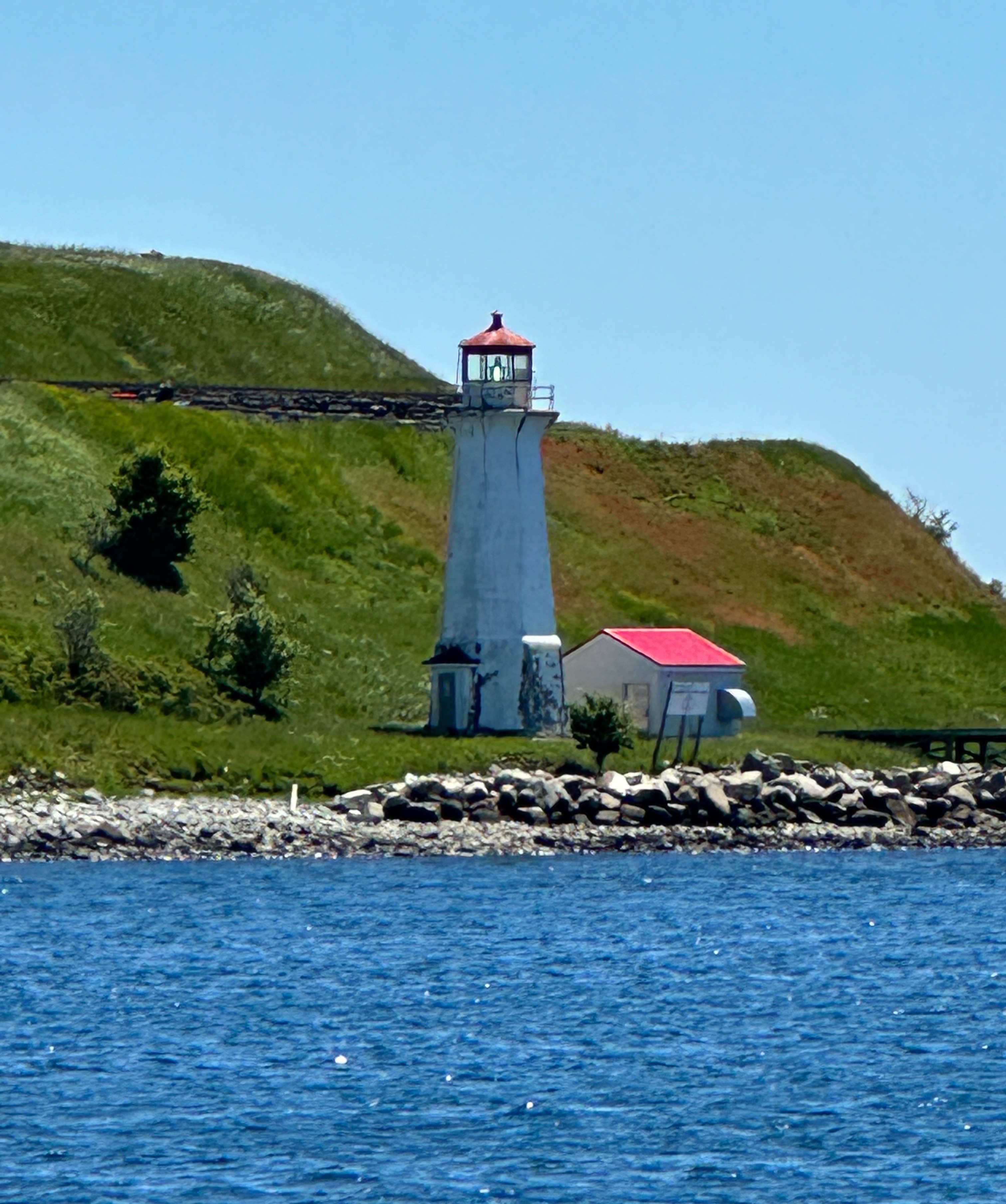
Always in search of the best chowder, we headed to Neils Harbor to sample the best chowder on Cape Breton. Neils Harbour is just off the CT at the beginning of New Haven Road. What a surprise awaited us when we came around the bend – another tiny, picturesque fishing village! Alas, the real surprise was that the Chowder House was not open! Thankfully, salvation was at hand because the ice cream parlour in the base of the nearby lighthouse had just opened for the season.

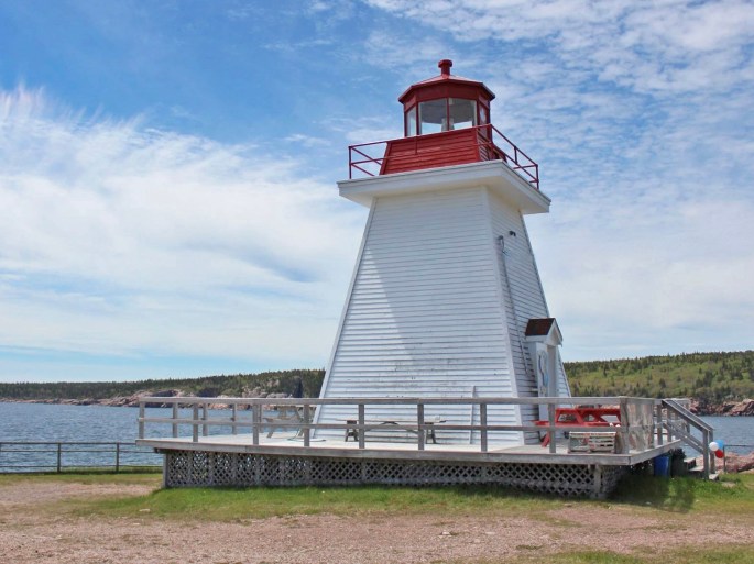
The settlement at Neils Harbour (pop. 300) has been occupied since the 1700s onward by French and Scottish settlers drawn to the close by and plentiful fishing grounds, as well as the protected cove (photos above). The lighthouse was constructed and began operations in 1899. The lighthouse was automated in 1956 and is still operational today; it is currently owned by the local community development agency. It is a Heritage Lighthouse which means it will be preserved in its current state.


After finishing our delicious ice cream and looking around the harbour we decided to push on further up the New Haven Road to explore a bit more. This road led us to White Point Road which runs parallel to the coast and provides wonderful view from a vantage point a couple of hundred feet above the shore. We spotted a bay below and turned down the winding White Point Road which took us down to the harbour.

There is a tiny settlement of houses sitting on the hill just above the harbour. The larger body of water beyond the breakwater is Aspy Bay which has been fished seasonally by Europeans since the 1500s (and before that by the Mi’Kmaq). The permanent population here is estimated at 100 people today. The point that extends out into the ocean is spectacular. We are so glad we spotted this gem!
Our last ramble before breaking camp and heading around the bend onto the Sunset Side of the cape was to Meat Cove (don’t ask – okay we will tell you – the local inhabitants used the beach pictured below to butcher whale and moose carcasses).

Meat Cove is another end of the road settlement at the extreme north of Cape Breton. We would have to say getting there is half the fun with the twisty dirt road scraped out of the mountainside providing fabulous views of the coastline and mountains. And yes, at the very end of it, just like in a dream (only real) is a seafood stand selling delicious seafood chowder and other goodies fresh from the ocean!


After taking in the astounding views and consuming our delicious fish chowder, we backtracked down the road and popped into the tiny fishing village of Bay St. Lawrence. This area is know as the Top of the Island because it is literally as far north as you can go. Longtime locals call the area Down North because rivers and streams here run northerly down from the mountains to the ocean.
The village was settled in the 1850s by Scots and retains its Gaelic heritage to this day. Some of the folks fishing out from this bay are fifth generation and direct descendants of the original Scottish settlers. There is no official census because the village is not officially recognized as a municipality – officially it is just an area within Victoria County. We found one estimate from 2022 which puts the local population at 400 although you could not prove that by us. The Bay Cafe in the community centre was not open so we unfortunately did not get to meet any local folks ( we hear they are very friendly). In fact, we did not see a single sole besides two fishermen cruising by the wharf on their boat (maybe they saw the van coming and took cover).

After our visit to Meat Cove and Cape North we traveled back to Broad Cove for our final night of camping at CBHNP. The following day we traveled the CT up through the highlands and followed the trail along the sunset side of Cape Breton. We are going to wrap up this post here because we have quite a bit more to share about our time on Cape Breton in our next post.
Be seeing you!

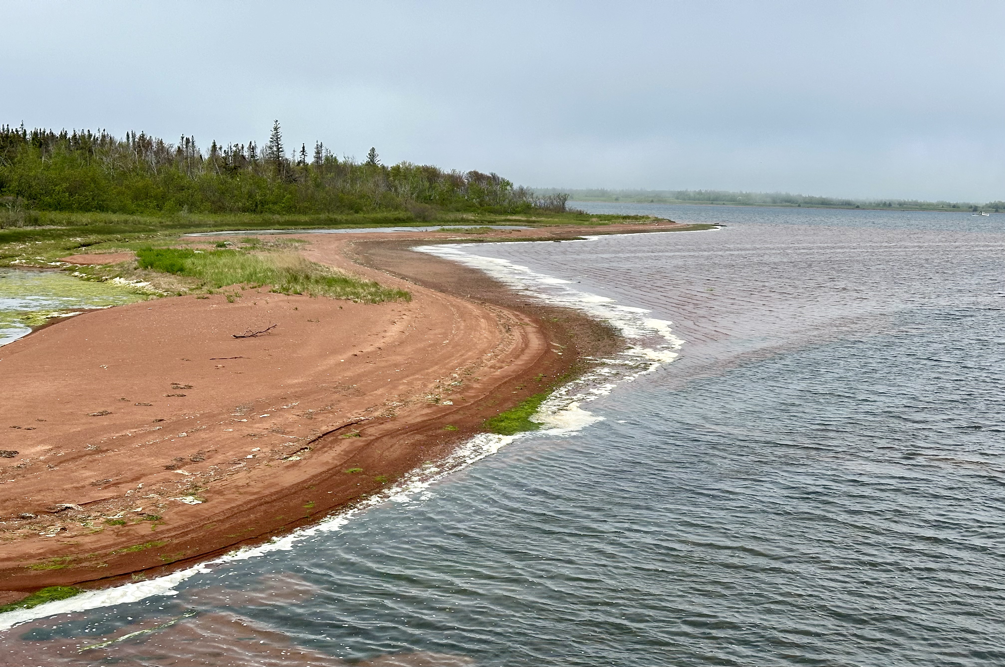
After out tour of the scenic Bay of Fundy coastline we made our way northeast to Prince Edward Island (PEI). The weather on the day we crossed over was raining, foggy and windy so we did not get much of a view of the Northumberland Strait or the PEI coastline. We have to admit that there was something a bit scary about driving across a narrow bridge over a strait that is part of the North Atlantic as opposed to a lake or river. Oh, by the way, when you cross the bridge back to New Brunswick, the toll is $48.00 Canadian!

The bridge is quite the engineering feat—spanning eight miles of the Northumberland Strait (North Atlantic) which freezes during the winter months. It is the longest bridge over frozen water in the world. The bridge opened in 1997 after four years of construction. Prior to the opening of the bridge, the only way on to the island in a vehicle was by ferry. The aforementioned freezing of the Strait meant that ferry service was periodically disrupted for extended periods during the winter.

Our pre-trip research indicated that PEI has an extensive bicycle trail network – the Confederation Trail. The trail runs the entire length of the island (140 miles) with many spurs to explore as well.

The Confederation Trail owes it’s existence to the Prince Edward Island Railroad (PEIR). The PEIR was a narrow gauge railway built during the 1870s. It hauled both freight and passengers. Much of the early freight hauled were potatoes – the major crop on the island. Potatoes are still the major agricultural crop today – you see large potato fields just about everywhere you travel outside of Charlottetown (no wonder, since there are 86,000 acres planted with potatoes). Farms on PEI produce 25% of all the potatoes produced in Canada even though it is the smallest province in all of Canada (land area and population).

The PEIR was heavily utilized during WW2 to haul supplies to military bases operating on the island as part of the war effort. After the war, volume declined as military bases closed and potatoes began to move by a combination of truck and large ferry boats. The railway was operational until 1989 when declining volume precipitated the demise of the PEIR.

The photos above are from our ride along St. Peter’s Bay. The scenery was delightful but the gusty winds coming from the bay made for a tiring ride (not complaining!).
Fortunately, coffee was at hand upon our return to Charlottetown, where we stayed during our visit. Most excellent coffee, tea and breakfast – thank you very much – at the stylish Receiver Coffee Company.


Receiver has three locations, two of which are in Charlottetown. The cafe and bistro is in the heart of downtown (above) while a second cafe and roastery is located on the waterfront (below).


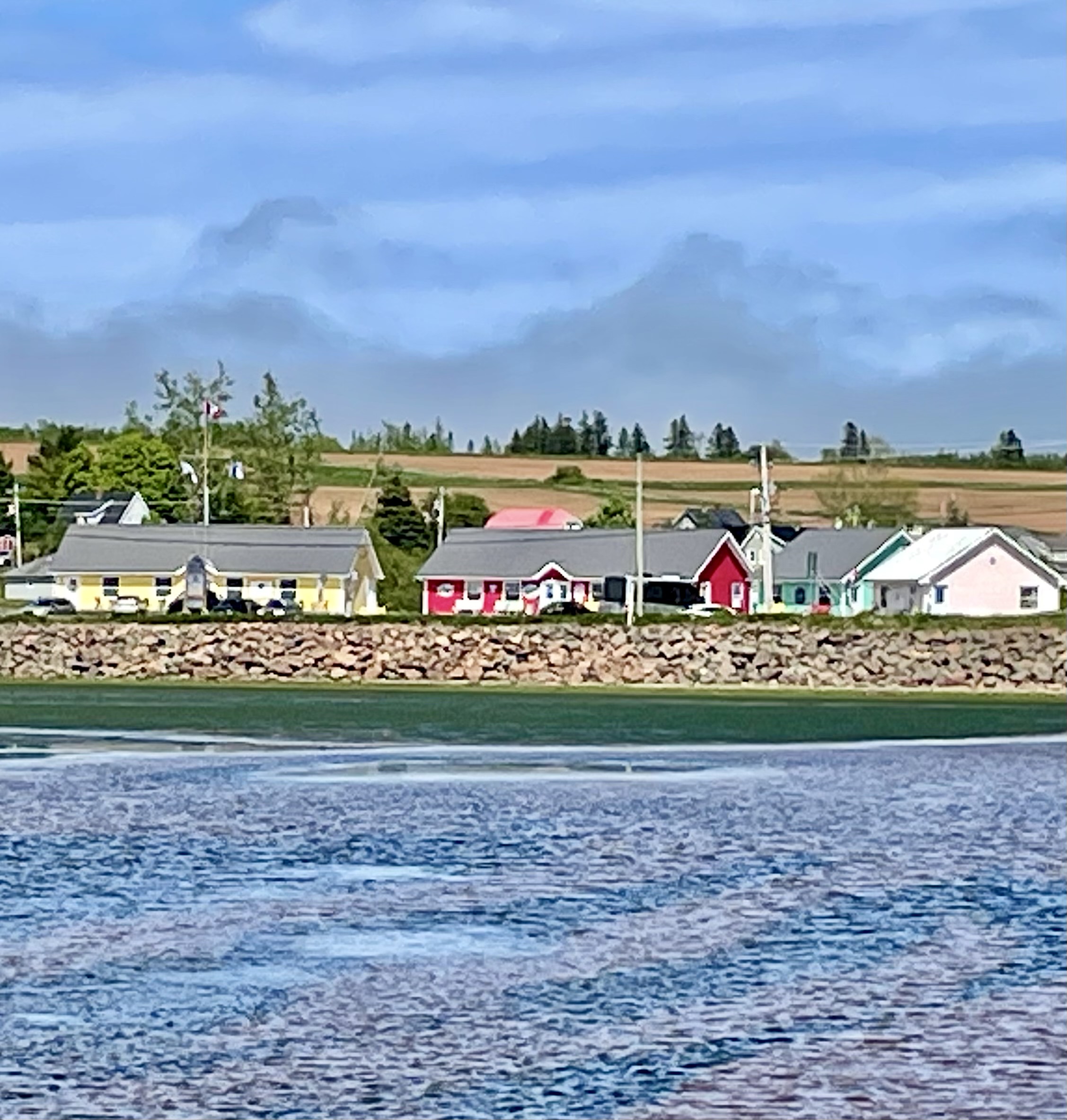
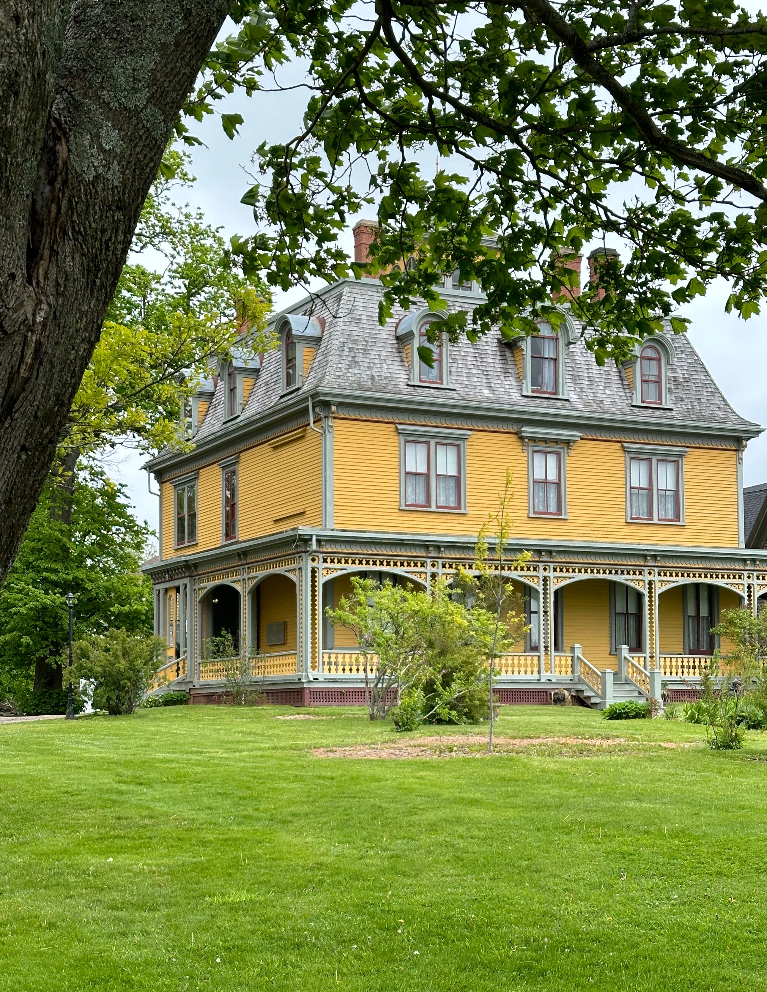
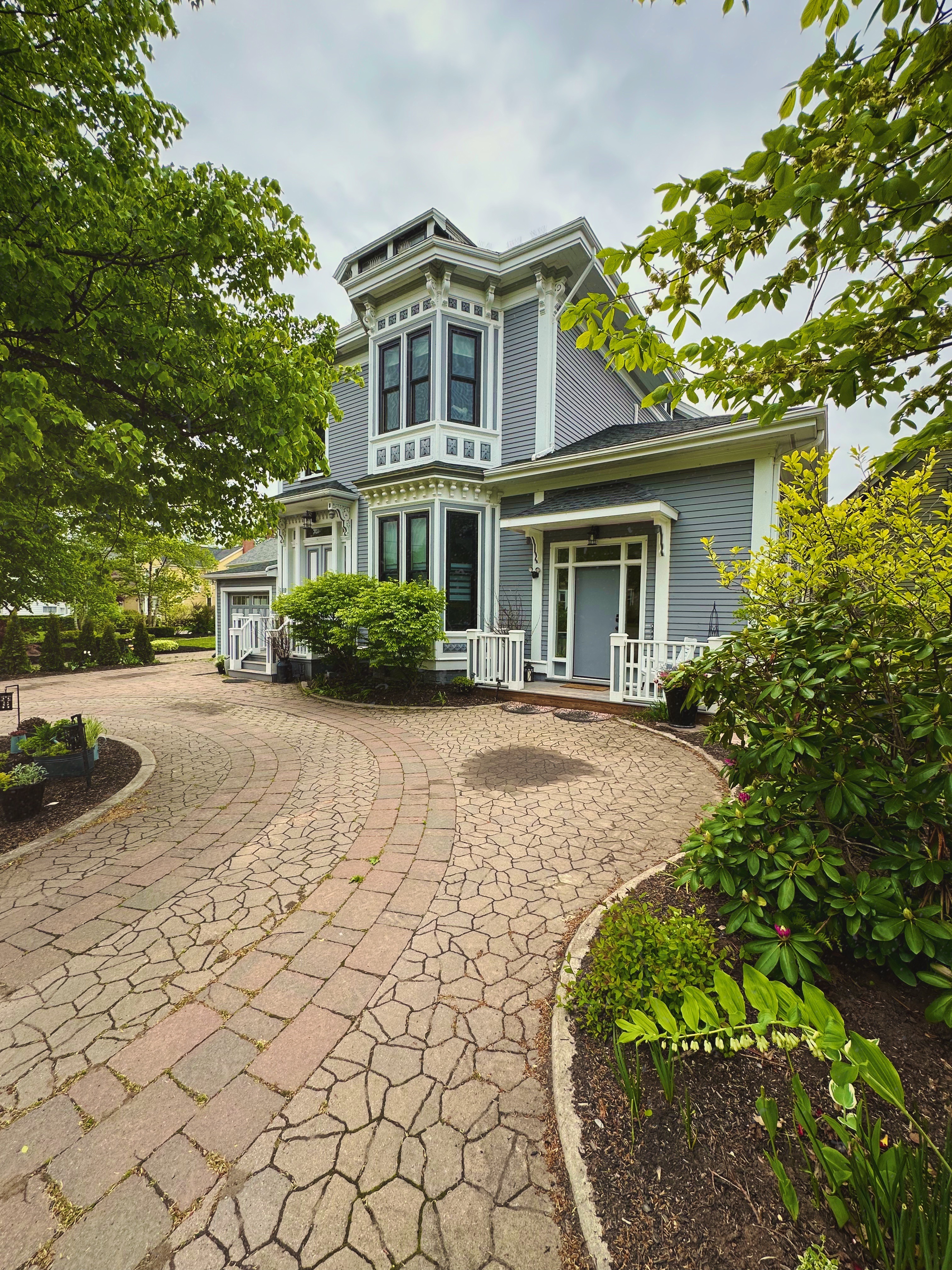
The city of Charlottetown is quite charming architecturally with a downtown and residential area on the waterfront of Hillsborough Bay. We spent part of a day walking around much of the historic downtown (it is quite compact). There are several residential neighborhoods of charming and beautifully maintained homes.


During our walkabout we happened on to a peaceful green space within the residential district – Rochford Square – this green space was set aside in 1771.

The square is bounded on the west side by All Souls Lane. At the far corner of the green space and All Souls Lane sits St. Peters Cathedral – Anglican. The cathedral is handsome but as we rounded the corner we came upon the All Souls’ Chapel tucked right against the cathedral. The chapel was open so we ventured in for a look at an Anglican Chapel. The description from the plaque at the chapel entrance is included below.

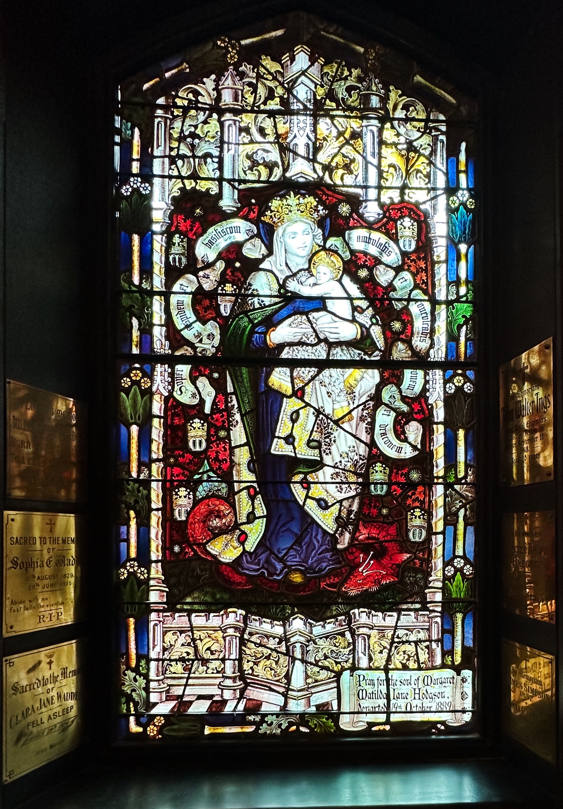

This 1888 chapel, designed by William Critchlow Harris, Jr., is a masterful example of High Victorian Gothic Revival architecture in Canada. Its robust design is distinguished by rough textures in rust-red Prince Edward Island sandstone and by deep-set hooded windows. Inside, a profound sense of religious mystery has been created by the complex decorative scheme. It features a dramatic chancel arch, rich carvings, beautifully patterned encaustic tiles, subdued lighting and eighteen exquisite mural paintings by the artist Robert Harris, brother of the architect. (Historic Sites and Monuments Board of Canada)
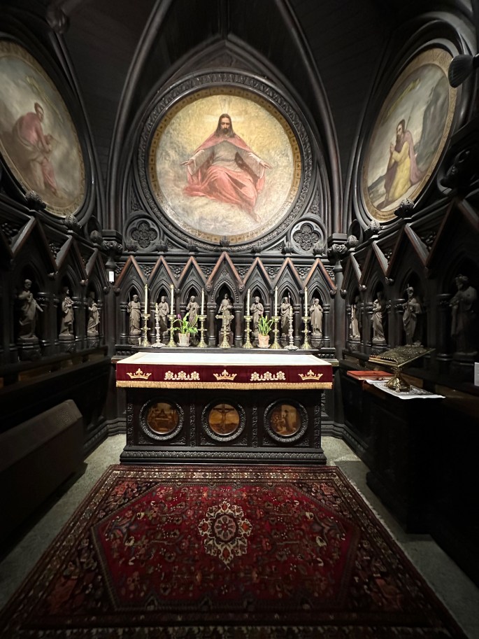
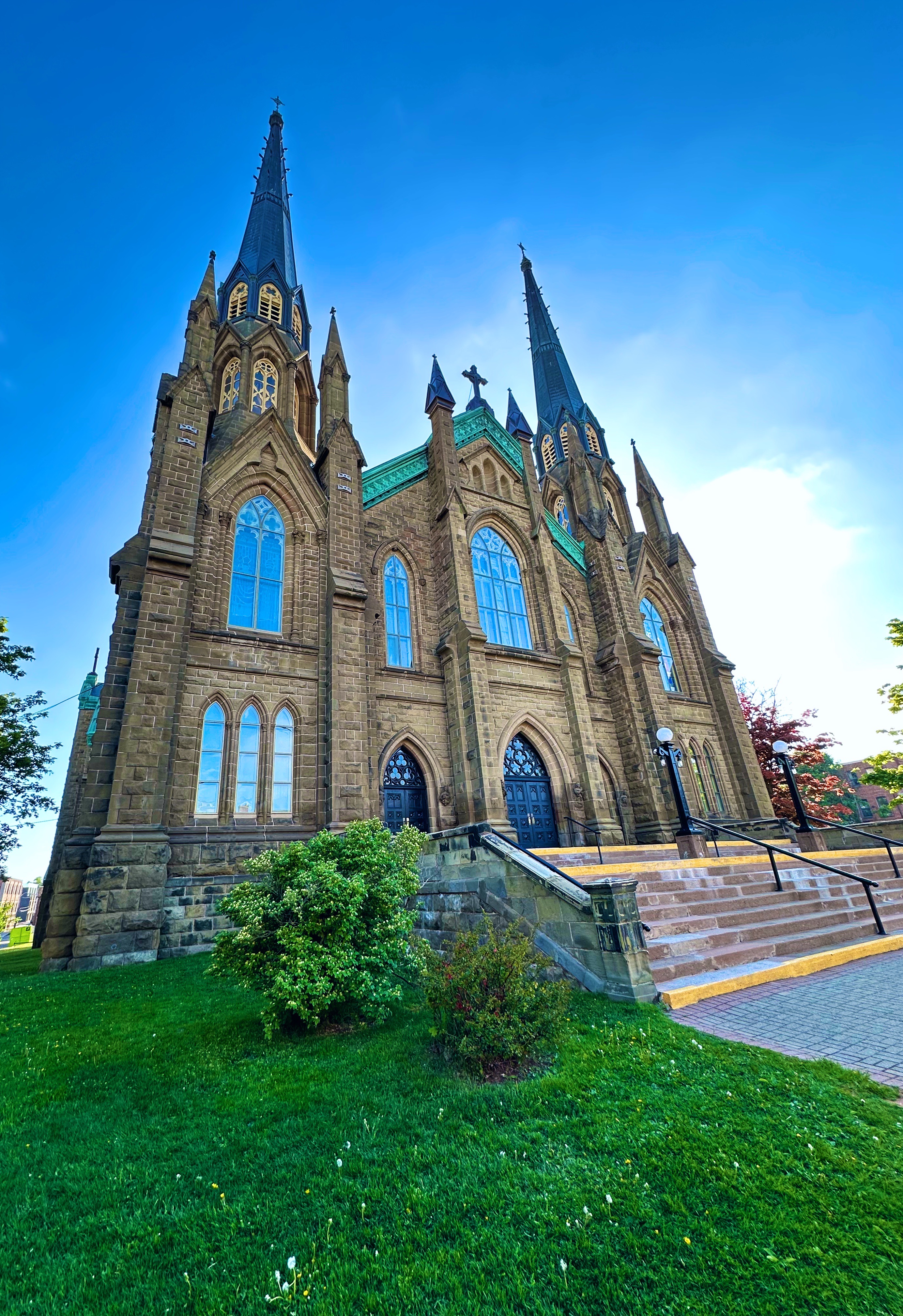
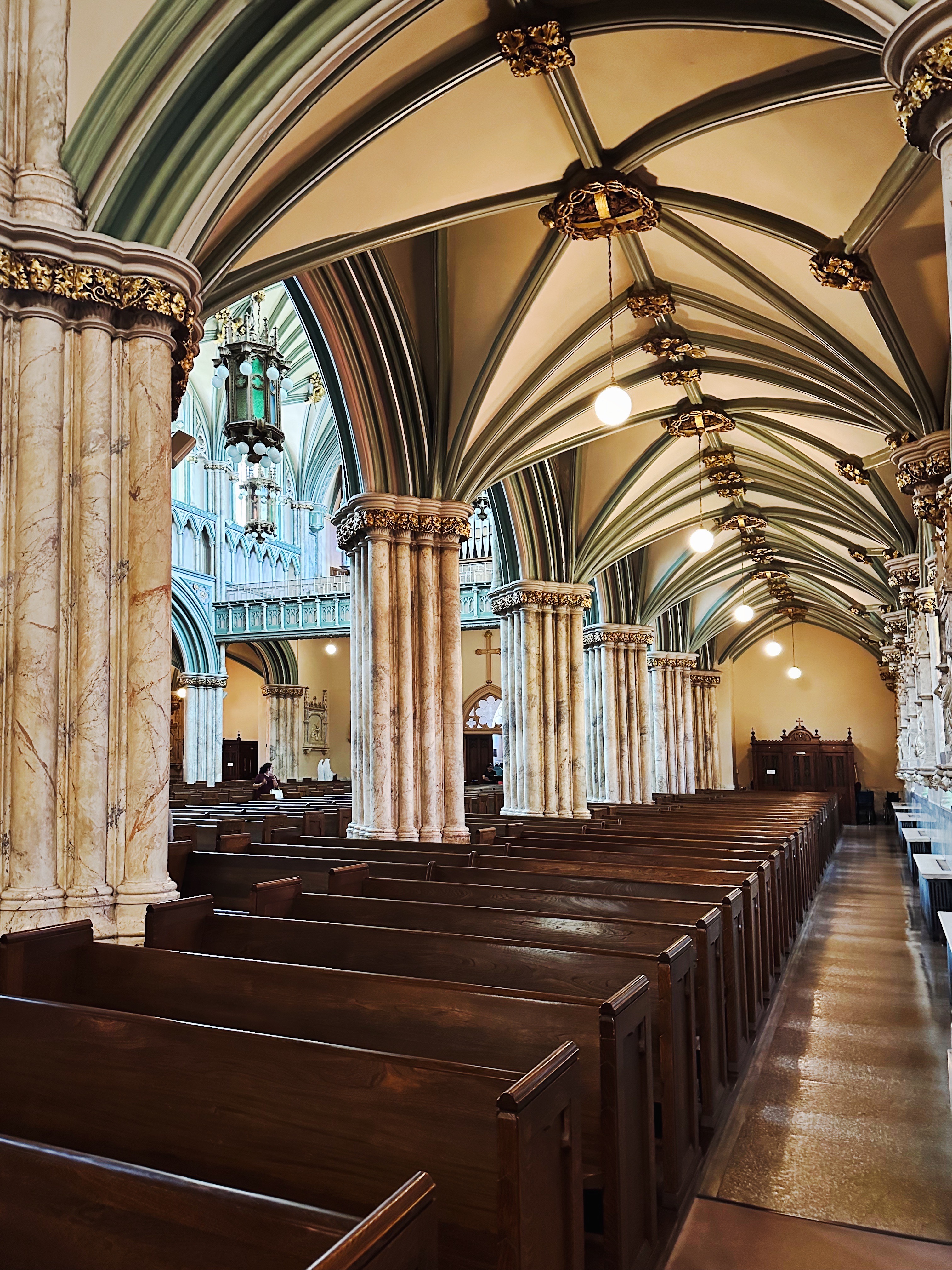
We also visited St. Dunstan’s Basilica. The twin steeples of the basilica (opened in 1919) are visible from anywhere in the city. Each spire is 200 feet in height. The basilica is the fourth St. Dunstan’s and replaced the cathedral which completely burned in 1913.

The history of this Catholic parish is interesting in that the congregation is a mix of the earliest French settlers who started the first Catholic church on PEI in 1721 and and were joined in 1722 by Catholic Scots . The Scots were seeking to escape religious persecution in largely protestant Scotland.


Of course, in due time, the British set about persecuting all of the non-english speaking inhabitants of PEI ( the Mi’kmaq who called the island Epekwik and the French who called it Ile Saint-Jean ). The French and Mi’kmaq fought together against the British but eventually lost after fighting multiple wars over an extended period against the British Redcoats. Many of the French were deported to the American Colonies. Without the French the Mi’maq could not continue to wage war against the British and signed a peace treaty with them. Interesting to note that while the Mi’maq signed a peace treaty with the British they never ceded their territory and they were guaranteed the right to hunt, fish and gather in order to sustain themselves or make a living. In 1997, Canada’s Supreme Court affirmed these rights after Mi’kmaq Nation members were arrested for exercising their rights guaranteed within the treaty signed in 1761!

Okay, that just about completes our report on PEI. However, before we sign off we have a fine dining recommendation for y’all when you get up to Charlottetown (and you should). The Claddagh Oyster House had -fortunately for us- just reopened after a several month renovation.
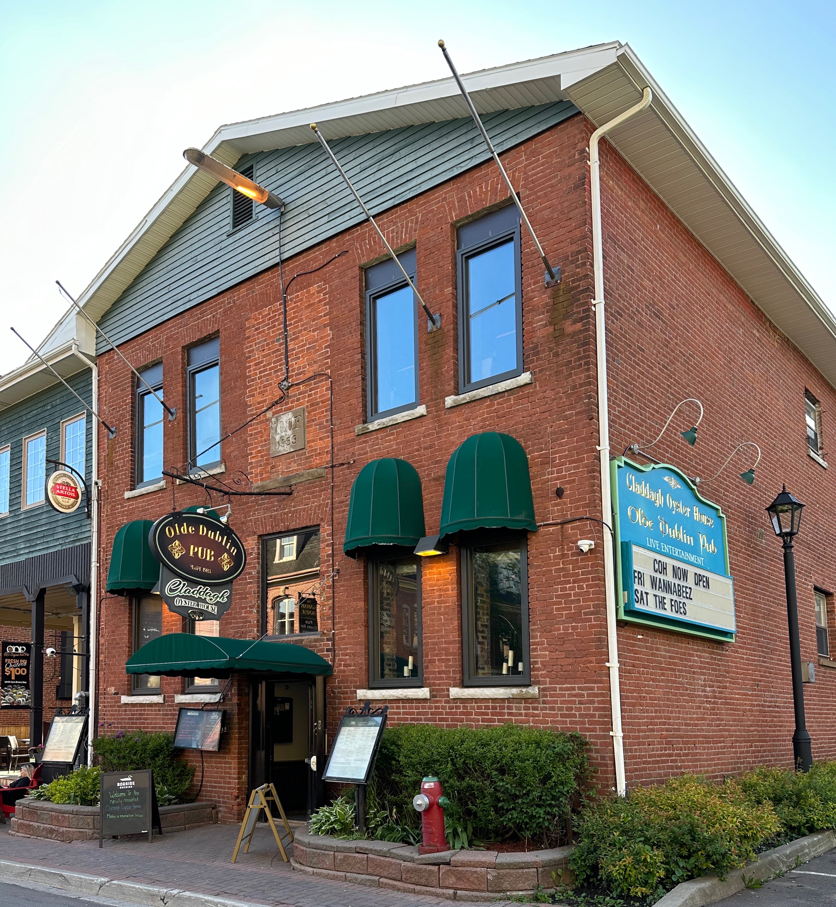

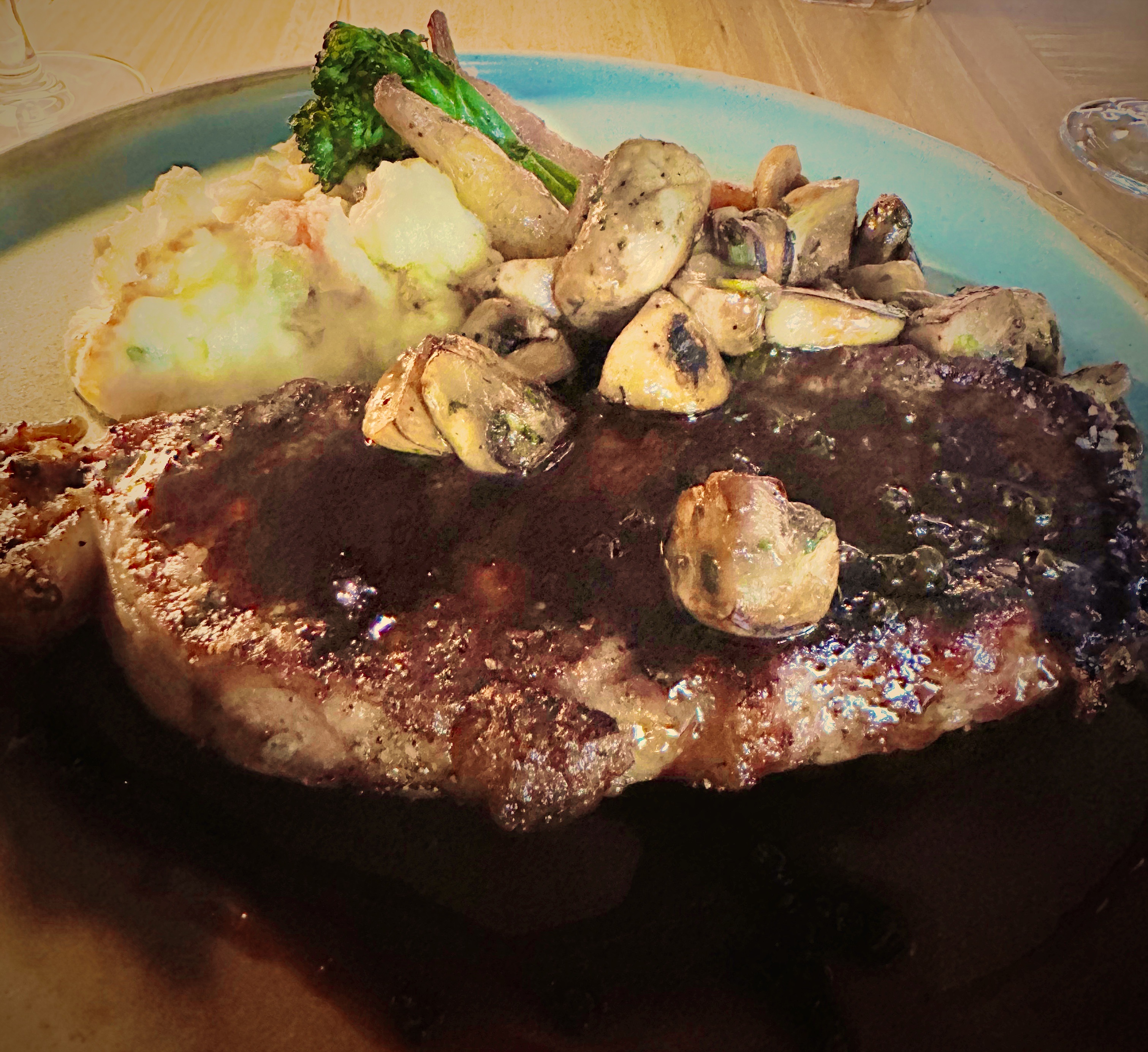
While most folks think seafood in this neck of the woods (as do we) PEI is well known for it’s beef. Claddagh serves only certified PEI beef which they dry age in house for 50 days. If you like oysters we recommend you gorge on them for your appetizer and then enjoy a delicious steak (all the cuts are dry aged). Solid wine list and excellent cocktail selection.
Be seeing you!
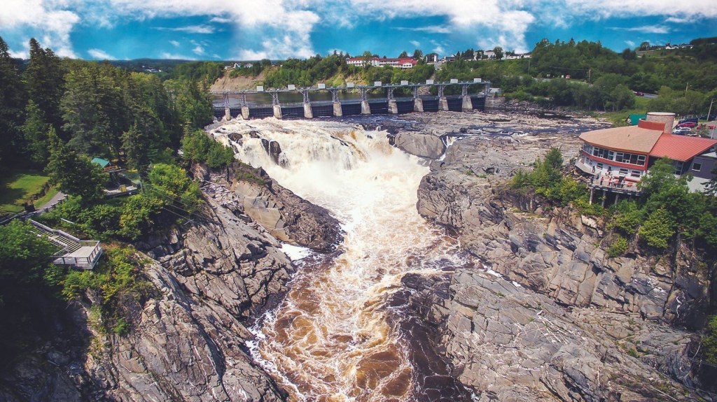
After our ramble through the remote north central region of New Brunswick, we traveled west across Route 17 to spend the evening in Edmundston. Edmunston is a predominately francophile city of approximately 16,000 people that sits on the St. John River. The mainstay of the economy here since it’s founding to the present is the paper industry. Logs were driven downstream to the mills by rivermen known as log drivers. Today the logs arrive by truck.
The mill in Edmunston dominates the cityscape as it sits right in the town along the river. The mill in Edmunston produces pulp which is sent via a milelong pipe that winds its way through the city and across the river to a paired paper mill in Madawaska, Maine.

As interesting as pulp and paper may be, we actually stopped over in Edmunston to visit the Jardin Botanique and then travel south along the St. John River before crossing back into the United States at Fort Fairfield.


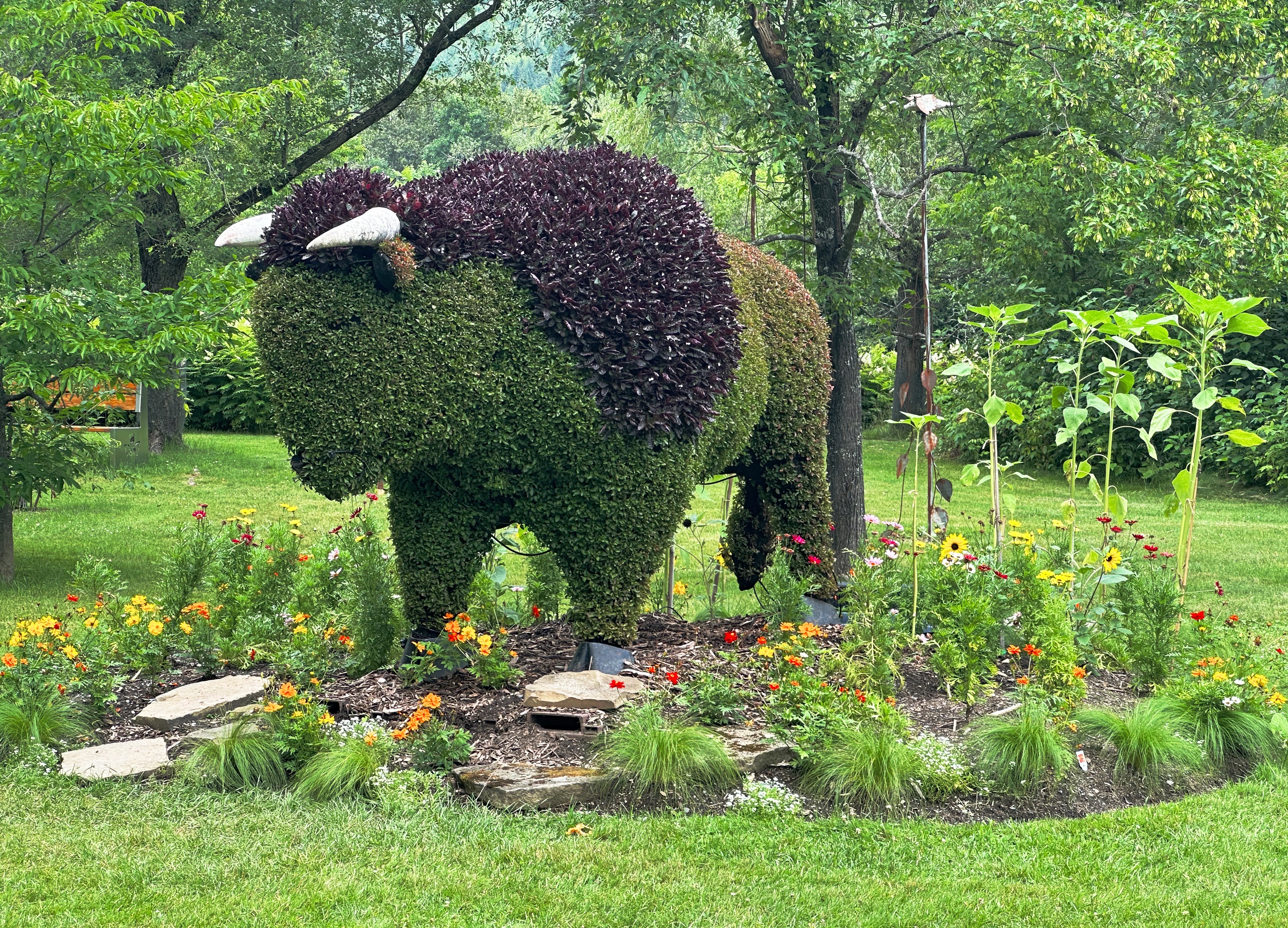
The botanical gardens are relatively small at 17 acres but includes 12 thematic gardens. The gardens are surrounded by an arboretum which makes the setting very tranquil and peaceful. There also a number of topiaries skillfully configured as animals to complete the setting.


We had the opportunity to meet with one of the artists in residence. Guylaine Dufour is a gardener at the Jardin Botanique and one of the artists in residence during the summer months. She works primarily with glass and staining; many of the pieces she creates during the summer are utilized in the gardens to complement the plantings. Below is a glass piece embedded in a wooden bench and glass pieces embedded in stone used as stepping stones in one of the gardens. We enjoyed meeting Guylaine and learning about her techniques and approach to enhancing le jardin.


We were just in Edmuston for one evening to position our drive south along the St. John River before crossing into Maine. However, that is no excuse for the seasoned traveler to forego fine food or coffee.
Because Edmundston is about 95% francophile (French is the primary language with English as a second language) we were confident fine dining would be at hand. We were quite pleased with ourselves when we were able to obtain a reservation at the Chantal Steakhouse. The restaurant has a bit of continental flair with several amuse bouche dishes selected by the chef and served prior to your appetizer and dinner selections. We had an excellent meal and Chantal stopped by our table to make sure we were happy with our dinner and service. Chantal and her daughter own and operate the restaurant. Lovely!


Ideally, our first and last activities when visiting a city is the consumption of good espresso and tea products. Bruliere du Vieux Poste operates a small cafe and roastery and was a two minute walk from the hotel. This happy circumstance made our brief stay all the more pleasant. The name translated by Google into English is The Burning of the Old Post Office — “pas sur” on this traslation
Okay — that is our report from Edmundston. We will be doubling back to chronicle our two weeks on the fascinating island of Cape Breton in our next post.
Be seeing you.
As we swung back westward through New Brunswick (NB) inorder to ultimately re-enter the U.S. through Northern Maine, we decided to pay a visit to Fredericton aka the “Freddy”. Freddy appeared to meet our usual city selection criteria — small to medium in size, coffee options, art, live music, bike trails and a city waterfront.
We thought we would need two days but the weather was excellent and so much was happening that we ended up staying four nights; before departing on our wood lands ramble into remote northern New Brunswick (Wood Lands Ramble post coming soon).


A coalition of volunteers (Fredericton Trail Coalition) began to mobilize after the Canadian Northern Railway abandoned a number of lines in New Brunswick in 1989. The first trail was opened in 1993. In 1996, 377 additional kilometers of abandoned railway was donated to the province by the Irving Family allowing Freddy to connect a number of trails and create today’s connected network of over 120 kilometers of trail. A key aspect of the donation was the inclusion of the 906 foot railway bridge that spans the St. John River — connecting the trail systems on both side of the river.

As a result, folks in Fredericton have a plethora of riding and walking trail options. It is not surprising that Fredericton was named Canada’s 6th most-walkable city in 2019, one of 5 “Great Canadian Bike Cities” in 2021 by People for Bikes, and was #9 on Canada’s Best Small Cities as ranked by World’s Best Cities.com in 2022. We took advantage of the trail system and delightful weather to explore a number of the trails during our stay in Freddy.

Combining biking with coffee is a double delight. Mill Town Coffee Roasters is conveniently located on one of the trails and we were able to take a coffee break on our way out and back during each ride. Pretty good, eh!
In our humble opinion, public art adds a great deal to a city’s environment. We were glad to find that Freddy has several notable street murals in the downtown area, although we would have loved to find more during our walks through town.


Freddy is very fortunate to have, in our opinion, a very impressive art museum, especially in light of the fact that the city population is barely 60,000. Much of the good fortune is owed to the generosity of one Lord Beaverbrook — who in 1959 gifted the museum building and 300 valuable works of art to a museum foundation he created for the benefit of the public. Did we mention that the museum is named the Beaverbrook Art Gallery?

The son of a Presbyterian minister in Miramichi, New Brunswick, the future Lord Beaverbrook, Max Aitken, enjoyed early success in Canadian business. In 1910, he left Canada for England, where he was knighted and elected a Member of Parliament, eventually serving as Minister of Aircraft Production in Churchill’s wartime government. No slouch Sir Max!
The museum is noted for it’s collection of renowned Canadian artists but also has works by Dali (not fans but still impressive to see a gallery of Dali paintings in Freddy) and Gainsborough and as well as other internationally acclaimed painters. The Beaverbrook became the official provincial gallery of New Brunswick in 1996.


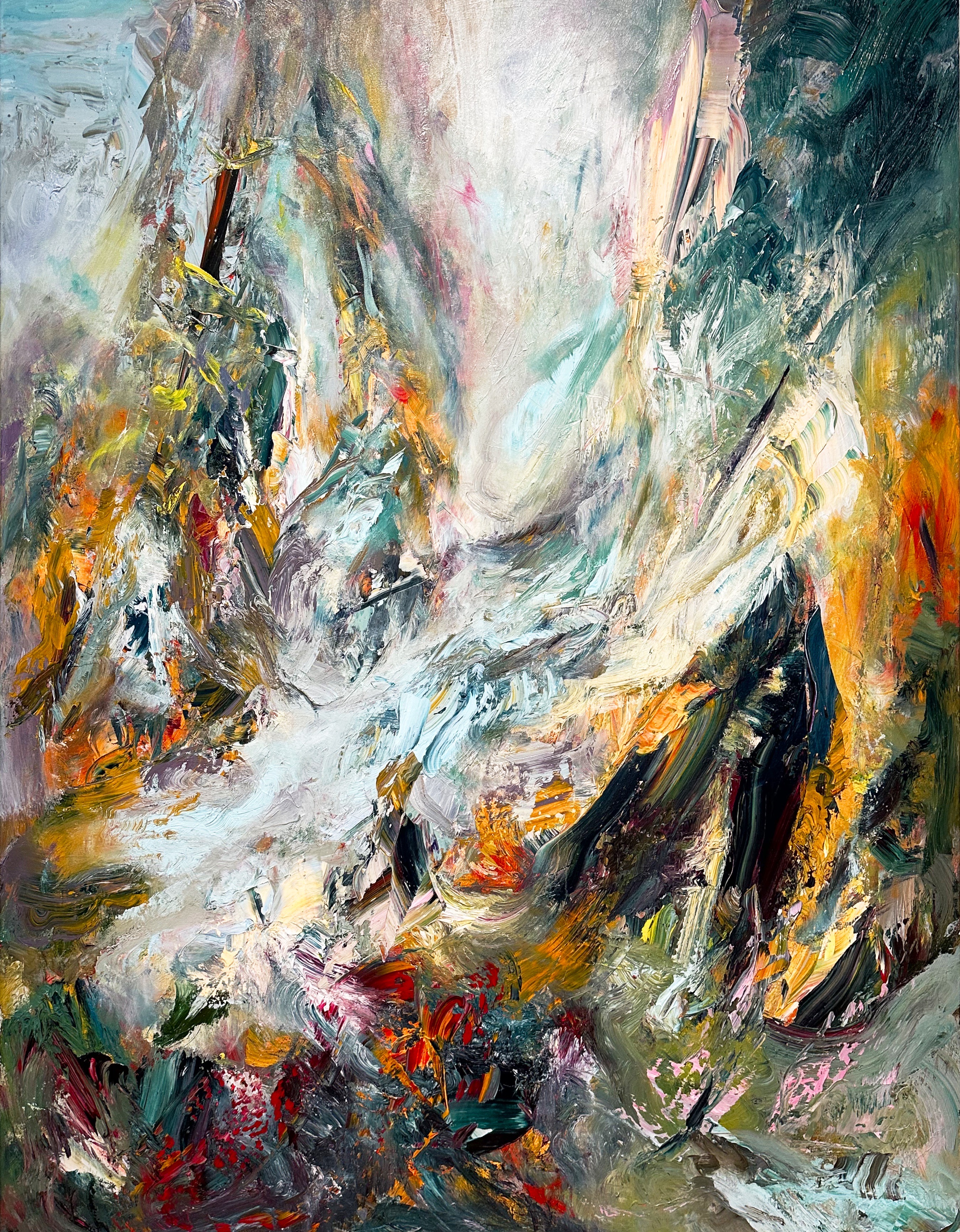
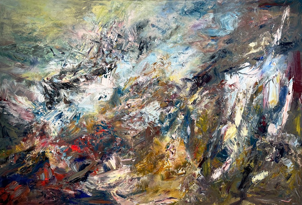
Montreal-based painter Michael Smith (directly above and below) is known for his fluid and impasto surfaces as well as his ability to strike a poetic balance between representation and abstraction. Inspired by art history as well as historic and current events, Smith pulls from various sources to create his energetic landscapes and seascapes. His Sea of Change series includes massive canvases exploding with colour and energy, as well as smaller studies on paper. These were inspired by a serendipitous encounter with a 19th-century painting of the Arctic expedition ship H.M.S. Terror during his time as artist-in-residence at the Beaverbrook Art Gallery in 2018. Layering texture and colour, the familiar with the unfamiliar, Smith’s paintings convey (as the artist writes) “a mix of excitement and anxiety of a land [that] although at times bucolic, is riddled with shadows.” Curated by John Leroux
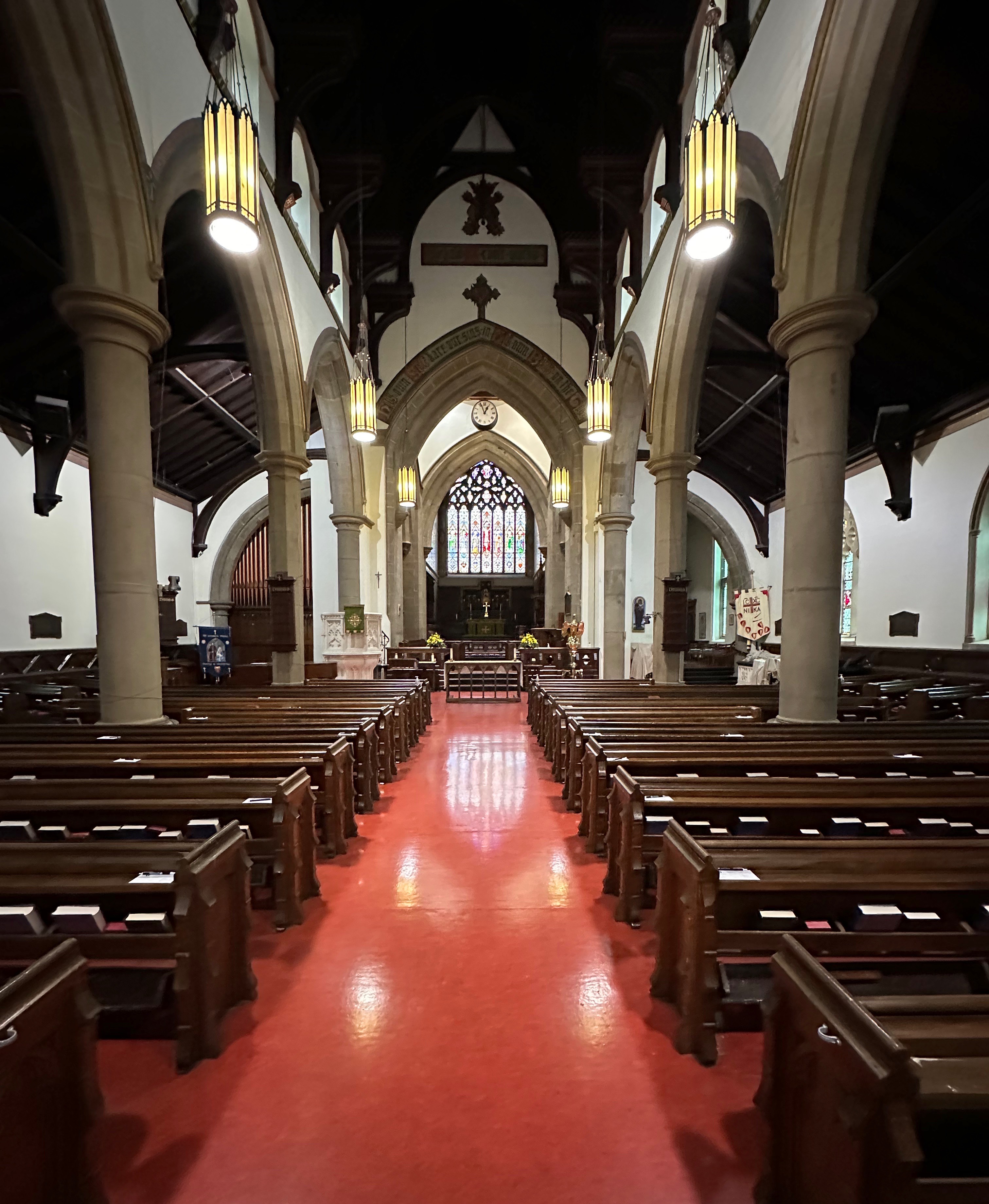
We often find that the early history of a city is intertwined with the creation of the dominate religion of the ruling class. Fredericton is no exception to that pattern. The city was named for Prince Frederick,son of King George III and Queen Charlotte. Subsequently, Queen Charlotte declared Fredericton a Cathedral City (even though its population was too small) so Christ Church Cathedral could be built. The Anglican Church at that time was utilized as a way to impose British custom and law (and to counter Acadian Catholicism) on the inhabitants be they British, Acadian or First Nations.

The Cathedral sits on its own park like island of green at the edge of downtown. The surrounding neighborhoods consist of stately and beautifully maintained homes. By many accounts the movers and shakers in Fredericton were members of this parish and much business was conducted and deals made between the businessmen and politicians who belonged here.

We always seem compelled to add a little bit of history (and an opinion or two) when we report on our travels — oh well!
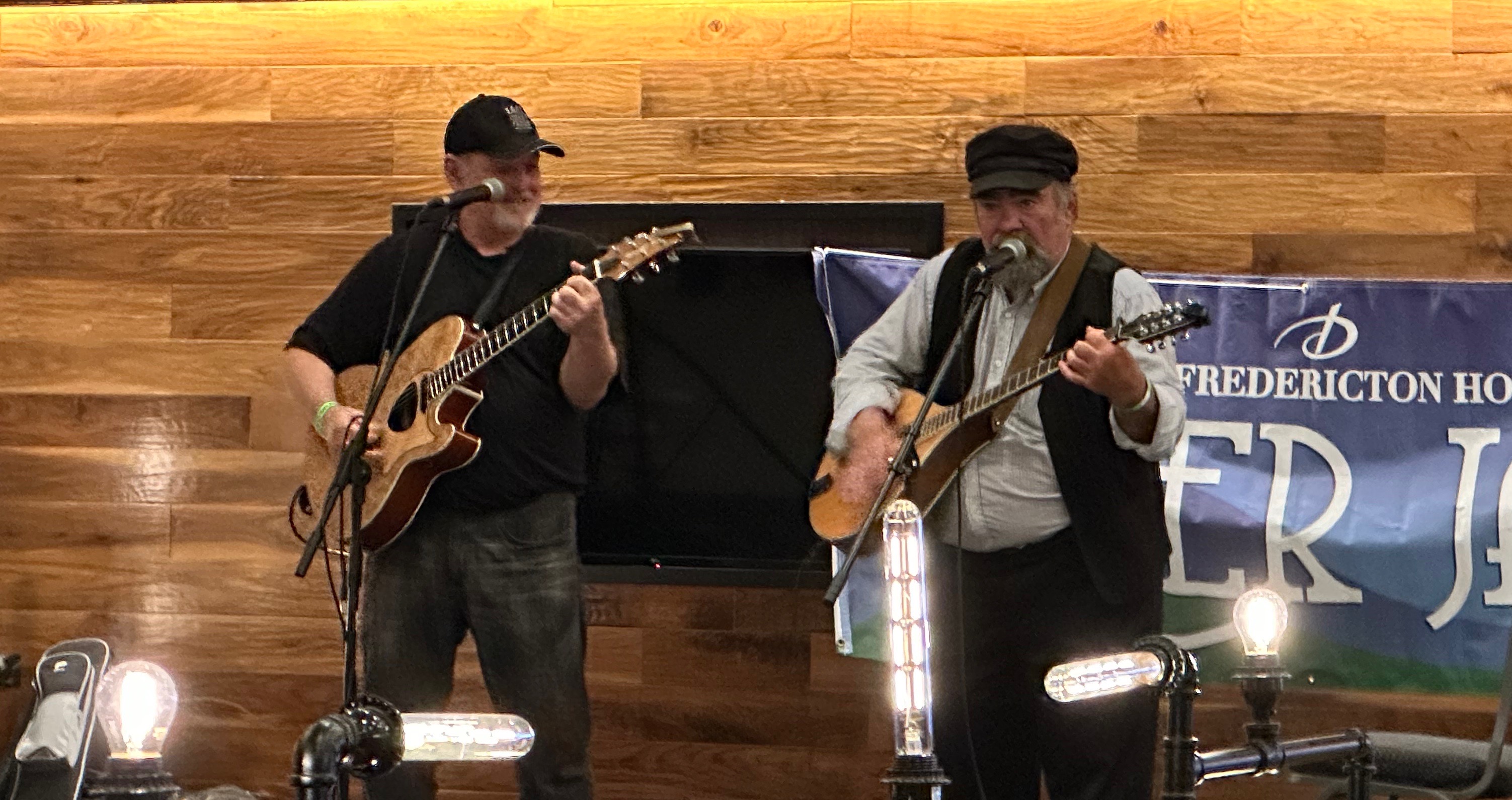
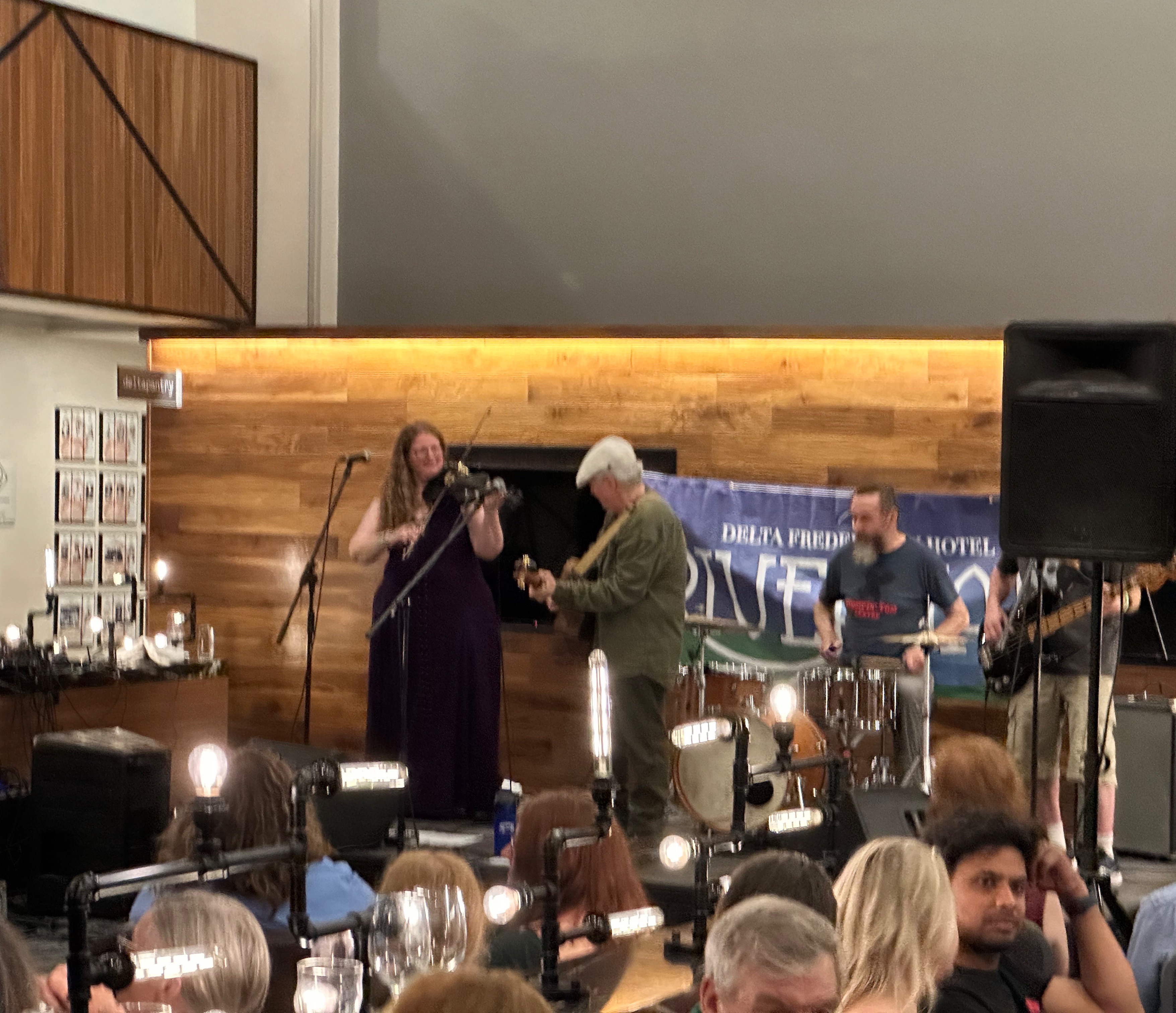
We closed out our stay in Freddy with an afternoon and evening of food and music. The River Jam Music Festival was taking place all around us at our hotel with four or five music acts performing in different areas of the facility simultaneously. We took in a couple of acts, had dinner and camped at the bar (surprised?) to take in the performances in the lobby which ran to midnight. We were treated to primarily traditional music from the Maritimes and the local crowd was up singing along and dancing. So good!
That’s it from Freddy! We had a great visit and look forward to sharing more of our travels soon.
Be seeing you!

Yes indeed, Halifax was named in honor of George Dunk (1716–1777), Second Earl of Halifax and Chief Lord of Trade and Plantations. We will include more history later in this post to keep our readers on the edge of their seats! We think the photo below provides a good indication of the dramatic nature of this post and will allow you to stop watching The Crown on Netflix once and for all.
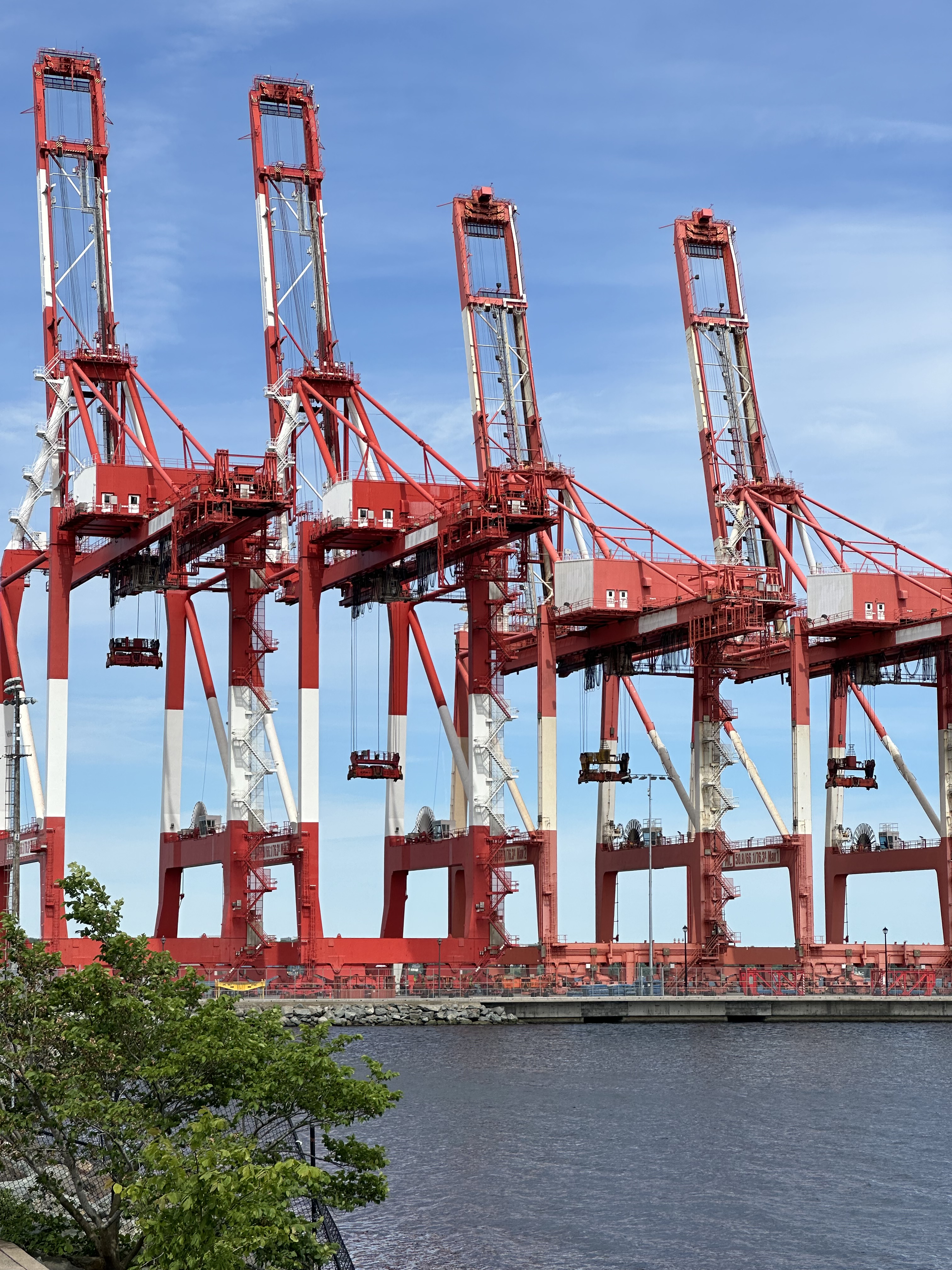
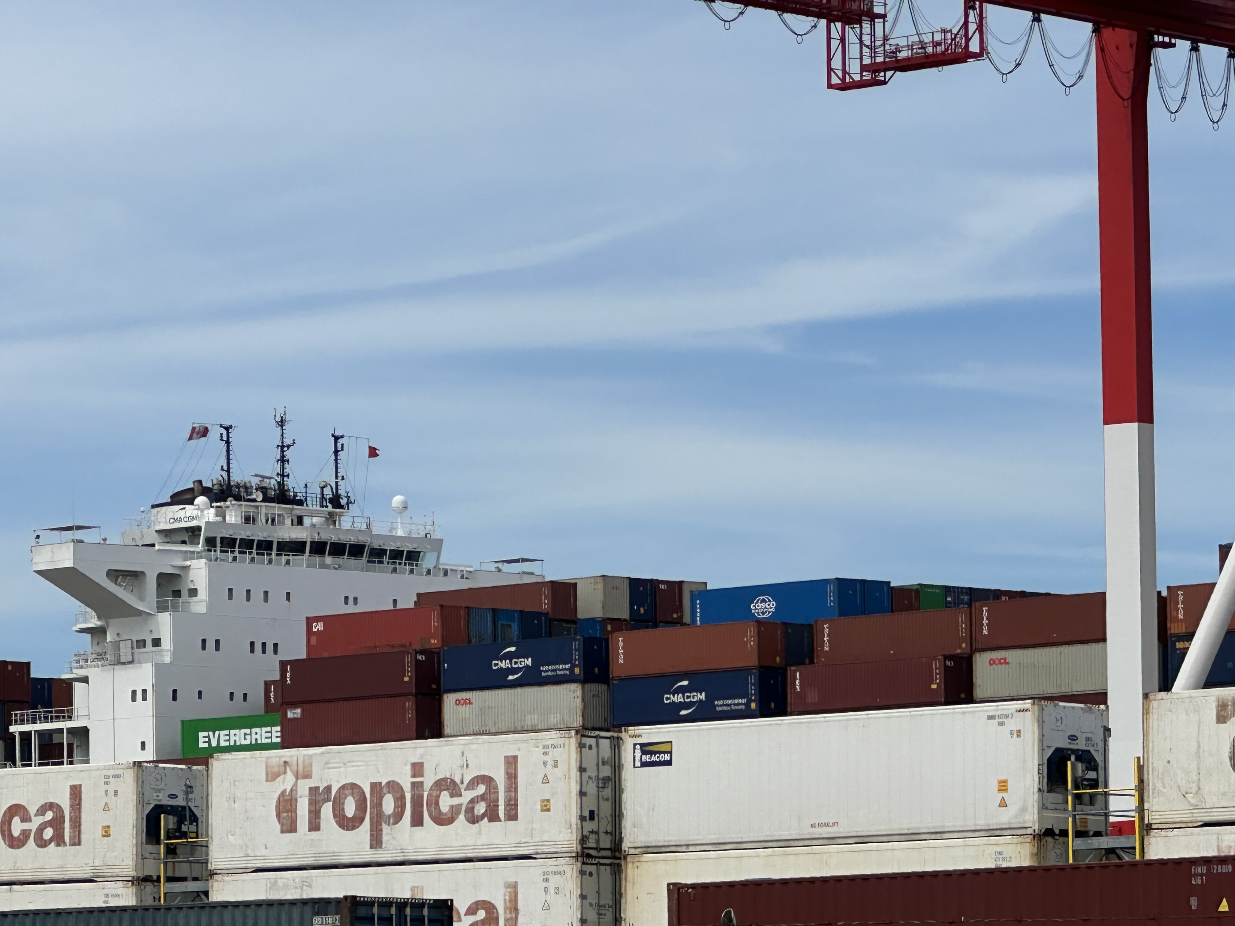
We arrived in Halifax in the afternoon fresh from our stop in the photogenic, post card perfection of Peggy’s Cove (no—we don’t know who Peggy was and no one else does either). Halifax is the largest city in the Canadian Maritime Provinces (population apx. 440,000). It’s modern, bustling and growing by leaps and bounds. Construction cranes are visible everywhere you look—there have been between 25 and 35 cranes across the area for the last several years! More on the growth topic later.

Halifax harbor is the second largest natural harbor in the world. Additionally, it is deep and ice free which has helped the port become the fourth largest by volume in Canada. Because one of us is like a child when it comes to big ships, trains, machinery and planes, we ventured to the south end of the compact waterfront to see the intermodal container operation.

Okay lets get to the truely important stuff….street art, fine art, coffee and food…..
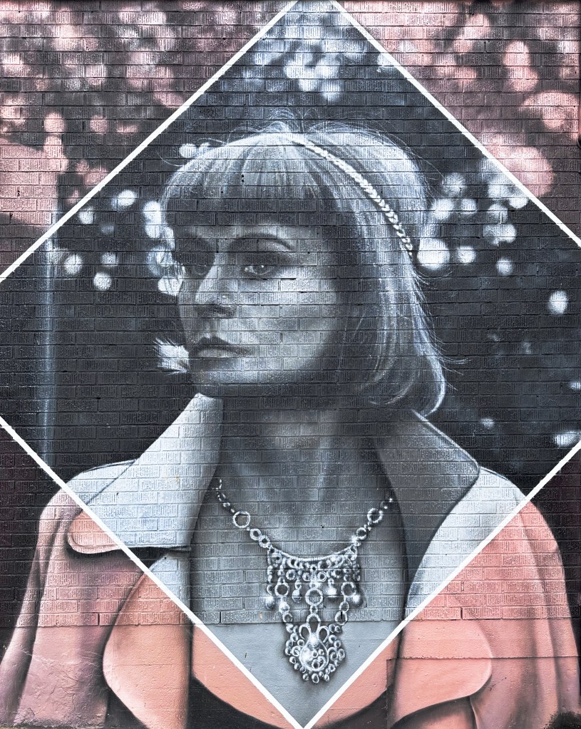
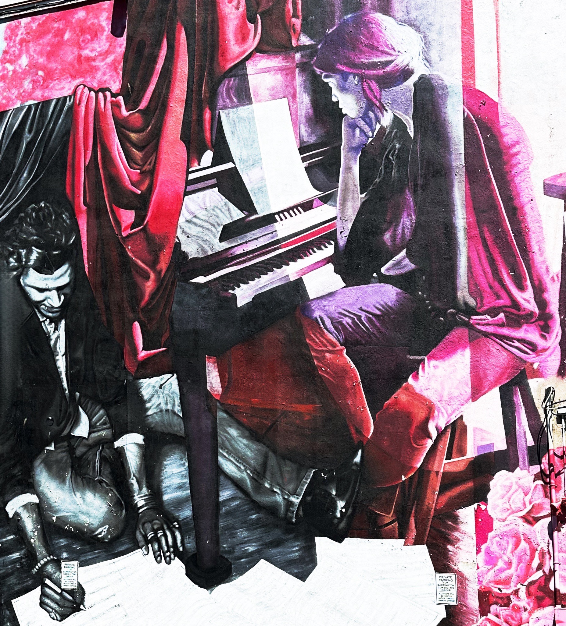
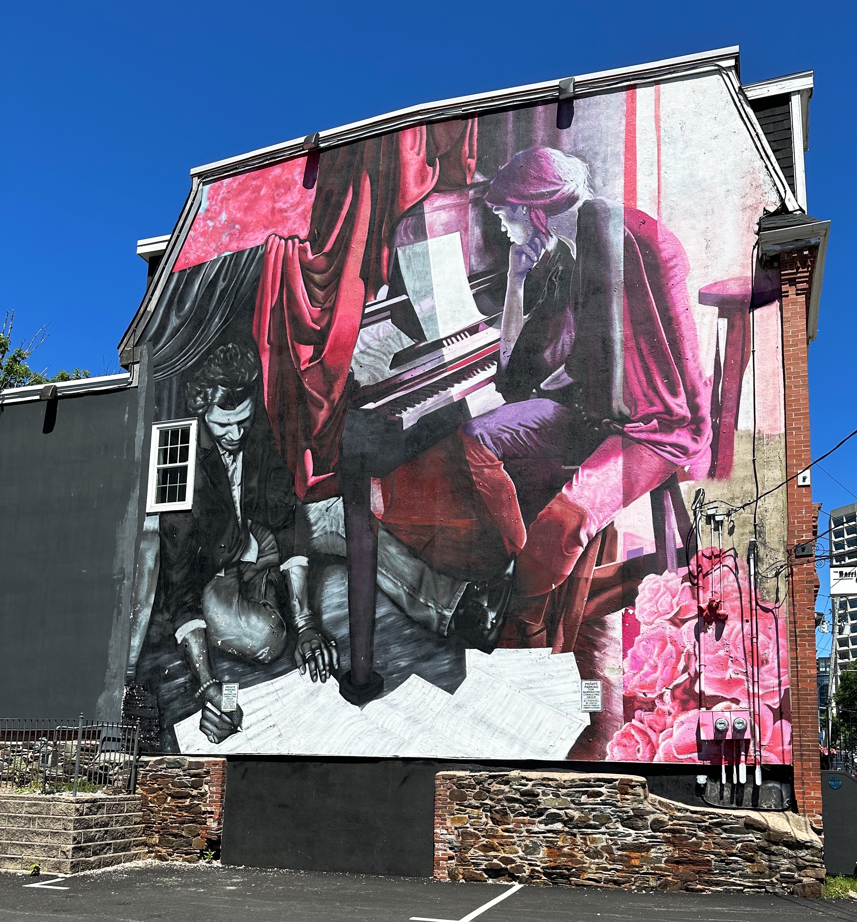
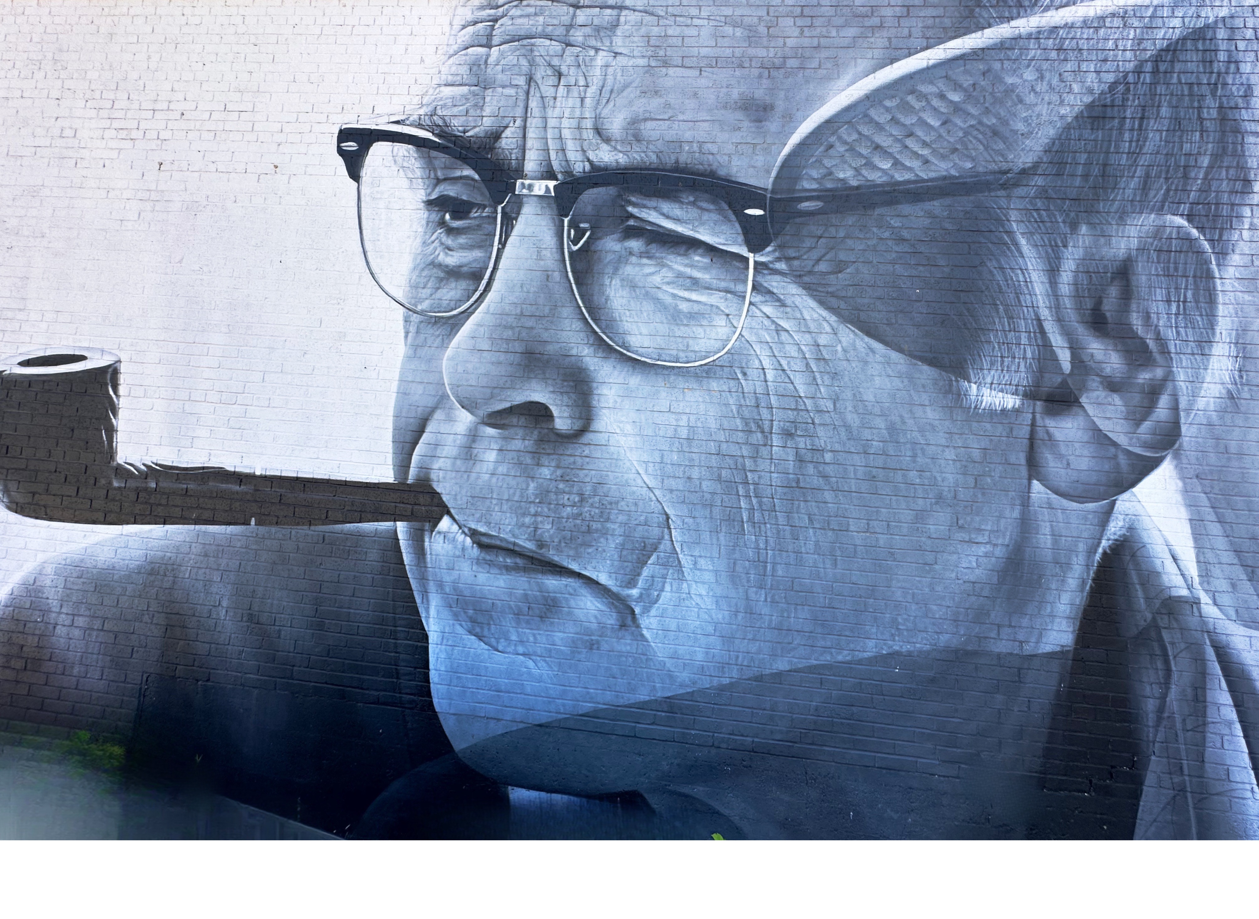
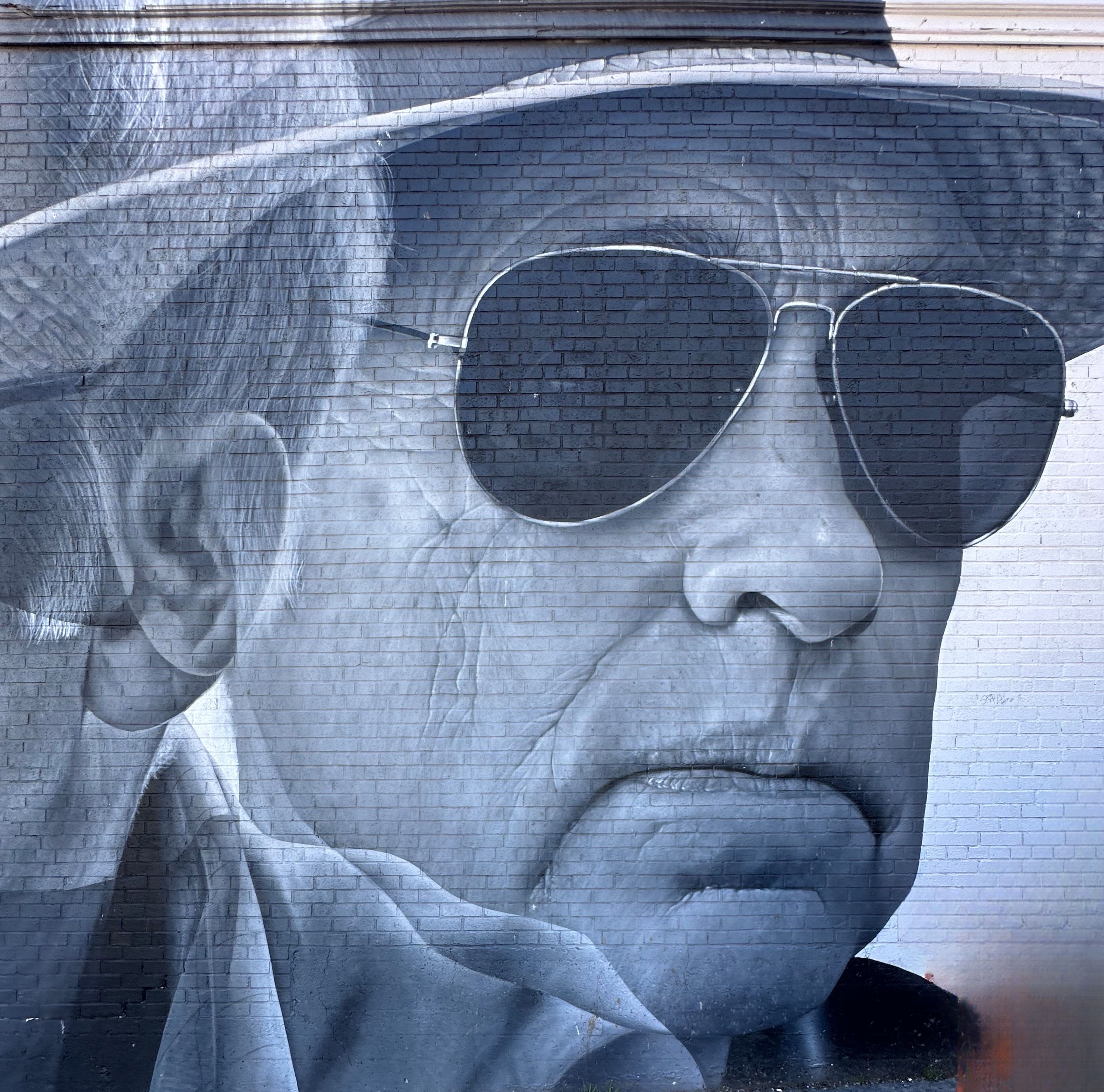
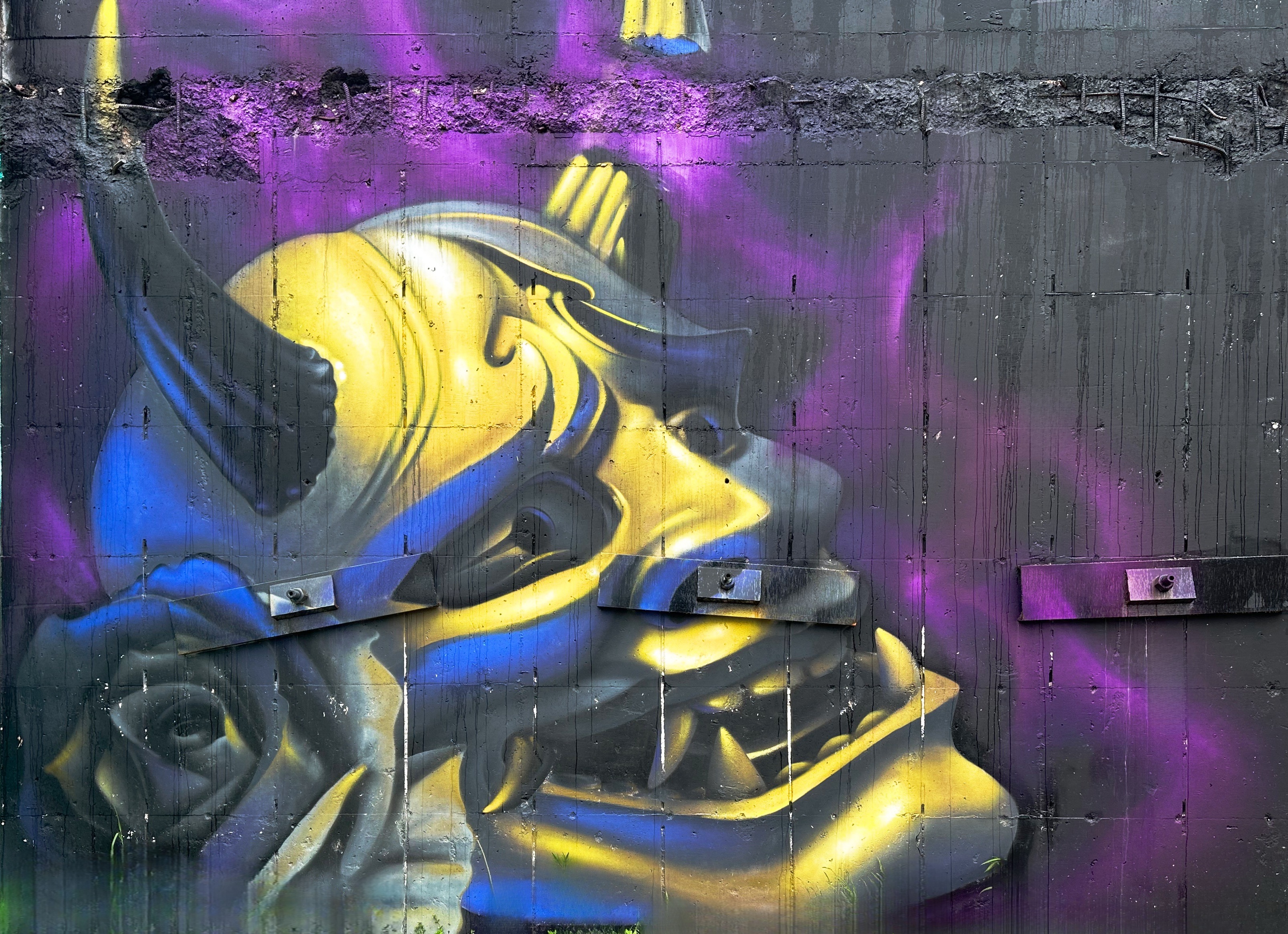
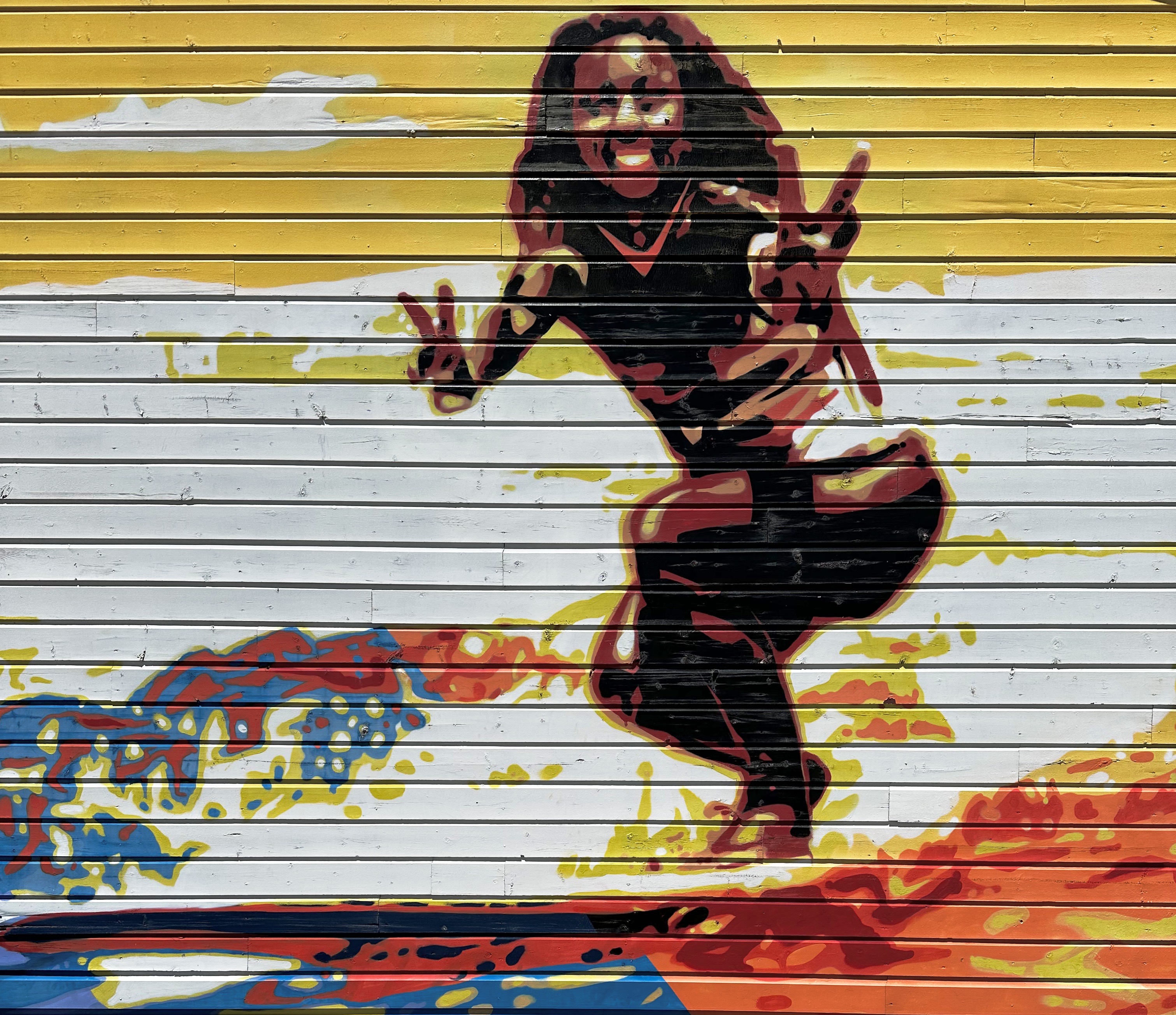
Halifax has been home to an annual week-long street mural since June of 2022. We were able to check out some of the murals from the 2022 and 2023 festivals. The 2024 festival will not take place until mid July.

The festival brings together a mix of local and international artists. Many of the murals are on Quinpool Road, a diverse and lively area of shops and ethnic restaurants.Some of the murals we photographed on our walkabout are pictured below. Some of the murals were difficult or impossible to photograph as they were painted in very narrow alleyways. Still great to see all the work!


In addition to street art, Halifax is home to the Art Gallery of Nova Scotia which is a provincial fine art museum. On our second day in Halifax the rains came so we donned our waterproofs and walked down the hill to the museum.
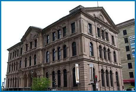
When we visited there were two major exhibitions taking place. We both were enamored of the exhibit of the Trinidadian-Canadian artist Denyse Thomasos (1964-2012). Thomasos began her career as a figurative painter and evolved over time to produce inceasingly abstract work. Thomasos was born in Trinidad and grew up in Canada and studied in Toronto before earning a MFA in Painting and Sculpture at Yale University. Sadly, Thomasos died unexpectedly during a routine medical procedure at the age of 47, ending her brilliant career prematurely.


Haligonians are blessed with a plethora of excellent specialty coffee shops spread across the town. We visited five different shops during our four-day stay. We can report that each shop was quite good but each also demonstrated a unique personality.


Coffeeology —— https://coffeeologyespresso.co/ Narrow Espresso —— @narrowespresso Glitter Bean Cafe —— @glitterbeancafe Uncommon Grounds —— @uncommongroundshfx Apartment3 EspressoBar —— https://apt3coffee.com
We had been dining extensively on seafood during our trip—why not when you are touring the Maritime provinces of Eastern Canada where the seafood is ridiculously fresh and delicious? We tend to avoid Italian cuisine (including pizza) when we travel outside the northeastern U.S. However, after several weeks without pasta, a fix was definitely in order. Fortunately, a solution was within our reach at The Bicycle Thief on the waterfront in Halifax.


The Bicycle Thief describes their offerings as North American food with an Italian Soul. Assolutamente! We were able to acquire a late afternoon reservation on a rainy Saturday (after our visit to the art museum). The restaurant was absolutely packed but the service was impeccable and our cocktails, appetizers and entrees were delizioso! Please dine there if you go to Halifax.
There are of course many other things to do in Halifax beside art, coffee and food. The harbor is spectacular and a walk along the boardwalk will provide you with views of several of the small islands situated in the harbor as well as cargo ships, navy vessels and cruiseliners entering and departing Halifax.

The Citadel, which overlooks the city, is a good attraction for history buffs. This fortress is the fourth version to be built on the hill overlooking the harbor. The last and current fortress was constructed by the British in anticipation of a possible attack (1820s) at Halifax by the United States. That of course never happened and none of the four fortresses was ever part of a military conflict. Today the fort is a national historic monument operated by Parks Canada. For more information: https://parks.canada.ca/lhn-nhs/ns/halifax/culture/histoire-history/citadelles-4-citadels


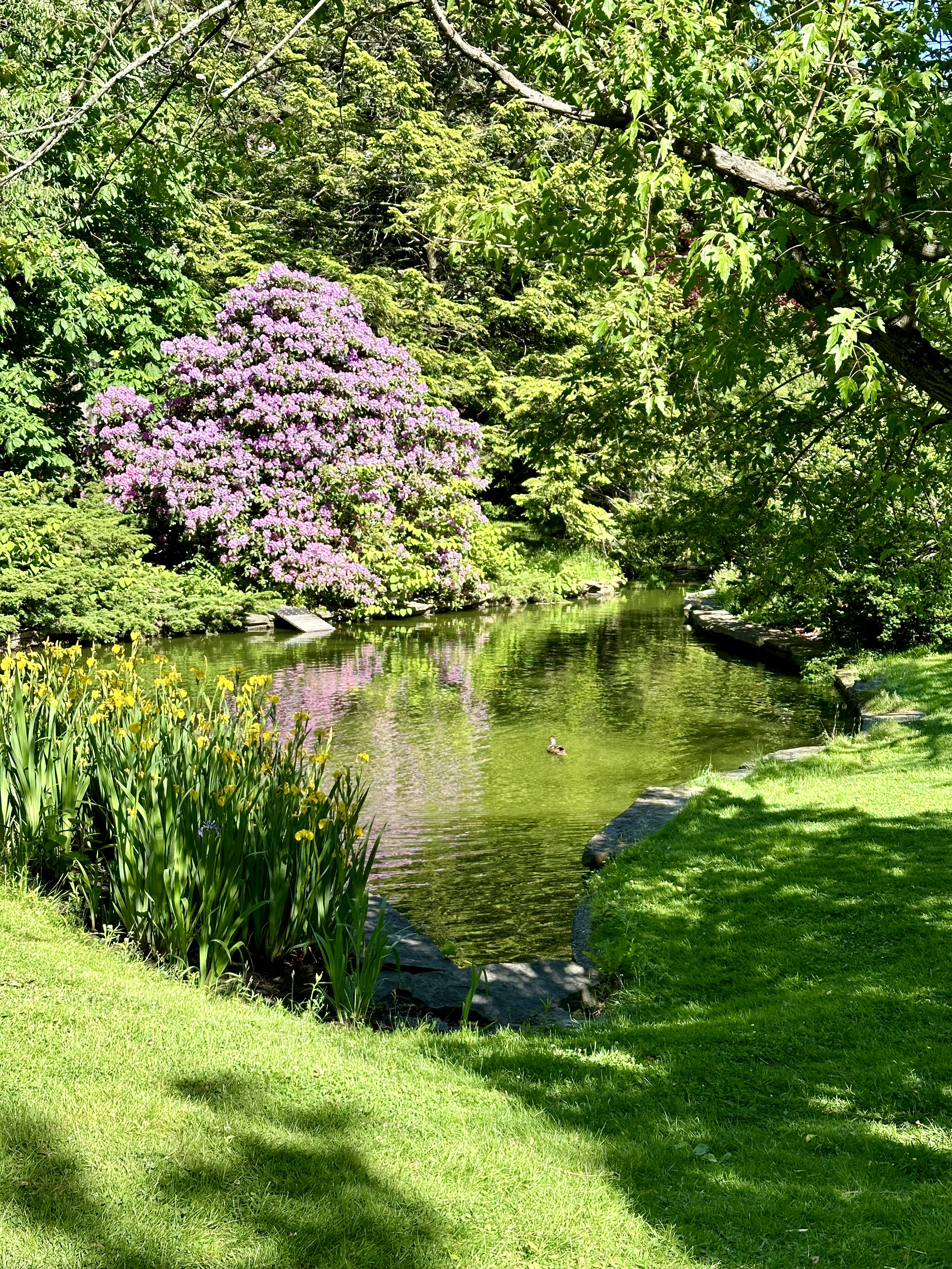
Another worthwhile stop on a sunny day is the Halifax Public Gardens. The timing of our visit was a tad early for everything to be in full bloom. Regardless, the garden is an oasis of quiet and serenity in the middle of a bustling city. P.S. added bonus—Apartment3 Espresso Bar is directly across the street from the gardens on the Park Street side.

We mentioned the growth ocurring in the city earlier in the post. The economy in Halifax continues to be robust with significant population growth fueled by emigration to the province. This growth has fueled the need for housing which is clearly under construction. How much of the housing is affordable we cannot say. The one facet of all the growth we did observe is that the city has been increasingly building skyward. Previous height restrictions have been relaxed and zoning seems to be relaxed as well with high rises going up in the midst of blocks once dominated by two story “jelly bean” houses (brightly painted wood frame residences). The view of the harbor from above is now largely obstructed (unless you live in a highrise). Oh well, just an observation by visitors—perhaps without the necessary context. Regardless, an interesting, lively and fun city to visit.
We are off to Cape Breton to explore the beauty and rich culture of the highlands where the “mountains meet the sea”.


Be seeing you!
