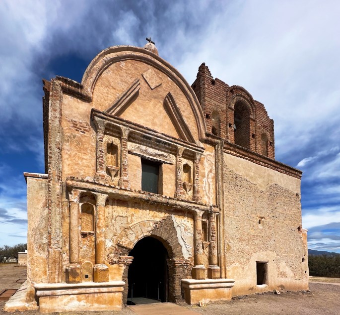
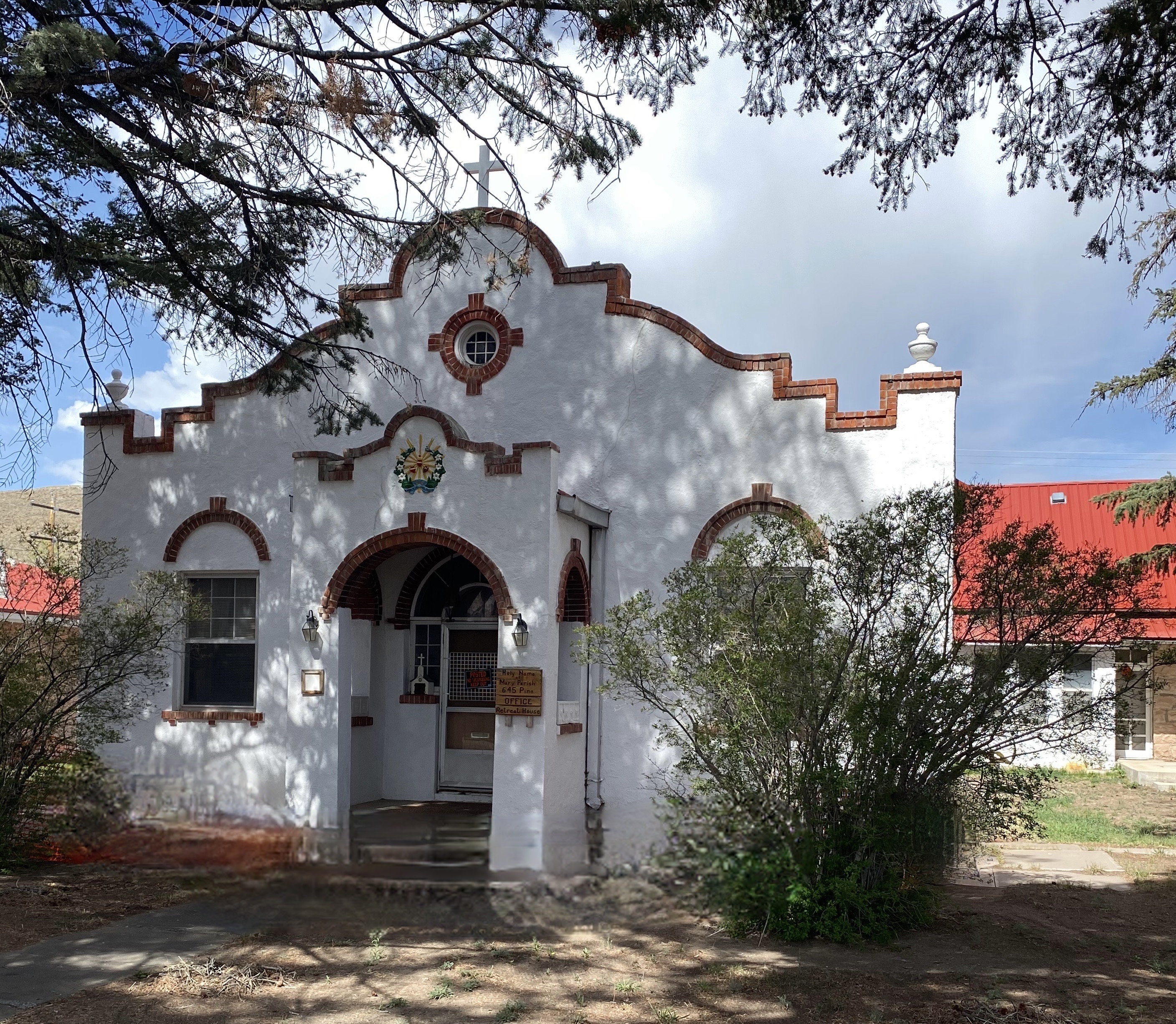
After our trek through the Coronado Monument and the San Rafael Valley (see previous post) we were ready for a city segment. While on our way north to Tucson we stopped at the THNP. This mission dates back to the late 1600s, and was one of 20 established by Padre Kino, a Jesuit missionary. Padre Kino is revered by the church for his work with the indigenous people of the Pima Alta (O’odham, Apache, Yaqui). There are other historians who have a different view of the work of Padre Kino and his fellow Jesuits. In this article we are not going to delve into the debate over the forced conversion of indigenous people to Catholicism. We have included links below regarding this topic.
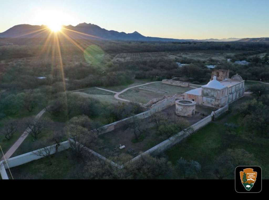
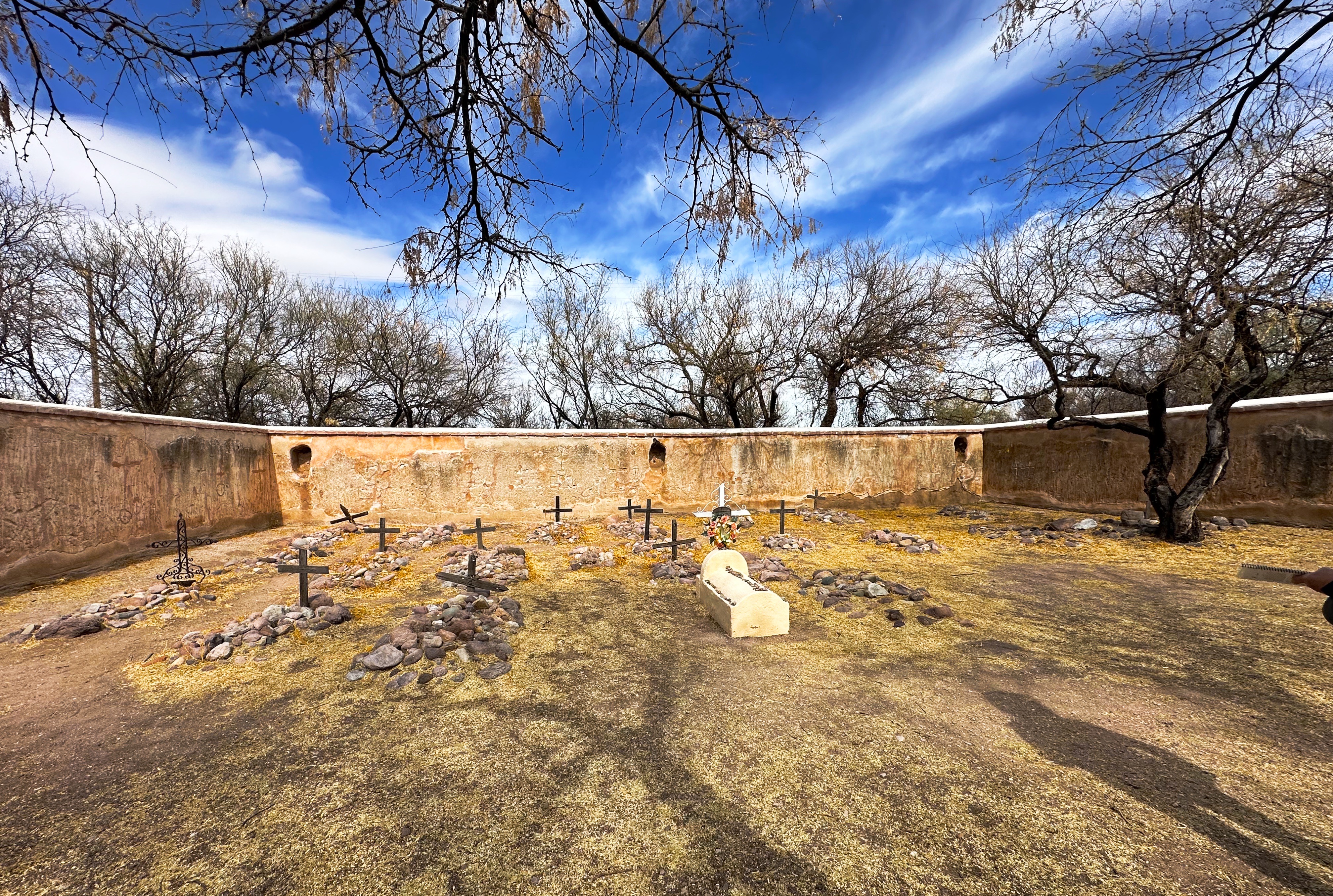
While the mission church is the centerpiece of the mission architecturally, it is important to remember that the mission was a self-sufficient community with approximately 200 people living within the mission wallls.
Tumacacori Mission (Photo courtesy of NPS)
The photo above gives a sense of the mission with the church and the remains of storage buildings, cemetary, living quarters and kilns within the walls and fruit orchards outside.
The church that stands within the mission grounds today was commissioned by Franciscan missionaries who had replaced the Jesuits by Spanish authorities who believed they had become too powerful. The Franciscans wanted a much larger church. They began work on a grand design in 1800. In 1820 they dedicated the new church, although over the 20 years of construction the design was changed due budget constraints. The new church, while larger than the orignal, was smaller and less ornate than the original design. Nonetheless, a beautiful structure in our opinion.
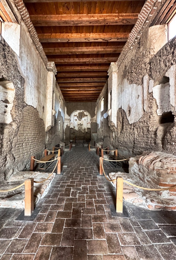
Church Nave
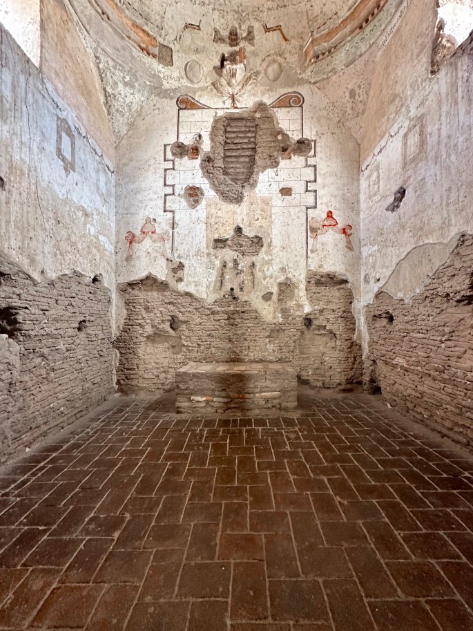
Church Sanctuary
Masses were conducted in Latin, but in recognition of the diversity of parishioners, readings and other parts of the mass were conducted in Spanish and O’odham. The O’odham, who were the victims signifcant physical violence from the Spanish settlers who were forcing their removal from their land, were not satisfied with this concession.
Finally, in 1751 the O’odham revolted under the leadership of Luis Oacpicagigua. The revolt was not long lived and the O’odham surrendered in early 1752. The O’odham cannily blamed the rebellion on the Jesuits (who were in much disfavor in Spain at that time) and the colonial governor promptly pardoned all of the O’odham who had participated in the rebellion.
The aftermath of the revolt, as well as the impact of Apache raids on the mission, led to its abandonment. Unfortunately, neglect and vandalism took its toll on the church. Fortunately, President Roosevelt declared the site a national monument in 1908 allowing for the preservation of the monument and no further vandalism or looting.
If you are a history buff, then we think that a two- to three-hour stop here will be worth your while. The self guided tour is well curated and the park staff were knowledgeable and helpful. There are also guided tours available several times a day.
Next is Tucson — comfy bed, hot showers, heated pool — the whole shebang!
We originally planned to visit the Black Canyon of the Gunnison (BCG), Rocky Mountain Nation Park (RMNP) and Great Sand Dunes National Park(GSDNP) while in Colorado. But as we monitored the conditions in Colorado during the trip (and spoke with some fellow travelers who had recently been in Colorado) it became apparent that we would not be able to access significant portions of our original itinerary due to this winter’s abundant snowfall in the Rockies.
So, after several excellent weeks touring western New Mexico, we departed Farmington, New Mexico to traverse Colorado in a northeasterly direction to visit GSDNP in southwestern Colorado, while forgoing the BCG and RMNP.
Durango – Four Corners – Route 550, Colorado
Of course, custom requires that our first meal after crossing a state line consist of burgers, fries and, if possible, a milkshake.Happily (and perhaps unhealthily) our tradition remains intact!
South Fork – Eastern Rockies – Route 160, Colorado
After refueling with burgers and diesel we continued our drive to the town of Del Norte. Prior to Euro-American settlement, this area was occupied by the Utes who migrated to the area from the south during the warmer months of the year. When this territory came under Mexican rule during the early 19th century, Hispanic settlers migrated north to take advantage of land grants offered by the Mexican government. Subsequently, this area was ceded to the United States by Mexico.
In 1859-1860 gold was discovered in the San Juan Mountains in what had been Ute territory for 500 years. Never mind, the Kit Carson Treaty (Ute Treaty of 1868) was negotiated in order to remove the Utes from the gold rich Central Rockies in exchange for land on the Western Slope of the Rockies. This treaty, as with most other treaties between the federal government and Native Americans, was eventually violated by the federal government and after the Utes rebelled they were driven out of Colorado entirely (Meeker Massacre).
Del Norte, Photos, Courtesy Denver Public Library
Today the small town of Del Norte (pop. 1600) is mainly an outdoor recreational hub with rafting on the adjacent Rio Grande and a plethora of rock climbing, mountain biking, hiking and camping options.
After a quick tour of the small downtown we headed west a short distance to find a camping spot in the Rio Grande National Forest. We found a great spot in a meadow which afforded us a panoramic view of Del Norte Peak.
Rio Grande National Forest
Del Norte Peak, Elevation 12,400′
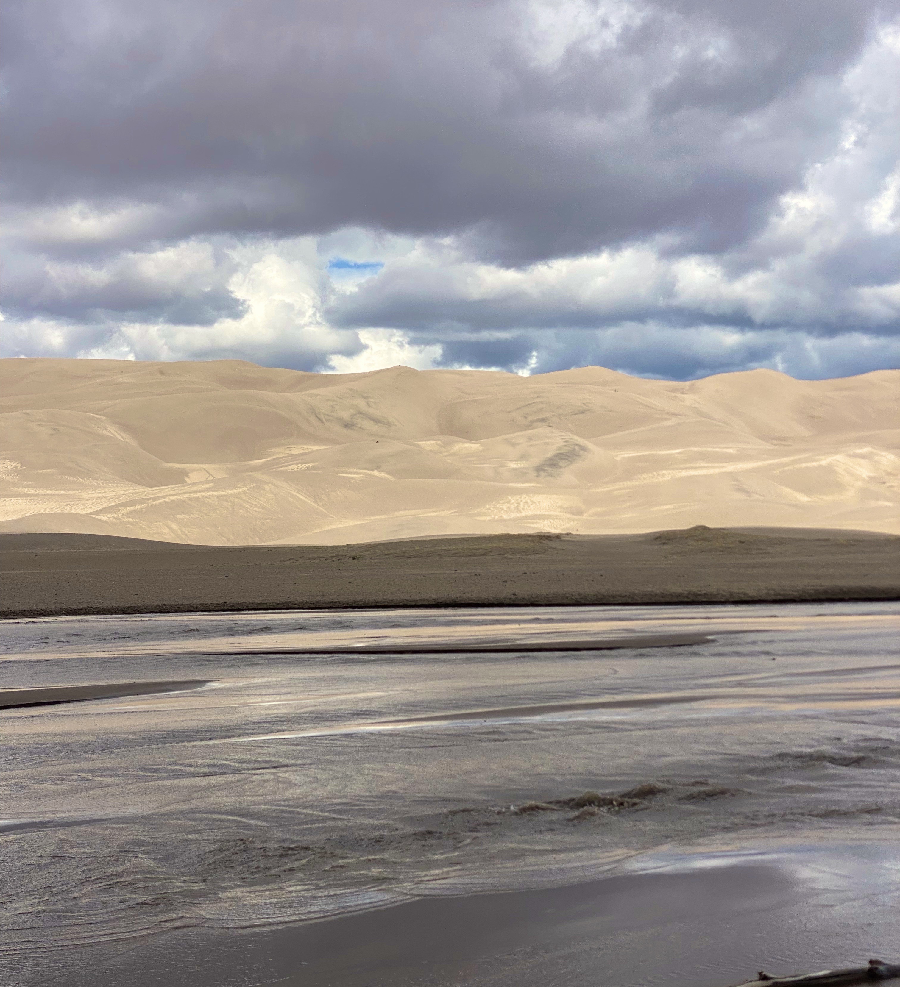
The following morning we set our course due west for the one hour drive to visit GSDNP. The park was declared a national monument in 1932 in order to keep the dunes from being damaged by gold mining or concrete manufacturing. The monument was elevated to full national park status in 2004.
Great Sand Dunes National Park – Sangre De Cristo Mountains
GSDNP presents a fascinating landscape with grasslands separated from a thirty square mile sand desert by Medano Creek. The dunes are tucked in against the base of the Sangre de Cristo Mountains–quite spectacular! The sand dunes at GSDNP are the tallest in North America. Some are as high as 700 feet (Star Dunes is the tallest at 750 feet).
The dunes here are constantly changing as winds from the mountains drives sand down onto the dunes. Weather and erosion form the sand into distinctly identified and ever changing shaped dunes – parabolic, transverse and barchan – as examples.
Unfortunately, our opportunity to explore the dunes was limited due to an approaching lightning storm. One of the park rangers was kind enough to point out the obvious – not smart to be standing on top of a 600 foot dune in the middle of a lightening storm!
Medano Creek
In addition to the fantastic scenery, we were looking forward to driving the Medano Pass Primitive Road. The road is a sandy and rugged 22 mile 4WD road which runs from the base of the dunes up and over the Medano Pass (10,040 feet). The road was not fully open due to the conditions at higher elevation. The road crosses the the creek nine times and the water flow was still too deep due to this years snowfall.We have included a short video clip (below) from our drive on the road to provide a feel for the road and scenery.
Medano Pass Primitive Road
The NPS video below by is about the Navajo (Dine’) People, their four sacred mountains and their relationship to the land that now constitutes GSDNP.
We enjoyed our brief visit at GSDNP and we look forward to returning on a future trip to explore the dunes in depth, boondock up on the mountain and traverse the entire Medano Pass Primitive Pass Road.
Walsenberg, Colorado
On departing GSDNP, we decided to push straight on through to Colorado Springs. Our previous trips to Colorado Springs were business related and we stayed at the world famous Broadmoor. We would not be staying at the Broadmoor on this self funded visit!
The Broadmoor
Colorado Springs sits at just over 6000′ above sea level at the eastern base of the Rocky Mountains. Snow covered Pikes Peak (14,100′) looms over the city to the west creating a stunning backdrop. We did not travel up to the peak on this trip as we had taken the nine mile cog railroad trip on a previous visit (we definitely recommend riding the railroad to the top if the weather is clear -which it usually is in this part of Colorado). The train ride is fun and the views are phenomenal.
Pikes Peak
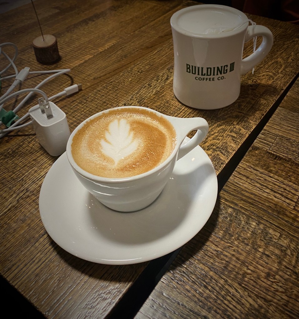
From our pre-trip research we knew that Colorado Springs held promise for specialty coffee and a vibrant street street art scene. Our first stop was Building III Coffee Bar and Roastery – B3 is located, along with a number of other occupants, in a former public school building now known as Lincoln Center – great to see the building repurposed. Excellent coffee, great breakfast sandwiches and uber friendly staff! Extremely popular – it can be hard to get a seat even with the large amount of seating capacity – but it is worth the wait. https://www.building3coffee.com/
Building Three Coffee
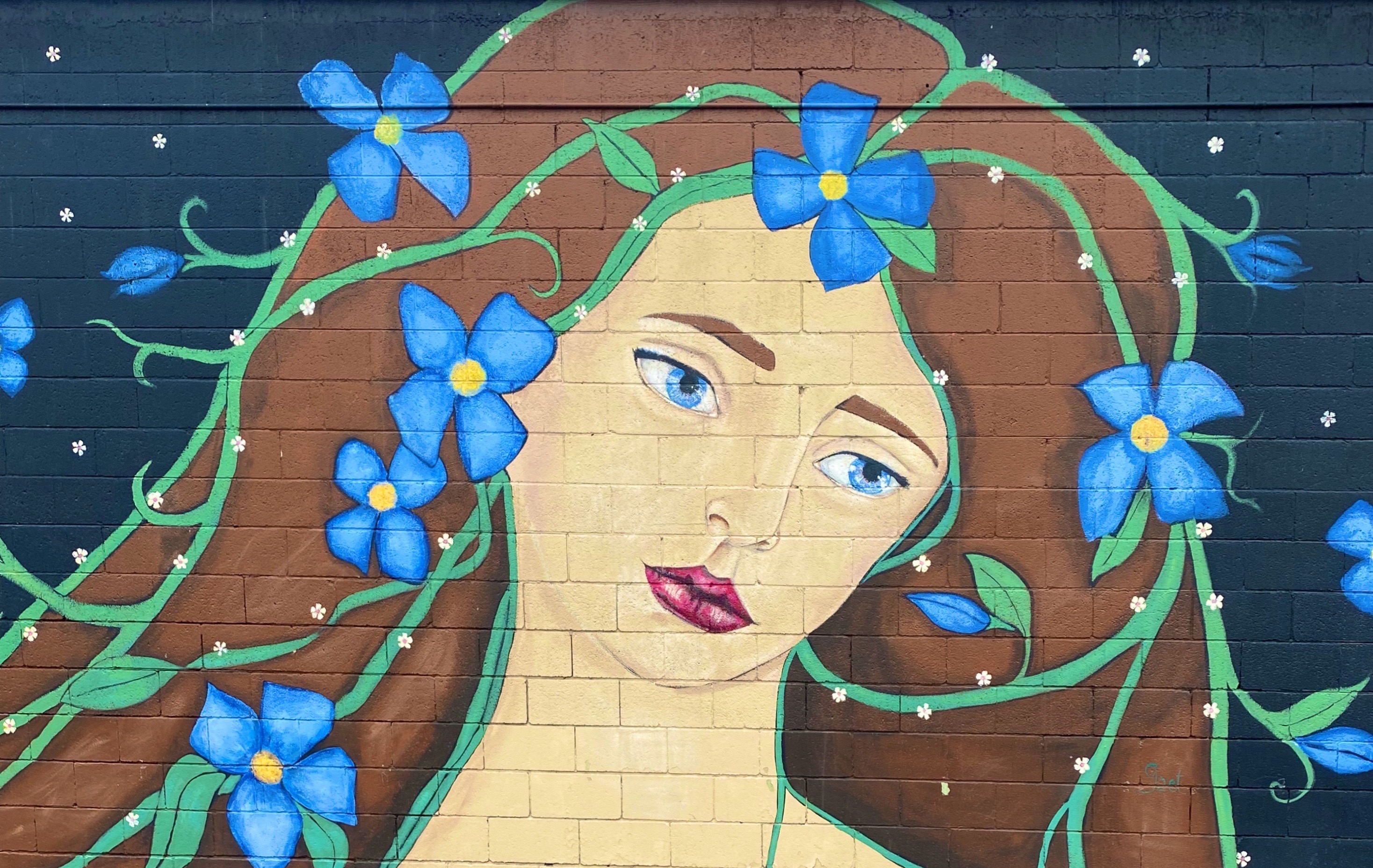
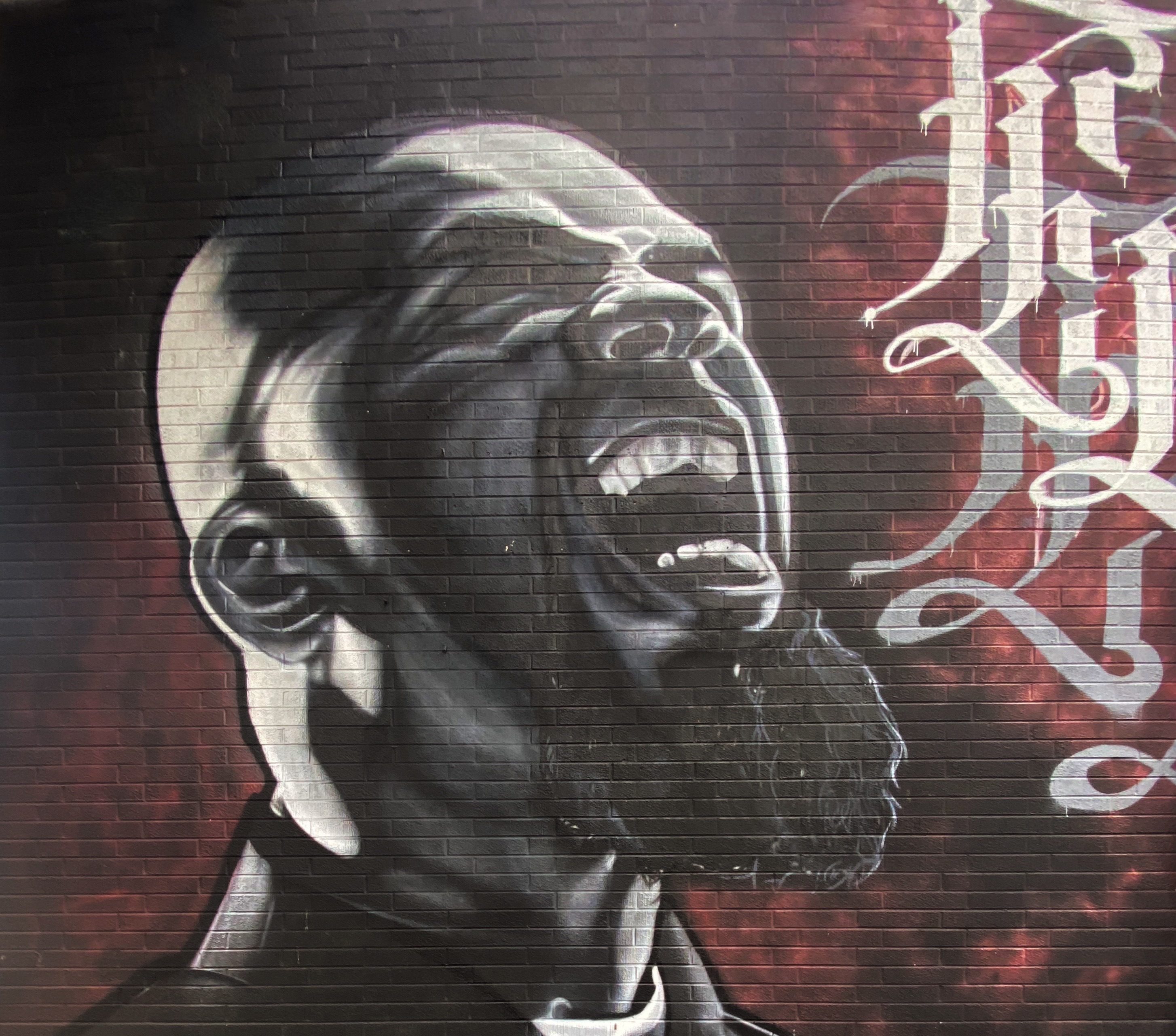
Well fortified with caffeine, we ventured out into the uncharacteristically gray, chilly day in search of street art. We decided to start our pic hunting session in the Knob Hill neighborhood, located a short distance northeast of downtown. We were pretty certain the neighborhood would be street art rich based on reading about the Knob Hill Urban Arts District. The District is a “nonprofit organization dedicated to putting art up on every damn wall we can get our hands on.” Love it!
The photos below are a small sample of the street murals we found in the Knob Hill neighborhood. This group is not kidding about putting art on every wall. We found art in every alley and available nook and cranny. So good! To see more of the street art we photographed during OTR 9.0 in Colorado Springs and other cities see our WordPress blog @streetartfromtheroad: part two.
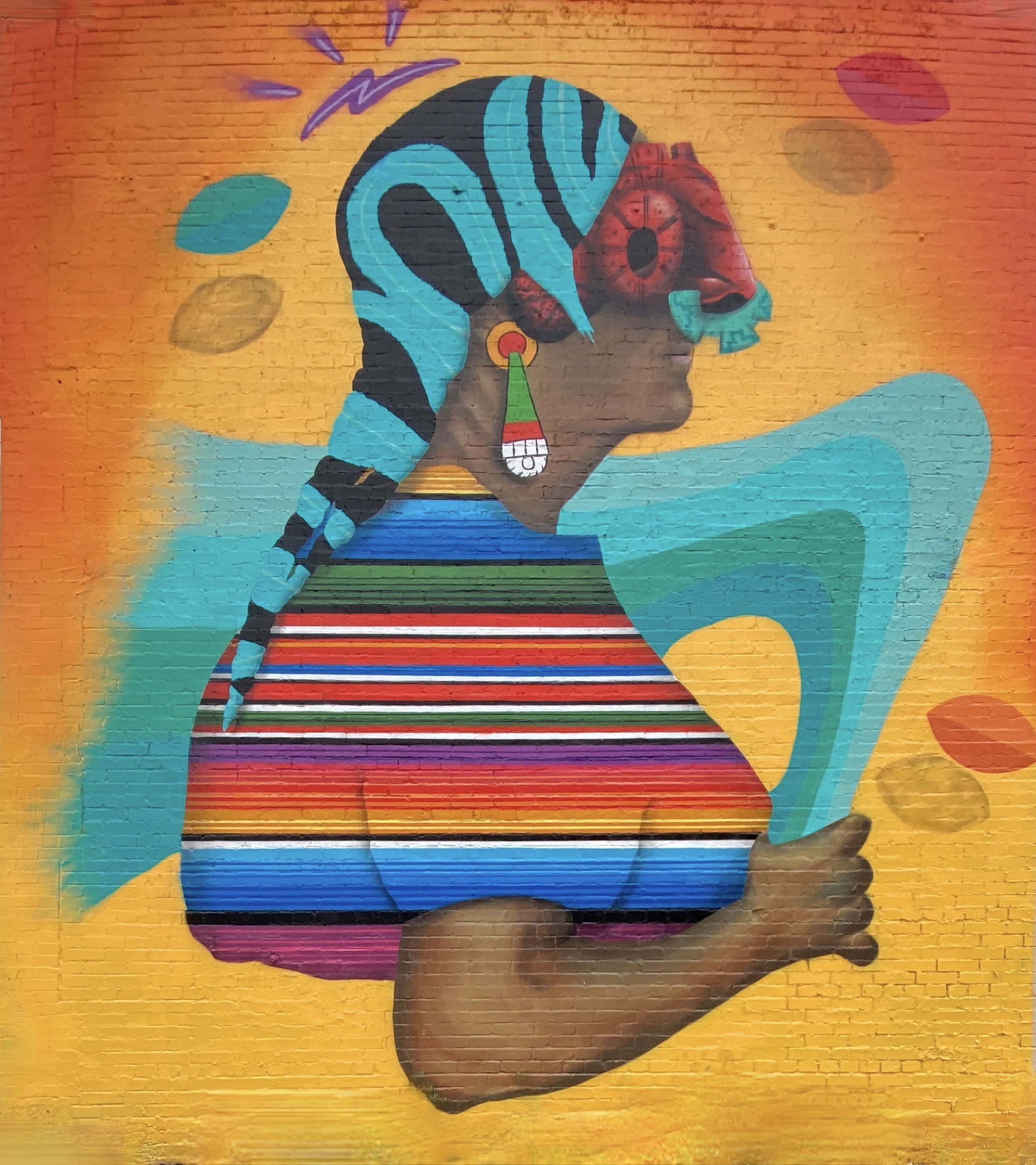
There are also a number of large scale murals in downtown. The photos below are a few of our favorites we captured while strolling through downtown.
With the cloudy, drizzly weather persisting into our second day in Colorado Springs (coincidently nicknamed “Little London” although not for the weather – there was a large British population in the 1870s) we decided to visit the Fine Arts Center (FAC) at Colorado College. The FAC is located in the Old North End neighborhood – an area of stately late 19th and early 20th century homes and tree lined boulevards.
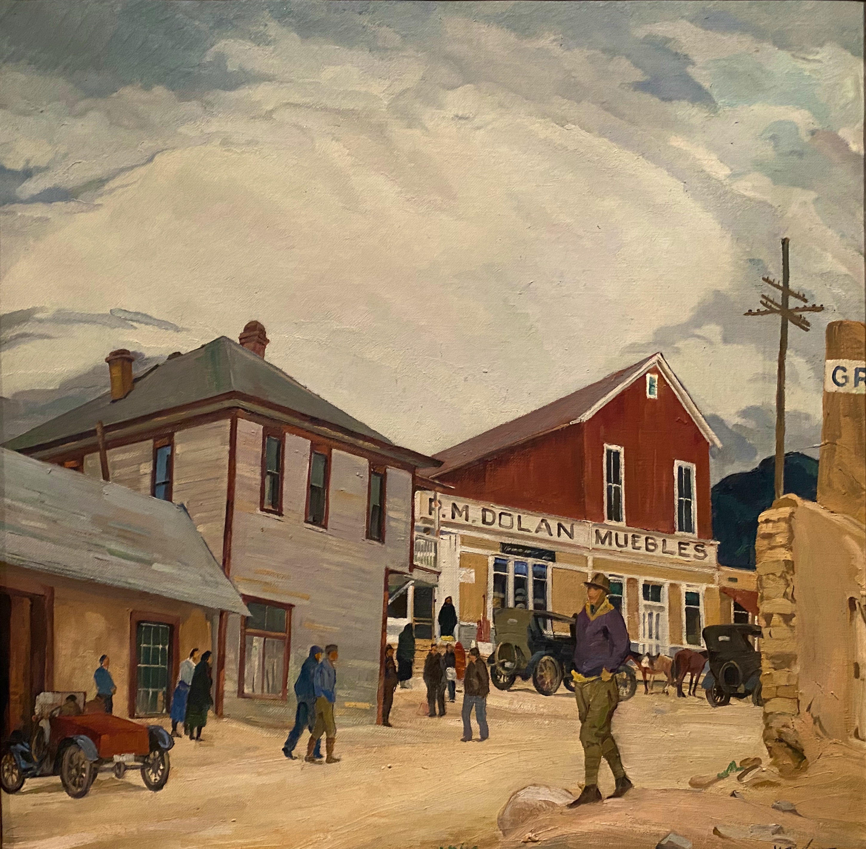
The Fine Arts Center is home to the art museum as well as a theater school and performing arts venue. The museum was opened in 1936 as an outgrowth of the Broadmoor Art Academy. The Colorado Springs area had become a hub for art on a scale commensurate with the more well known artist colonies in Taos and Santa Fe.
Charles R. Bunnell (1897-1968) March Snow, 1940, Oil on canvas
Victor Higgins (1884-1949) Santa Fe Hills, Date Unknown, Oil on canvas
As with many museums of this size, the collection is regionally (although not exclusively) focused. We have included photos of several paintings which reflect the southwestern focus (and which we really liked). The museum is definitely worth a couple of hour visit when you visit “Little London”.
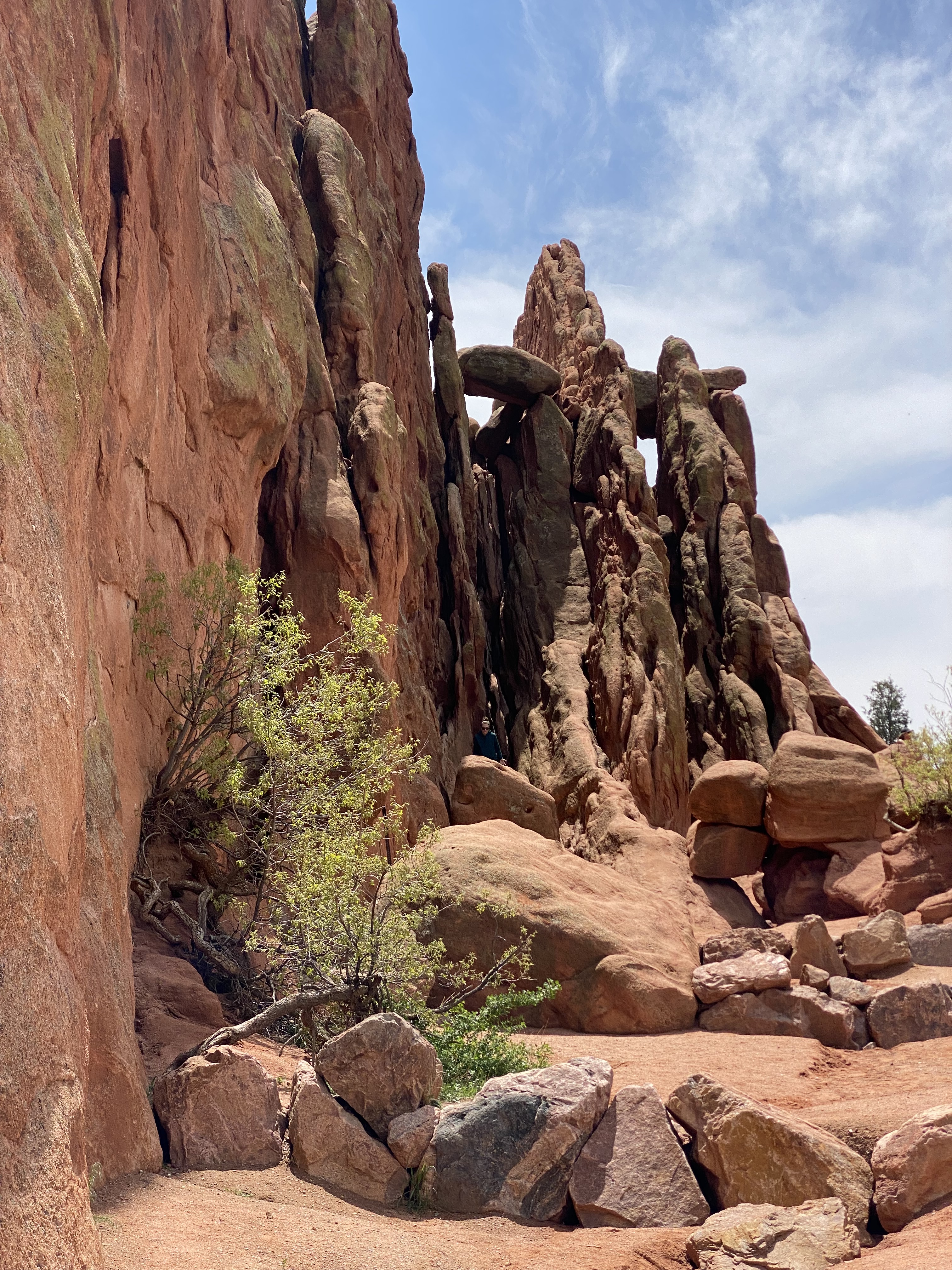
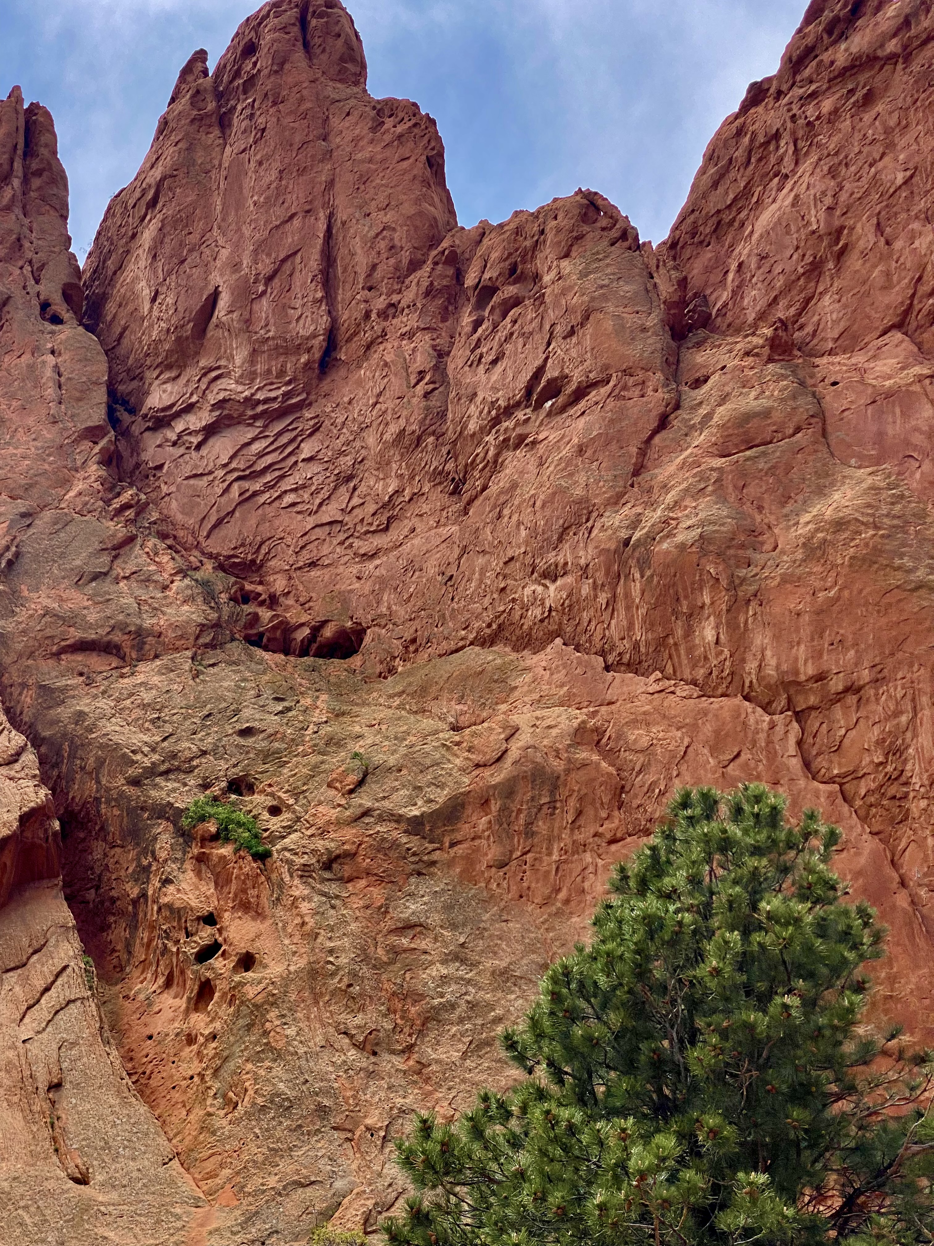
On our final day in Colorado Springs we ventured out to Red Rock Canyon. We had held off visiting earlier in our stay due to some cloudy weather. Unfortunately, it appeared that everyone else in Colorado Springs had done the same (it was also the weekend) and this popular open space was quite crowded.
Still, we managed to find some quiet spaces and uncluttered views as we walked between and around the rock formations. Additionally, there are a number of moderate and longer trails for the more adventurous which usually provide solitude regardless of when you visit.Do visit when the sky is clear in order to see Pikes Peak rising above the red rock formations.
Interestingly, Red Rock Canyon is a city park consisting of 1474 acres of land. The park was pieced together with the multiple purchases of parcels over a period of years during the 1920s and 1930s by private citizens. It was acquired by the city in 2003. What makes the park’s history all the more remarkable is that many of the parcels were formerly quarries, gravel pits and industrial sites which have been reclaimed. There is little evidence of the past use of the space – without reading about the history you would most likely not think that to be the case.
After our walkabout at Red Rock, we popped over to the nearby Old Colorado City neighborhood. The neighborhood was at one time a separate town that prospered as a coal mining town and in the late 19th century as a gold refining location after the discovery of gold nearby. Typical of so many western mining hubs, the boom ultimately became the bust. The final straw was the prohibition of liquor sales in 1914. In 1917, the town was annexed by Colorado Springs.
The brothels and saloons that once lined Colorado Avenue have long since been replaced by art galleries, restaurants, wine bars, coffee shops and clothing stores. After a bit of browsing in several of the art galleries and book shops we took lunch at La Baguette Cafe and Bakery. Yum – the best bread!http://labaguette-co.com/
We were uncertain what lay ahead in regard to specialty coffee as we were about to venture into more rural territory; so we stopped in downtown for coffee, tea and breakfast at Loyal Coffee. First rate in all regards!https://loyalcoffee.co/
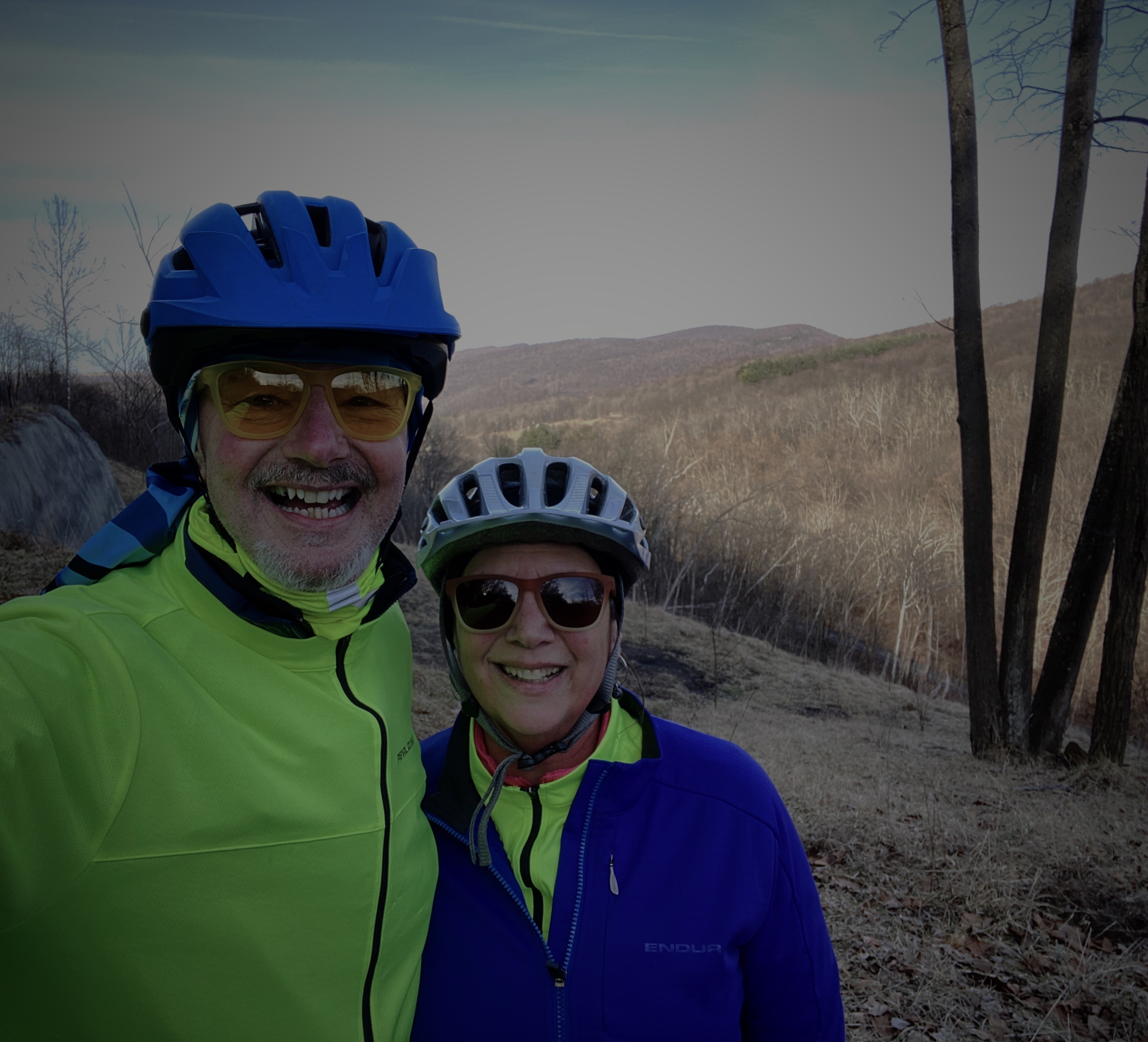
The photo below is of our unanimous choice for best vehicle OTR 9.0!
From Colorado Springs we traveled north – camping near Sterling, Colorado for our last night in the state. In future posts we will chronicle our trek across the midwestern plains en route to Connecticut.
Chaco Canyon is a place we have wanted to visit for some time. During our 2020 roadtrip we were unable to get there as a winter storm rendered the roads in impassable. There are two unpaved roads into the park – both are rough, heavily washboarded affairs. From the north, County 7950 is 13 miles from pavement end to CC while Route 57 is 21 miles coming in from the south.
In order to optimize our time at the park we decided to take advantage of the camping opportunity at the Horse Thief Camp. The ranch property is on County 7950 and is the closest option outside the park.
HORSE THIEF RANCH
The ranch is owned by Wayne and Yolanda Beyale, and has been owned by Wayne’s family for many generations. The ranch sits amongst a patchwork of properties owned by the Navajo Nation and various federal agencies. The area that Wayne has set aside for camping provides panoramic views and and very dark skies (we also saw several wild horses).
Wayne is Navajo and graciously shared the history of his family and the ranch. He and his seven siblings spent summers living in a single hogan in the spot where we camped. The outdoor oven they used to bake and cook still stands intact. Two of the photos above show the circle corral where Wayne tamed wild horses that they captured (hence Horse Thief Camp).
Chaco Canyon
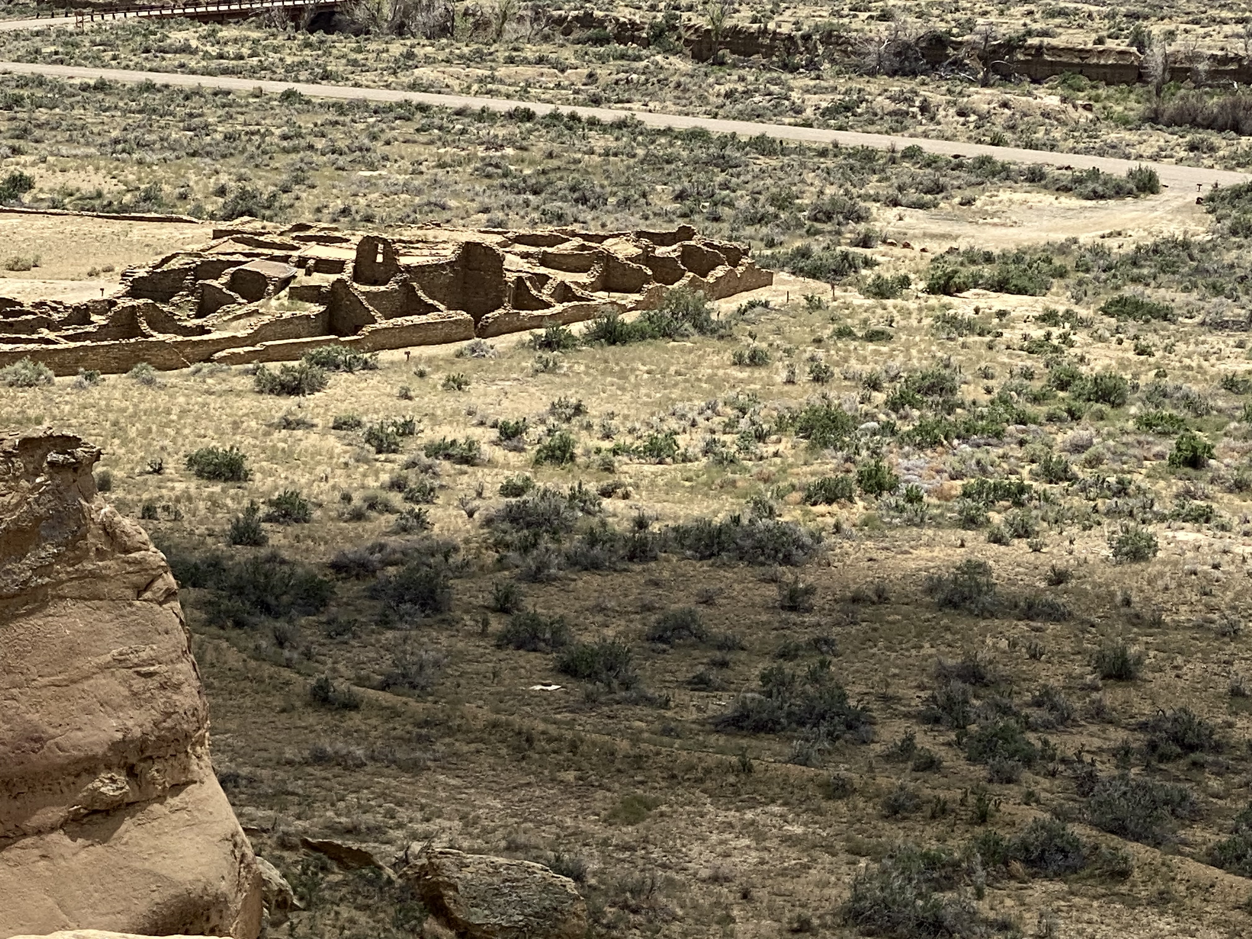
Chaco Canyon was a major center of Ancestral Puebloan Peoples between 900AD and 1150AD. The scale of the great houses and ceromonial sites here is larger than anything else to be found in the Southwestern United States. Within the canyon there are 15 major complexes. The largest of the structures — Bonito Pueblo — contains over 500 rooms!
Chaco Canyon is located in Northwestern New Mexico near the Four Corners. It is very remote — the first record of European people visiting the canyon is not until 1823 when New Mexican governor José Antonio Vizcarra led an expedition through the canyon. At that time this area was still under Mexican rule.
The Chaco Canyon National Monument was formally established on 11 March 1907 by President Theodore Roosevelt. This act preserved the canyon and the structures from any future development or extractive industries. The park was officially designated a national park in 1980 and an additional 12,500 acres was added to bring the park to the current total of 34,000 acres. There are over 4000 archeological sites within the 34,000 acres.
The structures at Chaco provide evidence of a very advanced civilization. The architecture, engineering and construction techniques are quite sophisticated. A number of the Great Houses were five stories tall. The structures were anchored by deep foundations which demonstrate the planning which took place prior to construction. The majority of the Great Houses were built on the north side of the canyon to optimize heat and light from the sun.
There is also evidence that the Chacoans built dams on side canyons to funnel water to the Great Houses and to the fields in order to irrigate crops. Additionally, the remnants of a road system leading away from the canyon in all four directions is still discernable.
Of course, the final question is why this great center was abandoned. And as is usually the case — no one really knows. There are a number of theories ranging from an extended drought, deforestation rendering the canyon unsustainable and political power struggles causing people to flee.
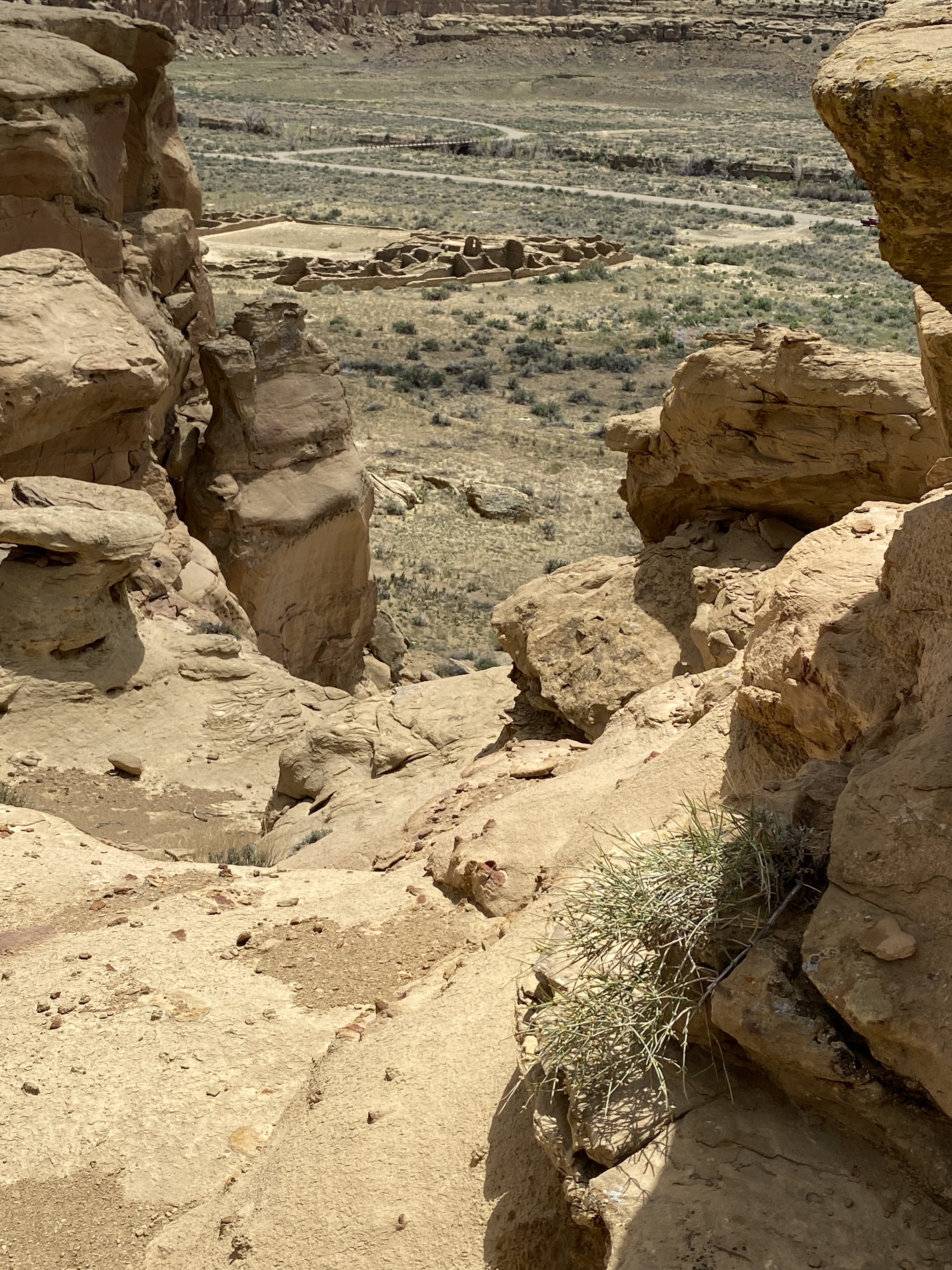
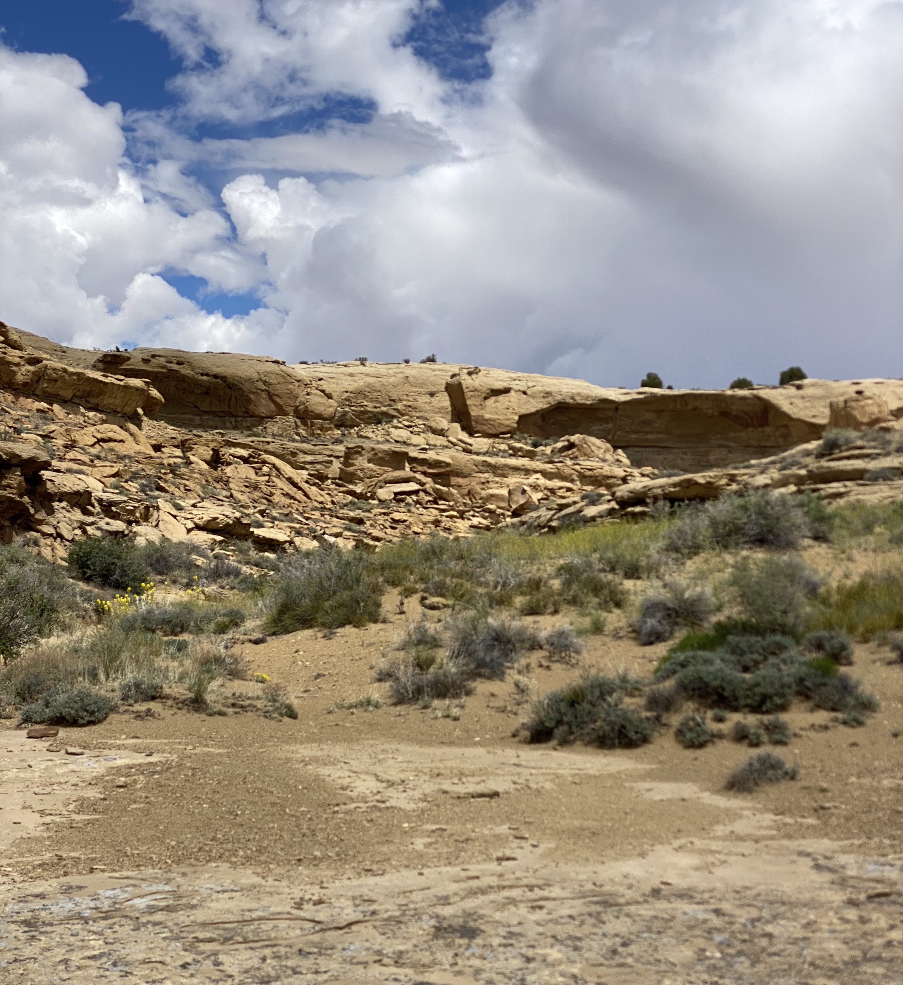
Hiking at chaco
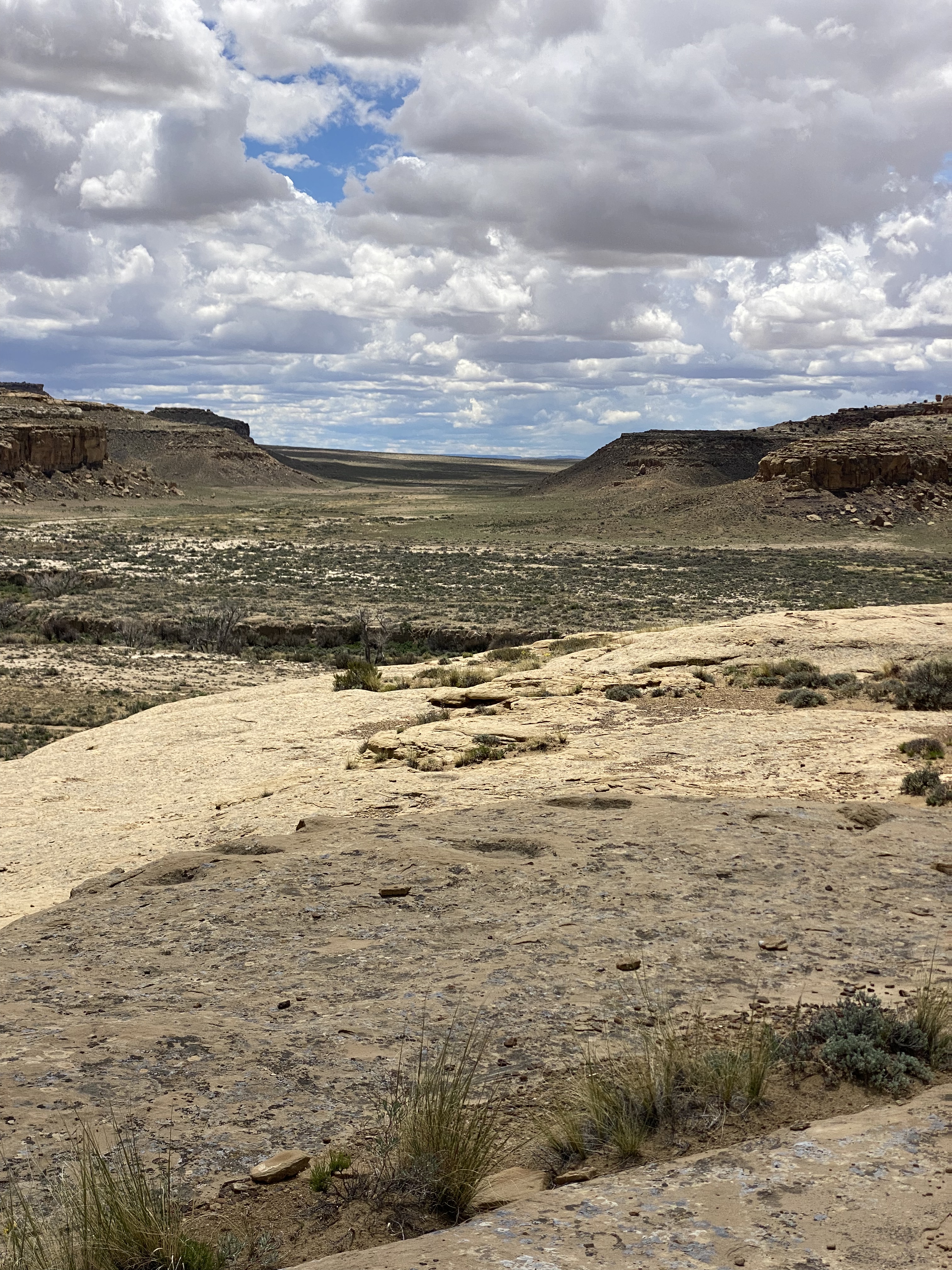
One of the great features at Chaco is the ability to tour the inside of the pueblos and explore the connected rooms, but the canyon rim above also provides a terrific overhead view. So we made the climb up on the Pueblo Alto Trail to see views of the pueblos and the canyon from above.
Pictured are three items we observed along the canyon rim. Starting from the left: a pecked basin — circle carved into the stone by the Chacoans as repositories for offerings; clam shells and shrimp burrows respectively. The clam shells and shrimp burrows testify to the canyon having been an inland sea during the Cretaceous Period (75–80 million years ago).
DEPARTING CHACO CANYON: ROUTE 57
After a full day of touring the pueblos and hiking along the rim of the canyon we set out for the Bisti/Da Nae Zin Wilderness. In orded to reach the Bisti we needed to travel south out of the park on the notorius Route 57. The 57 is a 21 mile stretch of rutted and washboarded dirt that runs through desolate ranch land.
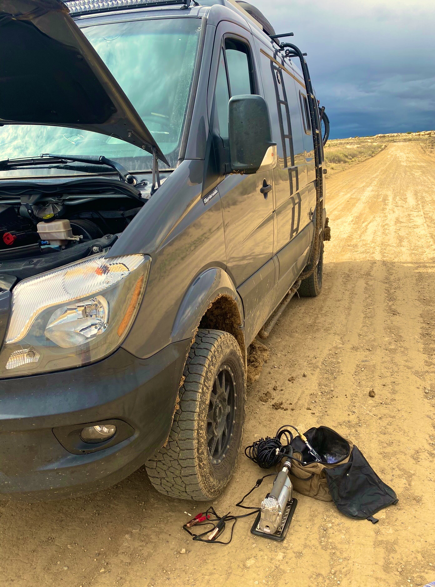
Route 57 is considered impassable when wet. When we left the park there were storms to our east — unfortunately, as we headed south a storm crossed our path and we found ourselves on the muddy and slippery version of the 57 (see video below).
Route 57
Fortunately, we were able to make it through — only sliding our back end into a ditch once — but we decided not to venture into the Bisti Wliderness as the road conditions there are as treacherous as the 57. In the photos below, we are airing up for our return to paved roads.
We highly recommend a visit to Chaco if you have the appropriate vehicle to handle the conditions and the patience to travel at very slow speeds for an extended period of time.Also, if you are interested in gaining further knowledge about this remarkable civilization we recommend Chaco Culture: A Complete Guide by Gian Mercurio and Maxymilian L. Peschel.
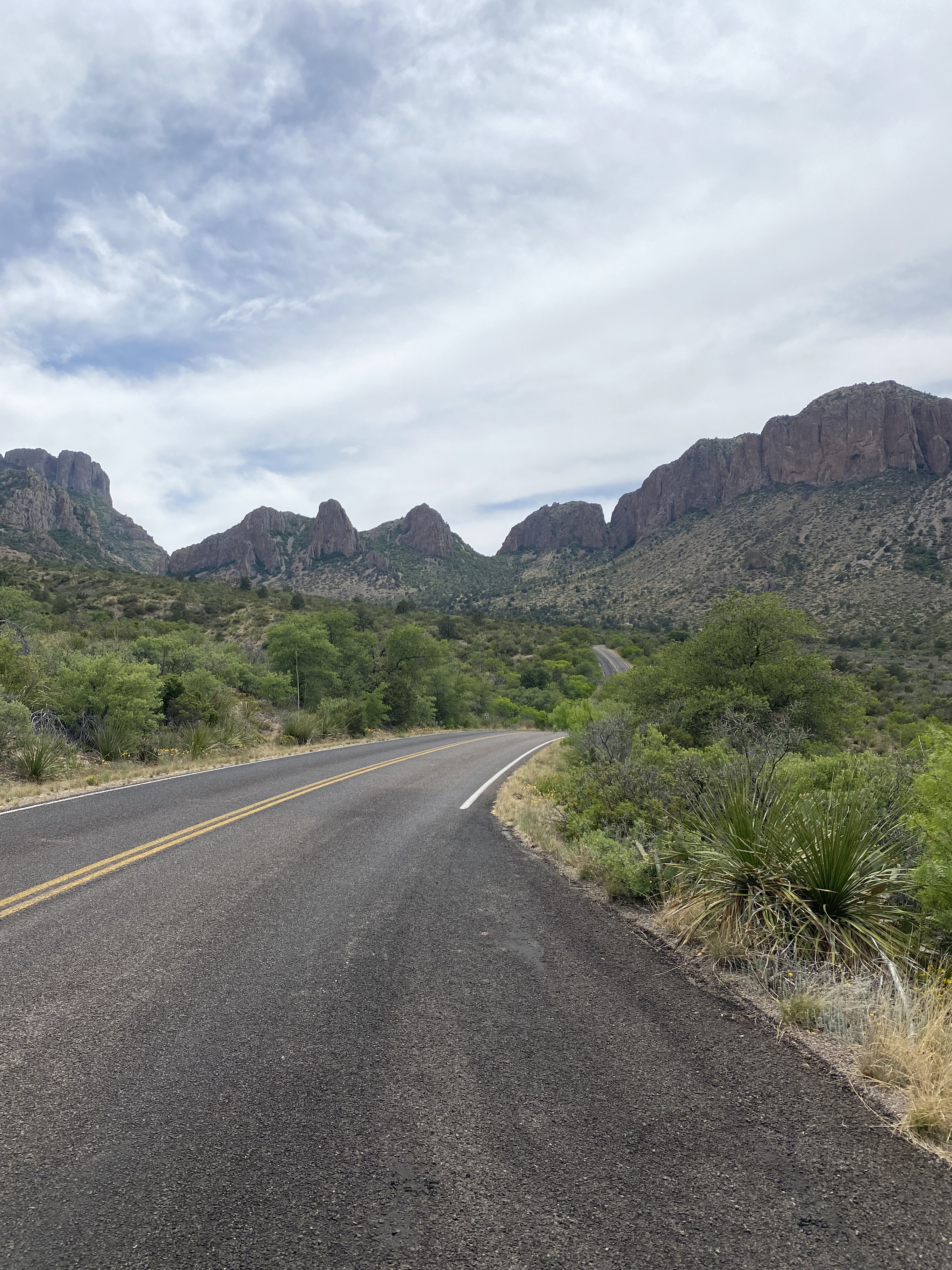
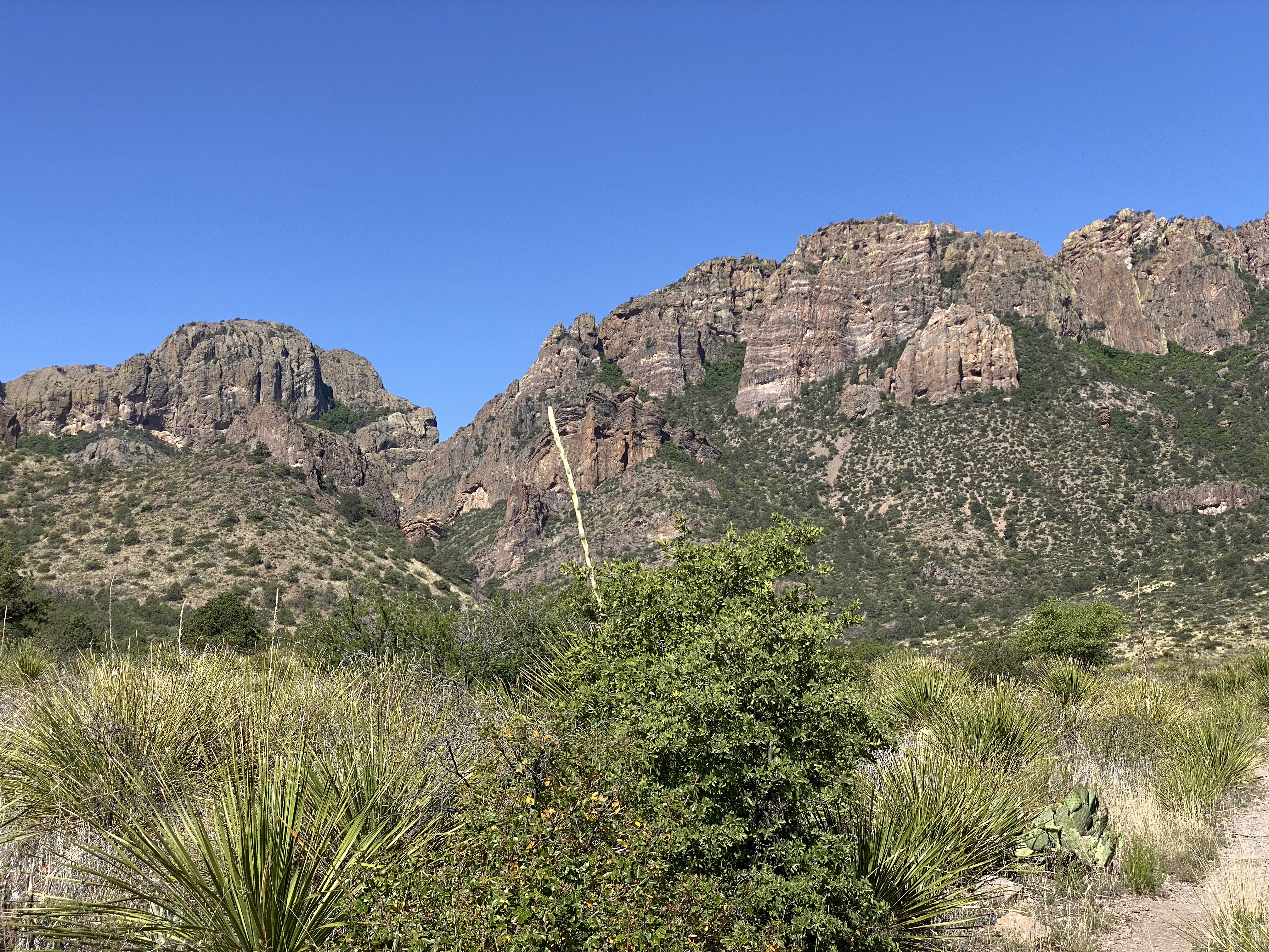
In March of 2020 OTR made our first visit toBBNP. Unfortunately, our timing was bad — the Covid Pandemic had finally made its way to Texas and the park closed the gates. We needed to leave the park after just two days.
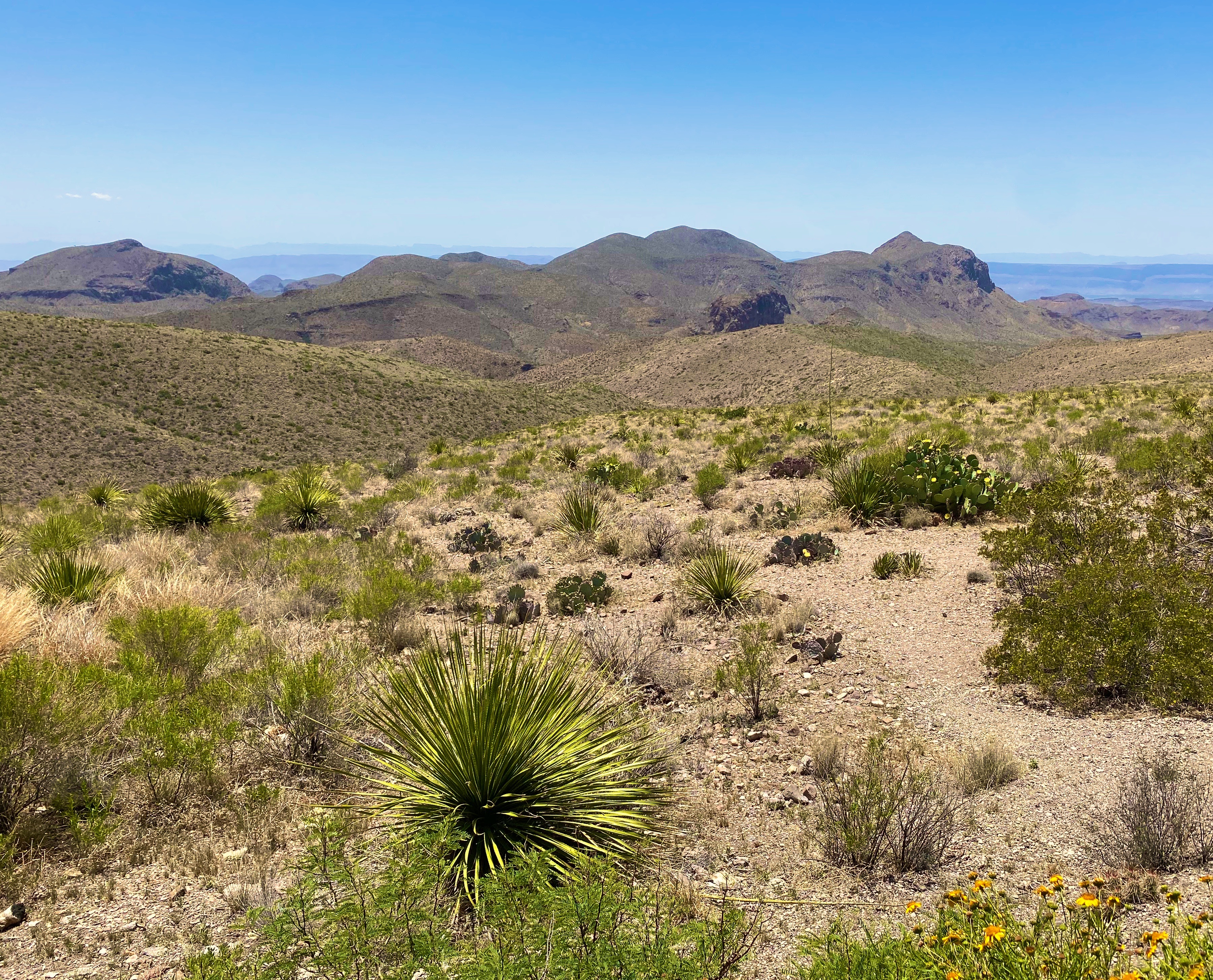
BBNP was created in 1944 by Congressional Act and signed by then President Franklin D. Roosevelt. The deed for the park covered 700,000 acres of Chihuahuan Desert along the Rio Grande. Today, the park encompasses a little over 800,000 acres.
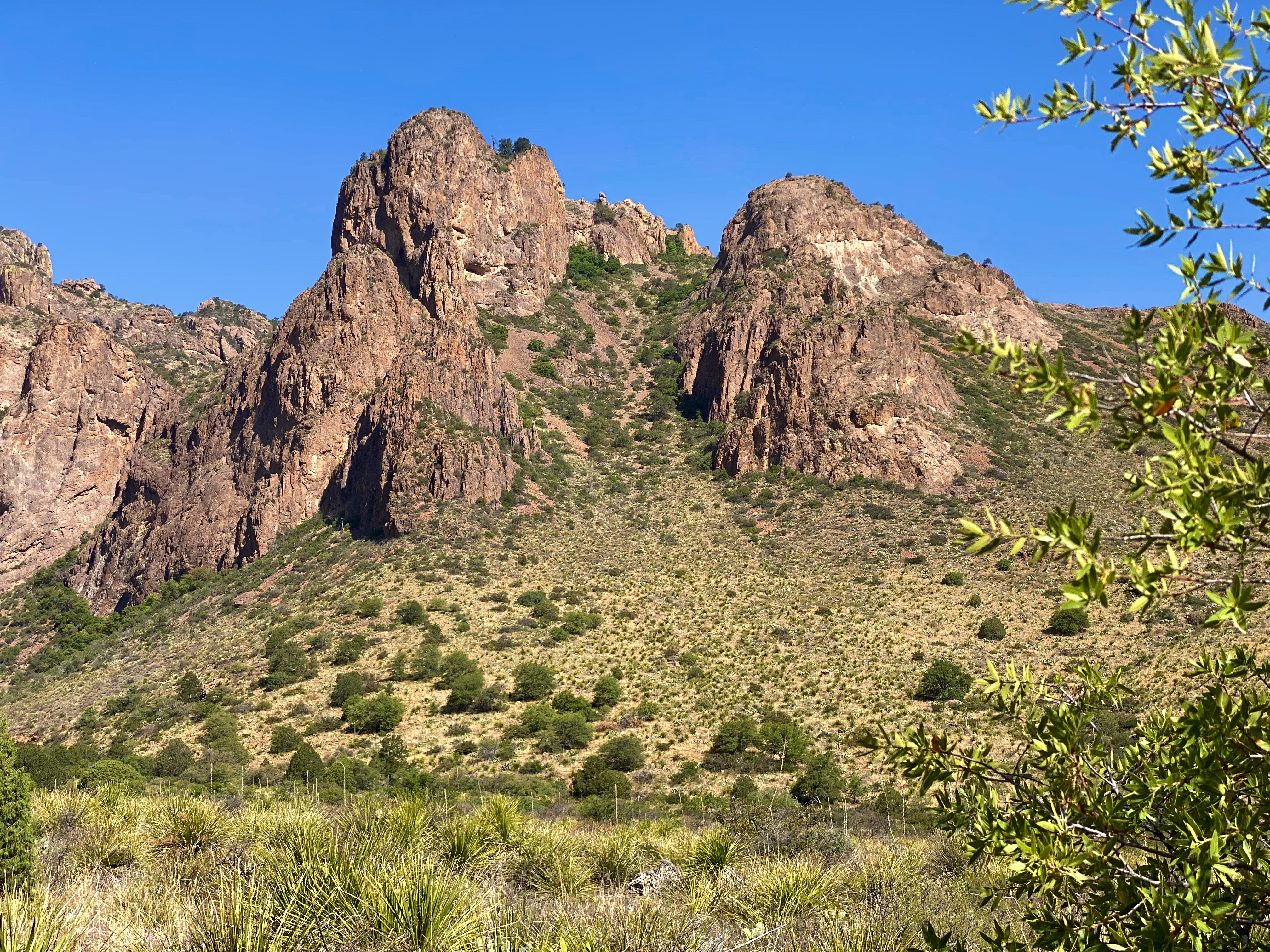
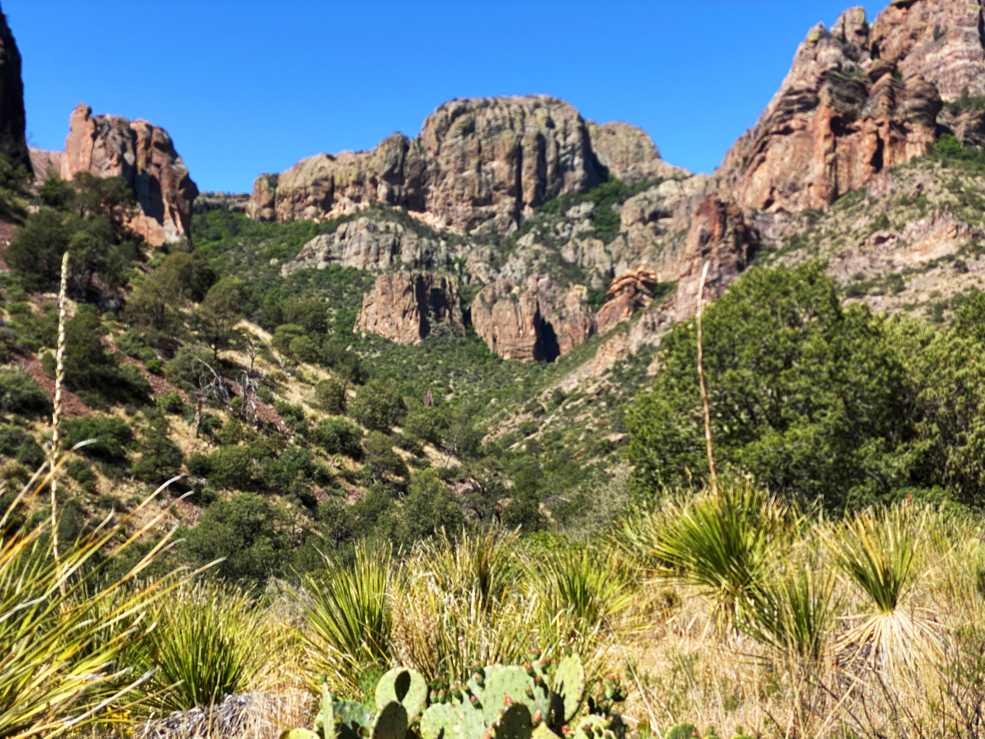
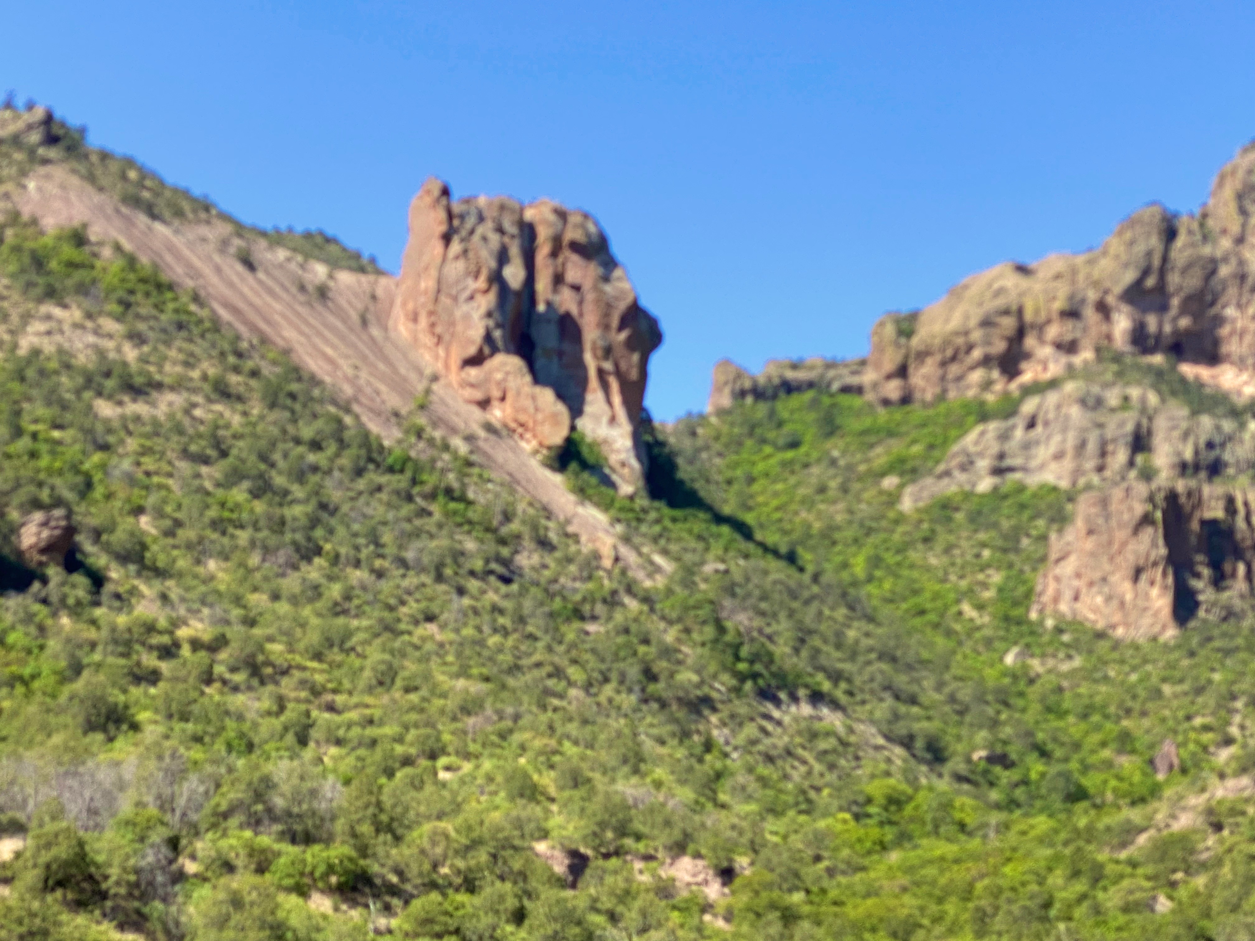
The park is one of the least visited National Parks, although it had its highest visitation in 2021. We can only surmise why this would be when this park offers so much stunning beauty – the Chiso Massive, desert, canyons and dark sky. There are probably several reasons – its remote location in Far West Texas abutting the Mexican border, the heat for much of the year and a lot of terrain accessible only by very rough roads.
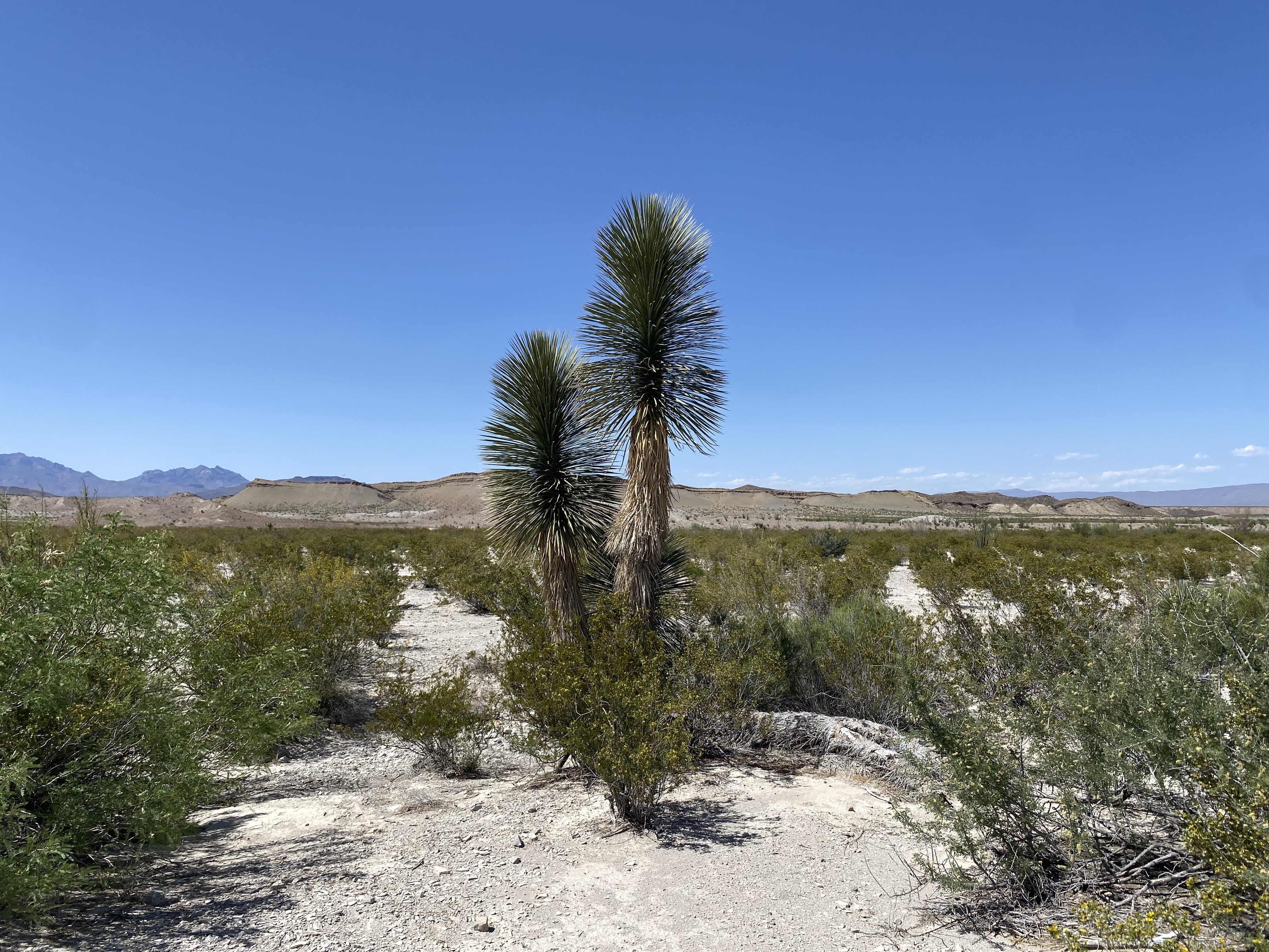
Dagger Flats, BBNP
Day one
Because we were entering the park from the north we decided to immediately drive the backcountry loop out to see the Dagger Yuca Forest. Fortunately, our timing was perfect— the Yucca were blooming.
From Dagger Flats we needed to secure our permits for camping in the backcountry. Backcountry camping in BBNP requires traversing rough 4WD drive roads and means that you will be on your own and in some cases in a very remote area of the park.
For our first night of camping we selected an area deep in the southeastern area of the park which is the desert floor (1700 feet above sea level). We followed the River Road East to its terminus a few miles north of the Rio Grande; the 25 mile journey took about 2.5 hours (slow going but exciting).
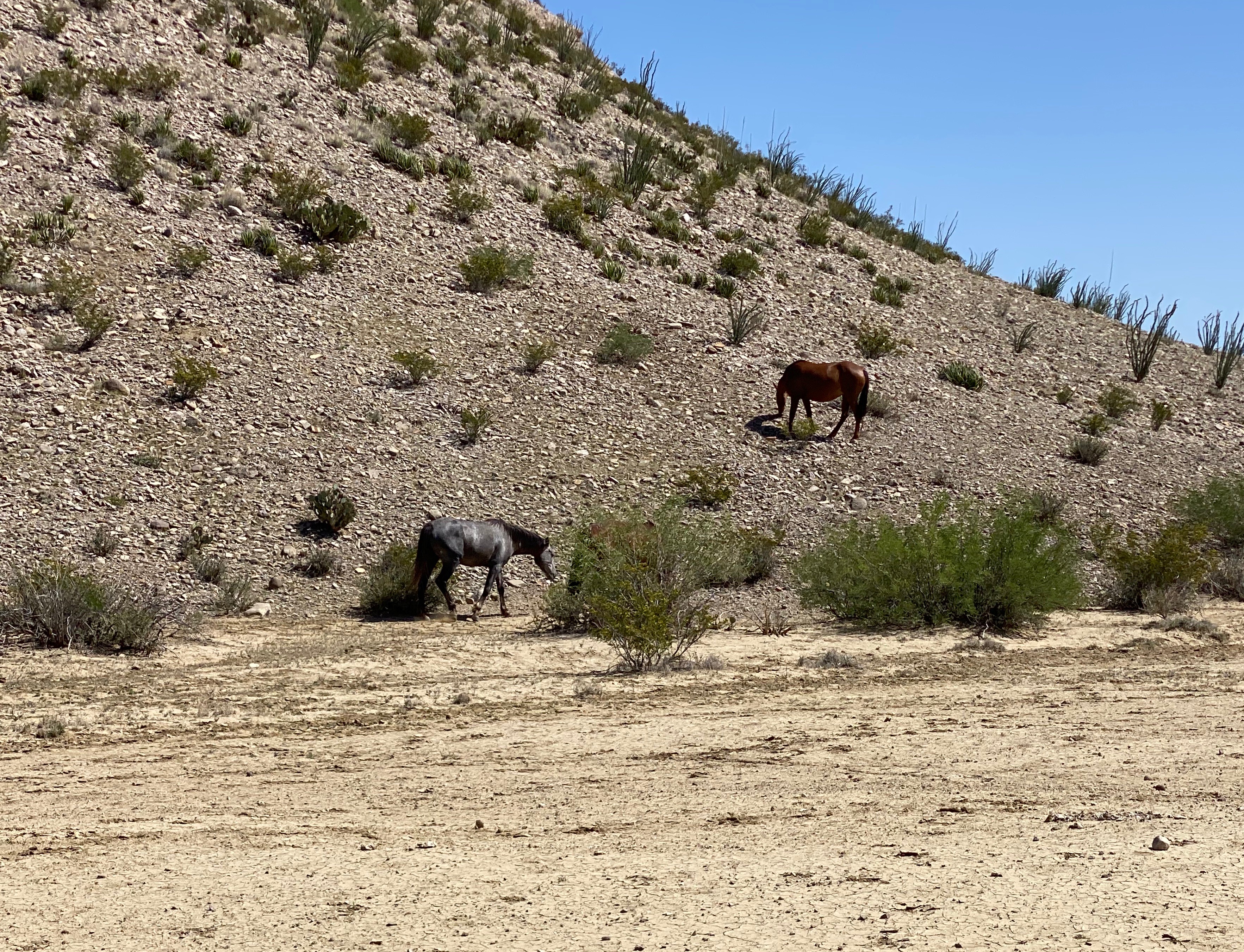
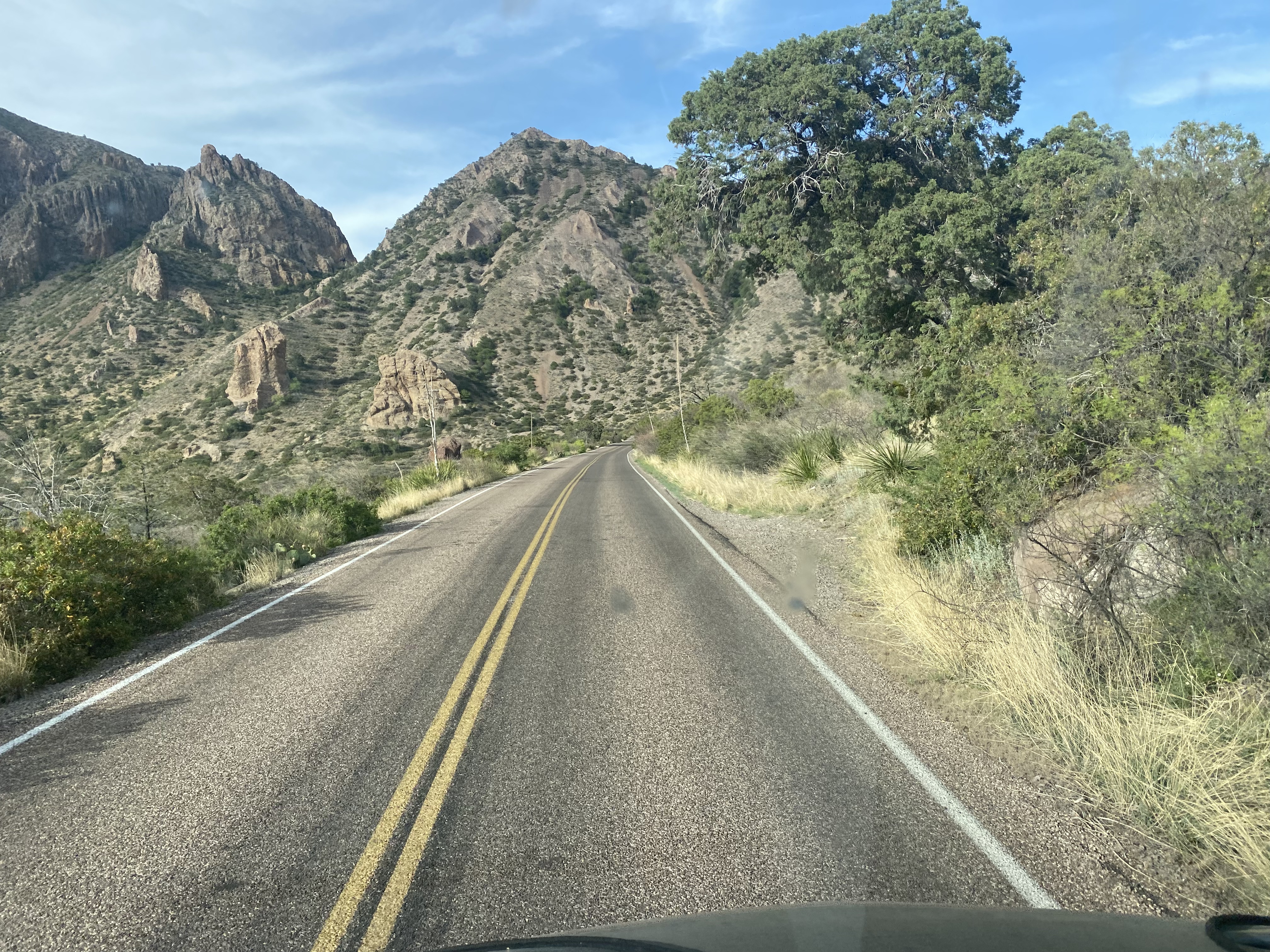
Our journey took us past an abandoned (but still toxic) mercury mine and provided phenomenal views of the Chisos Mouontains. Additionally, we encountered a herd of horses that we thought were feral but later learned are horses from Mexico that wandered across the border.
Day two
Our camping perch was a short distance from the Mariscal Mountains so we were able to get an early start hiking in the Mariscal Canyon and avoid the afternoon heat where the temperatures reach 95F this time of year.
We also learned that in addition to horses plenty of cattle from Mexico have found there way across the Rio Grande. When we later asked a ranger about the cattle he indicated that there are over 1000 head of cattle from Mexico in the park.
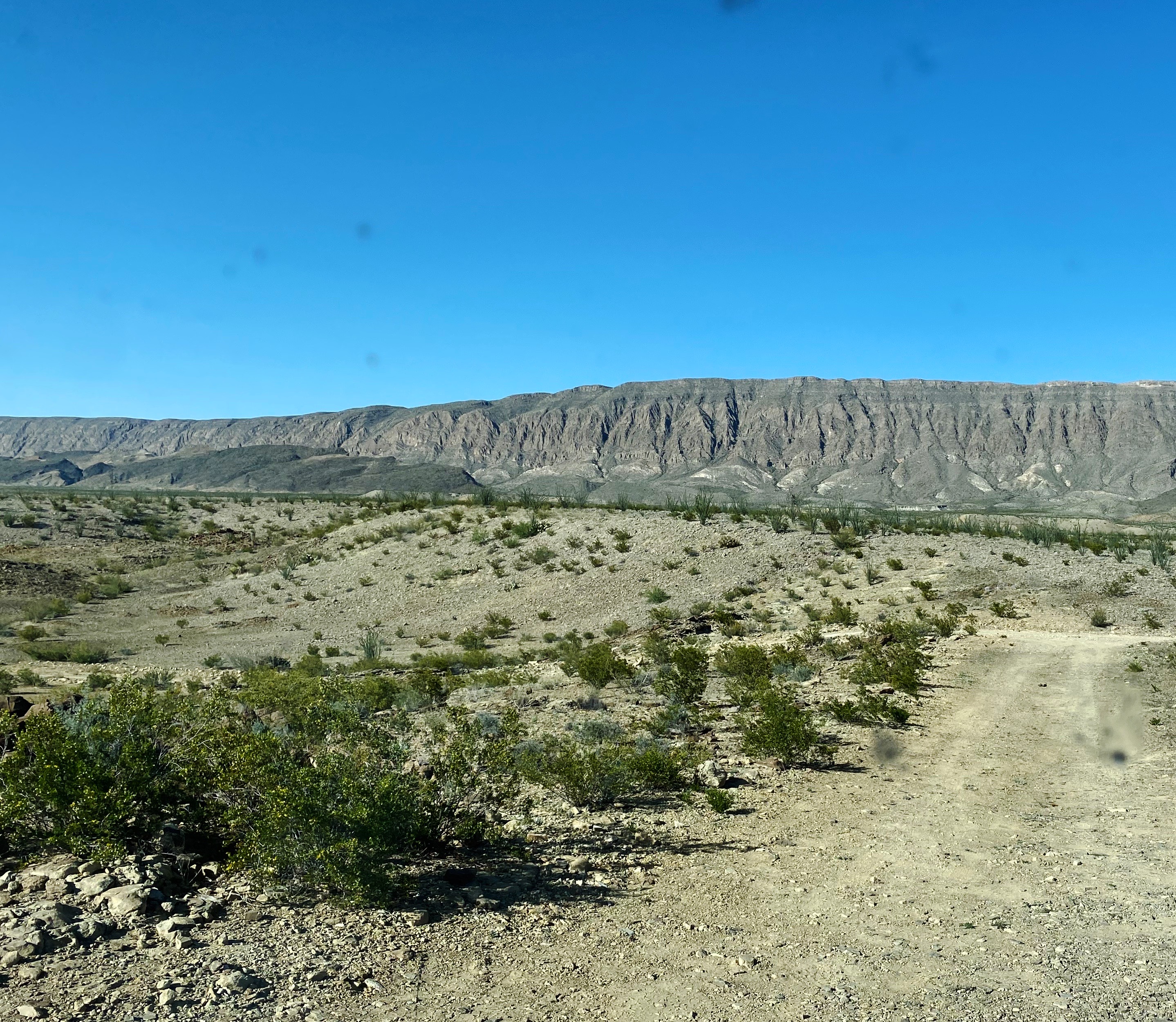
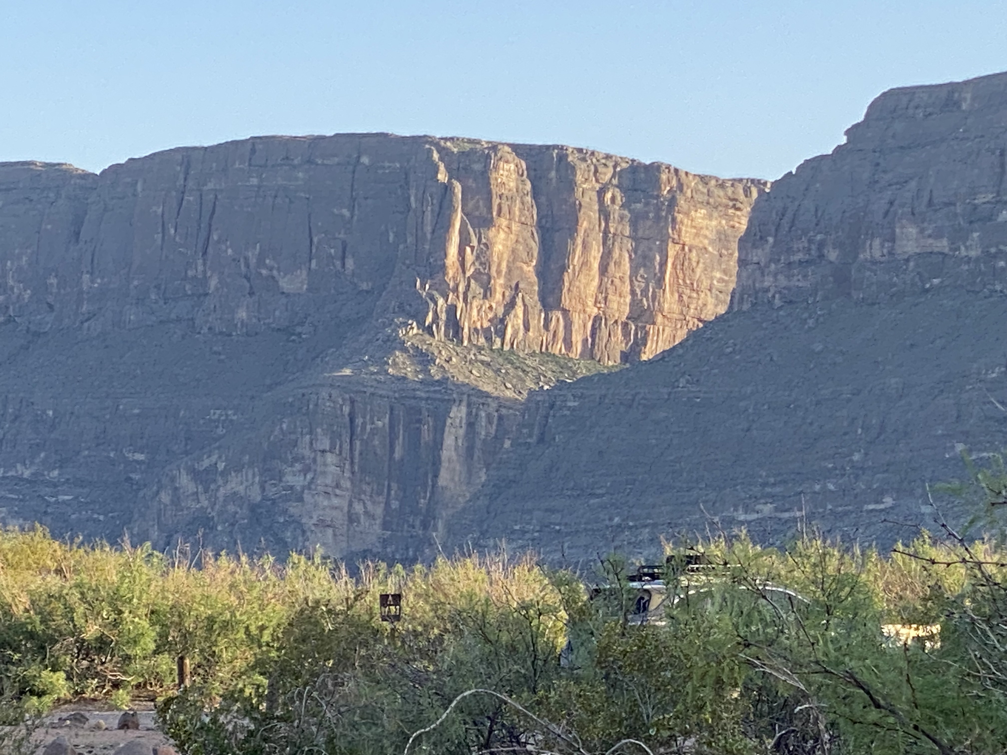
After our hike we retraced our route back east on the River Road until were back on asphalt and then motored north to drive up through the Chisos and into the Chisos Basin.
Casa Grande, BBNP
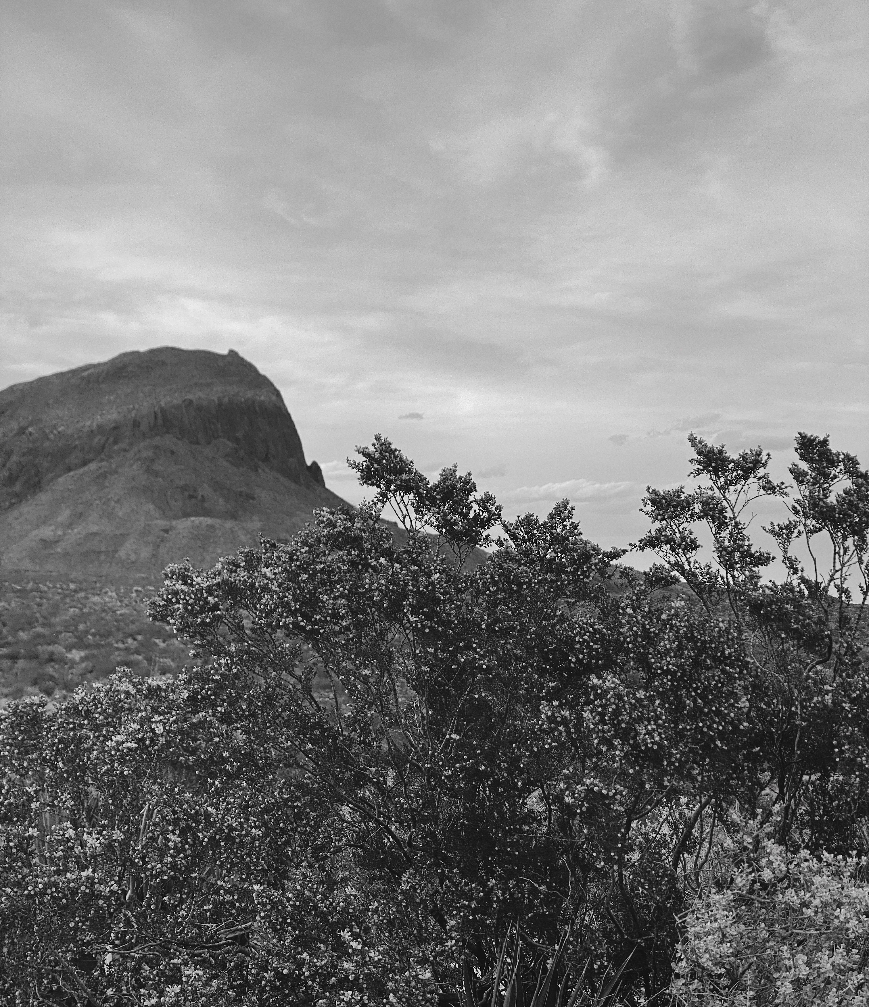
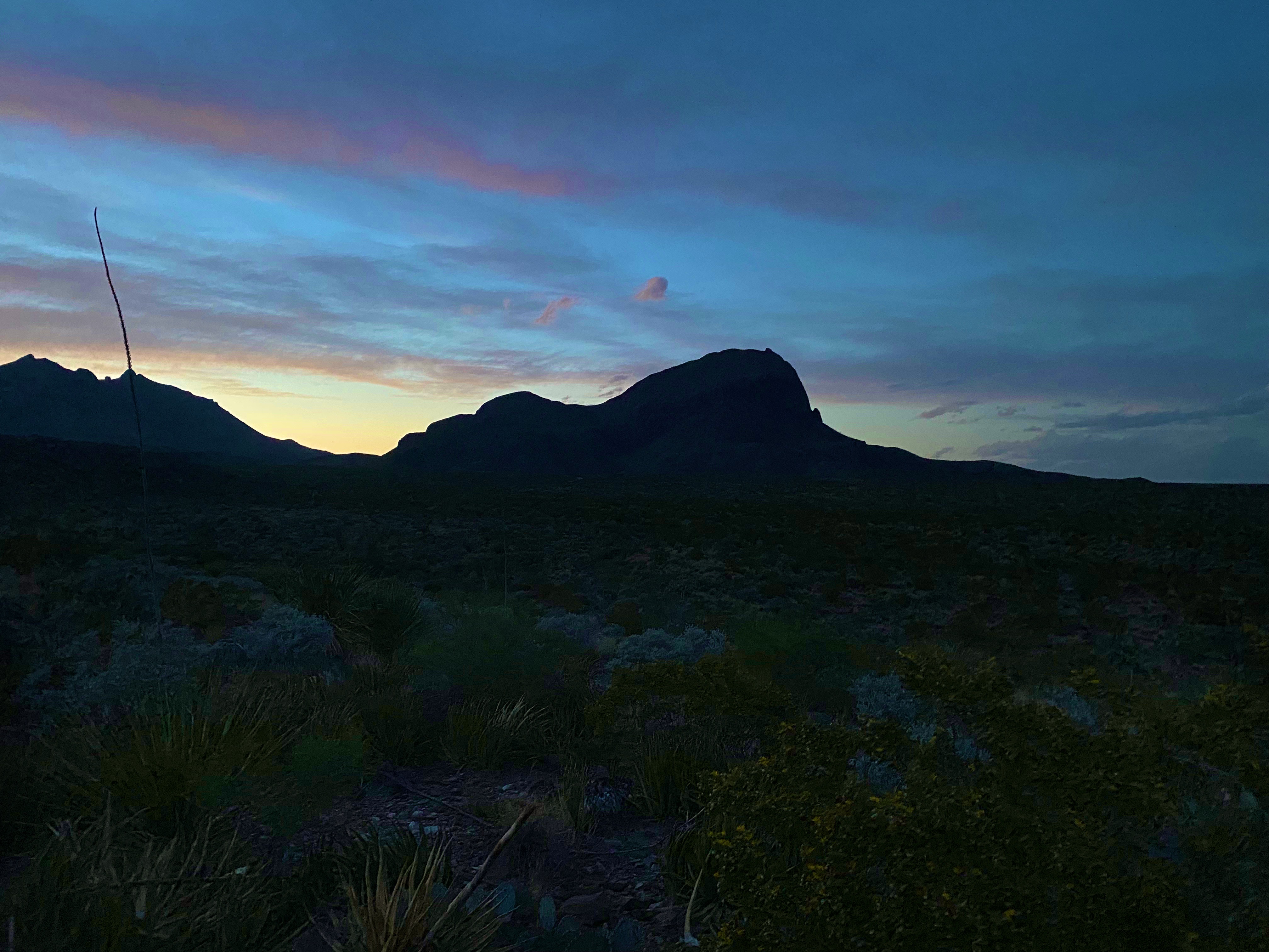
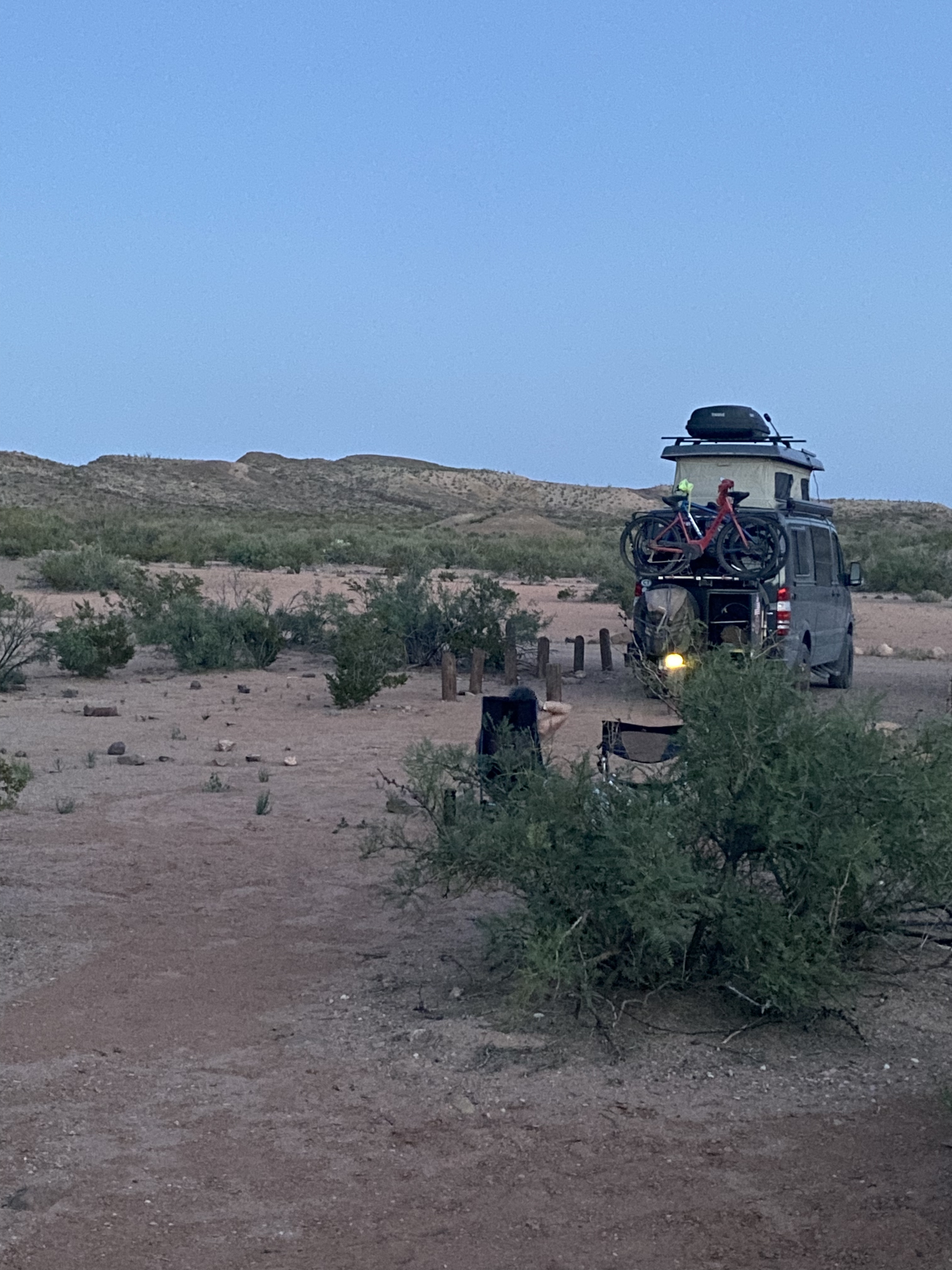
After taking in the views of the Chisos from the basin we headed back south to our camping spot for night two. We had another great camping spot in the shadow of the Chillicotal Mountain. From our camping area we had a 360 degree view – the views to the south were of mountains across the Rio Grande in Mexico.
Chilicotal Mountain, BBNP
Day three
Our campsite at Chilicotal was only about four miles from the Pine Canyon trailhead so we again got an early start to be off the trail before the worst of the heat.
Pine Canyon Road, BBNP
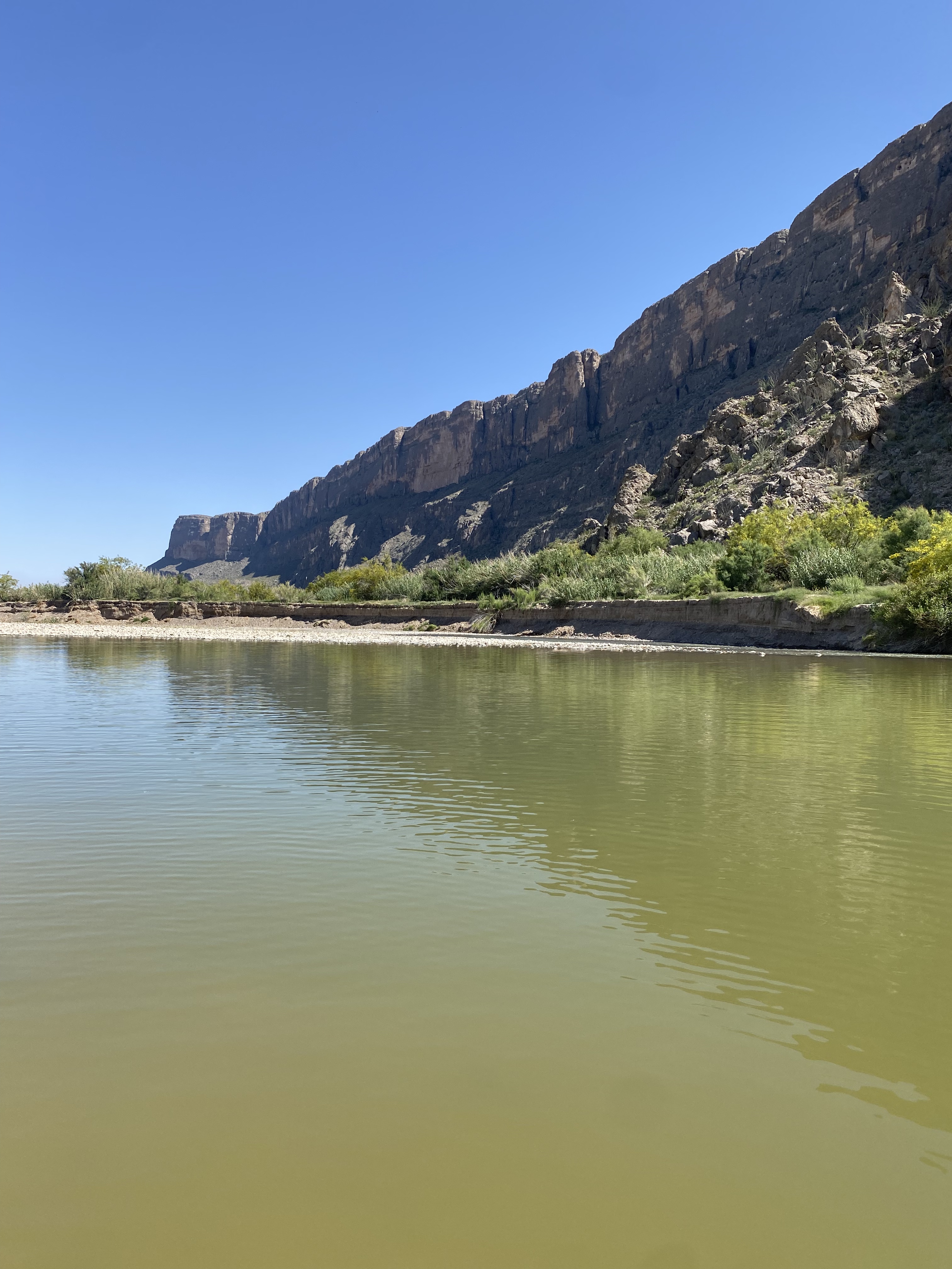
After finishing our hike up into the spectacular Spring Canyon we circled up across the northern section of the park to connect with the Ross Maxwell Scenic Drive. The scenic drive connected us to southwestern area of the parkalong the Rio Grande.
The four photos directly above are the of the Rio Grande. The far shore is Mexico. The canyon in the final photo bottom right is Saint Elena. The left canyon wall is Mexico while the right canyon wall is the United States.
After cooling off in the Rio Grande we connected with the MaverickRoad to head north for our final night of camping at a site nearTerlingua Abaya. Terlingua Abayo is an abandoned town on the banks of Terlingua Creek. The town was at one time a thriving agricultural community supplying produce for local ranchers and miners employed by the Quicksilver mines in the area.The town existed from 1900 until around 1930 when the mines ceased operations.
Terlingua Abaya Road, BBNP
day four
On day four we traveled north on the Maverick Road to exit the park and make our way north for a two day stay in Alpine. Before heading to Alpine we spent part of the day in Terlingua Ghost Town — home to Espresso Y Poco Mas — our coffee hangout from our previous visit to BBNP.
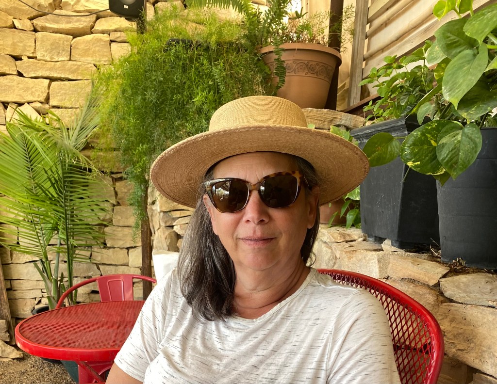
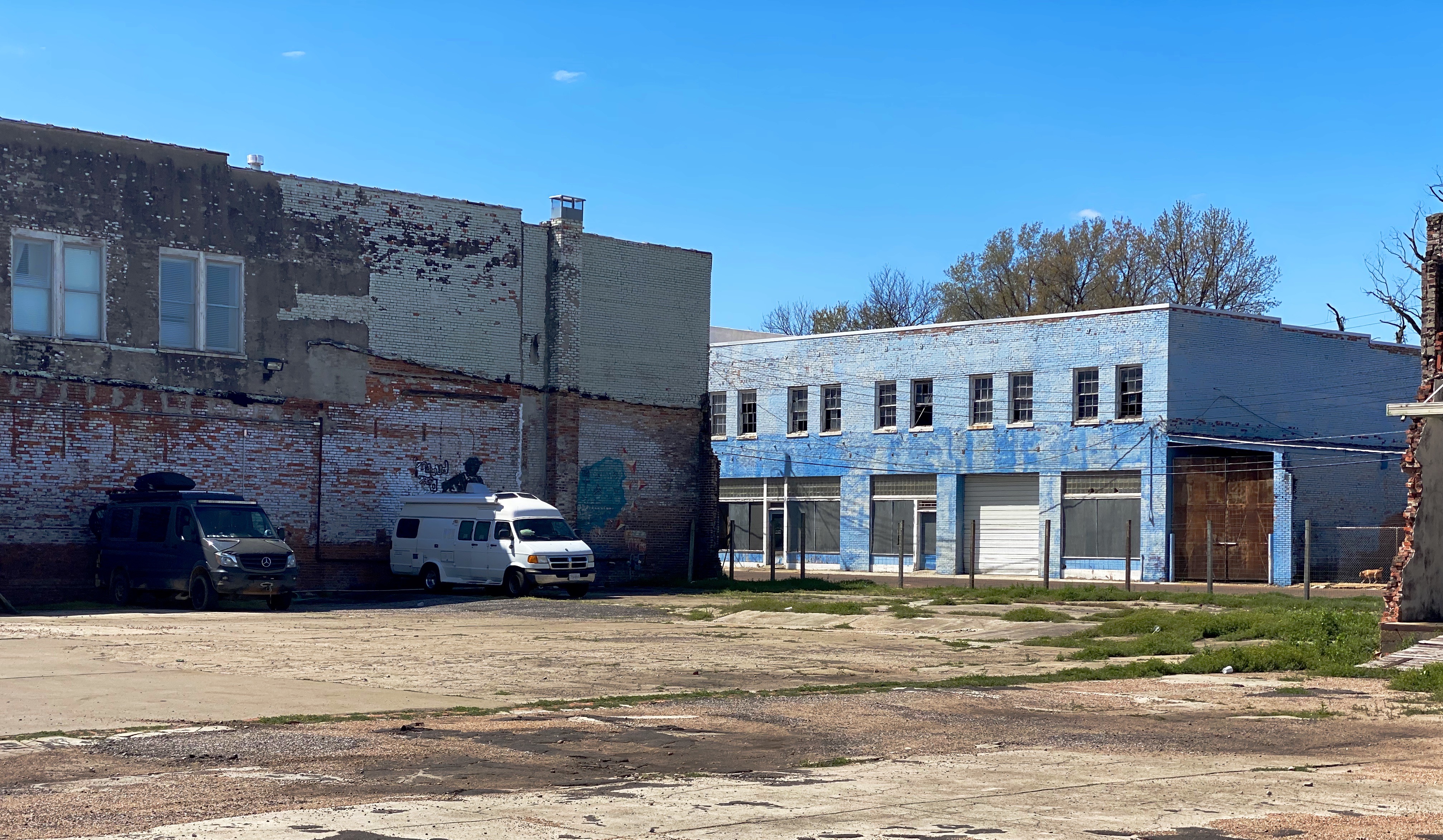
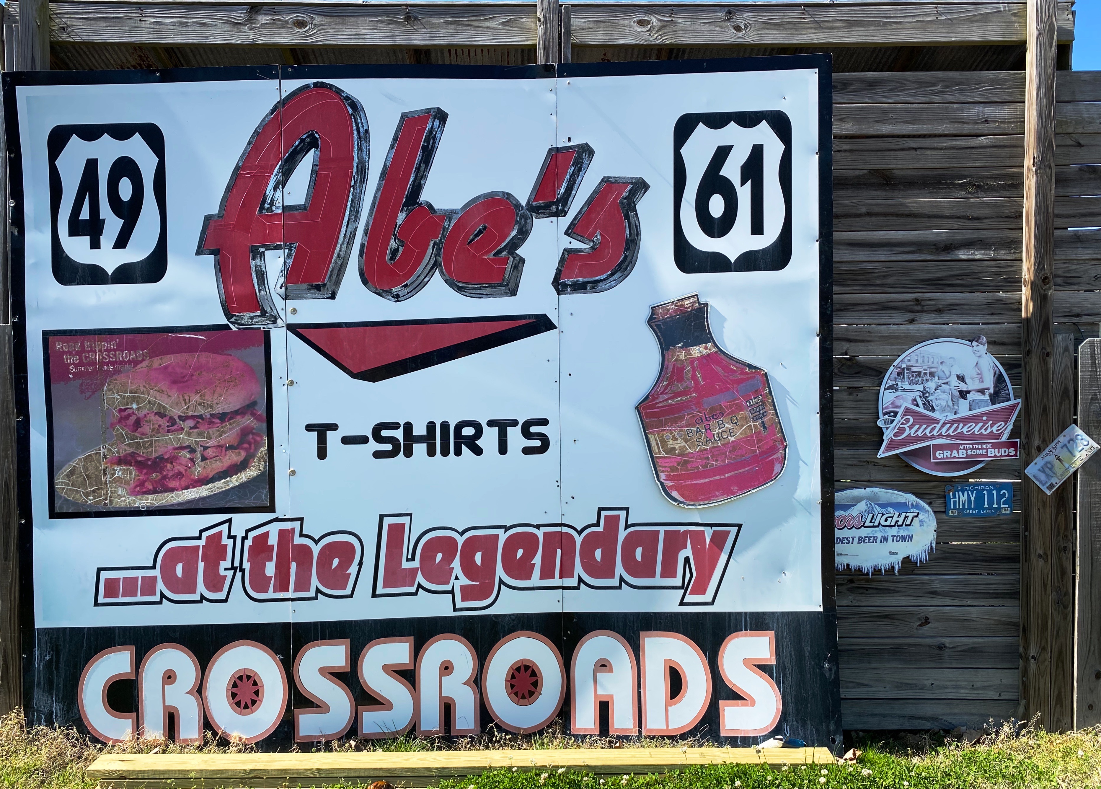
After completing the final portion of the Trans America Trail we traveled to Clarksdale to begin our exploration of the Mississippi Delta. Clarksdale is generally considered to be the home of the Delta Blues with an impressive roster of musicians calling Clarksdale their home in their early years (see previous post: Street Art from the Road: OTR 8.0: Part Two: Clarksdale Music and Artat http://www.ontheroadwithmariastephen.net.
Clarksdale boasts live Blues music every day of the year at one or more of the local blues clubs, bars or juke joints. The town itself is a bit hardscrabble but please don’t let that keep you away. Even if you are not a fan of the blues we think you will enjoy the live performances that take place at the various venues in town, all of which are very intimate and, you will hear the real Blues. Typically, you will pay $10 – $15 for a show that will run from two to four hours!
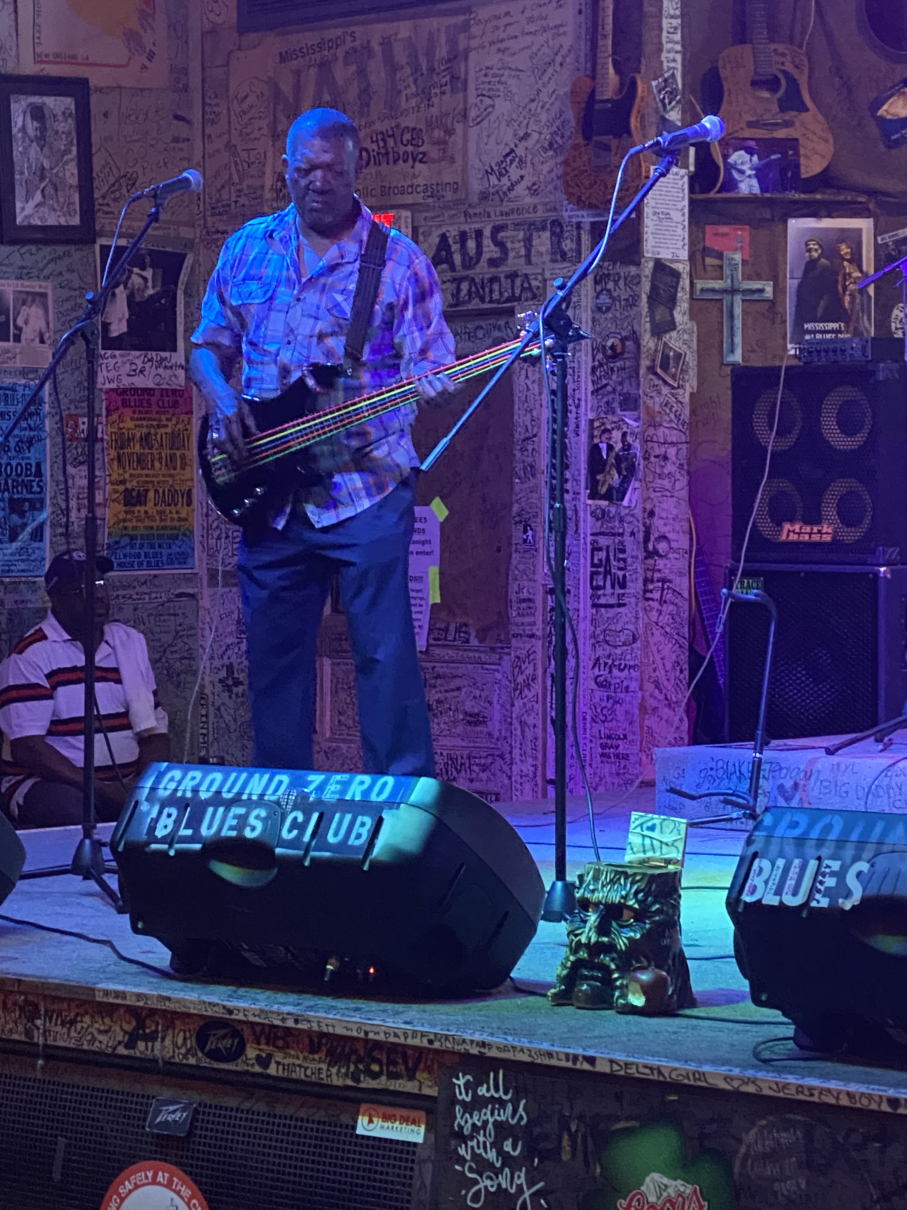
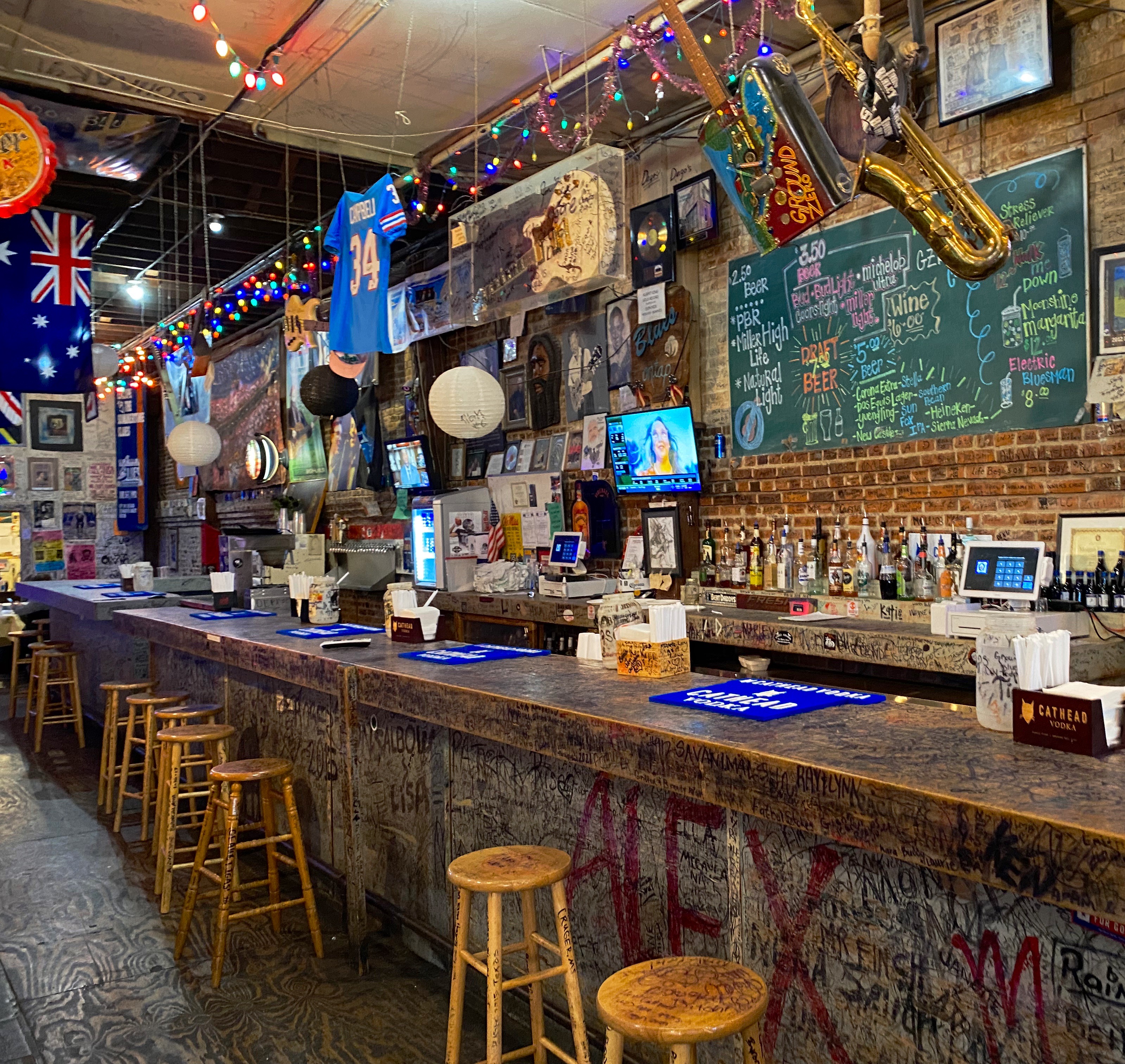
Ground Zero Blues Club
We opted to stay in an apartment above the Ground Zero Blues Club which is convenient-unless you plan on sleeping before midnight. We were in town to hear the Blues, so we figured it was all part of the experience.https://www.groundzerobluesclub.com/
Clarksdale is also home to the Delta Blues Museum. We spent a morning at the museum and learned a lot about the history of the Blues, the musicians and the Blues recording industry. There is a treasure trove of artifacts at the museum including musical instruments and performers’ stage costumes. We highly recommend a visit to the museum when you visit Clarksdale. We don’t have photographs to share with you as they are not allowed in the musuem.
There are several excellent restaurants in town in addition to the customary BBQ. We highly recommend Hooker Grocery & Eatery which is a two minute walk from the museum.https://www.hookergrocer.comP.S. If you like pancakes make sure to try Our Grandma’s House of Pancakes.
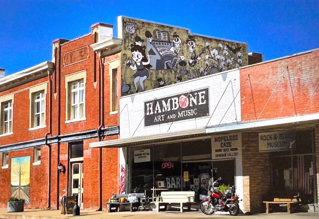
Last, but certainly not least, we recommend a visit to Hambone Art & Music. We popped into this gallery for a quick look around and then spent several hours with the owner Stan Street. He is a transplant to Mississippi and was a touring musician before settling here and focusing on his painting.
Stan bought a vacant building and converted it into his gallery in the front, his studio in the rear and his apartment above. He also operates a small bar in the studio and has a stage for musical performances. We really like his artwork and we were amazed to find out that he is largely a self-taught artist.
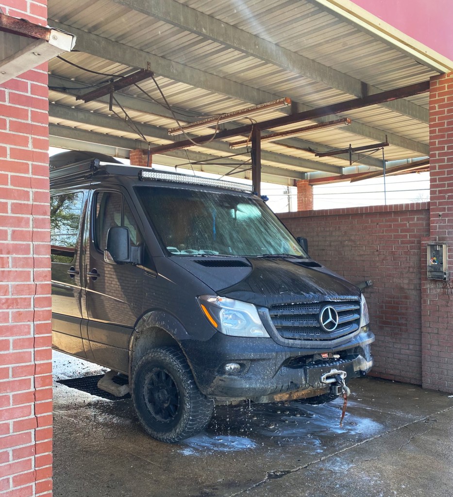
Greenville – do not, we repeat, do not get your car washed!
We visited Greenville after reading that there is a state park there with a hiking trail along the Mississippi and a 60 foot tall observation tower that provides fantastic views along the Mississippi River. WRONG! The park was turned over to Greenville and the town has not maintained the park other than the small boardwalk when you first enter the park. This was our first disappointment with Greenville.
As we were leaving town we spotted a self service car wash and pulled in to hose the van off – you may have noticed in our photographs the Beast is in perpetual need of a wash. Immediately, a man told me he was an employee and would wash the vehicle – a minute later another man showed up and informed me he was going to help wash the car and then a third man showed up to help wash the car.
At his point we knew we had a problem – none of these guys worked at the car wash and that this was a shake down. We were able to persuade the third manthat he was not going to get paid (although he hung around circling us). At that point, we told the two guys (taking turn hosing off the van) that we were good. The first of the gentlemen demanded $60.00 for the wash. We settled on a more reasonable amount and left town quickly.
Cleveland, or “fear the okra”
We stopped in Cleveland for coffee at Zoe Coffee. We met some nice folks at the coffee shop and learned that the coffee shop is affliated with Zoe Ministries, which focuses on providing clean water, orphan care, widow care, and education to communities in Kenya. https://zoeempowers.org/
Cleveland is also home to Delta State University. The mascot for the athletic teams is the Okra and the school chant is ”Fear the Okra!”. This is the best mascot and chant we have ever encountered! Look for DSU merchandise by the pool this summer. P.S. The men’s baseball team went 32-15 this year and is currently in Florida for the NCAA Division II regional tournament.
Vicksburg, or, it’s all about the war , no wait, it’s really all about the river
Vicksburg, MS is undoubtedly best known as the site of a major Civil War Battle which was a turning point in the war in favor of the Union.We were keen on visiting the Vicksburg National Military Park (VNMP) to gain a better understanding of this historic battle and see the battlefield.
The Mississippi River was a critical supply route for the Confederacy.Vicksburg sits on a bluff high above the eastern side of the riverand was heavily fortified with artillery to stop Union forces from cutting off this essential supply route. The Union forces knew that taking control of the river would seal the defeat of the South.
After several failed Union attempts to take Vicksburg, General U.S. Grant laid seige to Vicksburg. Grant surrounded the city with over 77,000 troops. The 29.000 Confederate troops dug in to defend the city. Confederate attempts to break through the encircled cityand resupply the soldiers and citizens failed. After 47 days, with all food and water supplies exhausted, the troops and citizens surrendered; the mighty Mississippi was under Union control. For additional information: https://www.nps.gov/vick/index.htm
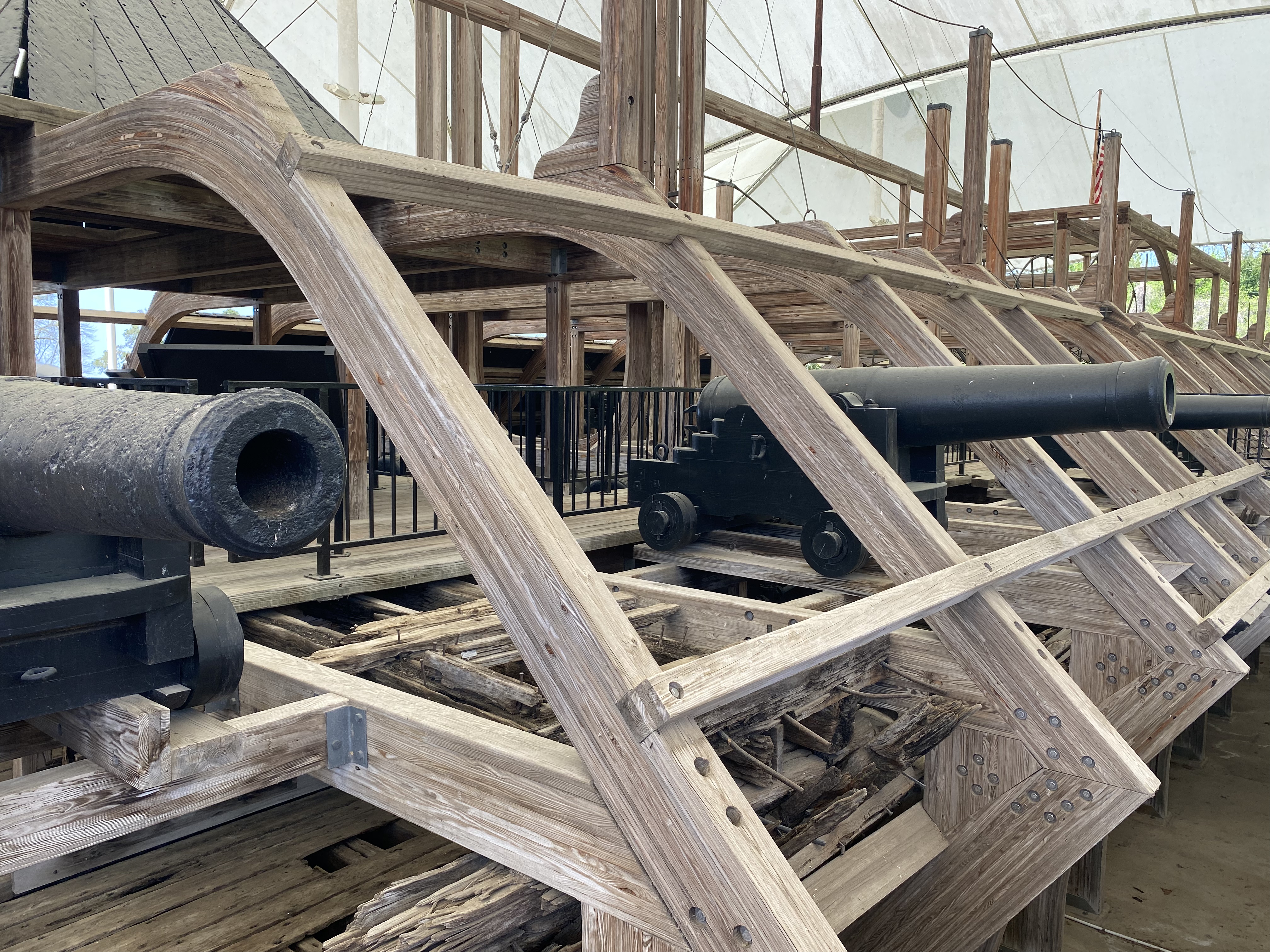
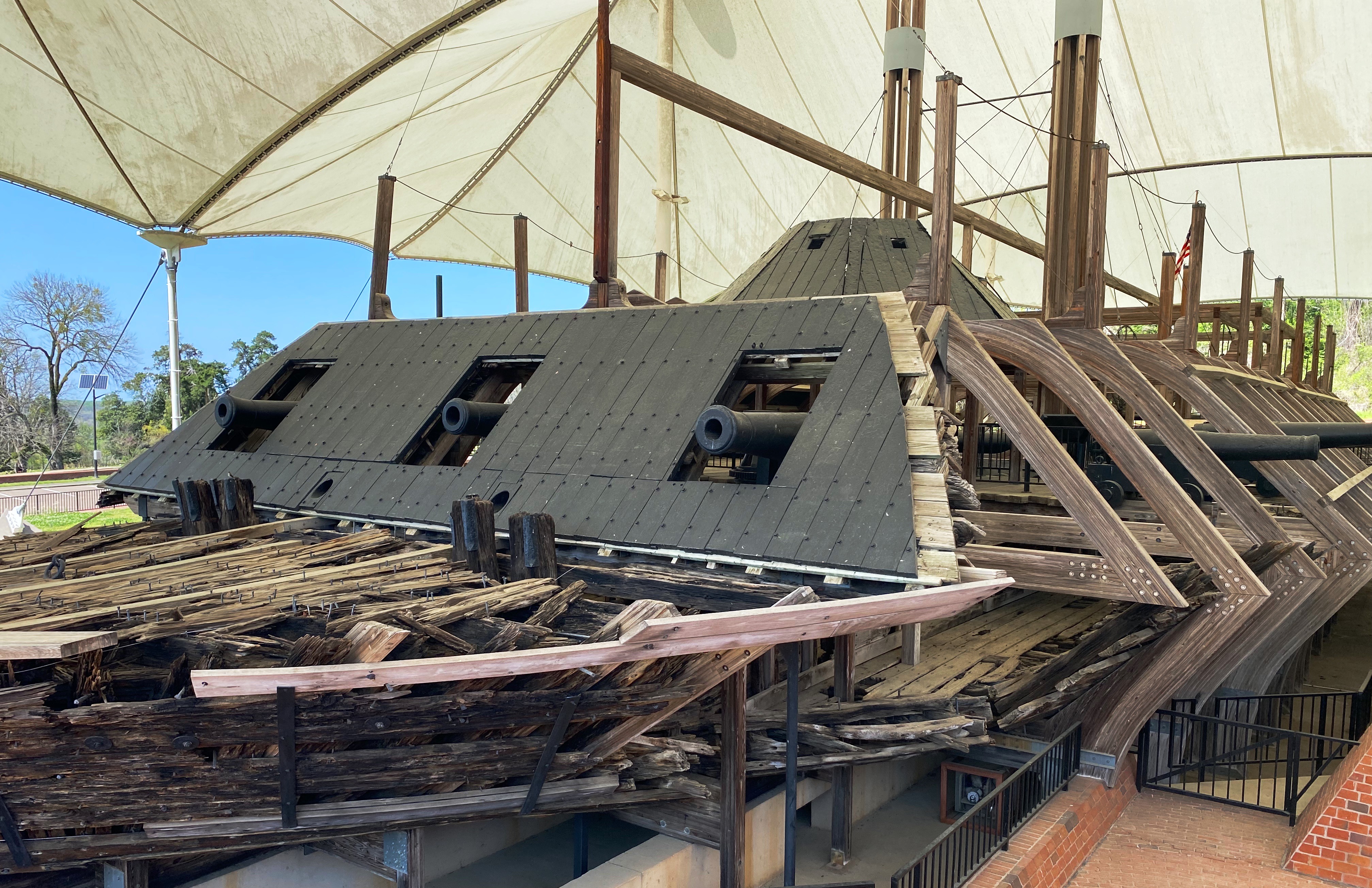
In addition to the battlefield, there is a museum in the park which includes the remains of the Union ironclad gunboat USS Cairo. The Cairo was sunk by Confederate torpedos seven miles north of Vicksburg. It slipped back into the river after being beached and abandoned. Over 100 years later the ironclad was raised, restored and given to the National Park Service. For additional information: https://www.nps.gov/vick/u-s-s-cairo-gunboat.htm
Historic downtown Vicksburg is perched above the river south of the main artillery emplacementsand battlefield. A number of excellent restaurants, rooftop bars and art galleries can be found there. The Jesse Bent Lower Mississippi River Museum, managed by the US Army Corps of Engineers, is on the waterfront and worth a visit.
The Mississippi River is still a vital supply route for the US economy. The Corps, one of the largest employers in the area, is responsible for commercial navigation, flood risk management and environmental stewardship.
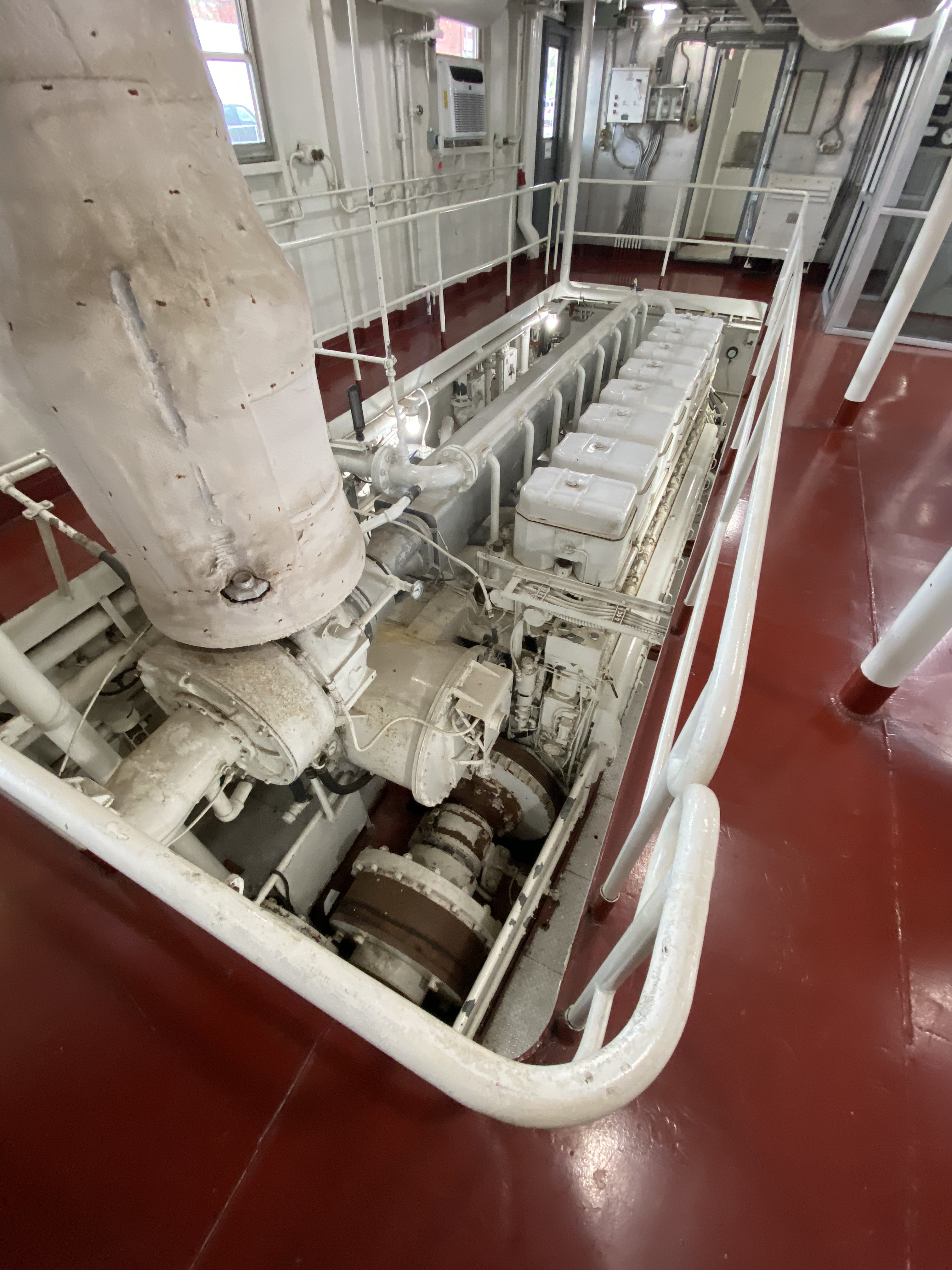
A visit to the museum also includes the opportunity to tour the retiredM/V Mississippi IV. The Mississippi IV was a tow boat used by the Army Corp from 1961 until 1993 when it was retired.
M/V Mississippi IV (Photo courtesy of Army Corp)
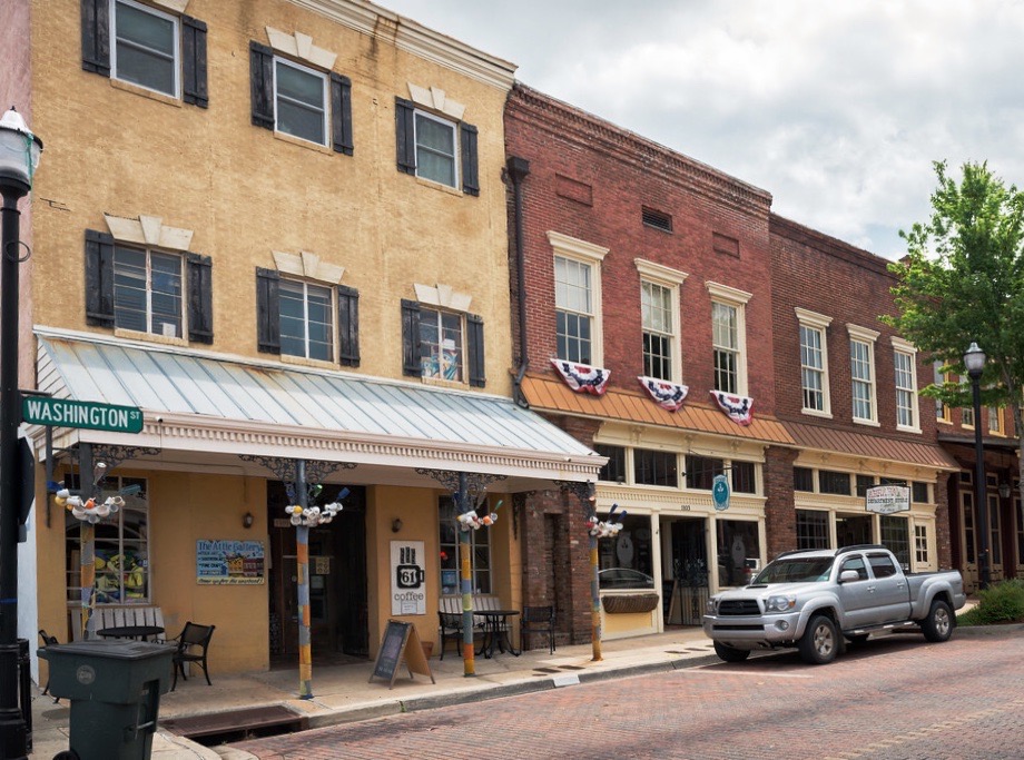
Our endless search for good coffee and tea took us to Highway 61 Coffee House in downtown Vicksburg. Highway 61 is a local coffee house with a cast of characters. We immediately ingratiated ourselves with the owner Daniel Boone – yes! – and his cohorts by making a donation to their poporn machine fund.
When Daniel Boone and his friends are not serving or drinking coffee they are the leaders of a local art movie house and amateur theater company. The popcorn machine that they have been utilizing for the last 14 years (on loan) for movie nights is going to be taken back by the owner.
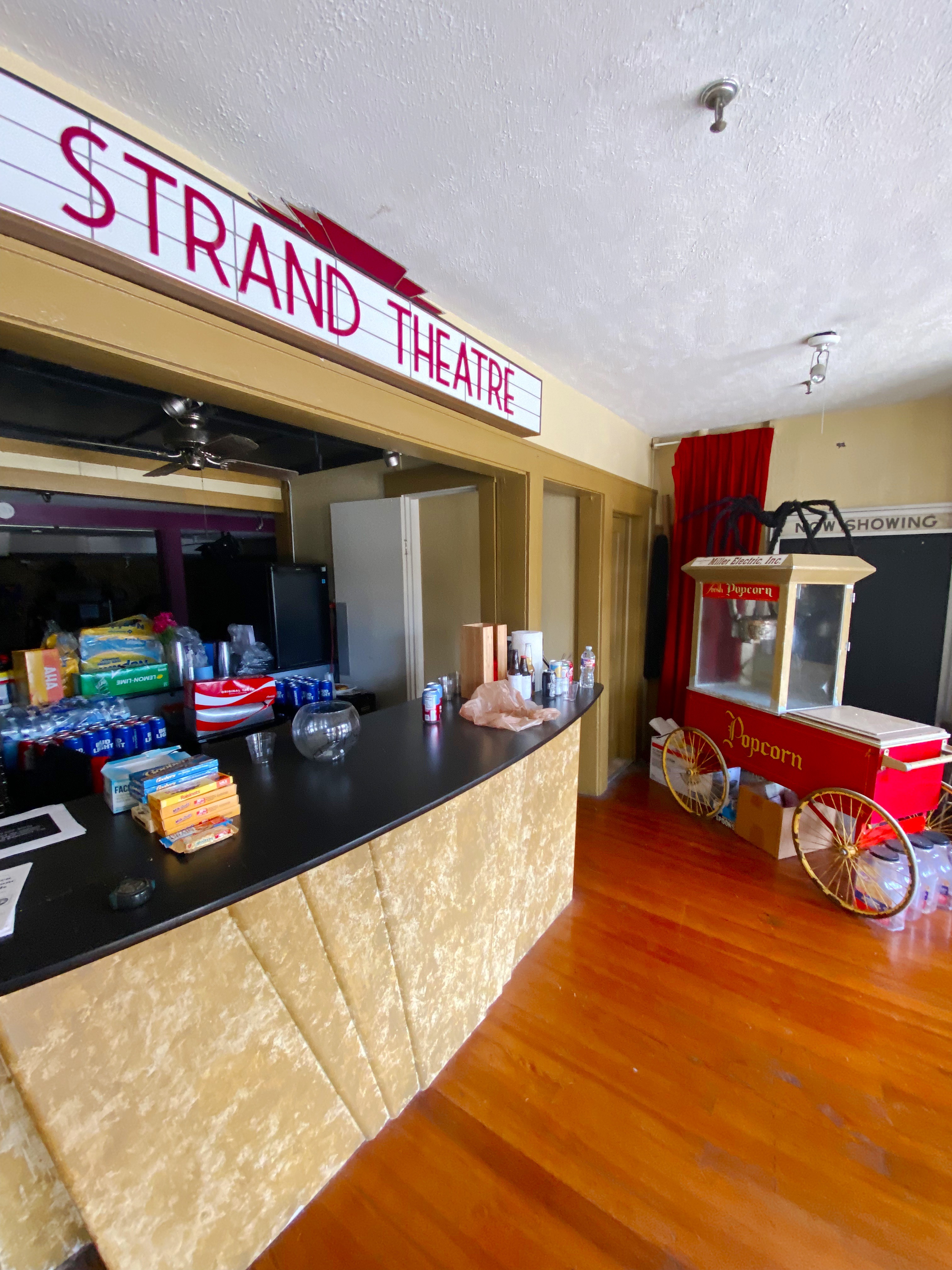
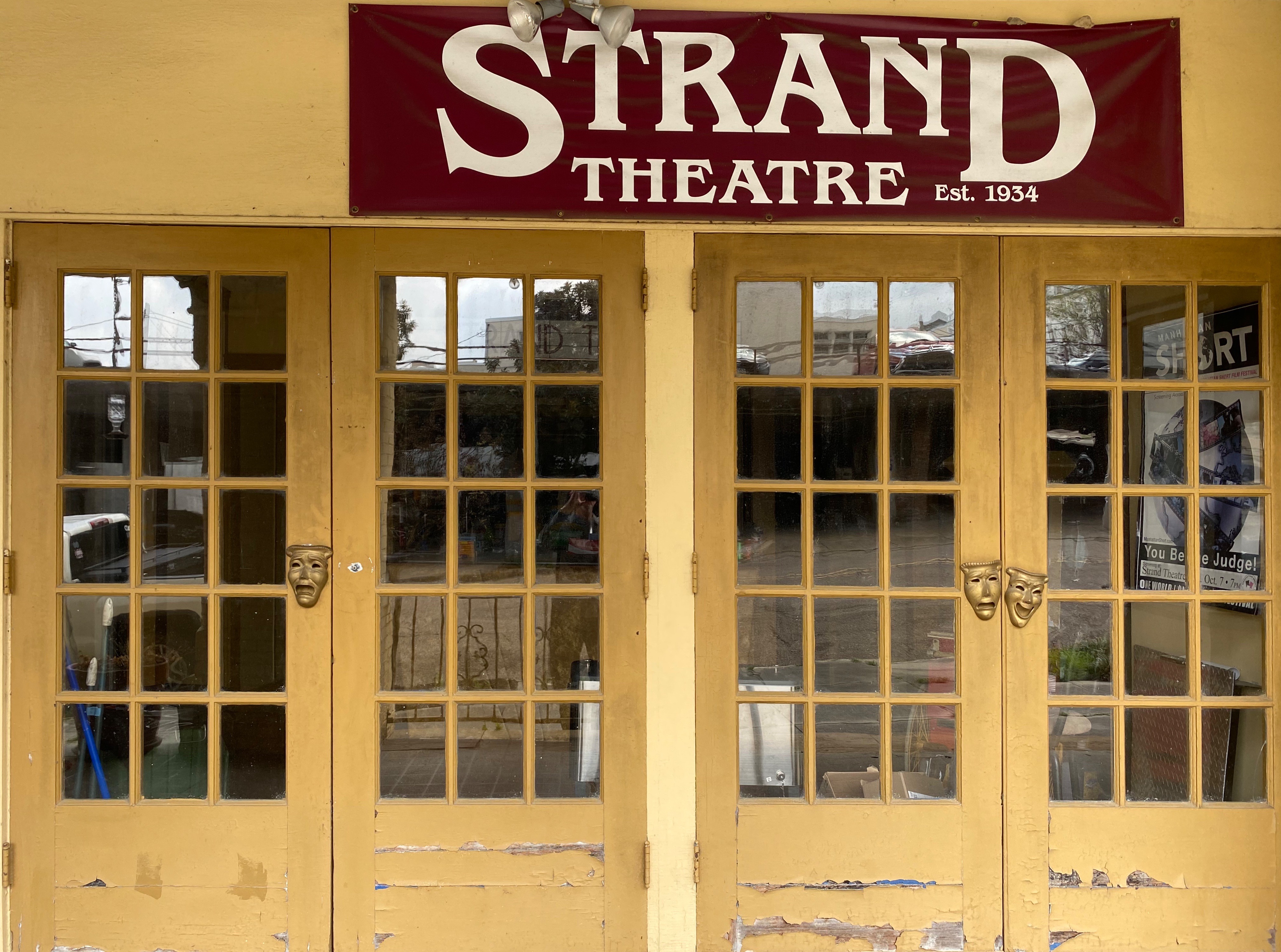
Our donation to the fund earned us a private guided tour of the Strand Theaterwith Jack Burns – a board member and coffee shop regular. The Strand was a movie theater until it closed in 1963. The building remained vacant for a number of years until the theater group struck a deal with the owner to lease the facility for both live theater performances and screening movies. The interior was renovated by volunteers from the community who were very interested in having an opportunity to see art house movies and community theater. An excellent history of the building can be found at Urban Decay: https://worldofdecay.blogspot.com/2011/04/strand-theatre-vicksburg-mississippi.html Strand Theater: http://www.strandvicksburg.com/
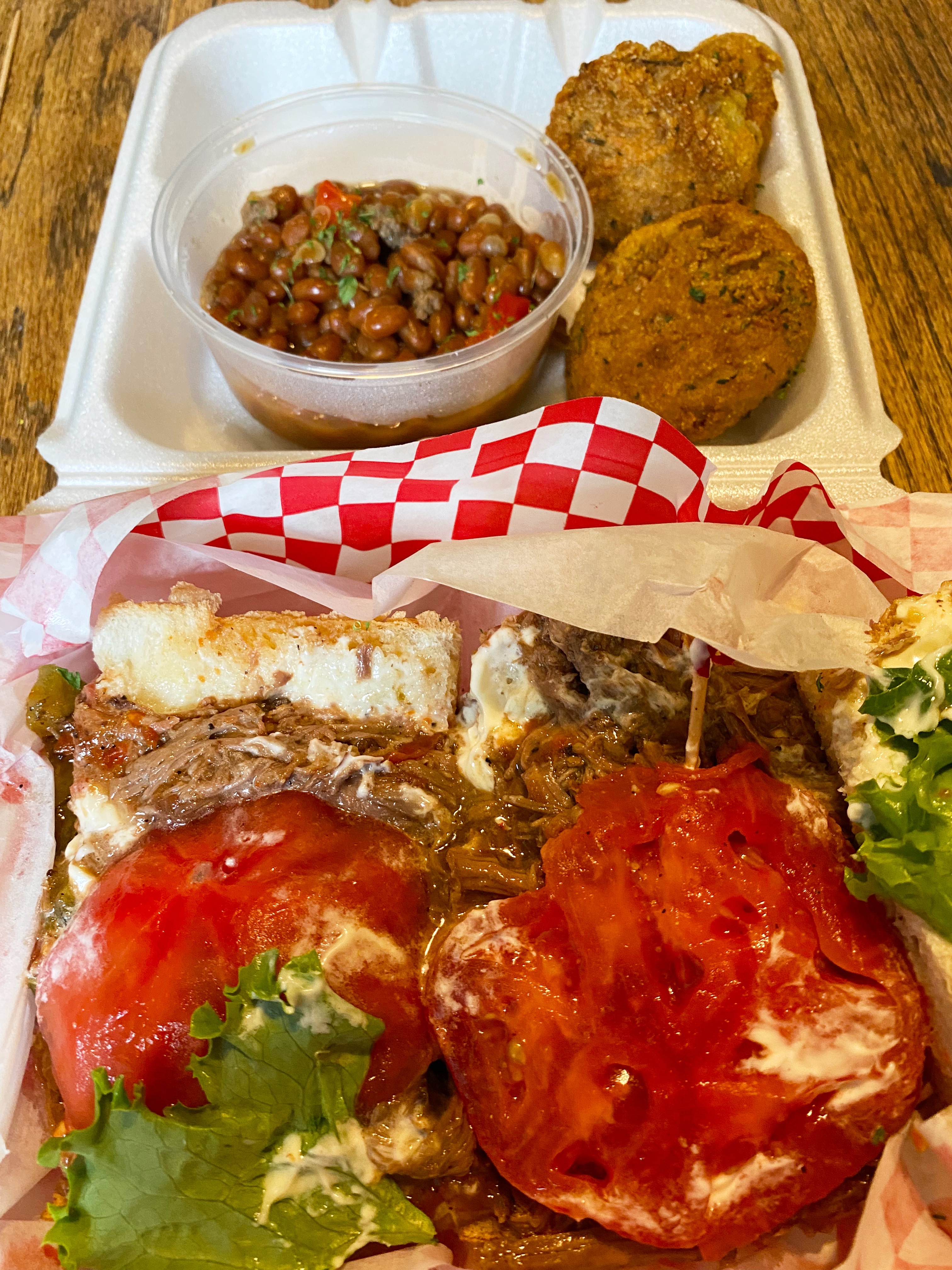
While we might attempt to live on coffee, tea, and wine, we are reasonably certain that as pleasant as that scenario sounds it would not work in the long run. So, we went in search of victuals during our Vicksburg visit and found a gem just outside of downtown. The Tomato Place started as a roadside produce stand and evolved into a restaurant and mercantile in addition to a produce stand- all still sitting roadside in a collection of colorful shacks. The Tomato Place is a must when you visit Vicksburg. For more information: https://www.onlyinyourstate.com/mississippi/you-havent-lived-until-youve-tried-the-blt-from-the-tomato-place-in-ms/
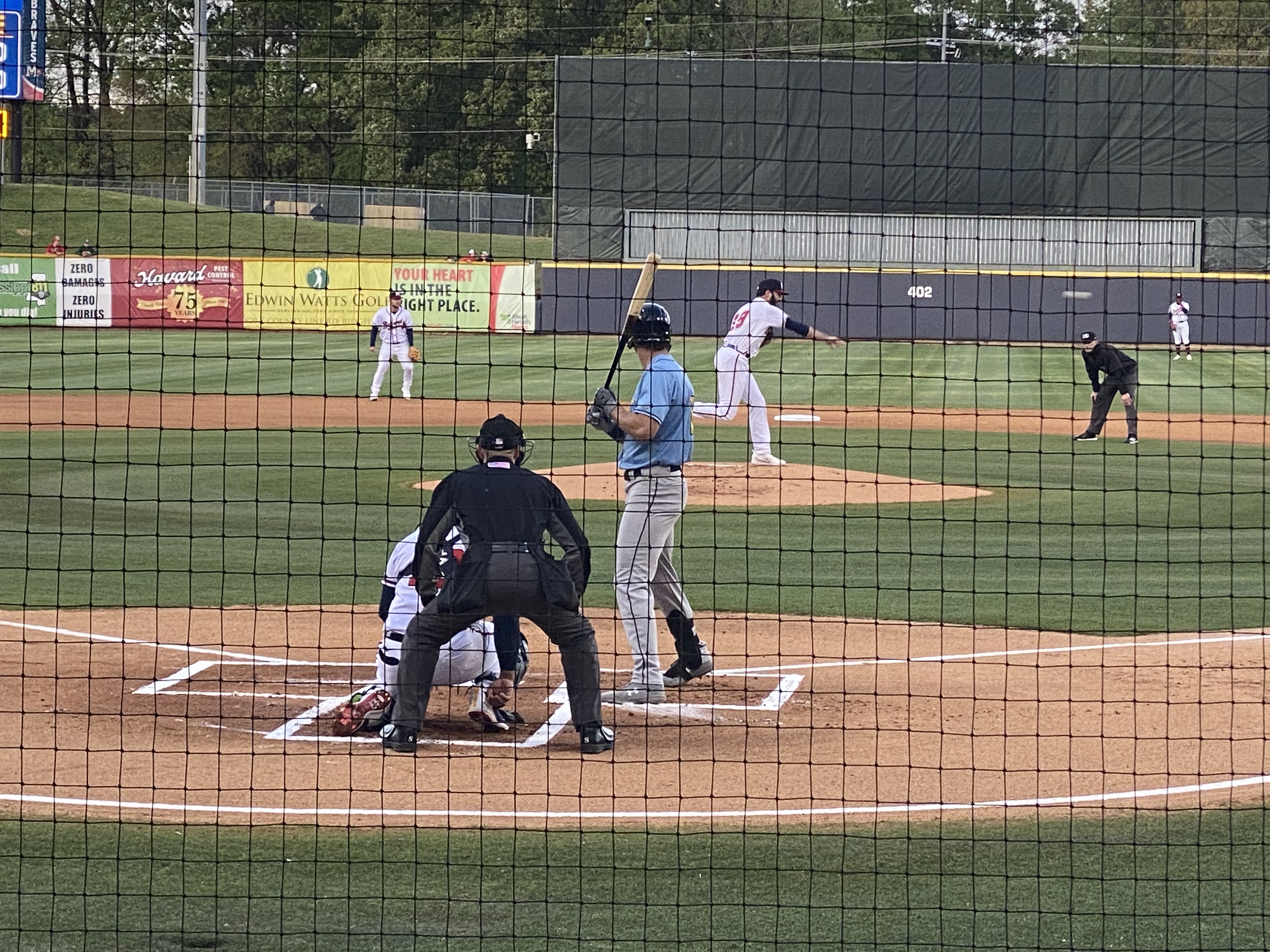
Jackson, or hello, art minton
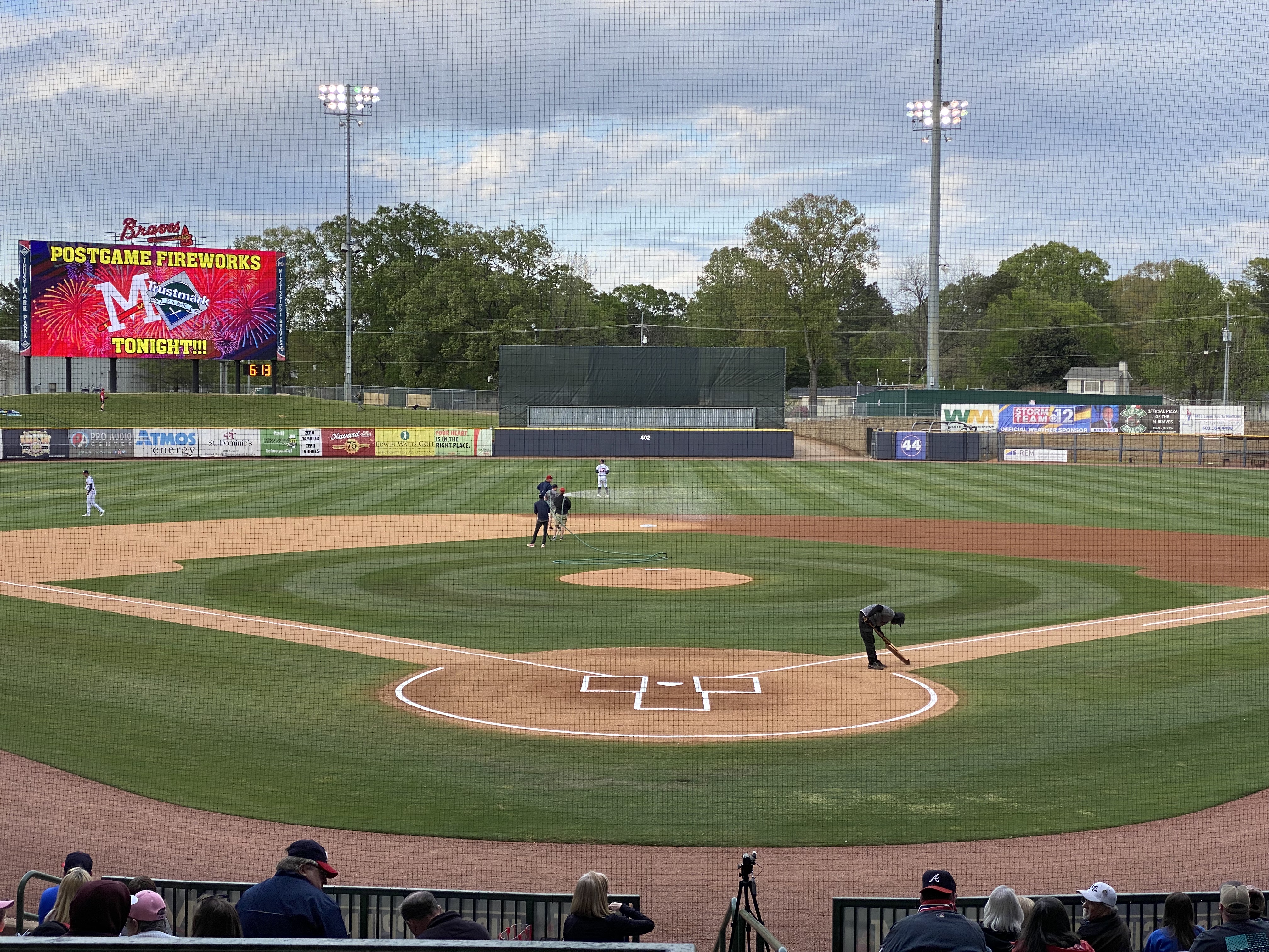
While in Vicksburg we decided to pop over to Jackson to see some minor league baseball. Jackson is home to the Mississippi Braves – the Double A affliliate of the Atlanta Braves. It also gave us the excuse to listen to the Johnny Cash – June Carter Cash version of the song Jackson for the entire ride from Vicksburg to Jackson. “We got married in a fever. Hotter than a peppered sprout. We’ve been talking bout Jackson ever since the fire went out. Oh, we’re going to Jackson.” Dang, that’s goodmusic!!
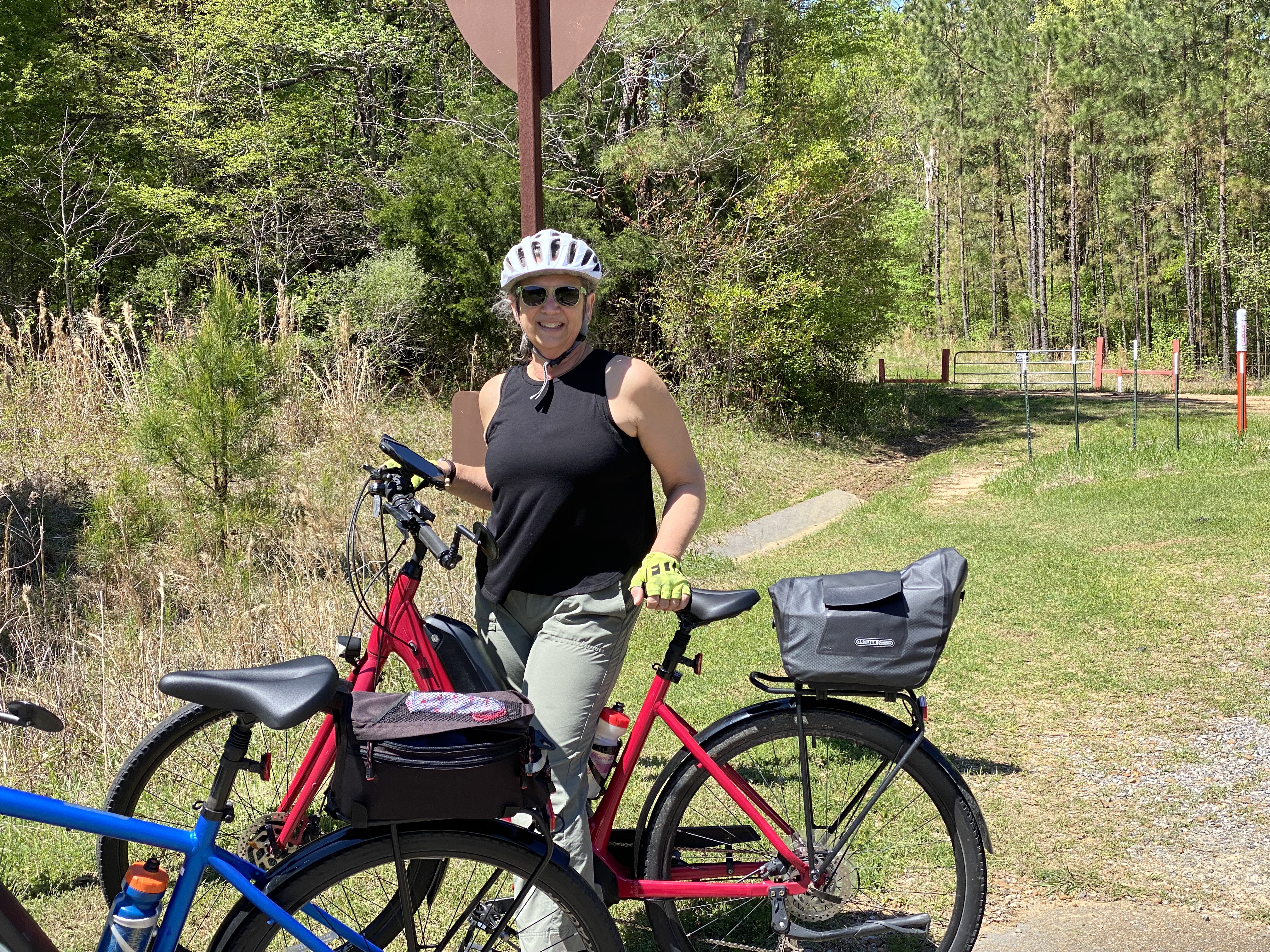
The Natchez Trace runs just north of Jackson. We have driven the majority of the Traceduring the course of several trips through Mississippi but had never done any biking as part of our travels along the Trace. Jackson provided a great opportunity to do so as the Chischa Fokka Greenway runs parallel to the Trace for a number of miles. It’s a great trail that cuts through Pine stands and farmland as you head north from Jackson.
ChischaFokka Greenway
We enjoyed our brief stay in Jackson with the added bonus of meeting @art.minton. Art is a fellow van adventurer who lives in Jackson and we follow each other on Instagram. He spotted our van while we were leaving Pig and Pint after having just finished dinner—Serendipity—Very cool!
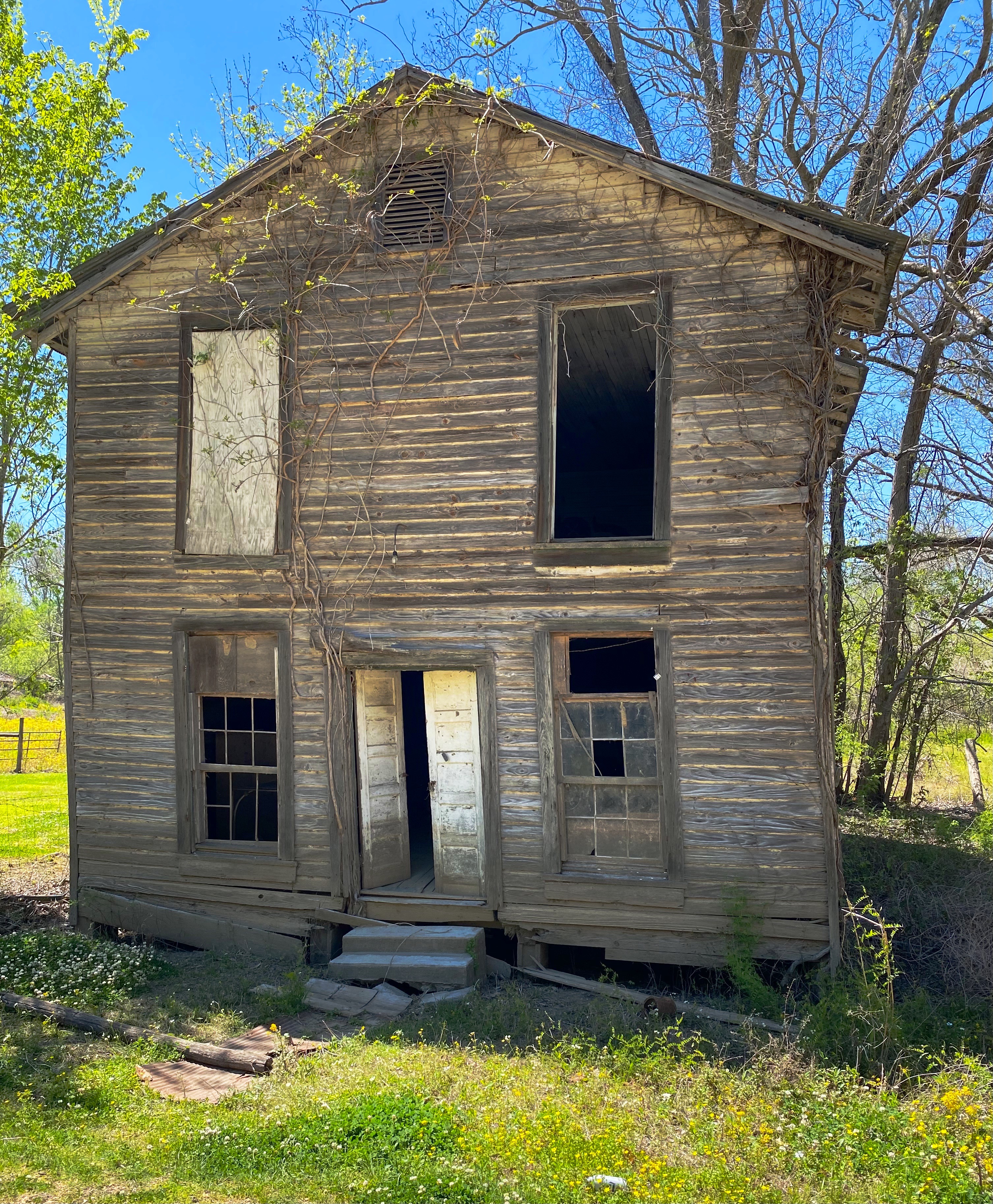
The road to Rodney
We decided to visit Rodney after reading an interesting article in Mississippi Folk Life about efforts by a local organization to preserve the remains of Rodney. The town was once a thriving Mississippi River port city. Migration from Rodney started in earnest after 1870 – Rodney had been bombarded during the Civil War by Union gun boats, enslaved individuals were emancipated and left the cotton plantations and finally, the course of the river shifted two miles west and Rodney was no longer a port city. For an excellent history of Rodney: http://www.mississippifolklife.org/articles/haunted-by-a-ghost-town-the-lure-of-rodney-mississippi
Getting to Rodney takes a bit of work. The only road to Rodney is a bumpy and muddy dirt road affair but you know we never say no to the chance for a bit of mud on the fenders.
On our way to Rodney we drove through Port Gibson. Like many other southern cities during the mid-twentieth century, Port Gibson’s elected leaders and businesses were still fighting against integration and equal rights for Black citizens. That eventually led to the Boycott of 1966. The photo below from a mural in town depicts the demands. ‘Nuff said!https://mississippiencyclopedia.org/entries/port-gibson-claiborne-county-civil-rights-movement/
We also happened on the Windsor Ruins after departing Rodney. The Ruins was an antebellum Greek Revival Mansion built (by enslaved African-Americans) for a wealthy cotton planter and his wife. Today, 23 of the Corinthian coloumns are still standing. The mansion survived the Civil War (the owner did not) but burned in 1890. It was the largest Greek Revival home in Mississippi. Today it is an historic site and there are plans to complete some restoration of the columns and the grounds. For more information: https://www.mdah.ms.gov/explore-mississippi/windsor-ruins
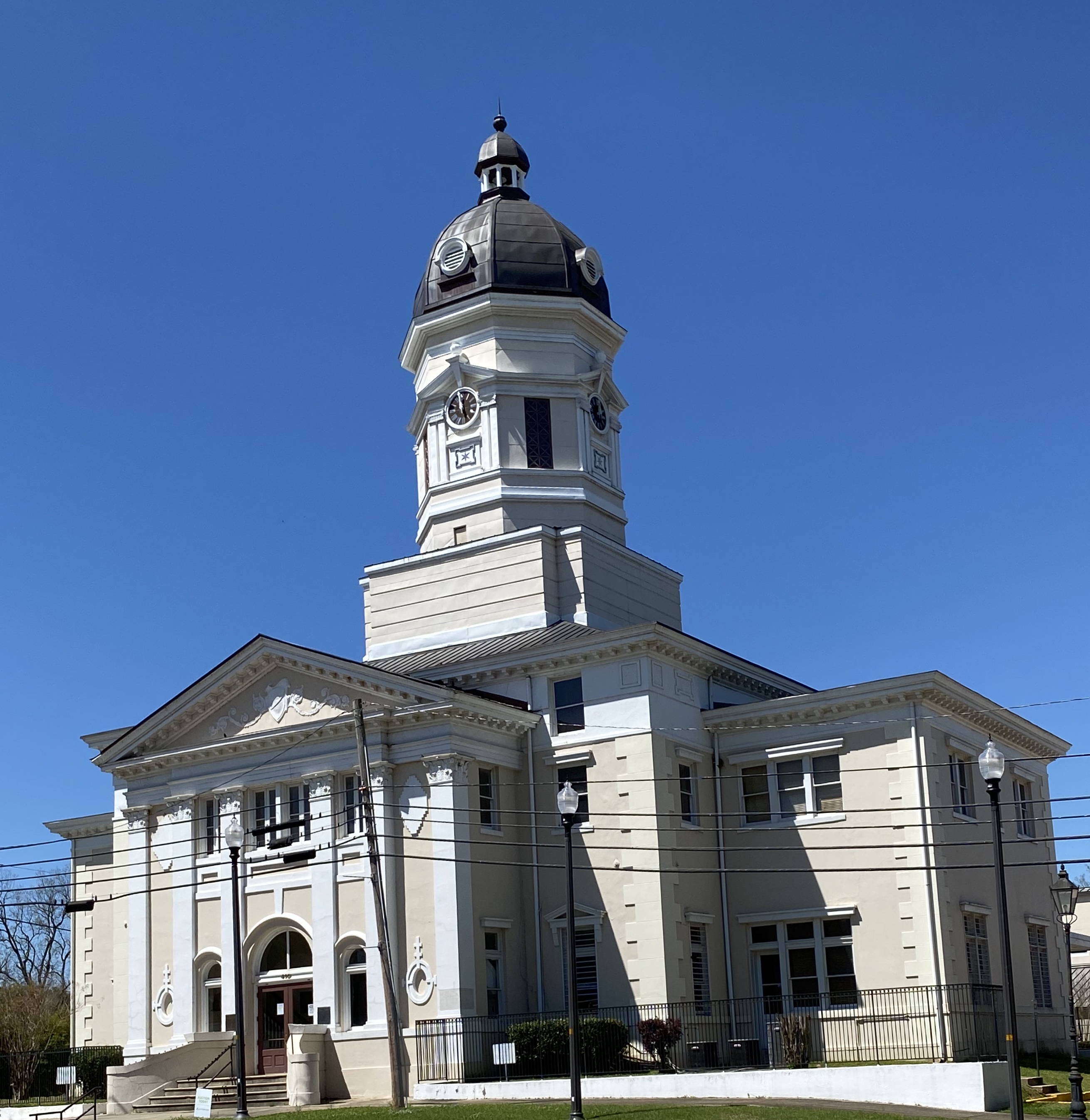
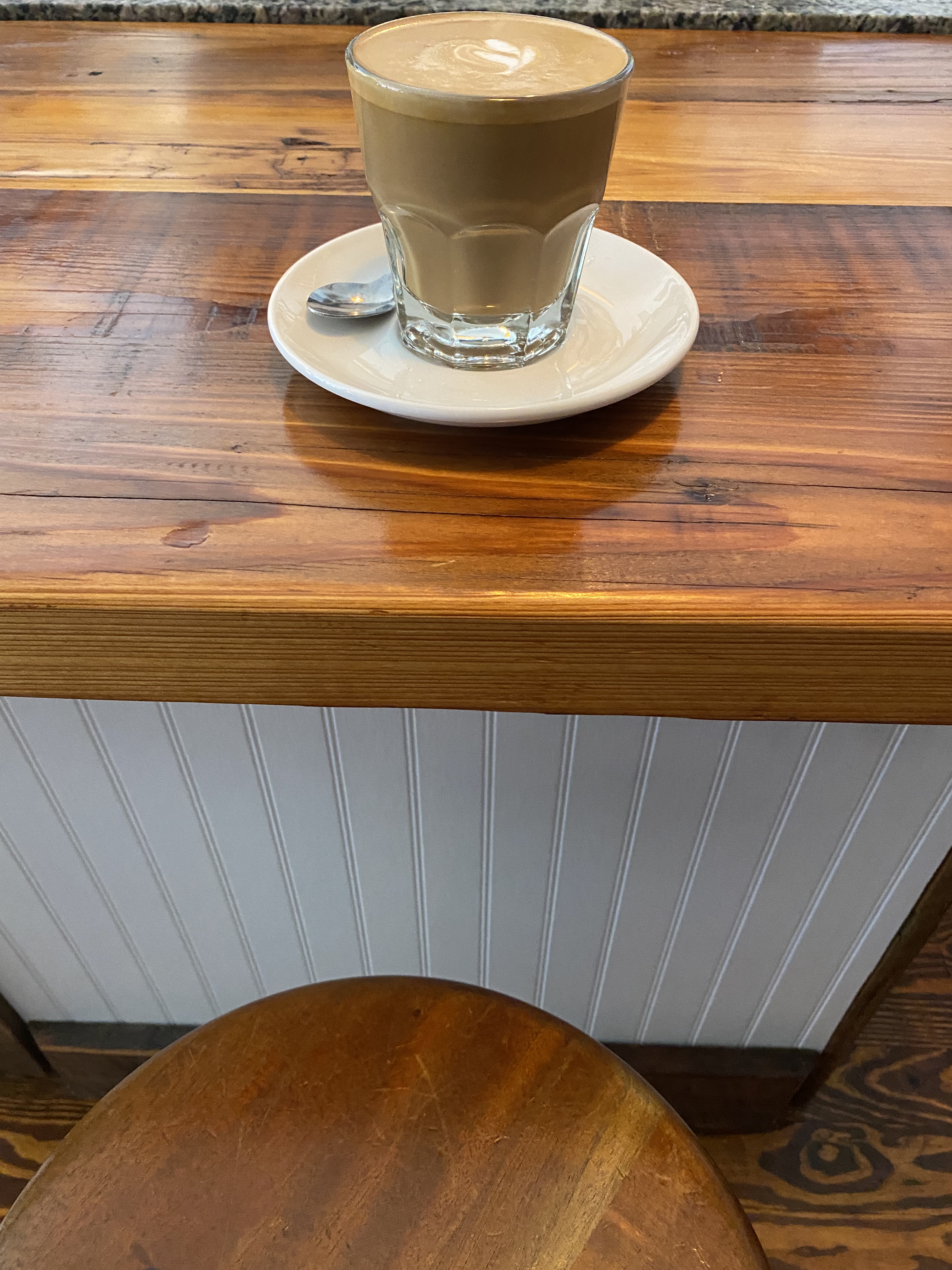
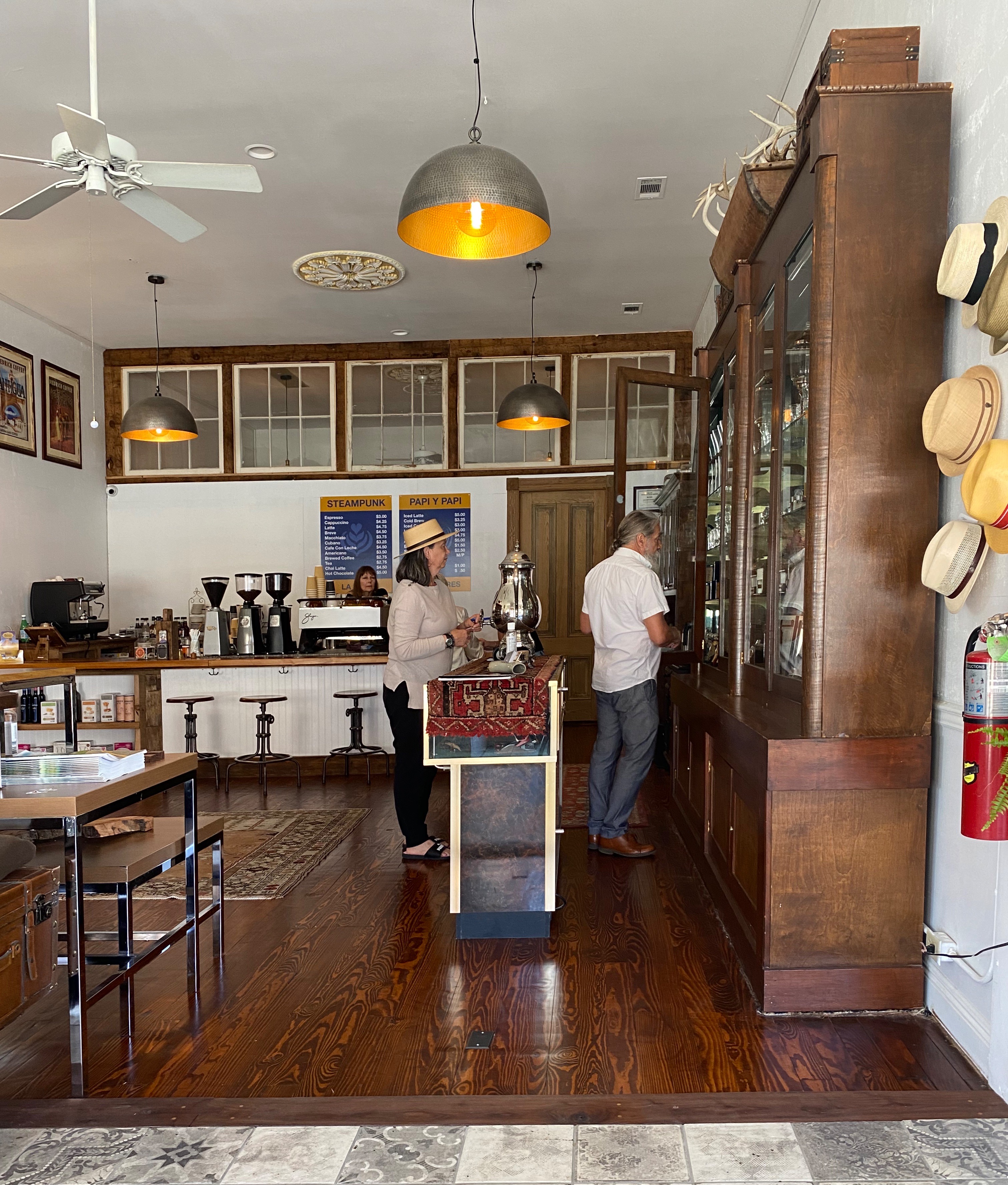
Natchez —— Steampunk anyone?
Natchez was our final stop before crossing the Mississippi into Louisiana. First stop, as always, was for espresso and tea and our research pointed to Steampunk. There we met Dub Rogers, the owner of this unique establishment. Dub Rogers was born in Mississippi but spent 30 years living and working in NYC in a variety of businesses.
Steampunk represents an amalgamation of Dub’s many interests. The shop and haberdashery sells fine cigars, coffee, tea, chocolate, conservas, mixology gear and hats (see Maria’s newest addition above) of which Dub has endless knowledge. Dub is a great host – and we almost forgot to mention that he personally renovated the handsome space that houses his boutique department store, apartment and patio.
Natchez dates back to 1716 when French traders built a Fort on the bluff overlooking the Mississippi. The French settlement came to an abrupt end when the Natchez Indiansattacked the fort, killing several hundred people and enslaving a number of women and children The surviving French left the territory toute suite.
Future President Andrew Jackson built a trading postnear Natchez in 1789. The trading post traded in African-American slaves. This set the course for Natchez to become a hub for slave trading – one of the most active in the South.
With the wealth accumulated from the slave and cotton trade Natchez became one of the wealthiest cities in America prior to the Civil War. Today many of the lavish antebellum homes are still standing and open for touring. Because Natchez was prized by both sides due to its location, the Union forces did not destroy it when they occupied the city.
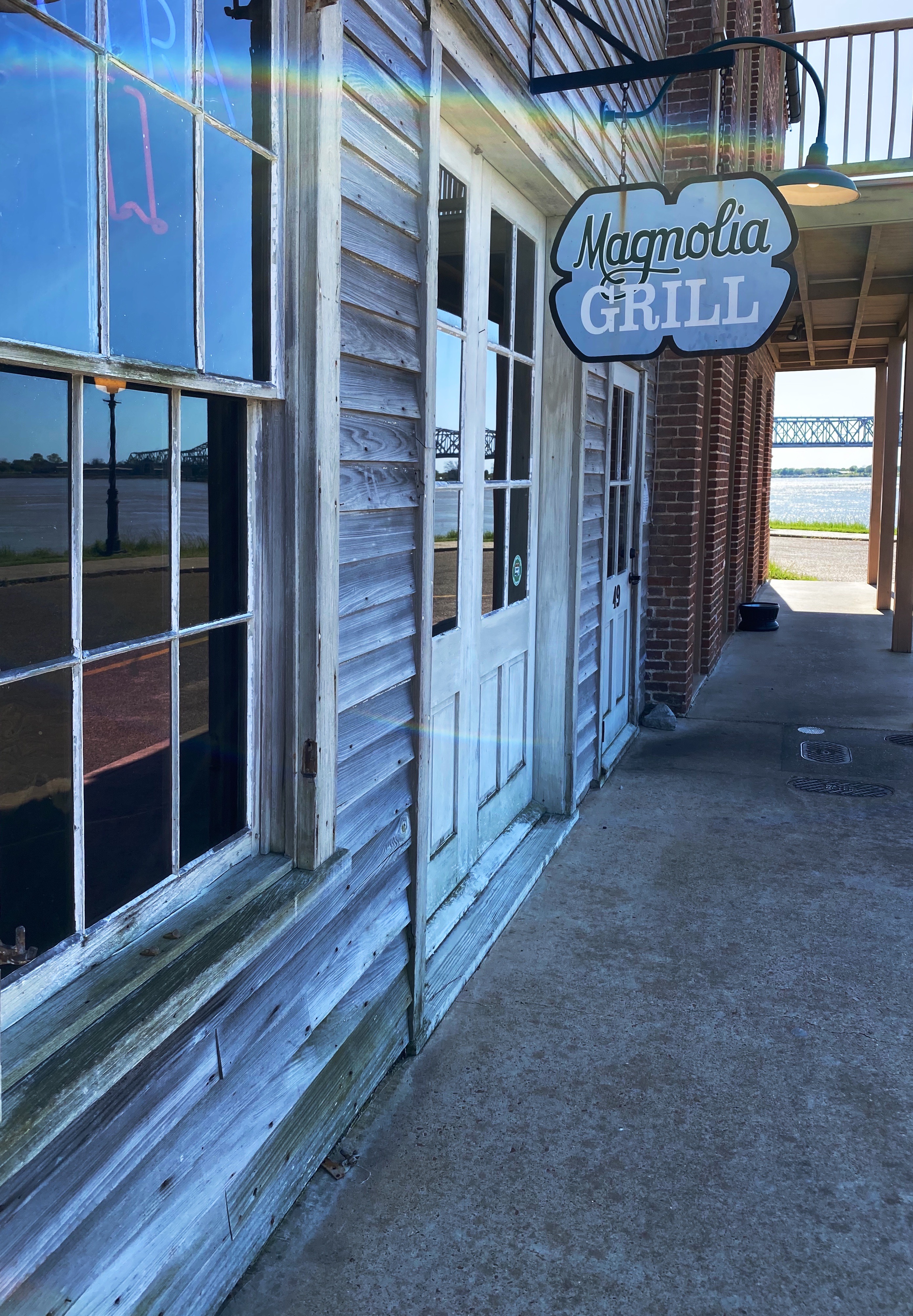
You now know where to go for all your caffeine needs in Natchez. Here are a couple of suggestions for dining: Magnolia Grill, located in the Under-the-Hill section of town down on the river (formerly the vice district of town); and Fat Mama’s Tamalesis the spot for excellent tamales.
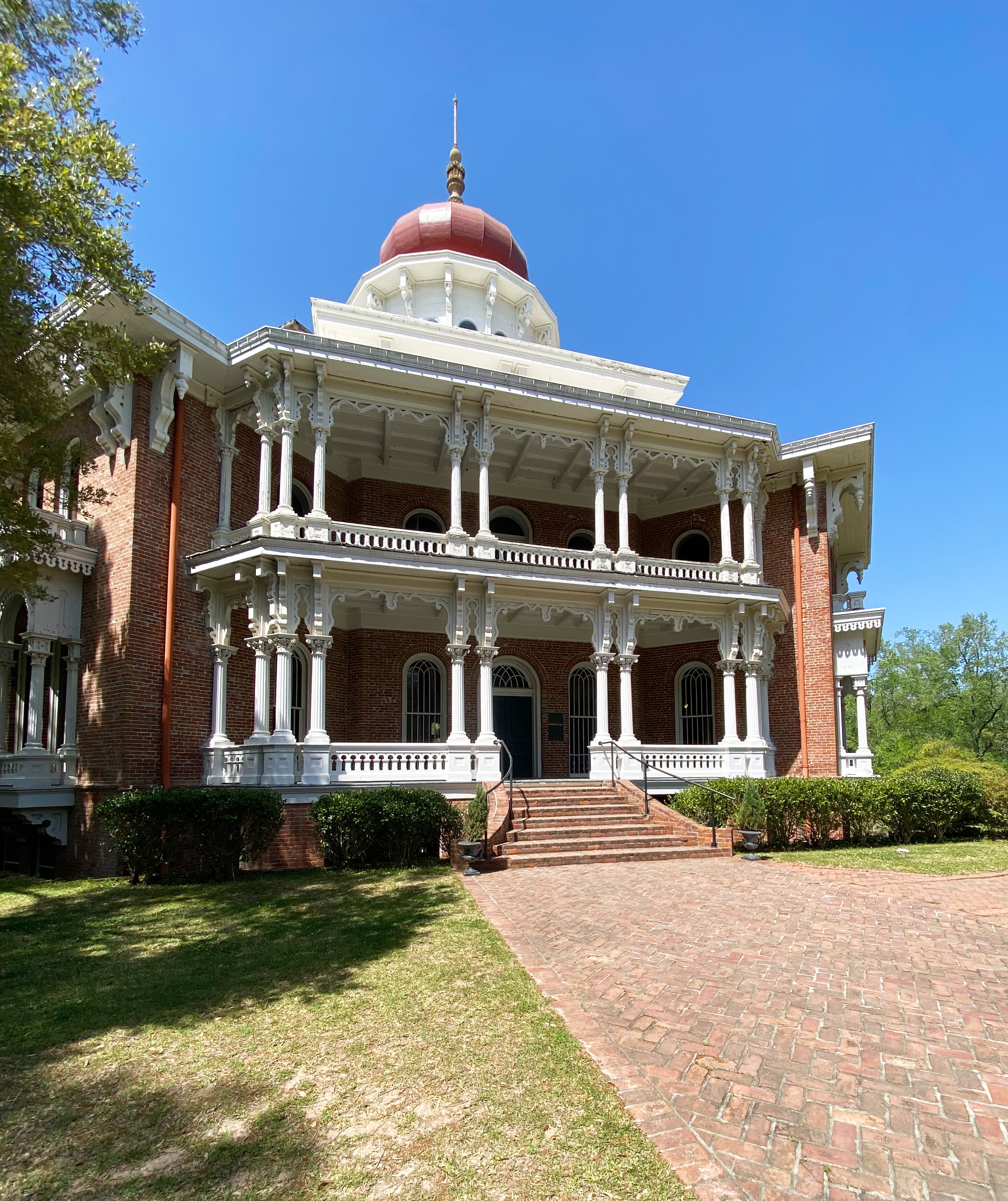
Our final foray in Natchez was visiting one of the decidely less glamorous antebellum homes in Natchez. The house is named Longwood but also derisively as Nutt’s Folly. Haller Nutt was a wealthy plantation owner who had an octagonal house designed for him and his family. The house, if completed, would have had 32 rooms.
The outbreak of the Civil War ended the construction of the home as Nutt’s financial position tumbled. Even if he had the funds to continue, work would have stopped because the majority of the craftsman completing the finish work were from Philadephia – they returned to the North as soon as the war began.
The family moved into the basement (originally designed for the house slaves). Nutt died in 1864 and his wife and children hung on to the house for many years with the help of friends and several wealthy relatives. The Nutt family sold the home to the Pilgrimage Garden Club of Natchez in 1968.
The photograph below shows the fingerprints of one of the enslaved individuals who worked on the construction of the home. The Nutt family owned 800 slaves prior to the demise of the family fortune.
Fingerprints of enslaved individual
We hope you enjoyed our final installment regarding our Mississippi exploration, thanks for reading.
OTR’s only previous experience in Alabama was a couple of days driving across the northern portion of the state in March of 2020 as we were returning home prematurely due to the impact of the pandemic.So we were excited to come back to Alabama and spend some additional time exploring.
Graces High Falls
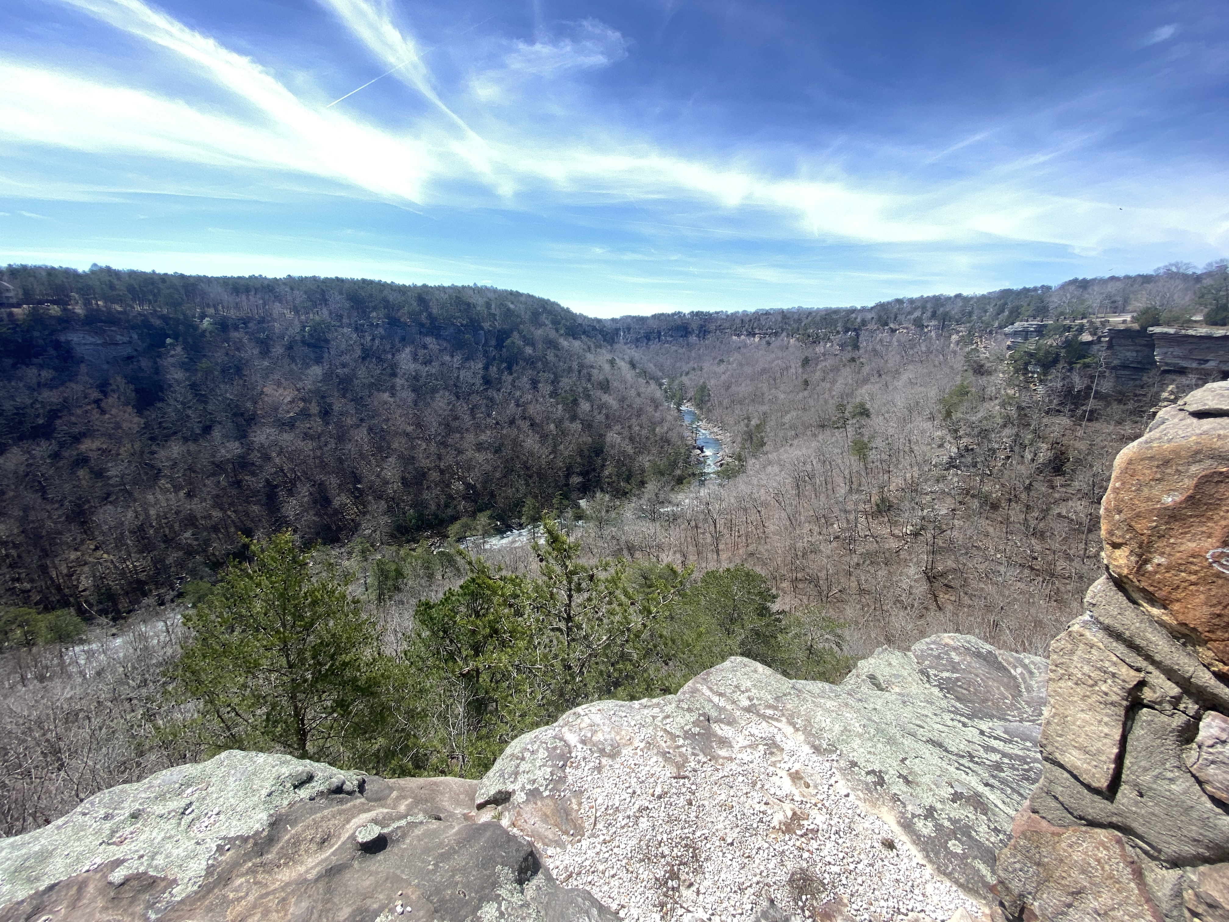
Little river canyon national preserve (LRCNP)
As we were preparing to leave Chattanooga and looking at potential points of interest on our way to Birmingham, we discovered LRCNP. The LRCNP was a great find – it provides a scenic drive along the canyon rim and a number of hikes on top of the canyon as well as down into the canyon.
Hawks Glide Overlook
The Little River flows across the top of Lookout Mountain and has carved a canyon as deep as 600 feet along the way.A river flowing across a mountain top is unusual but has helped keep this area much as it has been for centuries. There is no development within the canyon. The drive to get to the mouth of the canyon is an eleven mile steep, winding and narrow affair which limits the number of visitors to the day use area.
Little River
If you find yourself in Northeastern Alabama for any reason the LRCNP is a terrific place to spend a day driving the rim and taking a hike. https://www.nps.gov/liri/index.htm
Birmingham
We were interested in visiting Birmingham to better understand the history of this city that was so critical to the advancement of civil rights in America. However, our first stop in Birmingham was a visit to the city’s botanical garden.
We knew the gardens would not be at peak this early in the season but the grounds were still beautiful and provided us with a peaceful afternoon walking the paths.
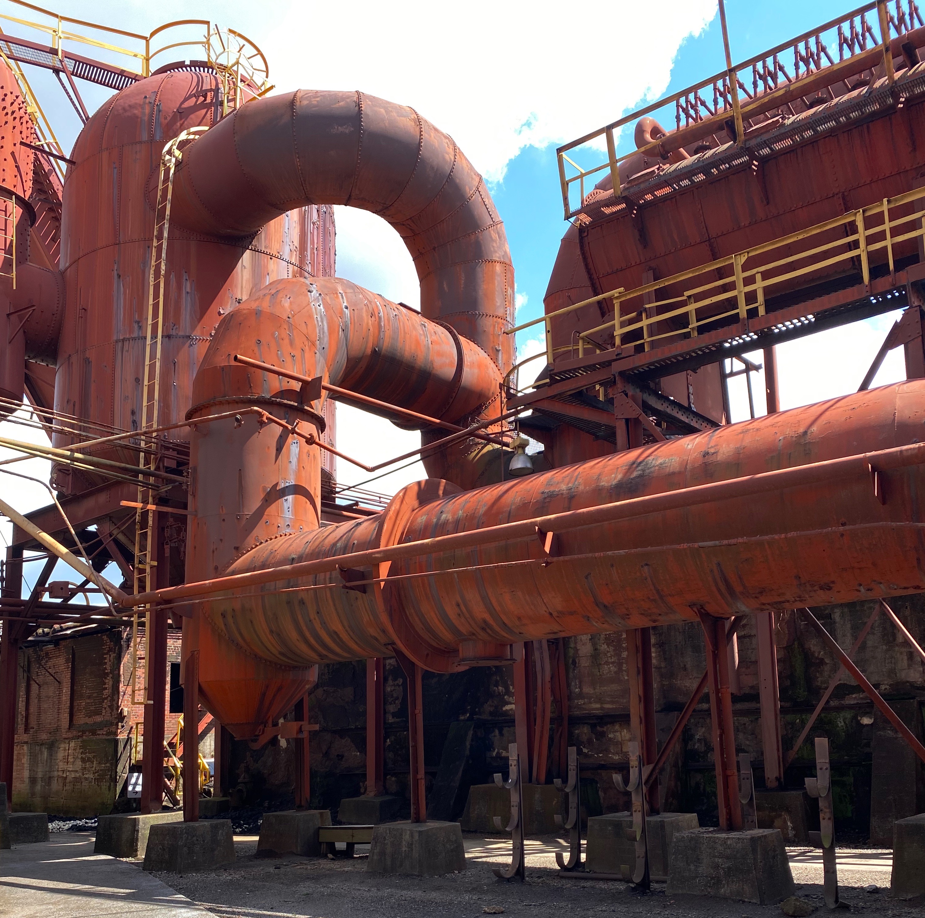
Sloss furnaces
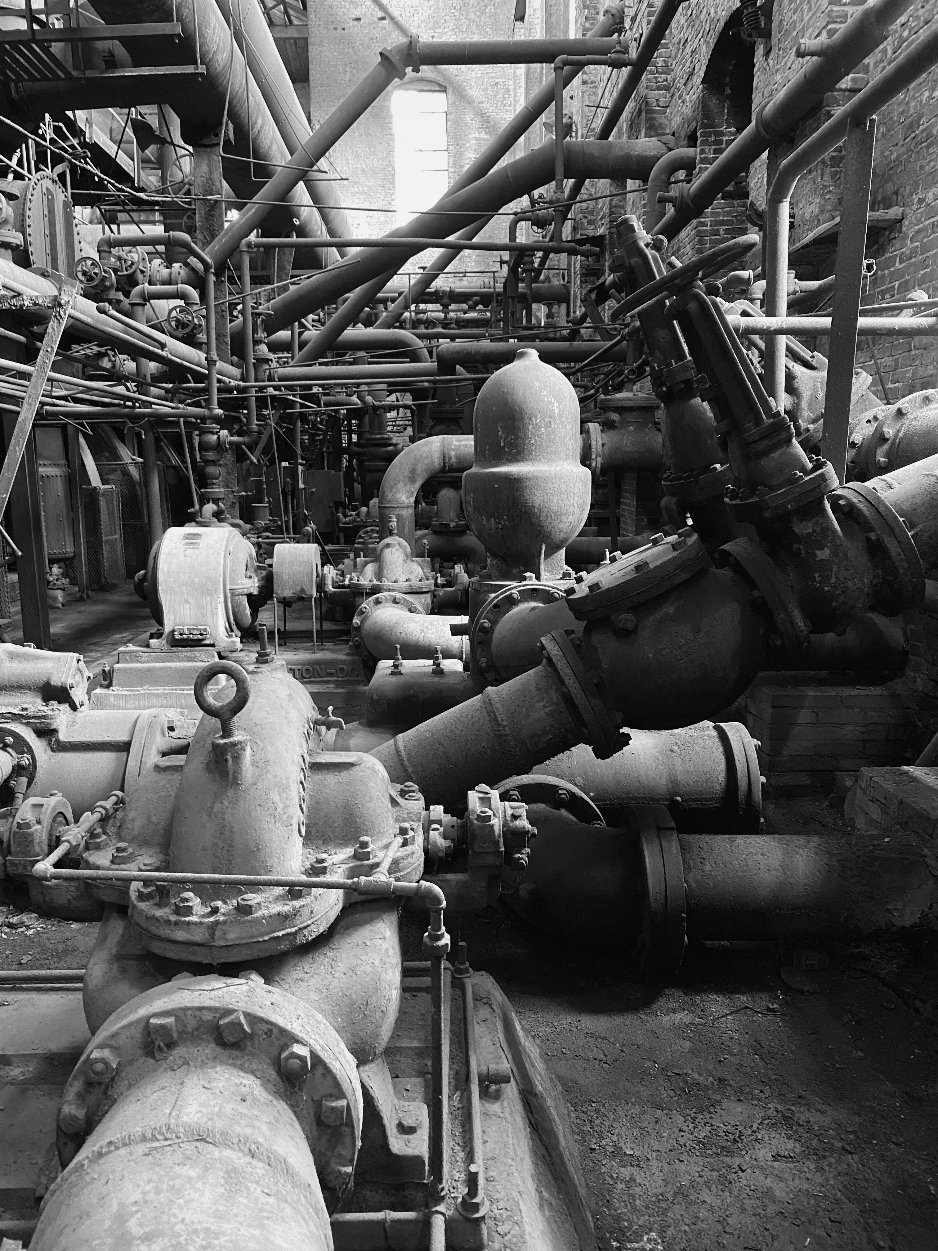
The following morning we commenced our tour (after fika at Seeds Coffee) of the city. We started at the Sloss Furnaces. The Furnaces is a historic landmark which both represents the industrial might that made Birmingham so prosperous and the racism that made Birmingham so notorius.
Sloss Furnaces
Birmingham is known as the Magic City due to its rapid growth and prosperity. Birmingham was just farmland until the mid 1800’s when it was discovered that the three items needed to make steel – iron ore, limestone and coal were all abundant in the area. Combined with the arrival of the railroad, the path forward was set.
The Sloss Furnaces operated from 1872 until 1970, helping to make Birmingham a prosperous city with culture and arts for the white residents.Black workers made up 70% of the workforce but provided 100% of the back-breaking labor in the mines and the furnaces. All managerial positions were held by white workers.The city was not so magical for African-Americans who were paid low wages for working in intolerable and unsafe conditions.To make the situation even more obscene the companies utilized “convict labor” in the coal mines and paid their wages to the city. Ninety percent of the convict laborers were blacks and many were falsely arrested on vagrancy charges, jailed and then leased to the city. This practice continued until 1928 – that’s right – 1928. So much for emancipation.
The workers at Sloss as well as the other furnaces were strictly segregated. Black workers had separate showers, time clocks and entrances. The segregated workplace was not abolished until the 1960’s when the civil rights movement forced the company to abolish the policy.
The Sloss Furnaces as a physical artifact of our history are a superlative piece of history showcasing the rapid and impressive technological advances of the United States. It is an outdoor museum like few others and we think it merits a visit. https://www.slossfurnaces.com/
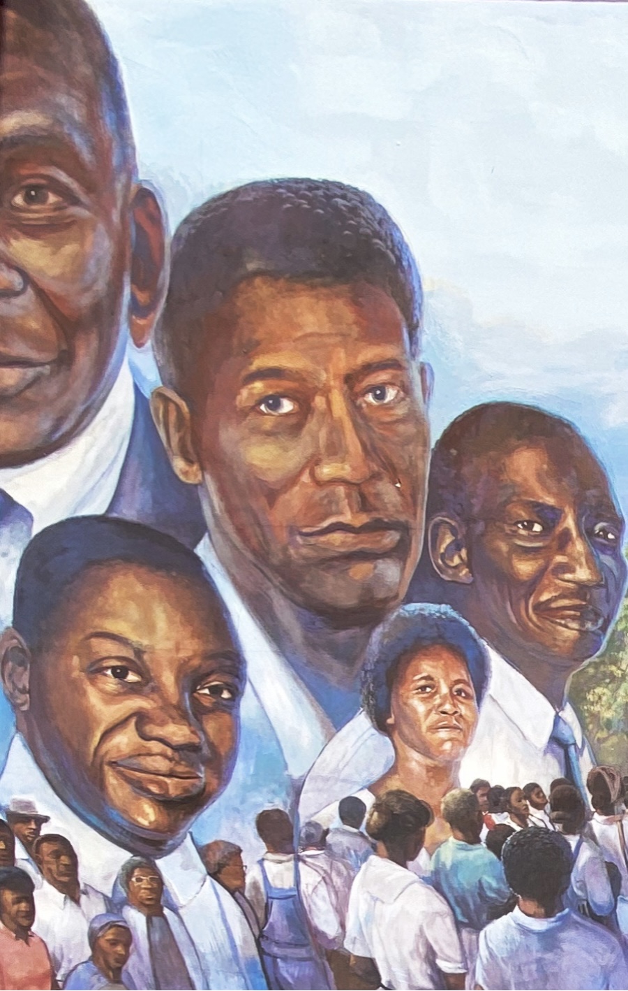
Birmingham civil rights institute
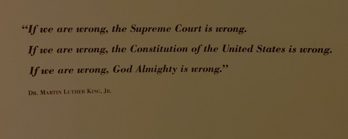
Martin Luther King, Jr – Birminghan Civil Rights Institute
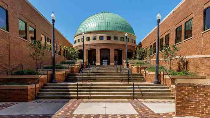
The Birmingham Civil Rights Institue (BCRI) was opened to the public in 1992.The BCRI is part of the Birmingham Civil Rights National Monument. In addition to serving as a museum chronicling the civil rights movement in Birmingham, it functions as a research and educational organization .
BCRI
The museum staff has laid out the story of the civil rights movement in a compelling and dramatic fashion. There are many significant artifacts on display but it is the videos, photographs and recordings of the actual events that give life to the history. We found ourselves struggling emotionally a number of times as we watched and listened to the events that demonstrated the cruelty of the segregationists and courage of people fighting for equality in the face of jail, physical harm or even death.
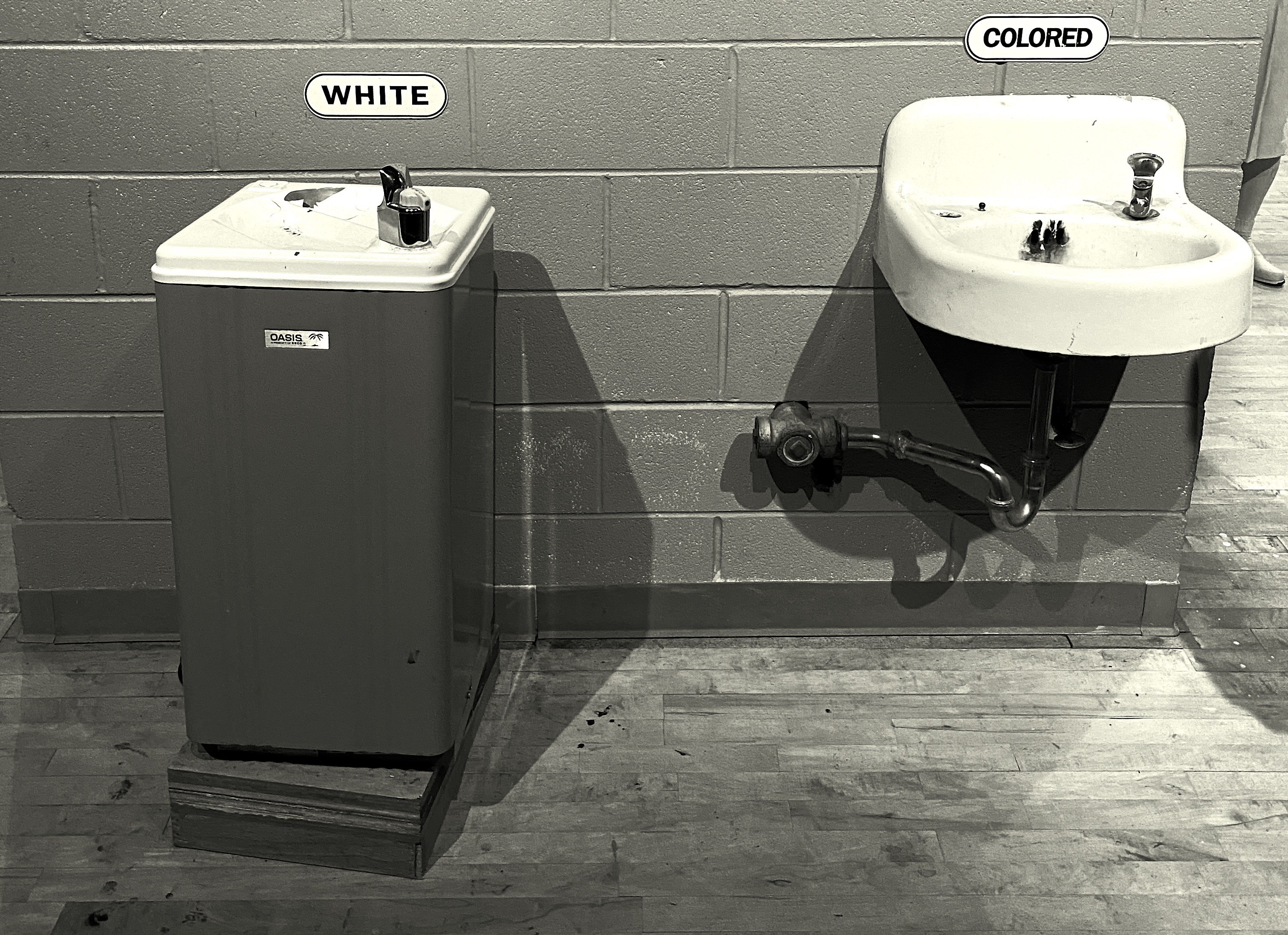
16th street baptist church
16th Street Baptist Church
The 16th Street Baptist Church is across the street from the BCRI. We took a tour of this church that figured so prominently in the fight to end segregation in Birmingham. This church was a central rallying point for the protests that took place in Birmingham.
As a result, white segregationists targeted the church and on Sunday, September 15, 1963, segregationists placed dynamite under the steps on the side of the church. The explosion killed four young girls and seriously injured another young girl.
The 16th Street Baptist Church is still an active and robust parish. The tour of the church is conducted by members of the parish. They are knowledgable and engaging. Several of the elder tour guides were parishioners at the time of the bombing. If you are visiting the BCRI most definitely walk across the street for a tour at the church.https://www.nps.gov/articles/16thstreetbaptist.htm
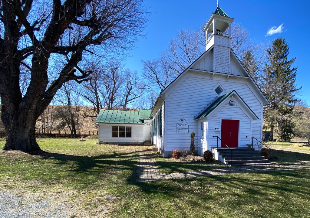
Headwaters Presbyterian Church, 1890, Headwaters, VA (pop. 113)
Cumberland, Maryland
Savage Mountain, GAP
With a cool but dry forecast in front of us we decided to delay our arrival in Virginia and head to Cumberland for a couple of days to take advantage of the forecast and do some cycling. Cumberland is the terminus for two exceptional bike trails. The Great Allegheny Passage (GAP) connects Pittsburgh to Cumberland providing 150 miles of cycling. The trail roughly follows the course of three rivers from west to east:the Monongahela River, the Youghiogheny River and the Casselman River.
The C&O trail begins in Washington DC and follows the C&O Canal for 185 miles to its terminus in Cumberland. Based on a recommendation from some local bicyclists we rode west on the GAP. While the GAP has a better surface than the C&O, riding west is all uphill out of Cumberland. Of course the ride back takes about half as much time.
The scenery along the trail is spectacular as the trail ascends into the Laurel Highlands of Virginia. We definitely plan on going back in the future to ride additional sections of the trail.
Skyline drive
Skyline Drivesits within Shenandoah National Park (SNP). The road winds its way (north/south) along the crest of the Blue Ridge Mountains for 105 miles. Skyline is the only through road in the entire park. Additionally, you can only enter or exit Skyline Drive in four places. We accessed the road at the Northern entrance in Front Royal.
Driving South – Skyline Drive
While the highest elevation on the road is 3680 FASL the views are none the less spectacular. You are witness to broad green valleys reaching across to more ridgeline, and are able to view the Shenandoah River meandering through the valley to the west.
We had hoped to camp overnight at Great Meadows, which sits approximately 51 miles south of the northern entrance at Front Royal. We would then complete the remainder of the drive the following day. We also planned on hiking from the Great Meadows that afternoon. Alas, the campground was gated and we were unable to camp on the ridge.
We also had planned to hike to Lewis Fall from the campground. We still wanted to hike so we pushed on to a trailhead about five miles further south based on a recommendation from a park rangers.
The Rose River Trail is a loop trail that descends from a trailhead at Fishers Gap. The Rose River is just 8.8 miles in length but flows down from one of the highest points on the Blue Ridge until it converges with the Robinson River.
After descending to the valley floor,the climb back up to the trailhead was steep and a bit arduous as you regain the 1000 feet of elevation lost on the way down. The sights and sounds of the multiple waterfalls and cascades that are your constant companions on this hike more than compensate for the effort.
Highland County
After finishing the hike we made our way south completing the drive and heading west to stay in Staunton (pronounced Stanton). We had stopped in Staunton in March, 2020 on our way back to Connecticut after the pandemic cut short that trip – looking for coffee and food. We found an excellent coffee shop and roaster (Crucible Coffee) and an excellent restaurant (Table 44) that were both still operating.We have fond memories of our stop in Staunton as we had limited option in March 2020 – the excellent news is that our memories had not failed us and we again had a great dinner and excellent coffee and tea before heading west to Highland County.
The trip west to Highland is a spectacular ride on Route 250. The road is a twisting up and down affair as you climb up and over the crest of Shenandoah Mountain.
Hankey Mountain Highway -Route 250
Highland County is the least populated county in Virginia. While the county is 416 square miles the population is a mere 2200 people. The economy is dominated by agriculture – mostly in the form of beef cattle as the mountainous terrain and narrow valleys are not conducive to growing crops at scale.
Eastern Continental Divide, Allegheny Mountains
The Western border of the county is formed by the ridges of the Allegheny Mountains (see photo above of Allegheny Mountains as viewed of Shenandoah Mountain). The Allegenies at the western edge of the county also form the border with West Virginia.There are just three communites in the county; McDowell, Montery and Blue Grass. You may find other places designated on maps but they are just remnants of towns.
Beulah Presbyterian Church
We are drawn, as you know, to more remote locations to enjoy nature and solitude but must confess that part of our motive for this segment of OTR 8.0 was the Annual Highland County Maple Festival. The Maple Festival has been taking place for two weekends in March for the last 52 years.
Maple Dounts
What can we say – donuts, pancakes, pretzels, etc. – all made fresh by local residents with pure maple syrup from Highland County. The money supports local churches, civic organizations and businesses. More importantly it is all gosh darn delicious and the people are happy you made the trip up to ”Little Switzerland” from down in the Eastern lowlands!
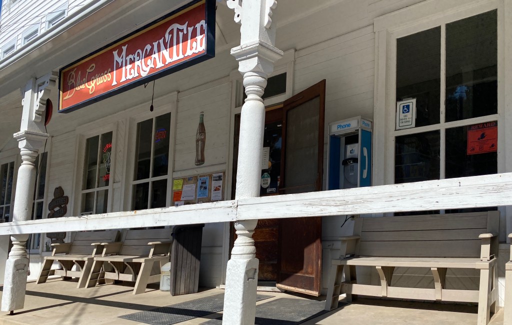
The Curly Maple, Monterey, Virginia (pop. 130)Blue Grass Mercantile, Blue Grass Virginia (pop.144)Episcopal Church of The Good Shepard, Blue Grass, Virginia
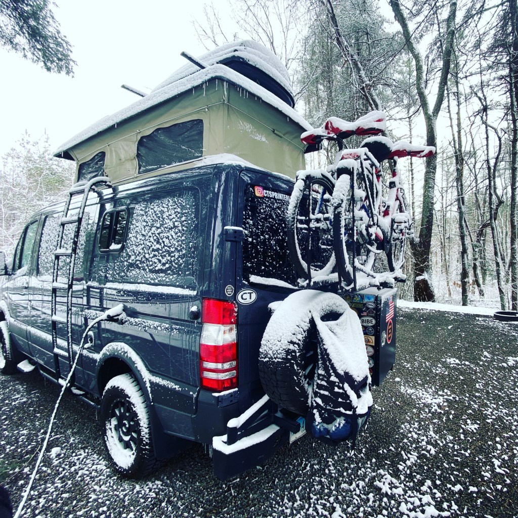
We enjoyed touring the valleys of Highland County and chatting with some of the local folks we met in the towns (even if one of them called us Yankees!) but we knew it was time to move on when we awoke to snow and howling winds.
Be seeing you!
P.S. As you may have noticed if you follow our blog on a regular basis our posts are not published on a strictly chronological basis.
GSMNPis a fantastic destination for hiking.There are 150 official trails within the park that provide over 800 miles of hiking opportunities. The Appalachian Trail also traverses the park.
We spent four days at the park. The mornings tended to be cloudy and foggy in the hollows and valleys so we auto toured in the mornings(after finding coffee)and hiked in the afternoon.
Hikes at GSMNP range from short and easy to full on backcountry. There are many connector trails allowing hikers to elongate or shorten hikes, or to create loop hikes.
GSMNP Trail Map
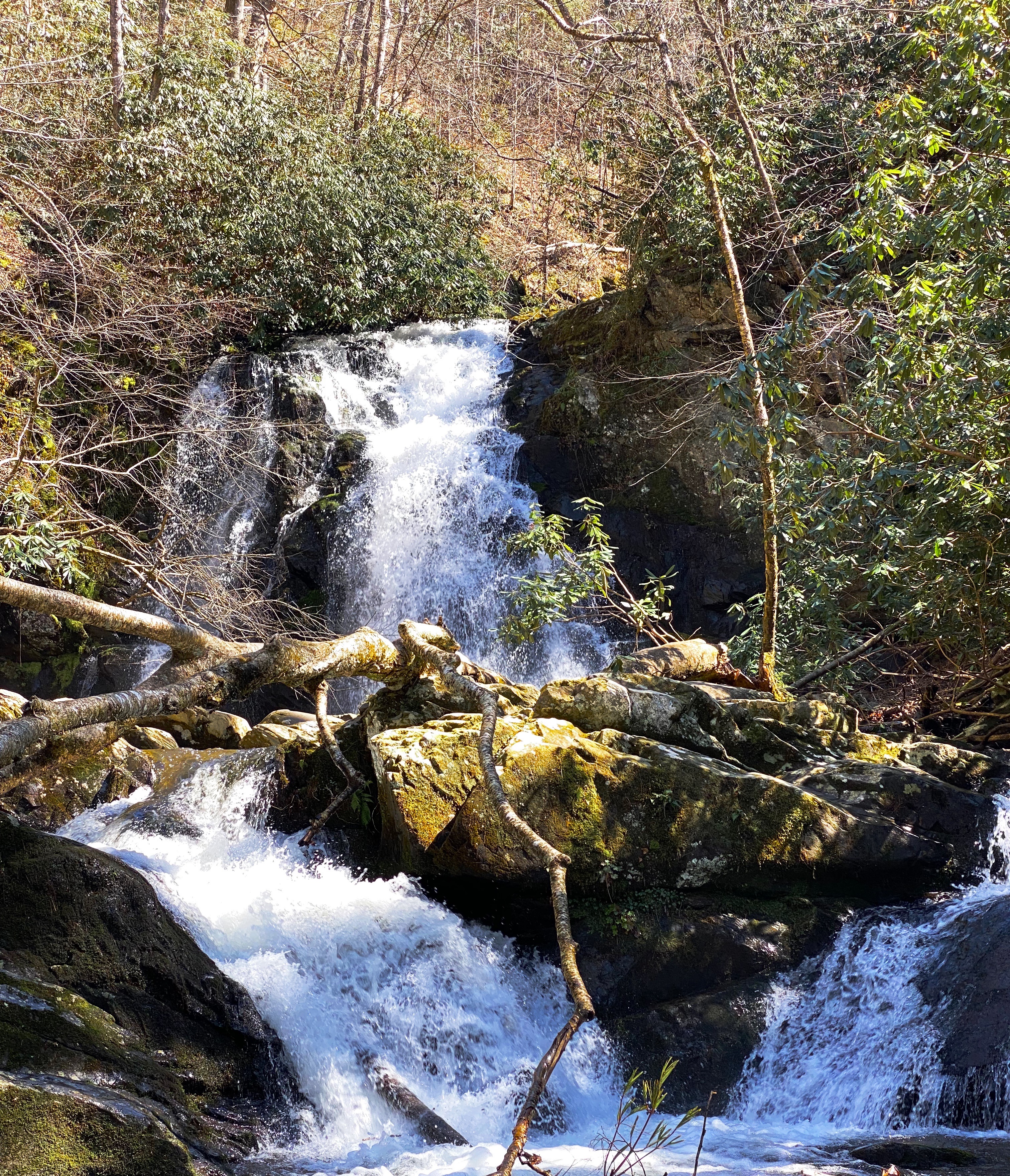
Because of the park’s topography, there are a multitude of creeks, streams, and rivers which make for many water crossings and provide the sound of rushing water as an accompaniment to the beautiful scenery. Additionally, waterfalls abound (especially in spring) providing hikers with plenty of ooh and ahh moments.
Spruce Flats Falls
Auto touring
GSMNP provides plentiful opportunities to take in vistas and view wildlife while touring the park by auto. There are a number of designated tour loops and routes throughout the park. There are almost 400 miles of paved and gravel roads suitable for ordinary passenger vehicles. There are also a number of primitive roads for those equipped with 4wd vehicles with high clearance.
Roaring Forks Motor Nature Trail New Found Gap
Park history
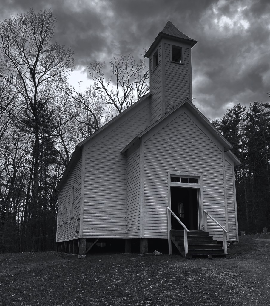
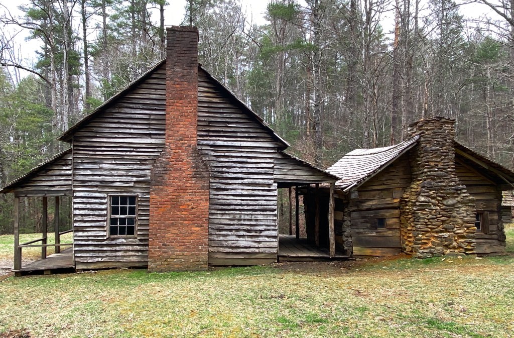
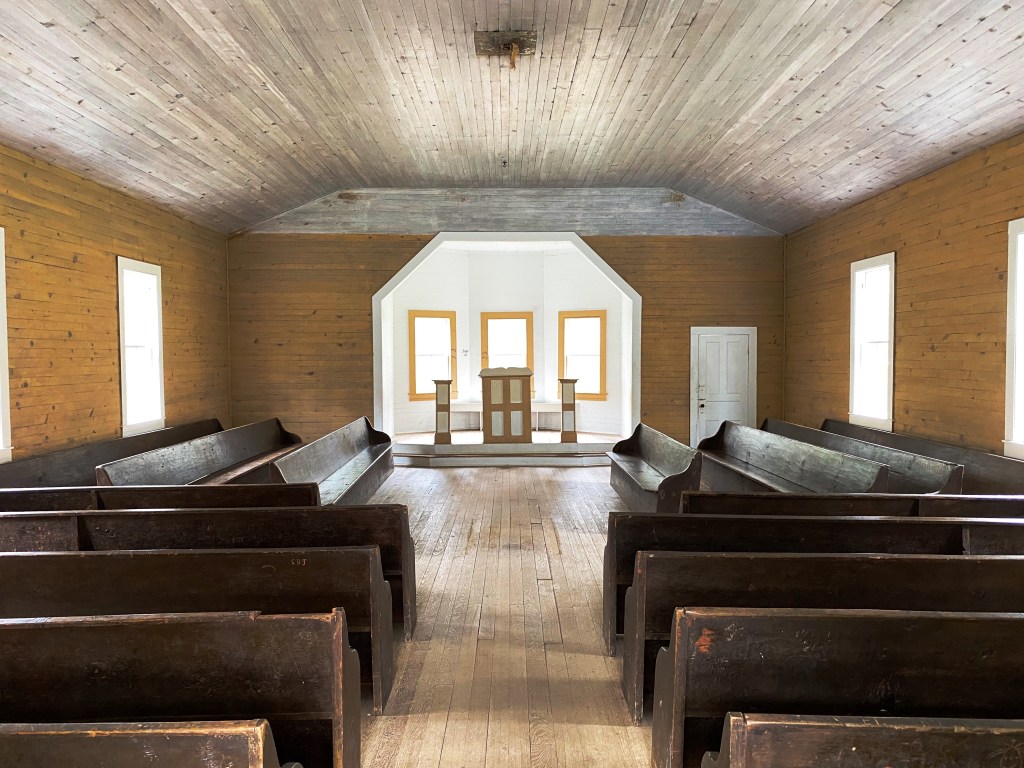
Cades Cove Primitive Baptist Church, 1827
GSMNP opened in 1940 about six years after being chartered by Congress. Much of the land within the park was previously privately owned. Many of the advocates for the park were attempting to stop the massive clear cutting by timber companies that was destroying the forest, and believed a national park was the best way to acquire and protect such a large tract of land (523,000 acres).
Henry Whitehead Cabin, Parsons Branch Road, c. 1895
Of course, in addition to the land owned by the timber companies, there were a number of small communities located within the proposed boundaries. Most of the residents were farmers.
Over a period of years the residents were forced off of their properties and the communities ceased to exist. Amazingly, many of the homes and other structures were not destroyed when the famlies relocated outside of the park.
Little Greenbrier School, 1892-1935
Little Greenbrier School
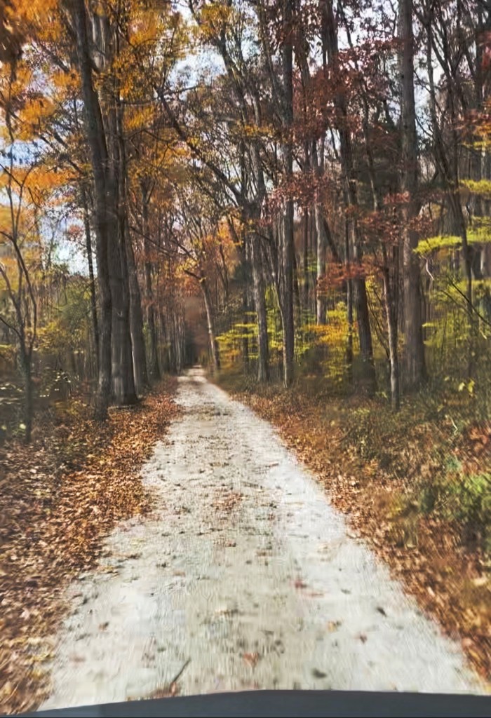
When we toured Mammoth Cave NP during OTR 7.0 we found the more typical situation – all the building and structures had been razed (except several churches and cemetaries) in order to erase the evidence of the communities and restore the land to its state prior to the creation of the park. We thought that practice was disrespectful and, fortunately, that was not the case at GSMNP.
We will skip the discussion of the displacement of the Cherokee Indians as we all know that story. Today, the Eastern Cherokees reside in a reservation just south of the park’s border in Cherokee, North Carolina.
There are over 80 structures still standing and maintained by the park service. The structures include, cabins, schoolhouses, barns, churchesand a grist mill.
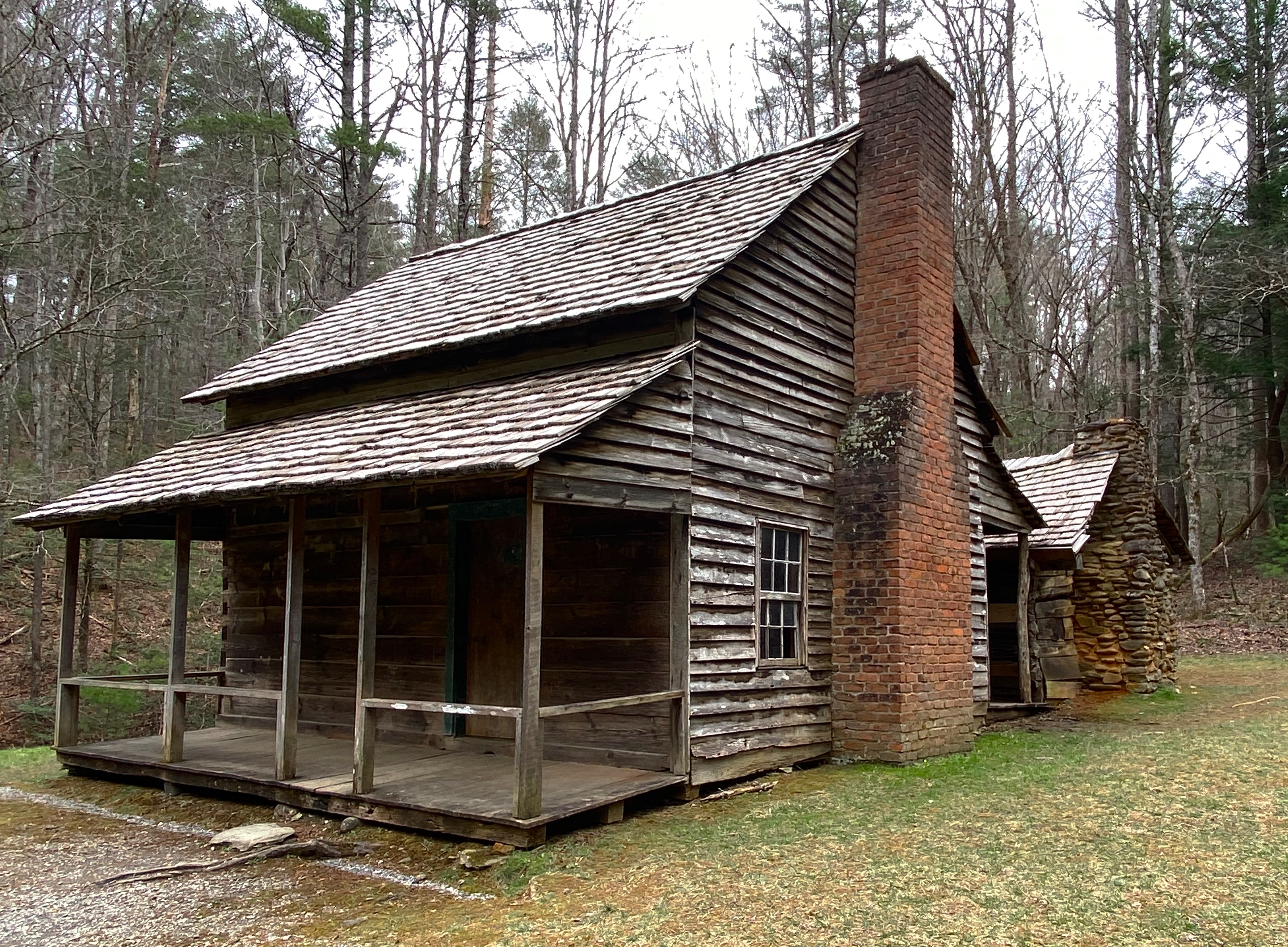
Cantilever Barn, Tipton Homestead
Pictured above and below is a replica of the original cantilever barn that was part of the homestead of William ”Fighting Billy” Tipton. The homestead still boasts the original two story cabin, blacksmith shop and corn cribs.
The origins of the cantilever barn are unknown but they are prevalent in this part of Tennessee. Historians generally agree that this type of barn was favored because it provided cover for the livestock from Tennessee’s abundant rainfall.
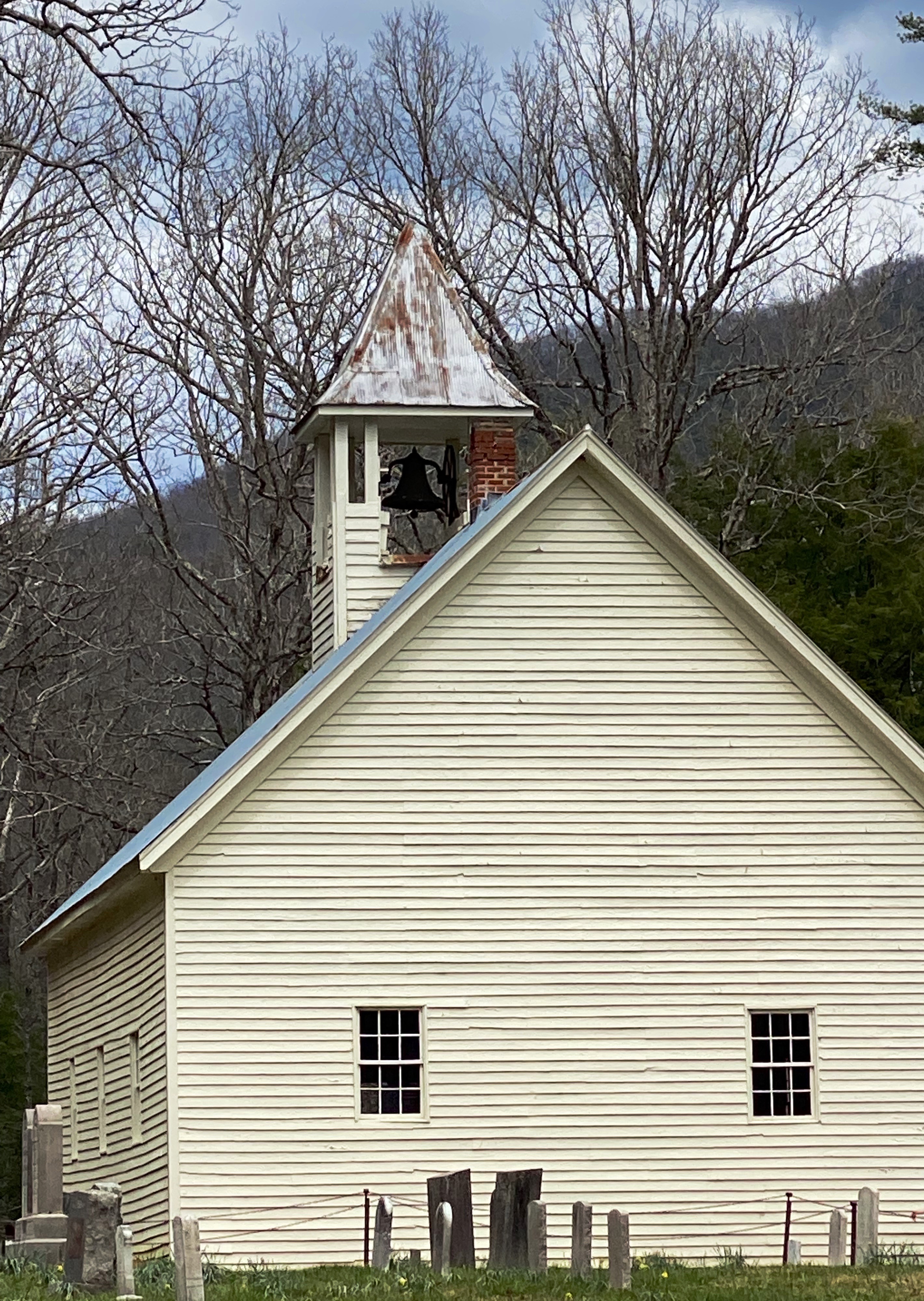
Cades Cove Missionary Baptist Church, 1842
Thoughts
We enjoyed our first visit to GSMNP and definitely recommend the park if you are hikers. Our caveats would be to avoid peak season – from talking with local folks, we understand that the roads into and within the park are jammed in high season. GSMNP recorded over 14 million visitors last year.
Also, we did drive through Gaitlinberg to find coffee – as a result we highly recommend entering the park through Townsend as we did. Gaitlinberg is crowded and uber touristy; it is the antithesis of the park. In our opinion there is no reason to visit Gaitlinberg unless you just cannot get enough of Ripley’s Believe It Or Not Museums!
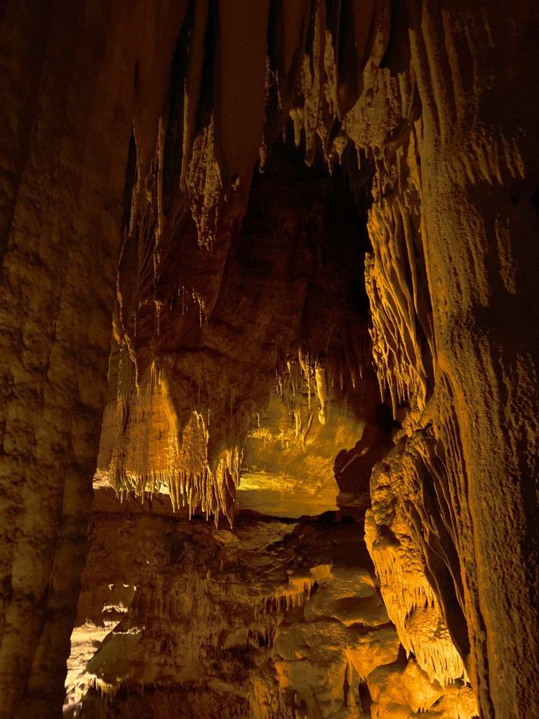
Mammoth Cave, located in southwestern Kentucky, was officially designated as a national park in 1941. The park is approximately 53,000 acres (small by national park standards); its main focus is the cave system which lies under the surface.
Mam Cave, as it is called locally, is the longest cave known to exist in the world at just under 400 miles. The 400 miles of cavern are not linear, but exist on six levels which crisscross and extend out in multiple directions, fitting inside a seven square mile area under the park.
We took a ranger led tour during our visit, venturing down 250 feet below the surface and then through a series of rooms as we gradually climbed back towards the surface to exit the mine.
The park offers a wide range of tours differing in time and the level of physical activity required to complete the tour. We took the Domes and Drips Tour where you are brought through some of the largest domes in the cave system and also to a wetter area where stalactites and stalagmites are still forming.
The lower two levels of the cave are underground rivers – with water draining down from the Green River and the numerous sinkholes in and around the park. In the past visitors could tour the lower cavern by boat but the practice was stopped to protect the environment.
Auto tour
Green River Ferry
A brief History of mam cave
As we mentioned above, Mam Cave became a national park in 1941. What we did not realize until we visited the park and spent time touring the scenic backways of the park was how the park came into being.
Road to Good Spring
The caves were originally mined for saltpeter which was used in the making of ammunition.The caves in the area were privately held and operated by the owners as tourist attractions from the early 1800s until the park became a national park.
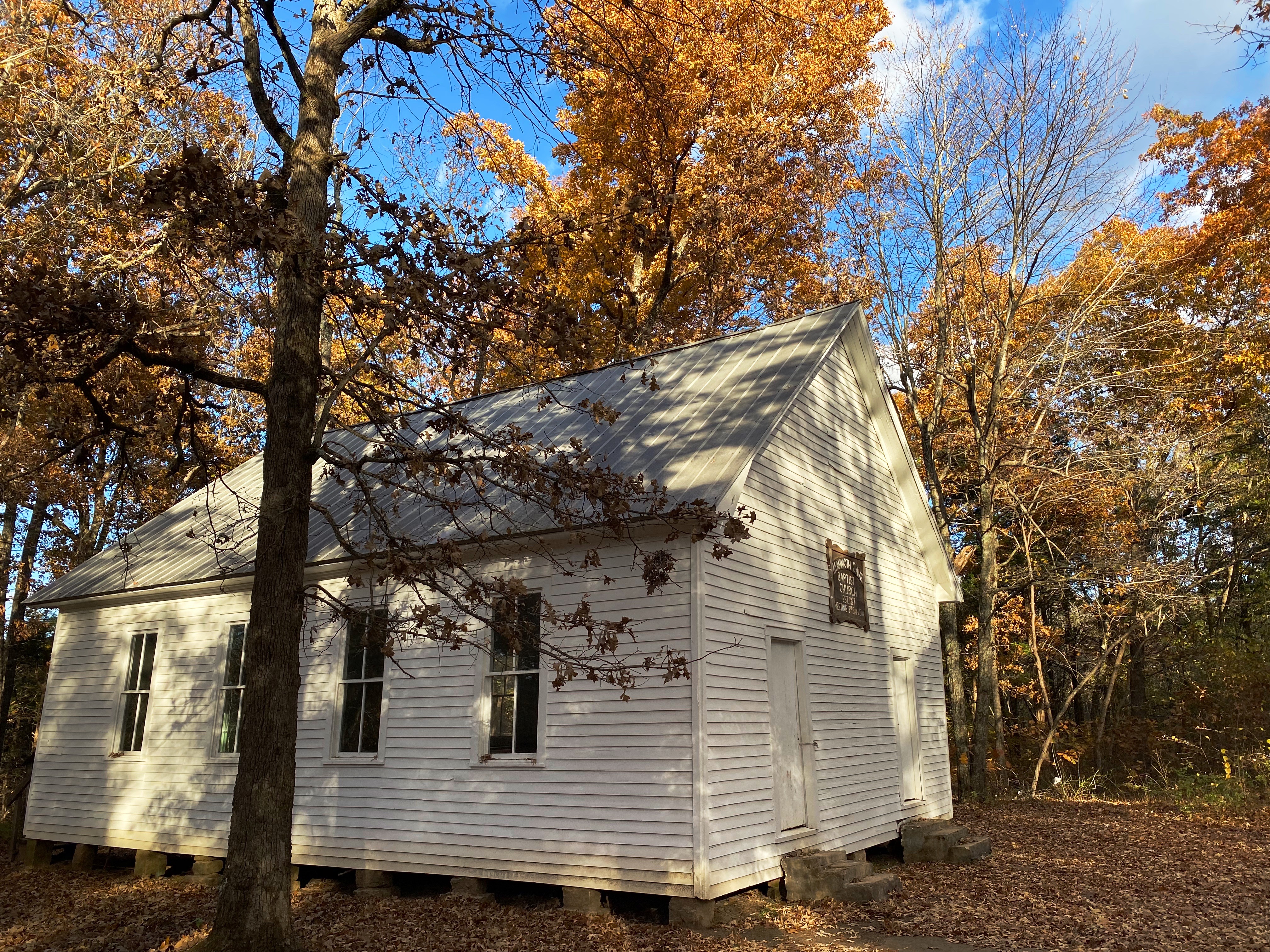
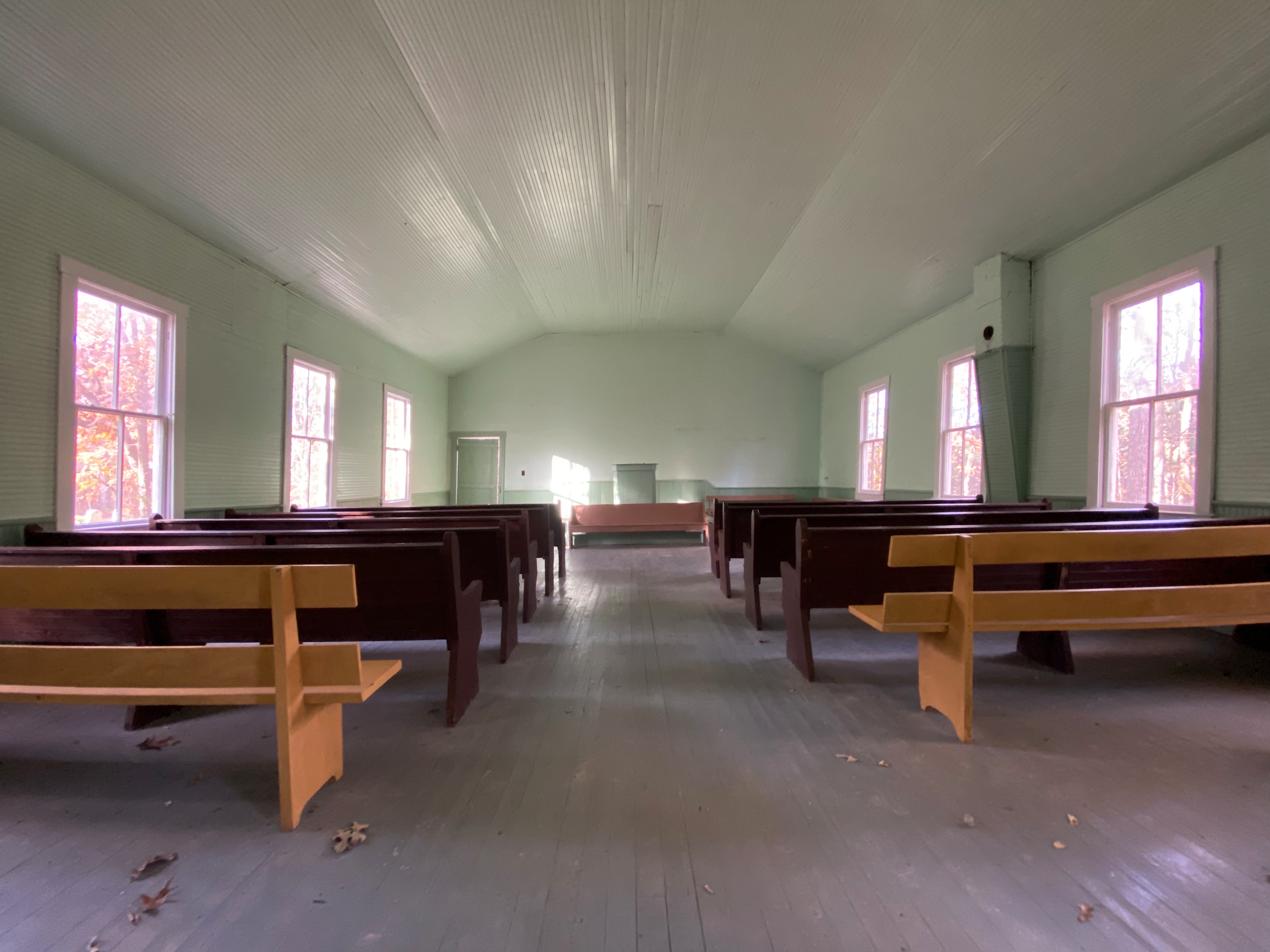
Good Spring Baptist Church
There were many people in government, science and business who, for various reasons, wanted to see Mam Cave designated as a national park and thus be protected. The federal government would not buy land for the creation of a national park but would accept donated land for that purpose. As a result, a private organization was formed for the purpose of buying the privately owned land and donating the land to the federal government.
Over a period of several years the required amount of land was purchased (in some cases through eminent domain). There was also a land donation of 8,000 acres made by a single family.
The photographs above and below show the only remaining structures from three of the communities (Good Springs, Flint Ridge, Joppa Ridge) that ceased to exist as the residents moved to other towns outside of the park boundary. Some of the families and their descendants lived in theses communities for 200 years before they were displaced.
The park service has preserved these churches and the adjacent graveyards, providing a peak into life in early rural America. All other structures from these communities were razed when the National Park was established.
The families of the descendants are still able to use the churches for weddings, funerals and other special occasions. The cemetaries bear witness to this use as we observed newer monuments in each of the graveyards.
Conclusion
We enjoyed our two days at Mam Cave. The cave tour was well organized and interesting. We would have to say that from a persective of the cave only that Carlsbad (New Mexico) and Wind Cave (South Dakota) are more dramatic from a visual perspective.
Having said that, Mam Cave offers a number of hiking and mountain biking trails as well as a paved bike path. Additionally, the Green River which flows through the park provides the opportunity for kayaking and canoeing.
If you are a national park fan and have not yet visited, we recommend that you include Mam Cave in an upcoming park itinerary.
After a brief but exhilarating visit to Moab (see post Moab = Fun and Adventure) we set out for Durango across Utah 46 which becomes Colorado 90 at the border. Colorado 90 is a gem – a beautiful ride up into the Southern Rocky Mountains within the Manti-La Sal National Forest. The pass at the top of route opens up to the panorama of the Paradox Valley. The majority of this route is very remote and we would not advise traveling this road in winter weather.
Climbing Route 90 EastboundParadox Valley, Colorado
Descending into Paradox Valley
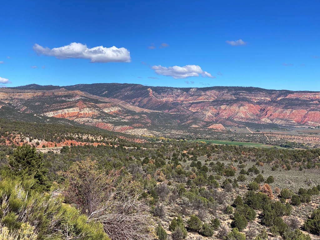
The Paradox Valley is a remote, thinly settled and beautiful place. The valley is approxiamtely 25 miles long running in a north – south direction. The width of the valley is between three and five miles. The paradox that led to the naming of the valley is the unusual east to west flow of the Dolores River which cuts across the valley, as opposed to running the length of the valley.
Paradox Valley from Slip Rock Hill
A Canadian company proposed building a uranium mill in the valley in 2009. Fortunately, the project was abandoned in 2020. As much as we recognize the need for extractive industries it would have been a shame to alter the beauty and character of this place with a uranium mill and everything that comes with the extraction of radioactive materials.
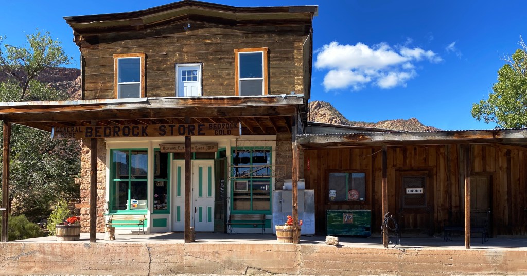
Bedrock Store, Bedrock, Colorado(pop. 56)
We were looking forward to taking a break at the Bedrock Store (serving outlaws since 1881). The Bedrock Store was used in the filming of the movie Thelma & Louise. Unfortunately, the store was not open.
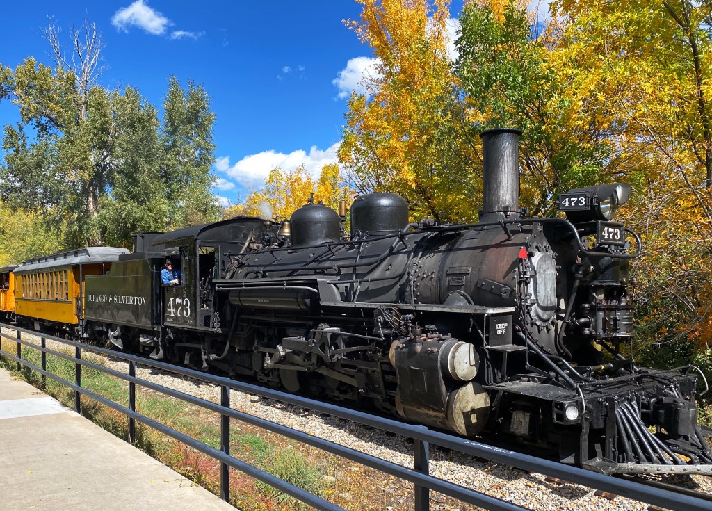
Durango
Taste Coffee, Durango, Colorado
We made a brief stop in Durango, CO enroute to New Mexico. Durango is a mountain town which sits just below 8000 feet above sea level and is a base for the alpine ski mountains in the areas. The town sits along the Rio de las Animas Perdidas which provides wonderful scenery for the bike path nestled on the bank of the river.
As you might surmise from the photos we were quite taken with Taste Coffee as well as barista and co-owner Mike Clarke. P.S. There is a narrow gauge railroad that runs from Durango to Silverton – which we did not ride because we left town to avoid a predicted snowstorm – but it looks like a lot of fun.
Biking and Fika in Durango
Aztec
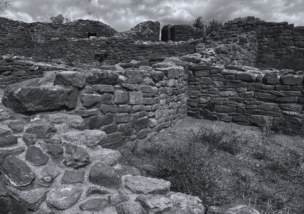
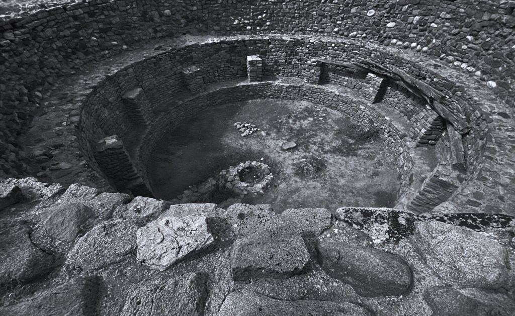
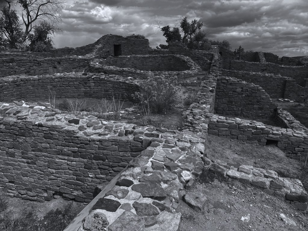
With heavy snow predicted in the Western Rockies we re-routed due south into New Mexico – stopping to visit the puebloan ruins located in the town of Aztec, Colorado.
The Aztec Ruins National Monument is located in the town of Aztec, New Mexico. The ruins are 900 years old. We utilized the excellent self-guided audio tour to explore the ruins. This is an impressive site with over 400 rooms and an a restored Pueblo Great House. It is well worth the visit if your travels will be taking you to northern New Mexico. ( https://www.nps.gov/azru/index.htm )
CHAMA
Camping on the Rio Chama
Change of plans
Route 17 Colorado
After our overnight in Chama we traveled north and east across Colorado Route 17 to access the Carson National Forest for our planned overland trip from the border to Jemez Springs, NM. When we arrived we found the forest roads still covered in snow with mud underneath. This is a bad recipe for safe travel on narrow mountain roads so we decided to hold off on overlanding (no paved roads) until conditions improved.
Carson National Forest
Taos
We decided to visit Taos while waiting for better conditions on our overland routes. We will report on our stay in Taos in our next post.