
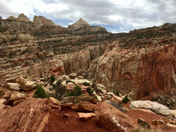
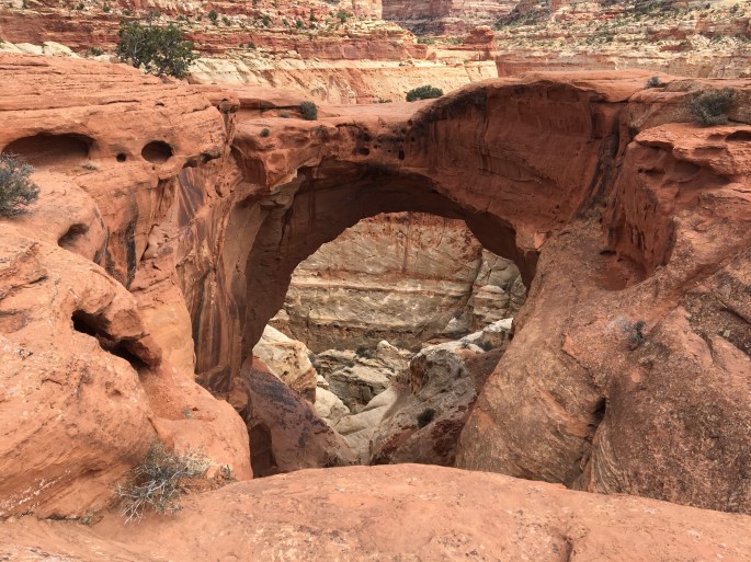
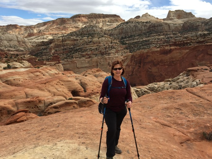
Cassidy Arch and Frying Pan Trail
Strenuous hiking today with several miles of moderate to steep climbing but well worth the effort with tremendous views. We first climbed to Cassidy Arch and then continued the hike to the highpoint of apx. 6400 ft on the Frying Pan Trail.


Cassidy Hiking Map
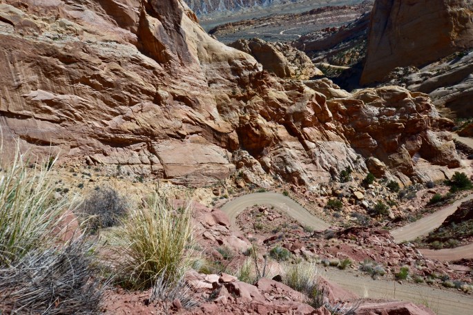
Notom Rd – Burr Trail Loop
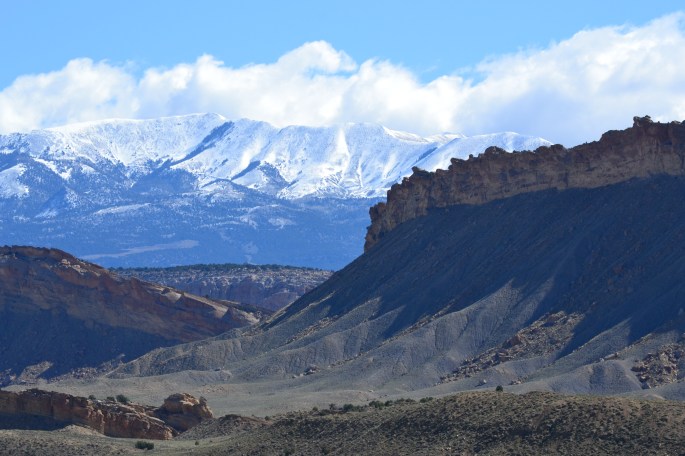
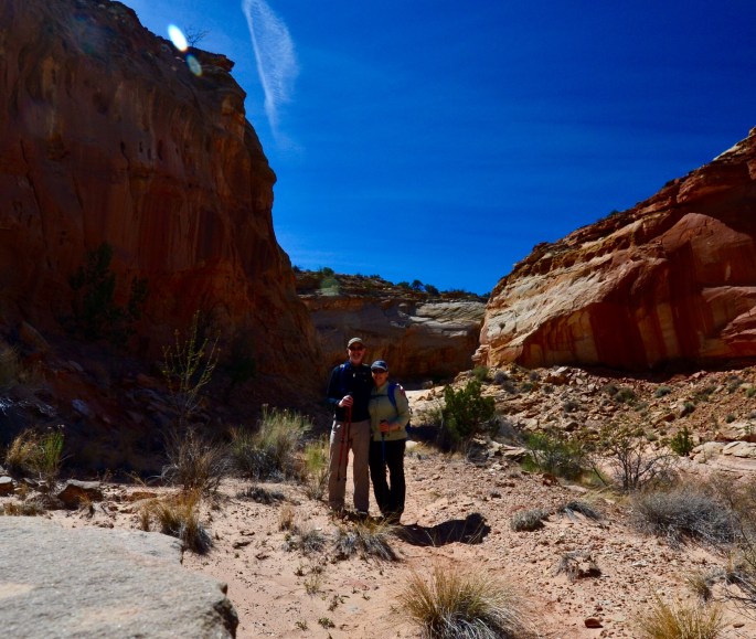
Sunday’s weather provided a beautiful backdrop for our drive and hike within the Waterpocket Fold District within CRNP. Our drive began with a thirty mile trek down the sandy and occassionally muddy Notom Road which provided spectacular views of the Reef and the Henry Mountains. We turned east at the junction with the Burr Trail to drive the incredible switchbacks to the top of the Reef. We then left the Burr Trail to journey up the 4WD track to the Strike Valley Overlook trailhead. After hiking up to see the impressive view of the full length of the valley we hiked back down and then hiked the Upper Muley Twist Canyon stopping at the Saddle Arch before returning to the jeep and back down the wash to the Burr Trail. The Burr Trail becomes paved after several miles and winds its way through numerous canyons ending at Rte 12 in Boulder. Boulder is an impossibly small town 40 miles from any other town but fortunately is the improbable home to a highly rated Zagat restaurant – Hell’s Backbone Grill. We had a great dinner and bottle of wine before heading north over the 9600 ft elevation of Deer Mountain within Dixie National Forest. A great way to celebrate Stephen’s birthday with a beautiful day and a wonderful dinner.


Stike Valley-Waterpocket Fold


Strike Valley and Burr Trail
Below
Upper Muley Twist and Saddle Arch


Upper Muley Twist Hiking Map
Cohab Canyon and Frying Pan Trails
Today we hiked the Cohab Canyon to the North Overlook and a portion of the Frying Pan Trail. After a challenging initial climb consisting of 22 switchbacks and a 20% grade over a quarter of a mile we explored the canyon which included multiple slot spurs and a further climb to the North Overlook. We then made another climb up Frying Pan Trail which is completely on the Kayenta Formation. From there we retraced our steps back to the trailhead.


CohabCyn Hiking Map
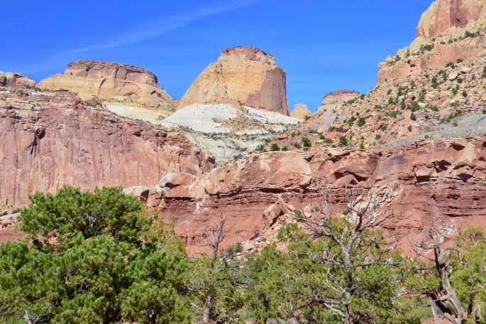
Capitol Gorge and Pleasant Creek
Today we hiked the Capitol Gorge Trail from the trailhead to the boundary of the park. Beautiful day with temperatures in the high fifties – perfect for hiking. After the hike we drove to Pleasant Creek on a 4wd track.


Capitol Gorge Hiking Map
Price to Torrey
Today we traveled from Price to Torrey where we will be staying while exploring Capitol Reef National Park. Along the way we traveled through the northern section of the San Rafael Swell to visit the Cleveland-Lloyd Dinosaur Quarry which has one of the largest and densest concentrations of dinosaur fossils ever found.
From there we traveled further south with the intent of driving through the Buckhorn Wash to visit the Wedge (aka the Little Grand Canyon) but rain overnight made the sand and dirt roads impassable. Instead we ventured south on Route 72 which took us through Fishlake National Forest and over the summit at Hogan’s Pass where we encountered gale force winds and snow.
Tomorrow we begin our hiking at Capitol Reef National Park.


Cleveland-Lloyd Dinosaur Quarry
 Paradise Valley, Fishlake National Forest
 Foy Bench 8975 Elevation
 Cathedral Valley
 Torrey, Utah
More Snow!
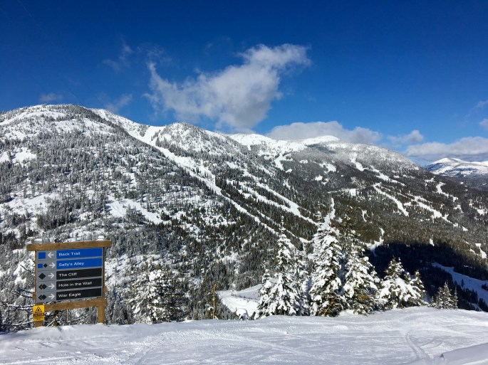
Tree skiing today with snow falling throughout the day. Travel day tomorow. Red Mountain is a terrific ski mountain with great terrain, no crowds and fine snow conditions. We met folks from Australia, New Zealand and many transplants from other regions of Canada.
Rossland is a small, funky and very friendly little town. Sort of off the grid and the residents are very focused on preserving their lifestyle and the incredible natural beauty of the region.
Over and out.


Cookie Jar!
Great snowshoeing today with all the recent snow. We left Nancy Greene Summit trailhead heading to the Mosquito Cabin within the Rossland Range trail system. On the way we found the Cookie Jar cabin originally constructed during the early 60’s and decommissioned in 2015. The cabin is still in relatively good shape but as you can see by the photos below well covered with snow. The cabin has been designated for preservation as an historic landmark. We followed a steep trail which ascended apx. 600 feet in the first three quarters of mile making for a strenuous hike with the starting elevation of 5200 feet and the deep powder. We did not reach the cabin as the last half mile to the cabin was exposed ridgeline with high winds.
After completing our hike we went into town for lunch. After lunch we visited Kootenay Gateway which features local artists. There we met Rachel who works locally as a guide. She is originally from New Zealand and has skied all over the world. She met her current partner when skiing at Red Mountain eight years ago and they conducted a long distance relationship for two years as Rachel spent half the year in New Zealand and the remainder here in Rossland. They now live here in Rossland and have a four year old daughter. Rachel says the best snow in the world for skiing is in Japan (we have not booked the trip yet!).
More importantly, Rachel tipped us off to the Mountain Nugget for locally made chocolate and the best hot chocolate! We followed that tip by eating at Mook Thai Restaurant which was recommended to us by the owner of a local shoe store – The Red Pair (two red headed sons!). Excellent Thai and Chang Beer to boot (no pun intended).
Notes: The selfie of the two of us has pine needles in the photo because we perched the camera on a pine tree branch. The bottom photo is Coumbia Street, the main street in Rossland with several of the ski mountains in the backdrop. There is one traffic light in Rossland although it is a blinking light (not sure if that counts).

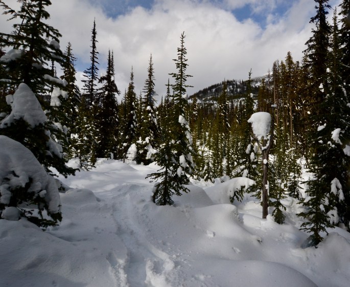


Powder!
 With snow falling steadily from Sunday afternoon through Monday evening conditions have been great. Lots of powder snow and great tree skiing. Snow will start again tonight and continue through Friday.


Day Trip to Nelson
On Sunday we took the day off from skiing and snowshoeing and hit the road to visit the “big city” of Nelson (pop. 10,000). The ride up provided the excitement of driving through the Nancy Greene Summit Pass (check out the video) and then motoring along the Kootenay River (pictured below). Of course, a major goal of our trip was to find the best coffee roaster in the region.
Happily, we can report that we had productive and delicious stops at Oso Negro Coffee Roastery and John Ward Fine Coffee both located on Ward Street.


