
Subscribe to continue reading
Subscribe to get access to the rest of this post and other subscriber-only content.
Subscribe to get access to the rest of this post and other subscriber-only content.
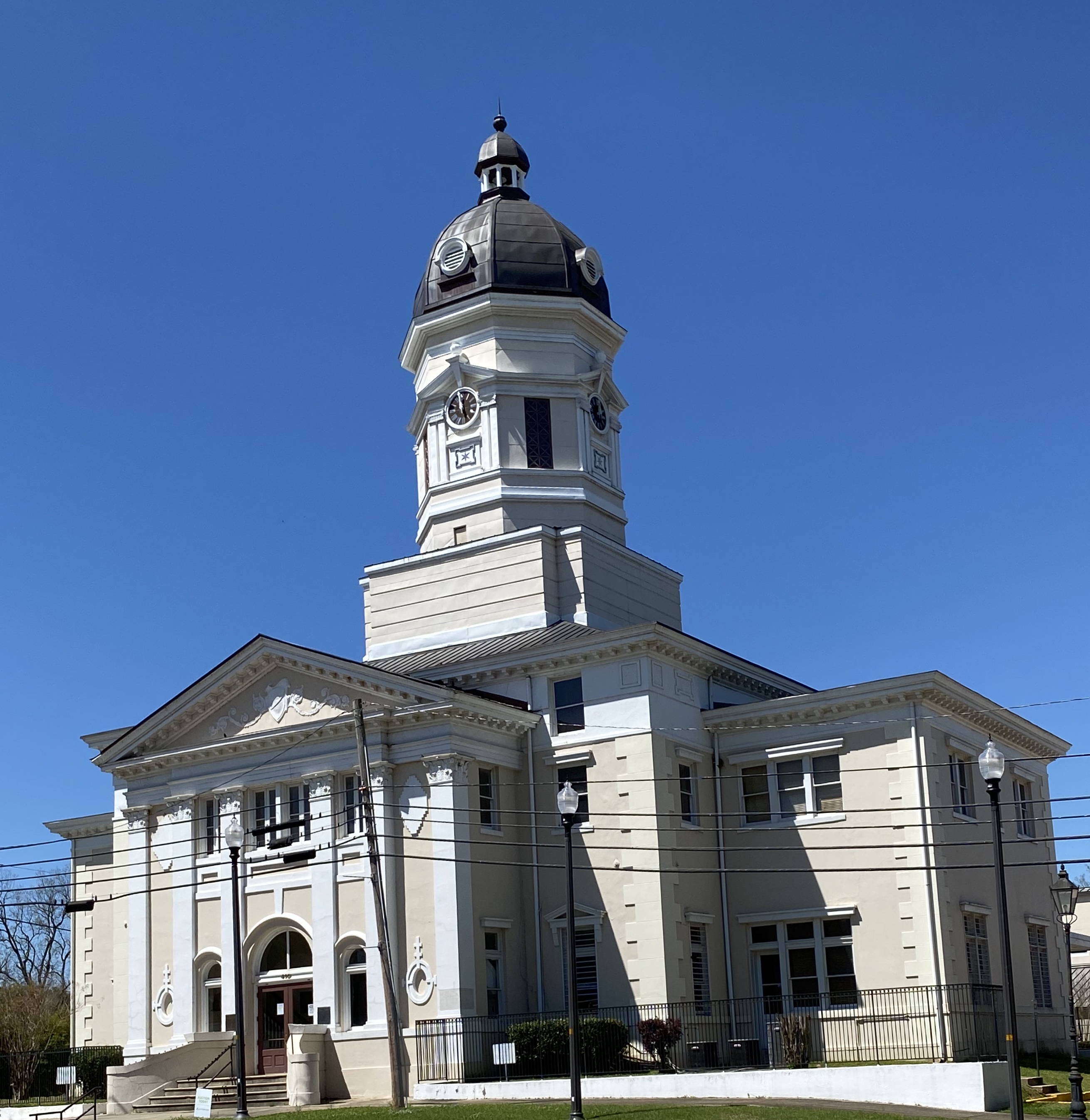
During a visit to Birmingham on a previous OTR we had taken in quite a lot of the history of the civil rights movement. At the time, a guide at the 16th Street Baptist Street Church had recommended that we visit Montgomery in the future to further our knowledge and understanding of the history of slavery and the civil rights movement in the United States. As we planned to head south before heading west to Arizona, we incorporated a stay in Montgomery into our journey.
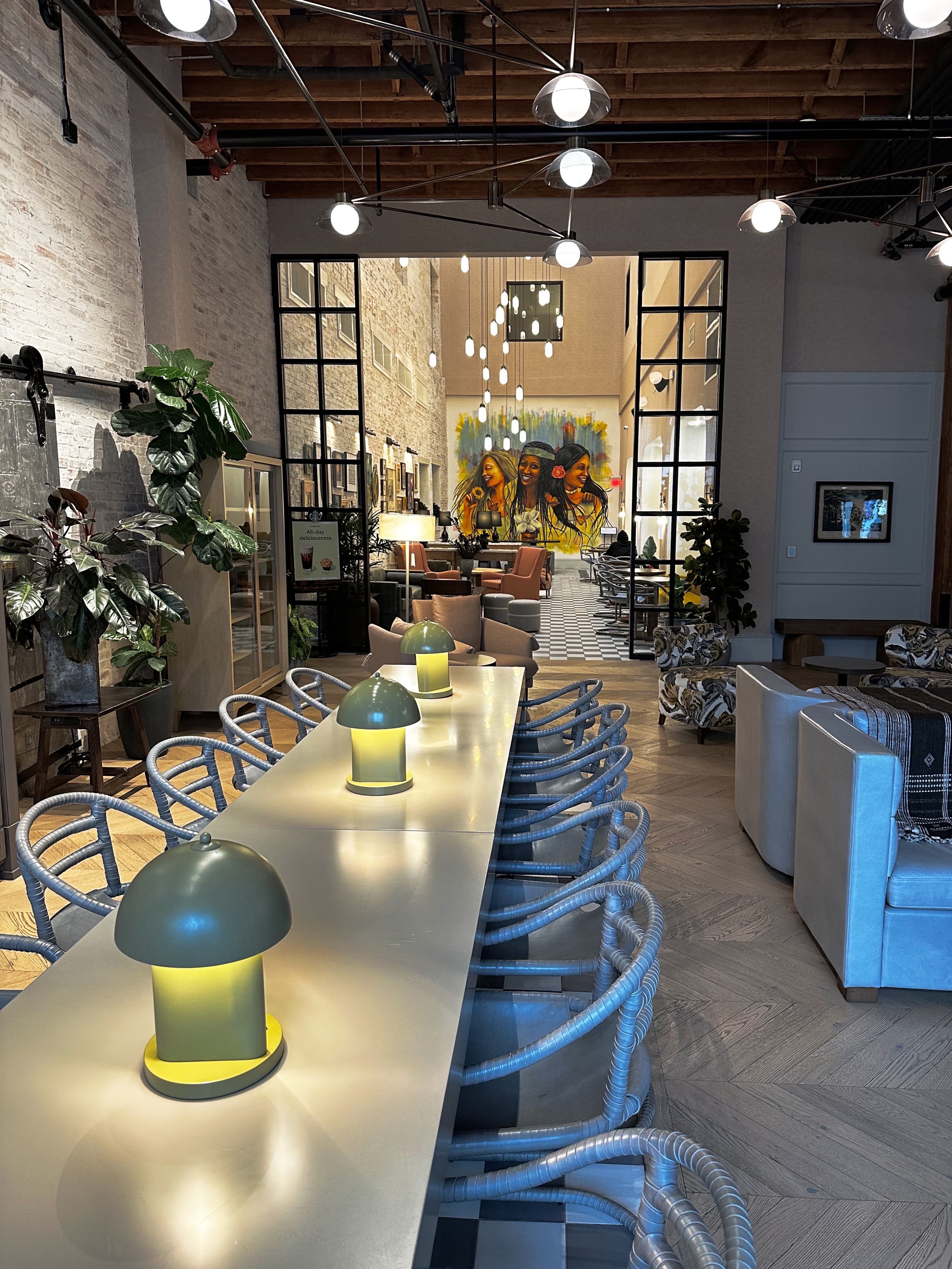
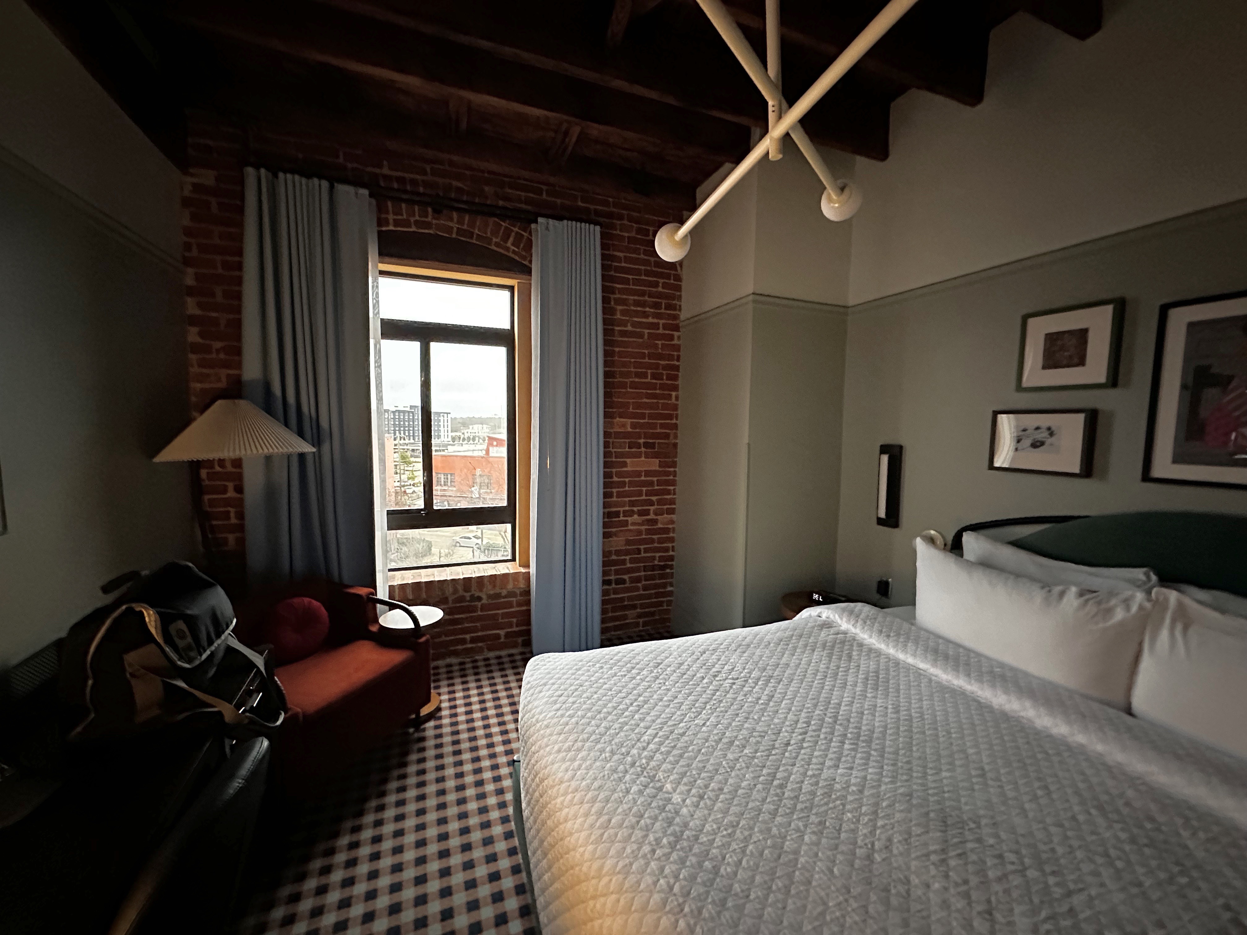
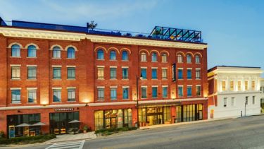
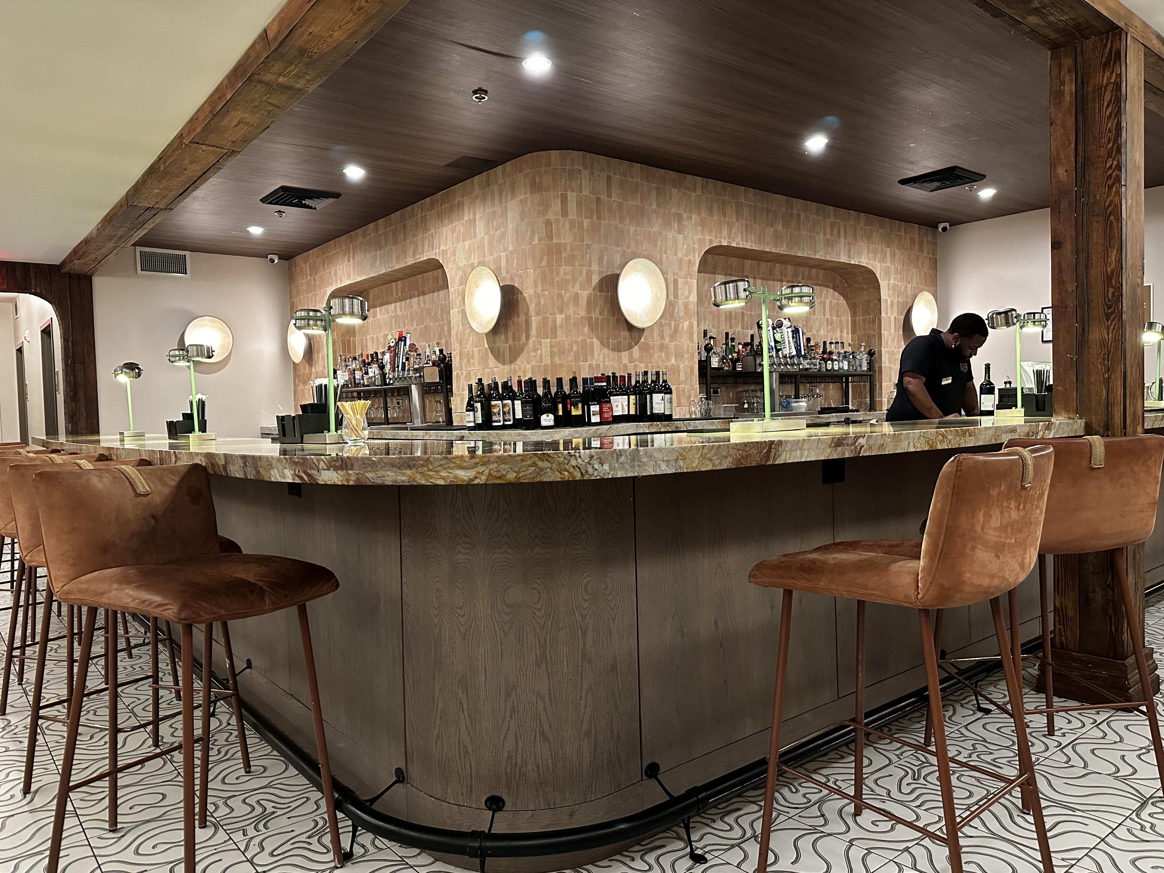
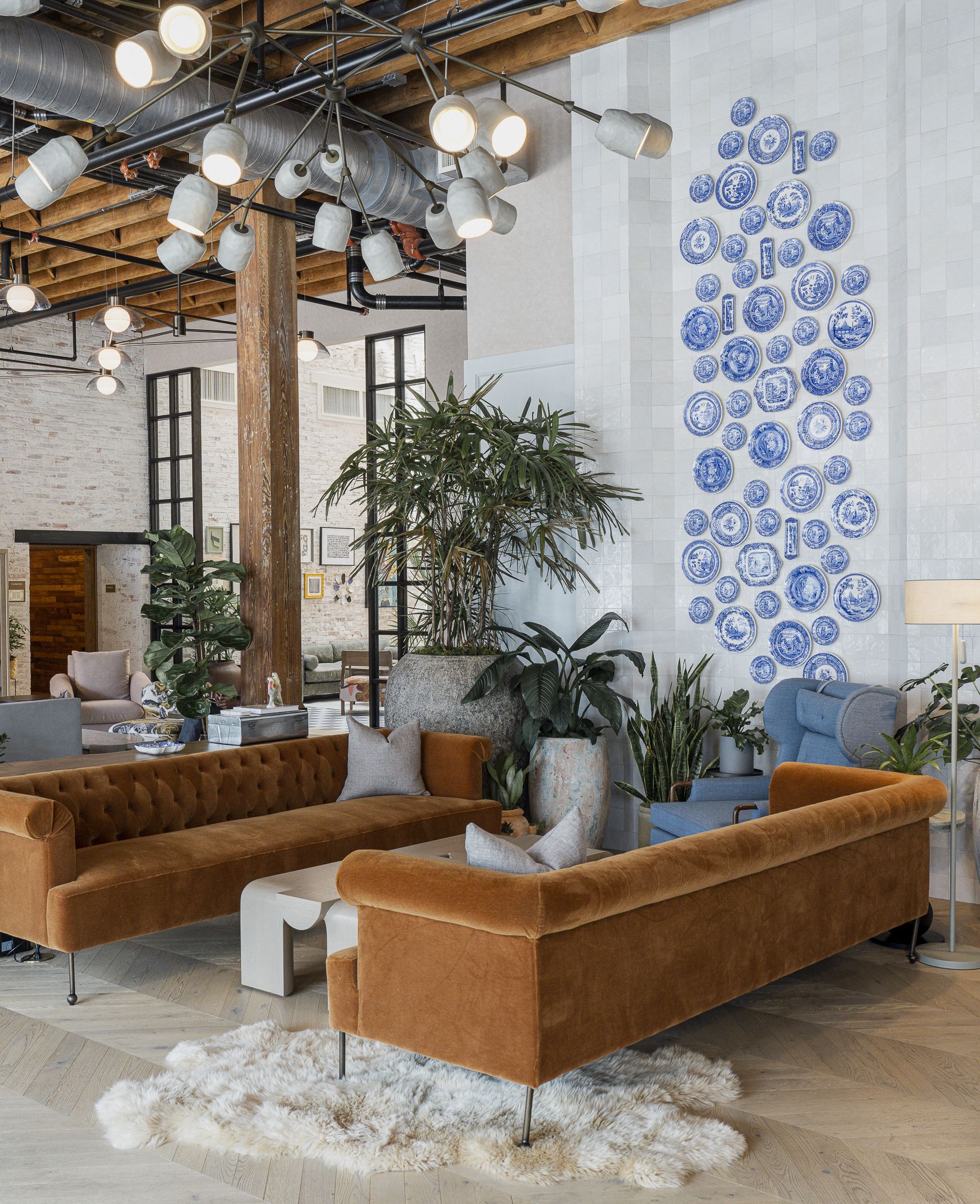
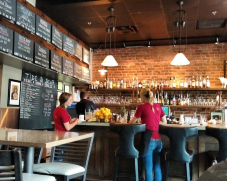
We chose the Trilogy Hotel as our base. The hotel is located in the heart of the city and within walking distance to the museums we planned to visit (as well as coffee).

The Trilogy Hotel opened in 2023. The hotel reflects the history of the city, consisting of two renovated cotton warehouses joined with an 1851 Greek Revival mansion housing the hotel restaurant (The Kinsmith). The hotel is beautifully decorated with artwork and furnishings which are authentic to the area. The service was friendly and professional.

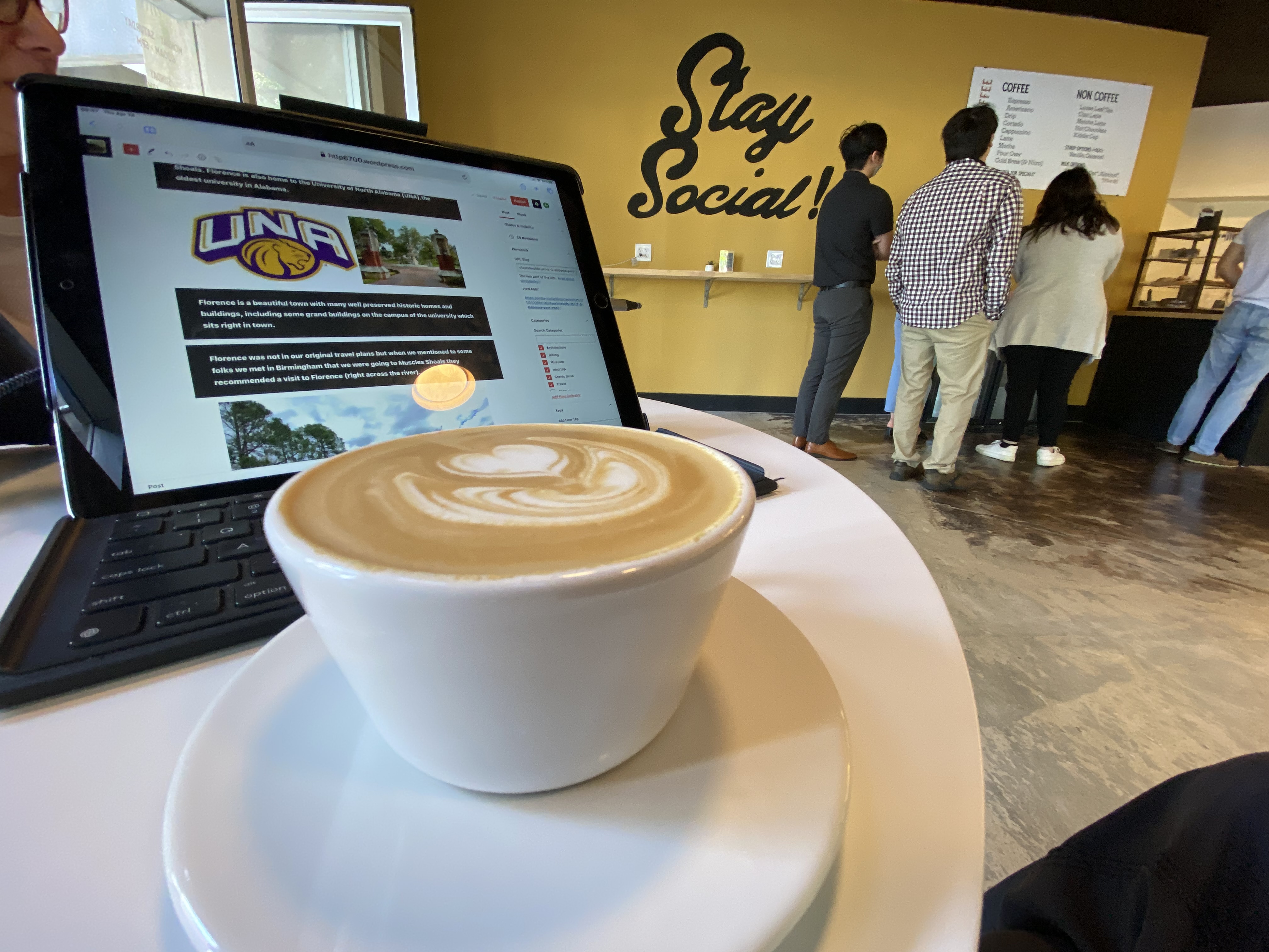
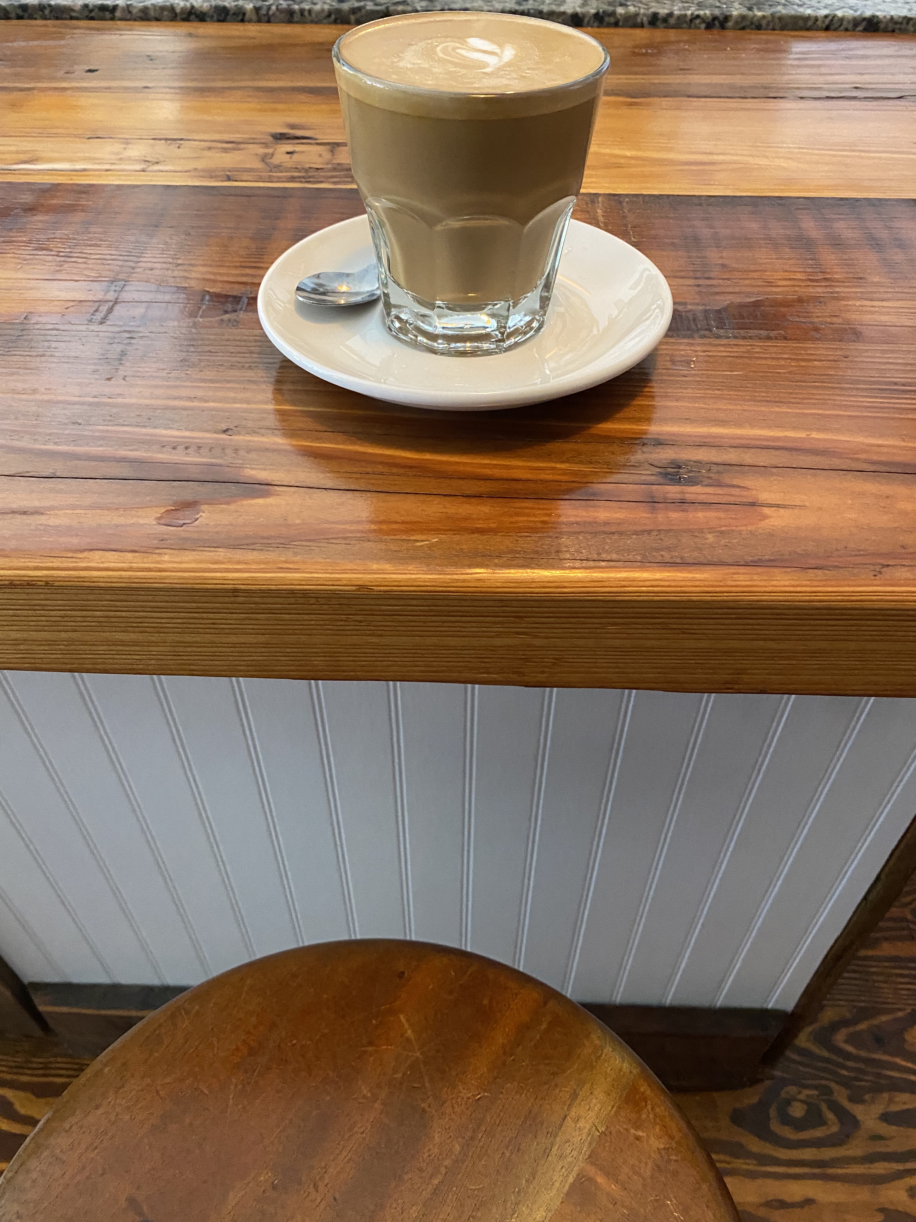
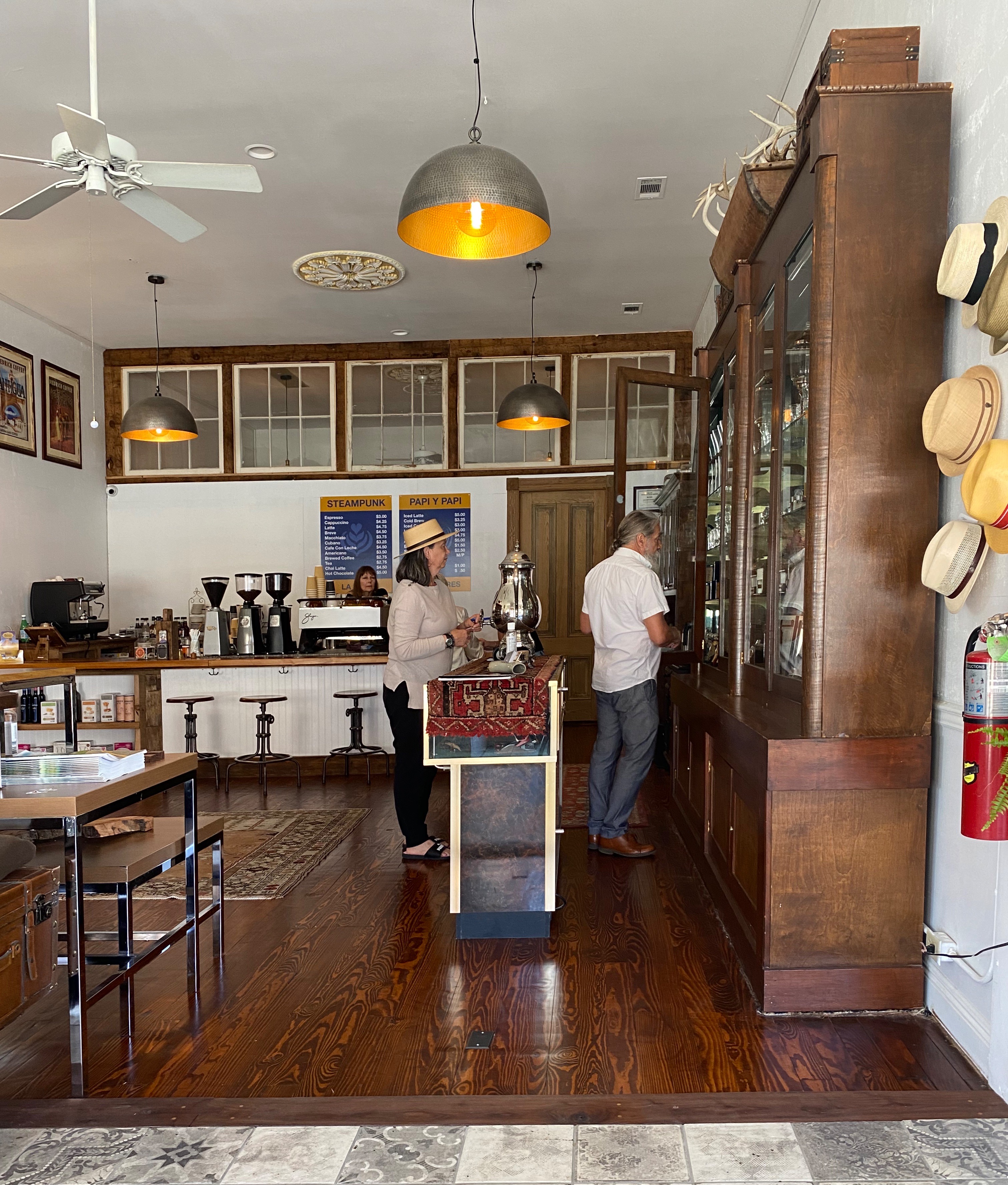
After checking in we departed for Prevail Union for coffee and tea. We were assured by our barista at Seeds (Birmingham) that Prevail is the only specialty coffee shop worth visiting in Monty.


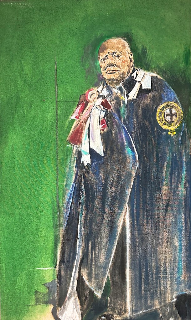
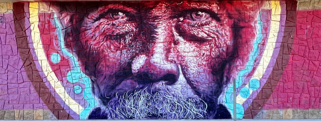
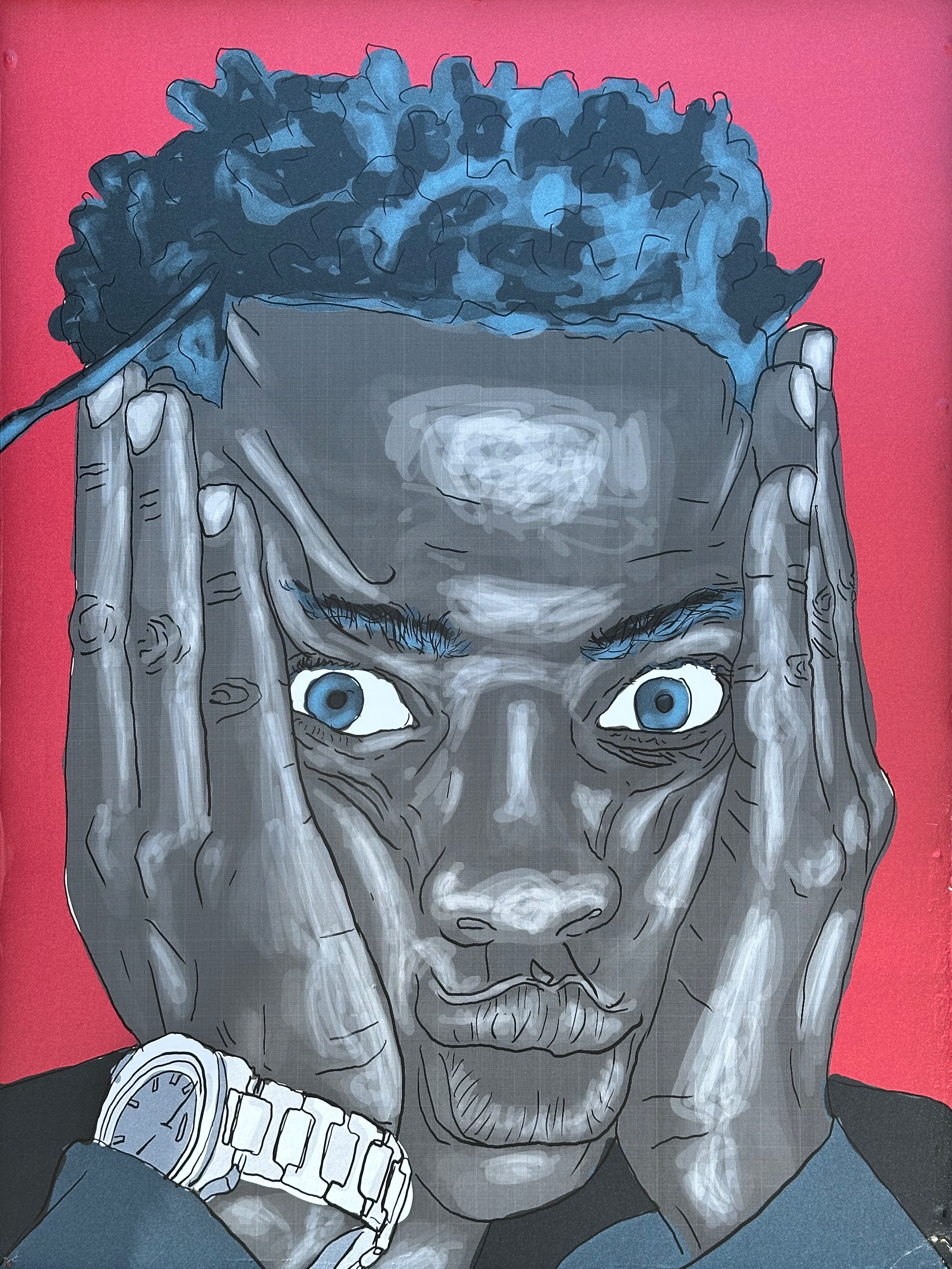
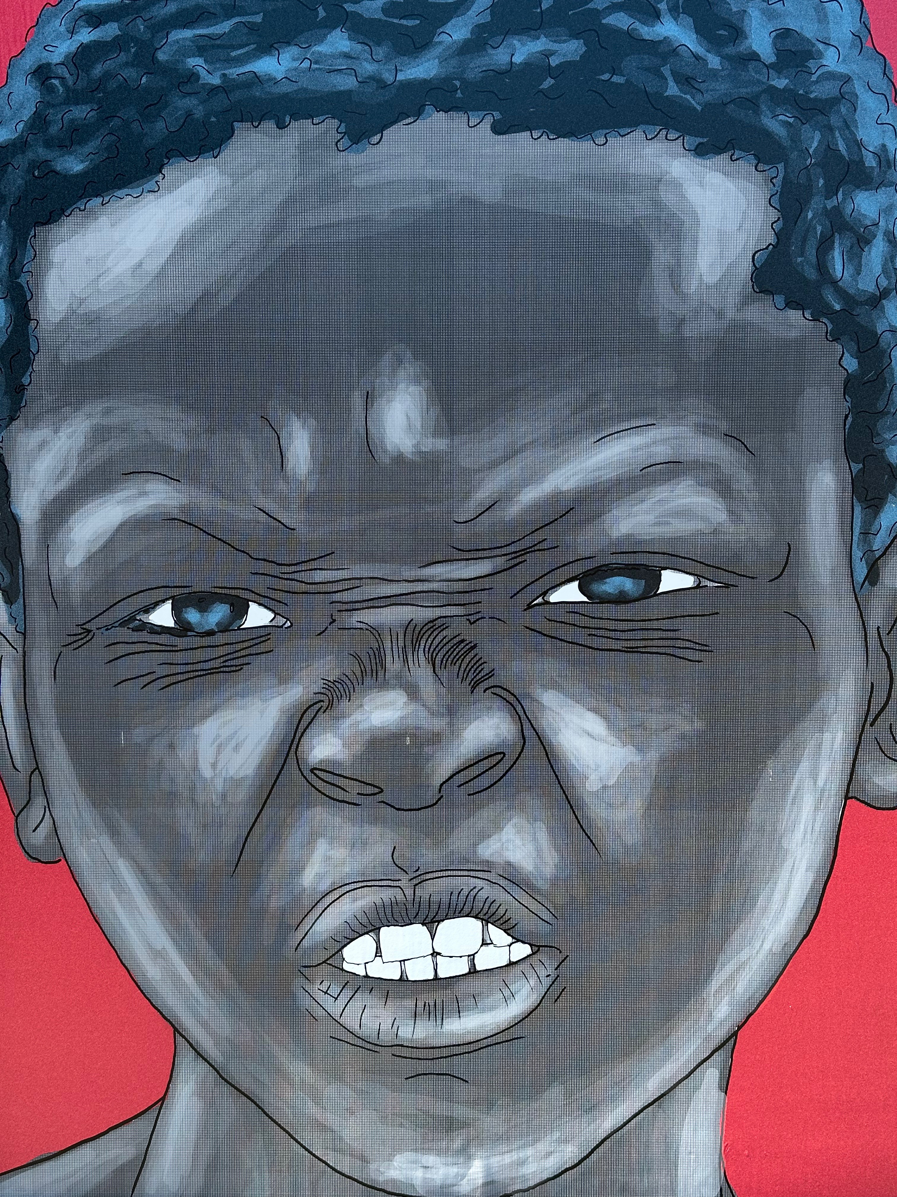
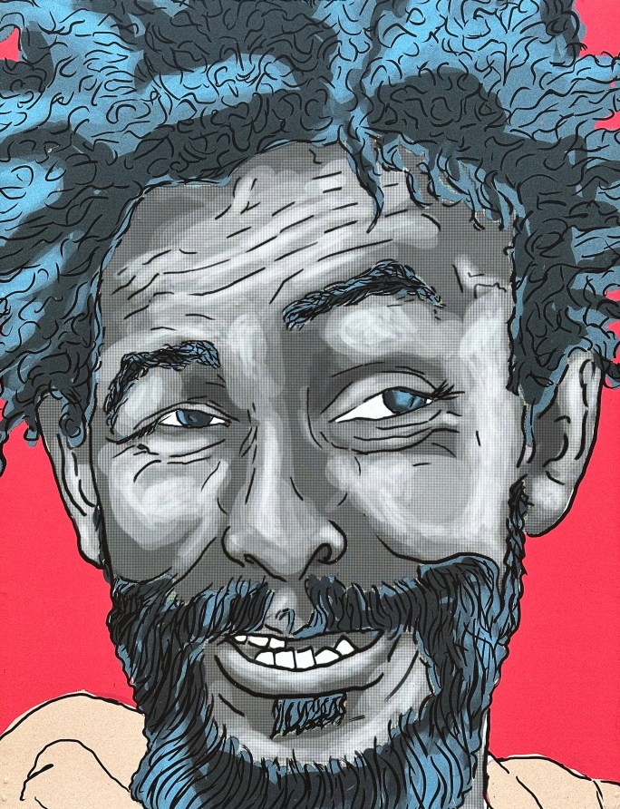
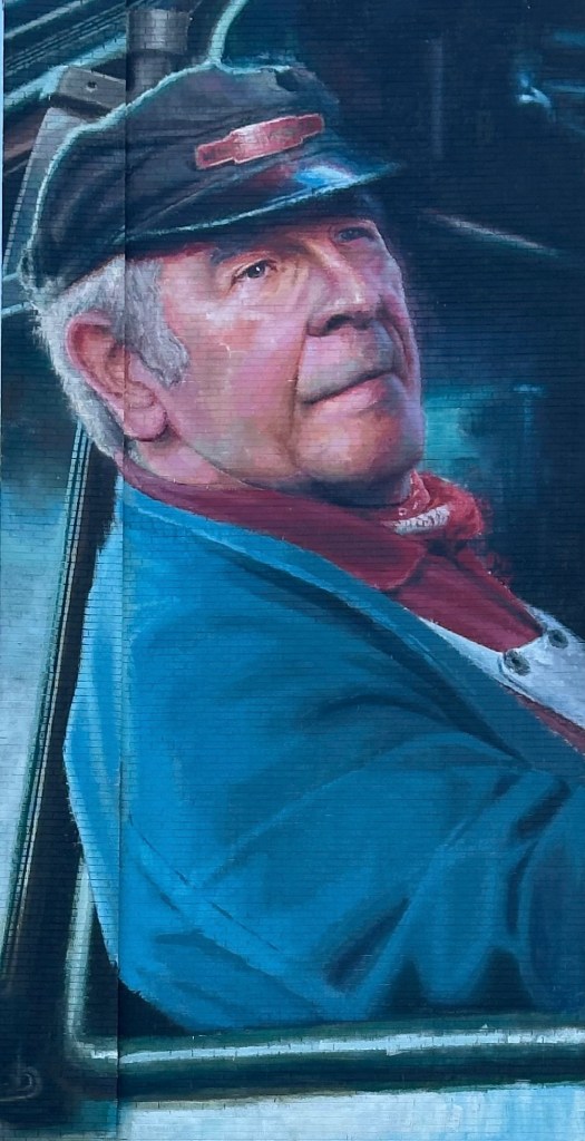
We also met local artist Bob Adams while at Prevail. Bob worked for many years as a court room artist for the local television station in addition to producing his own work. The work clearly required an eye for detail and the ability to work quickly. Bob is 70 years old but still draws for about 90 minutes every day and has not lost any of his skills as you can see from the drawing below, which he completed while we were enjoying our drinks.

Our first museum visit was to the Rosa Parks Museum. The museum provides a re-creation of the fateful day when Rosa Parks refused to relinguish her seat on the bus in order that a white man could sit.

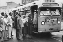
The re-creation is accomplished using an actual city bus from that time period with a digital representation of the people and characters involved visible through the bus windows. The exhibit is well done and quite moving.

We definitely recommend visiting the Rosa Parks Museum if you visit Montgomery. The link embedded is from the museum and provides an excellent overview of the life of Rosa Parks and the Montgomery Bus Boycott.
https://www.troy.edu/student-life-resources/arts-culture/rosa-parks-museum/about/index.html#bus
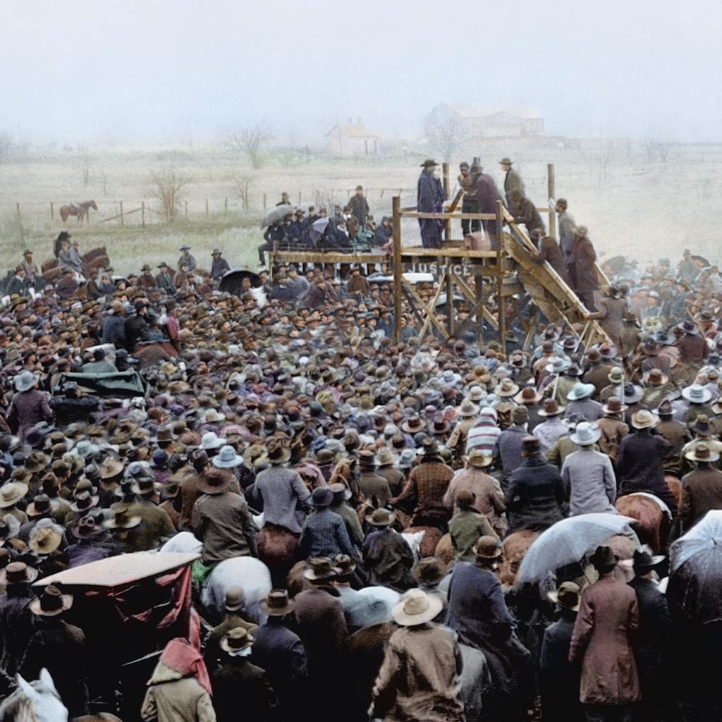
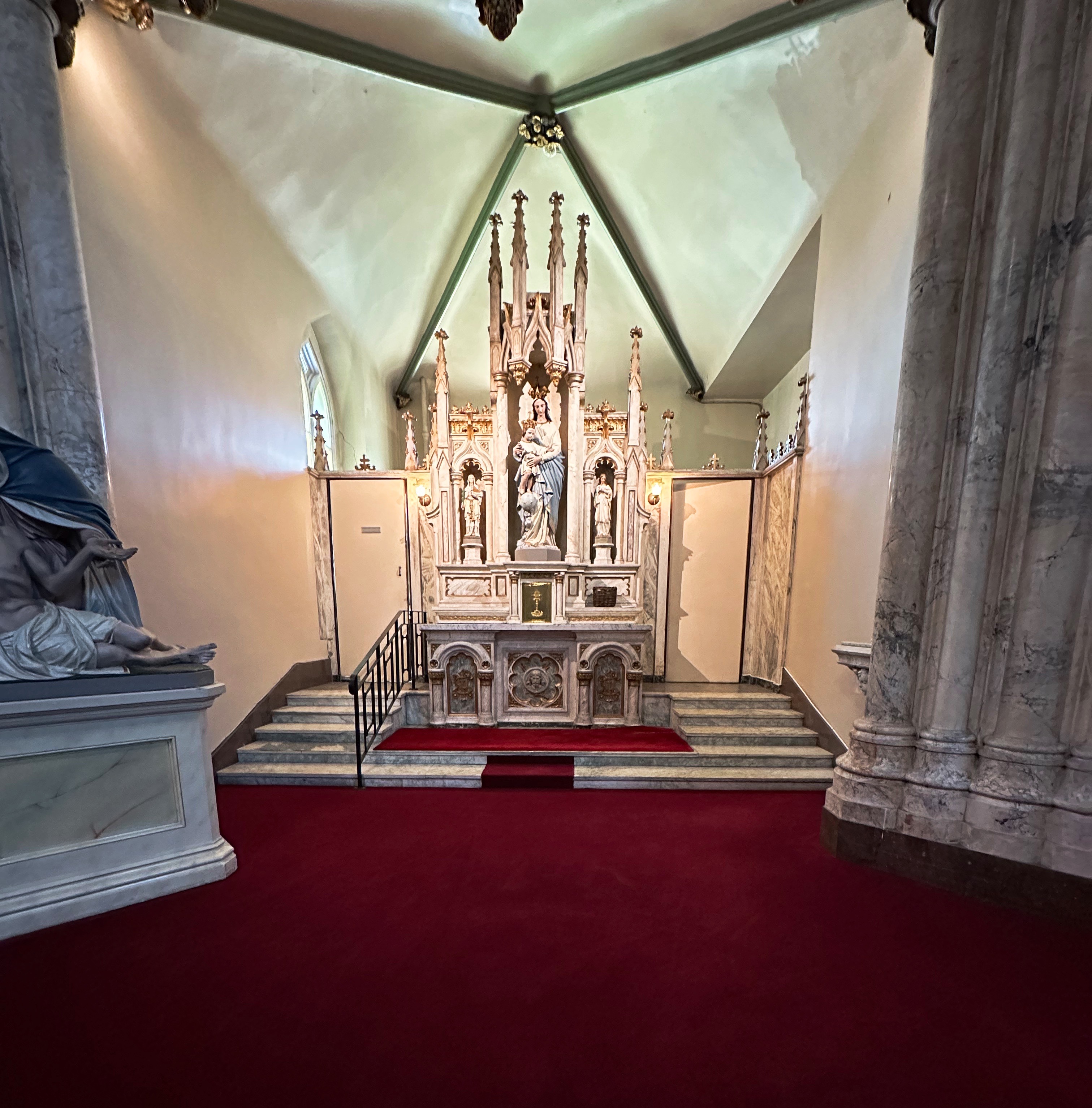
We also visited the Legacy Museum during our stay in Montgomery. The museum opened during April 2018 and was built on the site of a former cotton warehouse (there were many in Montgomery). The museum endeavors to tell the story of enslaved Africans starting with their kidnapping in Africa through to the years of Jim Crow and race issues which still persist today. (All photos courtesy of the Legacy Museum)
The museum is state of the art — making full use of technology to deliver an experience from the perspective of enslaved individuals. The exerience for us was quite intense.The physical and emotional suffering of the enslaved individuals is tragic. It is difficult for us to fathom how slave owners could have by any measure justified owning and brutalizng other human beings.
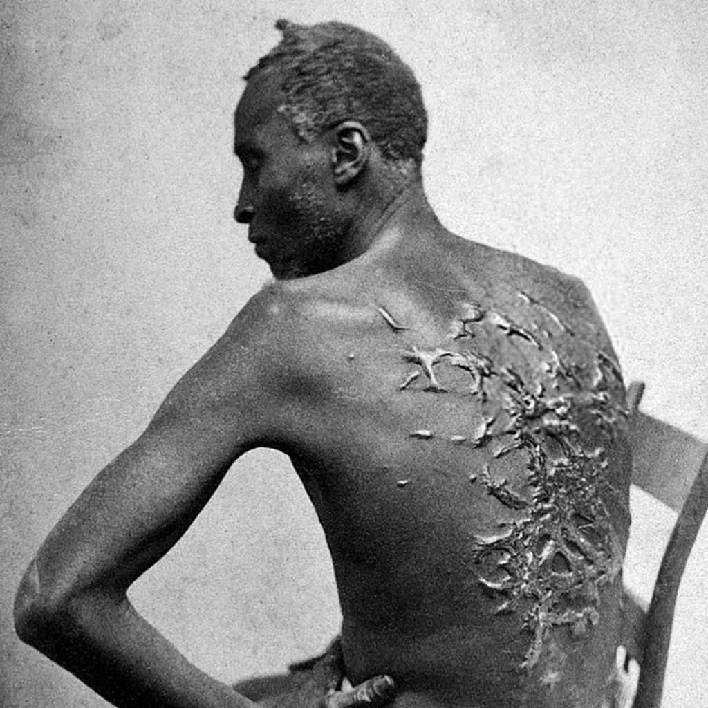
The museum also delves into the slave trade in detail. We commonly think about the hardships inflicted upon the enlaved individuals on the plantation while overlooking the misery and frequency of deaths that occurred on the slave ships. Over two million people died on the journey from Africa — starvation,sickness, beatings and sheer exhaustion.

Of course, slavery did not truely end with emancipation in 1865. As southerners were allowed back into politics and positions of power most African Africans found themselves anything but free. White only laws and other barriers restricted blacks in every aspect of their daily lives.
Another dimension of the immoral treatment of African Americans occurred all too routinely during the 12 year period of Reconstruction (1865-1877). Lynching of blacks by white mobs and the KKK. Over 2000 lynchings have been documented during that 12 year period. Sadly, a additional 2000 lynchings have been documented from Post Construction to the end of World War II.
We could continue on but instead will provide you with a link to the Legacy Museum if you are interested in learning more. We will leave you with one quote that we think captures the essence and depth of racism that existed in the South for over 200 years.
“In the name of the greatest people that have ever trod this earth, I draw the line in the dust and toss the gauntlet before the feet of tyranny, and I say segregation now, segregation tomorrow, segregation forever”. George Wallace, Alabama Governor, 1963 Gubanatorial Inaugural Address

We learned quite a bit more about black history in the United States during our visits to the two museums. The town itself is was nice but seems a bit on the sleepy side. The museums are worth a visit if you are going to be nearby but not a destination in our opinion.
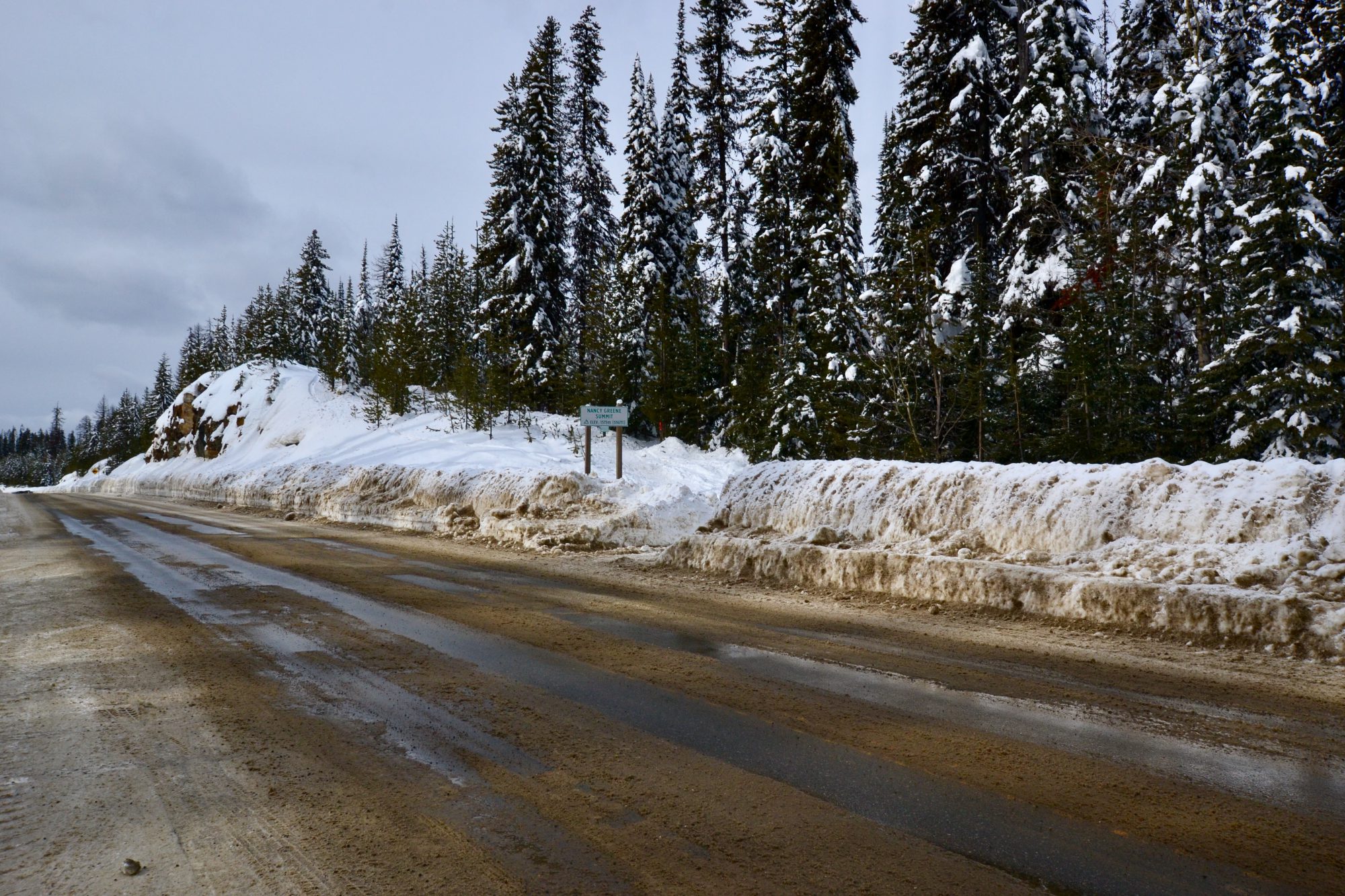
We are heading west from Montgomery on US 80 through Alabama, Mississippi, Louisiana and Texas. US 80 was, before the construction of the interstate system, one of a handful of coast to coast two lane highways We will keep you posted on what we find along the 80.
Be seeing you!


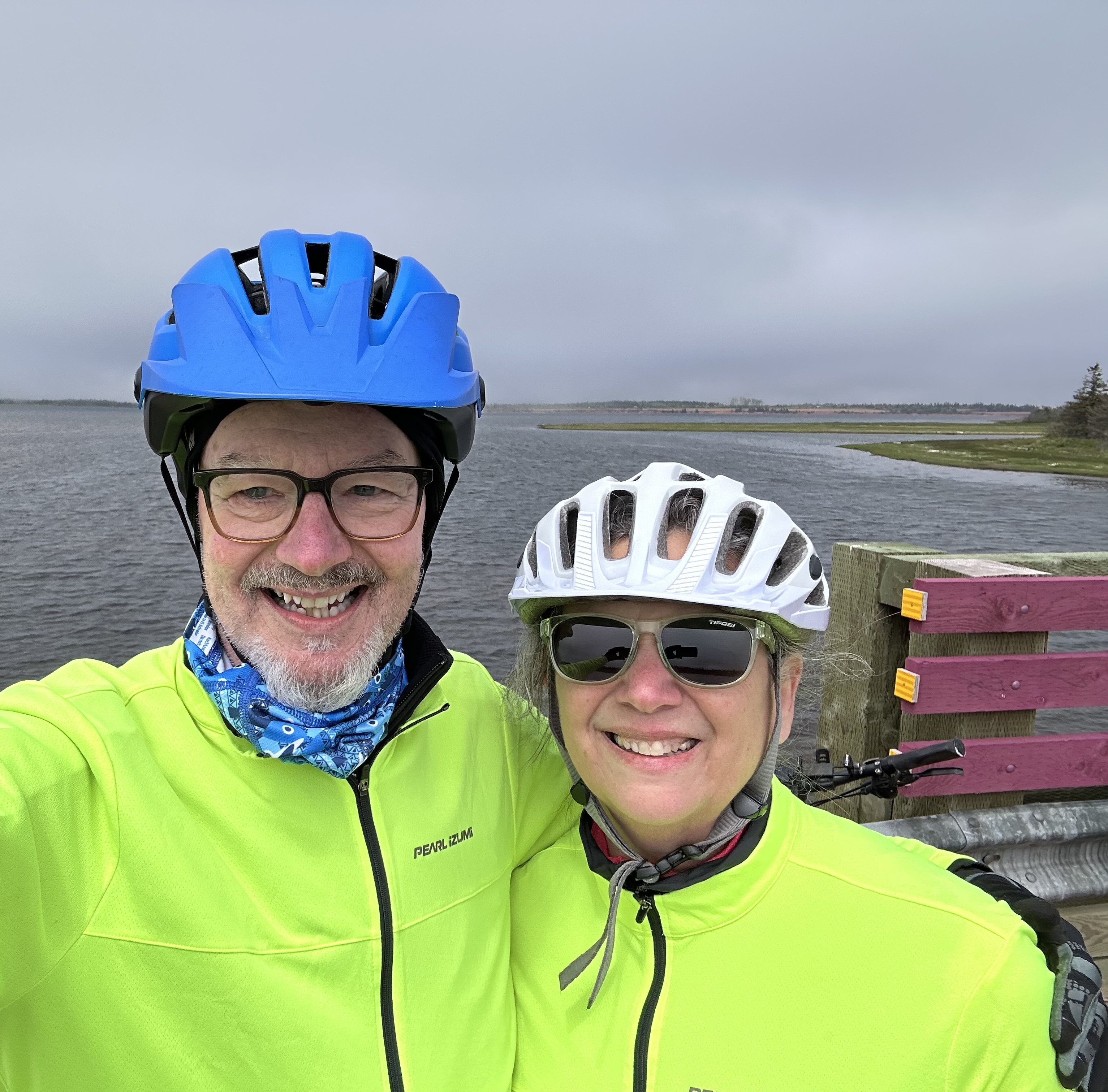
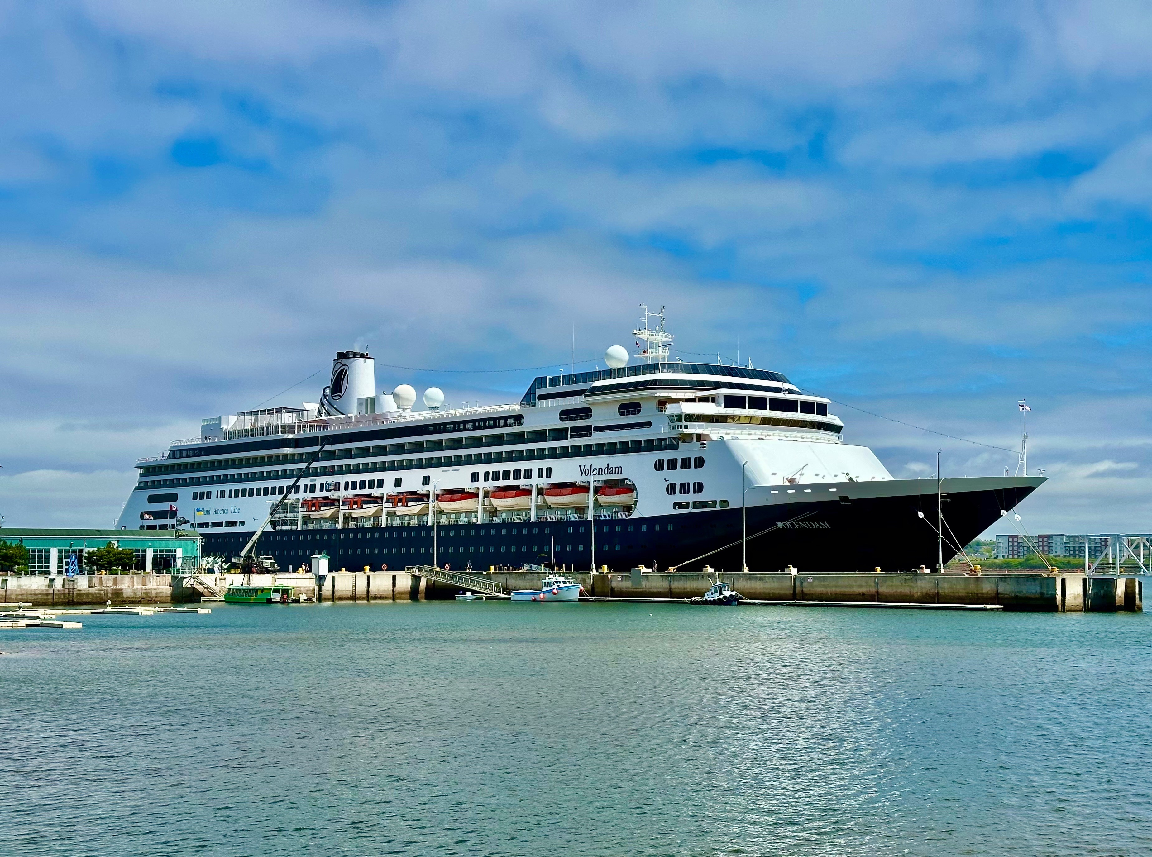
After out tour of the scenic Bay of Fundy coastline we made our way northeast to Prince Edward Island (PEI). The weather on the day we crossed over was raining, foggy and windy so we did not get much of a view of the Northumberland Strait or the PEI coastline. We have to admit that there was something a bit scary about driving across a narrow bridge over a strait that is part of the North Atlantic as opposed to a lake or river. Oh, by the way, when you cross the bridge back to New Brunswick, the toll is $48.00 Canadian!

The bridge is quite the engineering feat—spanning eight miles of the Northumberland Strait (North Atlantic) which freezes during the winter months. It is the longest bridge over frozen water in the world. The bridge opened in 1997 after four years of construction. Prior to the opening of the bridge, the only way on to the island in a vehicle was by ferry. The aforementioned freezing of the Strait meant that ferry service was periodically disrupted for extended periods during the winter.

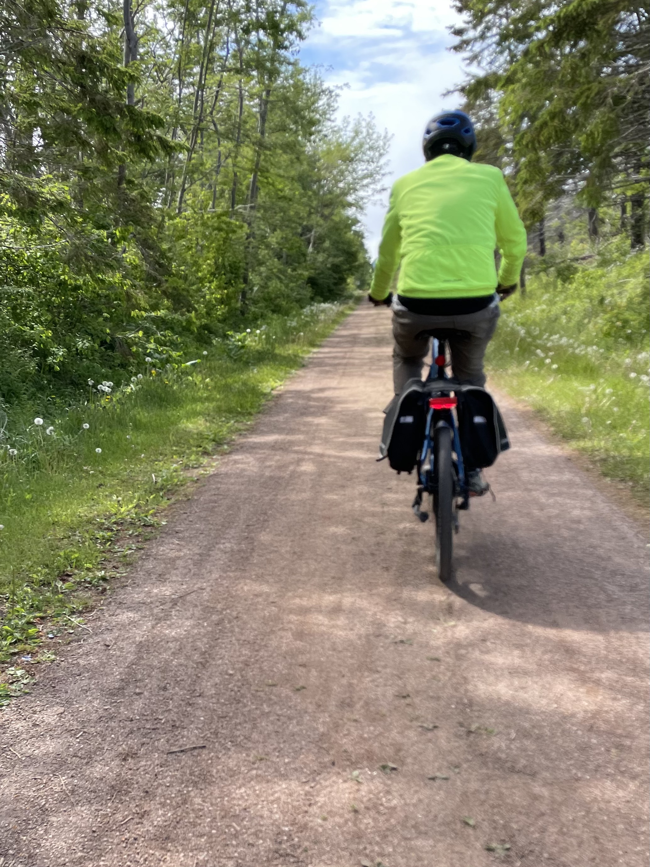
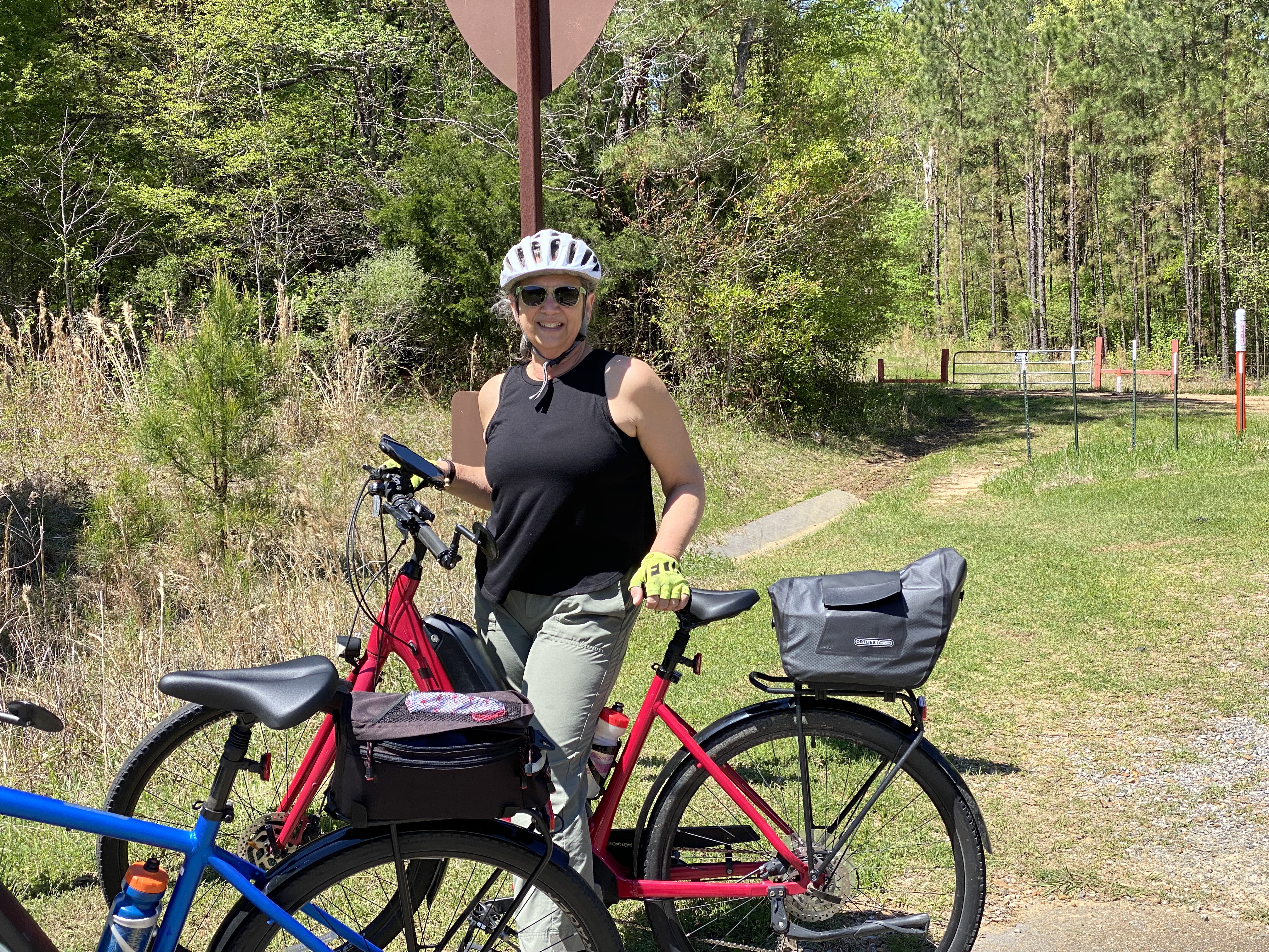
Our pre-trip research indicated that PEI has an extensive bicycle trail network – the Confederation Trail. The trail runs the entire length of the island (140 miles) with many spurs to explore as well.

The Confederation Trail owes it’s existence to the Prince Edward Island Railroad (PEIR). The PEIR was a narrow gauge railway built during the 1870s. It hauled both freight and passengers. Much of the early freight hauled were potatoes – the major crop on the island. Potatoes are still the major agricultural crop today – you see large potato fields just about everywhere you travel outside of Charlottetown (no wonder, since there are 86,000 acres planted with potatoes). Farms on PEI produce 25% of all the potatoes produced in Canada even though it is the smallest province in all of Canada (land area and population).

The PEIR was heavily utilized during WW2 to haul supplies to military bases operating on the island as part of the war effort. After the war, volume declined as military bases closed and potatoes began to move by a combination of truck and large ferry boats. The railway was operational until 1989 when declining volume precipitated the demise of the PEIR.

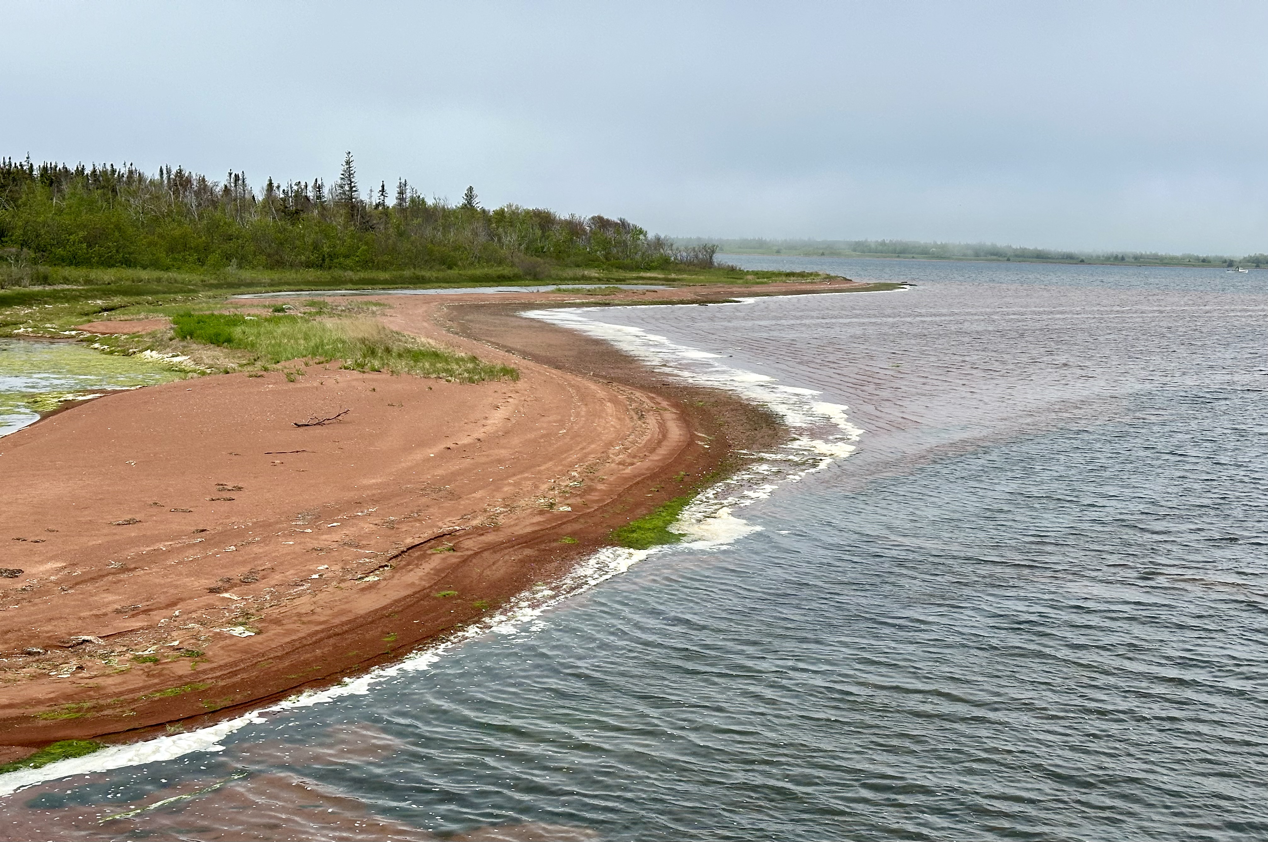
The photos above are from our ride along St. Peter’s Bay. The scenery was delightful but the gusty winds coming from the bay made for a tiring ride (not complaining!).
Fortunately, coffee was at hand upon our return to Charlottetown, where we stayed during our visit. Most excellent coffee, tea and breakfast – thank you very much – at the stylish Receiver Coffee Company.


Receiver has three locations, two of which are in Charlottetown. The cafe and bistro is in the heart of downtown (above) while a second cafe and roastery is located on the waterfront (below).


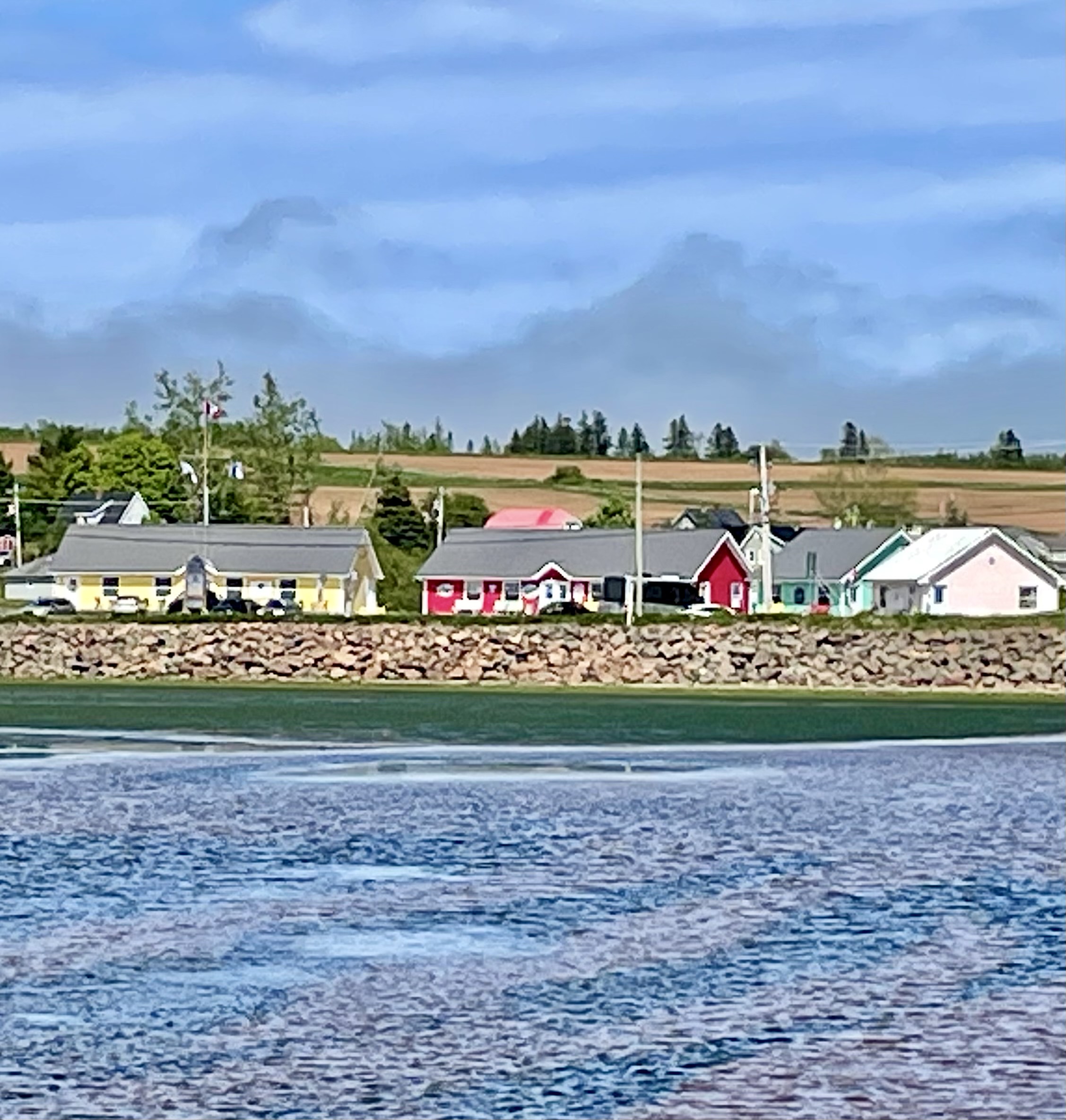
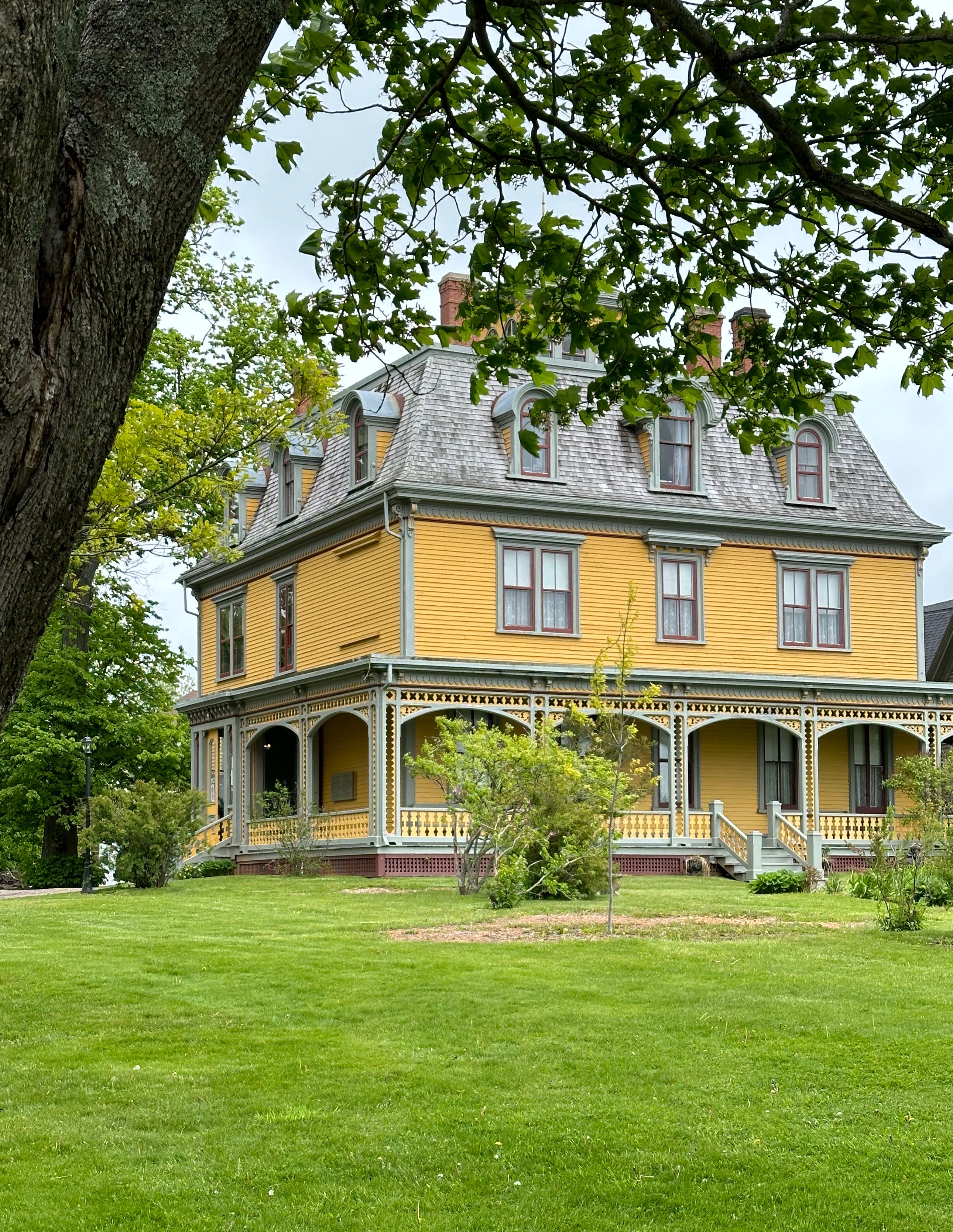
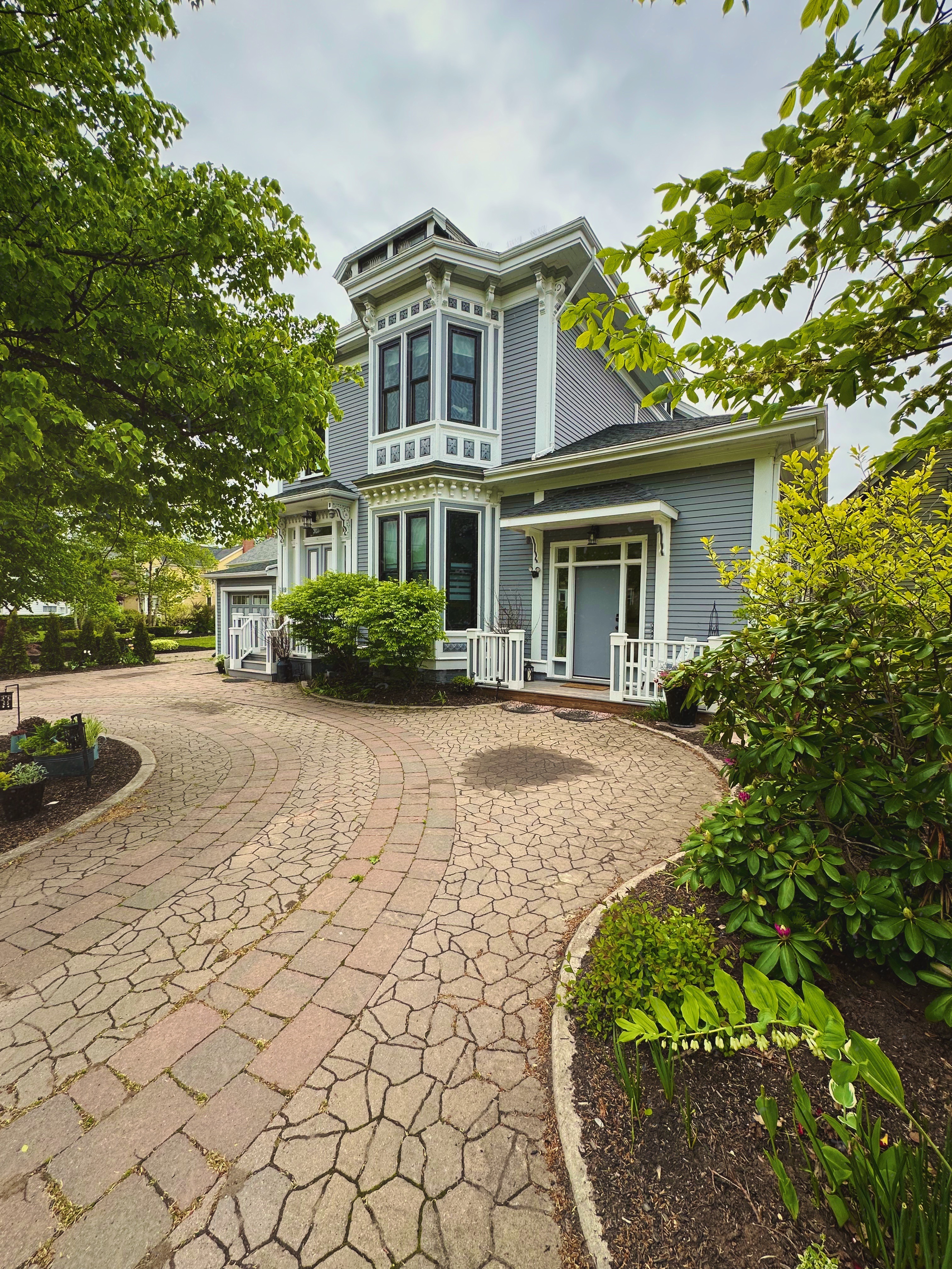
The city of Charlottetown is quite charming architecturally with a downtown and residential area on the waterfront of Hillsborough Bay. We spent part of a day walking around much of the historic downtown (it is quite compact). There are several residential neighborhoods of charming and beautifully maintained homes.


During our walkabout we happened on to a peaceful green space within the residential district – Rochford Square – this green space was set aside in 1771.

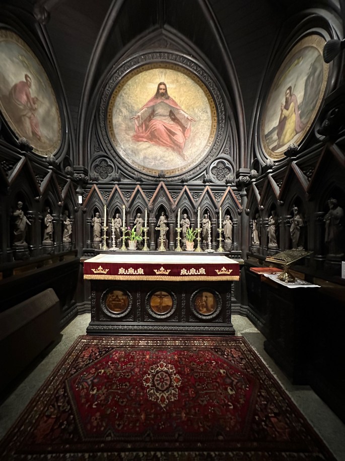
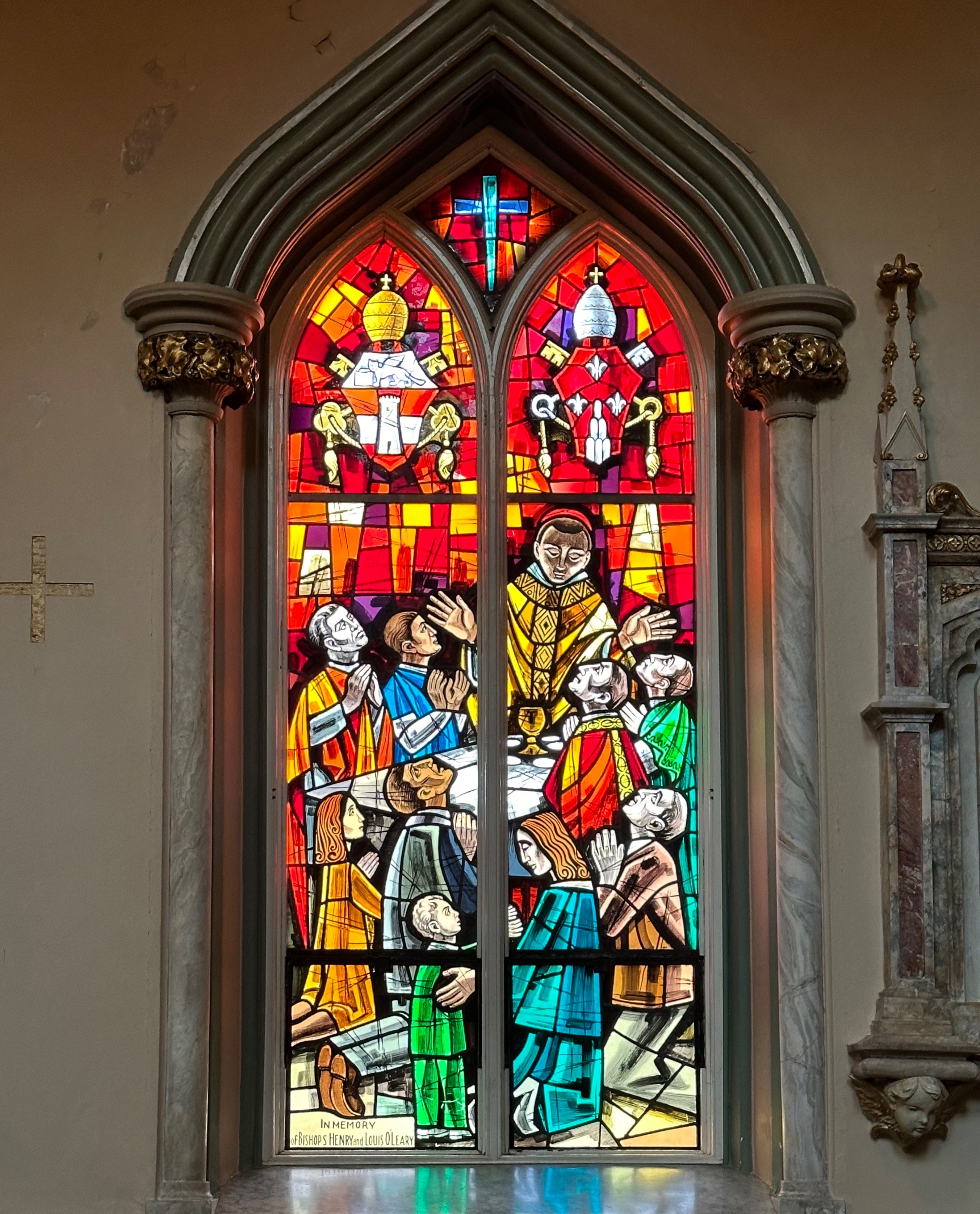
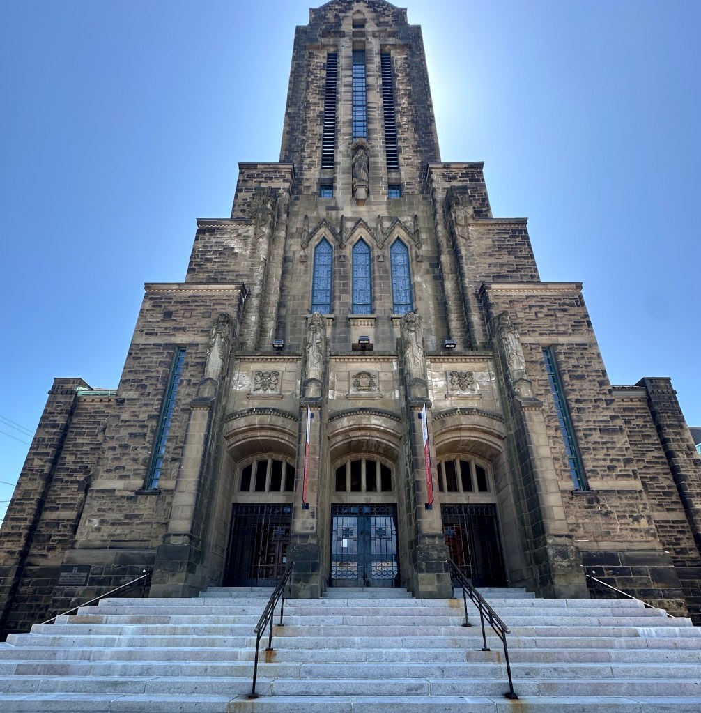
The square is bounded on the west side by All Souls Lane. At the far corner of the green space and All Souls Lane sits St. Peters Cathedral – Anglican. The cathedral is handsome but as we rounded the corner we came upon the All Souls’ Chapel tucked right against the cathedral. The chapel was open so we ventured in for a look at an Anglican Chapel. The description from the plaque at the chapel entrance is included below.

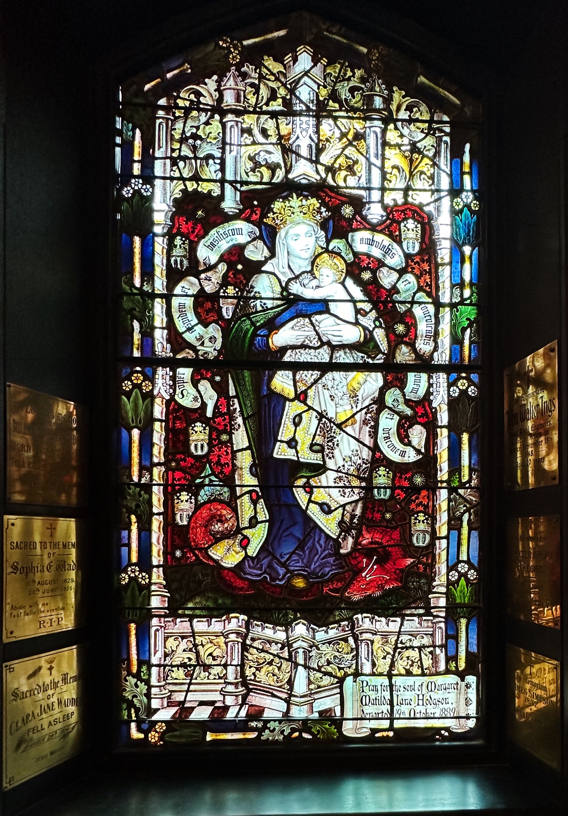

This 1888 chapel, designed by William Critchlow Harris, Jr., is a masterful example of High Victorian Gothic Revival architecture in Canada. Its robust design is distinguished by rough textures in rust-red Prince Edward Island sandstone and by deep-set hooded windows. Inside, a profound sense of religious mystery has been created by the complex decorative scheme. It features a dramatic chancel arch, rich carvings, beautifully patterned encaustic tiles, subdued lighting and eighteen exquisite mural paintings by the artist Robert Harris, brother of the architect. (Historic Sites and Monuments Board of Canada)
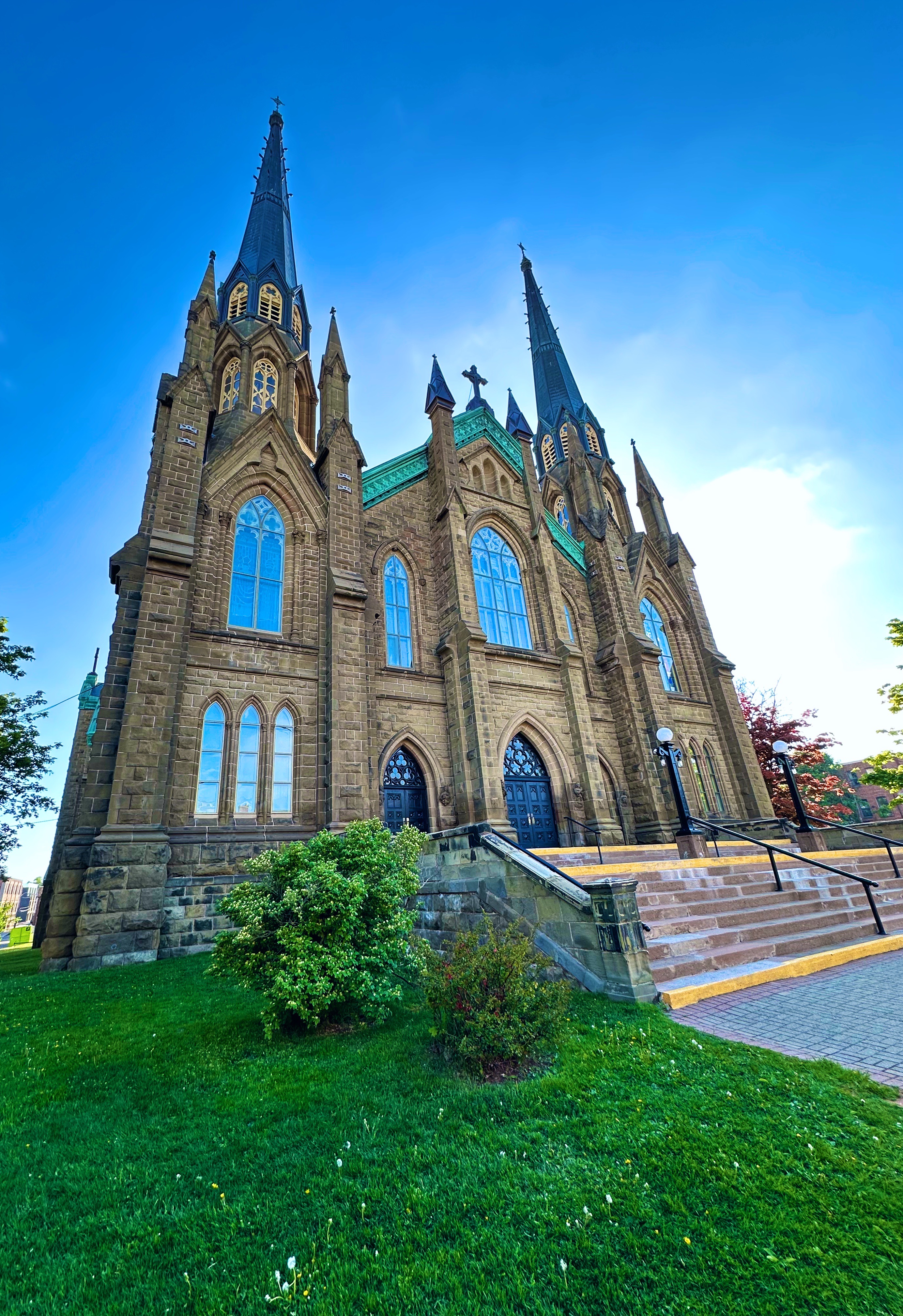
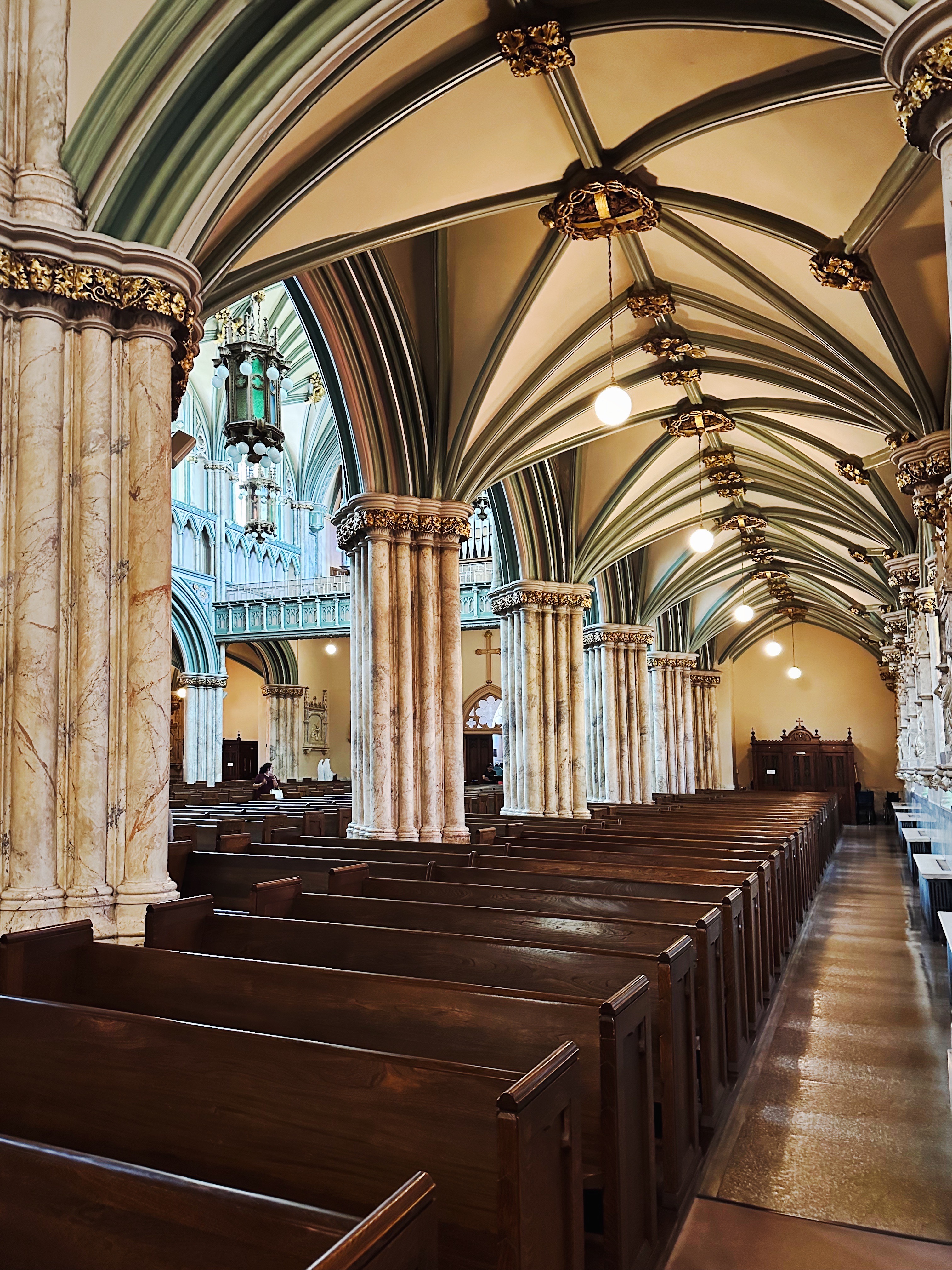
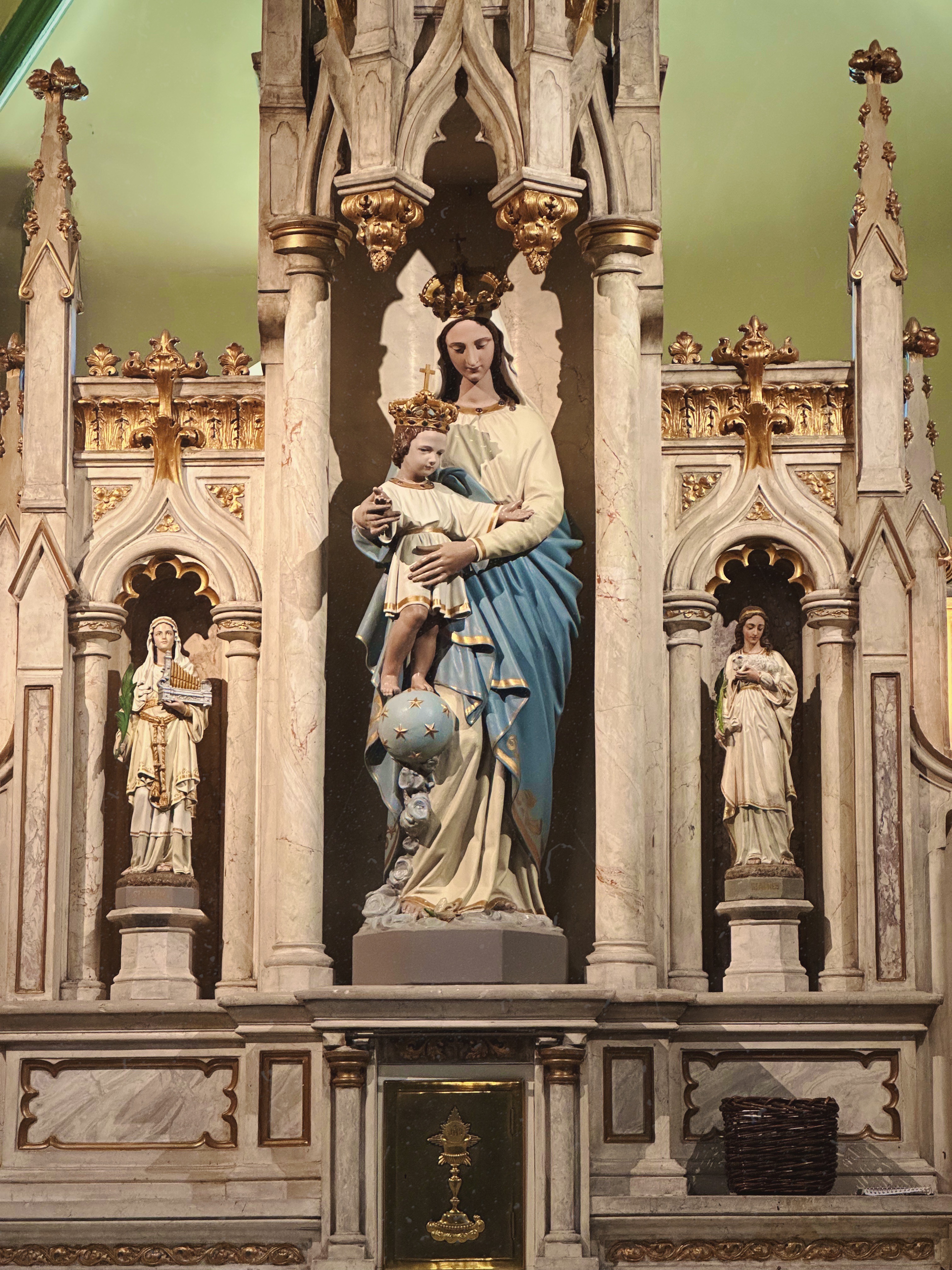
We also visited St. Dunstan’s Basilica. The twin steeples of the basilica (opened in 1919) are visible from anywhere in the city. Each spire is 200 feet in height. The basilica is the fourth St. Dunstan’s and replaced the cathedral which completely burned in 1913.

The history of this Catholic parish is interesting in that the congregation is a mix of the earliest French settlers who started the first Catholic church on PEI in 1721 and and were joined in 1722 by Catholic Scots . The Scots were seeking to escape religious persecution in largely protestant Scotland.


Of course, in due time, the British set about persecuting all of the non-english speaking inhabitants of PEI ( the Mi’kmaq who called the island Epekwik and the French who called it Ile Saint-Jean ). The French and Mi’kmaq fought together against the British but eventually lost after fighting multiple wars over an extended period against the British Redcoats. Many of the French were deported to the American Colonies. Without the French the Mi’maq could not continue to wage war against the British and signed a peace treaty with them. Interesting to note that while the Mi’maq signed a peace treaty with the British they never ceded their territory and they were guaranteed the right to hunt, fish and gather in order to sustain themselves or make a living. In 1997, Canada’s Supreme Court affirmed these rights after Mi’kmaq Nation members were arrested for exercising their rights guaranteed within the treaty signed in 1761!

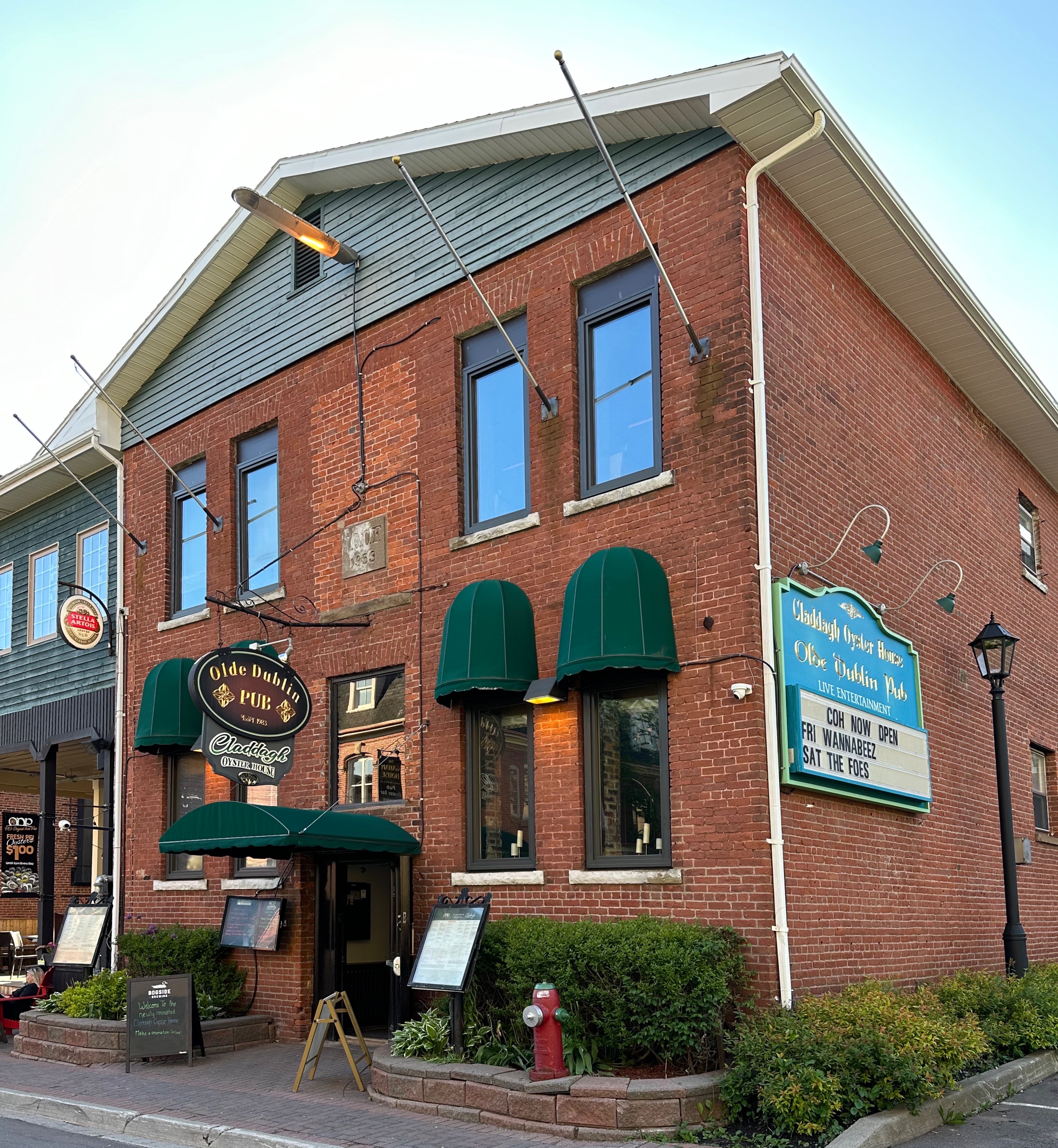
Okay, that just about completes our report on PEI. However, before we sign off we have a fine dining recommendation for y’all when you get up to Charlottetown (and you should). The Claddagh Oyster House had -fortunately for us- just reopened after a several month renovation.


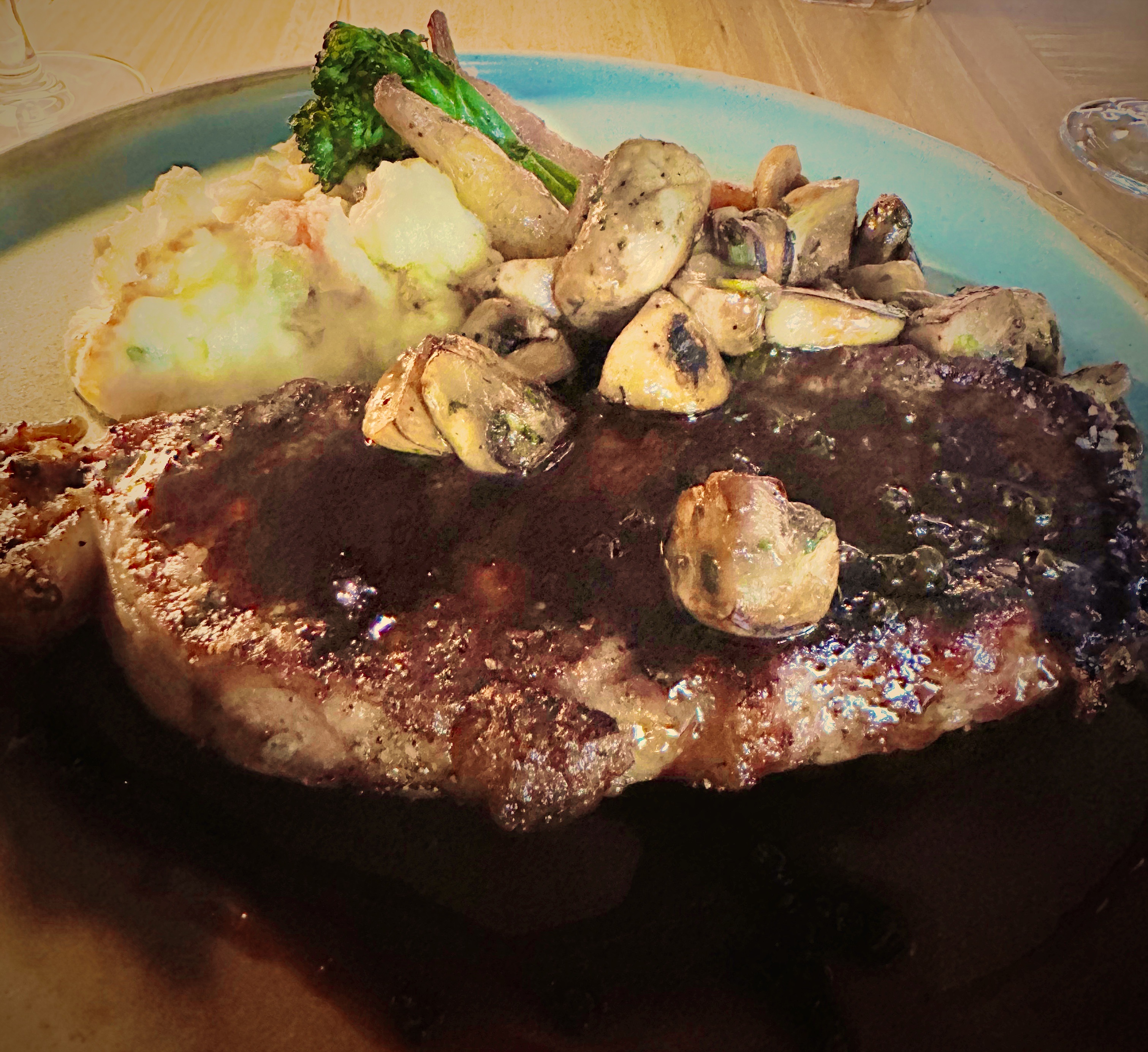
While most folks think seafood in this neck of the woods (as do we) PEI is well known for it’s beef. Claddagh serves only certified PEI beef which they dry age in house for 50 days. If you like oysters we recommend you gorge on them for your appetizer and then enjoy a delicious steak (all the cuts are dry aged). Solid wine list and excellent cocktail selection.
Be seeing you!
As we swung back westward through New Brunswick (NB) inorder to ultimately re-enter the U.S. through Northern Maine, we decided to pay a visit to Fredericton aka the “Freddy”. Freddy appeared to meet our usual city selection criteria — small to medium in size, coffee options, art, live music, bike trails and a city waterfront.
We thought we would need two days but the weather was excellent and so much was happening that we ended up staying four nights; before departing on our wood lands ramble into remote northern New Brunswick (Wood Lands Ramble post coming soon).


A coalition of volunteers (Fredericton Trail Coalition) began to mobilize after the Canadian Northern Railway abandoned a number of lines in New Brunswick in 1989. The first trail was opened in 1993. In 1996, 377 additional kilometers of abandoned railway was donated to the province by the Irving Family allowing Freddy to connect a number of trails and create today’s connected network of over 120 kilometers of trail. A key aspect of the donation was the inclusion of the 906 foot railway bridge that spans the St. John River — connecting the trail systems on both side of the river.

As a result, folks in Fredericton have a plethora of riding and walking trail options. It is not surprising that Fredericton was named Canada’s 6th most-walkable city in 2019, one of 5 “Great Canadian Bike Cities” in 2021 by People for Bikes, and was #9 on Canada’s Best Small Cities as ranked by World’s Best Cities.com in 2022. We took advantage of the trail system and delightful weather to explore a number of the trails during our stay in Freddy.

Combining biking with coffee is a double delight. Mill Town Coffee Roasters is conveniently located on one of the trails and we were able to take a coffee break on our way out and back during each ride. Pretty good, eh!
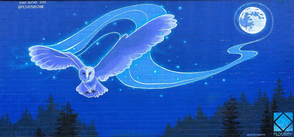
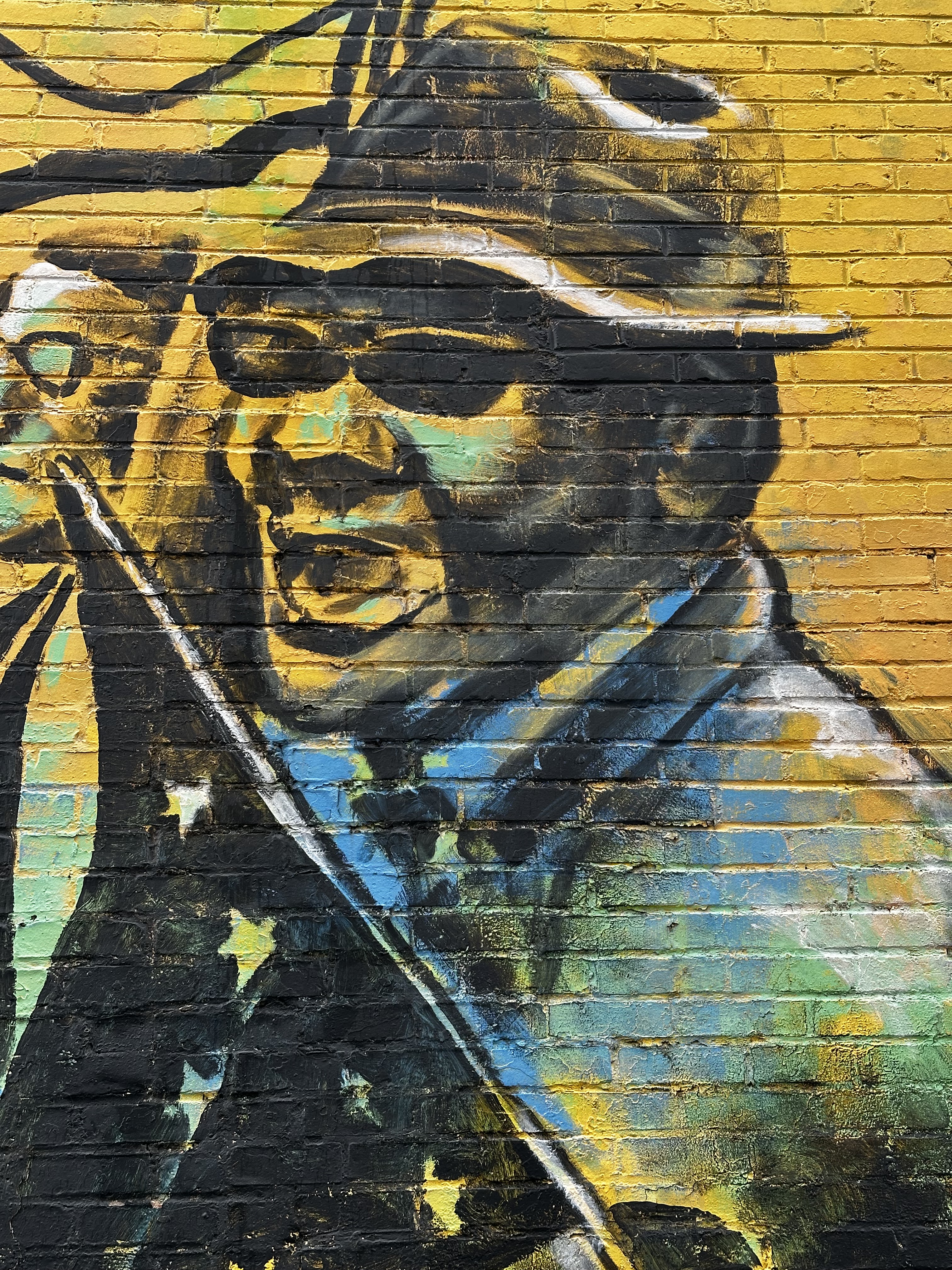
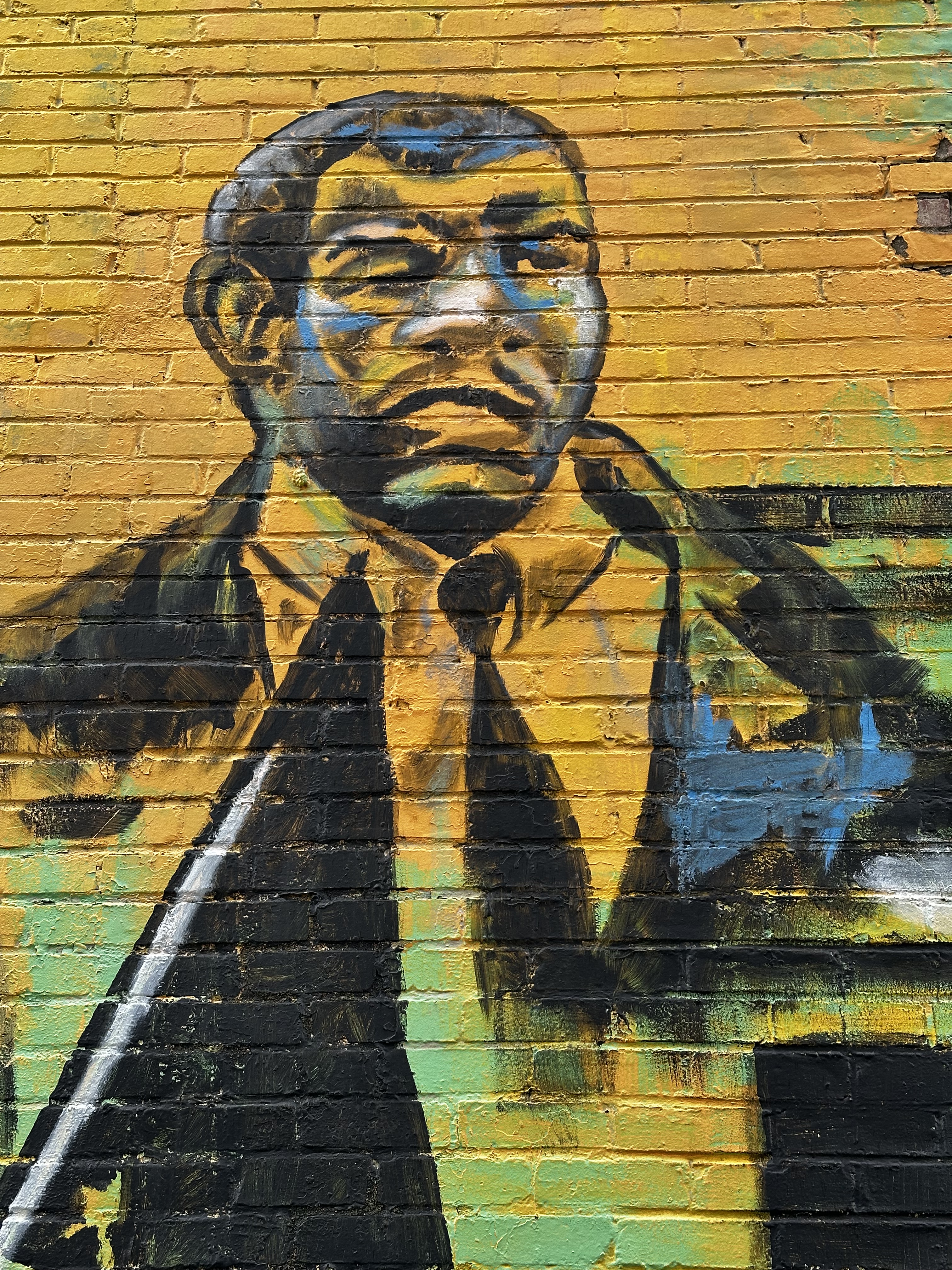
In our humble opinion, public art adds a great deal to a city’s environment. We were glad to find that Freddy has several notable street murals in the downtown area, although we would have loved to find more during our walks through town.


Freddy is very fortunate to have, in our opinion, a very impressive art museum, especially in light of the fact that the city population is barely 60,000. Much of the good fortune is owed to the generosity of one Lord Beaverbrook — who in 1959 gifted the museum building and 300 valuable works of art to a museum foundation he created for the benefit of the public. Did we mention that the museum is named the Beaverbrook Art Gallery?

The son of a Presbyterian minister in Miramichi, New Brunswick, the future Lord Beaverbrook, Max Aitken, enjoyed early success in Canadian business. In 1910, he left Canada for England, where he was knighted and elected a Member of Parliament, eventually serving as Minister of Aircraft Production in Churchill’s wartime government. No slouch Sir Max!
The museum is noted for it’s collection of renowned Canadian artists but also has works by Dali (not fans but still impressive to see a gallery of Dali paintings in Freddy) and Gainsborough and as well as other internationally acclaimed painters. The Beaverbrook became the official provincial gallery of New Brunswick in 1996.


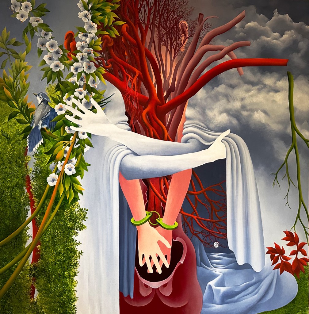
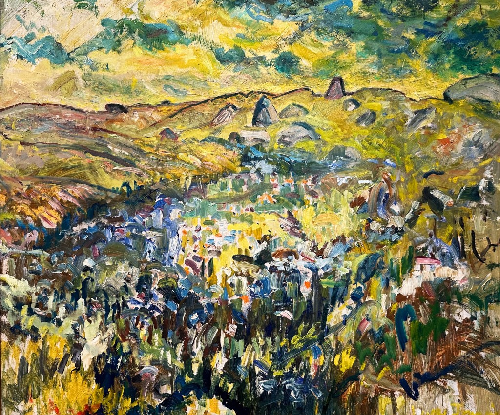
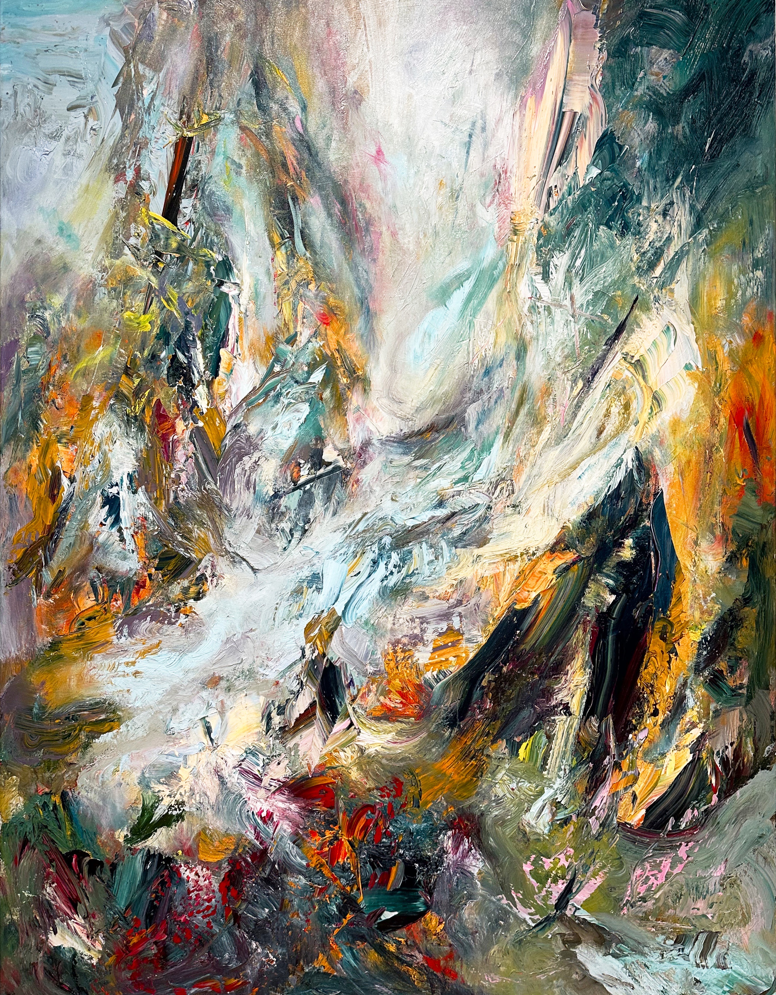
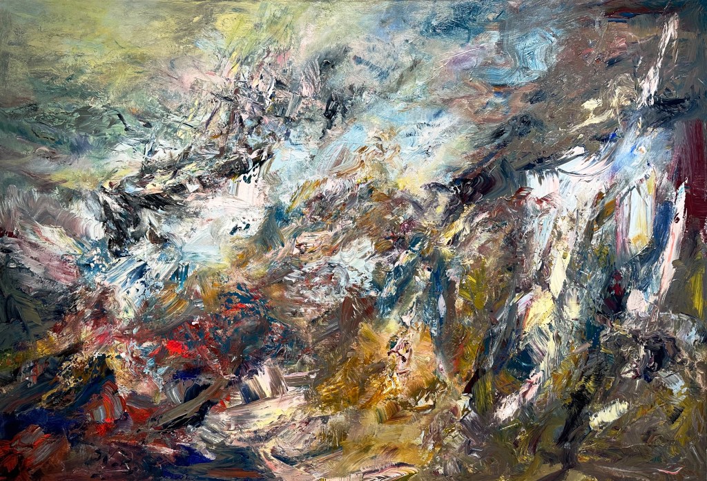
Montreal-based painter Michael Smith (directly above and below) is known for his fluid and impasto surfaces as well as his ability to strike a poetic balance between representation and abstraction. Inspired by art history as well as historic and current events, Smith pulls from various sources to create his energetic landscapes and seascapes. His Sea of Change series includes massive canvases exploding with colour and energy, as well as smaller studies on paper. These were inspired by a serendipitous encounter with a 19th-century painting of the Arctic expedition ship H.M.S. Terror during his time as artist-in-residence at the Beaverbrook Art Gallery in 2018. Layering texture and colour, the familiar with the unfamiliar, Smith’s paintings convey (as the artist writes) “a mix of excitement and anxiety of a land [that] although at times bucolic, is riddled with shadows.” Curated by John Leroux
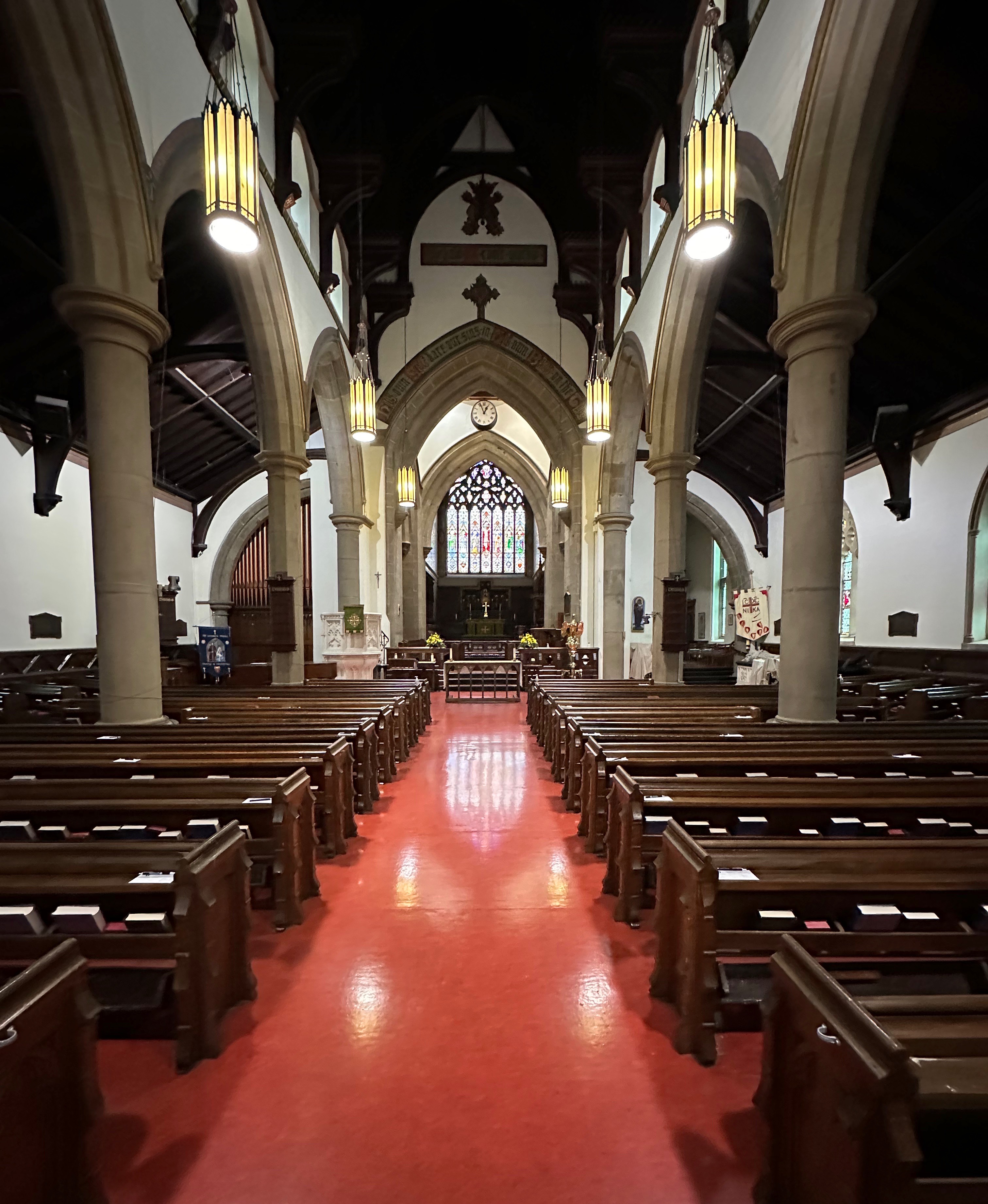
We often find that the early history of a city is intertwined with the creation of the dominate religion of the ruling class. Fredericton is no exception to that pattern. The city was named for Prince Frederick,son of King George III and Queen Charlotte. Subsequently, Queen Charlotte declared Fredericton a Cathedral City (even though its population was too small) so Christ Church Cathedral could be built. The Anglican Church at that time was utilized as a way to impose British custom and law (and to counter Acadian Catholicism) on the inhabitants be they British, Acadian or First Nations.

The Cathedral sits on its own park like island of green at the edge of downtown. The surrounding neighborhoods consist of stately and beautifully maintained homes. By many accounts the movers and shakers in Fredericton were members of this parish and much business was conducted and deals made between the businessmen and politicians who belonged here.

We always seem compelled to add a little bit of history (and an opinion or two) when we report on our travels — oh well!
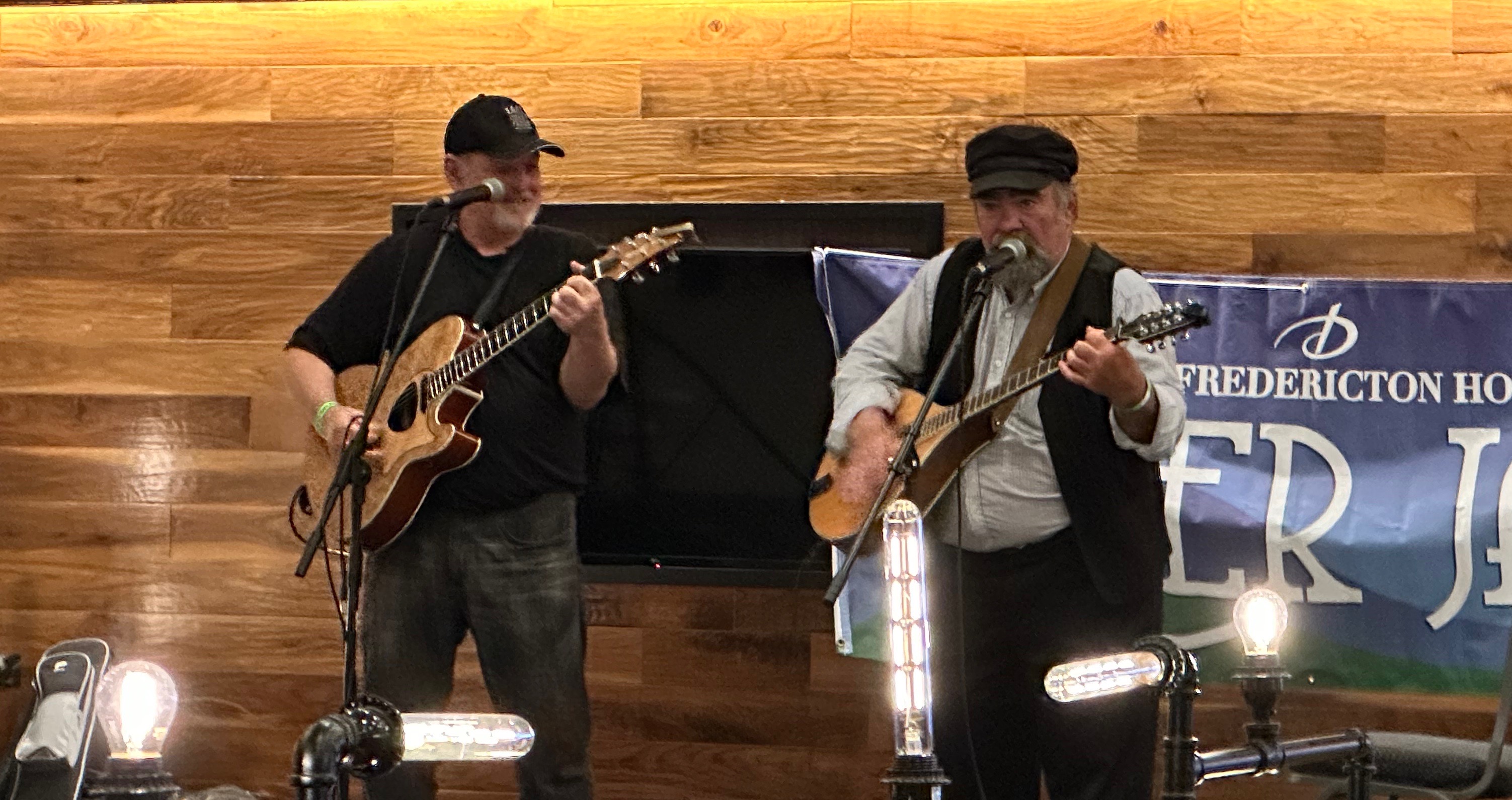
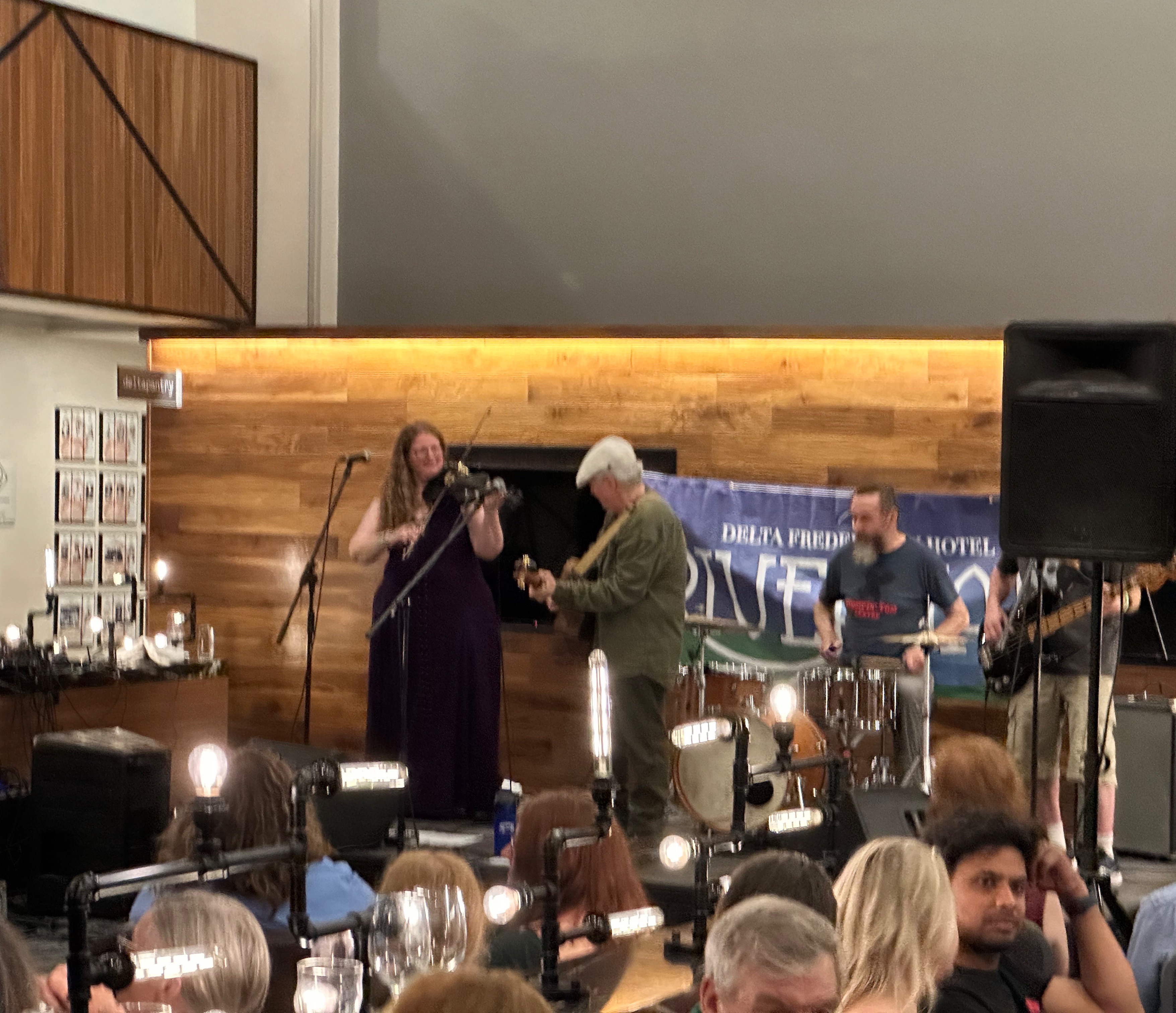
We closed out our stay in Freddy with an afternoon and evening of food and music. The River Jam Music Festival was taking place all around us at our hotel with four or five music acts performing in different areas of the facility simultaneously. We took in a couple of acts, had dinner and camped at the bar (surprised?) to take in the performances in the lobby which ran to midnight. We were treated to primarily traditional music from the Maritimes and the local crowd was up singing along and dancing. So good!
That’s it from Freddy! We had a great visit and look forward to sharing more of our travels soon.
Be seeing you!

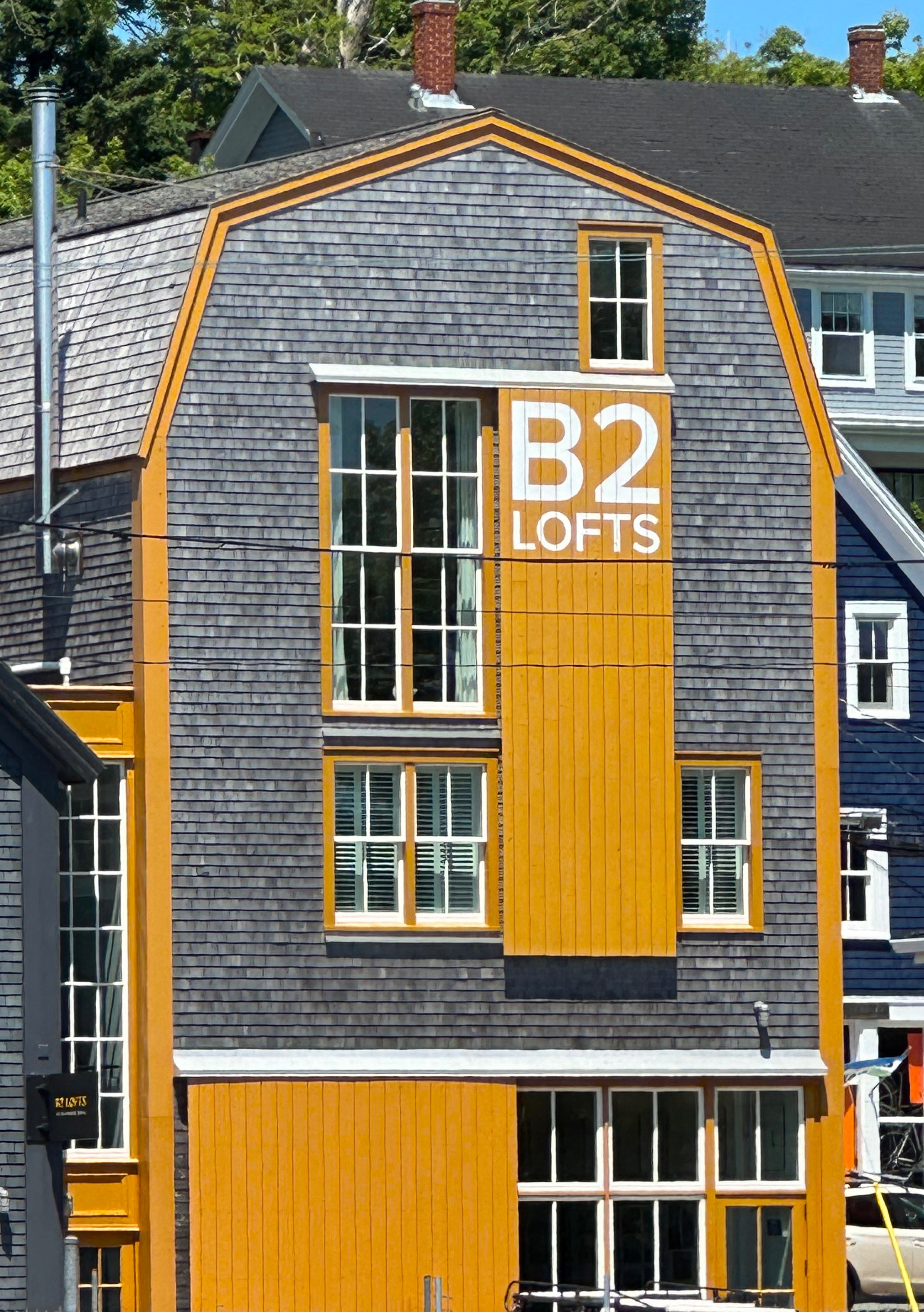
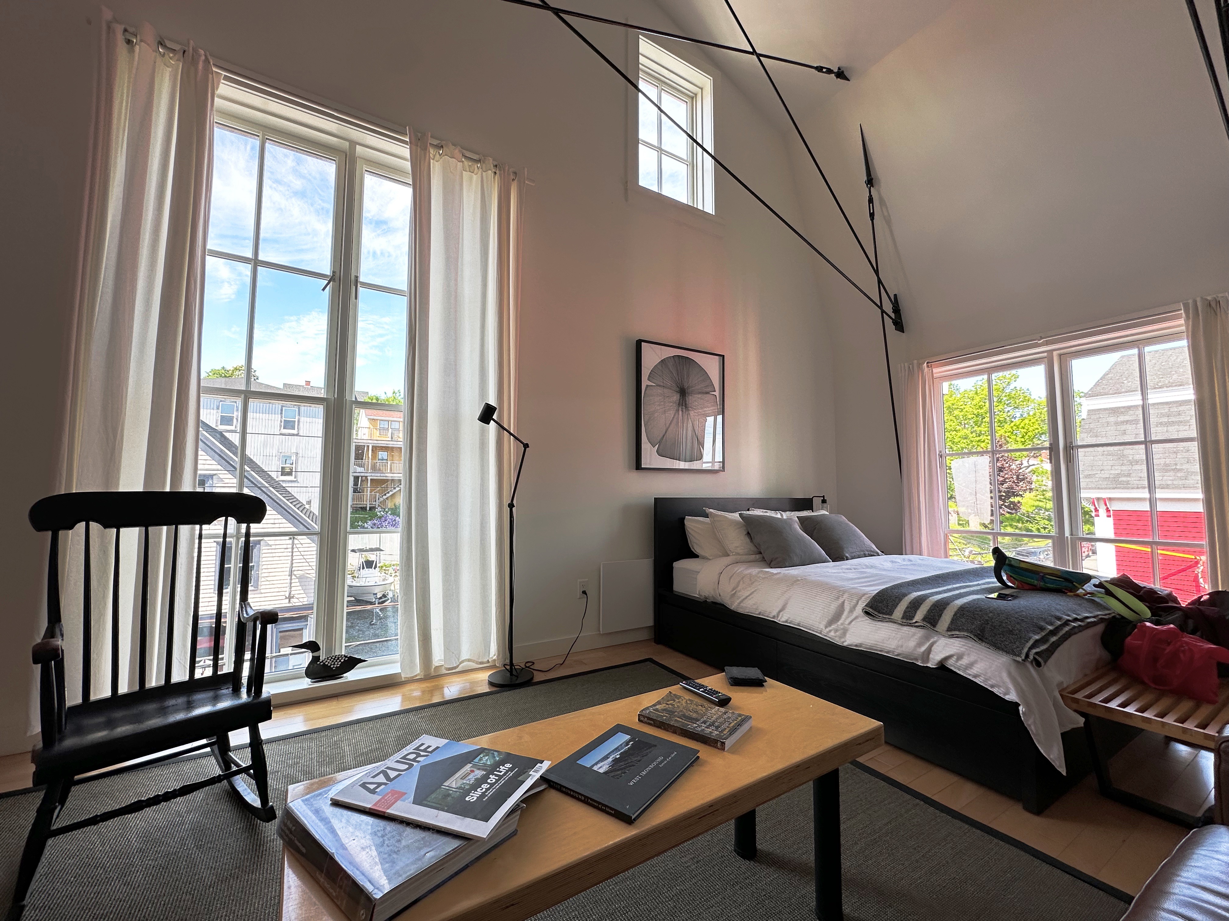
We made the short trip from Keji NP to the southwest coast to visit the town of Lunenberg, Nova Scotia. As we had been camping quite a bit on the stretch between Moncton and Keji we booked two nights at the B2 Lofts (AirBnb) one street up from the waterfront. This building was once home to one of the many shipbuilding businesses located in Lunenberg.


Lunenberg is a UNESCO World Heritage Monument which might infer that it is no longer a functioing, lively town; but it is infact so. The town is a very popular tourist destination with its beautifully maintained original architecture and Montague Street, which is lined with shops and a number of excellent restaurants. A brief history of Lunenberg from the Canadian Encylcopedia is included below for our history mavens.


Lunenburg, Nova Scotia, incorporated as a town in 1888, population 2,405 (2021 census), 2,262 (2016 census). The town of Lunenburg, the seat of Lunenburg County, is located on Lunenburg Bay, 90 km southwest of Halifax. Lunenburg is located on Mi’kmaq traditional territory. The Mi’kmaq call the town’s location E’se’katik or “place of clams.”To the French it was known as Merliguesche. The site was a small Acadian settlement until the British began deporting Acadians in 1755 (see also History of Acadia).
In 1753, the British government settled 1,453 “foreign Protestants” in Lunenburg. The settlers were recruited from southwestern Germany and the Montbéliard district of France and Switzerland. These mostly German-speaking people were intended to help counter the French and Catholic presence in Nova Scotia. The settlement was named for the royal house of Brunswick-Lüneburg, where King George I of England came from. Each settler was granted a free town-and-garden lot and farm acreage in the county. The town’s grid-like plan mirrored that of Halifax.
Despite initial hardships, by the late 18th century Lunenburg supplied Halifax with many agricultural products. Lunenburgers had also entered the offshore fishery. They first fished off the Labrador coast. In the late 1860s, with the introduction of new trawling techniques, the town’s schooner fleet turned to the Grand Banks of Newfoundland and the Western Bank, southwest of Sable Island. The “Lunenburg cure” of dried cod found steady markets in the West Indies, particularly Puerto Rico.
“A boom of splendid proportions” (Lunenburg Progress, 1888) did not persist, however. The fish export trade became centralized in Halifax, where fast steamships left directly for the West Indies and US markets. Moreover, a preference appeared for fresh instead of dried fish. Local entrepreneurs, especially the Smith and Zwicker families, made adjustments to recapture lost trade. Beginning in the late 1920s, cold-storage equipment, processing plants and diesel-powered trawlers replaced cod-drying flakes and traditional schooners.
Today, Lunenburg is home to one of Canada’s largest fish-processing plants. The plant is owned and operated by High Liner Foods Inc., the successor to several Lunenburg-owned firms.
Lunenburg is also home to the Fisheries Museum of the Atlantic. The famous racing schooner Bluenose was launched from a local shipyard in 1921.
Several churches serve as examples of Lunenburg’s heritage architecture. These churches include Canada’s oldest Presbyterian (St. Andrew’s, founded in 1769) and Lutheran (Zion, founded in 1770), and second-oldest Anglican (St. John’s, founded in 1754). Old Town Lunenburg was designated a national historic district in 1992 and a United Nations World Heritage Site in 1995. The film industry has been attracted by the town’s picturesque location and architectural heritage. The town hosts a craft festival in July and a folk festival in August.
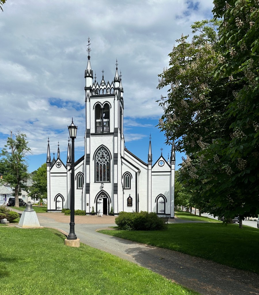
As part of our self-guided walking tour we visited St. John’s Anglican Church which sits atop the hill over looking the town and gorgeous harbor. The church itself is a national historic site. The building is a wood frame “carpenter gothic” style church. The church was originally built by German Protestants who were brought to counter the French Catholic culture established by the Acadians that had settled the area prior to the arrival of the British.
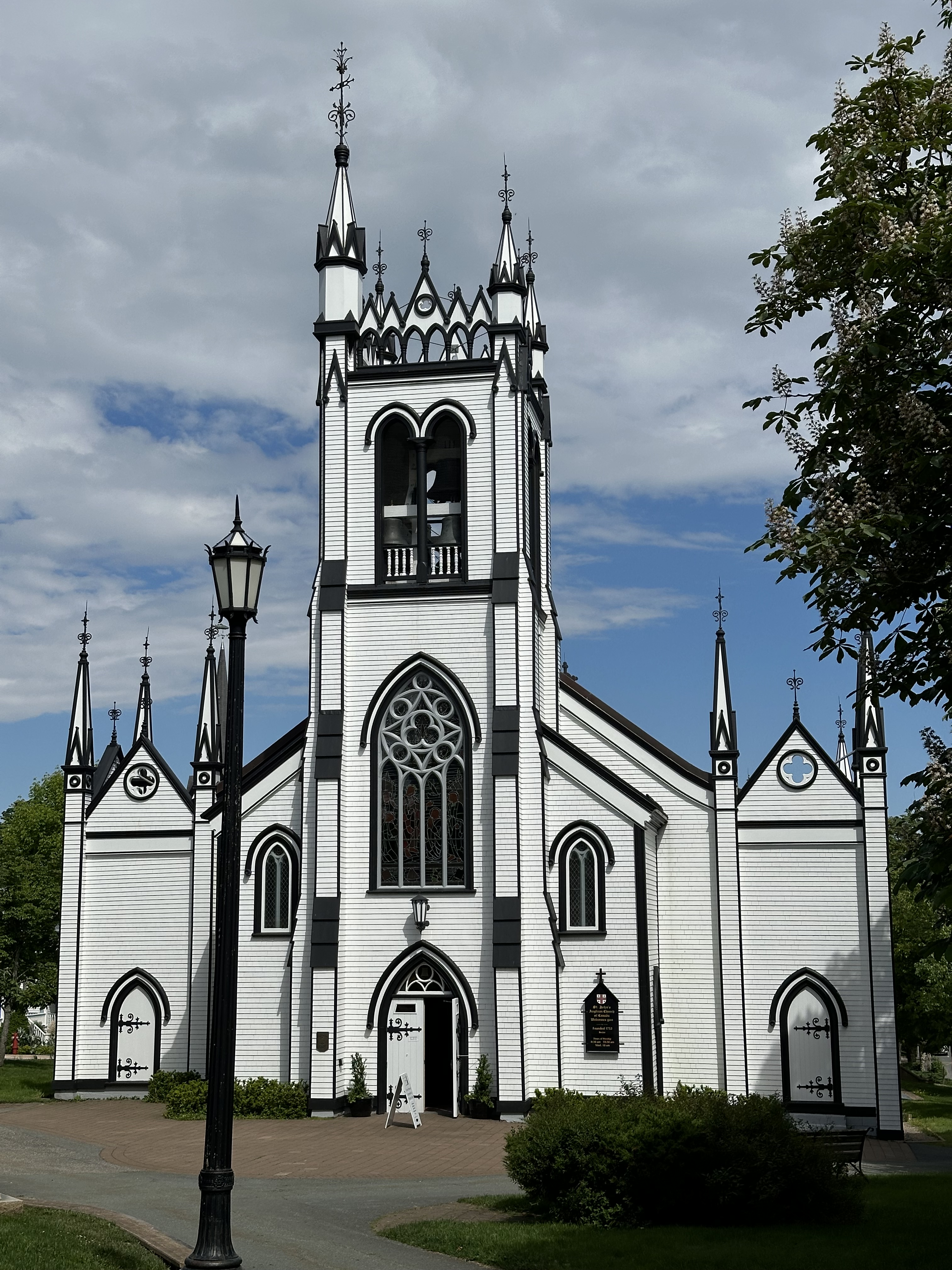
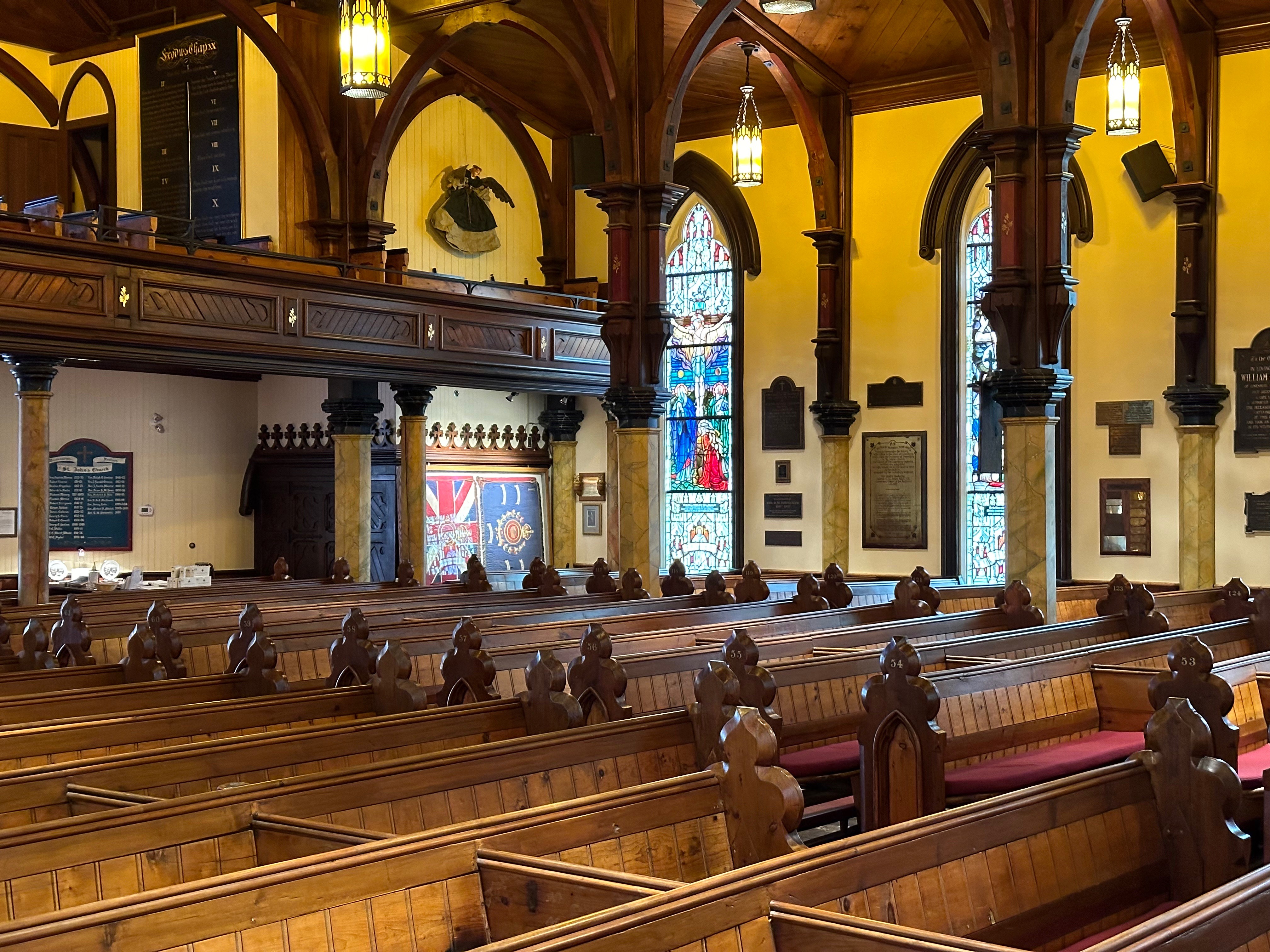
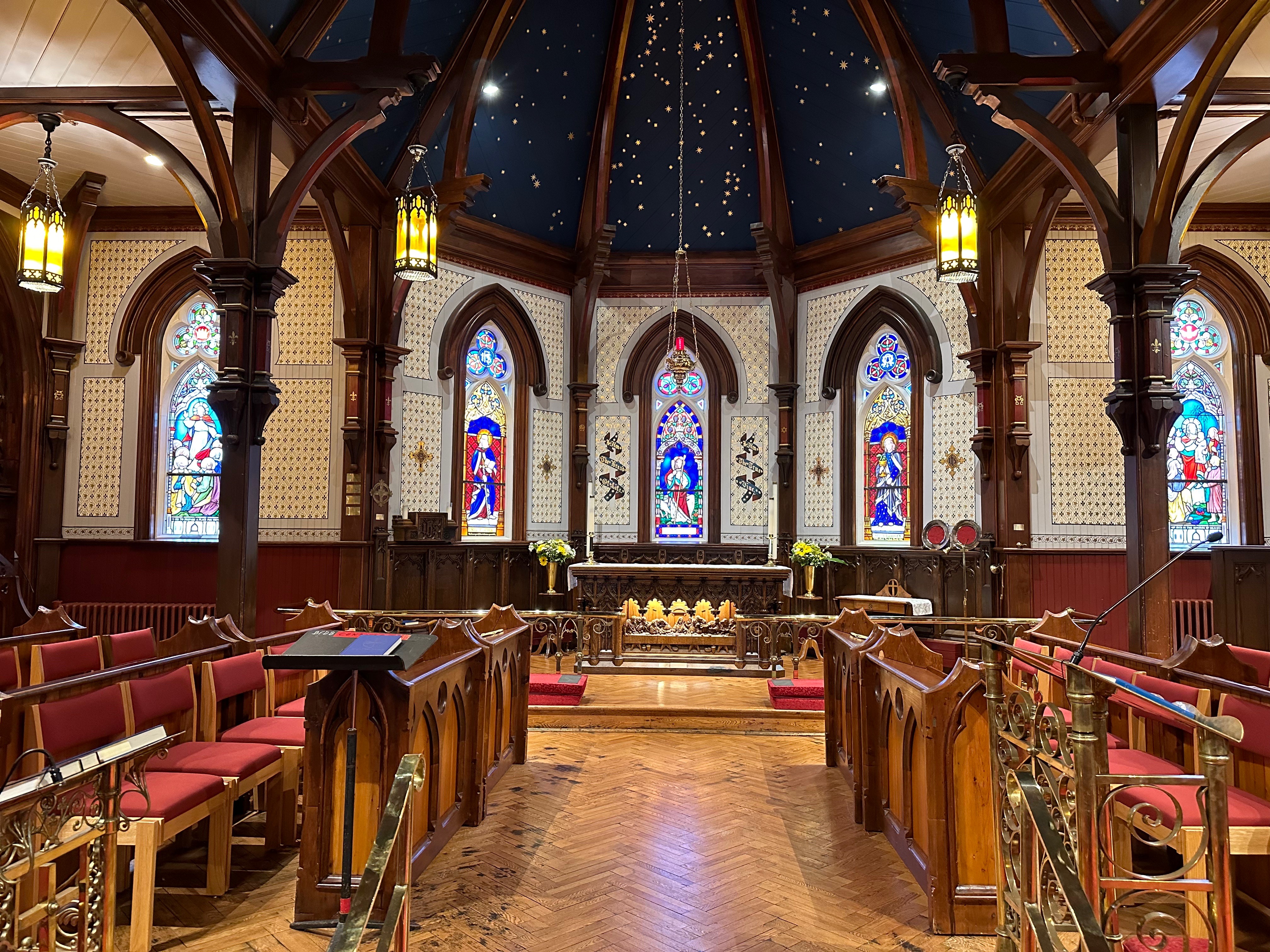
The construction of the church was intended to help establish the Anglican Church of England as the preeminent church in Canda and assist the British in formalizing their authority over the territory. Regardless of the intentions of the Anglicans and the British ruling class the church is a graceful, beautiful work of craftsmanship. Remarkably, for a frame church it avoided a catastrophic fire until 2001. Fortunately it was quickly rebuilt and reopened in about four years.
Let’s not forget coffee—essential to any stop over—Lunenberg was up to snuff with No9 Coffee a three minute walk down Montague Street from our loft.


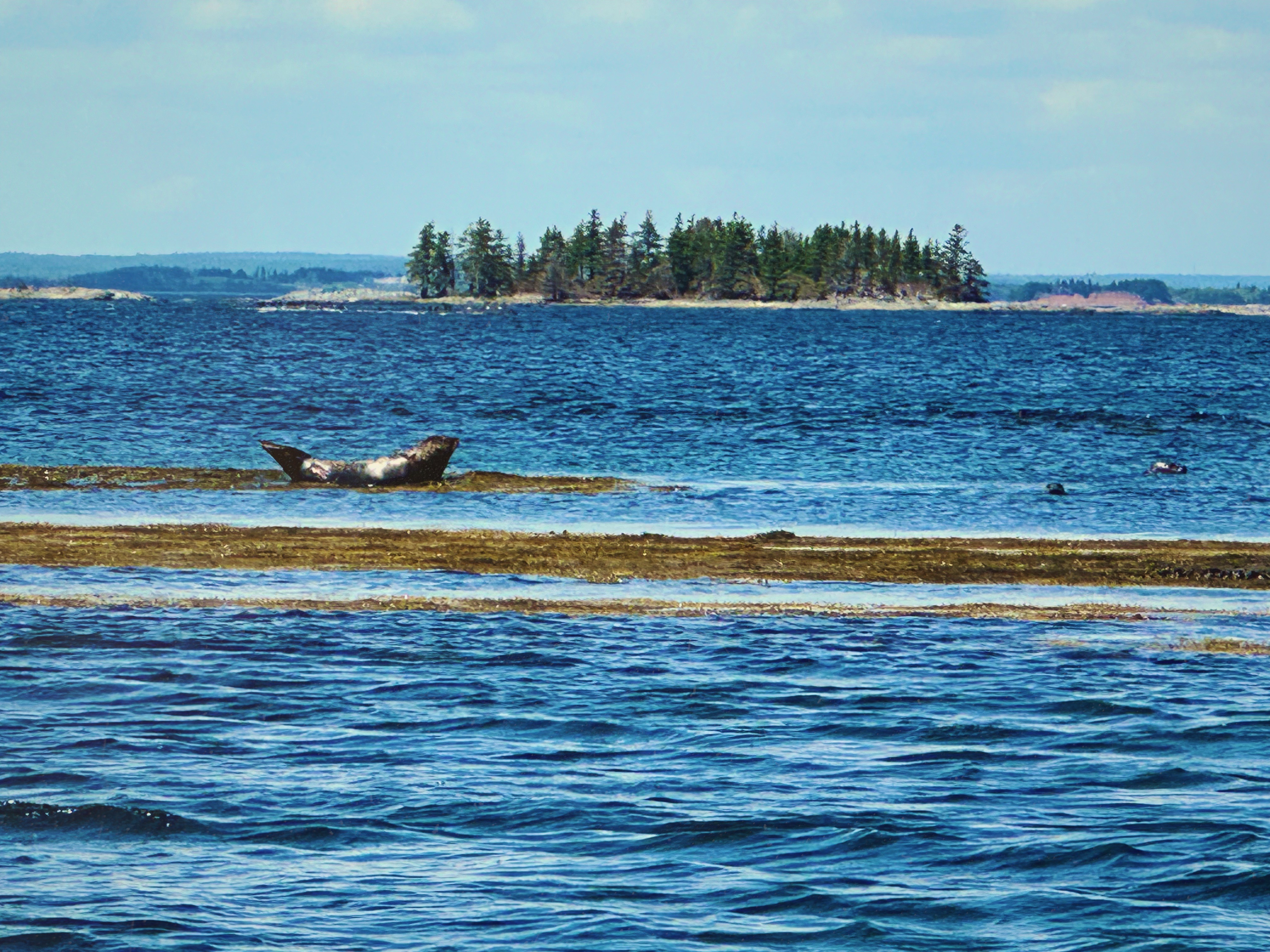
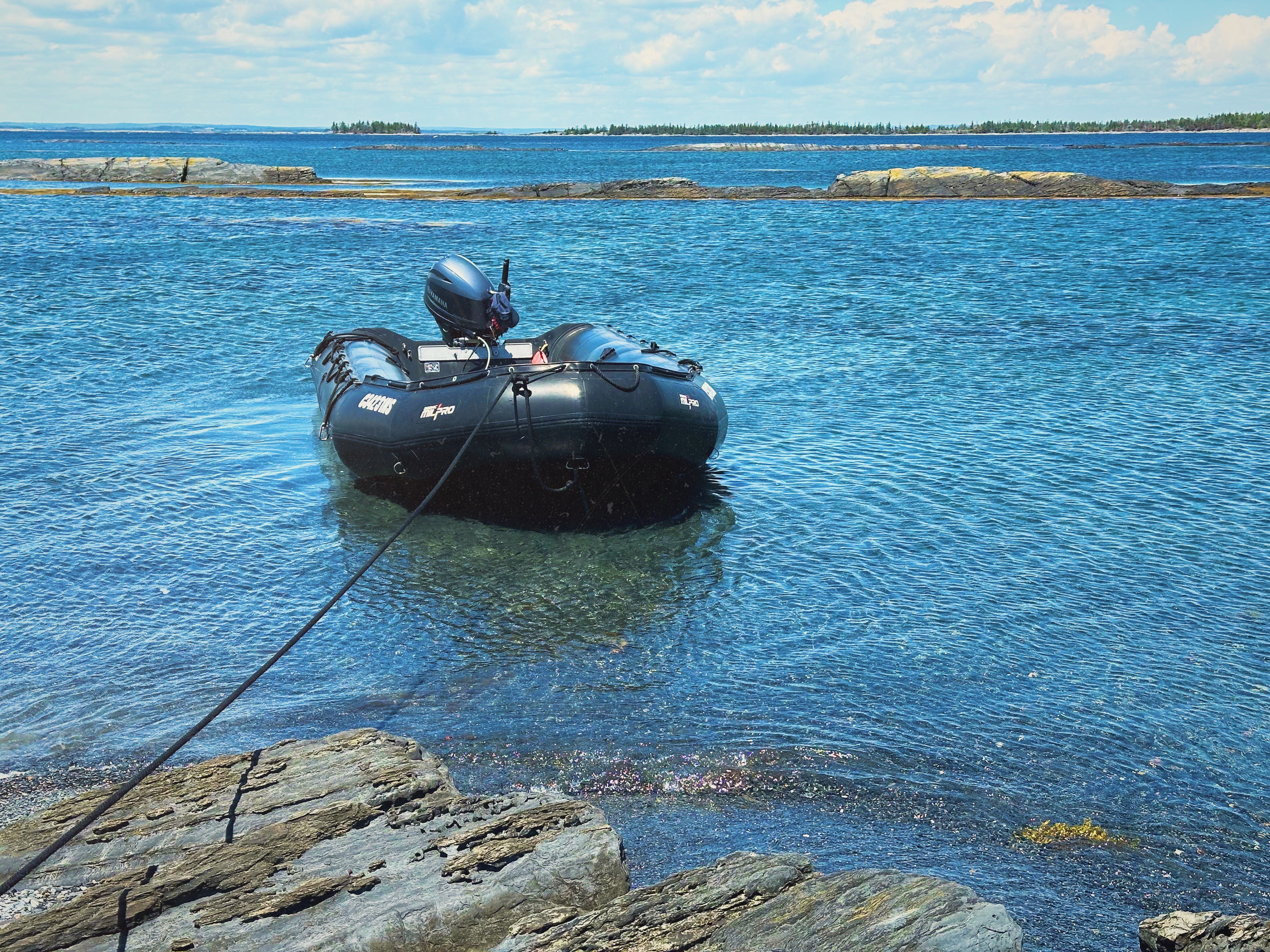
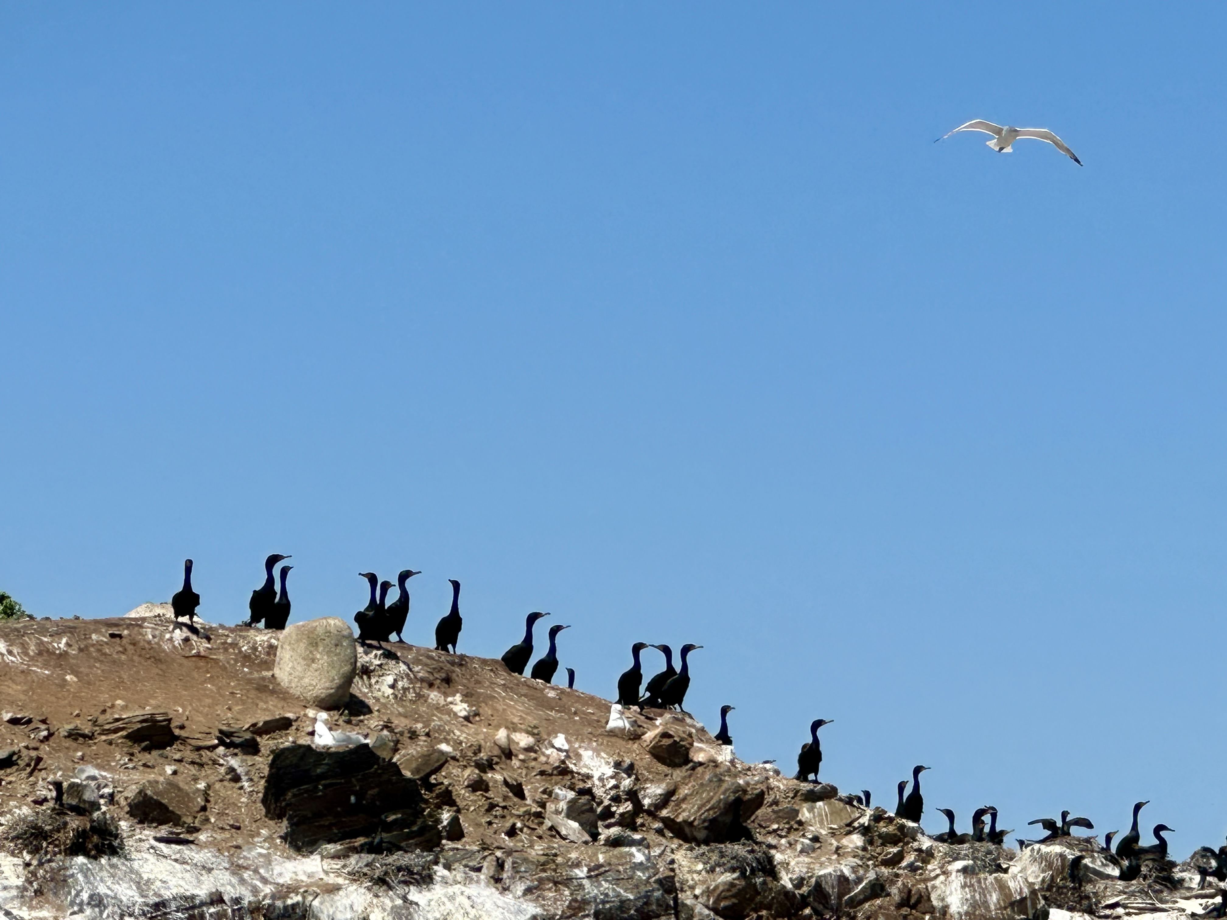
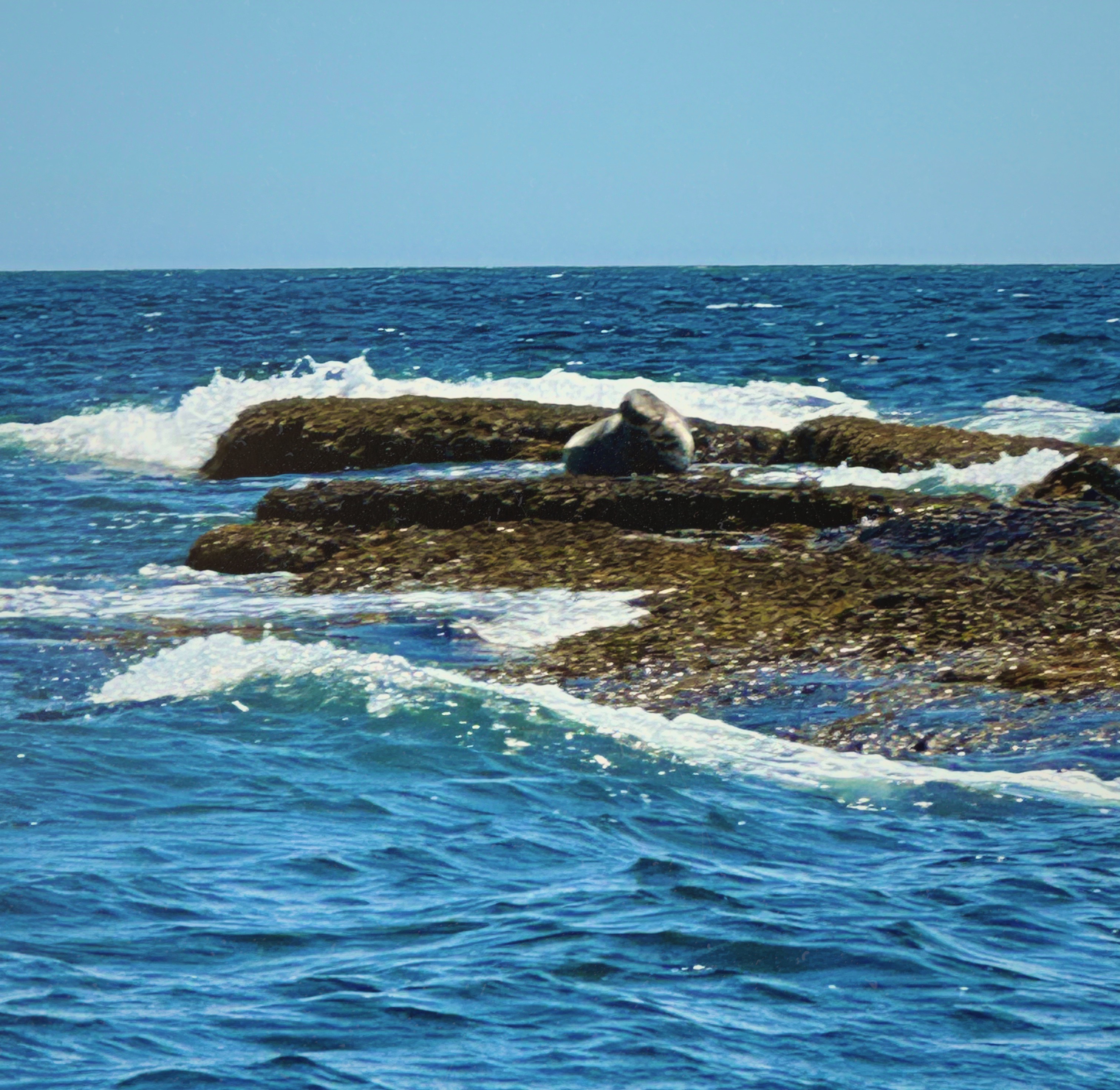
On our second day staying in Lunenberg we traveled about ten minutes east for a coastal tour by Zodiac. We had a picture perfect day although the open ocean was to quote our guide Jason —“a bit sporty”. The coves and gutters (channels) however were calm and serene. We saw many seals swimming and sunning on the rocks. We also were able to beach the Zodiac and explore several small islands. Jason was a great guide and host. After finishing the tour he served us Gin & Tonics on the dock. We squeezed fesh juniper berries that we collected on the islands into our G&Ts. Delicous!


Back in town we completed our stay with an excellent meal at the Beach Pea Restaurant. Beach Peas are native to temperate coastal areas in the Northern Hemisphere. I am not sure why the resaturant was named after this spcies since they are toxic if improperly prepared and are not on the menu. No matter — an excellent dinner and a greatwaytofinish our stay in Luxemberg.


From Lunenberg we set out for Halifax by way of Peggys Cove. Peggys Cove is a tiny working fishing village with a population of 30 year round residents. Amazingly, this tiny sheltered cove has upwards of 700,000 visitors per year. There is really nothing to do here other than soak up the scenery—pretty good scenery, eh!
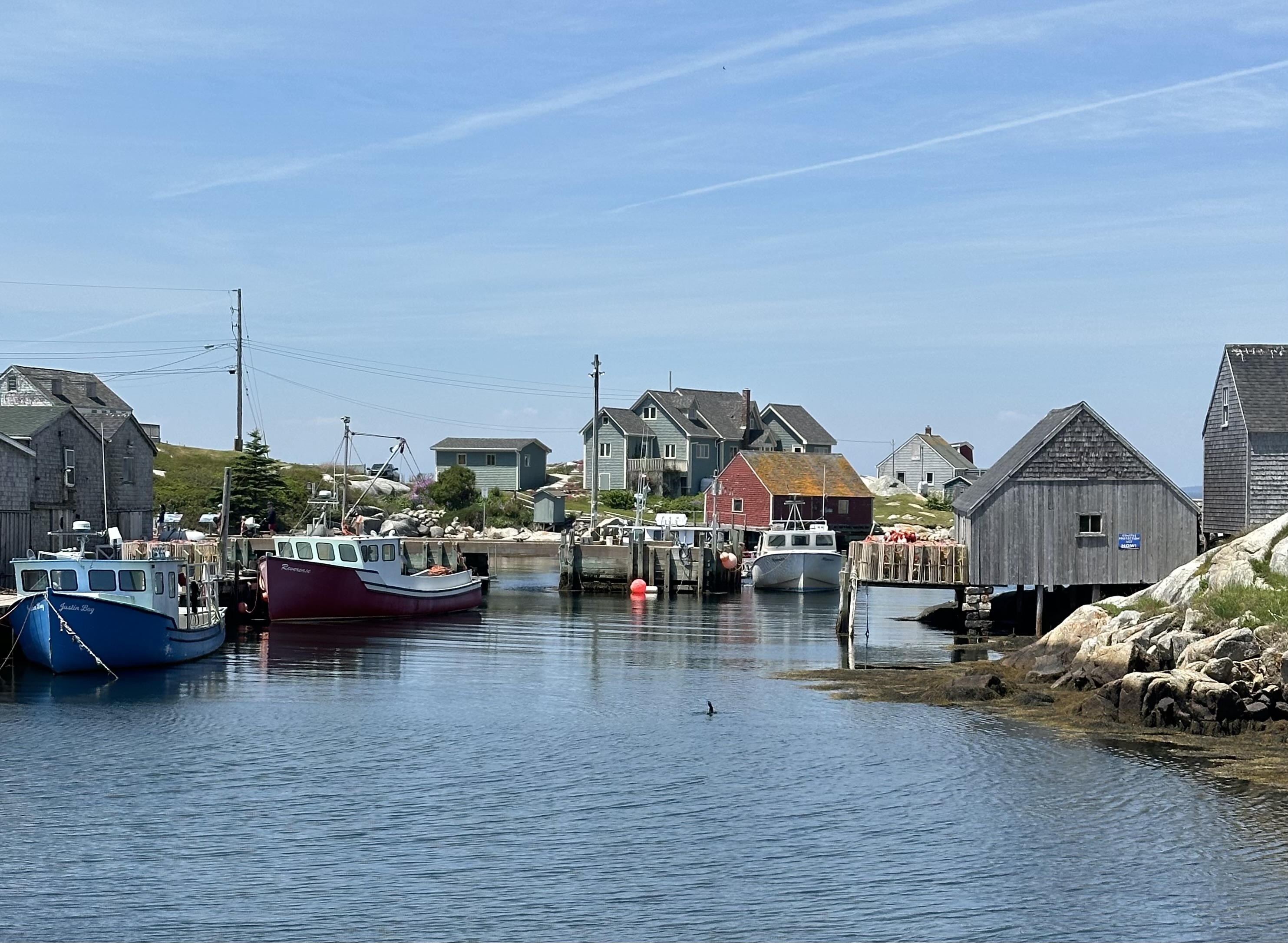


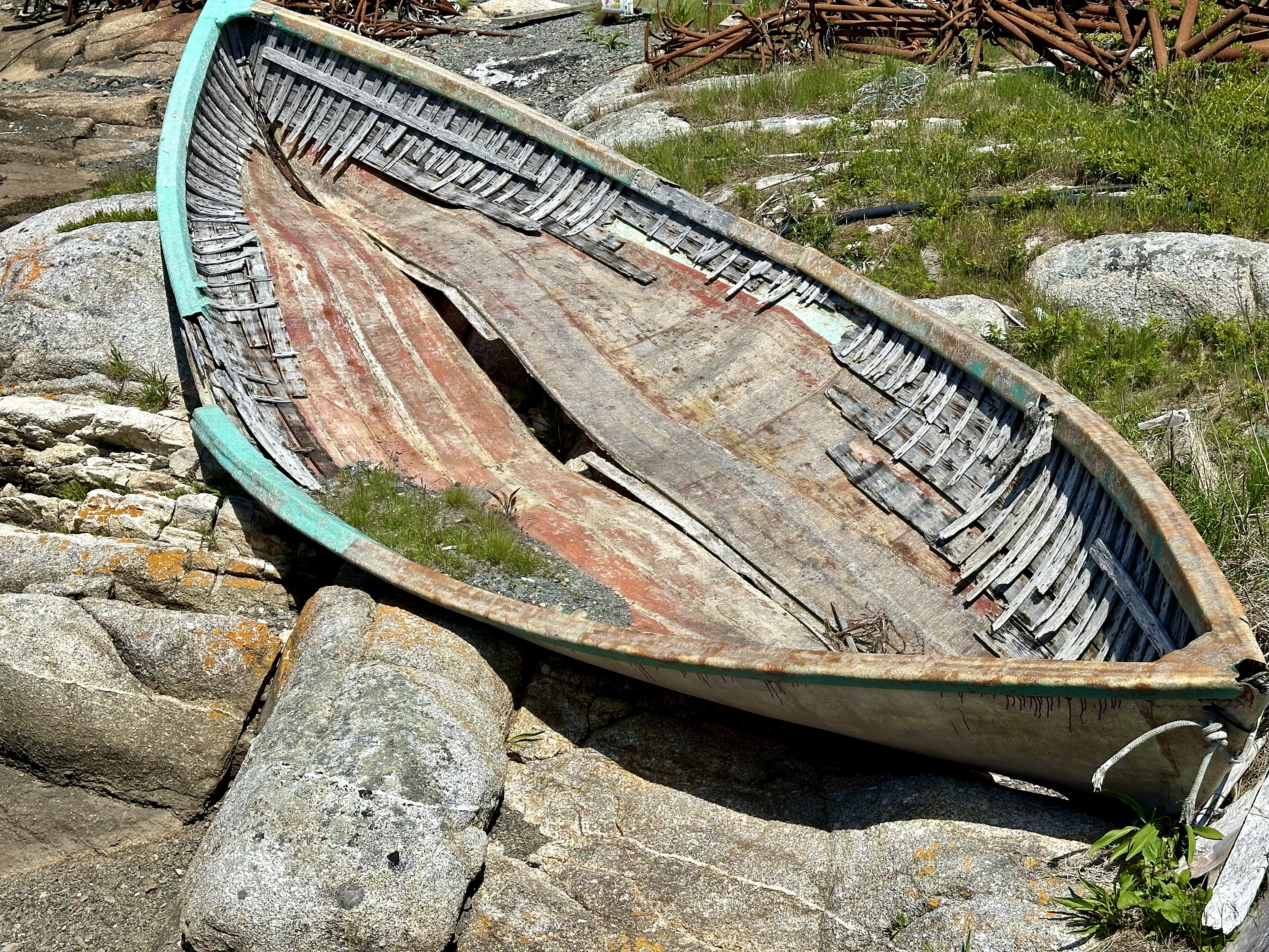


After soaking up the scenery and walking out onto the rocks to the lighthouse and taking a silly amount of photos (that can never adequately capture what you have seen) we finished the trip to Halifax. Halifax is the largest city in the Eastern Provinces and we look forward to sharing our experiences there soon.
Be seeing you!
After departing the charm of Charlottetown we decided on a brief stay in Moncton, NB on our way through to Nova Scotia. We booked two nights at the hip Canvas Hotel a block off of Main Street in downtown. The hotel is a newer hybrid property with hotel rooms on the first five floors and residences on the five floors above. This is a great location which allows walking access to the river, restaurants, coffee shops and street art in downtown.


The city has a growing and diverse population with a current estimated census of 85,000. The Greater Moncton area boasts a population of approximately 152,000 and is the fastest growing region east of Ontario. The population growth has been bolstered by much needed foreign immigration to fill the shortfall of labor created by an aging population and a robust economy.

The economy here has been traditionally anchored to transportation and related industries and more recently the financial services sector and increased tourism to the area. Moncton also has a Major Junior Hockey League team — the Wildcats — the team plays in the Avenir Centre. The venue was opened in 2018 and seats 10,000 fans. The Centre also hosts major music artists for concerts (we just missed Billy Idol — dang!).
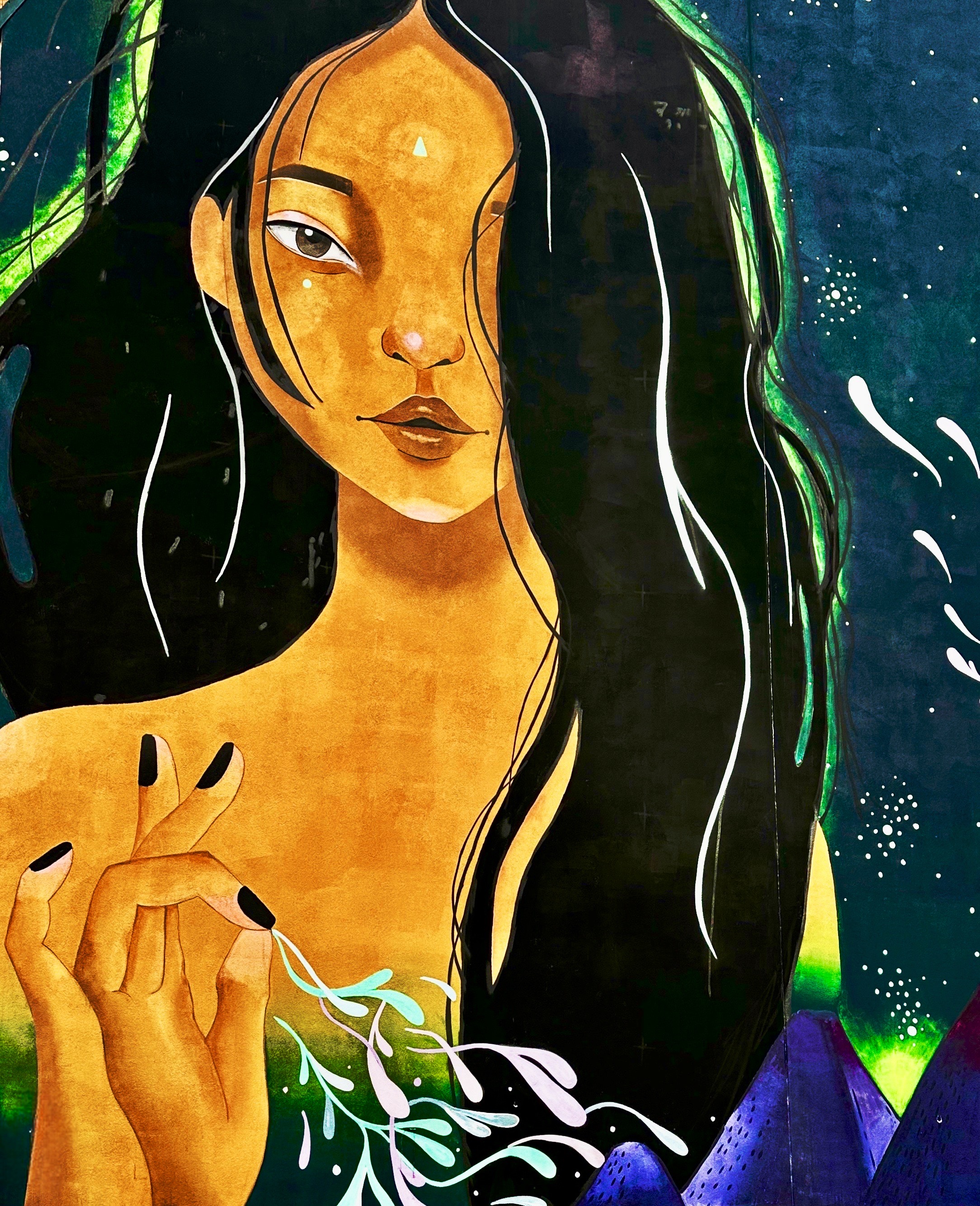
Most importantly from our perspective, the city is rife with remarkble restaurants, home to countless coffee cafes and a multitudinous mural scene (50+ murals and counting). We will let the photo collection below illustrate our 36 hours in Moncton.


“If we can’t cry or get angry, let’s make a face to lessen our misfortune and look less ridiculous.”— Rotchild Choisy

Built in 1939 and 1940, as the Monument of Remembrance, this cathedral is a symbol of the achievements and resilience of Acadians. It recounts their history in decorative elements, such as the tower sculpture of the Assumption of the Virgin Mary, patron saint of Acadie, capitals sculpted by Acadians, and stained glass windows depicting both secular and religious events in the history of Acadie.
The exterior combines elements of Art Deco and Gothic Revival styles, while the interior is Romanesque. An affirmation of Acadian identity, the construction of this cathedral followed the creation of the Archdiocese of Moncton in 1936.
This cathedral is historically significant as a reminder of the Great Deportation (Grand Dérangement). When Acadians (French) living in what is now New Brunswick, Noca Scotia, Prince Edward Islands and Maine refused to sign an oath of loyalty to the British Crown they were deported en mass to the American colonies — most notably Louisianna where they became known as Cajuns. Their homes and farms were destroyed and the land was given to British loyalists.
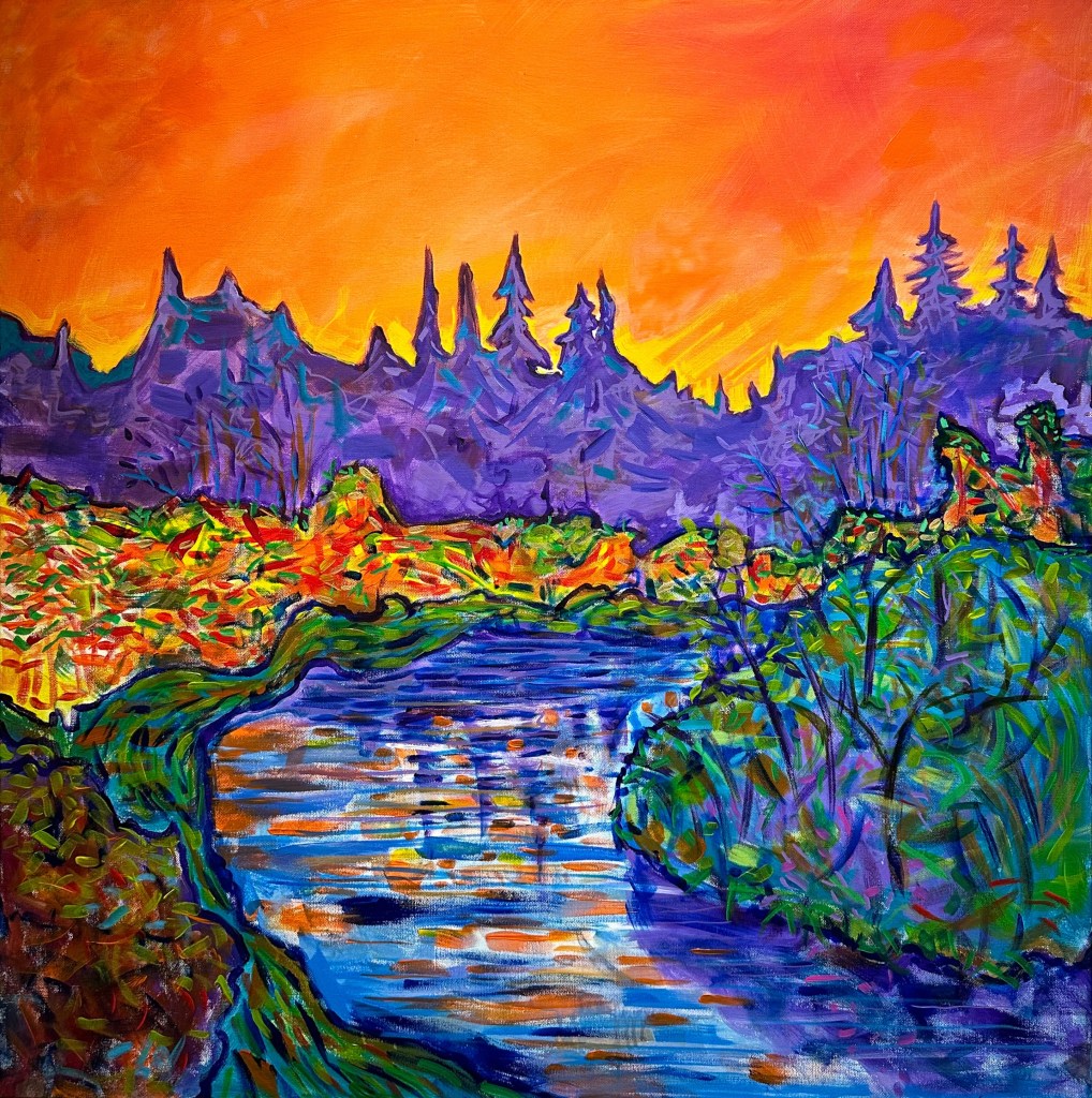
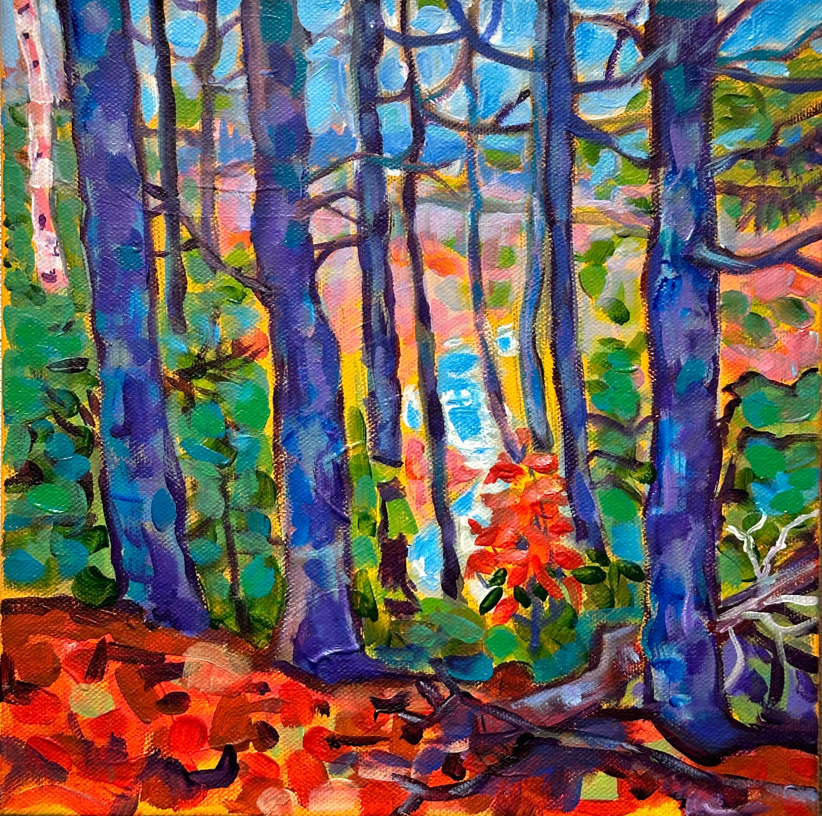
Moncton is also home to a number of fine art gallleries. We visited the Moncton Gallery housed inside the ground floor of City Hall. The small gallery currently has an exhibit of art by Luc Joseph Damien Cormier. We do not know much about the artist but we were really taken with the vibrant colors of the paintings featured in this exhibit.

If you are traveling in the Atlantic Provinces for the natural beauty of the breathtaking coastlines and quaint villages, don’t bypass Moncton. It is perfect for the classic 36 hour visit and can also be used as a base for many nearby attractions and outdoor activities. We will leave you with a couple more photos of our favorite street murals.

Our next post will cover our journey from the Canadian border to St. John.
Be seeing you!
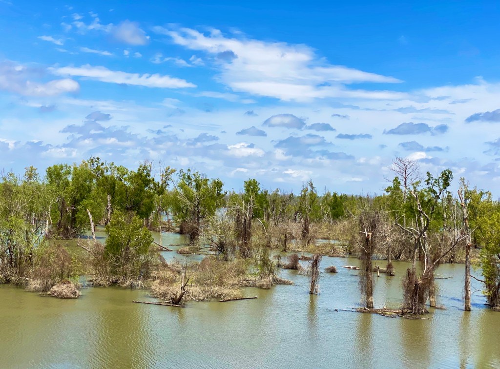
After a couple of interesting days exploring Natchez, we departed for Louisiana. Our new acquaintance, Dub Walker, proprietor of Steam Punk Coffee (see Mississippi Part Three) recommended that we cross into Louisiana from Natchez. This enabled us to travel a significant distance south along the river on the levees and also view a number of the Army Corps of Engineers flood prevention and control facilities.


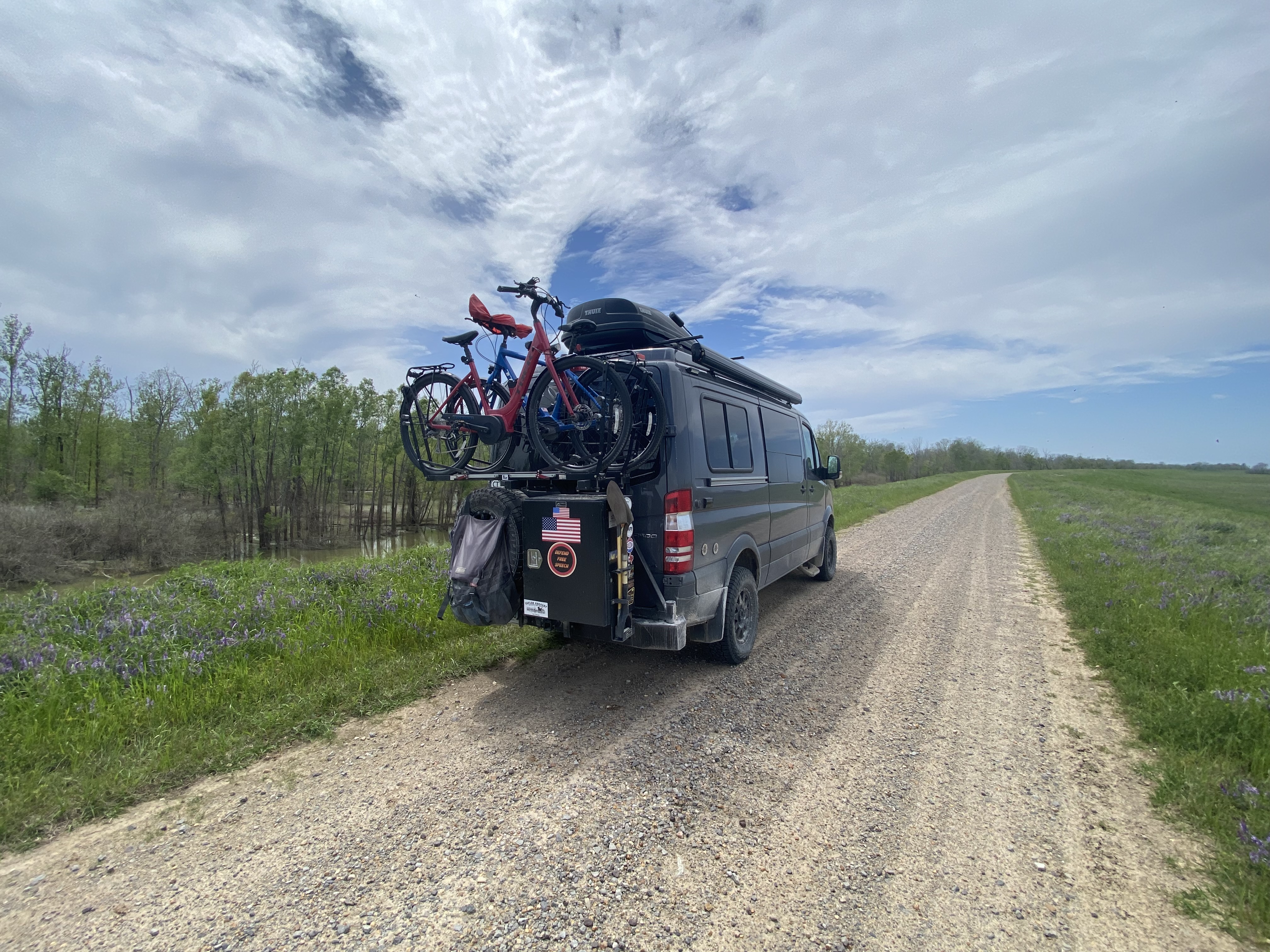
We are certainly glad that we followed Dub’s recommendation. Driving the levee was great fun and provided us with a tour of a very rural part of Louisiana. Our drive along the levee took us through Concordia Parish which covers 745 square miles with a population of just under 20,000 people. There are only seven incorporated towns or cities in the entire parish. We visited several “named places” (as noted on our map) such as Slocum and Shaw, but we found nothing other than a small sign and a bend in the road. Needless to say, we did not see many people on this drive!
The rich alluvial soil deposited by the Mississippi River in Concordia Parish was ideal for growing cotton. Being cotton country also meant that the parish was home to a small number of very large plantations. At the beginning of the Civil War, over 90% of the people living in the parish were enslaved African-Americans. No other parish in Louisiana had as high a percentage of the population enslaved. Not unexpectedly, the plantation owners staunchly backed the C.S.A. throughout the Civil War.

We departed the levee system somewhere north of Lettsworth. Our expert navigator guided us off the levee and through a series of dirt fields back to pavement (which was far more difficult than it sounds). Once back on pavement, we followed LA 971 and LA1 south and recrossed the river to lodge in St Francisville, Louisiana.
Traveling on LA1 took us across the Low Sill Dam and the 4200 foot long Morganza Spillway. The spillway has over 100 gates which allow for the diversion of a massive amount of water from the Mississippi River into the Atchafalaya Basin and River.
The Army Corps of Engineers plays a large role in the lives of those who live in the Mississippi River Delta. Without the structures built by the Corps, the communities throughout these lowlands (average elevation 56 feet above sea level) would continue to experience catastrophic flooding and loss of life.
We stopped in Lettsworth to visit the church pictured below. It is relatively simple structure which was constructed of hand made bricks. The stained glass windows were made in England – speaking to this church’s affiliation with the Episcopal Church.


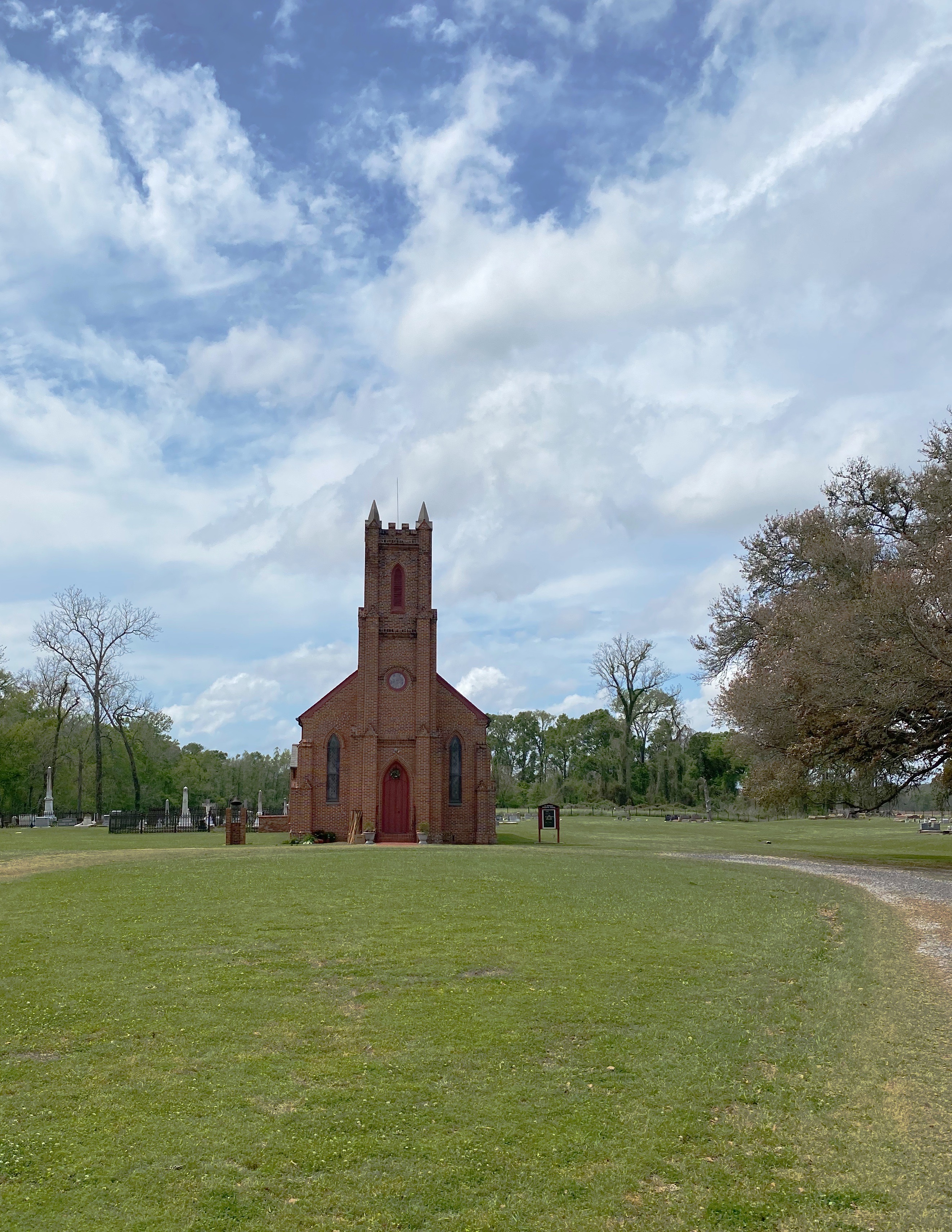
However, as with many things in the South, the Civil War changed all of that. The Episcopal Bishop of Louisiana at the time the Civil War started was Leonidas Polk. Polk, in addition to his religious calling, was as a slaveholding plantation owner (the plantation was located in Tennessee.)
With the states at war Polk felt the need to found a new church (ostensibly in support of god, country and slavery! ) – hallelujah – the Episcopal Church of the Confederate States of America! Polk then resigned his position in the church and joined the Confederate Army serving as a Lieutenant General, despite having no prior combat experience. His battle record was poor, but because he was appointed by Jefferson Davis – well you know. His nickname was the “Fighting Bishop” of the Confederacy and true to his nickname he died fighting in battle in 1864. Every church has a story! P.S. The Episcopal Church of the C.S.A. ceased to exist shortly after the South surrendered.


Gumbo and shrimp – yes please! No better way to conclude a dusty day on the levee. The Francis Southern Table and Bar. https://www.thefrancissoutherntable.com
We made an abbreviated stop in BTR as we were returning to Connecticut on our Covid-shortened trip of Spring 2020. The history of BTR sounds similar to many other port towns in Louisiana and Mississippi (an unfair and inaccurate observation no doubt.) French explorers built a fort on the bluff overlooking the river in 1699. Subsequently, BTR was under the control of the French, Spanish and British at various points in time. The Union Army captured the city in 1862 which, along with the capture of Vicksburg, meant game over for the Confederacy. From a current perspective, people tend to think Louisiana’s state capital (Governor John Bel Edwards), Louisiana State University (Tigers), ExxonMobil’s Baton Rouge Refinery (13th largest refinery in the world) and, of course, the Mississippi River. For history buffs interested in a more serious and less glib reading of Baton Rouge we suggest the following book: Historic Baton Rouge by Faye Phillips and Sylvia Frank Rodrique.


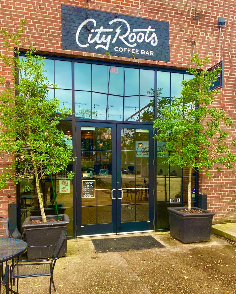
BTR is a short drive from St Francisville – good news in light of the lack of third wave coffee in St Francisville. First stop on the BTR coffee tour was City Roots Coffee Bar. This was a first visit for OTR and we would definitely recommend it be a part of your BTR specialty coffee rotation.


https://www.cityrootscoffee.com/

The BMG LSU is an unlikely oasis of green off Interstate 10 just outside of downtown BTR. The land was the gift of the Burden family to LSU on the condition that it only be utilized for agricultural, horticultural and agronomic research and the development of the Rural Life Museum.


Although it was early April, there were plenty of flowers and trees in bloom. We toured the gardens and walked the three mile interpretive trail system through woods and swamp. The trail was peaceful and secluded – you would never think you were in an urban area.


The Rural Life Museum consists of several buildings with 18th and 19th century artifacts from rural Louisiana. The exhibits include tools, furniture, wagons and clothing.


The outdoor exhibits consist of 32 buildings across 25 acres. The buildings are arranged in four sections representing different regions of Louisiana. The centerpiece from our perspective was the Working Plantation which included the living quarters and church for the enslaved people. Each of the buildings has a plaque identifying the function of the building and context – informative and in some cases dispiriting.


https://www.lsuagcenter.com/portals/burden/
Also on display on the grounds was the statue pictured below —- The Good Darky. We have included below all of the information provided by the museum. We agree with their view that is should be displayed despite the explicit racism depicted (the reader may, of course, disagree).
The sculptor left the statue untitled. Its dedication plaque from 1927 reads: “Dedicated to the arduous and faithful service of the good darkies of Louisiana.” This text was the source of the statue’s first acquired name, “The Good Darky.” The statue has also been called “Uncle Jack,” combining recognition of the statue’s donor, Jackson Bryan, and the practice of referring to an elderly Black man as “uncle.” Today, abandoning both pejoratives, we refer to this object as “the Schuler Statue.”
Museums collect and preserve objects to learn about the past and learn from the past. This principle applies equally to subjects that we are proud to share as well as those that are hurtful and unpleasant. The LSU Rural Life Museum’s role is to care for and to interpret our collection. We do this not to glorify the past or to place inauthentic meaning in the objects. Instead, we preserve and talk about these objects to better inform our shared history, in this case the role of race in the rural South and how it has shaped our lives today.

Jackson Lee Bryan, a successful cotton planter, mill owner, and banker, commissioned noted sculptor Hans Schuler of Baltimore, MD to create this statue. It was erected at the end of Front Street in Natchitoches, LA in 1927, with the stated intention of recognizing the loyalty and friendly relations shown between the segregated Black and White communities of the city. By 1968, much of the social system the statue represented had begun to be dismantled. Under pressure from voices within the Black community, the City of Natchitoches removed the statue from public display. Through the determination of Jo Bryan Ducoumau, J.L. Bryan’s niece, the city returned ownership to her, which ultimately led to the donation of the statue to the LSU Rural Life Museum.
This statue, the only one of its kind, embodies the Jim Crow culture by reinforcing “model” behavior. In Louisiana and elsewhere in 1927, the practice of African Americans bowing heads and tipping hats was as much a survival tactic as a polite gesture. The presence of the statue in a public space reinforced the Jim Crow era’s rigid social norms and racial stratification. Initial responses to the statue were filled with a nostalgic image of a more tranquil past. Similar sentiments appeared in local papers, proclamations, and other public documents. “The old negro looks as if he had just shuffled into the square and recognized some of his white folks; he has removed his battered hat and is bowing and smiling his joyful greeting.” (New York Times, July 31, 1927
Despite being cloaked in genteel manners, these customs were a response to an underlying threat of violence to African Americans who strayed outside societal norms.
“But then, there were times in growing up (under Jim Crow) … where you had to use survival psychology … That’s the time when I would grin, shuffle, say “Yes Sir” or “No Sir,” look down. All of those things that said that you were inferior, you know. But, that was a survival tactic. Even at a very young age, we understood how to survive in a racist and very violent system.” –Ser Seshsh Ab Heter Clifford Boxley, Natchez,MS
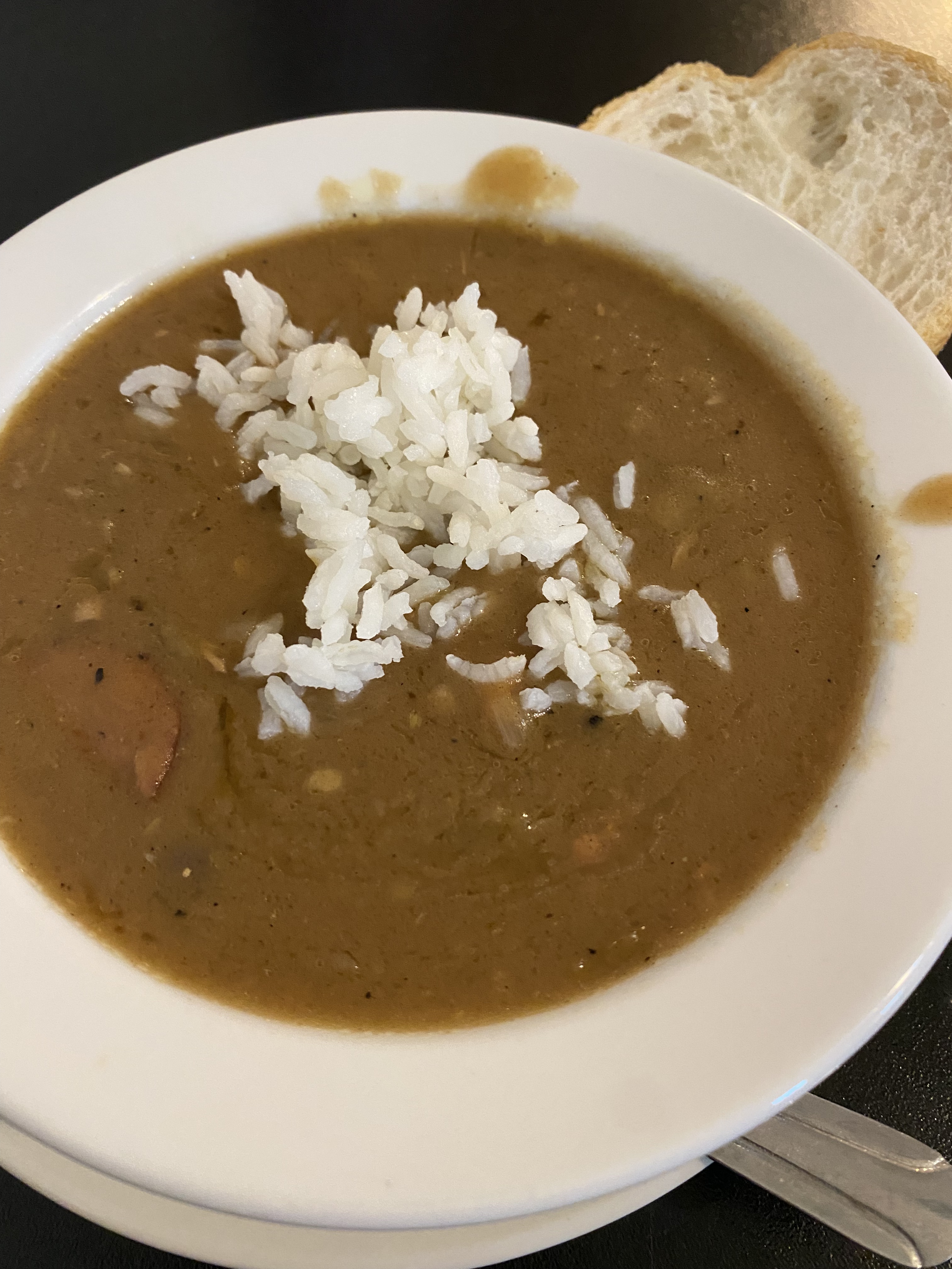

About 15 minutes east of the museum in Shenandoah sits a local favorite for cajun and creole cuisine – Dempsey’s Poboys – a perfect spot to sit and reflect on all that we had seen at the museum. Or could it be the photos above of gumbo and fried catfish represent the new primary diet of one of the members of our little band of travelers?
https://www.facebook.com/Dempseysbr/
After our day at the museum we hit the bike trail. BTR has created a 39.6 mile partially paved bike trail along the top of the Mississippi River levee. The northern trailhead trail begins in downtown BTR and extends southward. Once out of the city the scenery changes to a mix of farmlands, residential areas, the occasional factory and views of the river. You can, in fact ride this levee all the way to New Orleans, although portions are unfinished.


We have had the opportunity to ride on a number of levee trails – this is fun riding – expansive views due to your elevated riding position and no street crossings!
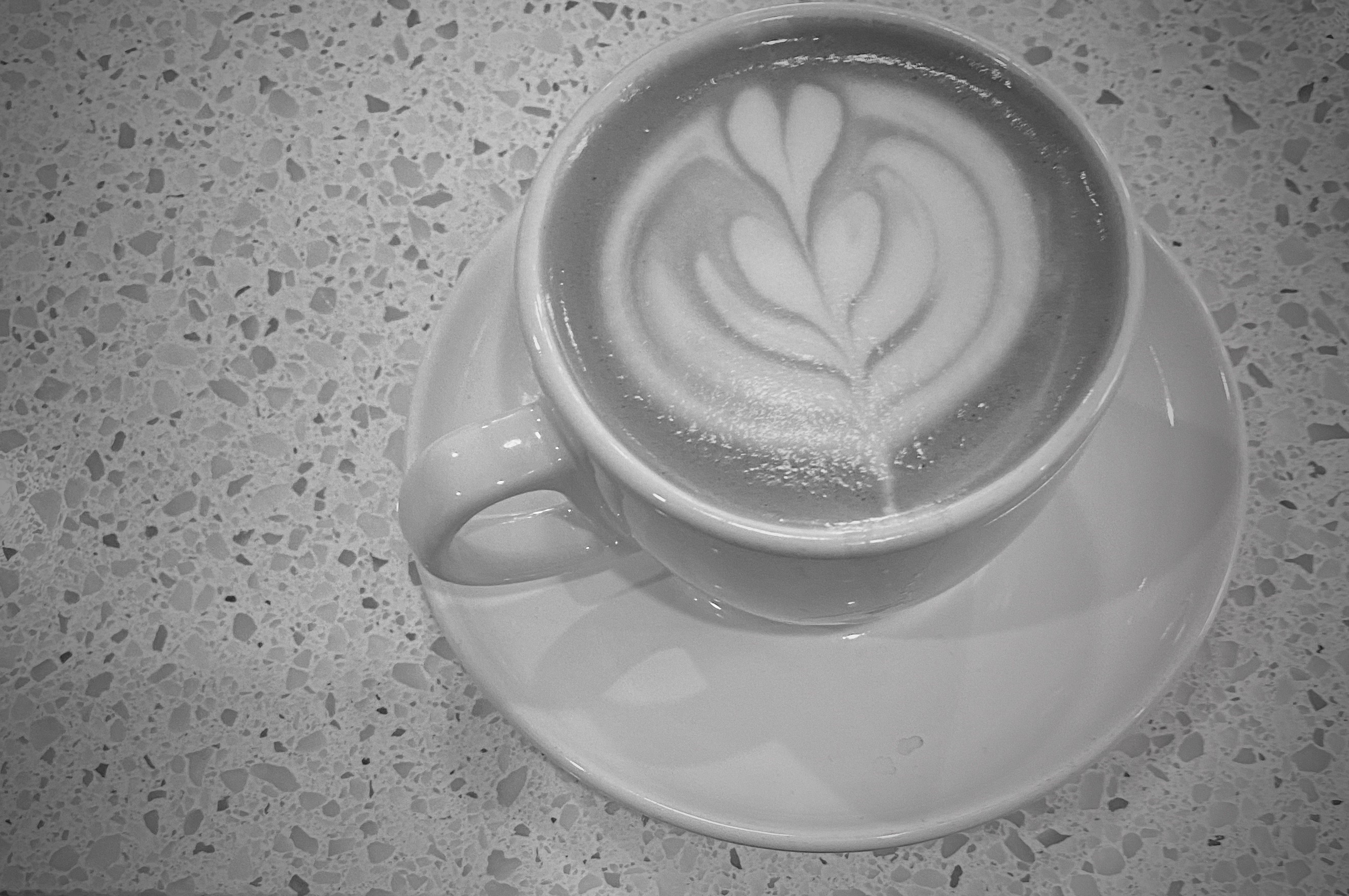
The best trail rides come with the opportunity to have espresso and tea (and perhaps toast) at a specialty coffee shop conveniently located near the trailhead. If the stars are truly aligned that same coffee shop also serves lunch and cocktails ( facilitating the critical transition from caffeine to alcohol).
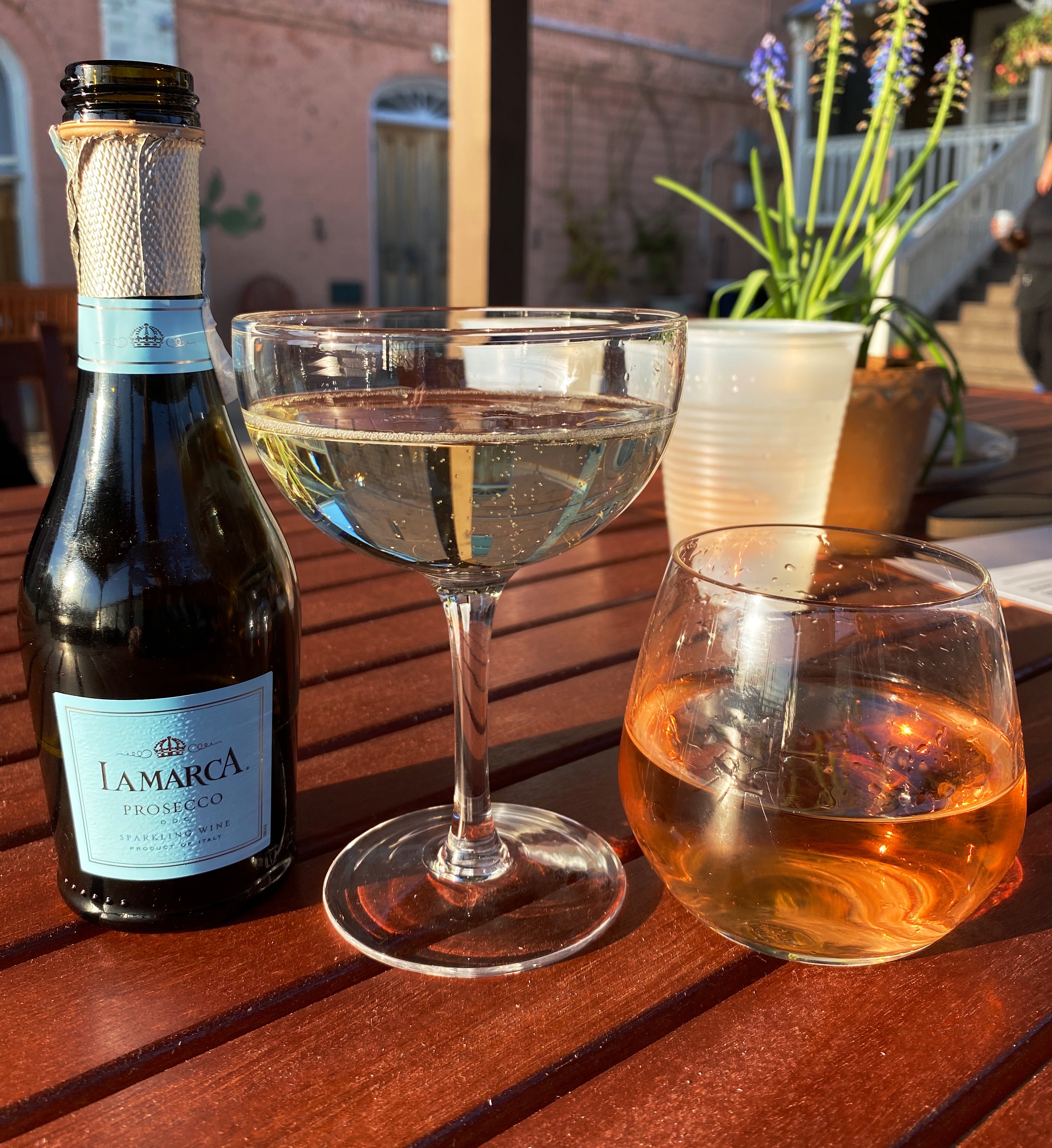
Fortunately, for us, Reve Coffee Lab BTR, was just a few minutes from where we had parked the Beast for our bike ride. Wrapping a bike ride between a pre-ride cappuccino and a tasty post ride sandwich washed down with a cold, bubbly Prosecco qualifies as an excellent day for OTR!
https://revecoffeeroasters.com/pages/reve-coffee-lab-baton-rouge


We departed BTR the following morning, but not before visiting a new specialty coffee shop located near the state capital building in downtown. The guys at Reve Coffee recommended that we stop by Social and say hey to owner Dillon Farrell.


Dillon first launched Social in 2019 utilizing a mobile coffee cart. He built a strong following and opened the current location in March of this year. Dillon is a sincerely nice guy – we really enjoyed the opportunity to chat with him between customers. He is a top notch barista – excellent caps, cortados and London Fogs. Sealing the deal – he uses Onyx Coffee. We wish him the very best with his shop.
https://www.socialcoffeebr.com/
We had a good couple of days exploring BTR. LSU brings a lot to the city – the gardens, museums, music and sports. We think BTR is worth two to three days depending on your interests.
Be seeing you!

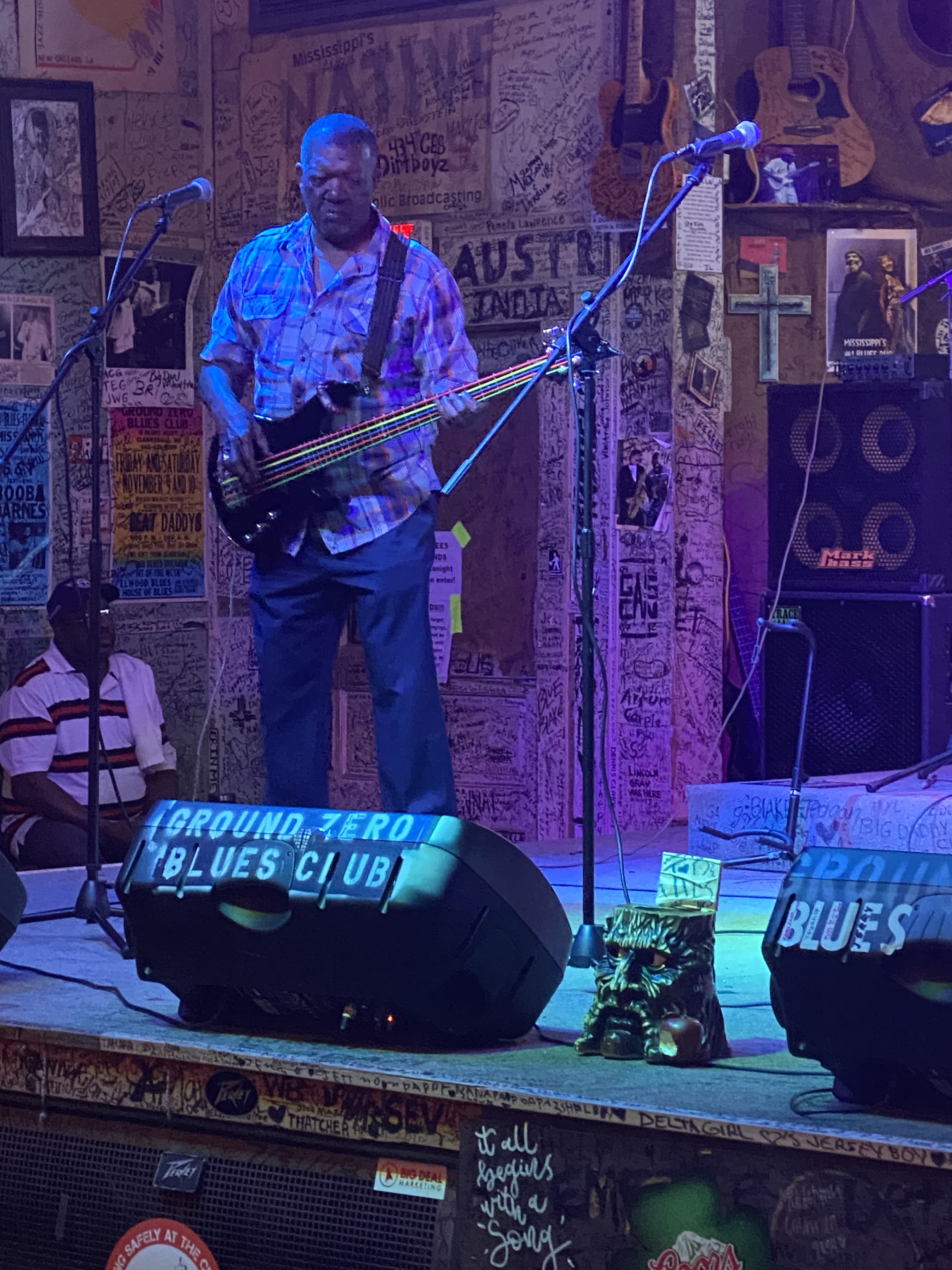
After completing the final portion of the Trans America Trail we traveled to Clarksdale to begin our exploration of the Mississippi Delta. Clarksdale is generally considered to be the home of the Delta Blues with an impressive roster of musicians calling Clarksdale their home in their early years (see previous post: Street Art from the Road: OTR 8.0: Part Two: Clarksdale Music and Art at http://www.ontheroadwithmariastephen.net.
Clarksdale boasts live Blues music every day of the year at one or more of the local blues clubs, bars or juke joints. The town itself is a bit hardscrabble but please don’t let that keep you away. Even if you are not a fan of the blues we think you will enjoy the live performances that take place at the various venues in town, all of which are very intimate and, you will hear the real Blues. Typically, you will pay $10 – $15 for a show that will run from two to four hours!


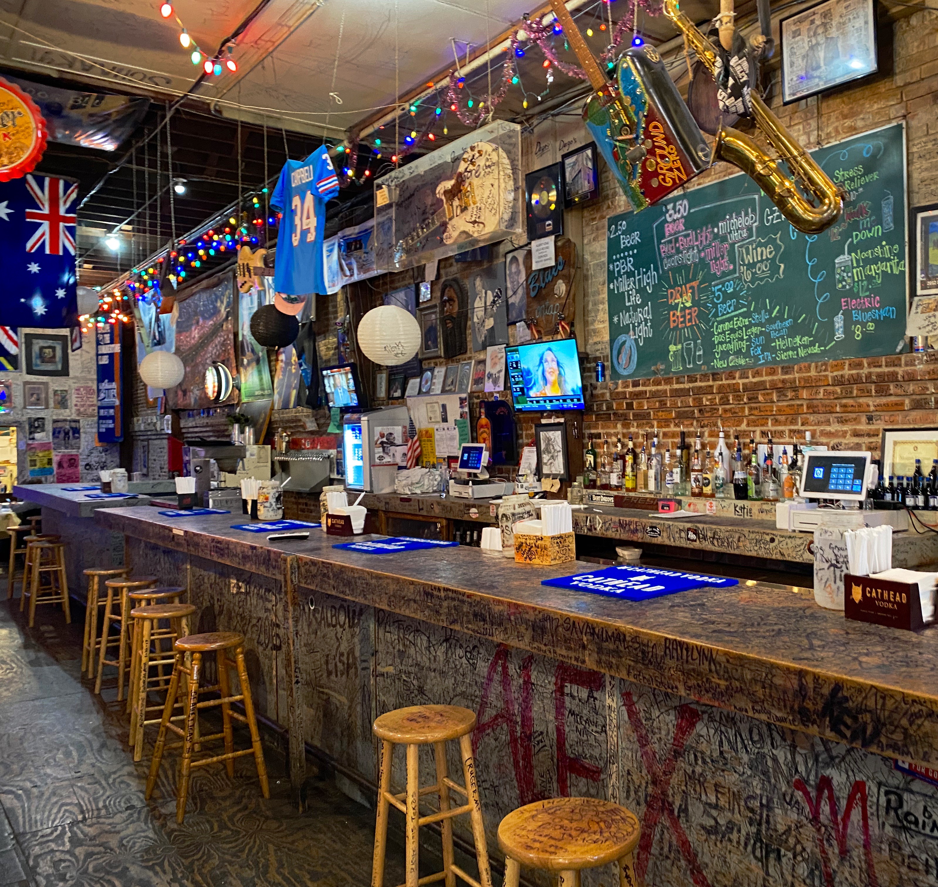
We opted to stay in an apartment above the Ground Zero Blues Club which is convenient-unless you plan on sleeping before midnight. We were in town to hear the Blues, so we figured it was all part of the experience. https://www.groundzerobluesclub.com/


Clarksdale is also home to the Delta Blues Museum. We spent a morning at the museum and learned a lot about the history of the Blues, the musicians and the Blues recording industry. There is a treasure trove of artifacts at the museum including musical instruments and performers’ stage costumes. We highly recommend a visit to the museum when you visit Clarksdale. We don’t have photographs to share with you as they are not allowed in the musuem.
There are several excellent restaurants in town in addition to the customary BBQ. We highly recommend Hooker Grocery & Eatery which is a two minute walk from the museum. https://www.hookergrocer.com P.S. If you like pancakes make sure to try Our Grandma’s House of Pancakes.


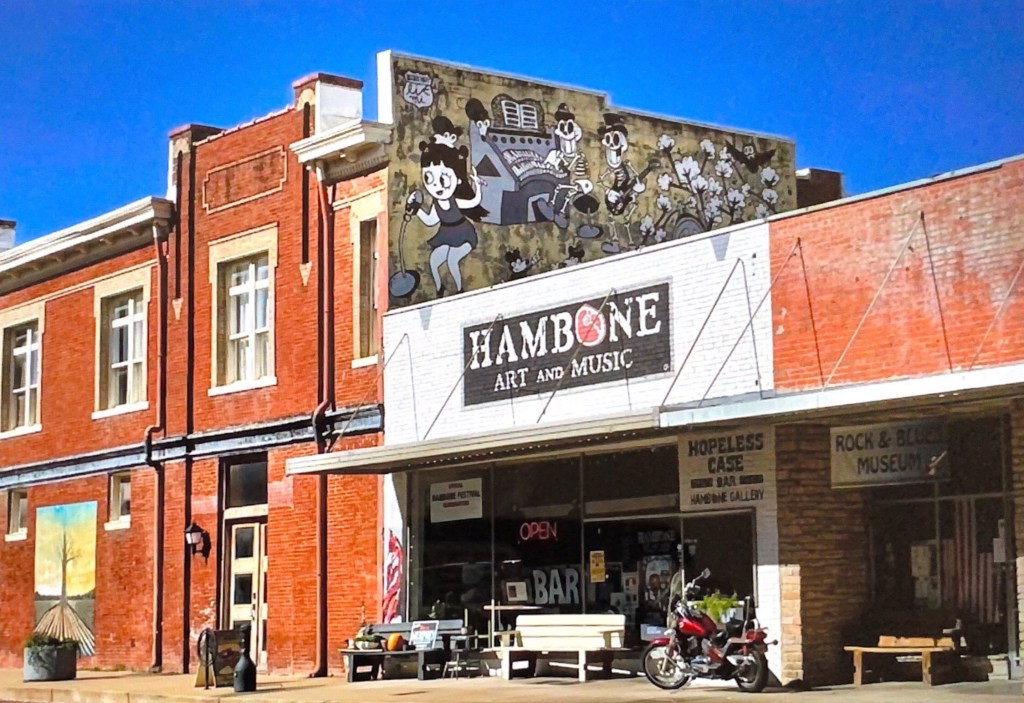
Last, but certainly not least, we recommend a visit to Hambone Art & Music. We popped into this gallery for a quick look around and then spent several hours with the owner Stan Street. He is a transplant to Mississippi and was a touring musician before settling here and focusing on his painting.
Stan bought a vacant building and converted it into his gallery in the front, his studio in the rear and his apartment above. He also operates a small bar in the studio and has a stage for musical performances. We really like his artwork and we were amazed to find out that he is largely a self-taught artist.
We visited Greenville after reading that there is a state park there with a hiking trail along the Mississippi and a 60 foot tall observation tower that provides fantastic views along the Mississippi River. WRONG! The park was turned over to Greenville and the town has not maintained the park other than the small boardwalk when you first enter the park. This was our first disappointment with Greenville.
As we were leaving town we spotted a self service car wash and pulled in to hose the van off – you may have noticed in our photographs the Beast is in perpetual need of a wash. Immediately, a man told me he was an employee and would wash the vehicle – a minute later another man showed up and informed me he was going to help wash the car and then a third man showed up to help wash the car.
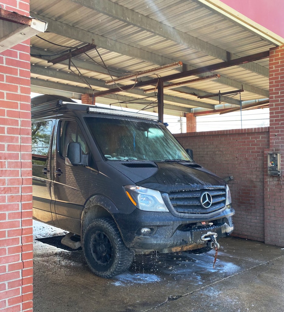
At his point we knew we had a problem – none of these guys worked at the car wash and that this was a shake down. We were able to persuade the third man that he was not going to get paid (although he hung around circling us). At that point, we told the two guys (taking turn hosing off the van) that we were good. The first of the gentlemen demanded $60.00 for the wash. We settled on a more reasonable amount and left town quickly.
We stopped in Cleveland for coffee at Zoe Coffee. We met some nice folks at the coffee shop and learned that the coffee shop is affliated with Zoe Ministries, which focuses on providing clean water, orphan care, widow care, and education to communities in Kenya. https://zoeempowers.org/


Cleveland is also home to Delta State University. The mascot for the athletic teams is the Okra and the school chant is ”Fear the Okra!”. This is the best mascot and chant we have ever encountered! Look for DSU merchandise by the pool this summer. P.S. The men’s baseball team went 32-15 this year and is currently in Florida for the NCAA Division II regional tournament.

Vicksburg, MS is undoubtedly best known as the site of a major Civil War Battle which was a turning point in the war in favor of the Union. We were keen on visiting the Vicksburg National Military Park (VNMP) to gain a better understanding of this historic battle and see the battlefield.


The Mississippi River was a critical supply route for the Confederacy. Vicksburg sits on a bluff high above the eastern side of the river and was heavily fortified with artillery to stop Union forces from cutting off this essential supply route. The Union forces knew that taking control of the river would seal the defeat of the South.
After several failed Union attempts to take Vicksburg, General U.S. Grant laid seige to Vicksburg. Grant surrounded the city with over 77,000 troops. The 29.000 Confederate troops dug in to defend the city. Confederate attempts to break through the encircled city and resupply the soldiers and citizens failed. After 47 days, with all food and water supplies exhausted, the troops and citizens surrendered; the mighty Mississippi was under Union control. For additional information: https://www.nps.gov/vick/index.htm
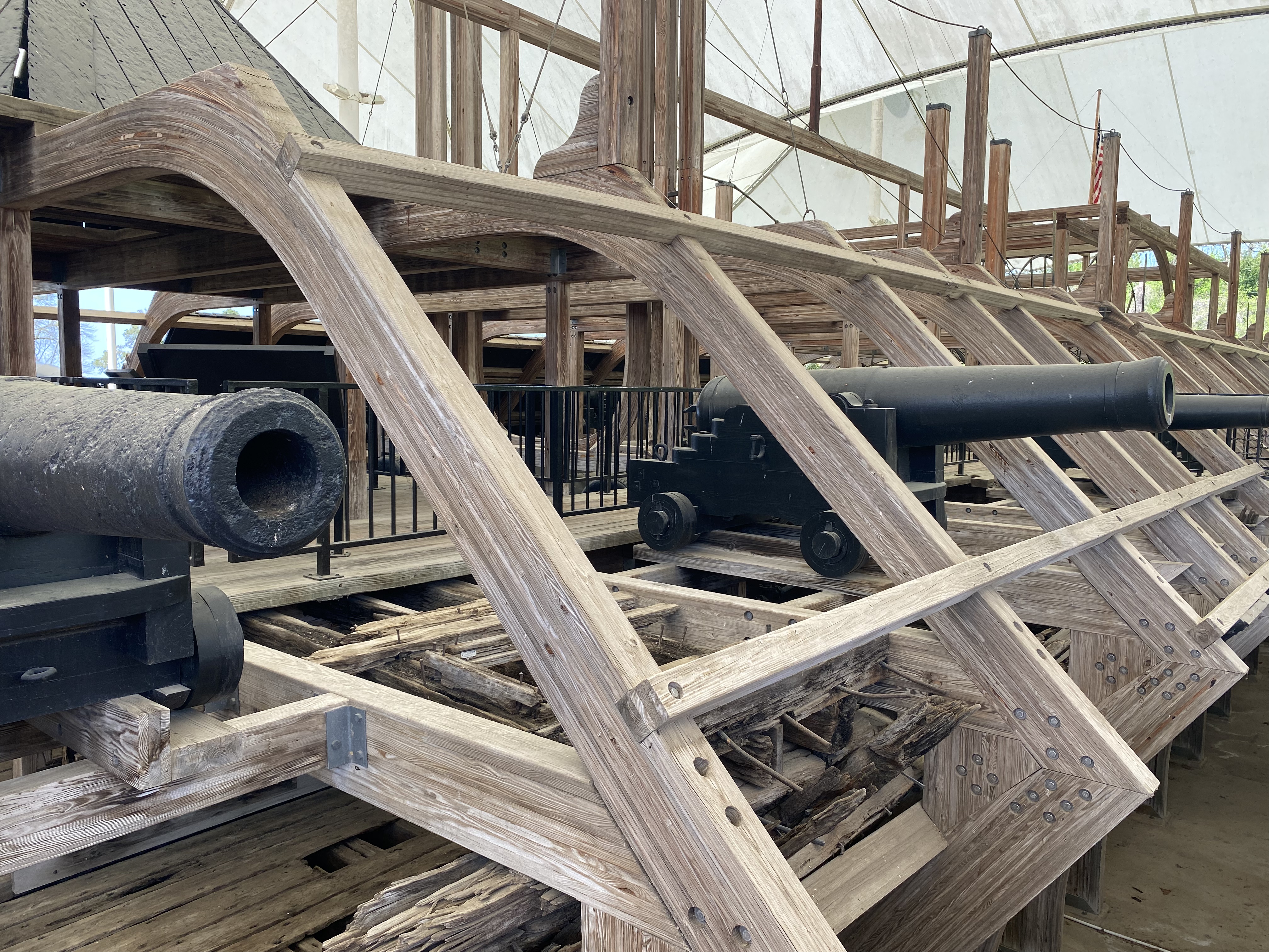


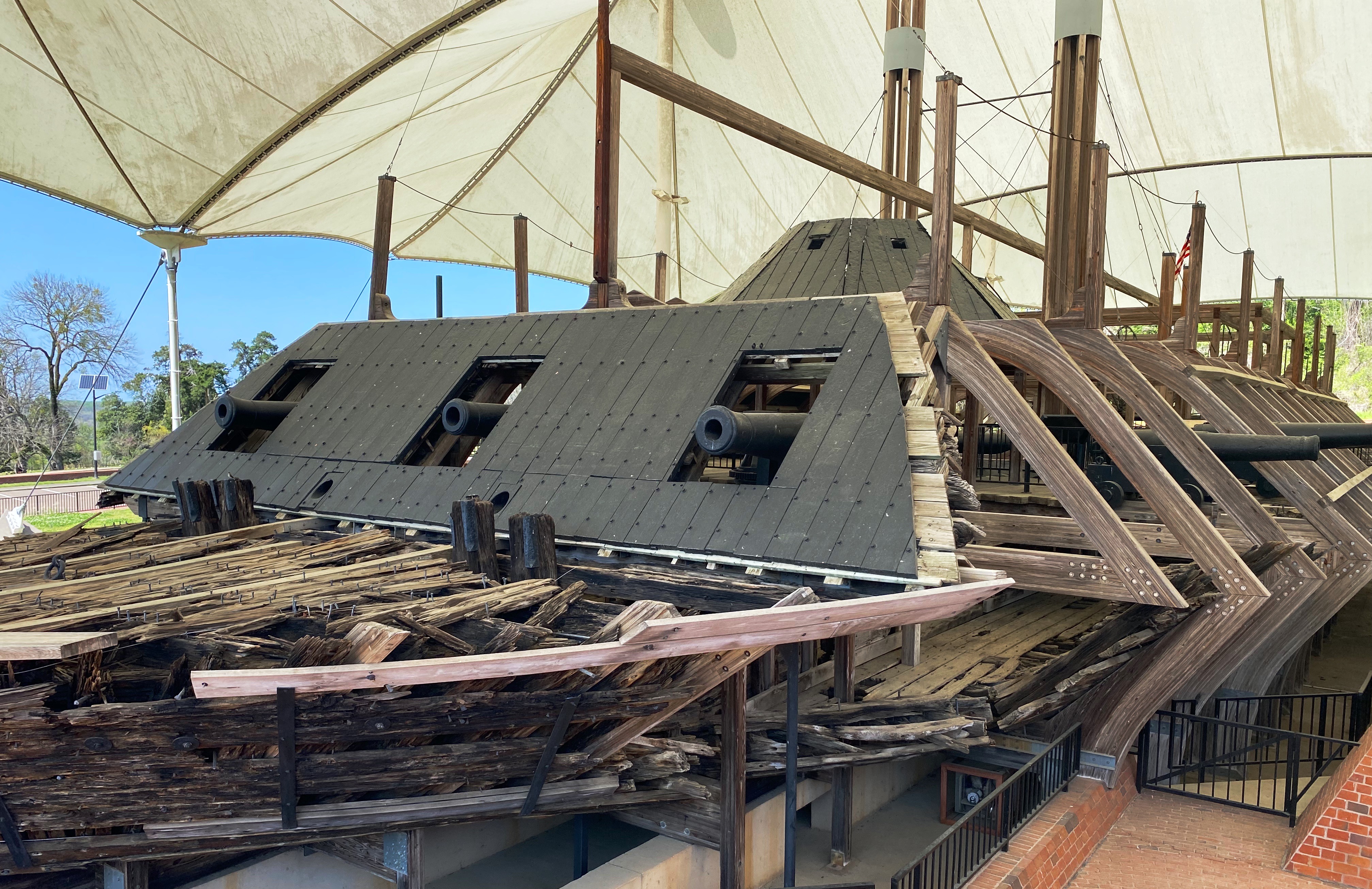
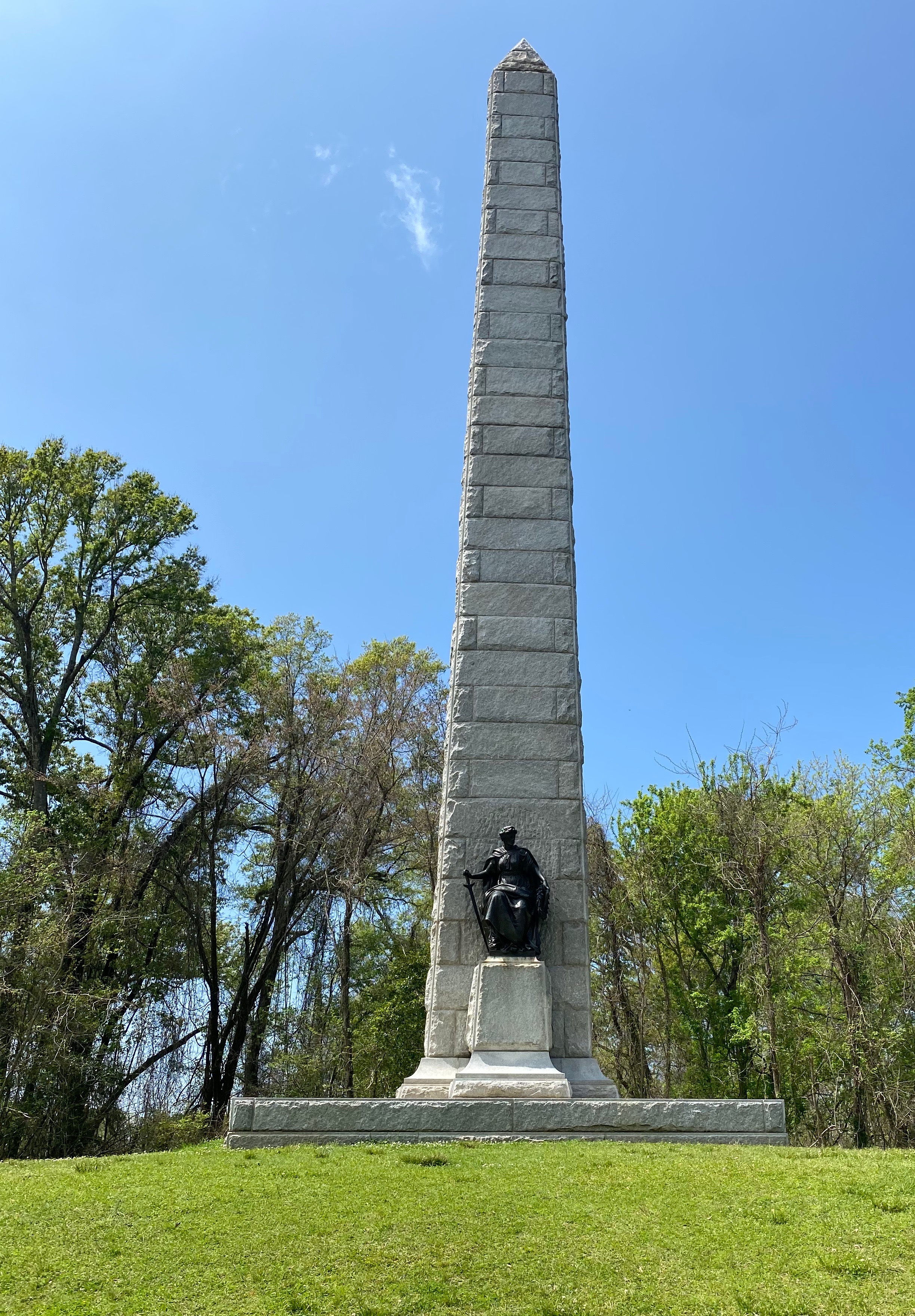
In addition to the battlefield, there is a museum in the park which includes the remains of the Union ironclad gunboat USS Cairo. The Cairo was sunk by Confederate torpedos seven miles north of Vicksburg. It slipped back into the river after being beached and abandoned. Over 100 years later the ironclad was raised, restored and given to the National Park Service. For additional information: https://www.nps.gov/vick/u-s-s-cairo-gunboat.htm
Historic downtown Vicksburg is perched above the river south of the main artillery emplacements and battlefield. A number of excellent restaurants, rooftop bars and art galleries can be found there. The Jesse Bent Lower Mississippi River Museum, managed by the US Army Corps of Engineers, is on the waterfront and worth a visit.
The Mississippi River is still a vital supply route for the US economy. The Corps, one of the largest employers in the area, is responsible for commercial navigation, flood risk management and environmental stewardship.
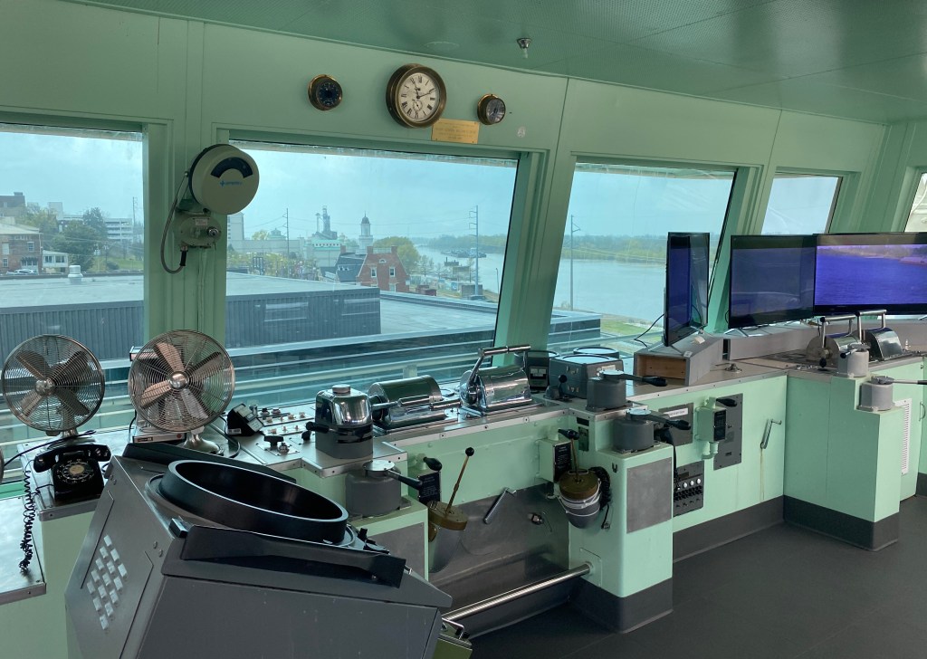
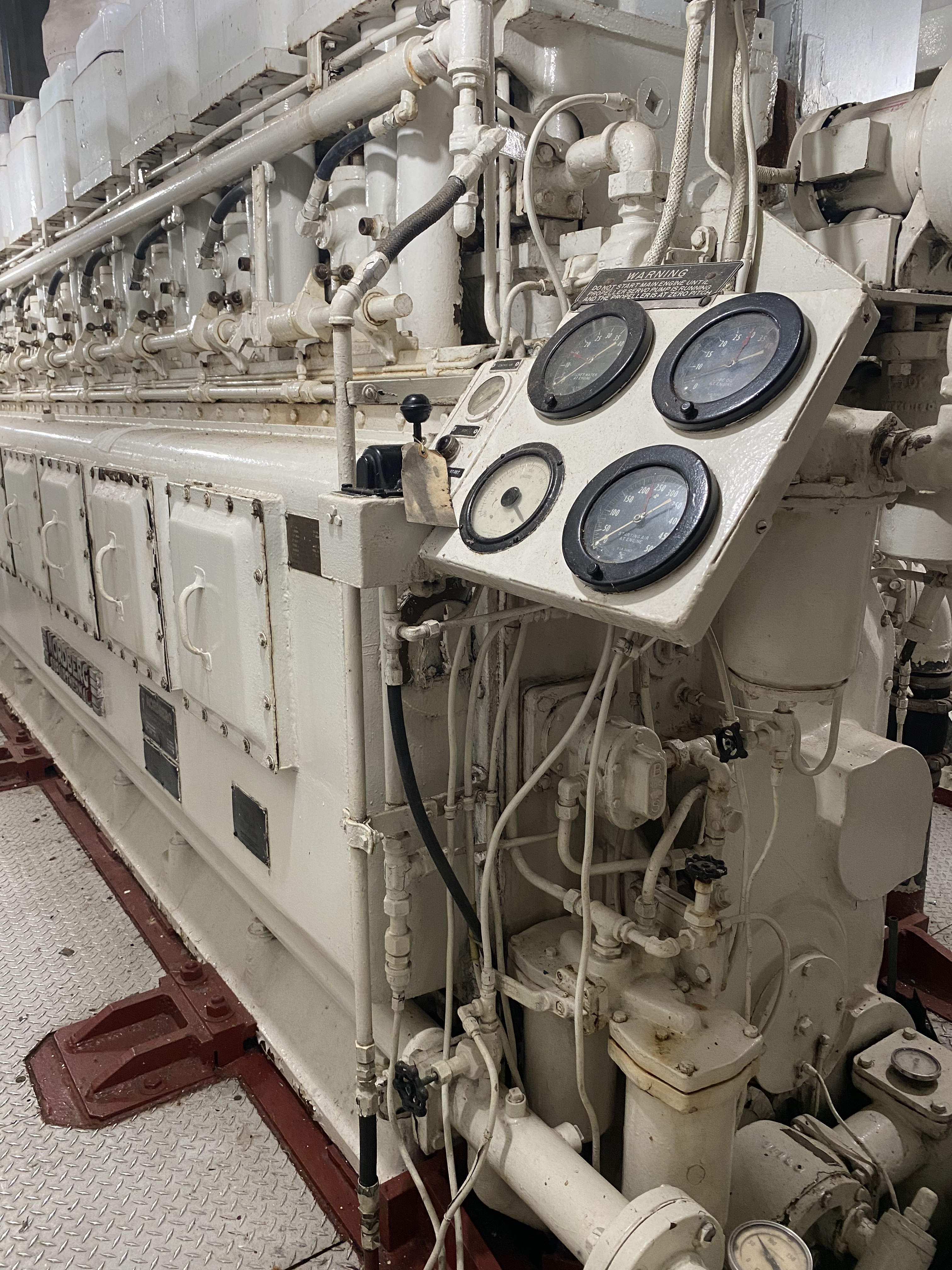
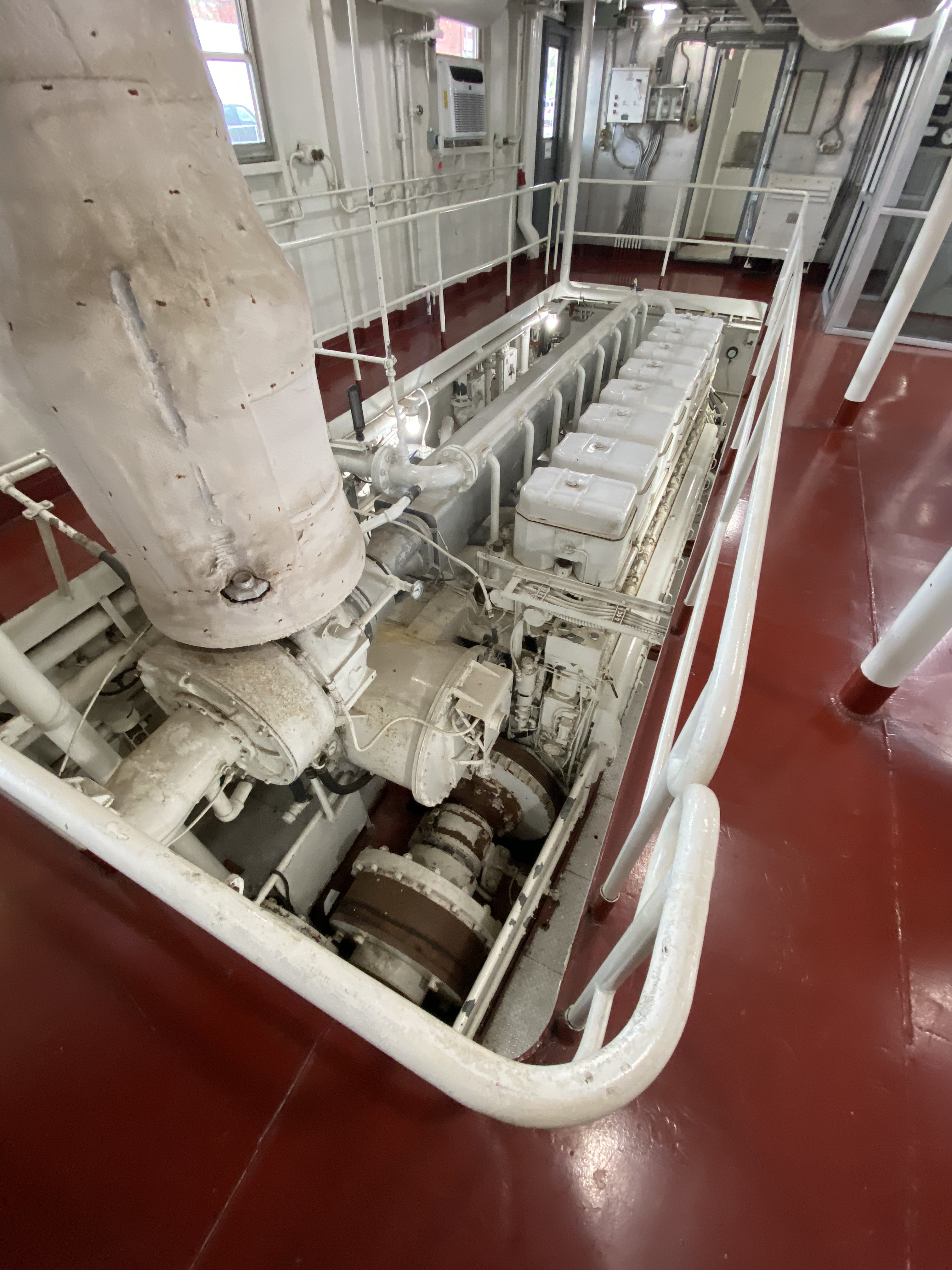
A visit to the museum also includes the opportunity to tour the retired M/V Mississippi IV. The Mississippi IV was a tow boat used by the Army Corp from 1961 until 1993 when it was retired.

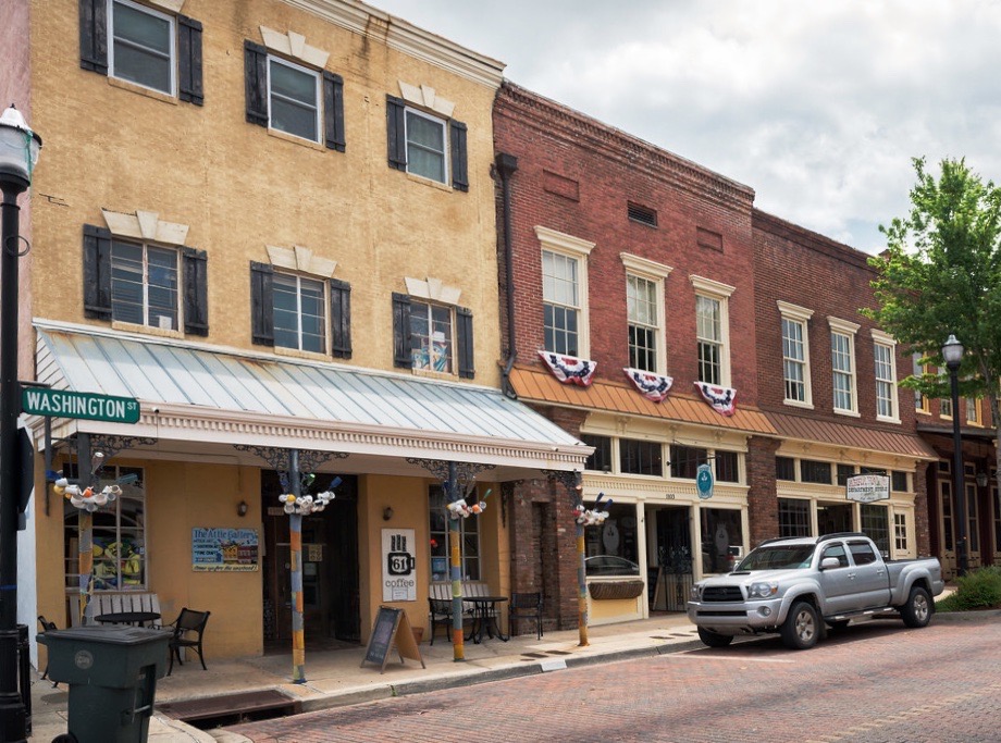
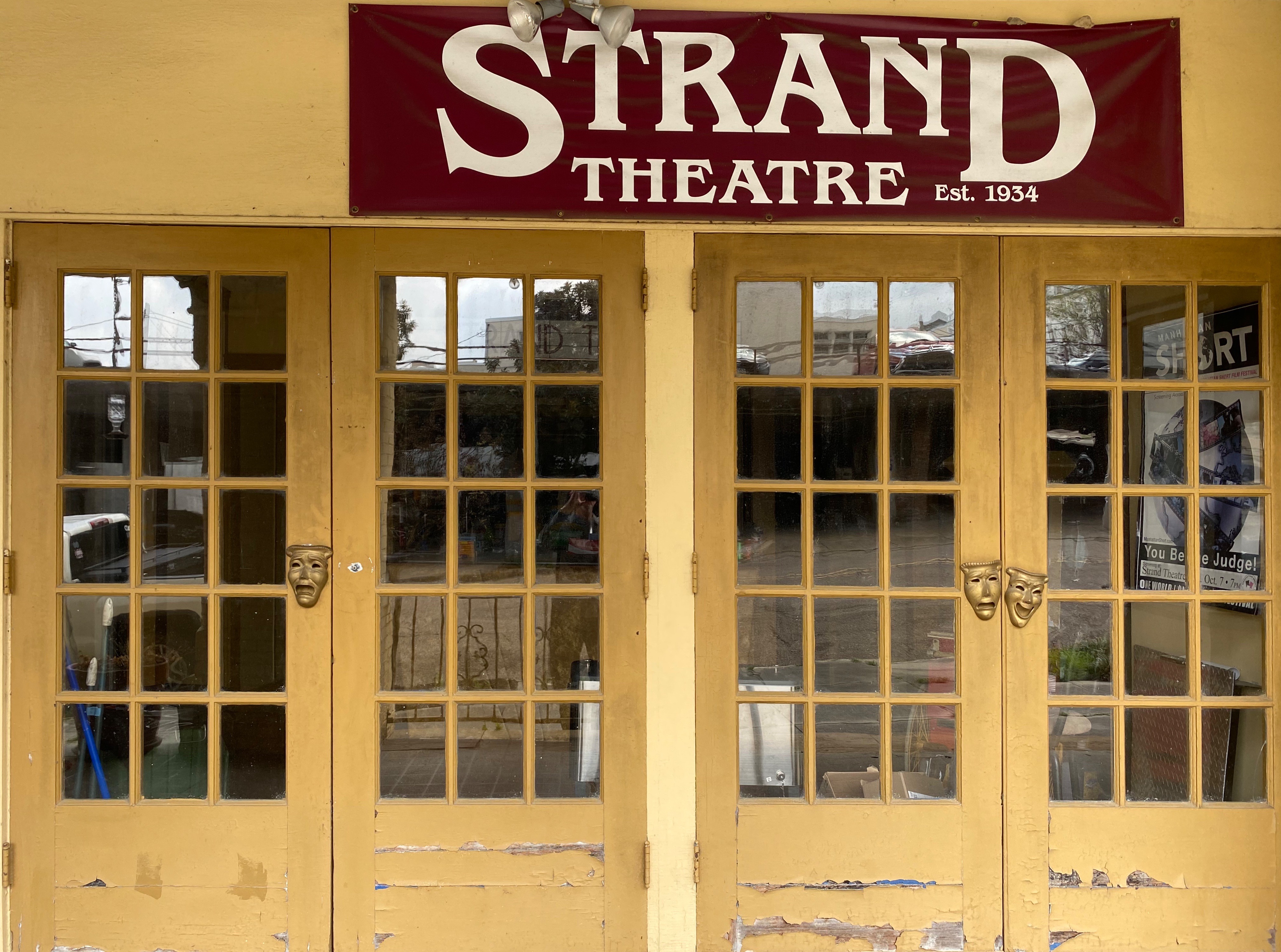
Our endless search for good coffee and tea took us to Highway 61 Coffee House in downtown Vicksburg. Highway 61 is a local coffee house with a cast of characters. We immediately ingratiated ourselves with the owner Daniel Boone – yes! – and his cohorts by making a donation to their poporn machine fund.
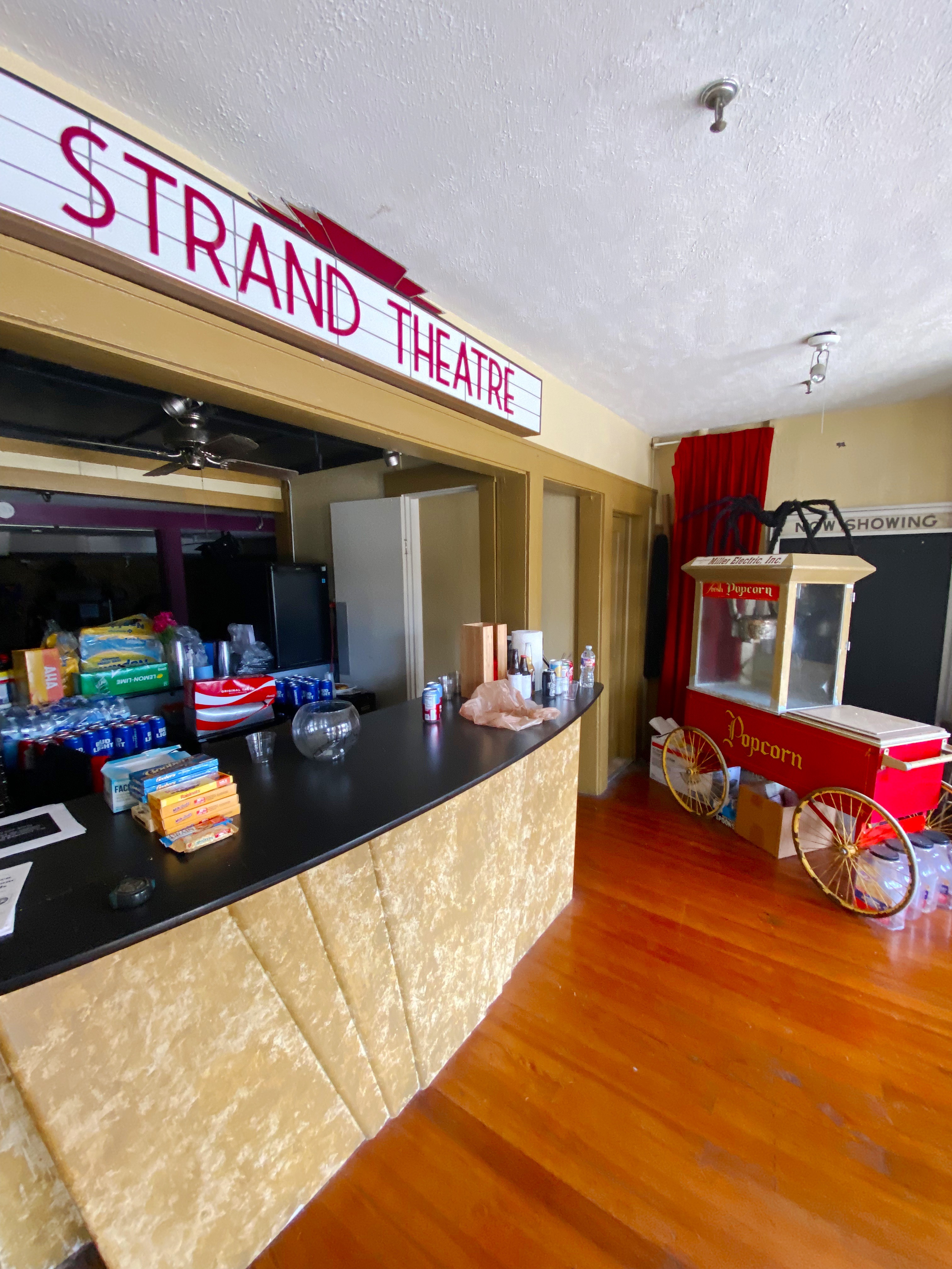
When Daniel Boone and his friends are not serving or drinking coffee they are the leaders of a local art movie house and amateur theater company. The popcorn machine that they have been utilizing for the last 14 years (on loan) for movie nights is going to be taken back by the owner.


Our donation to the fund earned us a private guided tour of the Strand Theater with Jack Burns – a board member and coffee shop regular. The Strand was a movie theater until it closed in 1963. The building remained vacant for a number of years until the theater group struck a deal with the owner to lease the facility for both live theater performances and screening movies. The interior was renovated by volunteers from the community who were very interested in having an opportunity to see art house movies and community theater. An excellent history of the building can be found at Urban Decay: https://worldofdecay.blogspot.com/2011/04/strand-theatre-vicksburg-mississippi.html Strand Theater: http://www.strandvicksburg.com/


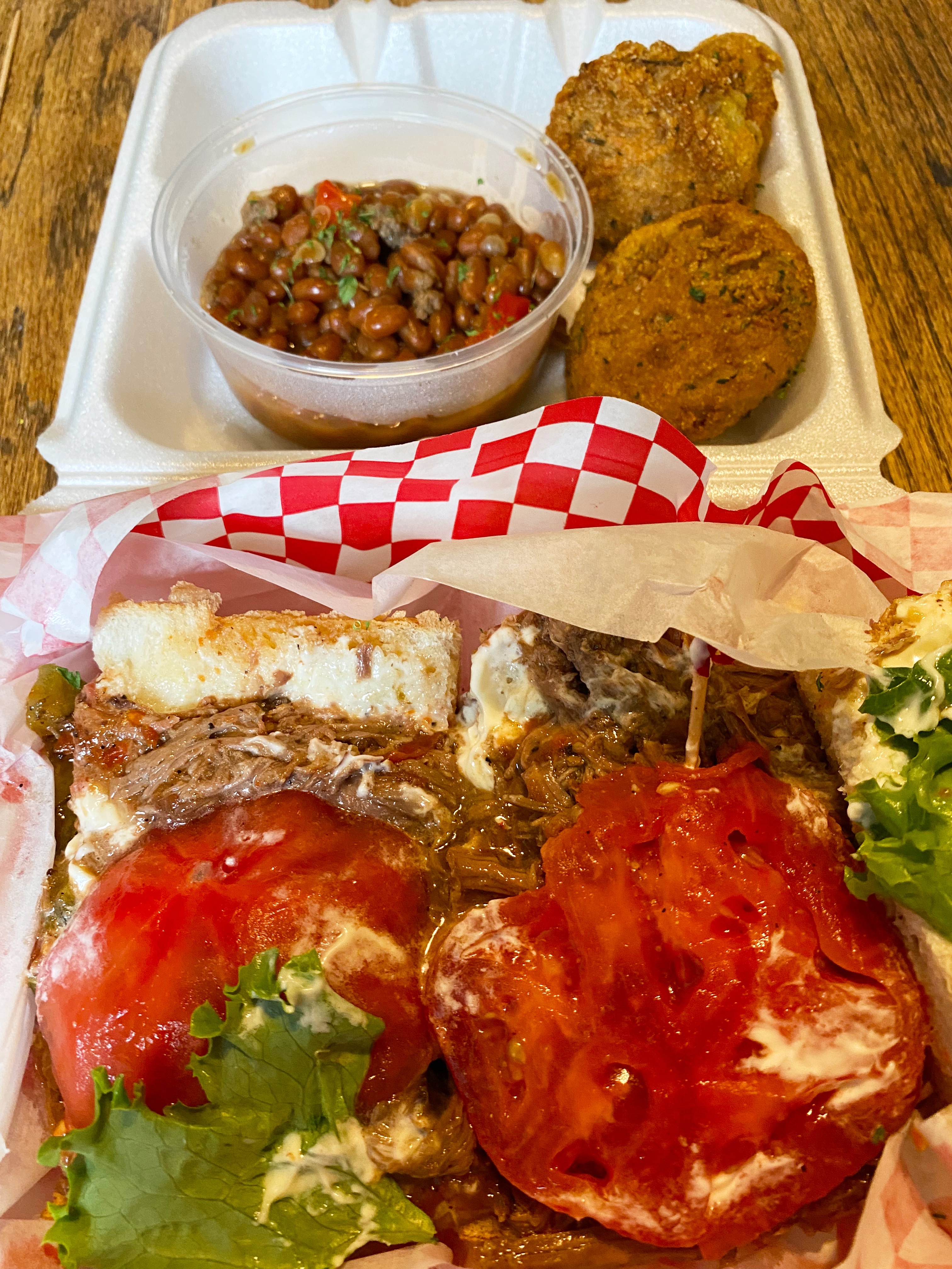
While we might attempt to live on coffee, tea, and wine, we are reasonably certain that as pleasant as that scenario sounds it would not work in the long run. So, we went in search of victuals during our Vicksburg visit and found a gem just outside of downtown. The Tomato Place started as a roadside produce stand and evolved into a restaurant and mercantile in addition to a produce stand- all still sitting roadside in a collection of colorful shacks. The Tomato Place is a must when you visit Vicksburg. For more information: https://www.onlyinyourstate.com/mississippi/you-havent-lived-until-youve-tried-the-blt-from-the-tomato-place-in-ms/


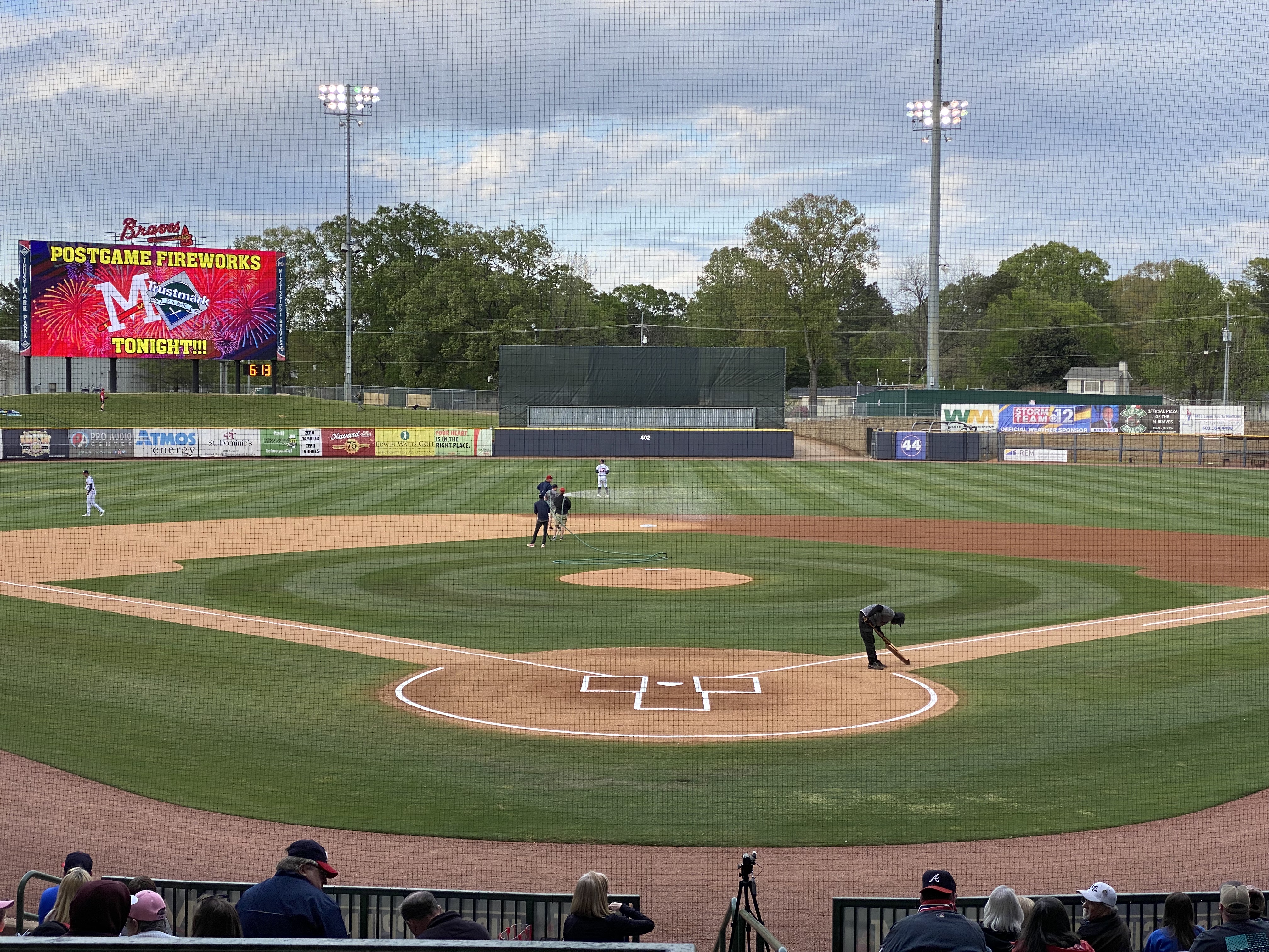
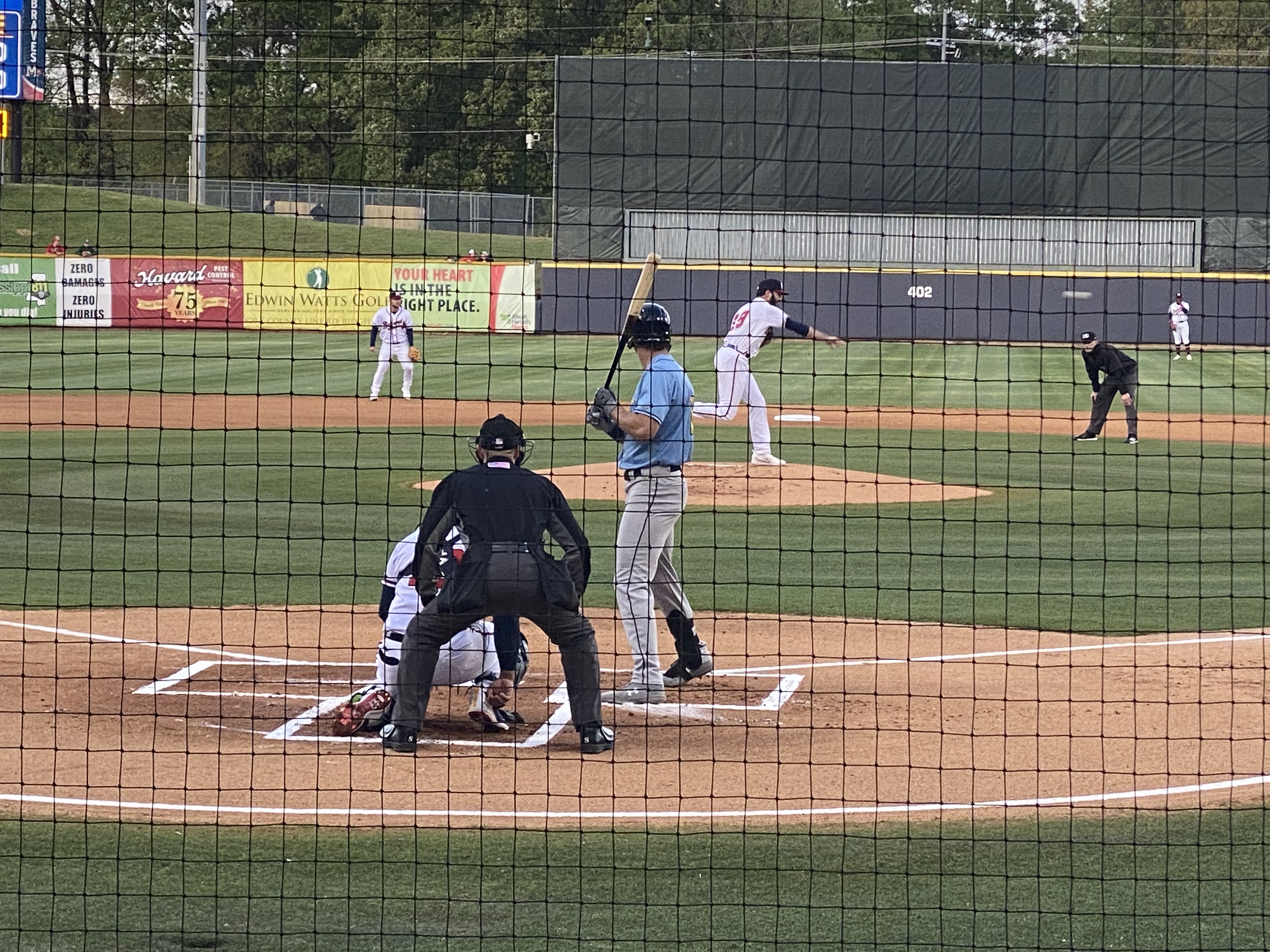
While in Vicksburg we decided to pop over to Jackson to see some minor league baseball. Jackson is home to the Mississippi Braves – the Double A affliliate of the Atlanta Braves. It also gave us the excuse to listen to the Johnny Cash – June Carter Cash version of the song Jackson for the entire ride from Vicksburg to Jackson. “We got married in a fever. Hotter than a peppered sprout. We’ve been talking bout Jackson ever since the fire went out. Oh, we’re going to Jackson.” Dang, that’s good music!!


The Natchez Trace runs just north of Jackson. We have driven the majority of the Trace during the course of several trips through Mississippi but had never done any biking as part of our travels along the Trace. Jackson provided a great opportunity to do so as the Chischa Fokka Greenway runs parallel to the Trace for a number of miles. It’s a great trail that cuts through Pine stands and farmland as you head north from Jackson.

We enjoyed our brief stay in Jackson with the added bonus of meeting @art.minton. Art is a fellow van adventurer who lives in Jackson and we follow each other on Instagram. He spotted our van while we were leaving Pig and Pint after having just finished dinner—Serendipity—Very cool!
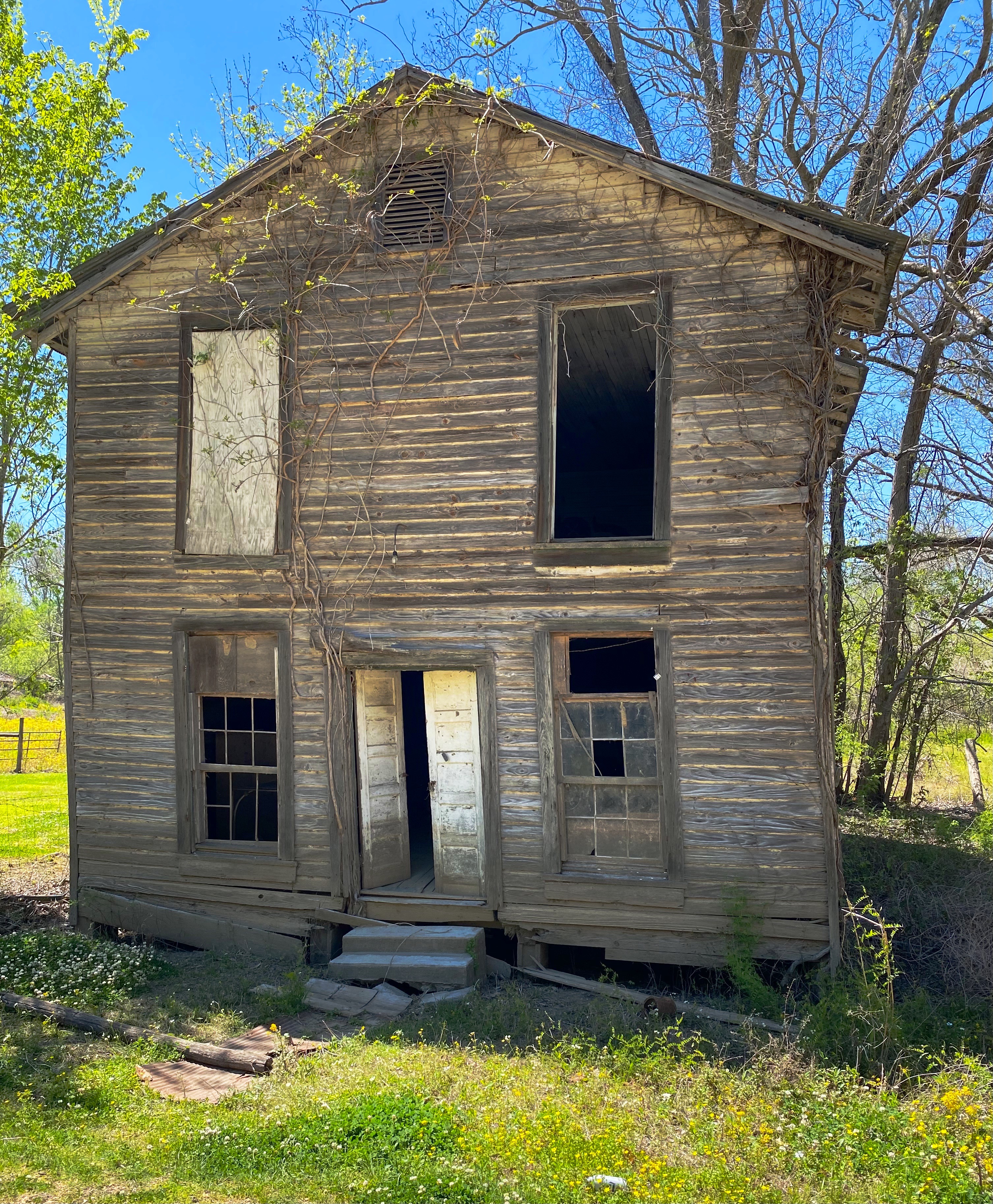
We decided to visit Rodney after reading an interesting article in Mississippi Folk Life about efforts by a local organization to preserve the remains of Rodney. The town was once a thriving Mississippi River port city. Migration from Rodney started in earnest after 1870 – Rodney had been bombarded during the Civil War by Union gun boats, enslaved individuals were emancipated and left the cotton plantations and finally, the course of the river shifted two miles west and Rodney was no longer a port city. For an excellent history of Rodney: http://www.mississippifolklife.org/articles/haunted-by-a-ghost-town-the-lure-of-rodney-mississippi
Getting to Rodney takes a bit of work. The only road to Rodney is a bumpy and muddy dirt road affair but you know we never say no to the chance for a bit of mud on the fenders.


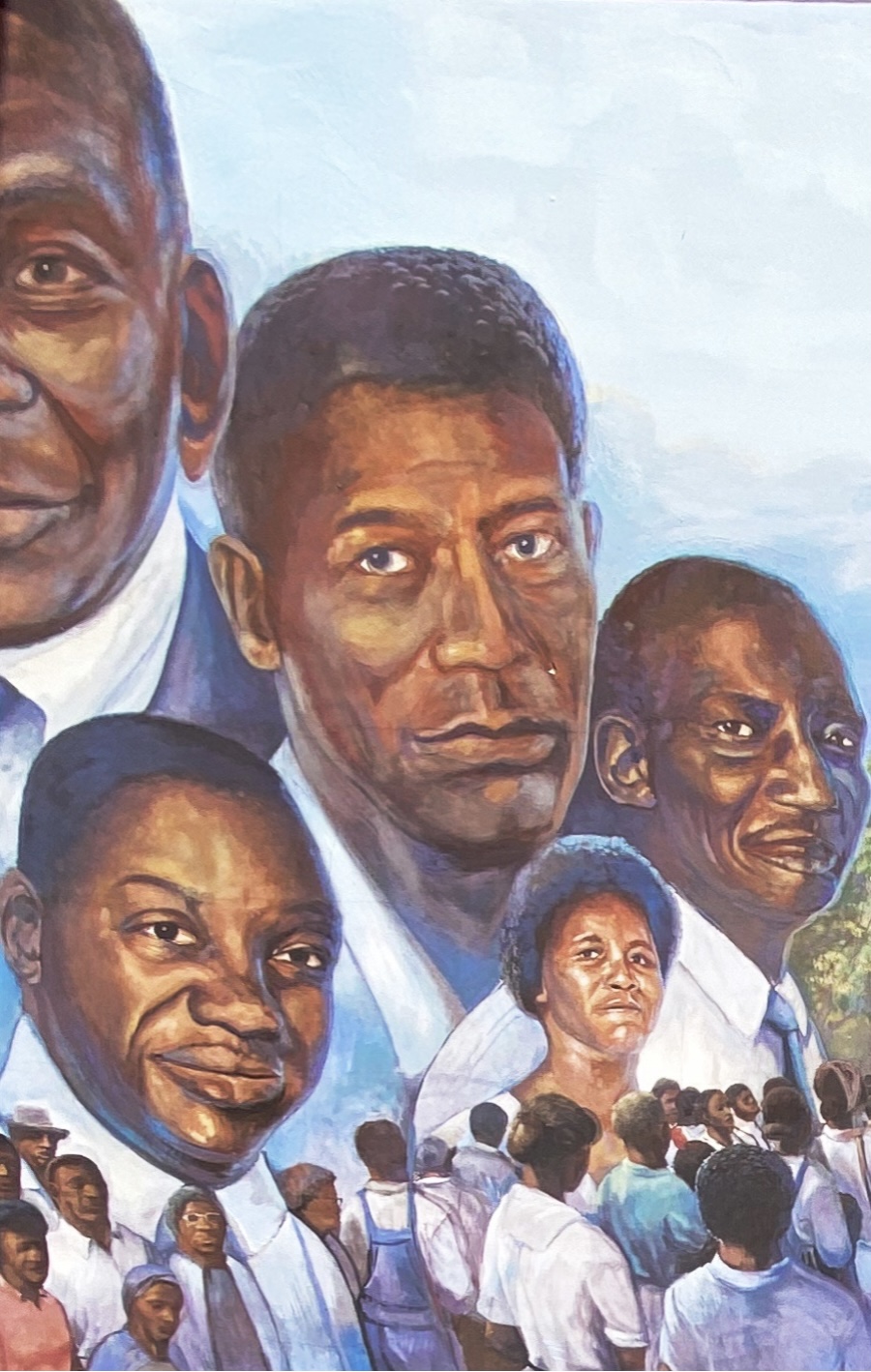
On our way to Rodney we drove through Port Gibson. Like many other southern cities during the mid-twentieth century, Port Gibson’s elected leaders and businesses were still fighting against integration and equal rights for Black citizens. That eventually led to the Boycott of 1966. The photo below from a mural in town depicts the demands. ‘Nuff said! https://mississippiencyclopedia.org/entries/port-gibson-claiborne-county-civil-rights-movement/


We also happened on the Windsor Ruins after departing Rodney. The Ruins was an antebellum Greek Revival Mansion built (by enslaved African-Americans) for a wealthy cotton planter and his wife. Today, 23 of the Corinthian coloumns are still standing. The mansion survived the Civil War (the owner did not) but burned in 1890. It was the largest Greek Revival home in Mississippi. Today it is an historic site and there are plans to complete some restoration of the columns and the grounds. For more information: https://www.mdah.ms.gov/explore-mississippi/windsor-ruins


Natchez was our final stop before crossing the Mississippi into Louisiana. First stop, as always, was for espresso and tea and our research pointed to Steampunk. There we met Dub Rogers, the owner of this unique establishment. Dub Rogers was born in Mississippi but spent 30 years living and working in NYC in a variety of businesses.
Steampunk represents an amalgamation of Dub’s many interests. The shop and haberdashery sells fine cigars, coffee, tea, chocolate, conservas, mixology gear and hats (see Maria’s newest addition above) of which Dub has endless knowledge. Dub is a great host – and we almost forgot to mention that he personally renovated the handsome space that houses his boutique department store, apartment and patio.


Natchez dates back to 1716 when French traders built a Fort on the bluff overlooking the Mississippi. The French settlement came to an abrupt end when the Natchez Indians attacked the fort, killing several hundred people and enslaving a number of women and children The surviving French left the territory toute suite.
Future President Andrew Jackson built a trading post near Natchez in 1789. The trading post traded in African-American slaves. This set the course for Natchez to become a hub for slave trading – one of the most active in the South.
With the wealth accumulated from the slave and cotton trade Natchez became one of the wealthiest cities in America prior to the Civil War. Today many of the lavish antebellum homes are still standing and open for touring. Because Natchez was prized by both sides due to its location, the Union forces did not destroy it when they occupied the city.


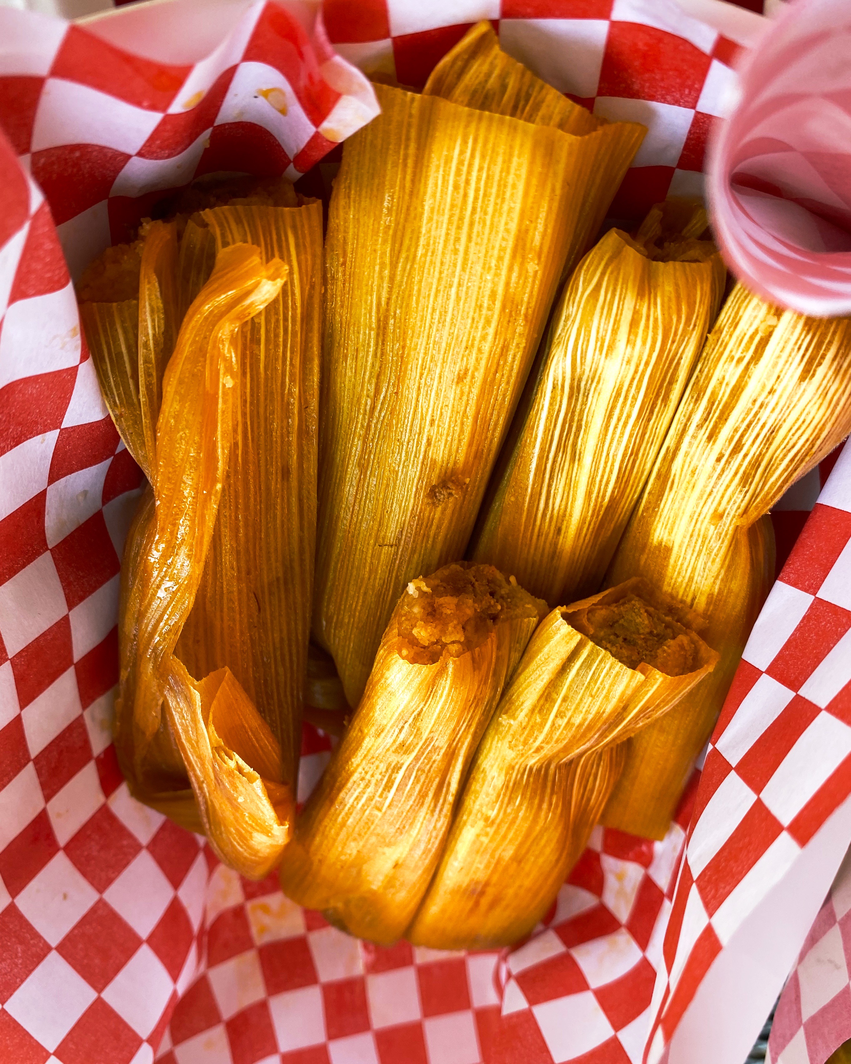
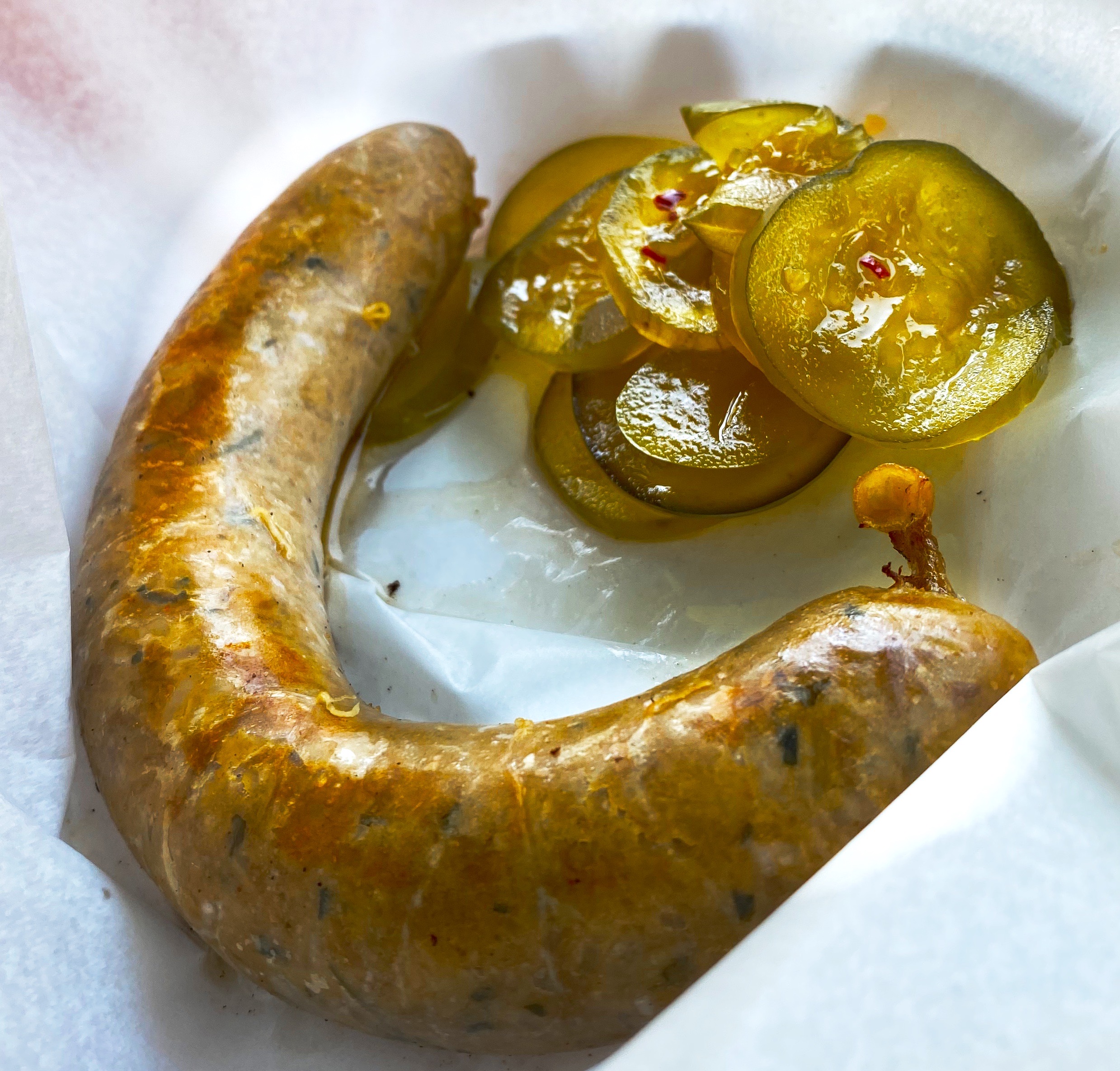
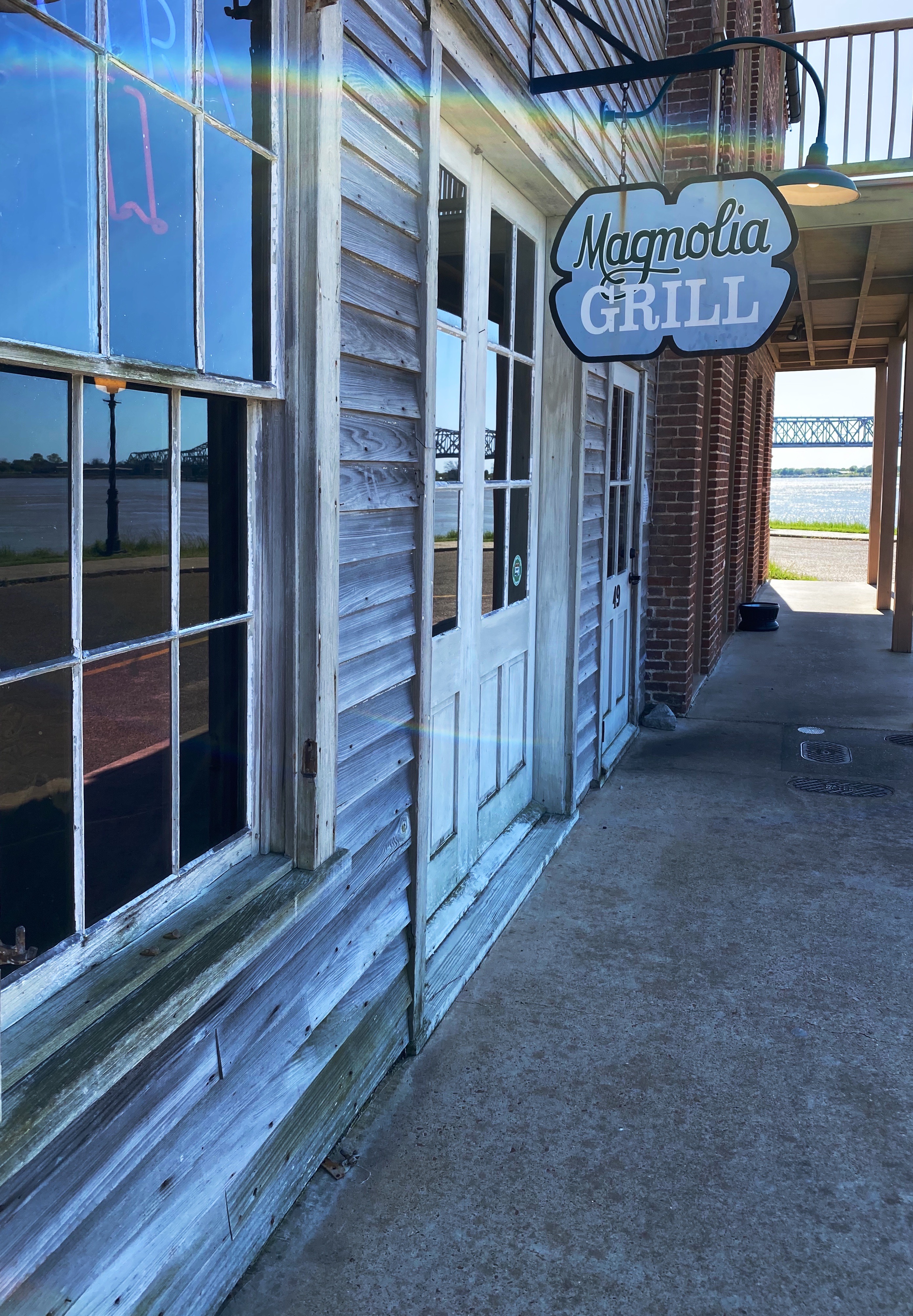
You now know where to go for all your caffeine needs in Natchez. Here are a couple of suggestions for dining: Magnolia Grill, located in the Under-the-Hill section of town down on the river (formerly the vice district of town); and Fat Mama’s Tamales is the spot for excellent tamales.


Our final foray in Natchez was visiting one of the decidely less glamorous antebellum homes in Natchez. The house is named Longwood but also derisively as Nutt’s Folly. Haller Nutt was a wealthy plantation owner who had an octagonal house designed for him and his family. The house, if completed, would have had 32 rooms.
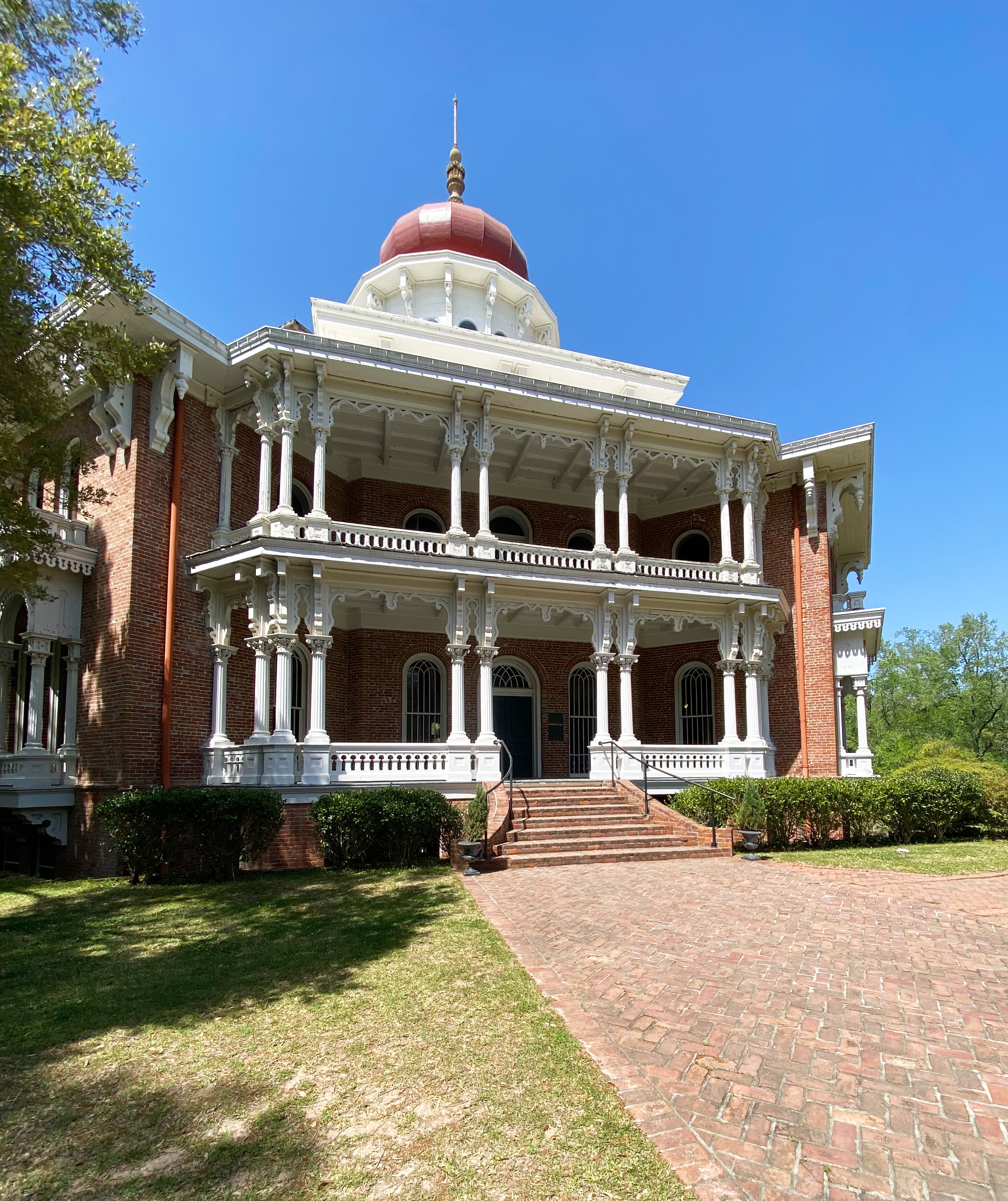


The outbreak of the Civil War ended the construction of the home as Nutt’s financial position tumbled. Even if he had the funds to continue, work would have stopped because the majority of the craftsman completing the finish work were from Philadephia – they returned to the North as soon as the war began.
The family moved into the basement (originally designed for the house slaves). Nutt died in 1864 and his wife and children hung on to the house for many years with the help of friends and several wealthy relatives. The Nutt family sold the home to the Pilgrimage Garden Club of Natchez in 1968.
The photograph below shows the fingerprints of one of the enslaved individuals who worked on the construction of the home. The Nutt family owned 800 slaves prior to the demise of the family fortune.

We hope you enjoyed our final installment regarding our Mississippi exploration, thanks for reading.
Be seeing you!

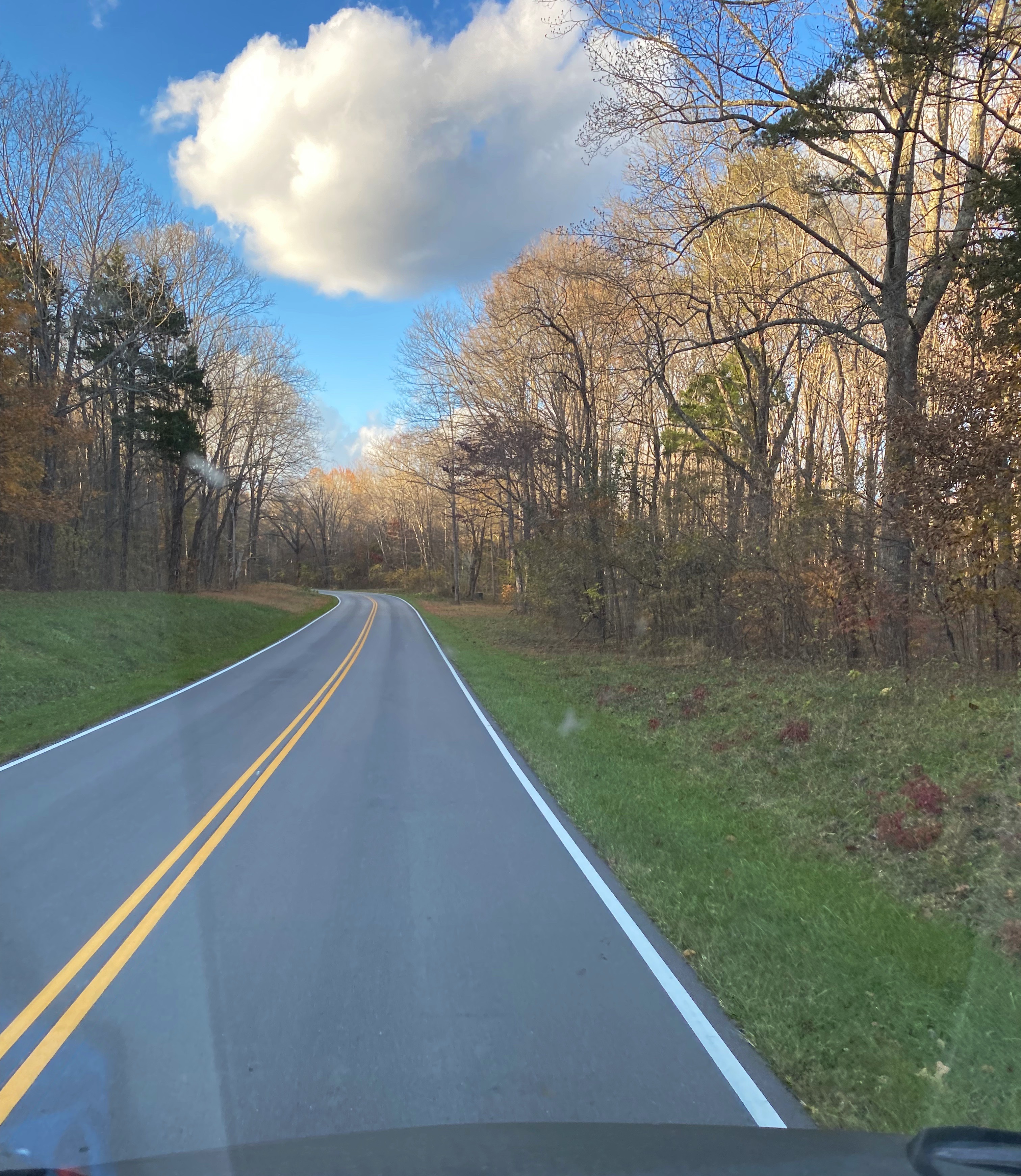
GSMNP is a fantastic destination for hiking. There are 150 official trails within the park that provide over 800 miles of hiking opportunities. The Appalachian Trail also traverses the park.
We spent four days at the park. The mornings tended to be cloudy and foggy in the hollows and valleys so we auto toured in the mornings (after finding coffee) and hiked in the afternoon.
Hikes at GSMNP range from short and easy to full on backcountry. There are many connector trails allowing hikers to elongate or shorten hikes, or to create loop hikes.


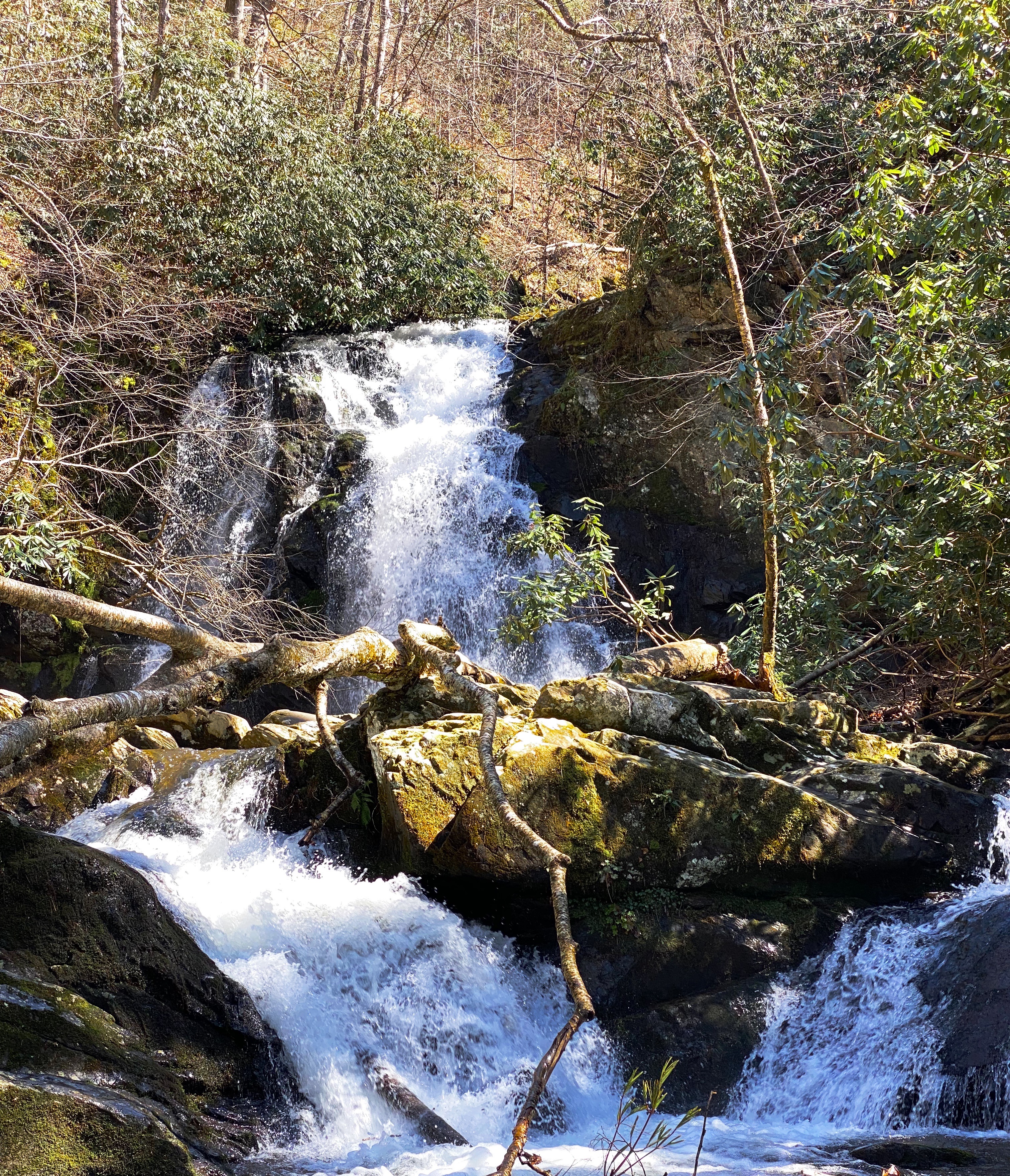
Because of the park’s topography, there are a multitude of creeks, streams, and rivers which make for many water crossings and provide the sound of rushing water as an accompaniment to the beautiful scenery. Additionally, waterfalls abound (especially in spring) providing hikers with plenty of ooh and ahh moments.


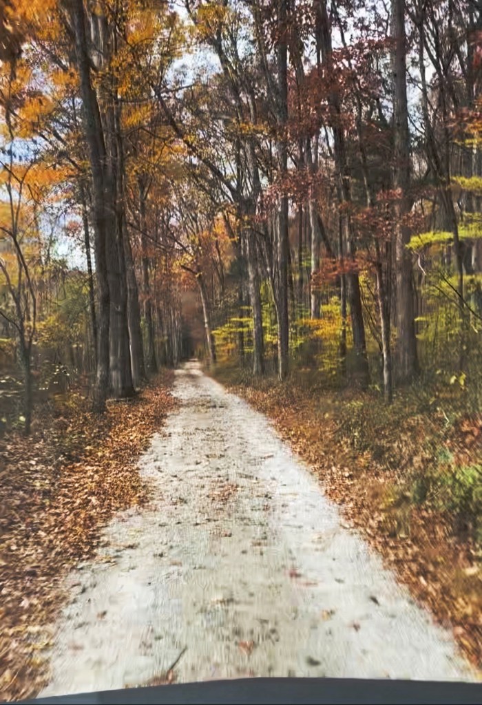
GSMNP provides plentiful opportunities to take in vistas and view wildlife while touring the park by auto. There are a number of designated tour loops and routes throughout the park. There are almost 400 miles of paved and gravel roads suitable for ordinary passenger vehicles. There are also a number of primitive roads for those equipped with 4wd vehicles with high clearance.


GSMNP opened in 1940 about six years after being chartered by Congress. Much of the land within the park was previously privately owned. Many of the advocates for the park were attempting to stop the massive clear cutting by timber companies that was destroying the forest, and believed a national park was the best way to acquire and protect such a large tract of land (523,000 acres).


Of course, in addition to the land owned by the timber companies, there were a number of small communities located within the proposed boundaries. Most of the residents were farmers.
Over a period of years the residents were forced off of their properties and the communities ceased to exist. Amazingly, many of the homes and other structures were not destroyed when the famlies relocated outside of the park.


When we toured Mammoth Cave NP during OTR 7.0 we found the more typical situation – all the building and structures had been razed (except several churches and cemetaries) in order to erase the evidence of the communities and restore the land to its state prior to the creation of the park. We thought that practice was disrespectful and, fortunately, that was not the case at GSMNP.
We will skip the discussion of the displacement of the Cherokee Indians as we all know that story. Today, the Eastern Cherokees reside in a reservation just south of the park’s border in Cherokee, North Carolina.
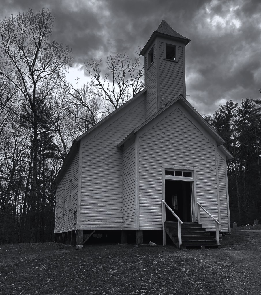
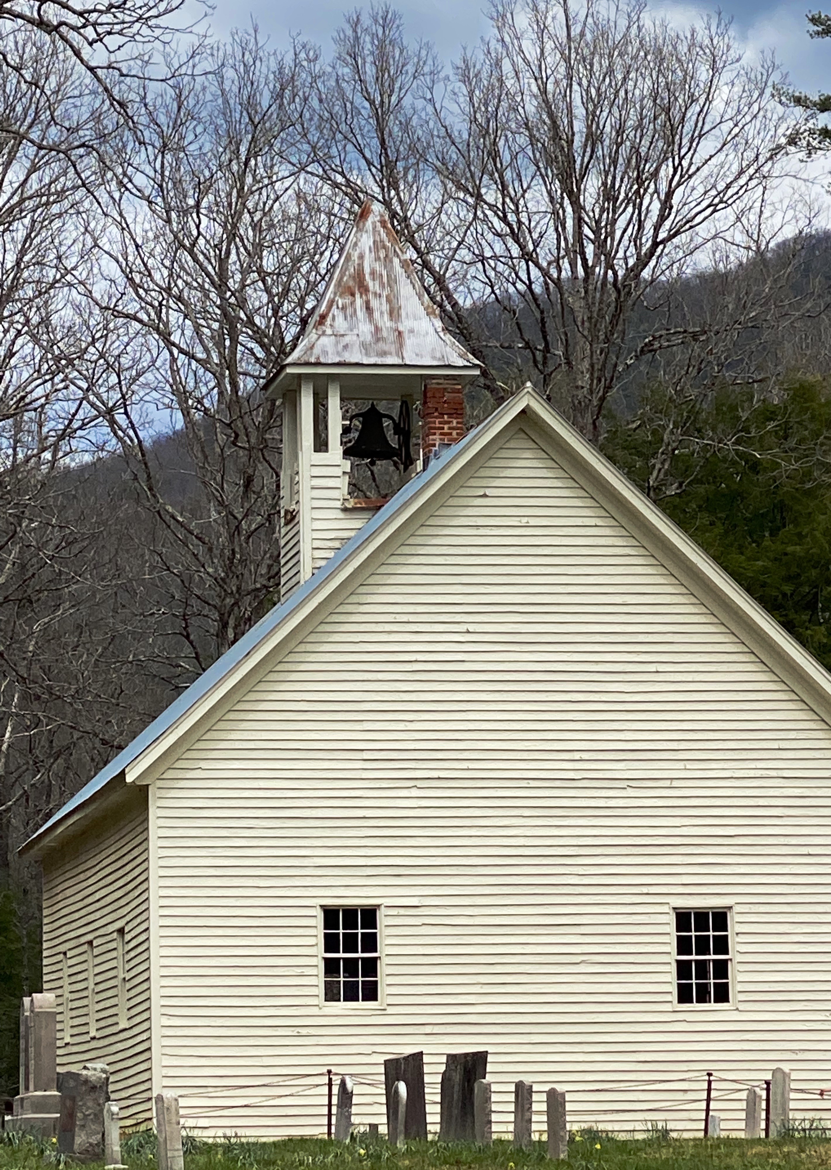
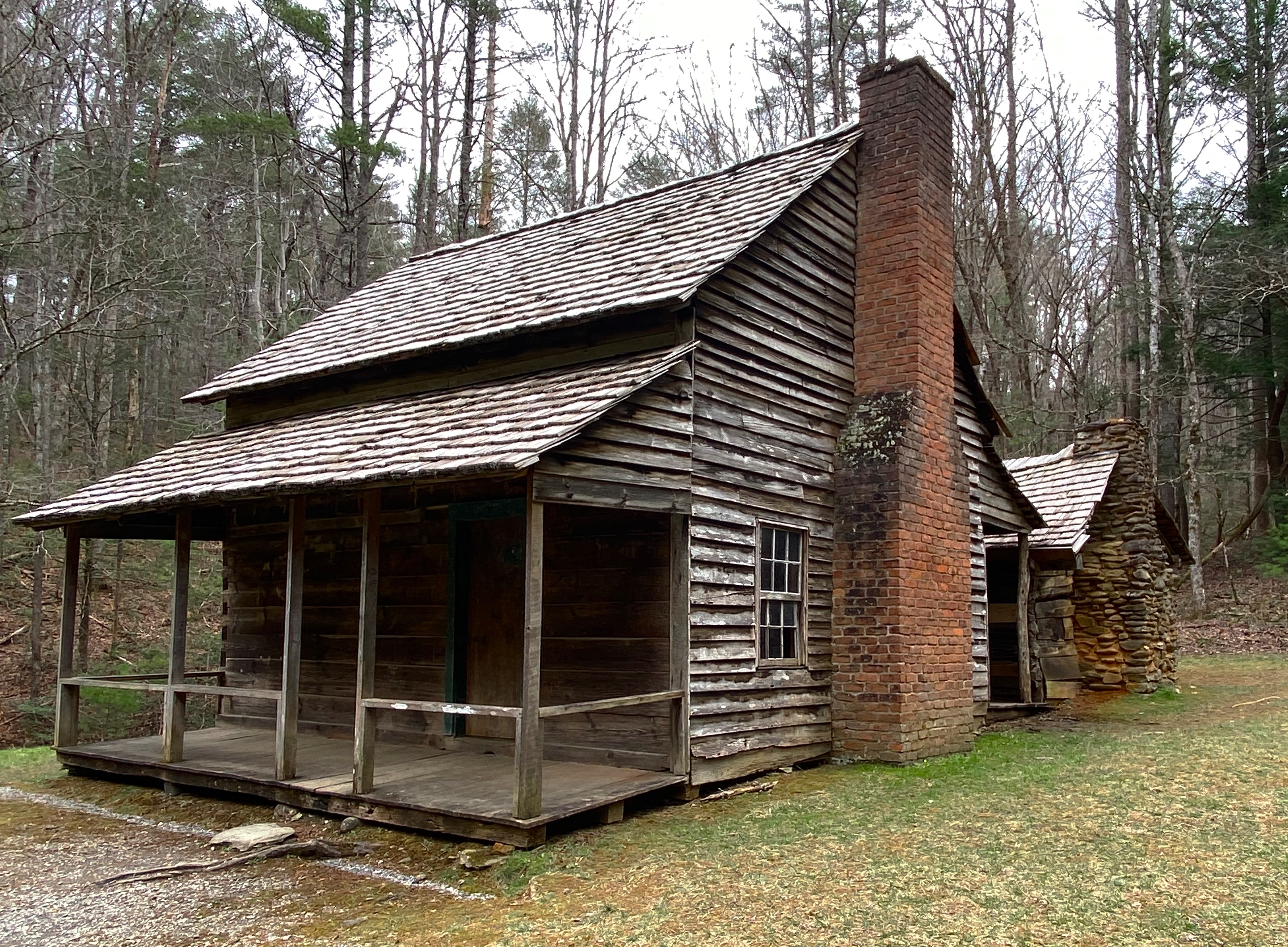
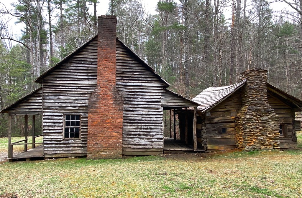
There are over 80 structures still standing and maintained by the park service. The structures include, cabins, schoolhouses, barns, churches and a grist mill.

Pictured above and below is a replica of the original cantilever barn that was part of the homestead of William ”Fighting Billy” Tipton. The homestead still boasts the original two story cabin, blacksmith shop and corn cribs.

The origins of the cantilever barn are unknown but they are prevalent in this part of Tennessee. Historians generally agree that this type of barn was favored because it provided cover for the livestock from Tennessee’s abundant rainfall.

We enjoyed our first visit to GSMNP and definitely recommend the park if you are hikers. Our caveats would be to avoid peak season – from talking with local folks, we understand that the roads into and within the park are jammed in high season. GSMNP recorded over 14 million visitors last year.
Also, we did drive through Gaitlinberg to find coffee – as a result we highly recommend entering the park through Townsend as we did. Gaitlinberg is crowded and uber touristy; it is the antithesis of the park. In our opinion there is no reason to visit Gaitlinberg unless you just cannot get enough of Ripley’s Believe It Or Not Museums!
Be seeing you.

Mammoth Cave, located in southwestern Kentucky, was officially designated as a national park in 1941. The park is approximately 53,000 acres (small by national park standards); its main focus is the cave system which lies under the surface.

Mam Cave, as it is called locally, is the longest cave known to exist in the world at just under 400 miles. The 400 miles of cavern are not linear, but exist on six levels which crisscross and extend out in multiple directions, fitting inside a seven square mile area under the park.
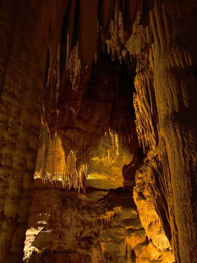
We took a ranger led tour during our visit, venturing down 250 feet below the surface and then through a series of rooms as we gradually climbed back towards the surface to exit the mine.
The park offers a wide range of tours differing in time and the level of physical activity required to complete the tour. We took the Domes and Drips Tour where you are brought through some of the largest domes in the cave system and also to a wetter area where stalactites and stalagmites are still forming.
The lower two levels of the cave are underground rivers – with water draining down from the Green River and the numerous sinkholes in and around the park. In the past visitors could tour the lower cavern by boat but the practice was stopped to protect the environment.


As we mentioned above, Mam Cave became a national park in 1941. What we did not realize until we visited the park and spent time touring the scenic backways of the park was how the park came into being.
The caves were originally mined for saltpeter which was used in the making of ammunition.The caves in the area were privately held and operated by the owners as tourist attractions from the early 1800s until the park became a national park.

There were many people in government, science and business who, for various reasons, wanted to see Mam Cave designated as a national park and thus be protected. The federal government would not buy land for the creation of a national park but would accept donated land for that purpose. As a result, a private organization was formed for the purpose of buying the privately owned land and donating the land to the federal government.


Over a period of several years the required amount of land was purchased (in some cases through eminent domain). There was also a land donation of 8,000 acres made by a single family.

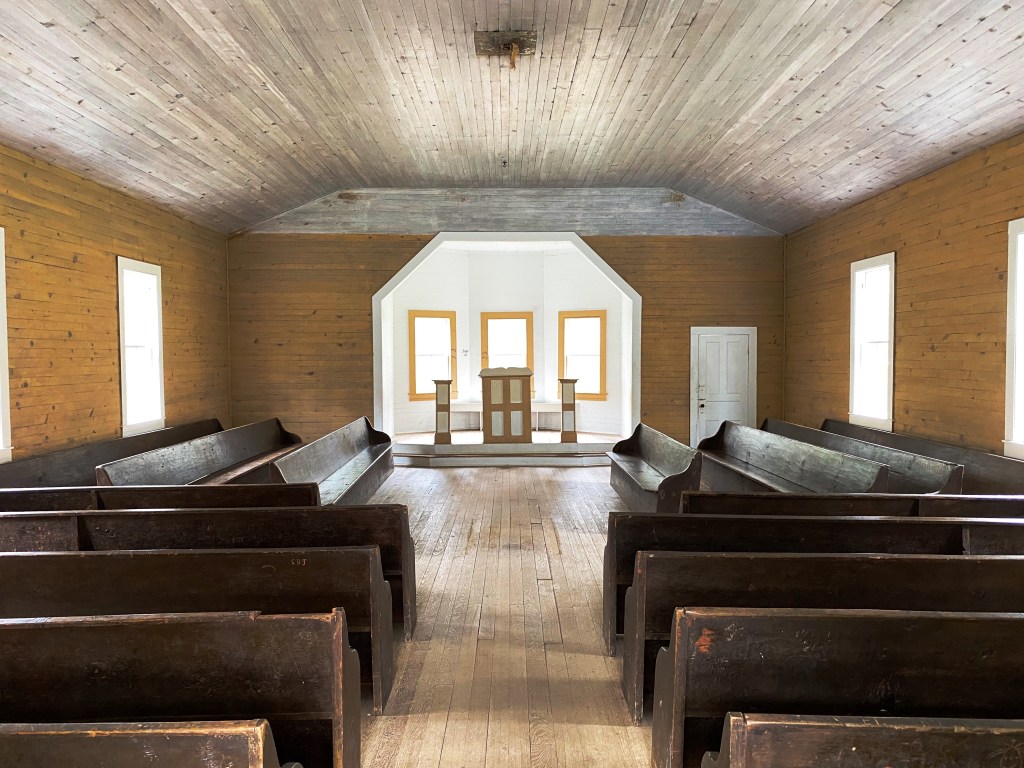
The photographs above and below show the only remaining structures from three of the communities (Good Springs, Flint Ridge, Joppa Ridge) that ceased to exist as the residents moved to other towns outside of the park boundary. Some of the families and their descendants lived in theses communities for 200 years before they were displaced.
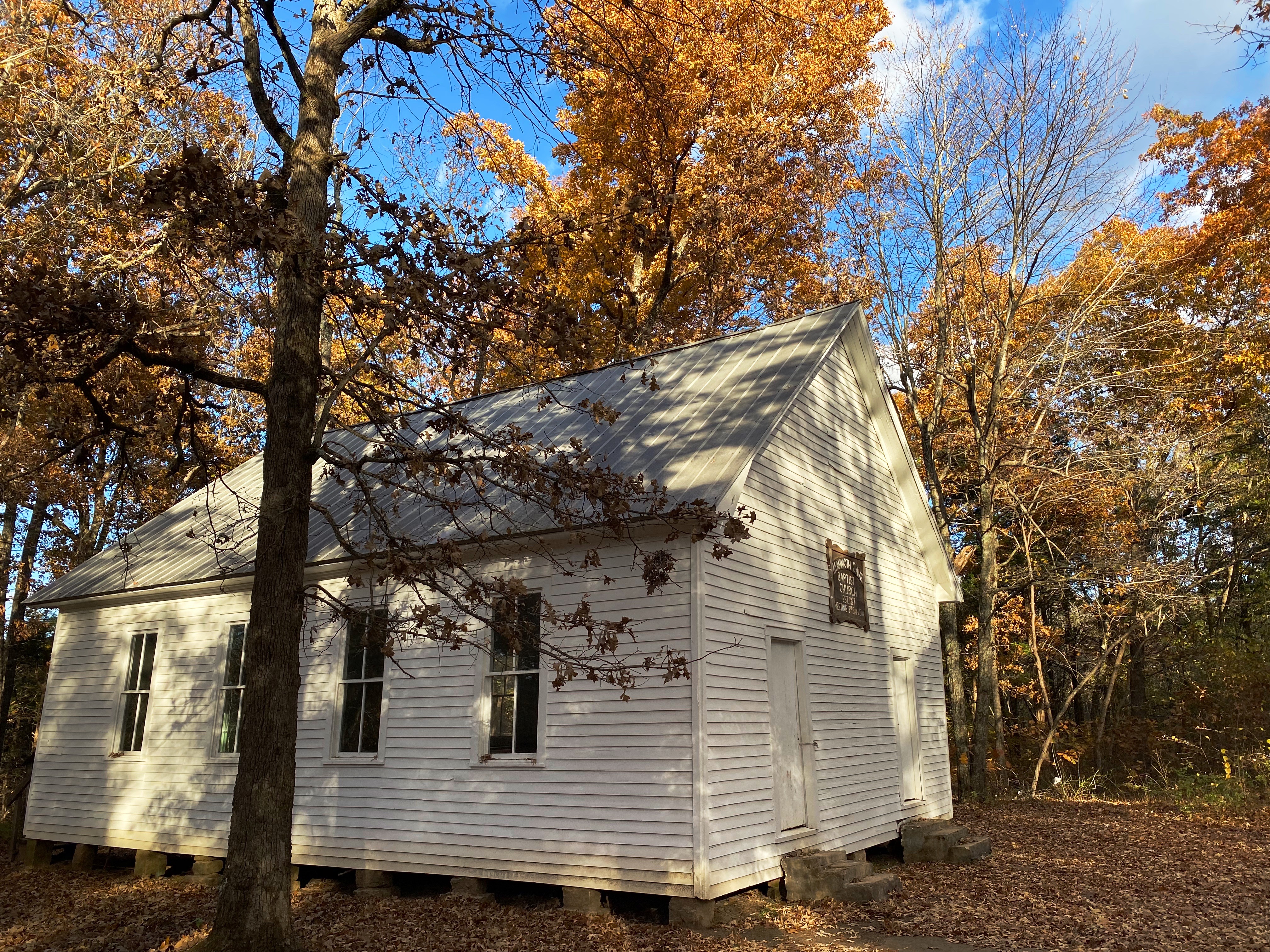

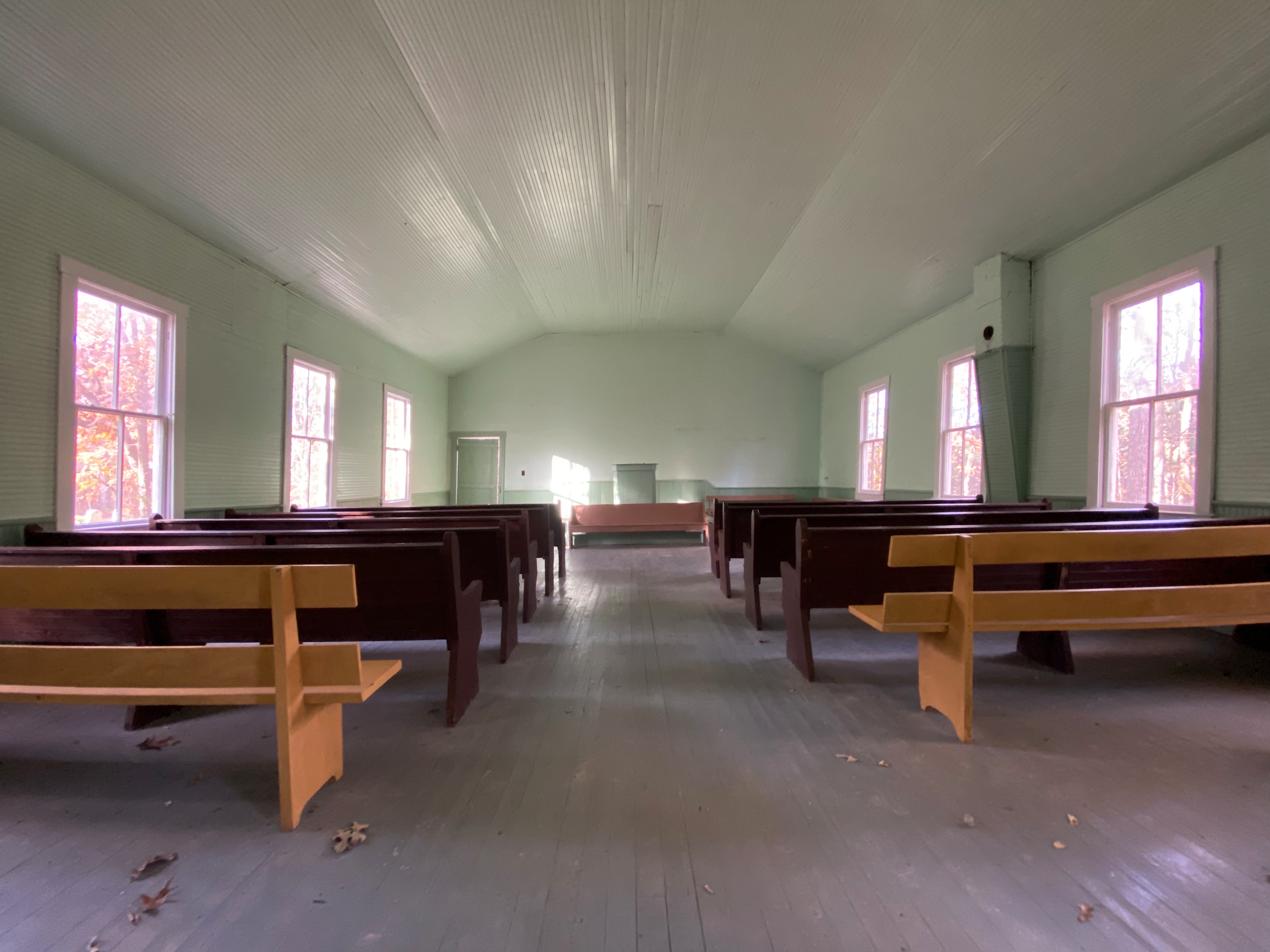


The park service has preserved these churches and the adjacent graveyards, providing a peak into life in early rural America. All other structures from these communities were razed when the National Park was established.
The families of the descendants are still able to use the churches for weddings, funerals and other special occasions. The cemetaries bear witness to this use as we observed newer monuments in each of the graveyards.
We enjoyed our two days at Mam Cave. The cave tour was well organized and interesting. We would have to say that from a persective of the cave only that Carlsbad (New Mexico) and Wind Cave (South Dakota) are more dramatic from a visual perspective.
Having said that, Mam Cave offers a number of hiking and mountain biking trails as well as a paved bike path. Additionally, the Green River which flows through the park provides the opportunity for kayaking and canoeing.
If you are a national park fan and have not yet visited, we recommend that you include Mam Cave in an upcoming park itinerary.
Be seeing you.
