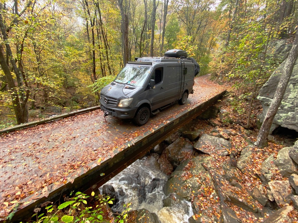
Tag: 4WD Road
Ctsprinterlife: OVERLAND adventure
CARSON NATIONAL FOREST
After camping in Chama, New Mexico, we followed Route 17 along the Colorado/New Mexico border to access the Carson NF for our trip south. Unfortunately, the heavy snow in the Colorado mountains had reached into northern New Mexico. After testing the road we decided that prudent risk taking required that we delay our start. As a result we traveled to Taos and spent several days exploring there (see posts Taos, The High Road to Taos and Taos is Art) while waiting for the roads to dry out and harden.

The above photo is from the KML file we overlaid on Google Earth to assist with navigation as we traveled through the forest and mountainous terrain.

Overlanding is currently defined as “self-reliant overland travel by vehicle where the journey is more important than the destination.” Overlanding has gained popularity in the United States over the last several years and particularly since the pandemic interrupted standard modes of travel.

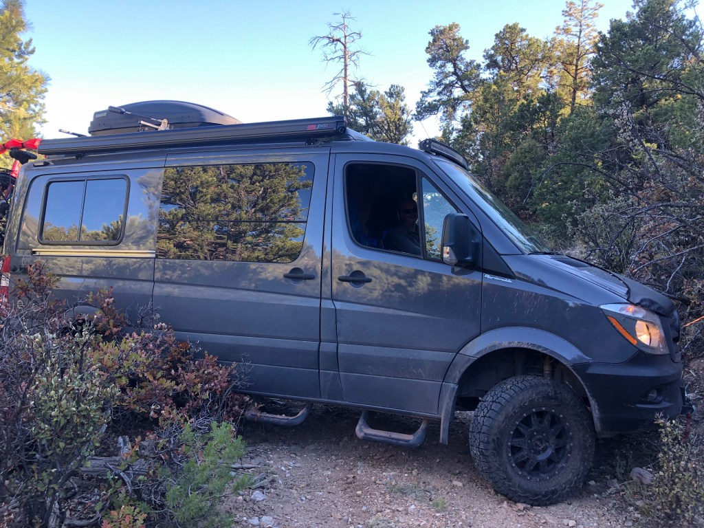
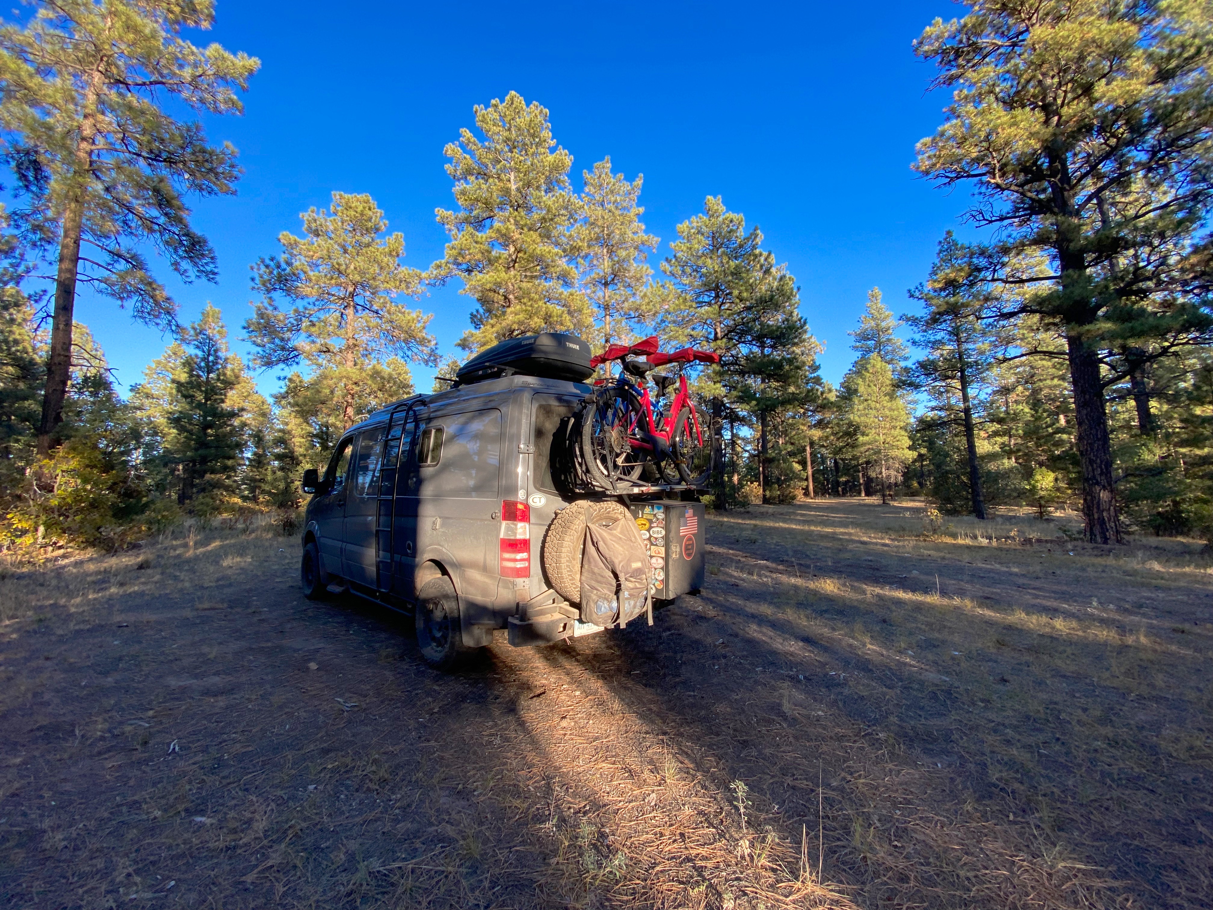
Our trips over the last three plus years have been a mix of overland adventures and standard touring. Overlanding is not for everyone due to the risks and the need for specialized gear (high clearance, 4wd, skid plates, winch, extended range, etc.) Overlanding also requires patience – it is often very slow going on rough, narrow, rutted roads and trails.
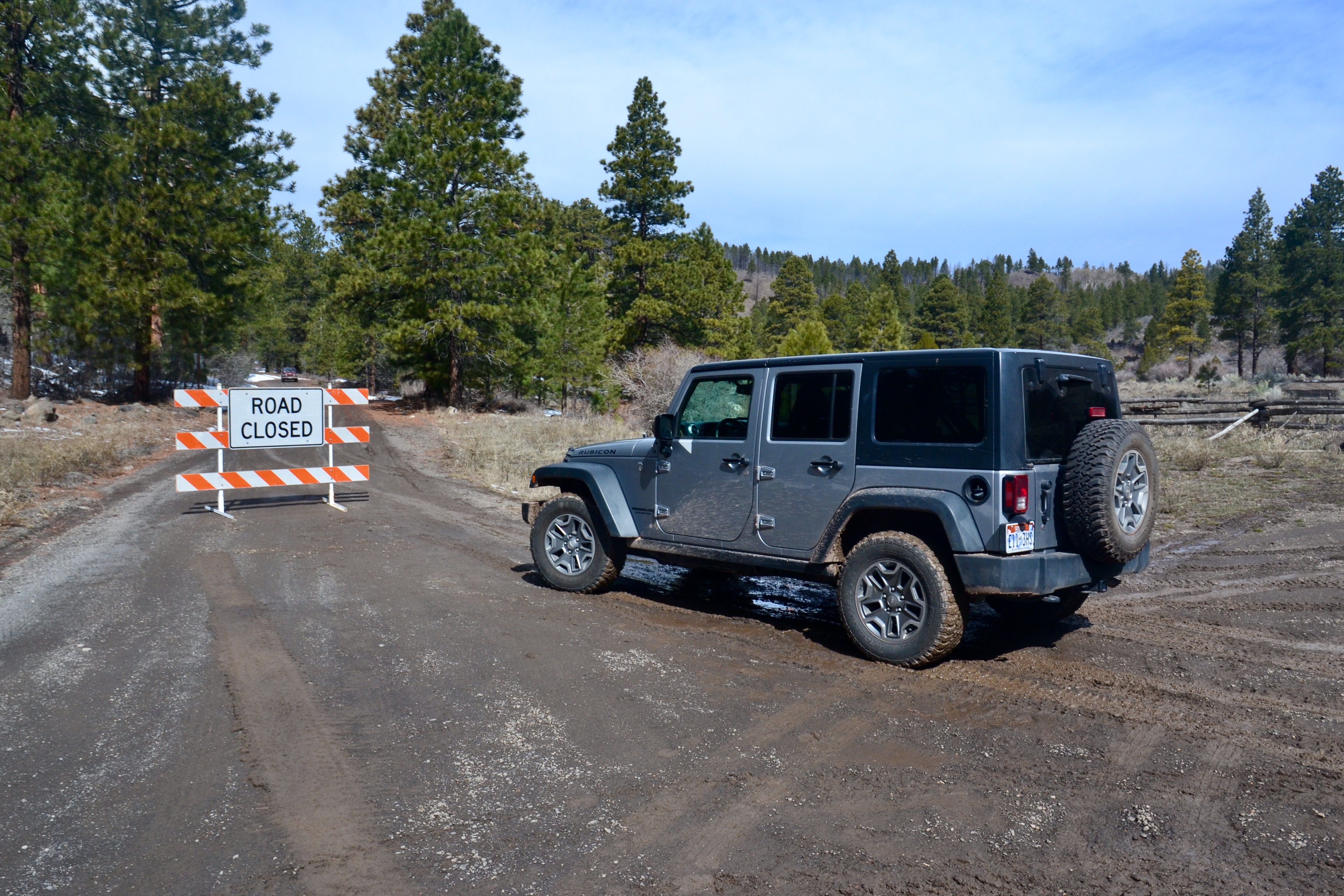
Case in point – the photo above is Forest Road 45B – after driving a number of miles down this rough and narrow route the trail became impassable. We we forced to back up the hill until we could turn the vehicle while causing the least damage possible.


EL RITO (pop. 808)
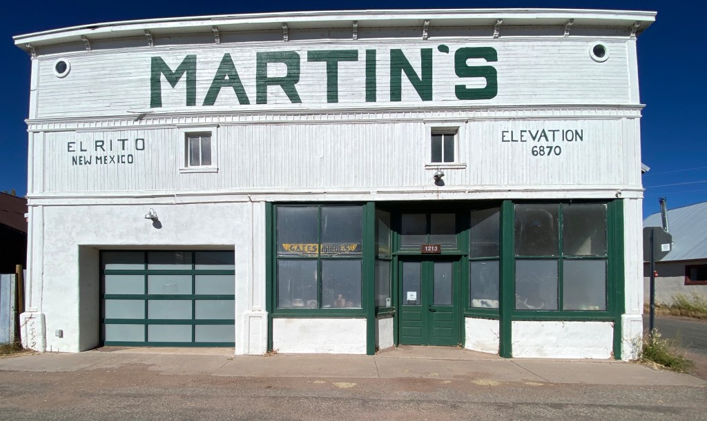
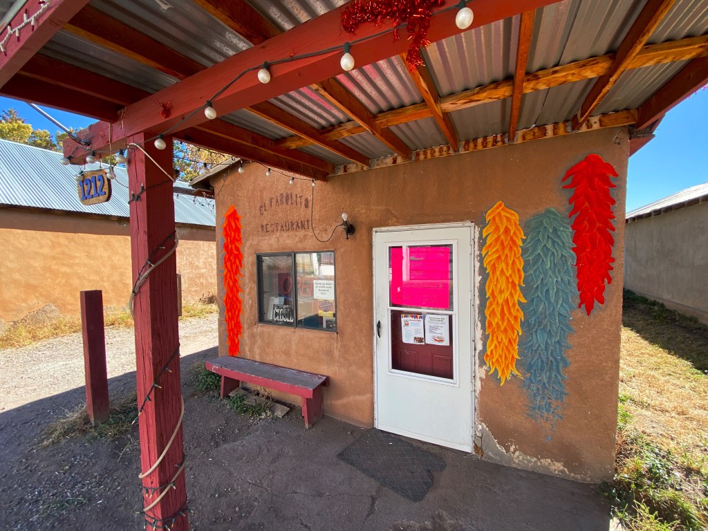
After two days on the trail we came out of the forest at El Rito on a crisp Sunday morning. We were hoping to have breakfast burritos at El Farito Restaurant but alas the restaurant was closed. We cannot vouch for the reported census – we met one person and one dog during our brief stop. We were surprised to learn that the Mars Polar Lander was designed and built here in town by a local scientist/artist!!!


Abiqui and south
We stopped in the town of Abiqui for diesel fuel and refreshments. Abiqui is the town where Georgia O’Keefe lived for many years on her ranch north of town. Many of her paintings include the surrounding mountains.
After refueling we headed back up into the forest to continue our overlanding trip south for another day – leaving the route near Los Alamos and then traveling to Santa Fe for much needed high quality coffee and tea.


The snow of the prior week caused us to shorten our time overlanding through the Carson National Forest, but it was a good trade off as the weather and conditions were much improved by the time we started on our overlanding adventure.
Be seeing you.
Montana Prairie…Sun, Heat, Wind and Beauty

After a brief visit to Billings (see previous post) we set out due north to traverse the Great Plains of central Montana before turning west in the Northland parallel to the Canadian border.
Charles M. Russell National Wildlife Refuge (CMR)

Our first stop on the journey north was the CMR. Once again we found ourselves crossing the mighty Missouri River which so dominates the history of this part of the country with its integral connection to the Lewis & Clark expedition.
We crossed the river within the Charles M. Russell National Wildlife Refuge. This refuge consists of 1.1 million acres which border the river from the Fort Peck Dam on the east to the Missouri River Breaks National Monument on the west – a distance along the river of about 125 miles.
This protected area is primitive and essentially looks as it did when Lewis and Clark journeyed up the river. There is a rough auto road that drops down to the river level and follows the river before looping back to the highway.
We drove the road and were able to see some of the Missouri Breaks (rock formations) as well as a number of the remnants of abandoned praire homesteads. It is hard to fathom how hardy people must have been to homestead in this rugged terrain – most failed.
The refuge is named after Charles M. Russell – an artist known for his western landscape paintings, many of which depict the refuge, and as an early conservationist.


american prairie reserve (APR)
The APR is a non-profit organization dedicated to preserving and expanding the prairie land of central Montana. It is estimated by the APR that a land area of three million acres (5000 square miles) is necessary to preserve the Great Plains in perpetuity. The APR is buying prairie land from private owners and leasing land from the federal and state government which is contiguous to existing public lands (including CMR) to create the reserve.
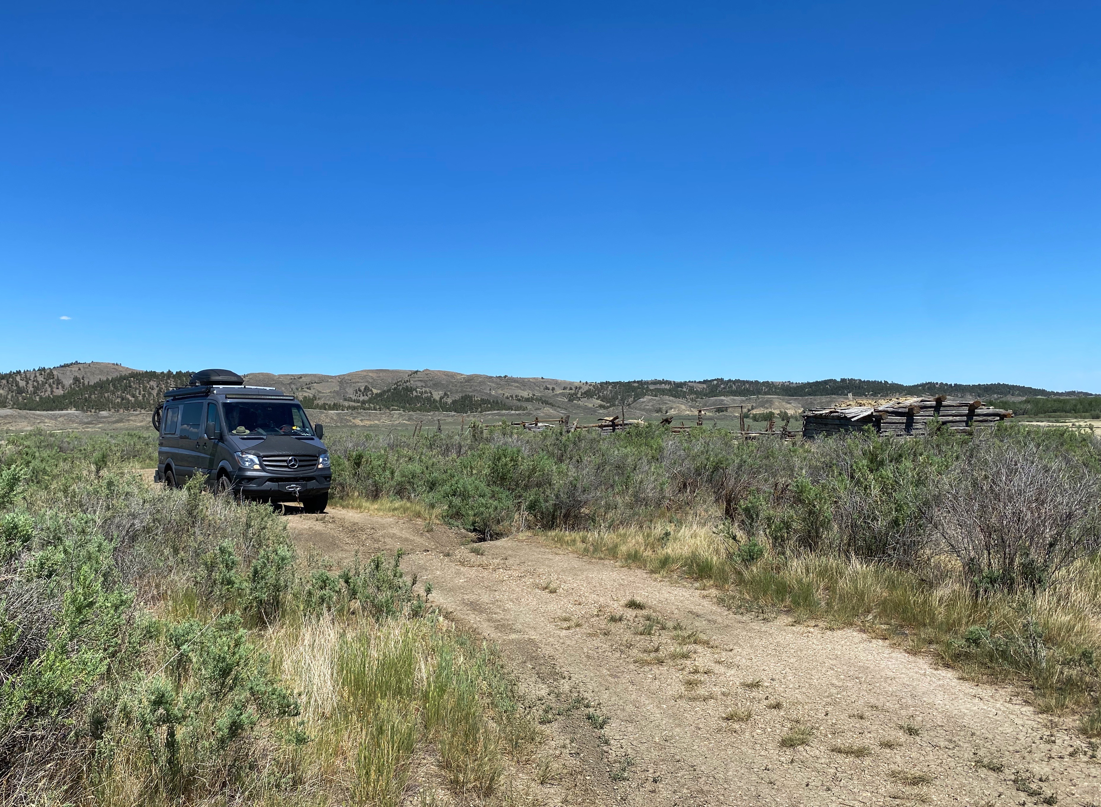
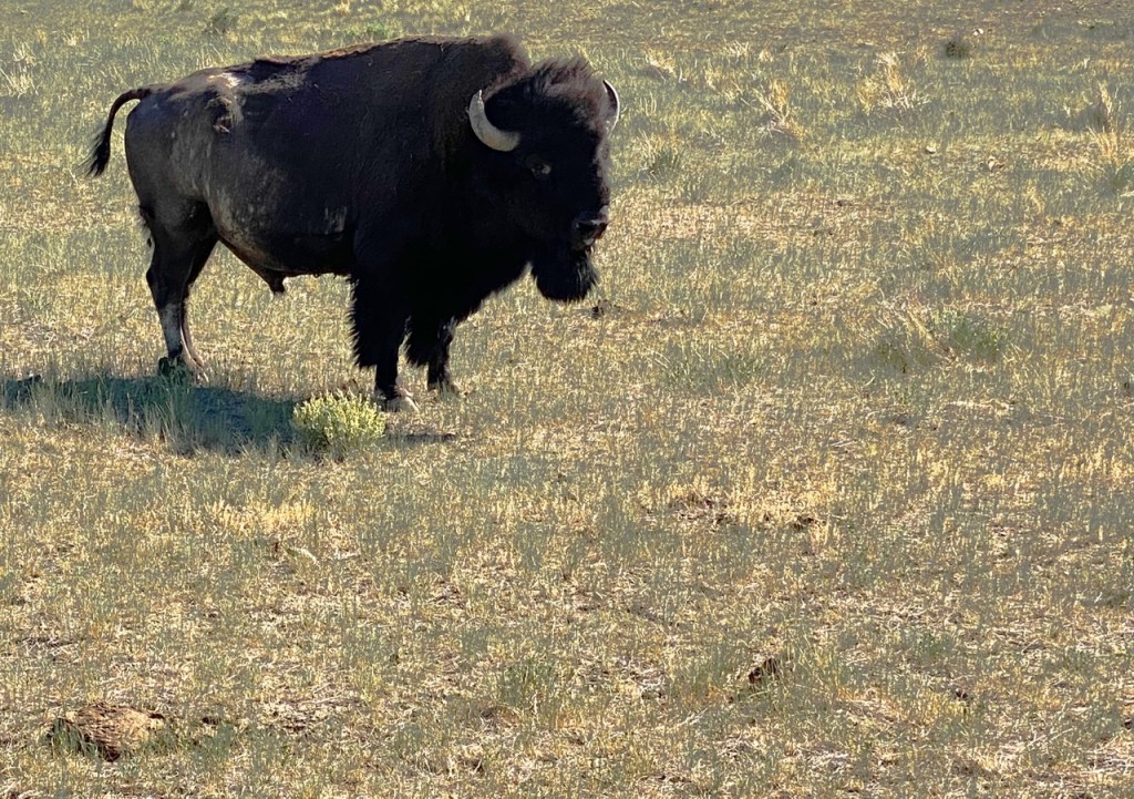
The APR has also established a sizeable bison herd which freely roams within the reserve. When we were completing our research on Montana we learned that we could camp within the reserve among the bison (at our own risk obviously).
We were definitely up for the camping on the prairie. Adding to the adventure was the need to navigate across 60 miles of prairie devoid of signage and without the aid of satnav. Since we are writing this post you are correct in concluding that our navigator was more than up to the task.


We enjoyed our journey through the prairie and our overnight camping with the bison despite the triple digit temperatures, 30 mile per hour winds and accompanying dust. The opportunity to see these magnificent animals roaming the prairie freely, as they did until the late 1800s, felt as if we had the privilege of traveling back in time.
Of course, we probably all have read about the near extinction of the bison at the hands of Euro-Americans to supply the east with fur and hides. The slaughter of the bison also served to deprive the Native Americans of their way of life.
The Native Americans of the plains not only killed bison for the meat – they used every bit of the bison to make shelters, clothing, weapons and tools. The Native Americans worshipped the bison as it provided so much of what they needed to live.
“When the buffalo went away, we became a changed people… The buffalo was everything to us. When it went away, the hearts of my people fell to the ground, and they could not lift them up again. —Plenty-Coups (Crow) 1880


When we decided to visit the APR we did not know that the Montana ranching community is adamantly opposed to it. We had the opportunity to speak with a rancher when we stopped for fuel and provisions on the trip to the APR.
The cattle ranchers are concerned they will not be allowed to continue to use the land that the APR buys and leases from the government for grazing. They are also concerned that the APR wants to let the bison roam freely throughout the reserve and not be managed as stock; which could lead to transmission of Brucellosis to cattle, causing spontaneous abortion in pregnant cattle. Bison in Yellowstone National Park have been infected with Brucellosis in the past. How real the concern is we do not know.
In the end though, much of the opposition is to what the ranchers view as a land grab by the federal government. Ranchers have a deep animosity towards the federal government and as you may recall, this has manifested itself in violence on a number of occasions.
The Montana economy is primarily agricultural and extractive – cattle, sheep, barley, wheat, copper mining and fossil fuel. Therefore, any partnership by the government (in this case with the APR) to de facto acquire more land (which ends up off-limits for agricultural or extractive purposes) is going to be controversial.
Hopefully, the ranchers and APR can work things out, although presently there are several lawsuits in progress.
The montana hi-Line and Sweet grass hills
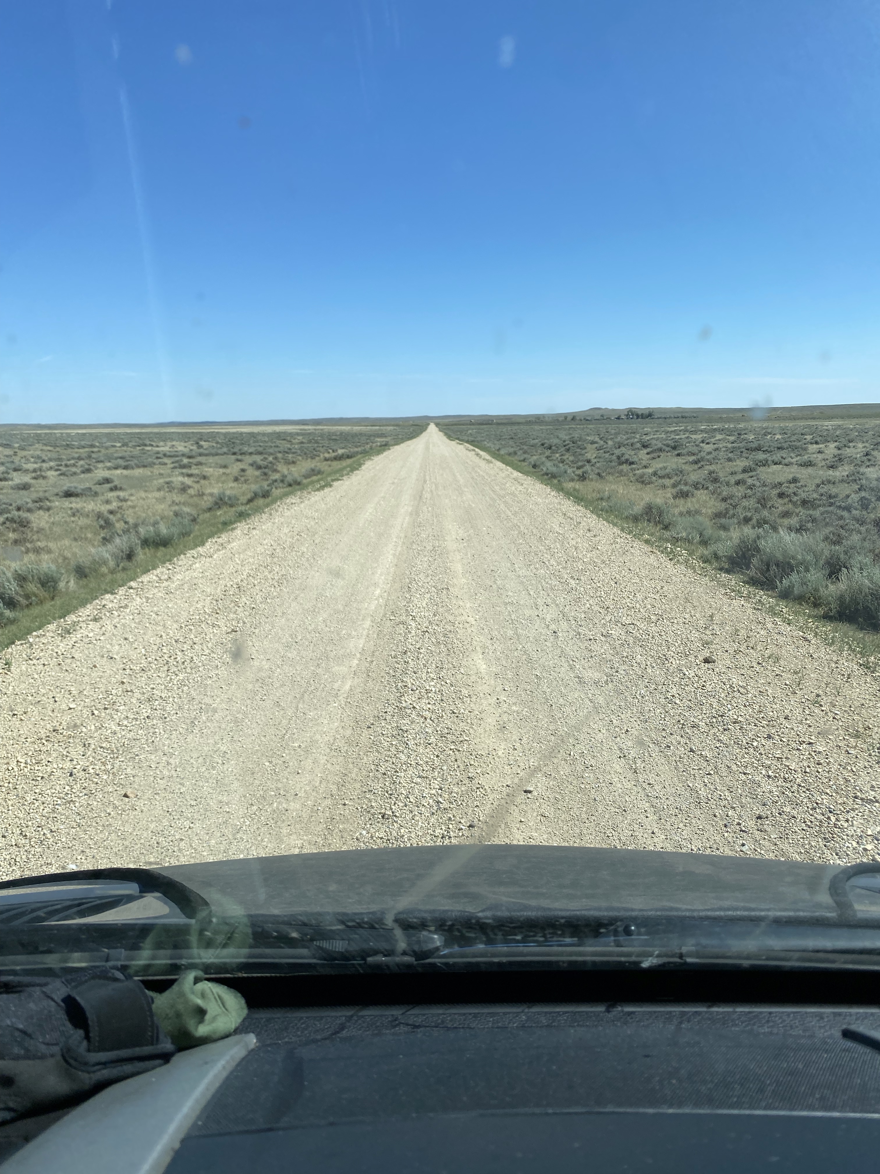
We departed the APR traveling north through another 50 miles of dusty prairie until we reached the town of Malta and our first paved road in several days. At Malta we turned west to travel on Route 2 to reach Chester and then head north into the Sweet Grass Hills. The area from Route 2 north to Canada and from the North Dakota border on the east to the Idaho border on the west is known as the Montana Hi-Line.
The Hi-Line is emblamatic of Montana – rolling grasslands, cattle ranches and mile after mile of wheat, barley and cannola fields under seemingly un-ending blue sky. This area known as the Hi-Line was sparsely populated until the late 1800s.
Around this time James Hill, a railroad executive, began the construction of the Great Northern Railroad (GNR), envisioning a railroad extending from St. Paul, Minnesota to the Pacific Ocean. He envisioned this railroad as a trade route ultimately extending to Asia. The construction of the railroad through northern Montana brought multitudes of ranchers and farmers into the area. The railroad brought supplies to the towns that popped up along the railway and moved their crops and stock to market. Today the railroad and Route 2 run side by side through most of this area.


The photos above are from our stop in Chester – our departure point from Route 2. We had fika at Well in Chester and met several local farmers and ranchers. The coffee shop owner is also the local pastor, a firearms dealers and a substitue teacher – apparently not unusual in this part of the world based on our conversations. The town is tiny at 311 acres and a population of 1099 and it was obvious that there is a real sense of community here.
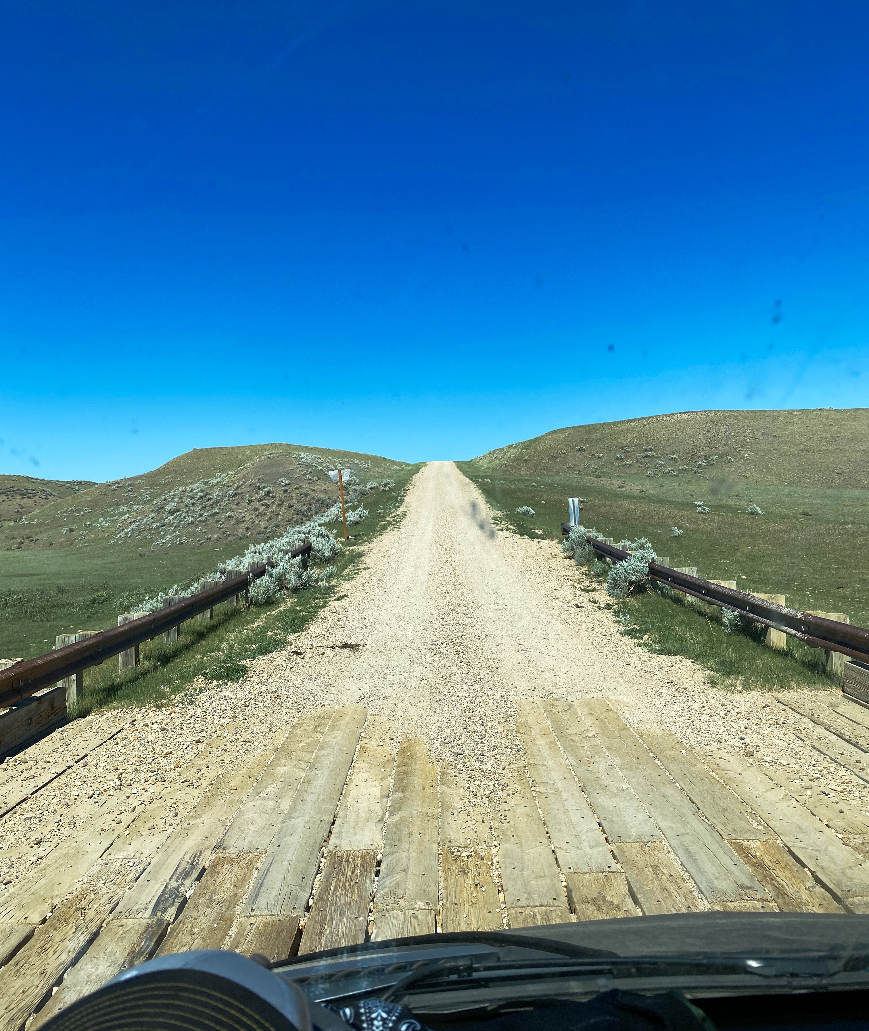
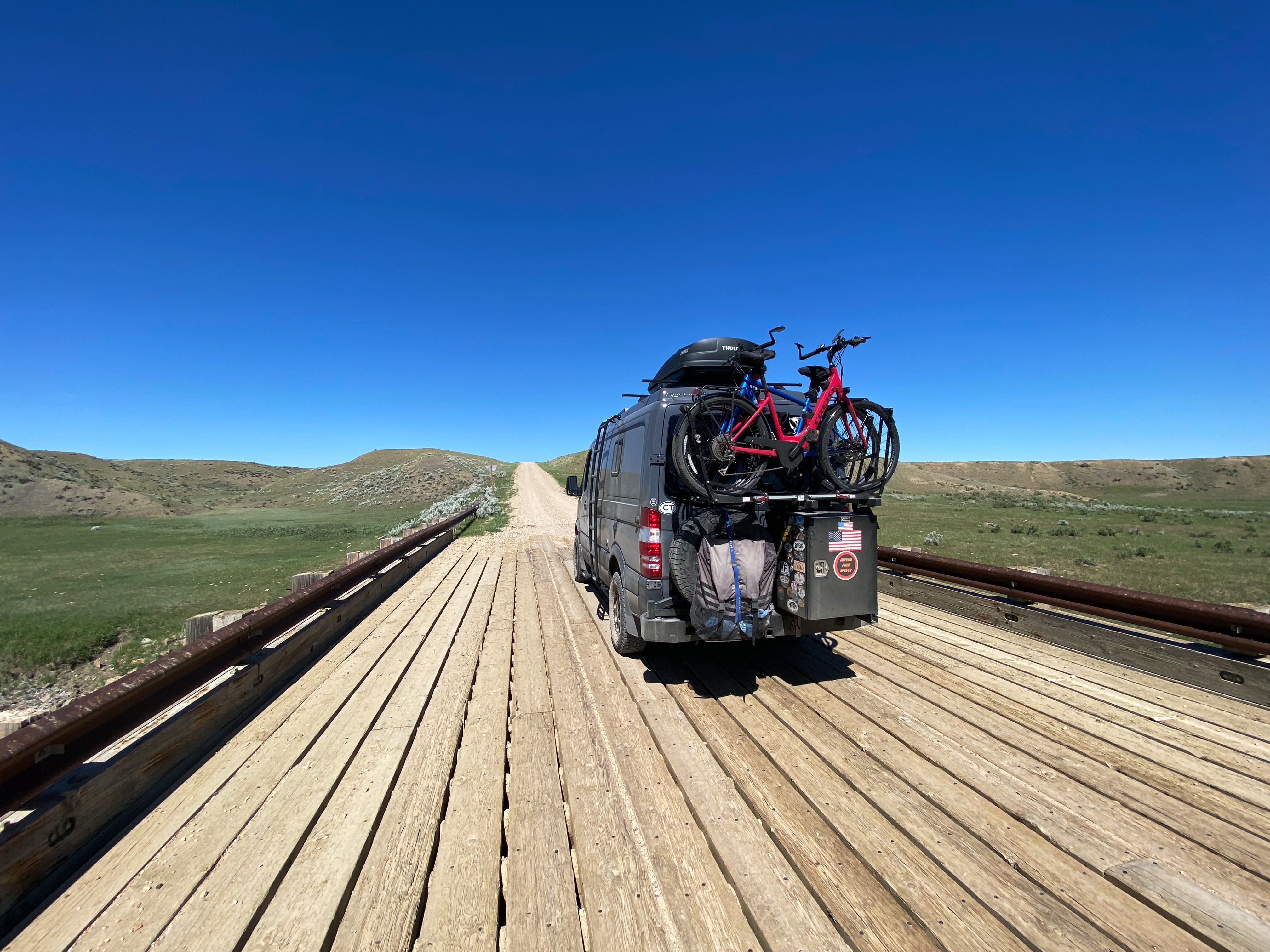
After our stop in Chester we were on our way north. We were surprised when we turned onto Route 409 North that is was paved but as so often happens here, the pavement ended abruptly in just a couple of miles and we were back to traveling on dirt roads once again.
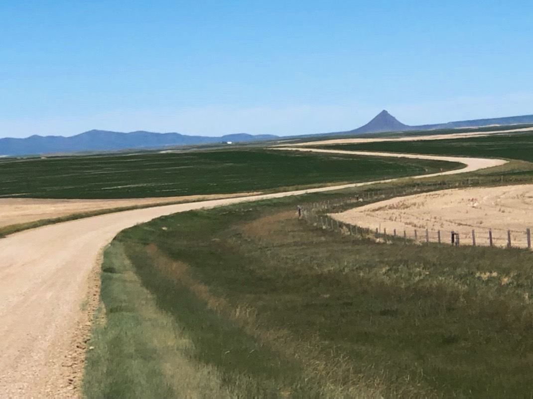


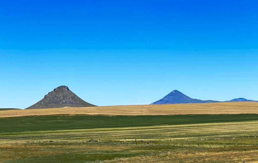
The Sweet Grass Hills are dominated by three buttes – West, Gold and East. The buttes stand at about 7000 feet and they can be seen from a significant distance because of the gently rolling grasslands around them.
We spent the remainder of the day touring the Sweet Grass Hills following Route 409 and Route 552. While that sounds straightforward – we assure you it is not – the 409 and 552 are meandering and unmarked routes crossing other dirt roads and forking off in multiple directions (with many of the trails not shown on our maps).
Nonetheless, this backcountry tour was amazing. This is remote country inhabited by cattle and a handful of ranchers. The wind apparently never stops on the prairie adding to the sense of isolation and remoteness – we felt it in just the day traveling through the area.

Whitlash, population 15, was the only named place on our tour of the hills. We did not see anyone at this bend in the road called Whitlash. We stopped for a “pop” at what we thought was a store based on a sign for cold pop. Upon entering we found a coin operated washer and dryer and a soda machine but no people. When was the last time you purchased a 12 ounce cans of pop for 50 cents?

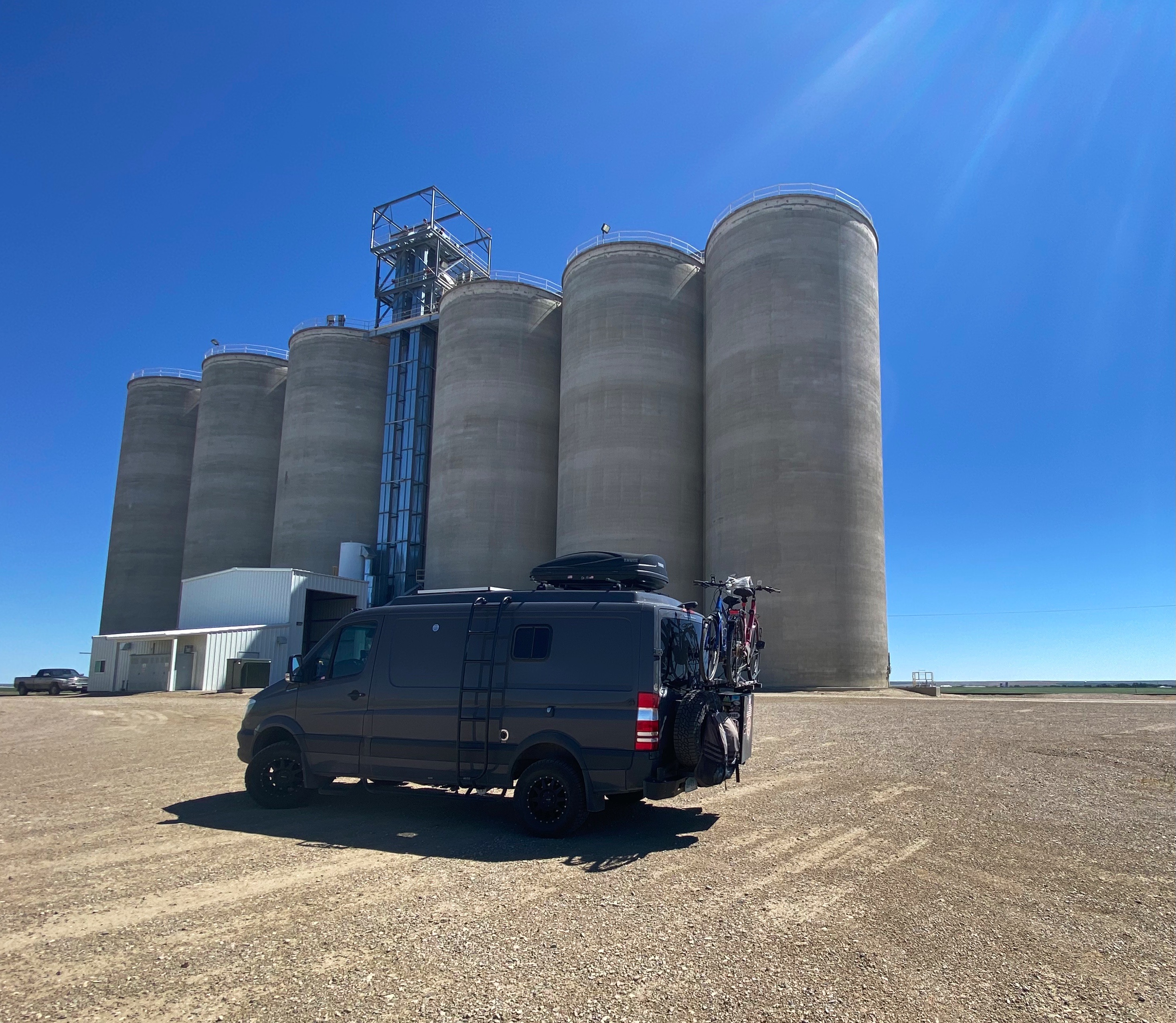
About three miles east of the terminus of Route 552, the road became paved once again and we cruised into Sunburst in search of a well deserved chocolate milkshake.
We had the opportunity to chat with several life long residents of the area while enjoying our shake. We learned that this tiny town which is just eight miles from the Canadian border was once home to the largest refinery in Montana and one of the largest in the states when it was in operation.
Sunburst sits in the aptly named Kevin – Sunburst Dome, a significant deposit of oil and gas. The refinery was purchased by the Texas Company (Texaco) in 1929. During World War II the refinery was a major supplier of aviation fuel for the U.S. military.
Texaco closed the refinery in 1962, concluding a 30-year run of prosperity for the town. Subsequently, the refinery was leveled, the site remediated and the town returned to its agricultural roots. The only vestige of the refinery today is the road sign declaring that Sunburst is home to the Sunburst High School Refiners athletic teams.
First Peoples Buffalo Jump


We wrote above about the literally life sustaining importance of the bison to the Native Americans of the plains. Traveling south from Sunburst we visited a buffalo jump used by Native Americans to kill the bison that so sustained their way of life.
A “buffalo runner” disguised in bison hide would lead the short-sighted herd towards a precipice, sometimes running for days to bring the herd to the jump. Other members of the tribe would follow behind, agitating the herd. The agitators would usually be disguised as wolves.
Once the bison went over the edge the rest of the tribe went to work. Any bison not killed by the plunge were quickly dispatched. The entire bison was disassembled – blood and meat for immediate consumption. The remainder of the bison was set aside for making tools, clothing, teepees and weapons. Meat not eaten during the ensuing feast would be dried for consumption after the last of the fresh meat was eaten.
The photos above show the cliff at First Peoples Buffalo Jump – thought to be the largest of the 6000 known buffalo jump sites in North America.
Thoughts on the Prairie
We thoroughly enjoyed our trip through the prairie and grasslands of central and northern Montana. It is unquestionably beautiful country, but it is also without a doubt a harsh environment. We experienced many days of temperatures well over 100F. There is little to no shade, the wind never stops blowing and it is dusty, dusty, dusty.
Visit, but go prepared for extremes in weather, keep your fuel tank full and carry as much water as you can if you are going to venture deep into the backcountry.
Be seeing you!
Be Seeing You!
New River Gorge National River (NRGNR)

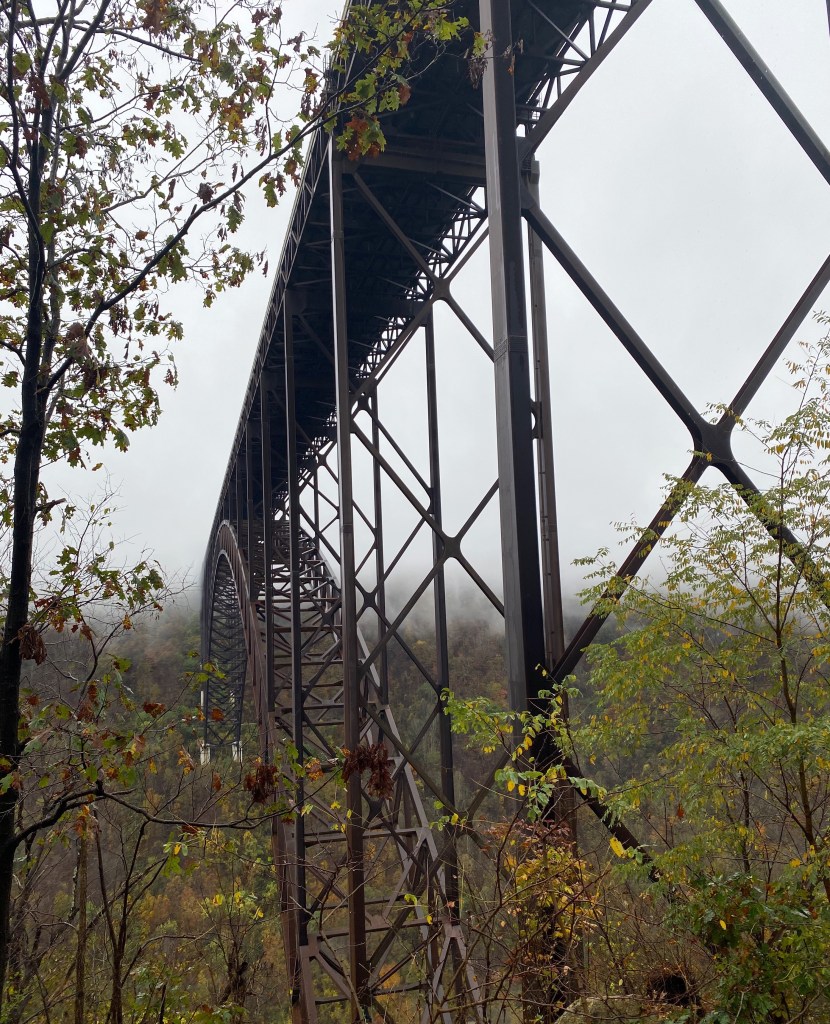
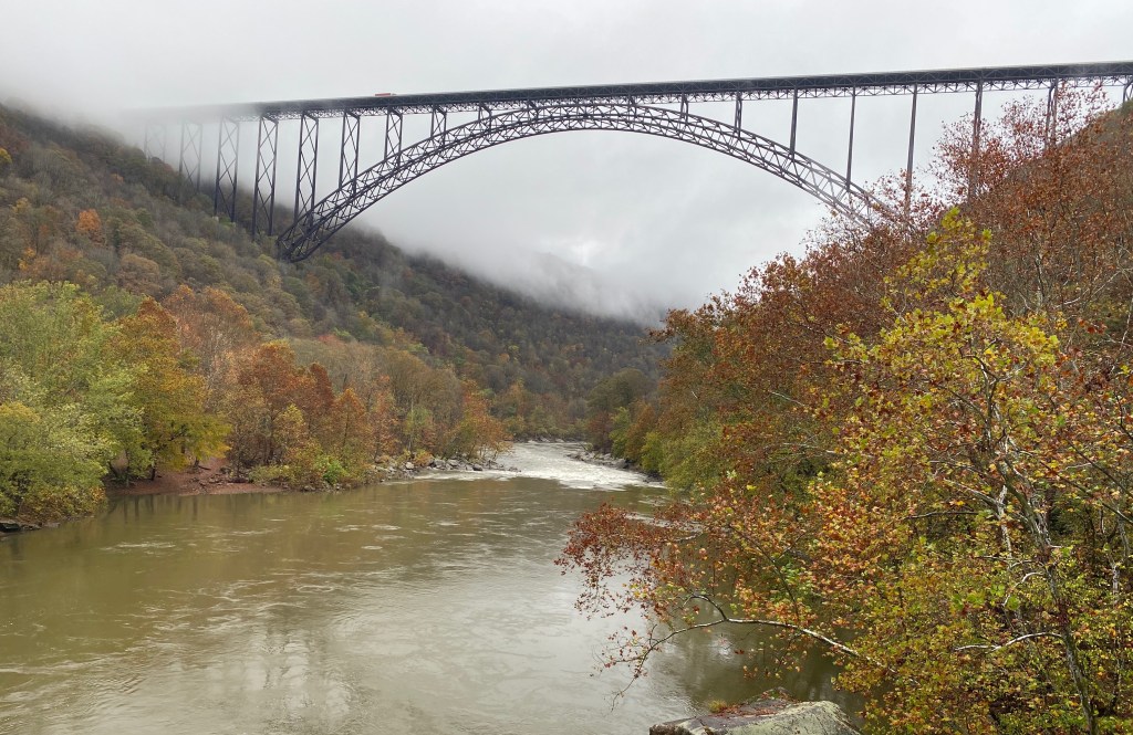
The New River Bridge is quite a sight to see and truely an engineering marvel. It is the fourth longest single arch bridge in the United States and sits at a jaw dropping 876 feet above the floor of the gorge.
But for our money, the real attractions of the NRGNR are the history and artifacts of a way of life that existed down in the gorge for more than eighty years. The gorge was scarcely inhabited until surveyors discovered coal, and not just any coal. The coal in the gorge was high quality “smoke less” coal – highly prized for its high carbon content with minimal waste.


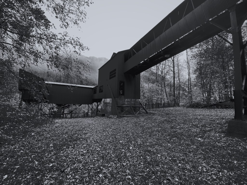
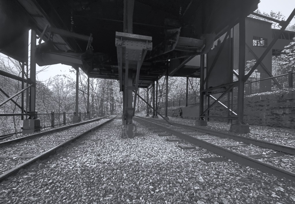
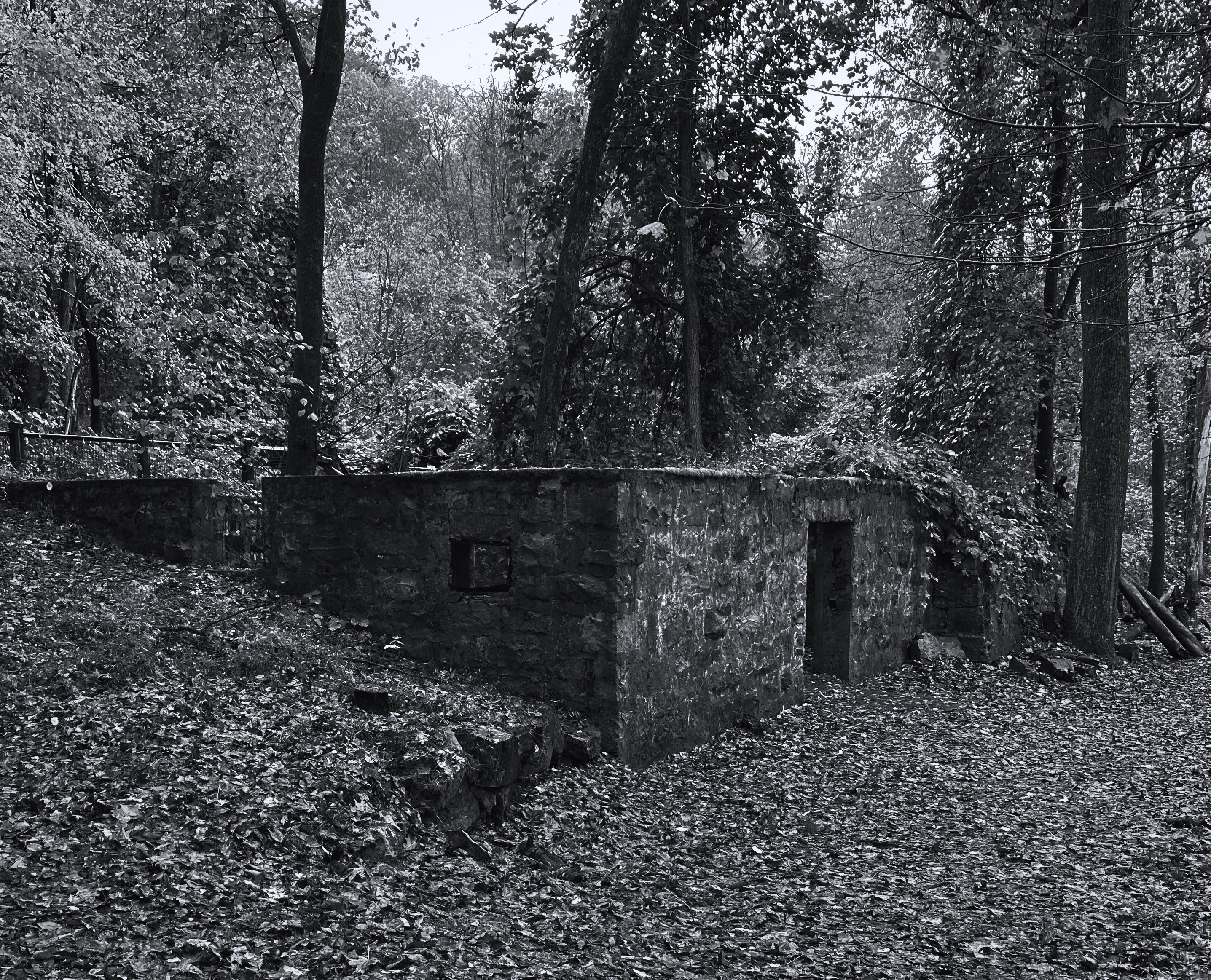
Within the gorge the remains of the Nuttallburg Mine provide insight into the workings of a coal mine and the life of the miners and their families. It is considered one of the best preserved mining complexes in West Virginia.
Visiting the site is a commitment in and of itself. The mining complex sits deep in the gorge at river level and requires driving down a windy, narrow and sometimes steep one lane road.
The Nuttallburg Mine began operations in 1873 after the completion of the Chesapeake & Ohio railine through the gorge was completed. The rail line enabled the shipping of large quantities of coal as the river was not navigable and getting coal up out of the gorge by road was not feasible.
Because mining in the early days was very labor intensive and the local population was small, the mine operators needed to import workers. Workers came from all over Europe and Canada to work at the mine in a variety of capacities. As a result, the mining workforce and their families were a very diverse population.
The mine also employed African American workers who worked side by side with the other employees. However, outside of work the black employees and their families lived in a segregated town on the opposite end of the mining complex with their own church and school.
The mining town here appears to be typical of mining towns in this era as it was self-contained with its own schools, doctors, blacksmiths, social clubs, athletic teams and company store.
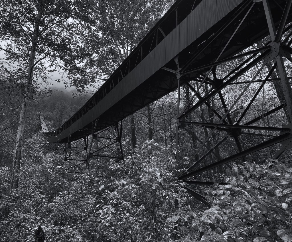
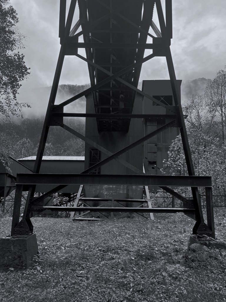
The coal conveyor pictured above is 1385 feet in length and brought coal down from the mine 600 feet above the gorge floor. This conveyor was built in 1926 and could move 125 tons of coal per hour.
The company store was a necessity because the employees had no means to travel from the mine complex. Therefore, the company paid the employees in a company issued scrip and most likely significantly overcharged their employees.

Henry Ford leased this mine and others during the early 1920s in order to control the coal supply that Ford needed for automobile production in the Dearborn, Michigan plant. Ford made substantial investments in the mine including the state of the art coal conveyor.
Ford ultimately sold his lease back to the Nuttall family when he found that he could not control the the railroad companies and often could not get his coal to Michigan when he needed it.

The mine continued operations under three different owners until the mid 1950s when it became abundantly clear that the mine was “played out”.
Today the National Park Service manages the mine complex and is doing a good job protecting the area and providing research and education relating to the history of the mine and the town of Nuttallburg.
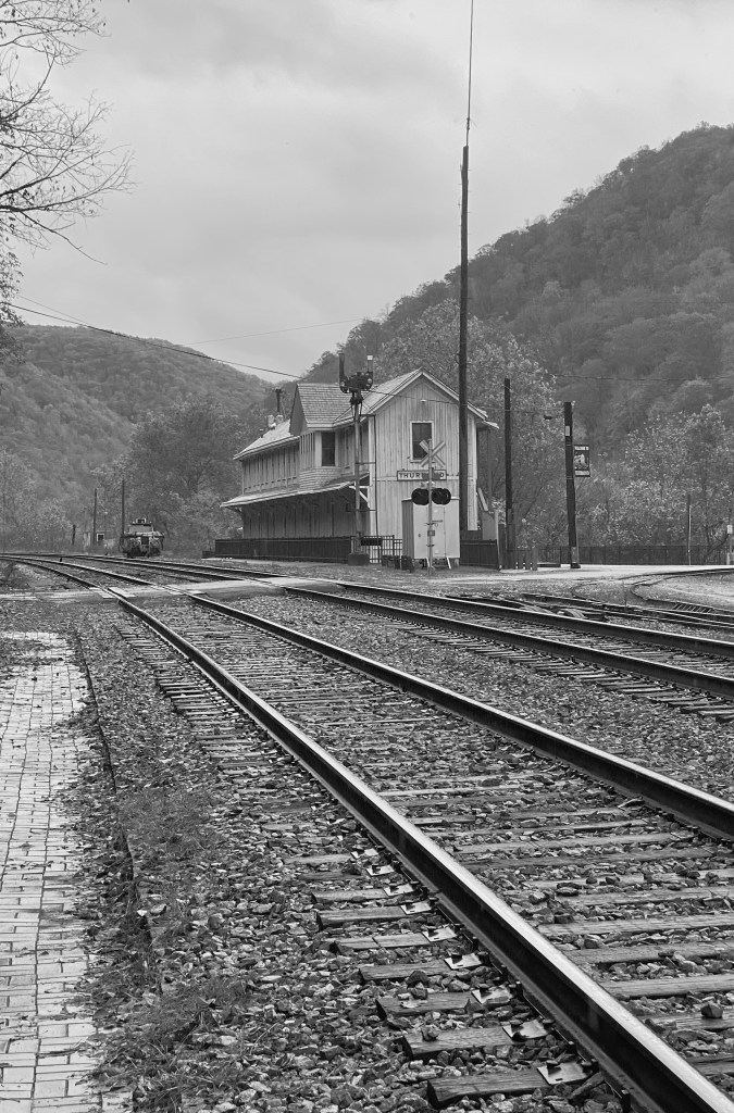
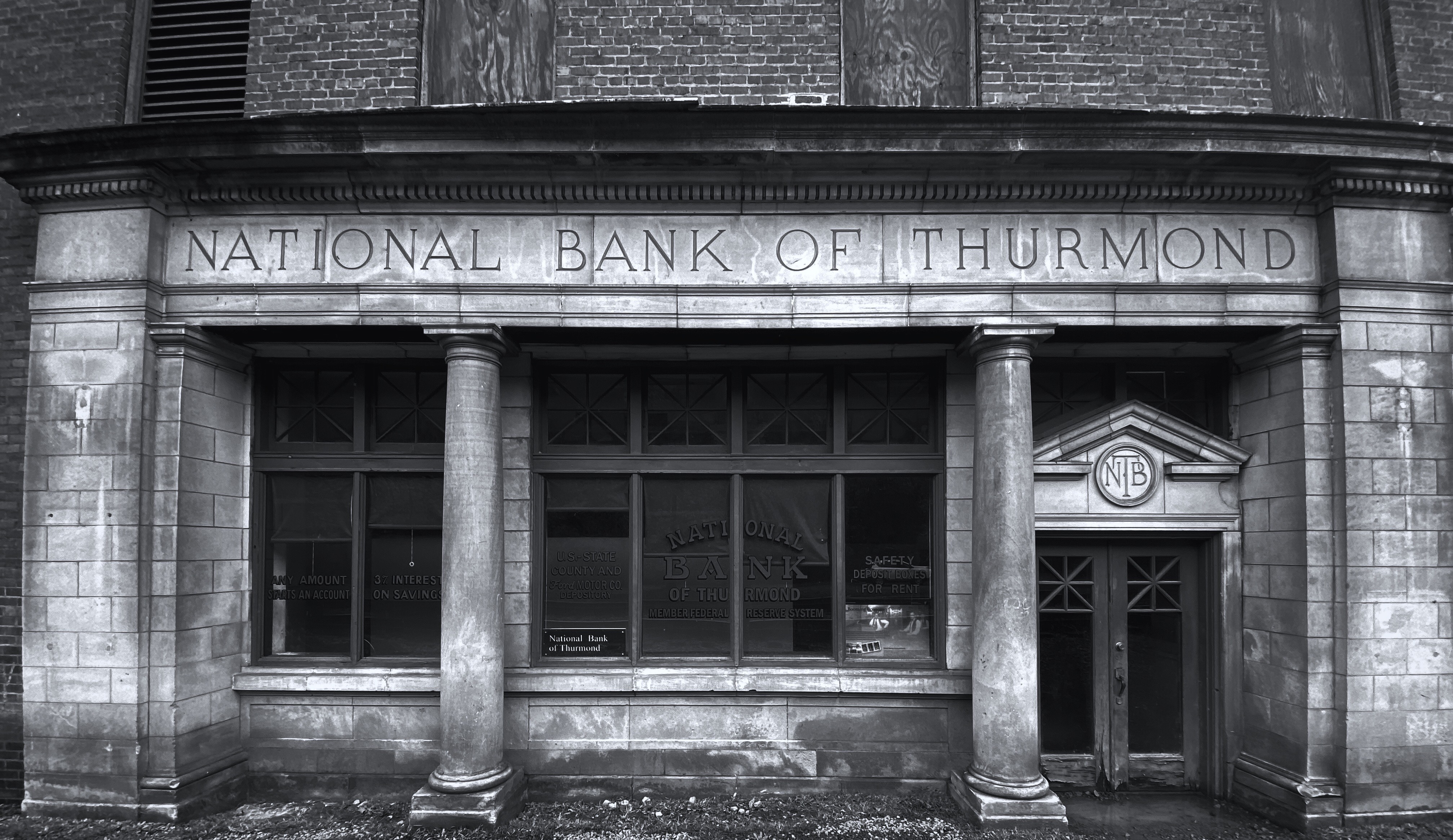
Thurmond, West Virginia
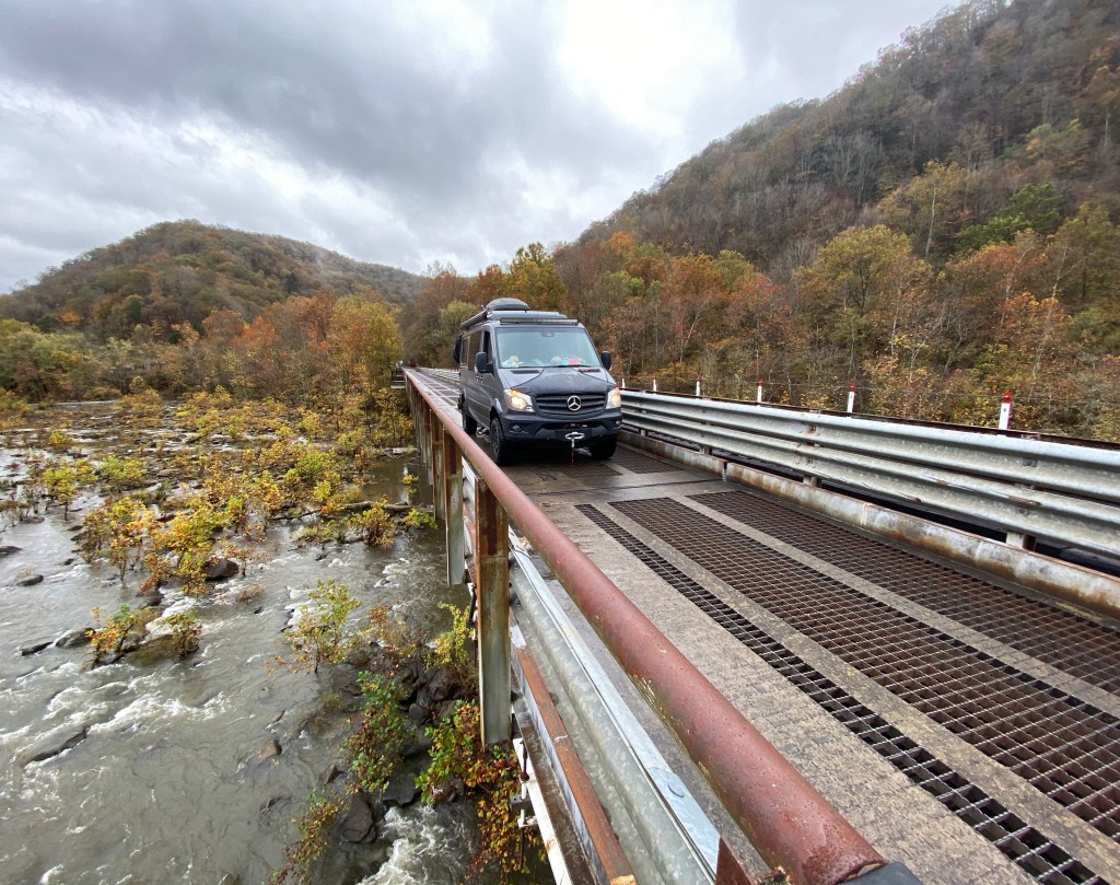
After our exploration of the remains at the Nuttallburg Mine site we ventured south and then east along the Dunloup Creek on County Road 25 to the town of Thurmond. The only way to get to Thurmond was by rail until 1921 when CR 25 was built. Crossing the New River today to Thurmond entails driving across a single lane bridge shared with the railroad.

At one time Thurmond was a rail center where short coal trains were assembled into longer trains that hauled coal out of the gorge. It was also the only place in the gorge where steam engines could load coal and water.
While the town “thrived” (population 462 in 1930) during the early portion of the 20th century the advent of the diesel locomotive rapidly diminished the need for the fueling and servicing of steam powered locomotives. From 1930 on the population diminished steadily although passenger trains continued to bring visitors who stayed at the two hotels that had been built during the prosperous days. Unfortunately, both of the hotels burned to the ground and those events put the finishing touches on the demise of the town.
While the town essentially vanished by the 1950s, the rail lines continue to be operated by the CSX Railway- still hauling coal out of the gorge from the many active mines that remain operational today (more on that topic in a future post about coal country).
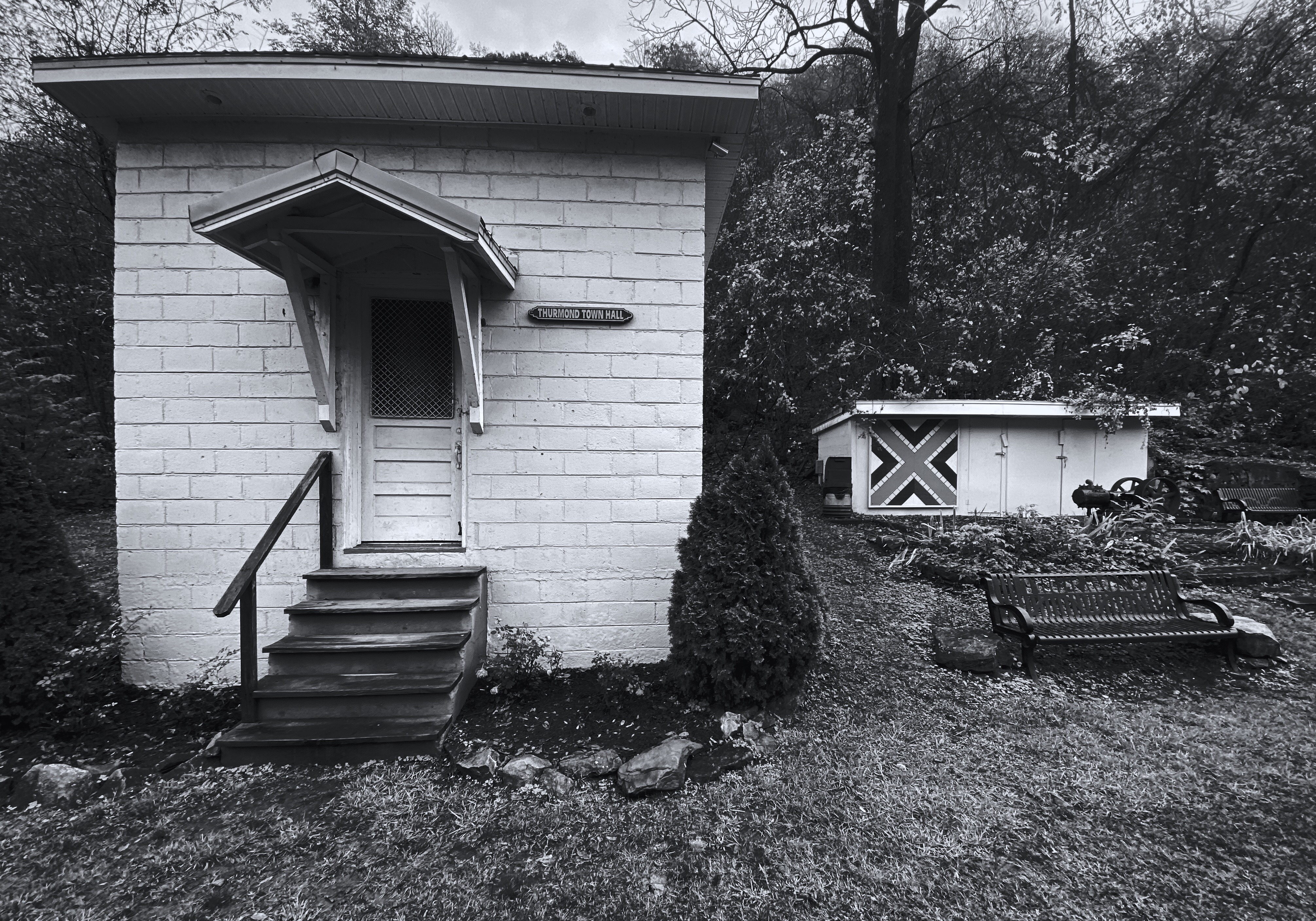
Today the population of Thurmond is four and most of the property in the town is owned and managed by the National Park Service. The former depot pictured below is now a visitor center during the summer months.

Additionally, the Amtrak Cardinal train which runs three times a week from New York City to Chicago still stops at the Thurmond Depot. Not surprisingly, there is only one other stop in Amtrak’s entire system where fewer passengers board the train.

An interesting feature of the town is that it never had a main street. All of the commercial buildings in town sat directly along the railroad tracks because there was no room for a street in addition to the rail line in the narrow river gorge.
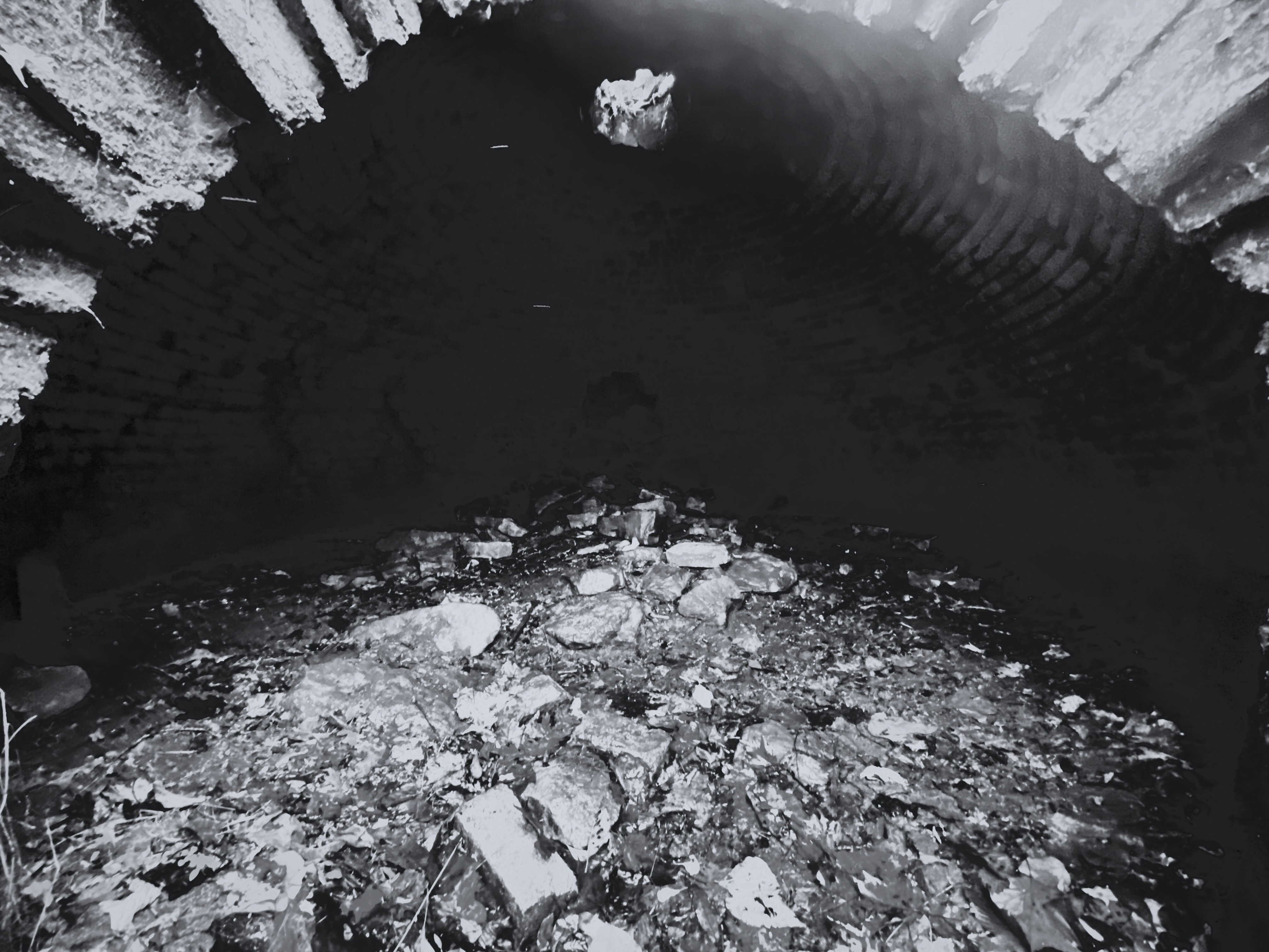
The Coaling Station pictured below was built in 1922 and could hold more than 500 tons of coal for re-fueling steam locomotives.


We enjoyed exploring the New River Gorge National River and highly recommend this area for its beauty and history.
We will spend the next several days touring “coal country” in the southern part of the state before turning east and heading for Lewisburg, West Virginia for several days of bicycling the Greenbrier River Rail Trail.
Be seeing you!
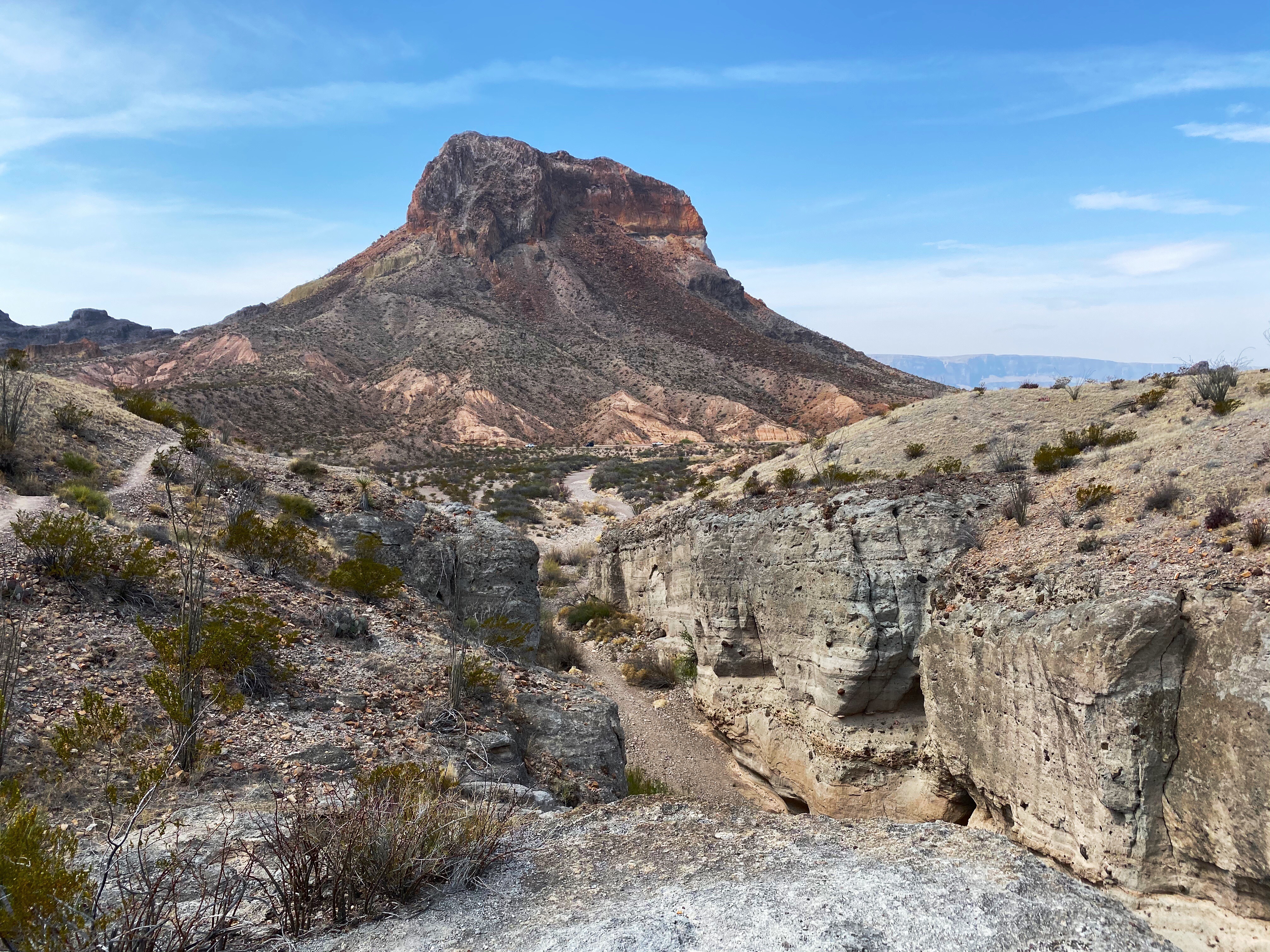
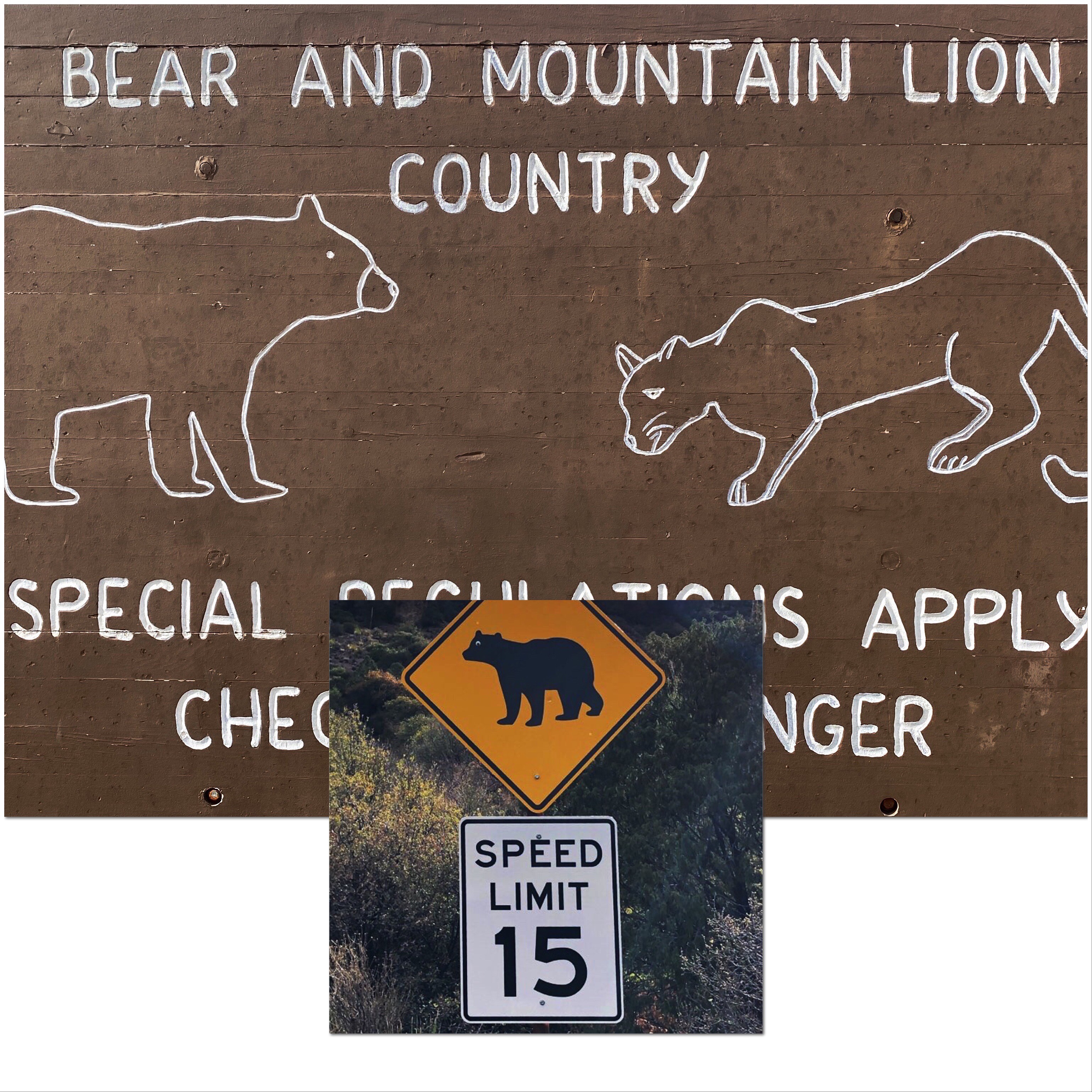
Big Bend National Park
Hola!
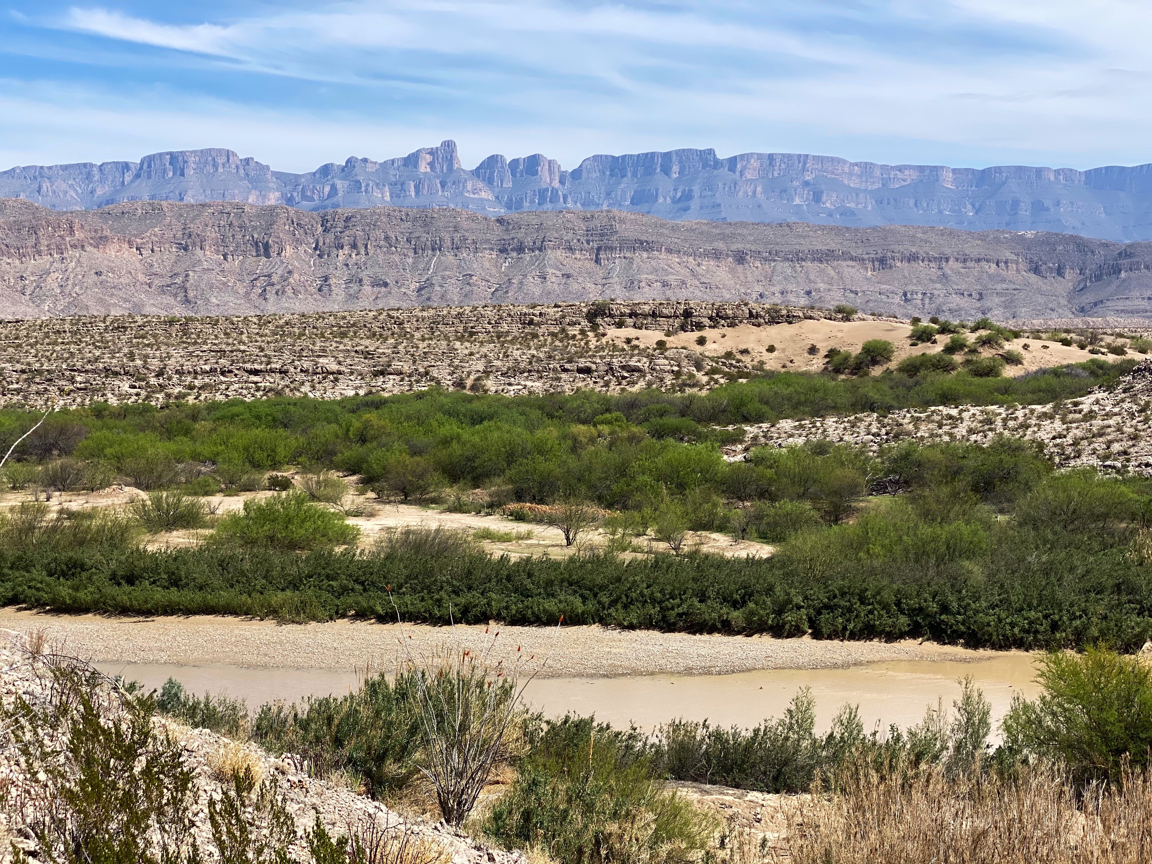
After our terrific stay in BBRSP we journeyed east on FM 170 (farm to market) alternatively known as Farm Road 170. The local folks just call it the River Road. It is also a segment of the Texas Mountain Trail. Regardless of what name you reference it by it is an absolutely stunning drive. The road is an undulating strip of asphalt winding its way between the mountains of BBRSP on one side and the Rio Grande and Sierra Madre Oriental Mountains on the other.
Big Bend National Park is an expansive park with remarkable diversity in regard to the terrain and species of wildlife and flora. While it is wild and rugged it is far more accessible than Big Bend Ranch State Park. There are visitor centers, a gas station, drinking water, paved scenic drives and more people. The one thing that both parks have in common is the spectacular scenery.
We would rate this park as a “must visit” national park. A couple things to keep in mind – this is not a summer park due to the South Texas location and it is a spring break destination for many Texas families (making mid-March the busiest time).
Re-assessing our itinerary based on developments with Covid-19.
Be seeing you!

Video Clip: FM 170


Video: Chisos Basin Road, BBNP
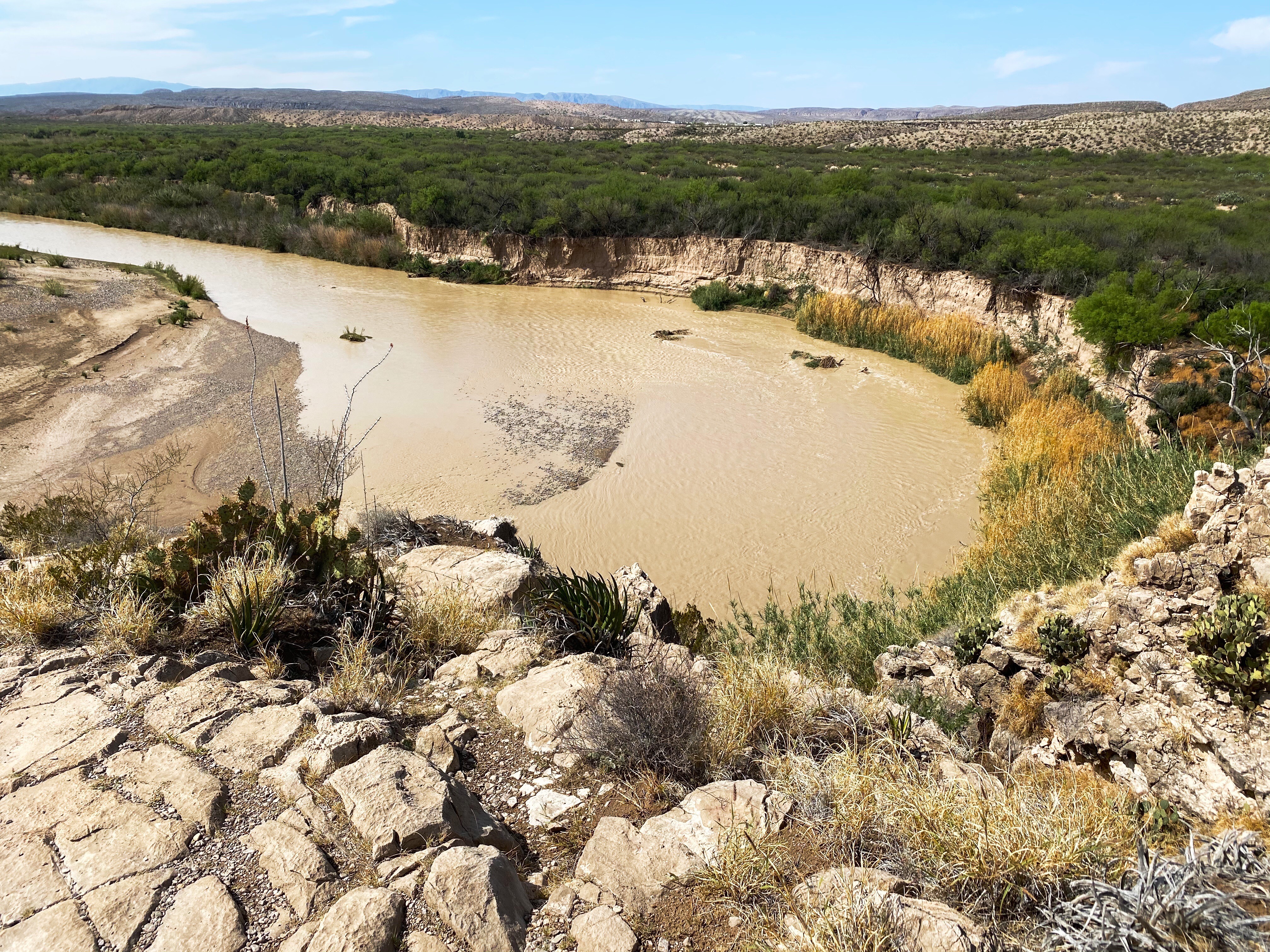

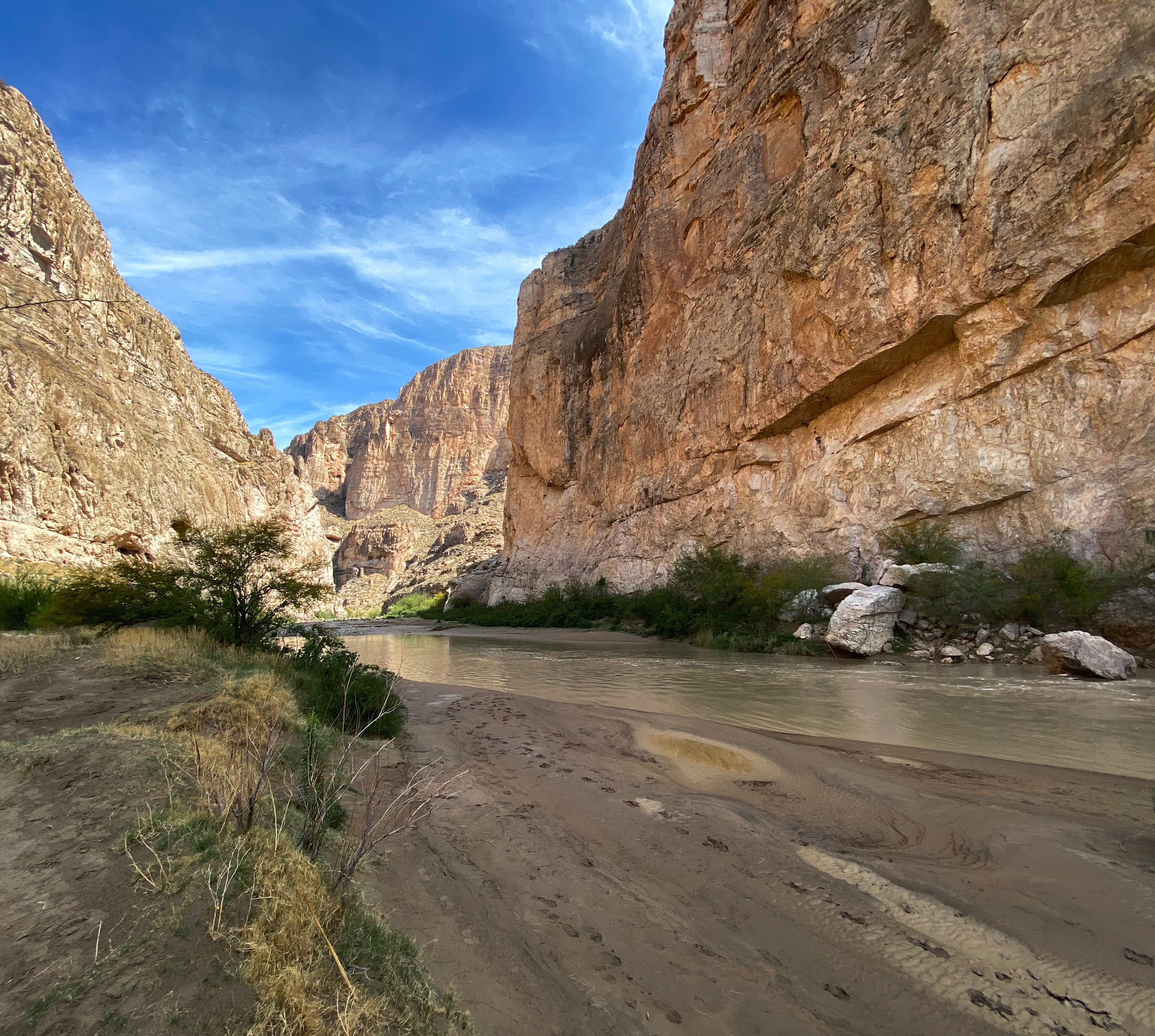
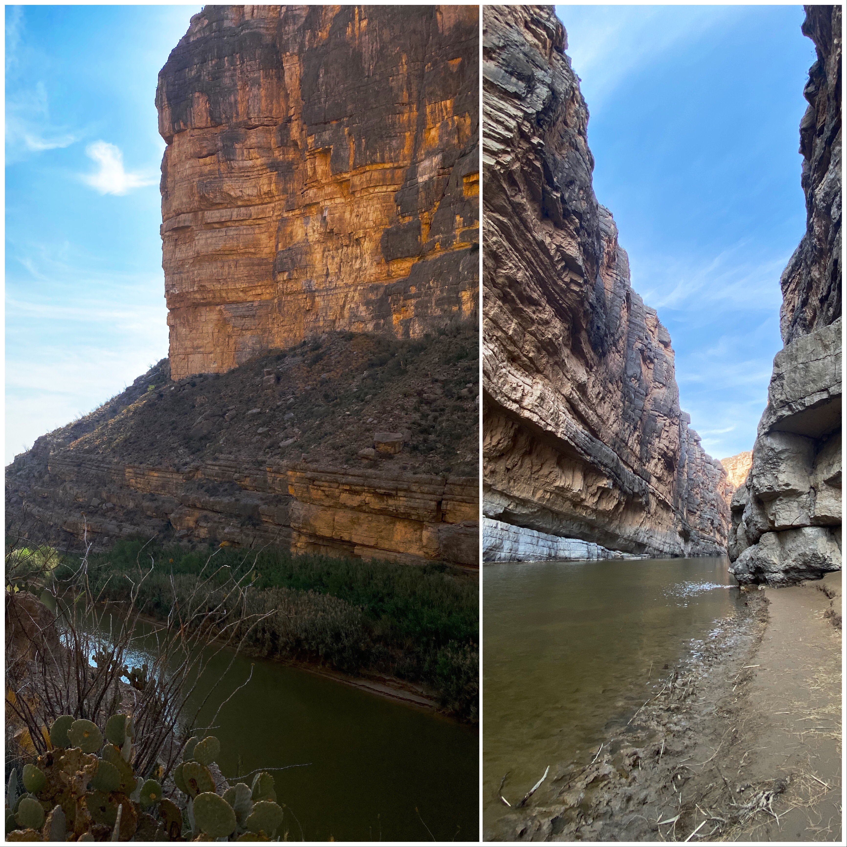
Boquillos Canyon, Rio Grande, Mexico on the Right
Kolob Terrace Road
On Wednesday afternoon we drove the Kolob Terrace Road to take in the views of the terrace and Zion NP to our east. The road ends at the Kolob Resevoir after 24 miles and an elevation gain of over 1000 ft. We traveled to mile 18 where the road is still closed due to remaining snow making the road impassable. Great views and a refreshing drop of about 10 degrees in temperature from the desert floor below.


Kolob Terrace


Hole in the Rock Road to Dry Fork
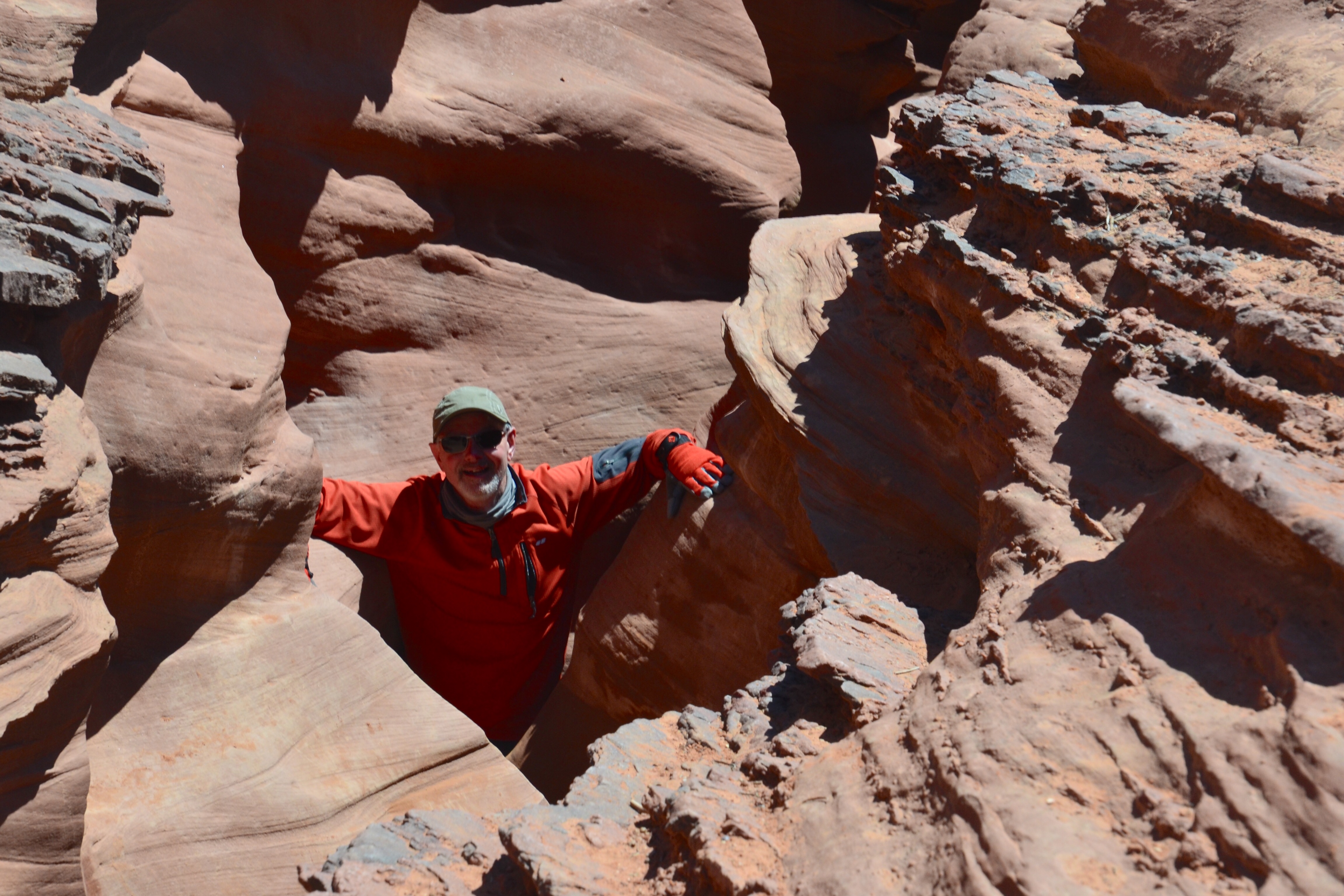
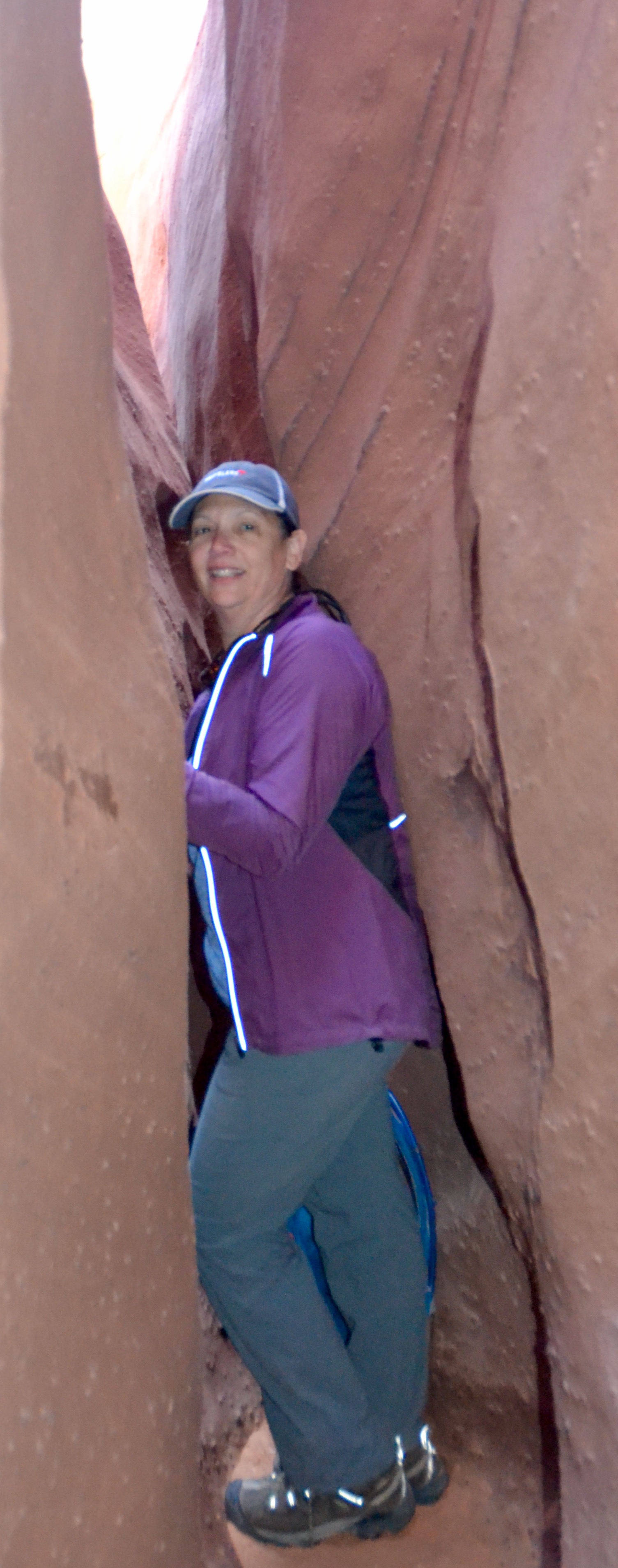
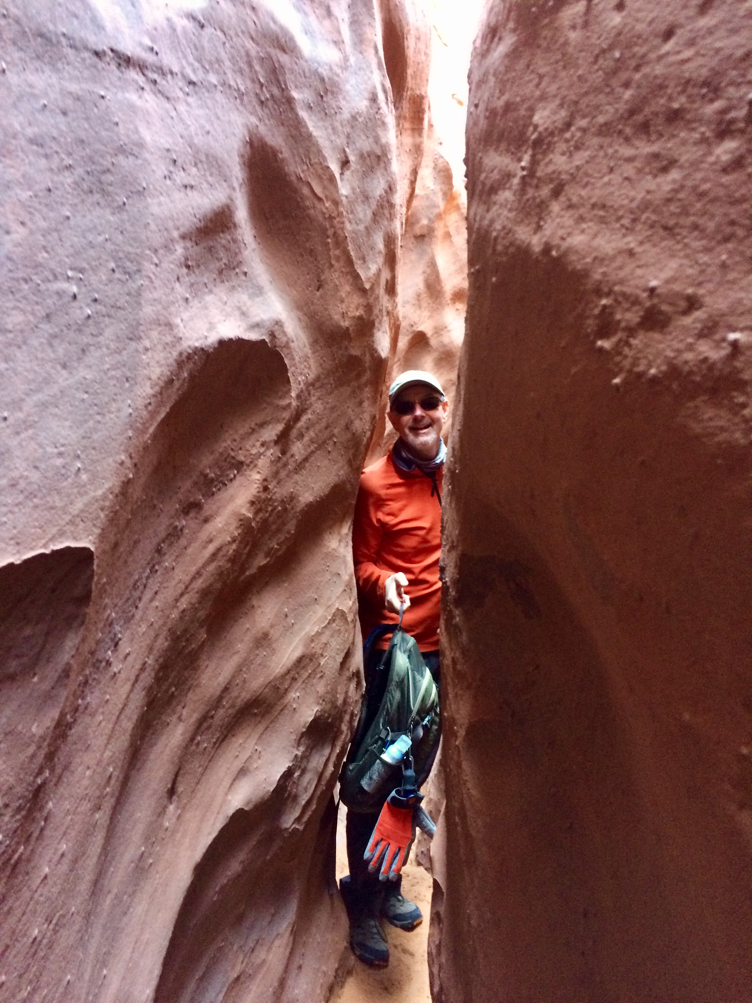
On Wednesday we ventured down the Hole in the Rock Road for 26 miles to canyoneer in several exciting slot canyons. This environment was a dramatic change from the tall Ponderosa Pines of the Box Canyon in Dixie NF where we hiked on Tuesday. The road is a washboarded bone rattling dirt track but fun to drive none the less and provides dramatic views of the Straights Cliffs section of the Fifty Mile Bench and Fifty Mile Mountains. Once at the trailhead we tackled the three slot canyons which can be accessed from the Dry Fork Gulch below the trailhead. We hiked Dry Fork first as an out and back as the slot became impassable due to water. We then made a loop by climbing up through the Peek-a-Boo slot and then traversed across to Spooky Gulch and then down climbed Spooky slot exiting into Coyote Gulch and returning to the trailhead from there. As you can see from the photographs below the slots provide some challenging terrain with the tight spaces and chimney descents but make for great fun and excitement.


Hells Backbone Road Scenic Backway
Today we attempted to drive the Hells Backbone Rd. We knew that it was unlikely we could make it through but wanted to see if we could make it to the Hells Backbone Bridge which spans Sand Creek. The Bridge is 109 feet long and 14 feet wide. The drop is 1500 feet on both sides! Unfortunately due to a late winter storm the road is closed just short of the bridge. We spoke with another traveler who proceeded past the road closure sign but turned back when he saw a vehicle ahead of him stuck in the snow.
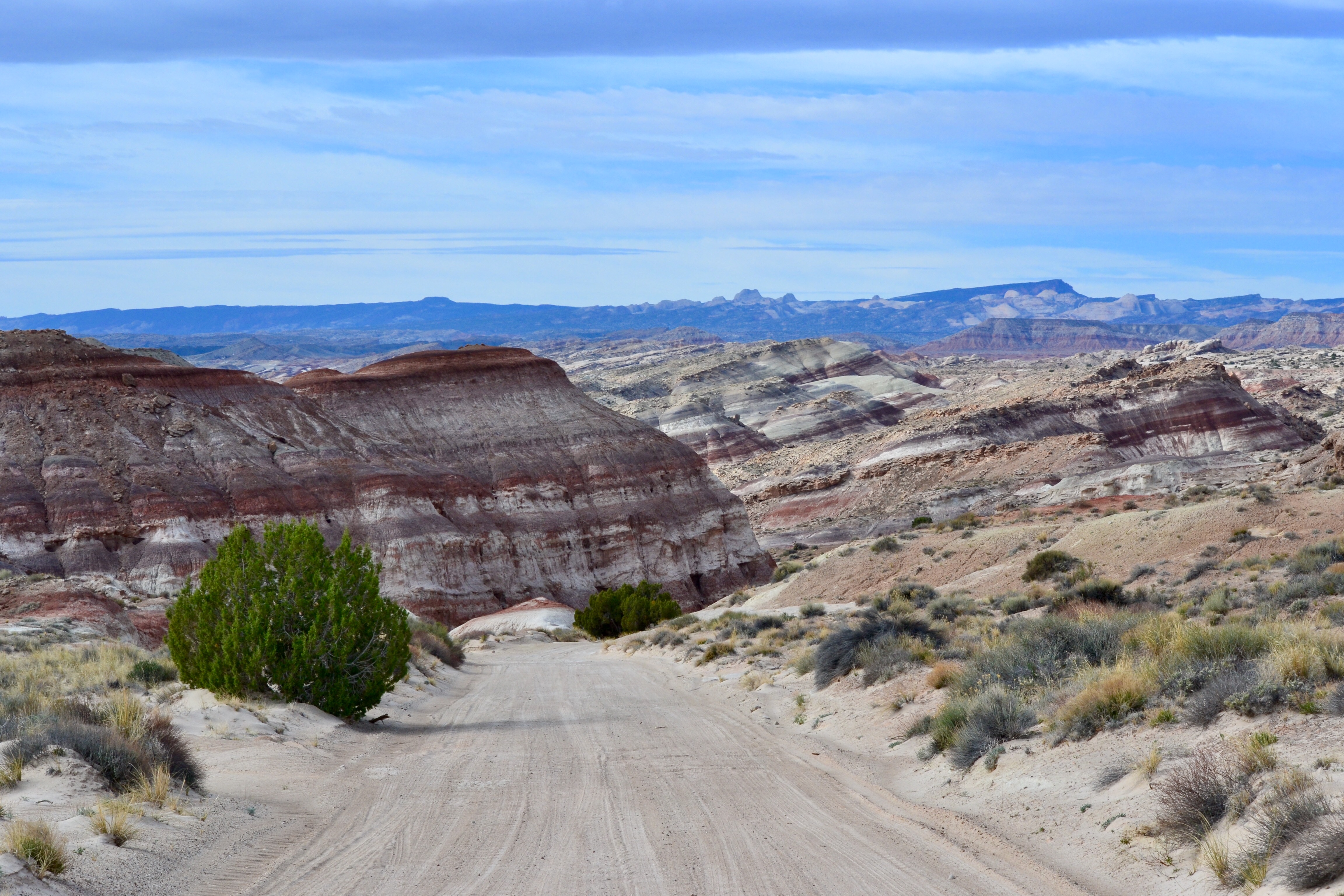
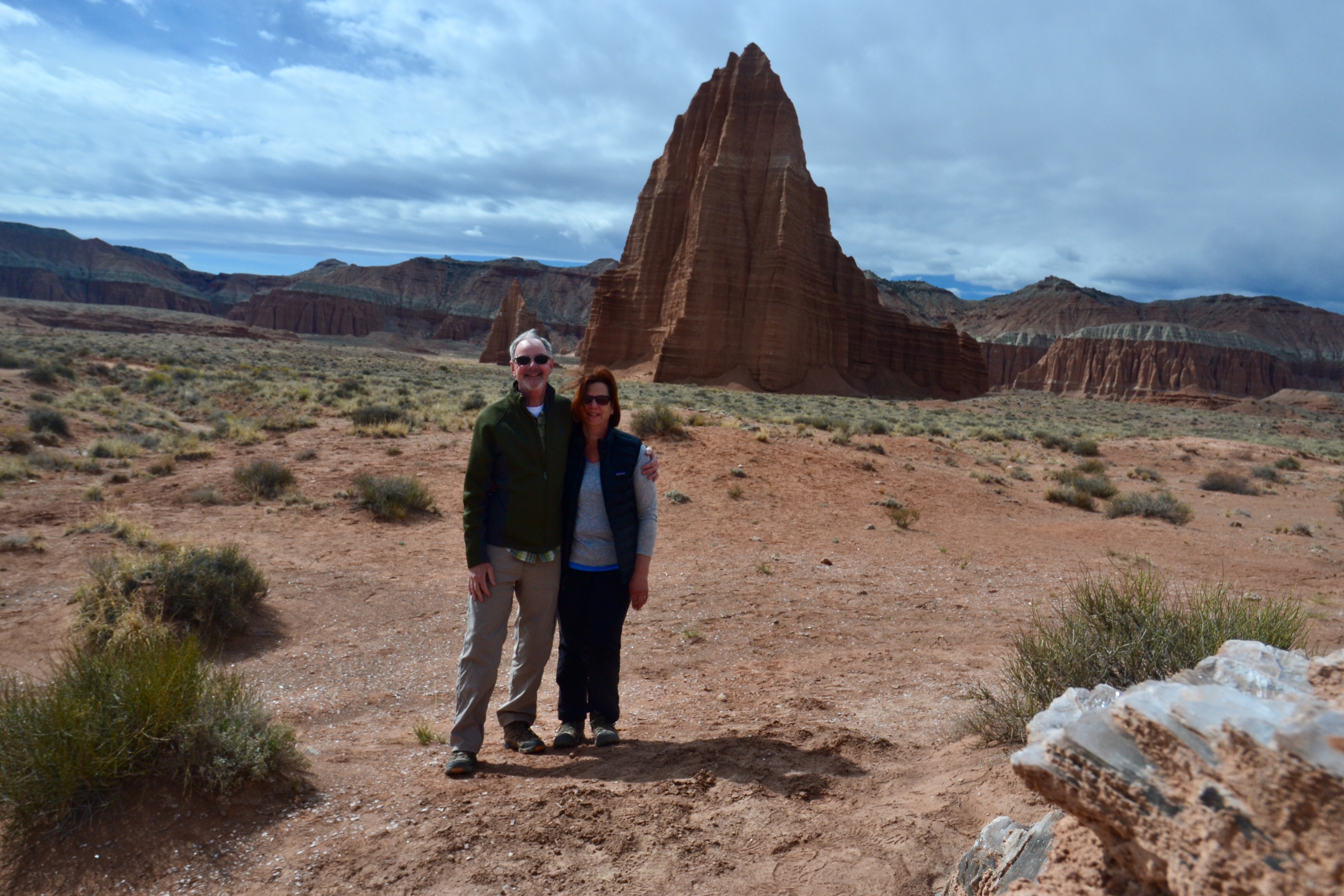
Cathedral Valley Drive
On Thursday road conditions allowed us to venture into the remote Cathedral Valley district of CRNP. The terrain in this area consists largely of Bentonite which when wet is virtually impassable for any vehicle. So with several days of dry weather behind us we set out to reach the Sun and Moon Temples. Our average speed was only about 15 MPH due the significant washboarding present along with the many washes that need to be carefully negotiated. We again had many hours of solitude and beauty in this very unique portion of the San Rafael Swell.